Geography of Canada Physical Features Where People Live


 • Surrounded")


- Slides: 48
Geography of Canada Physical Features, Where People Live, & How They Trade
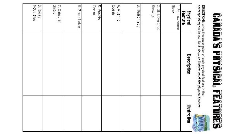
Teachers Print off the following slide for each student. They should complete the chart while discussing the presentation.
Physical Features
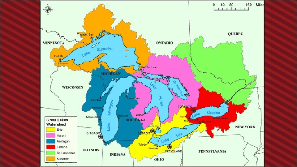
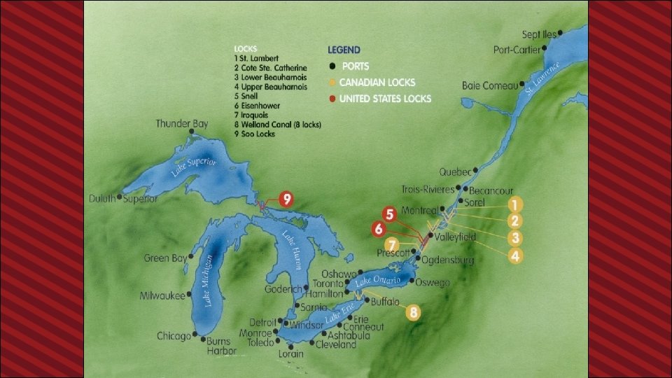
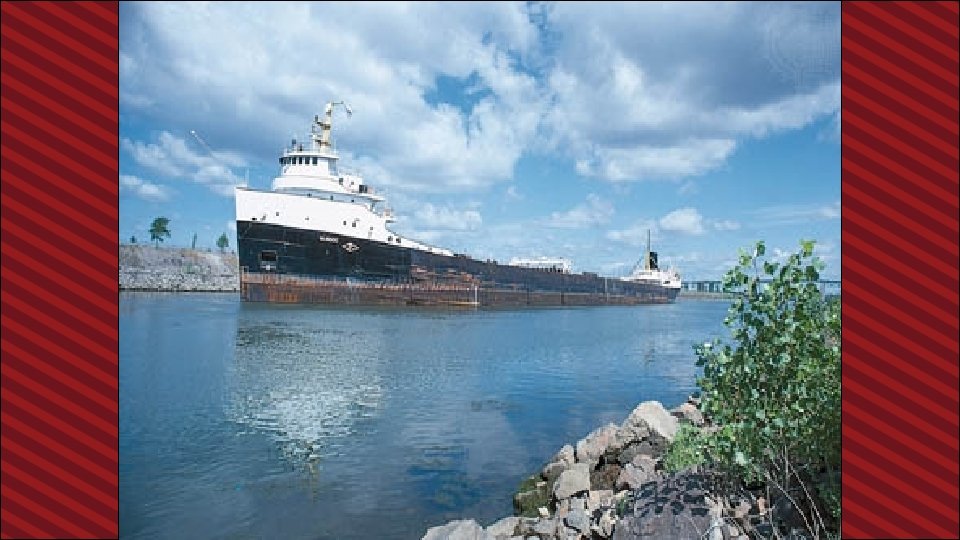
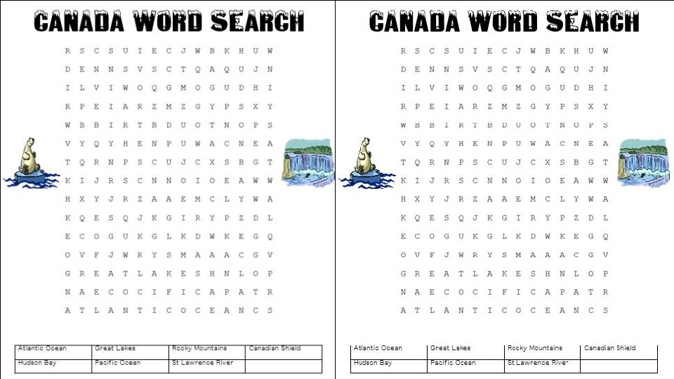
Great Lakes • 5 large freshwater lakes in central North America • HOMES (Huron, Ontario, Michigan, Erie, Superior) • Serve as the “industrial heartland” of the continent because of all of the factories • One of the world’s busiest shipping areas • Most of Canada’s population lives in this region
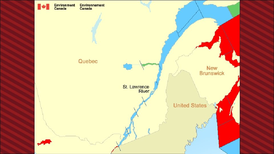
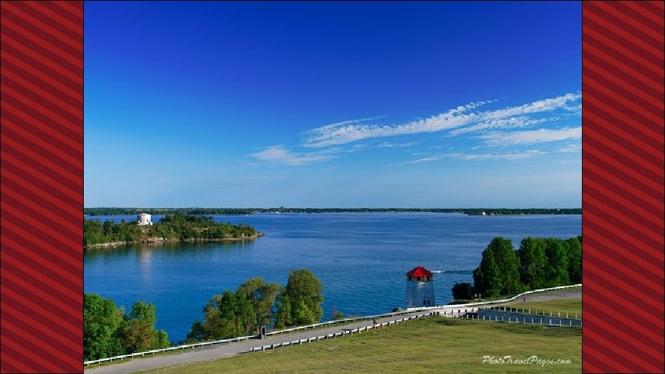
St Lawrence River • Major source of overseas and US/Canada shipping & trade • Shortcut that connects the Great Lakes to the Atlantic Ocean • Huge producer of hydroelectricity
St Lawrence Seaway • A canal completed in 1959 at the eastern end of the Great Lakes • Connects the Great Lakes with the St. Lawrence River (which flows to the Atlantic Ocean) • Major source of overseas and US/Canada shipping & trade • Closed from November to April (frozen) • Seaway has made cities in Eastern Canada home to many successful manufacturing companies
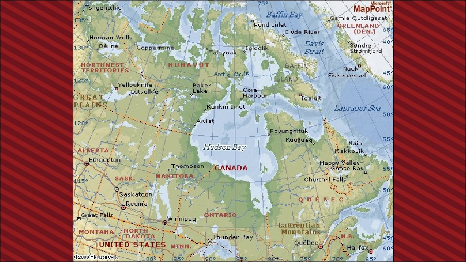
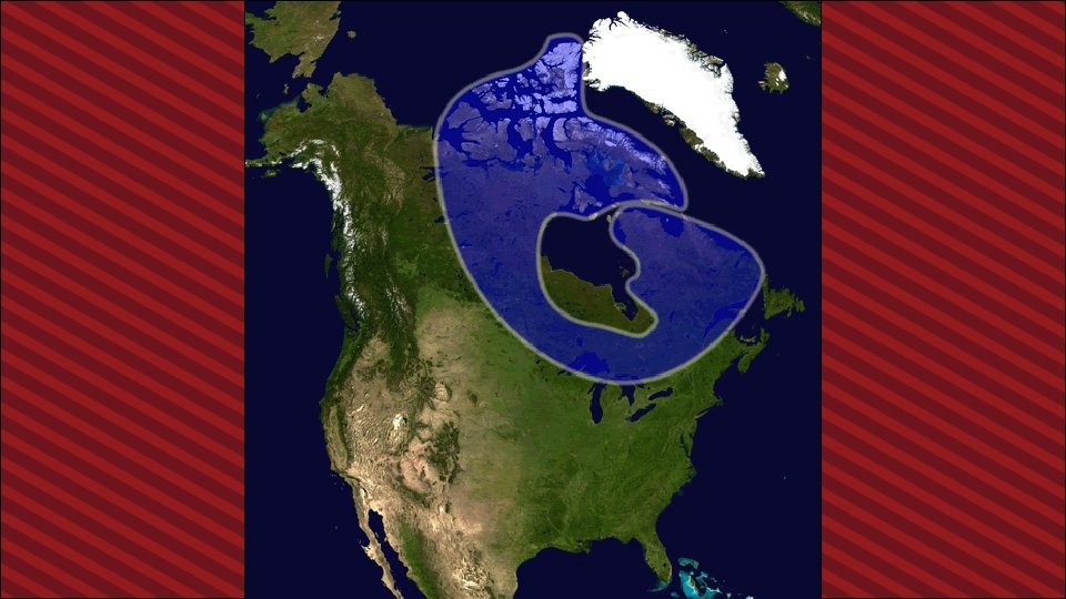
Hudson Bay • HUGE inland sea in east central Canada • “an arm” of the Atlantic Ocean • Grain from Alberta & Saskatchewan is shipped from Hudson Bay out to the Atlantic and on to other countries • Only navigable from July to October
Atlantic Ocean • This is the 2 nd largest of the earth’s 5 oceans. • It’s also the most heavily traveled ocean. • It forms the eastern border of Canada. • It’s a major shipping route to Europe & Africa.
Pacific Ocean • Largest & deepest of the world’s 5 oceans • Covers 1/3 of the earth’s surface! • Western border of Canada • Major shipping route to Asia
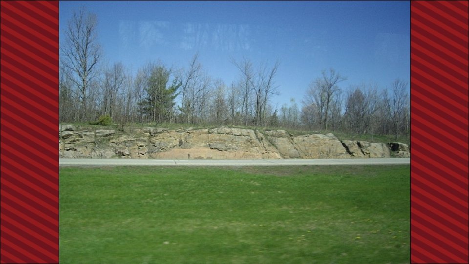
Canadian Shield • Stretches from Great Lakes to Arctic Ocean; covers half of Canada! • Horseshoe region around Hudson Bay • Region of mostly thin soil lying on top of rock, with many bare outcrops of rock & thousands of lakes • Major source of natural resources: timber, minerals, & water • Region is sparsely populated.
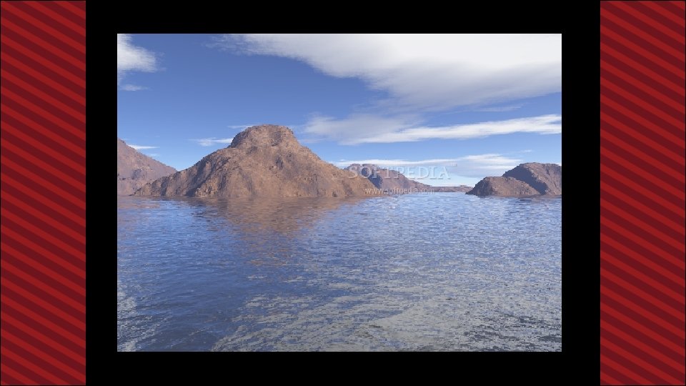
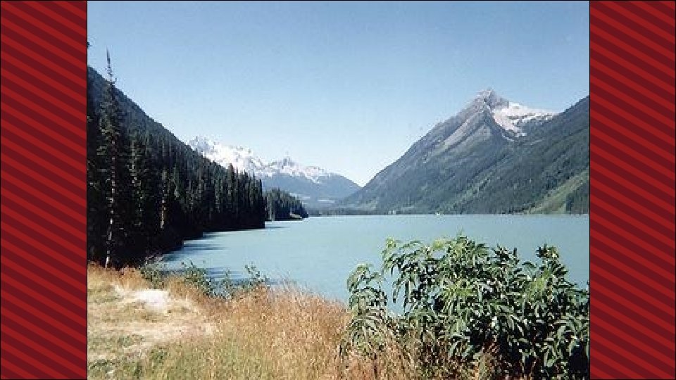
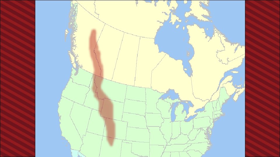
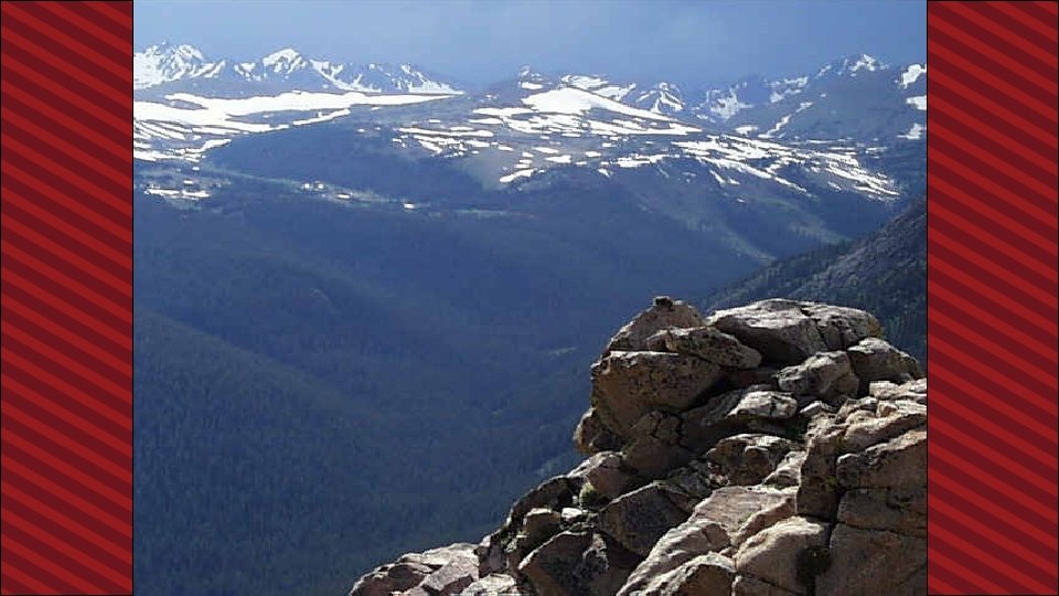
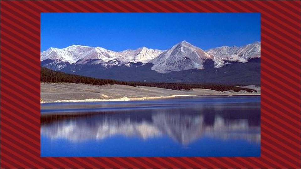
Rocky Mountains • Mountains located in Western Canada • Includes western Alberta and eastern British Columbia • Stretch a distance of 2, 000 miles! • Mining is the biggest industry in the region, followed closely by logging. • Major minerals include: iron ore, copper, coal, gold. • Sparsely populated & contain few cities
Be the Thing… Your Task: • Choose 1 of the physical features • Fold your paper “hamburger style” to make a desk tent • On the front : Imagine that you are one of the features. Write 5 facts about yourself. • On the back: draw an illustration of the feature We will walk around and try to guess the features!
Example: Brrrrr! I am always so cold!! It’s chilly up here in northern Canada. I am so tired of everybody always picking on me. Dig, dig all day long. I wish I had some pretty trees to look at…All that I can see is scraggly trees and flat, rocky land. It’s so lonely. No one lives near me.
Canadian Shield!
Where People Live & How They Trade
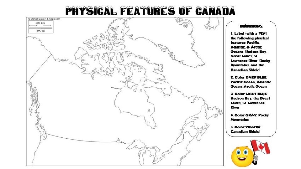
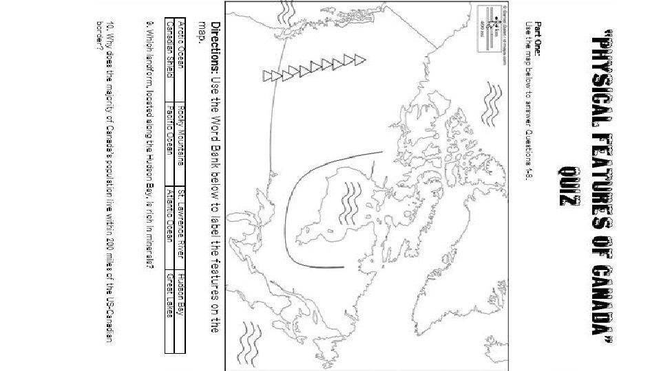
Teachers Project the following slide on the board/wall, and have students point out or label the physical features.
Let’s Review: Physical Features
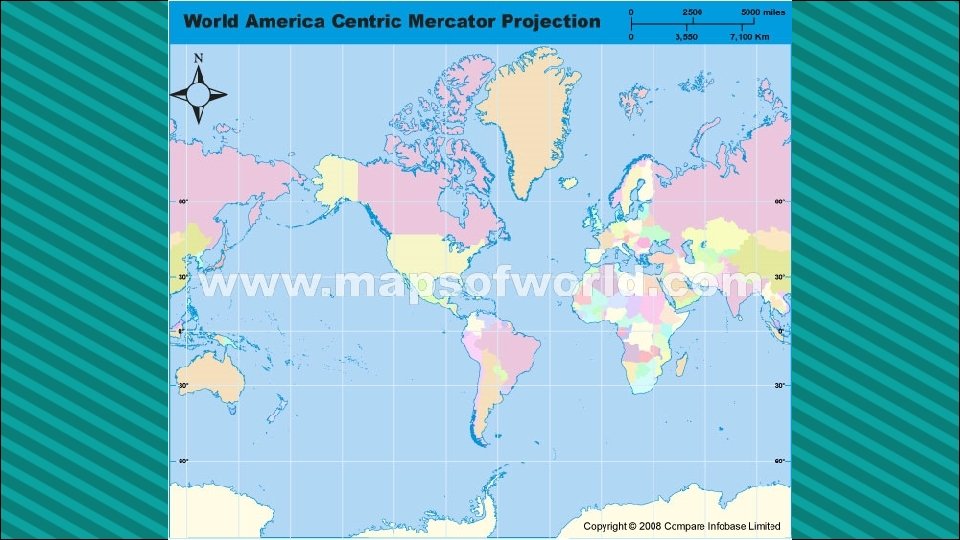
Location • 2 nd largest country in the world (Russia is larger) • Surrounded by three oceans: Atlantic, Arctic, & Pacific • Southern border is the US • Alaska also forms part of the western border. • Population is 33 million, which is small compared to its size (US population is 9 times larger!) • 90 percent of population lives within 100 miles of the USCanadian border…WHY?
Location & Trade • Canada’s location in the world helps it to be a leader in world trade: • It’s uniquely located on 3 oceans, so it has opportunities to trade with Europe & Asia. • Great Lakes and the St. Lawrence Seaway allow goods to be shipped to and from central Canada and the Atlantic Ocean • A major benefit for Canada is its border with the US (#1 trading partner). • Share over 3, 000 miles of border & trade is relatively easy • 80% of Canada’s exports come to US
Climate • Southeastern part of Canada has a MUCH warmer climate than the rest of the country. • Warm to hot summers & cold winters • Allows for a long growing season • Pacific coast has a temperate climate. • Pacific ocean cools the region in summer and warms it in winter. • Over 100 inches of precipitation per year • Northern Canada is COLD! • Few people live here – temperatures can be below freezing even in summer!
Climate & Trade • Canada’s location in the world helps it to be a leader in world trade: • It’s uniquely located on 3 oceans, so it has opportunities to trade with Europe & Asia. • Great Lakes and the St. Lawrence Seaway allow goods to be shipped to and from central Canada and the Atlantic Ocean • A major benefit for Canada is its border with the US (#1 trading partner). • Share over 3, 000 miles of border & trade is relatively easy • 80% of Canada’s exports come to US
Natural Resources • Rich in natural resources: • coal, oil, natural gas, iron ore, nickel, zinc, copper, gold, lead, molybdenum, potash, diamonds, & silver • Rivers and lakes have an abundance of fish, fresh water, & hydroelectric power. • Good soil allows farmers to grow crops for Canadians--with enough left over to trade with other countries • Timber is also a major natural resource.
N. R. & Trade • Sells oil and natural gas, fish, agricultural products, & timber to other countries • Hydroelectricity is used in Canada and also sold to the US. • 5% of the land in Canada is arable (actually a large amount because there is so much land). • Rich soil produces valuable crops that are consumed in Canada and traded to other countries.
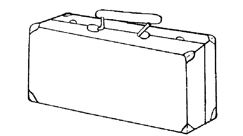
Pack Your Bags • Inside of the suitcase, draw FIVE things that you are going to take with you on our class trip to Canada. • Think about the location, climate, physical features, and natural resources of the country. Look in your notebook for clues about what you might need on your trip. • Next, include a brief description of why you chose to bring that particular item. • Color your suitcase—be creative! • Example: I’m bringing a snowboard so that I can go down the Rocky Mountains!
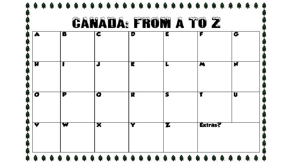
Teachers I give my students the following handout at the beginning of our Canada unit. I tell them to keep it handy in their Interactive Notebook, and whenever we discuss any words that begin with certain letters, they are to write them down. The first person to complete the chart wins a prize. *The words have to be things that we’ve discussed in class, not things that they already know, so they must always pay attention!
Teachers Thank you for downloading this file. I hope you enjoy using it with your students, and I can’t wait to read your feedback in my TPT store! • For more social studies materials, please visit my store: http: //www. teacherspayteachers. com/Store/Brain-Wrinkles • I teach 6 th grade Language Arts and Social Studies in Georgia, so my products are aligned with Common Core (LA) and Georgia Performance Standards (SS). © Copyright 2013. Brain Wrinkles. All rights reserved. Permission is granted to copy pages specifically designed for student or teacher use by the original purchaser or licensee. The reproduction of any other part of this product is strictly prohibited. Copying any part of this product and placing it on the Internet in any form (even a personal/classroom website) is strictly forbidden. Doing so makes it possible for an Internet search to make the document available on the Internet, free of charge, and is a violation of the Digital Millennium Copyright Act (DMCA).