Summary of HFIP Application Development and Diagnostics Team


- Slides: 34

Summary of HFIP Application Development and Diagnostics Team Mark De. Maria NESDIS/St. AR/RAMMB Advanced Diagnostics for Hurricane Models Workshop NCEP/EMC September 28, 2010 1

Outline • • Summary of ADD Team Plan Schematic of model diagnostic system Preliminary RAMMB/CIRA results from 2010 Possible ADD contributions to general diagnostic effort 2

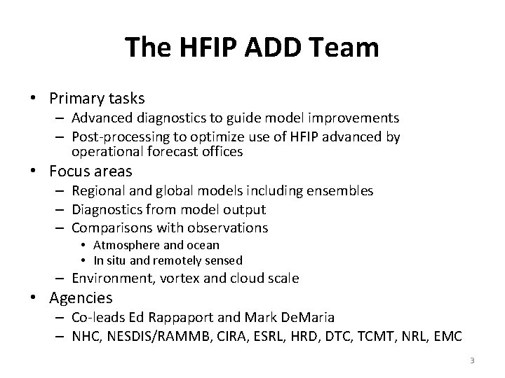
The HFIP ADD Team • Primary tasks – Advanced diagnostics to guide model improvements – Post-processing to optimize use of HFIP advanced by operational forecast offices • Focus areas – Regional and global models including ensembles – Diagnostics from model output – Comparisons with observations • Atmosphere and ocean • In situ and remotely sensed – Environment, vortex and cloud scale • Agencies – Co-leads Ed Rappaport and Mark De. Maria – NHC, NESDIS/RAMMB, CIRA, ESRL, HRD, DTC, TCMT, NRL, EMC 3

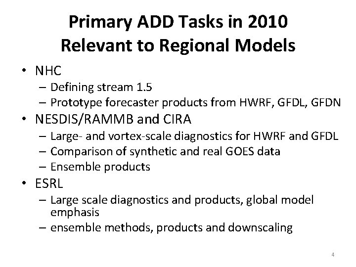
Primary ADD Tasks in 2010 Relevant to Regional Models • NHC – Defining stream 1. 5 – Prototype forecaster products from HWRF, GFDL, GFDN • NESDIS/RAMMB and CIRA – Large- and vortex-scale diagnostics for HWRF and GFDL – Comparison of synthetic and real GOES data – Ensemble products • ESRL – Large scale diagnostics and products, global model emphasis – ensemble methods, products and downscaling 4

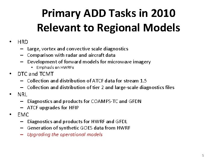
Primary ADD Tasks in 2010 Relevant to Regional Models • HRD – Large, vortex and convective scale diagnostics – Comparison with radar and aircraft data – Development of forward models for microwave imagery • Emphasis on HWRFx • DTC and TCMT – Collection and distribution of ATCF data for stream 1. 5 – Collection and distribution of tier 2 and large-scale diagnostics files • NRL – Diagnostics and products for COAMPS-TC and GFDN – ATCF upgrades for HFIP • EMC – Diagnostics and products for HWRF and GFDL – Generation of synthetic GOES data from HWRF – Upgrading the operational models 5

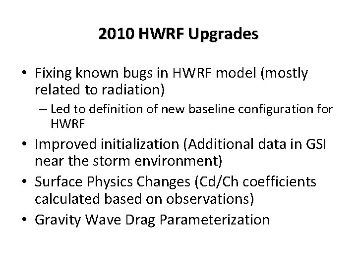
2010 HWRF Upgrades • Fixing known bugs in HWRF model (mostly related to radiation) – Led to definition of new baseline configuration for HWRF • Improved initialization (Additional data in GSI near the storm environment) • Surface Physics Changes (Cd/Ch coefficients calculated based on observations) • Gravity Wave Drag Parameterization

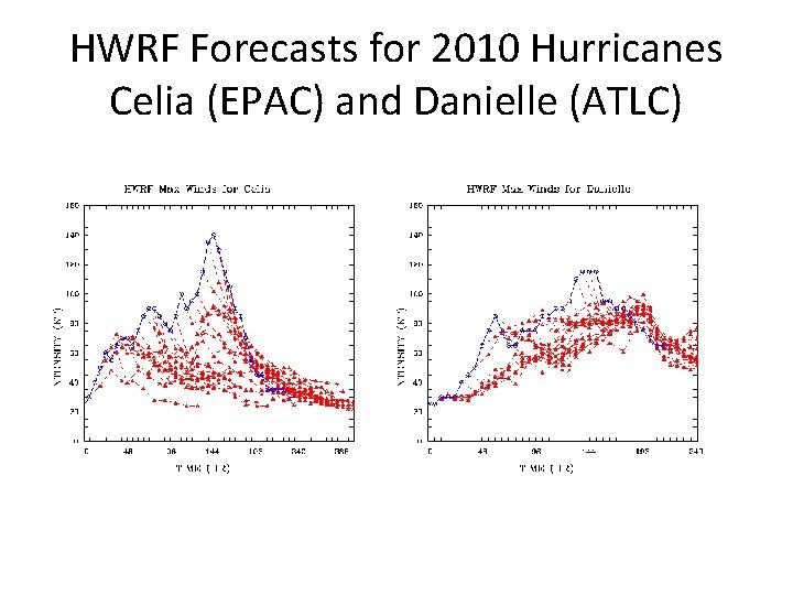
HWRF Forecasts for 2010 Hurricanes Celia (EPAC) and Danielle (ATLC)

Automotive Diagnostics

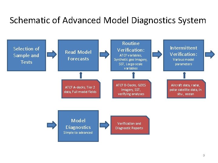
Schematic of Advanced Model Diagnostics System Selection of Sample and Tests Read Model Forecasts ATCF A-decks, Tier 2 data, Full model fields Model Diagnostics Routine Verification: ATCF variables, Synthetic geo imagery, SST, Large-scale variables ATCF B-Decks, GOES imagery, SST, verifying analyses Intermittent Verification: Various model parameters Aircraft data, radar, polar satellite data, in situ , ocean Verification and Diagnostic Reports Simple to advanced 9

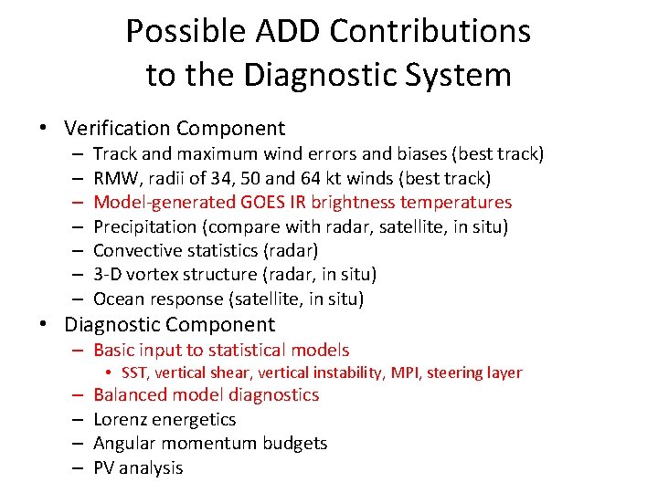
Possible ADD Contributions to the Diagnostic System • Verification Component – – – – Track and maximum wind errors and biases (best track) RMW, radii of 34, 50 and 64 kt winds (best track) Model-generated GOES IR brightness temperatures Precipitation (compare with radar, satellite, in situ) Convective statistics (radar) 3 -D vortex structure (radar, in situ) Ocean response (satellite, in situ) • Diagnostic Component – Basic input to statistical models • SST, vertical shear, vertical instability, MPI, steering layer – – Balanced model diagnostics Lorenz energetics Angular momentum budgets PV analysis

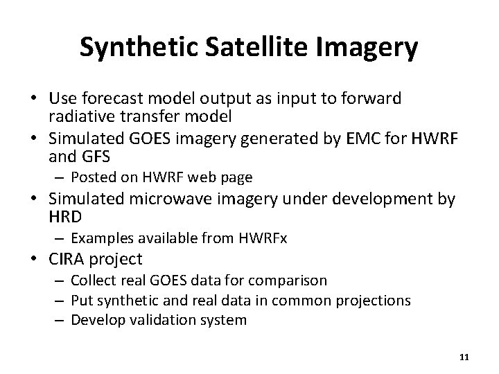
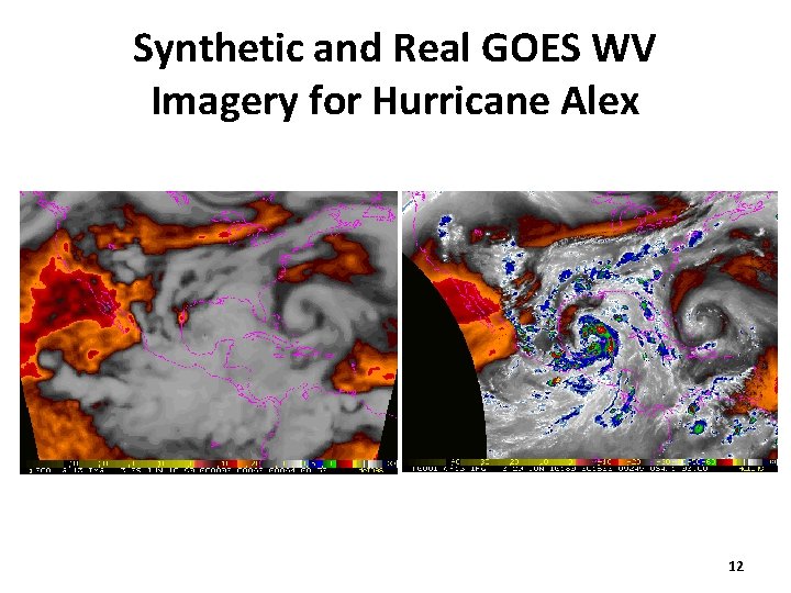
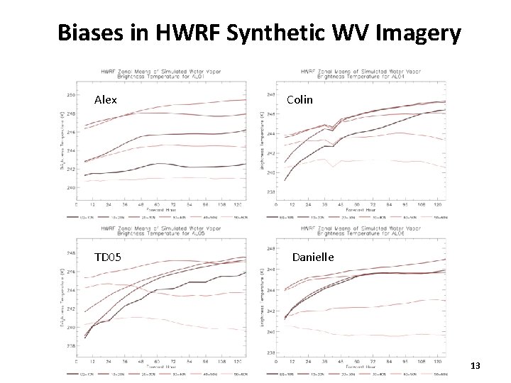
Synthetic Satellite Imagery • Use forecast model output as input to forward radiative transfer model • Simulated GOES imagery generated by EMC for HWRF and GFS – Posted on HWRF web page • Simulated microwave imagery under development by HRD – Examples available from HWRFx • CIRA project – Collect real GOES data for comparison – Put synthetic and real data in common projections – Develop validation system 11

Synthetic and Real GOES WV Imagery for Hurricane Alex 12

Biases in HWRF Synthetic WV Imagery Alex TD 05 Colin Danielle 13

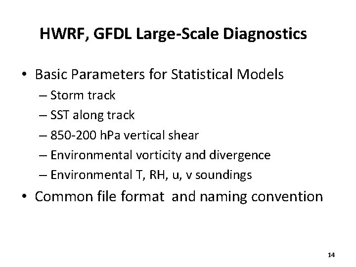
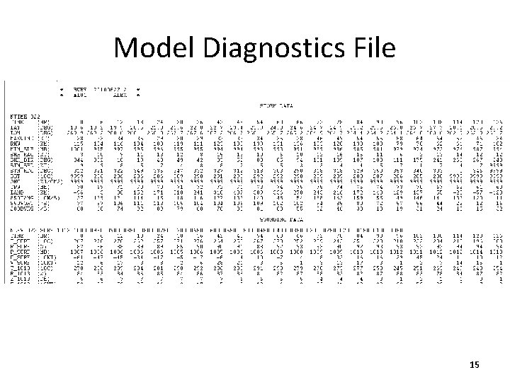
HWRF, GFDL Large-Scale Diagnostics • Basic Parameters for Statistical Models – Storm track – SST along track – 850 -200 h. Pa vertical shear – Environmental vorticity and divergence – Environmental T, RH, u, v soundings • Common file format and naming convention 14

Model Diagnostics File 15

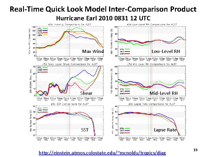
Real-Time Quick Look Model Inter-Comparison Product Hurricane Earl 2010 0831 12 UTC Max Wind Shear SST Low-Level RH Mid-Level RH Lapse Rate http: //einstein. atmos. colostate. edu/~mcnoldy/tropics/diag 16

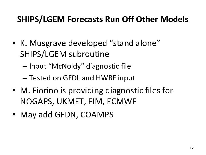
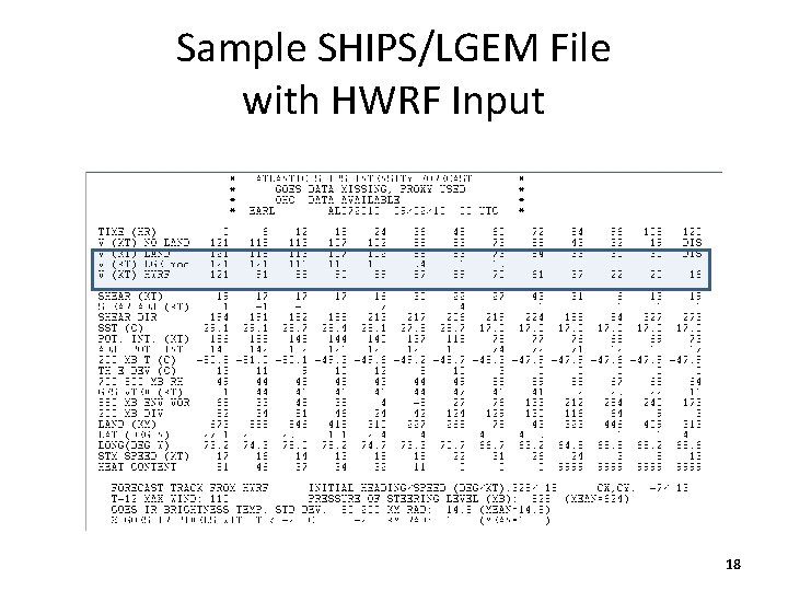
SHIPS/LGEM Forecasts Run Off Other Models • K. Musgrave developed “stand alone” SHIPS/LGEM subroutine – Input “Mc. Noldy” diagnostic file – Tested on GFDL and HWRF input • M. Fiorino is providing diagnostic files for NOGAPS, UKMET, FIM, ECMWF • May add GFDN, COAMPS 17

Sample SHIPS/LGEM File with HWRF Input 18

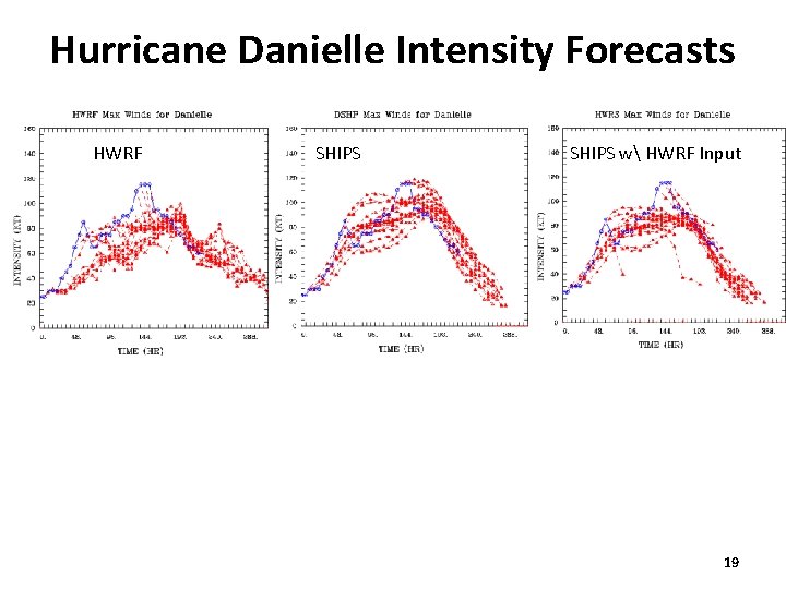
Hurricane Danielle Intensity Forecasts HWRF SHIPS w HWRF Input 19

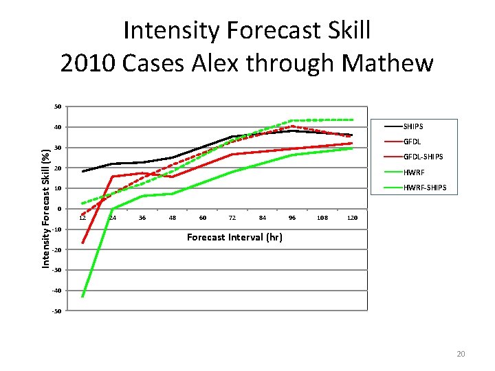
Intensity Forecast Skill 2010 Cases Alex through Mathew 50 SHIPS Intensity Forecast Skill (%) 40 GFDL 30 GFDL-SHIPS 20 HWRF 10 HWRF-SHIPS 0 12 -10 24 36 48 60 72 84 96 108 120 Forecast Interval (hr) -20 -30 -40 -50 20

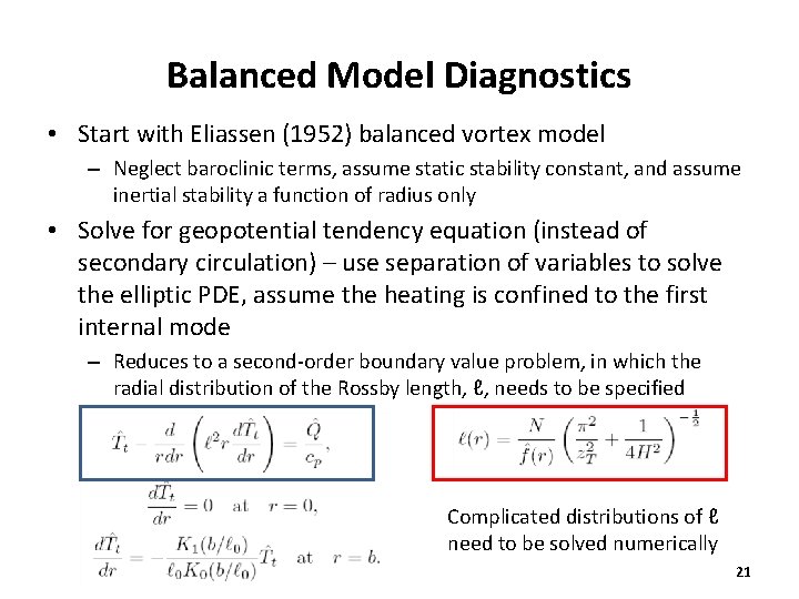
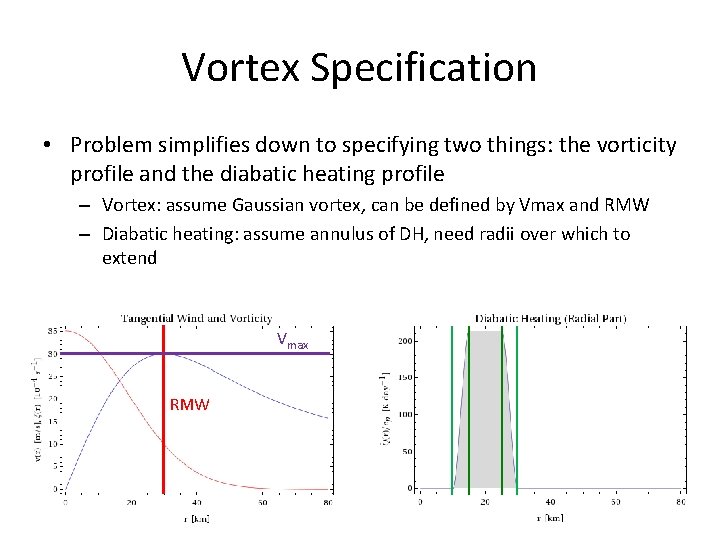
Balanced Model Diagnostics • Start with Eliassen (1952) balanced vortex model – Neglect baroclinic terms, assume static stability constant, and assume inertial stability a function of radius only • Solve for geopotential tendency equation (instead of secondary circulation) – use separation of variables to solve the elliptic PDE, assume the heating is confined to the first internal mode – Reduces to a second-order boundary value problem, in which the radial distribution of the Rossby length, ℓ, needs to be specified Complicated distributions of ℓ need to be solved numerically 21

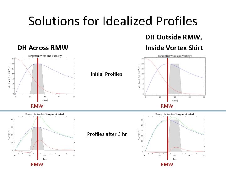
Solutions for Idealized Profiles DH Outside RMW, Inside Vortex Skirt DH Across RMW Initial Profiles RMW Profiles after 6 hr RMW

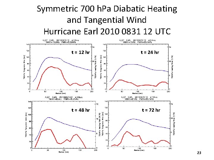
Symmetric 700 h. Pa Diabatic Heating and Tangential Wind Hurricane Earl 2010 0831 12 UTC t = 12 hr t = 24 hr t = 48 hr t = 72 hr 23

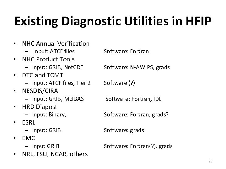
Tools needed For Diagnostic System • Model output readers • Verification datasets and readers • Numerical operations – Coordinate transformations • z to P, map projections to cylindrical, etc – Derivative and integral operators – Interpolation operators – Subsets of model subroutines, forward models • Statistical tools • Graphical output generation 24

Existing Diagnostic Utilities in HFIP • NHC Annual Verification – Input: ATCF files Software: Fortran – Input: GRIB, Net. CDF Software: N-AWIPS, grads – Input: ATCF files, Tier 2 Software (? ) – Input: GRIB, Mc. IDAS Software: Fortran, IDL – Input: Binary, Software: Fortran, grads? – Input: GRIB Software: grads – Input GRIB Software: Fortran(? ), grads • NHC Product Tools • DTC and TCMT • NESDIS/CIRA • HRD Diapost • ESRL • EMC • NRL, FSU, NCAR, others 25

Back-Up Slides 26

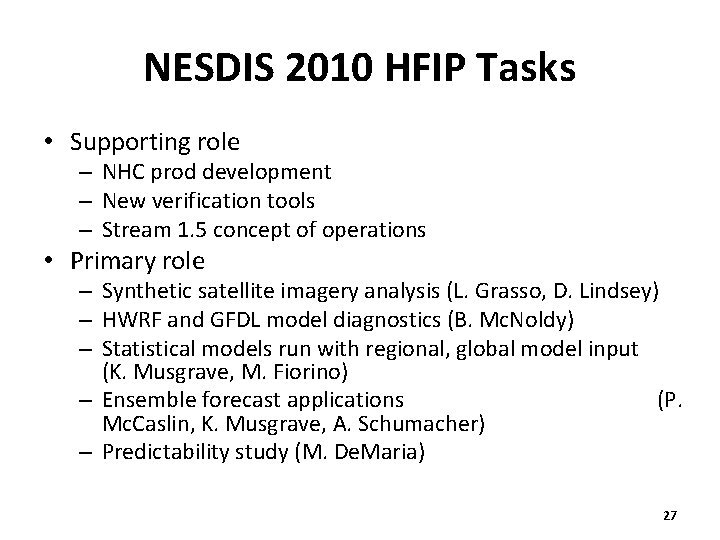
NESDIS 2010 HFIP Tasks • Supporting role – NHC prod development – New verification tools – Stream 1. 5 concept of operations • Primary role – Synthetic satellite imagery analysis (L. Grasso, D. Lindsey) – HWRF and GFDL model diagnostics (B. Mc. Noldy) – Statistical models run with regional, global model input (K. Musgrave, M. Fiorino) – Ensemble forecast applications (P. Mc. Caslin, K. Musgrave, A. Schumacher) – Predictability study (M. De. Maria) 27

Vortex Specification • Problem simplifies down to specifying two things: the vorticity profile and the diabatic heating profile – Vortex: assume Gaussian vortex, can be defined by Vmax and RMW – Diabatic heating: assume annulus of DH, need radii over which to extend Vmax RMW

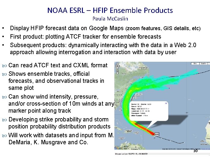
NOAA ESRL – HFIP Ensemble Products Paula Mc. Caslin • Display HFIP forecast data on Google Maps (zoom features, GIS details, etc) • First product: plotting ATCF tracker for ensemble forecasts • Subsequent products: dynamically interacting with the data in a Web 2. 0 approach allowing interrogation and interaction with data by user Can read ATCF text and CXML format Shows ensemble tracks, official forecasts, and observational tracks in same plot Can show wind intensity, pressure, and/or cross-section of 10 m winds at any marker point along track Developing strike probability and storm position probability distribution products Will work with datasets and input from M. De. Maria, K. Musgrave and Co. 29

NOAA ESRL – HFIP Ensemble Products Paula Mc. Caslin • Display HFIP forecast data on Google Maps (zoom features, GIS details, etc) • First product: plotting ATCF tracker for ensemble forecasts • Subsequent products: dynamically interacting with the data in a Web 2. 0 approach allowing interrogation and interaction with data by user Can read ATCF text and CXML format Shows ensemble tracks, official forecasts, and observational tracks in same plot Can show wind intensity, pressure, and/or cross-section of 10 m winds at any marker point along track Developing strike probability and storm position probability distribution products Will work with datasets and input from M. De. Maria, K. Musgrave and Co. 30

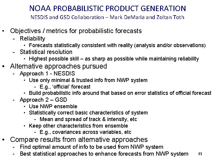
NOAA PROBABILISTIC PRODUCT GENERATION NESDIS and GSD Collaboration – Mark De. Maria and Zoltan Toth • Objectives / metrics for probabilistic forecasts - Reliability • Forecasts statistically consistent with reality (analysis and/or observations) - Statistical resolution • Highest possible skill – as sharp as possible while maintaining reliability • Alternative approaches pursued - Approach 1 - NESDIS • Use only minimal & trusted info from NWP system - E. g. , ‘official’ forecast • Build probabilistic info around that based on error statistics of official forecast - Approach 2 – GSD • Use NWP ensemble • Statistically correct basic characteristics of system - Mean and spread of track & intensity, etc • Keep other characteristics from ensemble - E. g. , covariances across variables, etc • Compare results from alternative approaches - Find optimal amount of info to be used from NWP system - Best statistical approaches to enhance forecasts from NWP system 31

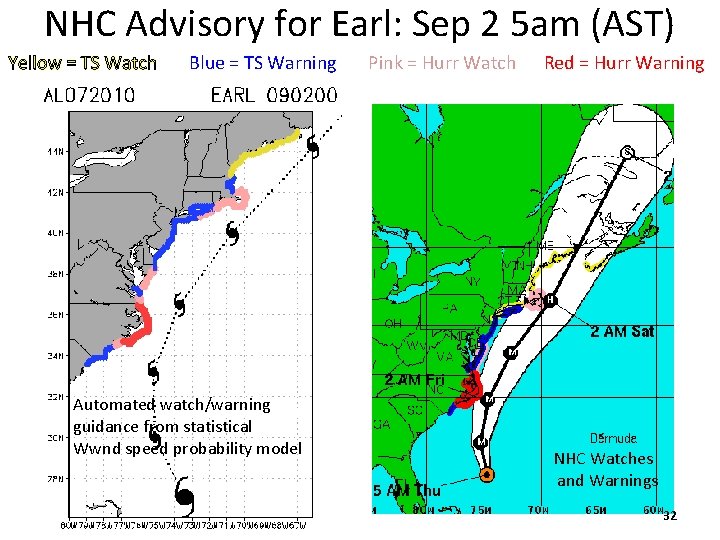
NHC Advisory for Earl: Sep 2 5 am (AST) Yellow = TS Watch Blue = TS Warning Automated watch/warning guidance from statistical Wwnd speed probability model Pink = Hurr Watch Red = Hurr Warning NHC Watches and Warnings 32

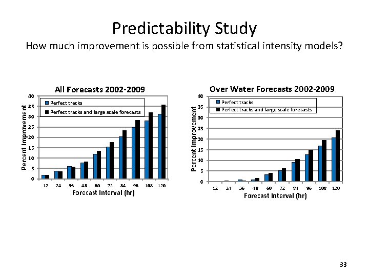
Predictability Study How much improvement is possible from statistical intensity models? All Forecasts 2002 -2009 40 Perfect tracks 35 Percent Improvement 40 Perfect tracks and large scale forecasts 30 25 20 15 10 5 0 12 24 36 48 60 72 84 96 Forecast Interval (hr) 108 120 Over Water Forecasts 2002 -2009 Perfect tracks and large scale forecasts 35 30 25 20 15 10 5 0 12 24 36 48 60 72 84 96 Forecast Interval (hr) 108 120 33

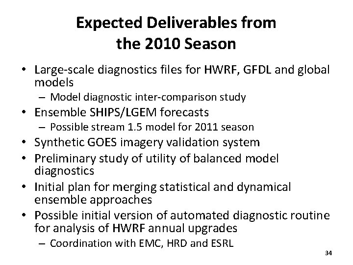
Expected Deliverables from the 2010 Season • Large-scale diagnostics files for HWRF, GFDL and global models – Model diagnostic inter-comparison study • Ensemble SHIPS/LGEM forecasts – Possible stream 1. 5 model for 2011 season • Synthetic GOES imagery validation system • Preliminary study of utility of balanced model diagnostics • Initial plan for merging statistical and dynamical ensemble approaches • Possible initial version of automated diagnostic routine for analysis of HWRF annual upgrades – Coordination with EMC, HRD and ESRL 34