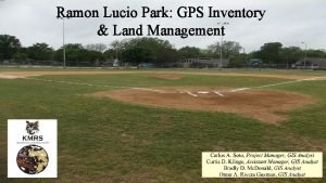
Ramon Lucio Park GPS Inventory Land Management 1


- Slides: 19

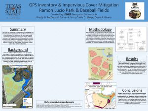
Ramon Lucio Park: GPS Inventory & Land Management

1 Outline 1. Introduction 2. Data 3. Methods 4. Results 5. Conclusions

2 Introduction San Marcos, Texas & the San Marcos River Corridor GPS Inventory & Land Management Rio Vista Park Pilot Project

3

4 Data The COSM provided an aerial image of the park, relevant land development code, and the following shapefiles: 1. River 2. Park Boundaries 3. Buildings 4. Road Centerline 5. Pavement Edge The course instructor provided a copy of all submitted Rio Vista Park project data

5 Data Rio Vista Park project data: 1. Features Landscape Map 2. Data Dictionary Spreadsheet 3. Trimble Data Dictionary 4. Rio Vista Park Geodatabase (GDB) 5. Features Landscape Arc. Map Document 6. Images

Methods – Previous Work Assessment 6 Previous file GDB architecture & data collection methodology evaluation

7 Methods – GPS Data Collection Logging Settings Real-Time Satellite Based Augmentation System (SBAS) Corrected signal • Point feature position averaging: 30 positions @ 1 s intervals • Line & polygon features mapped at 5 s intervals. • Positions with HDOP > 10 Deleted Post-Processing Height, Position Dilution of Precision (HDOP, PDOP) Accuracy Aerial Image Georectification • Positions with PDOP > 10 Deleted • Positions with Horizontal Accuracy of 40” or less were kept • Points within the park and 4 additional points more than ¼ mile away from nearest park boundary.

8 Methods – Impervious Cover Calculation & Analysis (Total Impervious Cover)/(Total Park Area) = % Impervious Cover Mitigation Plan: 1. San Marcos: Green Infrastructure – LID Practices Guidance Manual (COSM 2011) 2. Stormwater Technical Manual (COSM 2014)

9 Methods – Database Merger All feature classes in Rio_Vista_Park. gdb exported to shapefiles “PARK_NAME” attribute added to shapefiles (Rio Vista and Ramon Lucio) Shape files for feature classes appearing in more than one park merged (ex. Park Benches) New GDB named San. Marcos. Parks. gdb created All shapefiles imported to new GDB

10 Results – Previous Work Structure Accuracy

11 Results – Data Collection Line and polygon features required georectification Achieved with image provided by COSM and georeferenced by us

Results – Impervious Cover 12 Sq ft Acreage % of Park IC Enclosed % of Zone Park Size 810390 18. 60 100. 0% N/A Existing IC 183267 4. 21 22. 6% N/A 100’ Buffer 157072. 05 3. 61 19. 4% 7294. 786 0. 05 % 200’ Buffer 140171. 48 3. 22 17. 3% 16939. 638 0. 12 % Remainder 513146 11. 78 63. 3% 159032. 5758 0. 31 Impervious cover within 100’ buffer also falls within the floodplain. All Impervious cover within park boundaries should be relocated to areas as far from the banks of the river as possible.

13 Results – Impervious Cover Areas in closest proximity to San Marcos River include portions of single largest continuous expanse of impervious cover

14 Results – Parking Main parking area should be moved to areas farthest from river.

15 Results – Drainage Area of most concern is retention area (left) draining into San Marcos River (below).

16 Results – Drainage

17 Conclusion KMRS Geospatial Consultants completed a facilities inventory at Ramon Lucio Park & Baseball Fields and proposed an impervious cover mitigation plan. Existing data acquisition methods were improved. An expandable geodatabase that can be updated according to the COSM’s growing needs was created. Data produced can help the COSM in reaching their objectives of: 1. Reducing park maintenance cost 2. Facilitating dissemination of information to the public 3. Providing scientific analytics for sound ecological range management

18 References Flinker, Peter; 2008. The Need To Reduce Impervious Cover to Prevent Flooding and Protect Water Quality. Rhode Island Department of Environmental Management, 2008, revised 2010. City of San Marcos; 2011. San Marcos: Green Infrastructure – LID Practices & LID Guidance manual. November 2011. City Of San Marcos; 2014. Stormwater Technical Manual. February 2014.
 Ramon lucio park
 Gps gps gps
 Modulo positioning
 Aeneadae sive decius
 Lucio rossi
 Lucio rossi
 Outelock
 Quadrifarmaco
 Lucio andreani
 K
K Es probable que lucio y carmen (dormir).
 Liceo classico lucio anneo seneca
 Lucio costa brasilia plan
 Mi piace la nutella
 Lucio tarquinio
 Lucio baggio
 Robert lucio
 An area of land largely enclosed by higher land
 Identifying landforms
 Brush mountain park orchard park
