Multimedia Resources NWP Resources and new WRF Training
- Slides: 38
Multimedia Resources: NWP Resources and new WRF Training Dr. William R. Bua, Project Scientist, UCAR/COMET Bill. Bua@noaa. gov
Talk Outline • Introduction – Demystifying the NWP “black box” as a tool for understanding the atmosphere • Training on NWP on Met. Ed – NWP Model matrix • Nuts and bolts of NWP (PCU 1) • Specific model “architecture” (PCU 2) • Case studies (PCU 3) – Other content • Teletraining, webcasts, NWP modules • Multiple levels of content available – Introduction to meteorology – NWP/synoptic case study for advanced courses • WRF: An NWP infrastructure, not a specific model!
NWP Then…. • When I was an undergraduate at dear old State (Penn State)…. – Forecasting was an art, supported by science – Existing tools (1970 s) • Barotropic model (2 layers, 380 km) • Primitive Equation model (PE), 2. 5°, 8 layers ran out to 84 forecast hrs with barotropic ext to 144 hrs, was NH only until 1974, then global domain • Limited-area Fine Mesh (LFM, 190. 5 km, 6 layers) – 24 hours in 1974, 48 hours by 1976 • No biosphere modeling, soil modeling; fluxes were determined using crude energy balance methods
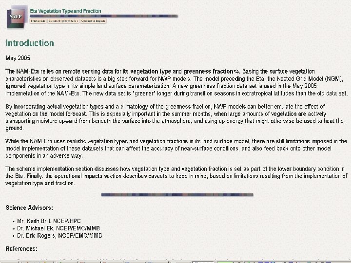
…and NOW • Now, forecasting is a science [NWP]; the art is in its use – Global Forecast System (GFS) at T 382 (about 50 km equivalent), 64 levels run to 384 hours, 4 layer soil model, predicted cloud water; ensemble forecasts based on GFS – Climate Forecast System (CFS) T 62 (about 310 km equivalent), 28 levels run out 9 months, coupled to a global ocean model – North American Mesoscale (NAM) Weather Research and Forecast (WRF) non-hydrostatic mesoscale model (NMM), 12 km, 60 levels, 4 layer soil model
What May Be Common to Both • NWP is a black box to many students (and forecasters, unfortunately) – Meteorological cancer* from unquestioning use of NWP • Teaching is not just for meteorologists … – But for the non-meteorological public as well • Multimedia is a good tool for demystification – Reaches people through visual, auditory, and even kinesthetic (e. g. VISITView, drawing/ participation by students) methods, “interactions” – Examples of some of these will follow * Snellman, L. , National Weather Digest, 16, 1991.
Multimedia NWP Training Materials • Many hours of training on generic NWP and model-specific architecture – – – Dynamics Precipitation microphysics Radiation and turbulence Data assimilation Post-processing • Material was developed for training experienced NWS meteorologists rather than students – Assumes knowledge of acronyms, jargon/short hand, concepts that may not hold for students – Material can be parsed out for use in the classroom, especially graphics and some learning objects
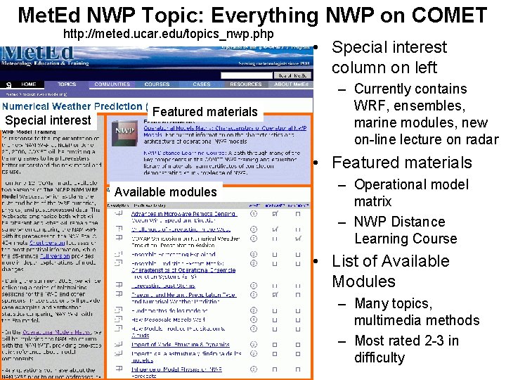
Met. Ed NWP Topic: Everything NWP on COMET http: //meted. ucar. edu/topics_nwp. php Special interest Featured materials • Special interest column on left – Currently contains WRF, ensembles, marine modules, new on-line lecture on radar • Featured materials Available modules – Operational model matrix – NWP Distance Learning Course • List of Available Modules – Many topics, multimedia methods – Most rated 2 -3 in difficulty
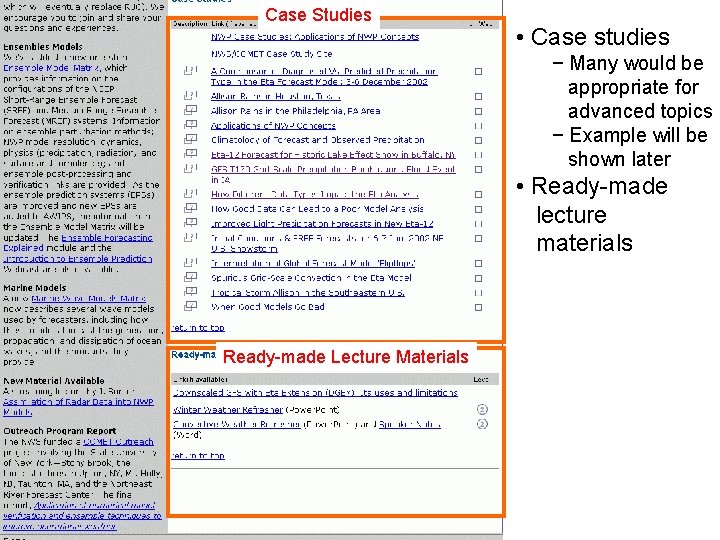
Case Studies • Case studies − Many would be appropriate for advanced topics − Example will be shown later • Ready-made lecture materials Ready-made Lecture Materials
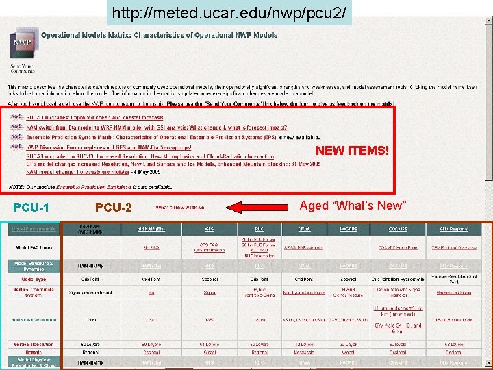
http: //meted. ucar. edu/nwp/pcu 2/ NEW ITEMS! PCU-1 PCU-2 Aged “What’s New”
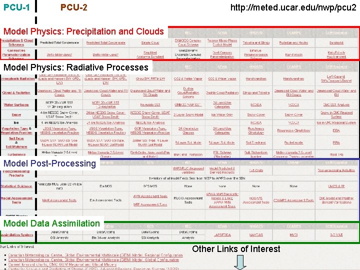
PCU-1 PCU-2 http: //meted. ucar. edu/nwp/pcu 2 Model Physics: Precipitation and Clouds Model Physics: Radiative Processes Model Post-Processing Model Data Assimilation Other Links of Interest
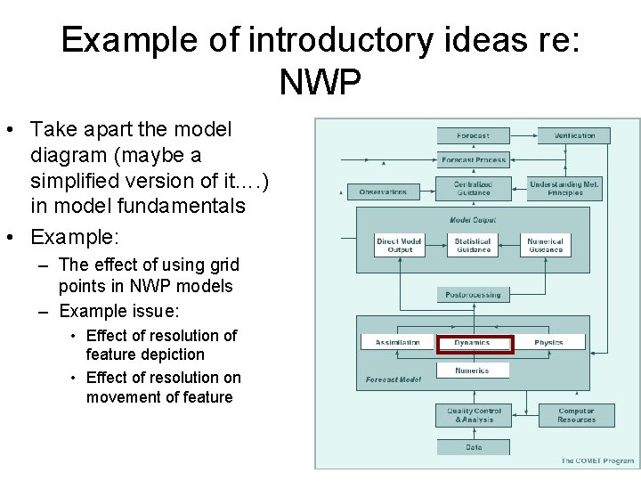
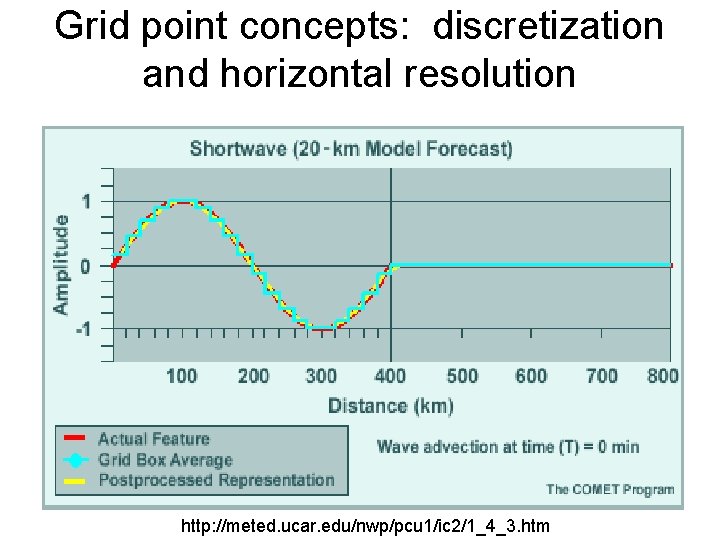
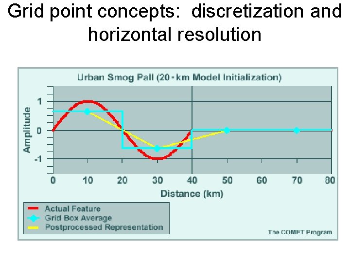
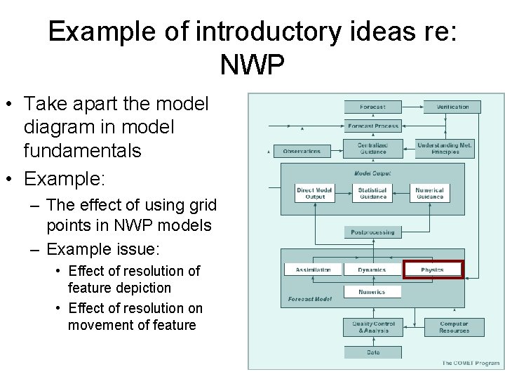
Example of introductory ideas re: NWP • Take apart the model diagram (maybe a simplified version of it…. ) in model fundamentals • Example: – The effect of using grid points in NWP models – Example issue: • Effect of resolution of feature depiction • Effect of resolution on movement of feature
Grid point concepts: discretization and horizontal resolution http: //meted. ucar. edu/nwp/pcu 1/ic 2/1_4_3. htm
Grid point concepts: discretization and horizontal resolution
Example of introductory ideas re: NWP • Take apart the model diagram in model fundamentals • Example: – The effect of using grid points in NWP models – Example issue: • Effect of resolution of feature depiction • Effect of resolution on movement of feature
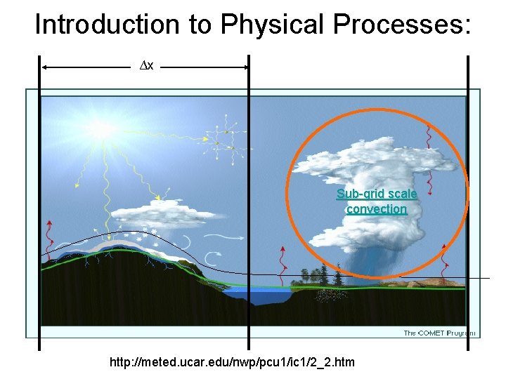
Introduction to Physical Processes: ∆x Sub-grid scale convection http: //meted. ucar. edu/nwp/pcu 1/ic 1/2_2. htm
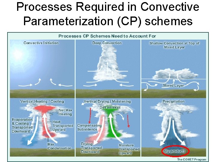
Processes Required in Convective Parameterization (CP) schemes
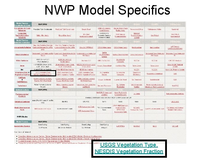
NWP Model Specifics USGS Vegetation Type, NESDIS Vegetation Fraction
Case Studies • Good tools for inquiry about NWP from a pedagogical and operational meteorology perspective • Possible inquiries: – Why did model not predict the weather event? – Why did model predict a weather event that did not occur? – How will new version of model (or entirely new model, like NAM NMM WRF) perform?
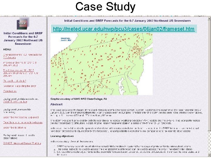
Case Study http: //meted. ucar. edu/nwp/pcu 3/cases/06 jan 02/frameset. htm
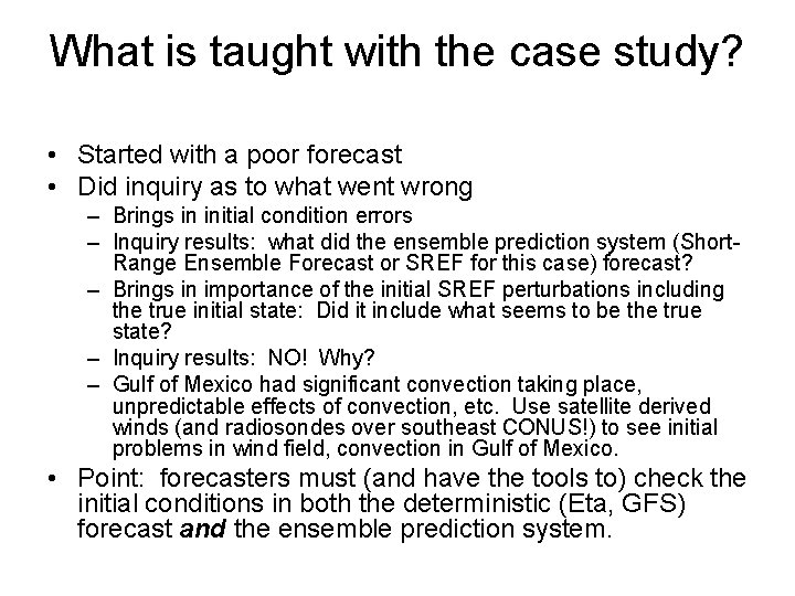
What is taught with the case study? • Started with a poor forecast • Did inquiry as to what went wrong – Brings in initial condition errors – Inquiry results: what did the ensemble prediction system (Short. Range Ensemble Forecast or SREF for this case) forecast? – Brings in importance of the initial SREF perturbations including the true initial state: Did it include what seems to be the true state? – Inquiry results: NO! Why? – Gulf of Mexico had significant convection taking place, unpredictable effects of convection, etc. Use satellite derived winds (and radiosondes over southeast CONUS!) to see initial problems in wind field, convection in Gulf of Mexico. • Point: forecasters must (and have the tools to) check the initial conditions in both the deterministic (Eta, GFS) forecast and the ensemble prediction system.
Is THIS W(o)RF?
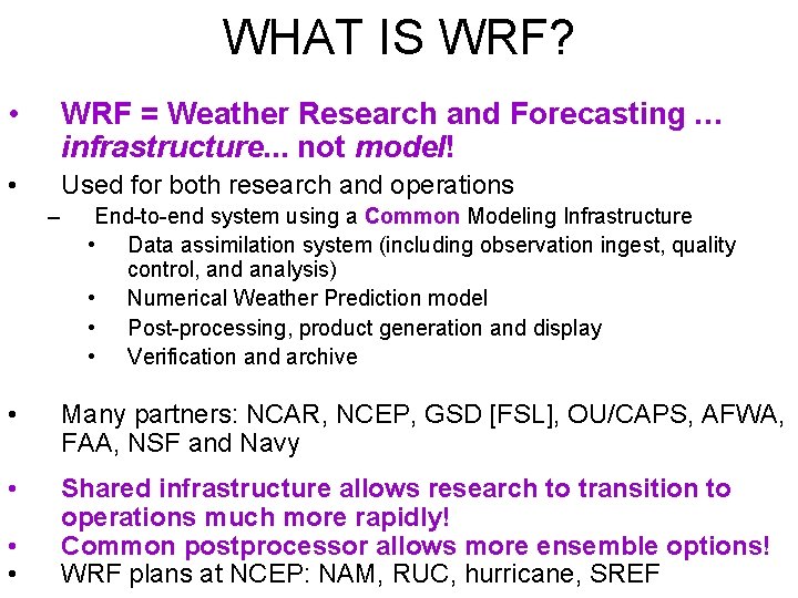
WHAT IS WRF? • WRF = Weather Research and Forecasting … infrastructure. . . not model! • Used for both research and operations – End-to-end system using a Common Modeling Infrastructure • Data assimilation system (including observation ingest, quality control, and analysis) • Numerical Weather Prediction model • Post-processing, product generation and display • Verification and archive • Many partners: NCAR, NCEP, GSD [FSL], OU/CAPS, AFWA, FAA, NSF and Navy • Shared infrastructure allows research to transition to operations much more rapidly! Common postprocessor allows more ensemble options! WRF plans at NCEP: NAM, RUC, hurricane, SREF • •
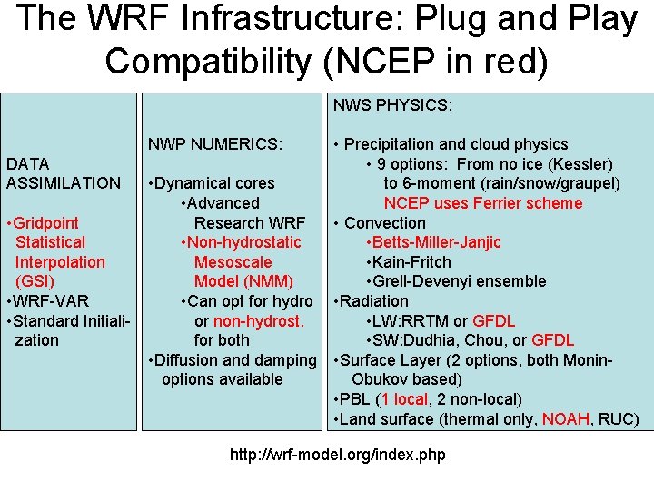
The WRF Infrastructure: Plug and Play Compatibility (NCEP in red) NWS PHYSICS: NWP NUMERICS: DATA ASSIMILATION • Gridpoint Statistical Interpolation (GSI) • WRF-VAR • Standard Initialization • Dynamical cores • Advanced Research WRF • Non-hydrostatic Mesoscale Model (NMM) • Can opt for hydro or non-hydrost. for both • Diffusion and damping options available • Precipitation and cloud physics • 9 options: From no ice (Kessler) to 6 -moment (rain/snow/graupel) NCEP uses Ferrier scheme • Convection • Betts-Miller-Janjic • Kain-Fritch • Grell-Devenyi ensemble • Radiation • LW: RRTM or GFDL • SW: Dudhia, Chou, or GFDL • Surface Layer (2 options, both Monin. Obukov based) • PBL (1 local, 2 non-local) • Land surface (thermal only, NOAH, RUC) http: //wrf-model. org/index. php
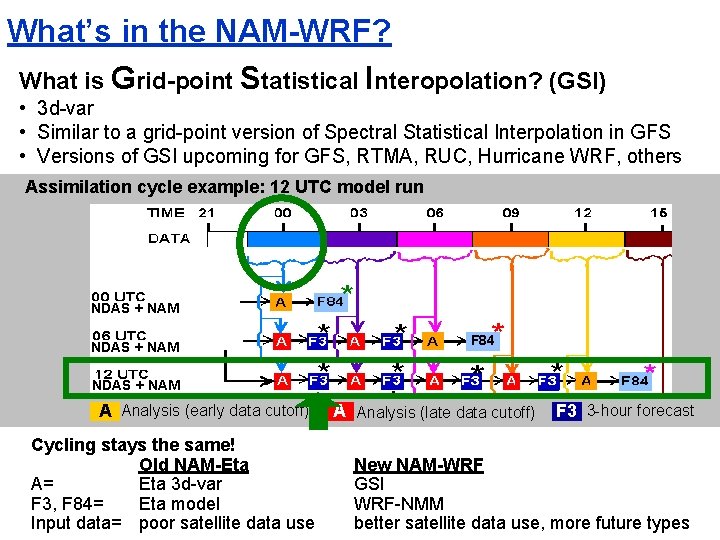
What’s in the NAM-WRF? What is Grid-point Statistical Interopolation? (GSI) • 3 d-var • Similar to a grid-point version of Spectral Statistical Interpolation in GFS • Versions of GSI upcoming for GFS, RTMA, RUC, Hurricane WRF, others Assimilation cycle example: 12 UTC model run NDAS + NAM F 84 NDAS + NAM A Analysis (early data cutoff) Cycling stays the same! Old NAM-Eta A= Eta 3 d-var F 3, F 84= Eta model Input data= poor satellite data use A Analysis (late data cutoff) F 3 3 -hour forecast New NAM-WRF GSI WRF-NMM better satellite data use, more future types
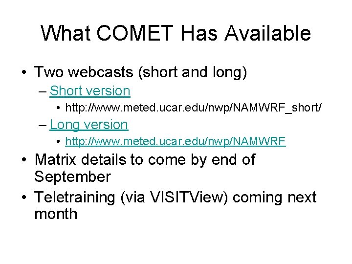
What COMET Has Available • Two webcasts (short and long) – Short version • http: //www. meted. ucar. edu/nwp/NAMWRF_short/ – Long version • http: //www. meted. ucar. edu/nwp/NAMWRF • Matrix details to come by end of September • Teletraining (via VISITView) coming next month
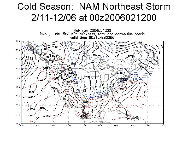
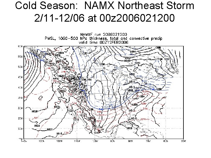
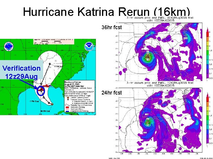
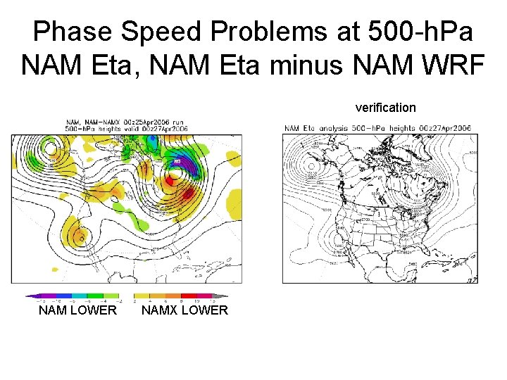
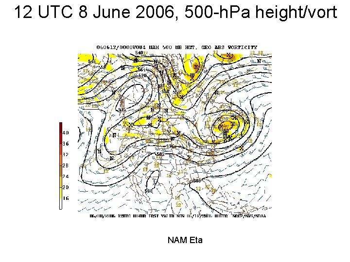
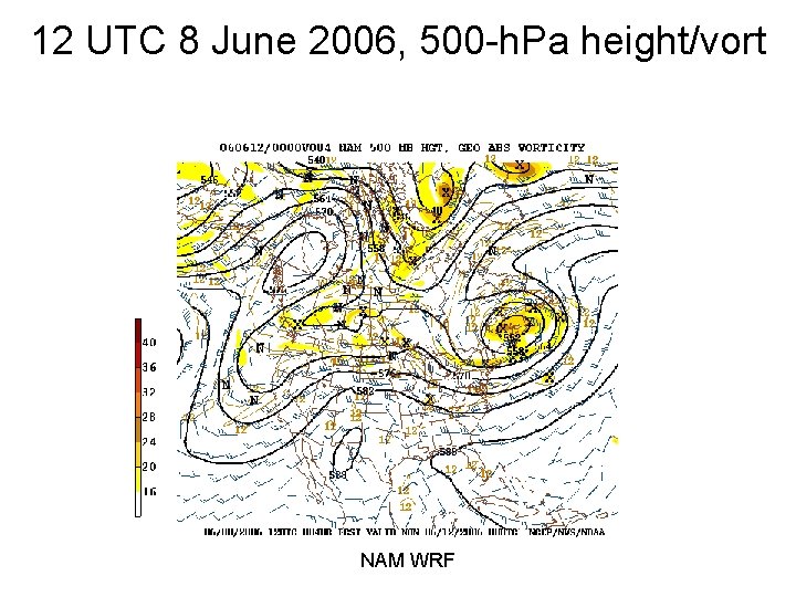
Teasers from Teletraining (comparisons of NAM WRF v NAM Eta) • Cold Season Examples: – 11 -12 February 2006 snow storm • Warm Season Examples: – Tropical Storm Alberto and Katrina Rerun • Other Examples – Phase speed (and overamplification? ) problem (late April, early June)
Cold Season: NAM Northeast Storm 2/11 -12/06 at 00 z 2006021200
Cold Season: NAMX Northeast Storm 2/11 -12/06 at 00 z 2006021200
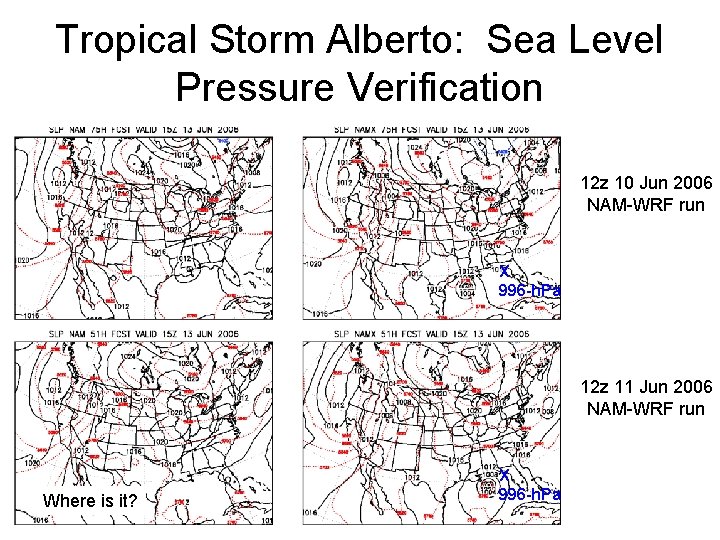
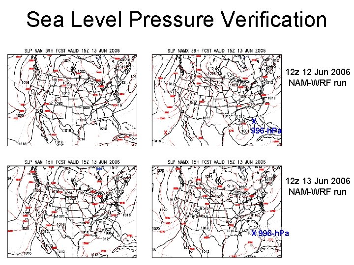
Tropical Storm Alberto: June 2006 • 1 st named storm of 2006 season • NAM-Eta did poor job with development and movement • NAM-WRF did better job earlier in the development, but was too strong w/cyclone for awhile. – Note: Two previous false alarms from NAM-WRF … this will likely be a characteristic of model, similar to how GFS behaved in past seasons • NAM-WRF had precip. after landfall too far inland for a time • NAM-WRF does *not* have vortex relocation like GFS
Tropical Storm Alberto: Sea Level Pressure Verification 12 z 10 Jun 2006 NAM-WRF run X 996 -h. Pa 12 z 11 Jun 2006 NAM-WRF run Where is it? X 996 -h. Pa
Sea Level Pressure Verification 12 z 12 Jun 2006 NAM-WRF run x X 996 -h. Pa 12 z 13 Jun 2006 NAM-WRF run X 996 -h. Pa
Hurricane Katrina Rerun (16 km) 36 hr fcst Verification 12 z 29 Aug 24 hr fcst
Phase Speed Problems at 500 -h. Pa NAM Eta, NAM Eta minus NAM WRF verification NAM LOWER NAMX LOWER
12 UTC 8 June 2006, 500 -h. Pa height/vort NAM Eta
12 UTC 8 June 2006, 500 -h. Pa height/vort NAM WRF
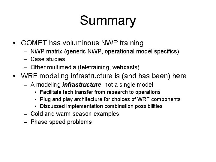
Summary • COMET has voluminous NWP training – NWP matrix (generic NWP, operational model specifics) – Case studies – Other multimedia (teletraining, webcasts) • WRF modeling infrastructure is (and has been) here – A modeling infrastructure, not a single model • Facilitate tech transfer from research to operations • Plug and play architecture for choices of WRF components • Discussed implementation combination possibilities – Cold and warm season examples – Phase speed problems
Where To Go for Materials • Met. Ed web site (http: //meted. ucar. edu, click on NWP topic) • NWP model matrix (http: //meted. ucar. edu/nwp/pcu 2) – One stop shop for generic and model specific NWP • E-mail to the COMET NWP Training Team – Bill. Bua@noaa. gov – Stephen. Jascourt@noaa. gov