Minnesota Geospatial Advisory Council March 11 2020 Welcome


 Gerry Sjerven")
 Interagency Climate Adaptation Team, formed")


 Metro MAWD Regional GIS user &")


- Slides: 38
Minnesota Geospatial Advisory Council March 11, 2020
Welcome • Introductions • Approve agenda • Approve December minutes
Agenda Time Topic 11: 15 Committee annual reports - Review and accept 11: 20 GAC accomplishments and work plan – Review and approve 11: 30 GAC chair and vice chair duties update 11: 35 GIS/LIS Consortium salary survey 11: 40 GIS-T conference 11: 45 Initiative for Climate Action Transparency 11: 55 One Minnesota Plan Response working group update 12: 05 Break, networking 12: 35 Sector report: Watershed Districts 12: 45 GAC priority projects and initiatives updates 1: 25 Legislative updates 1: 35 Announcements
Agenda Item 2 Committee Annual Reports - Review and accept
Agenda Item 3 GAC Accomplishments and Work Plan – Review and approve Mark Kotz
GAC Accomplishments • Created Image Service Sustainability Committee • Created Awards Committee • Clarified language for the Governor’s Geospatial Commendation Award • Swapped Archiving Workgroup for Archiving Implementation Workgroup • Formed ad-hoc group about One Minnesota Plan
GAC Accomplishments • Approved Road Centerline Data Standard • Approved revision to the Parcel Data Standard • Approved formal process for creating, approving and revising standards • Approved old Governor’s Council on Geographic Information standards” • state, county and CTU codes • positional accuracy reporting • US National Grid
GAC 2020 Work Plan • Approve damage assessment data standard • Ratify remaining older GCGI standards • Promote & facilitate progress on priority geospatial projects and initiatives • Begin measuring progress on GAC priorities • Continue to increase outreach to the geospatial and related communities. • Formal efforts of the Outreach Committee • Less formally by GAC members and their sectors and stakeholders • Conduct annual geospatial community priorities survey
Agenda Item 4 GAC Chair and Vice Chair Duties Update Cory Richter, Mark Kotz
Vice Chair Duties Update • GAC Calendar • GAC Committees and priority projects • Metrics and goal setting • Web presence • Important dates published • Priority Survey • Broad promotion • Engage stakeholder groups
Agenda Item 5 GIS/LIS Consortium Salary Survey Ryan Stovern
Agenda Item 6 GIS-T Conference Ben Timerson
GIS for Transportation Overview • https: //gis-t. transportation. org/Program/ • Tuesday, April 14 are workshops, ½ day morning and ½ day afternoon • Wednesday, April 15 to Friday, April 17 • Early-Bird cost is $550, One-Day is $325, and Student is $385 • All go up $100 after March 13 • Map Gallery still accepting posters until March 27 • Special Interest Groups (SIGs) - Women in GIS • Exhibit Hall with vendors • Esri Hands-on learning lab
Session Topics: 28 Sessions and 84 Presentations • Asset Management • Geospatial Collaboration • Data Governance • LRS Implementation • Data Management & LRS • Emerging Technology • Energy and the Environment • Mobile Data • Process Improvement • Solving Geospatial Issues • Traffic Data • Traffic and Safety • Enterprise LRS & Business Integration • Transport Canada • Federal Topics • Work Zone Initiatives
Sessions and Presenters Round Table Discussions • Getting Current, Authoritative Data in the Hands of GPS Users – Dan Ross, moderating Presentations • Statewide Multisector Geospatial collaboration – Mark Kotz • Improving Traffic Safety Outcomes by Bringing People and Systems Together – Dan Ross
Agenda Item 7 Initiative for Climate Action Transparency (ICAT) Gerry Sjerven
Agenda Item #7 Initiative for Climate Action Transparency (ICAT) Interagency Climate Adaptation Team, formed in 2009, to explore climate change in Minnesota and how to adapt. Includes representatives from: • Pollution Control Agency (Lead agency) • Department of Natural Resources • Department of Health • Department of Agriculture • Department of Transportation • Department of Commerce (Office of Energy Security) • Department of Public Safety (Division of Homeland Security and Emergency Management) • Board of Water and Soil Resources • Metropolitan Council
ICAT Five statewide indicators to help track climate change impacts and Minnesota’s progress in climate adaption 1. Climate adaptation planning among state agencies, tribes and local units 2. Disruptions to the power grid 3. Heat-related health impacts 4. Damages from extreme weather 5. Urban and community forest canopy cover 2019 Climate Adaptation Planning Survey Report § MPCA and Management Analysis and Development (MAD) developed survey
ICAT - GAC & Committee Roles What is current role of GAC members with ICAT membership? How do we communicate with ICAT? Next Steps?
Agenda Item 8 One Minnesota Plan Response Working Group update Victoria Reinhardt, Renee Huset
Break - Networking
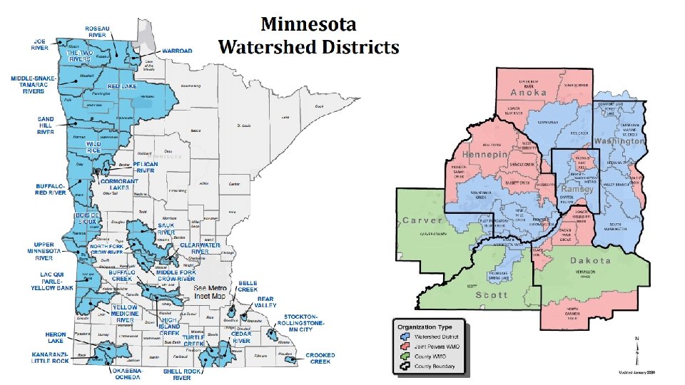
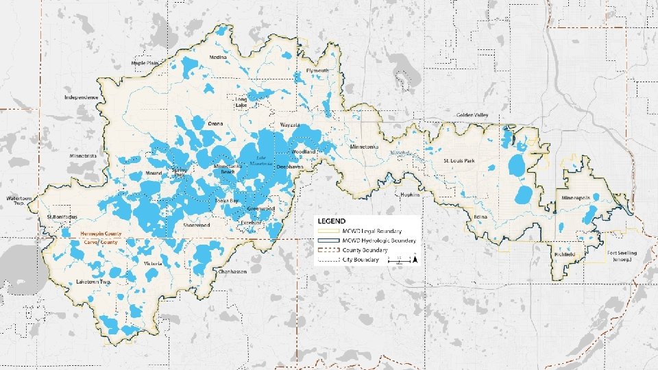
Agenda Item 10 Sector Report Watershed Districts: Alex Steele
Photo credit: Ernesto Ruiz Minnesota Geospatial Advisory Council Sector Report
Minnesota Geospatial Advisory Council Data standards Statewide datasets State/regional imagery services Li. DAR and derived products (DEM, Hydro. DEM)
Sector Engagement Minnesota Association of Watershed Districts (MAWD) Metro MAWD Regional GIS user & collaboration groups Metro. GIS Local and county governments within Minnehaha Creek Watershed District
Photo credit: Ernesto Ruiz Questions?
Agenda Item 11 Updates on GAC priority projects and initiatives Cory Richter
GAC Priorities Champion Owner • Upper management, policymaker • Define scope and dependencies • Big Picture • Responsible for success • Remove Barriers • Day to day work • Procure Resources • Communication with Champion • Promotion • Report to GAC • Promotion
GAC Priorities GAC Rank 1 2 3 4 5 6 7 8 9 10 11 12 13 Project or Initiative Description All Data Free and Open Updated and Aligned Boundary Data Archiving Implementation Parcel Data Image Service Improvements Accurate Hydro-DEMs Road Centerline Data New Li. DAR Acquisition EM Damage Assess Data Standard Address Points Data U. S. National Grid Materials Parks and Trails Data Standard NG 9 -1 -1 Forum Status Active Active Active Inactive Project Owner Kari Geurts Preston Dowell Ryan Mattke Alison Slaats Sean Vaughn Sandi Stroud Gerry Sjerven Champion many Dan Ross many Mark Kotz Dan Ross many Dan Ross Brad Anderson, Cory Richter Sandi Stroud Randy Knippel Dan Ross Randy Knippel
GAC Inactive Priorities GAC Rank 14 15 16 17 18 19 Project or Initiative Description Underground Utilities Forum Basemap Services Unmanned Vehicle Metadata Guide Geospatial Data Asset Inventory Critical Infrastructure Custodian Culvert Data Standard Status Inactive Active Inactive Project Owner Champion
Agenda Item 12 Legislative Updates Dan Ross
Legislative Update • Li. DAR budget request • Could be other sources as well or instead • Putting in for LCCMR this spring • Survey Coordinator Position at Mn. Geo • Will be asking for a legislative change to support the position in terms of ongoing funding • This would be for July 1, 2021
Legislative Update • SF 3696 • Minnesota Statutes 2018, section 394. 25, subdivision 7, is amended to read… • o) Counties are prohibited from imposing a fee on an applicant for geographic information systems data on dwellings or homes.
Agenda Item 13 Announcements or other business
Adjourn Next meeting is Wednesday, May 27, 2020