Use of Open Geospatial Consortium OGC Standards in
- Slides: 36
Use of Open Geospatial Consortium (OGC) Standards in the Geosciences Tutorial at IGARSS 2010 George Percivall OGC Chief Architect 25 July 2010 Copyright © 2010, Open Geospatial Consortium, Inc.
Use of OGC Standards in the Geosciences • This tutorial will provide an overview of standards from the Open Geospatial Consortium (OGC) and their use in the geosciences. – The OGC is a non-profit, international, voluntary consensus standards organization. • Geosciences have been a main driver for OGC standards. – Concepts from geodesy, remote sensing, metrology, and science informatics were used to define the standards. – The standards have been applied both before and after adoption to the fields of hydrology, geology, meteorology, oceanography, land cover, and many other scientific domains of the geosciences. – Geoscience applications will be presented showing use of OGC standards for data and information discovery, access, processing, fusion and decision-support. Making Location Count… Copyright © 2010, Open Geospatial Consortium, Inc.
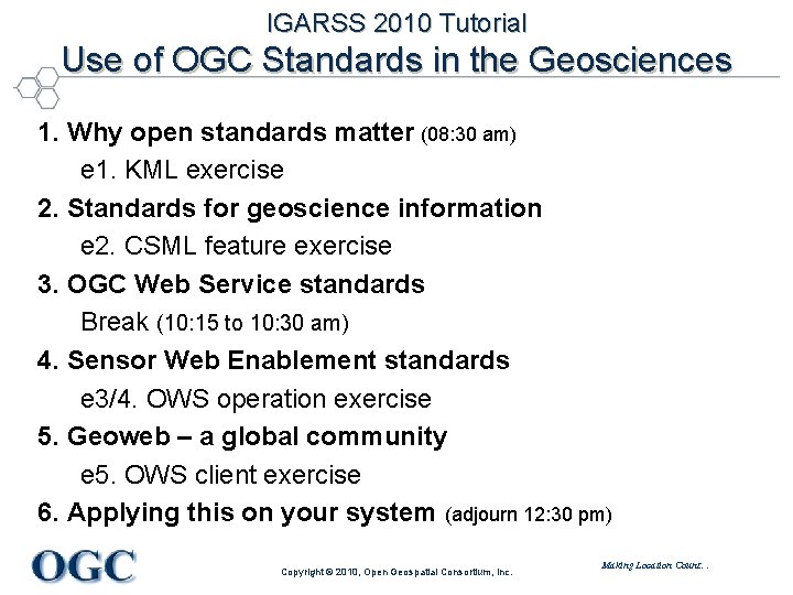
IGARSS 2010 Tutorial Use of OGC Standards in the Geosciences 1. Why open standards matter (08: 30 am) e 1. KML exercise 2. Standards for geoscience information e 2. CSML feature exercise 3. OGC Web Service standards Break (10: 15 to 10: 30 am) 4. Sensor Web Enablement standards e 3/4. OWS operation exercise 5. Geoweb – a global community e 5. OWS client exercise 6. Applying this on your system (adjourn 12: 30 pm) Copyright © 2010, Open Geospatial Consortium, Inc. Making Location Count…
Instructor: George Percivall • University of Illinois at Urbana-Champaign – BS Engineering Physics – MS Electrical Engineering - Control Systems • Hughes Aircraft – GOES and GMS Weather Satellite System Engineer – Commercial Systems Engineering – NASA EOSDIS Core System Chief Engineer: • Evaluation Prototypes and Terra/Landsat Release • NASA representative to OGC, FGDC and ISO TC 211 • Joined OGC in 2004 – Chief Architect – Executive Director, Interoperability Program • IEEE Senior Member - member since 1983 Making Location Count… Copyright © 2010, Open Geospatial Consortium, Inc.
Exercises developed by Arnulf Christl • Geography and Informatics at Phillipps University of Marburg, and Rheinische Friedrich-Wilhelm University of Bonn, Germany – Ex. SE Experimental Server development of OGC WMT standard • Founder and owner of CCGIS Consulting Center for GIS, Bonn – Joined OGC as Principal Member in 2006 – Design, Implementation of the Geoportal of Rhineland-Palatinate, Germany • Co-Founder of the non-profit Open Source Geospatial Foundation (OSGeo) – Elected president of OSGeo (2008) • Founder and owner of the Where. Group, Bonn (http: //www. geoportal. rlp. de) – Design and Implementation of the Pollutant Release and Tranfer Registry of Germany (http: //www. prtr. bund. de) • Joined the OGC Architecture Board in 2008 • Founder of the brand Metaspatial (2010) focusing on Metadata in the Geospatial Realm Making Location Count… Copyright © 2010, Open Geospatial Consortium, Inc.
Section 1. Why Open Standards Matter OGC and Geosciences Tutorial at IGARSS 2010 George Percivall OGC Chief Architect 25 July 2010 Copyright © 2010, Open Geospatial Consortium, Inc.
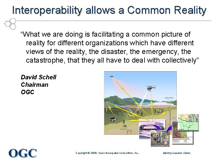
Interoperability allows a Common Reality “What we are doing is facilitating a common picture of reality for different organizations which have different views of the reality, the disaster, the emergency, the catastrophe, that they all have to deal with collectively” David Schell Chairman OGC Copyright © 2009, Open Geospatial Consortium, Inc. , Making Location Count…
OGC and Geosciences Tutorial 1. Why Open Standards Matter What do we mean by open standards? The value of open standards The OGC organization and programs OGC Standards Making Location Count… Copyright © 2010, Open Geospatial Consortium, Inc.
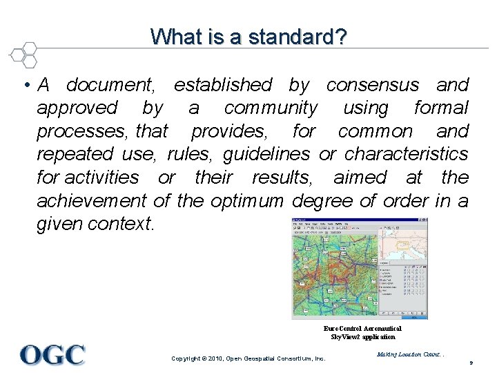
What is a standard? • A document, established by consensus and approved by a community using formal processes, that provides, for common and repeated use, rules, guidelines or characteristics for activities or their results, aimed at the achievement of the optimum degree of order in a given context. Euro. Control Aeronautical Sky. View 2 application Copyright © 2010, Open Geospatial Consortium, Inc. Making Location Count… 9
What do we mean by “Open” Standard? • Freely and publicly available • Non discriminatory • No license fees • Vendor neutral • Data neutral • Agreed to by a formal consensus process Making Location Count… Copyright © 2009, Open Geospatial Consortium, Inc. ,
Why Open Standards? • Rapidly mobilize new capabilities – plug and play • Lower systems costs • Encourage market competition – Choose based on functionality desired – Avoid “lock in” to a proprietary architecture • Decisions to share information and services become policy decisions Making Location Count… Copyright © 2009, Open Geospatial Consortium, Inc. ,
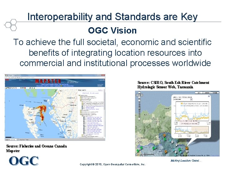
Interoperability and Standards are Key OGC Vision To achieve the full societal, economic and scientific benefits of integrating location resources into commercial and institutional processes worldwide Source: CSIRO, South Esk River Catchment Hydrologic Sensor Web, Tasmania Source: Fisheries and Oceans Canada Mapster Making Location Count… Copyright © 2010, Open Geospatial Consortium, Inc.
OGC and Geosciences Tutorial 1. Why Open Standards Matter What do we mean by open standards? The value of open standards The OGC organization and programs OGC Standards Making Location Count… Copyright © 2010, Open Geospatial Consortium, Inc.
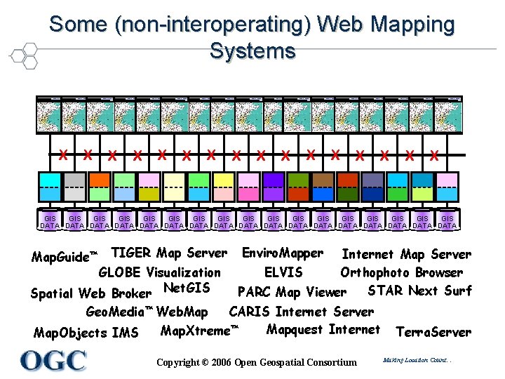
Some (non-interoperating) Web Mapping Systems Web Browser X Web Browser X Web Browser X Web Browser X Web Browser X GIS GIS GIS GIS GIS DATA DATA DATA DATA DATA Map. Guide™ TIGER Map Server Enviro. Mapper Internet Map Server ELVIS Orthophoto Browser STAR Next Surf PARC Map Viewer GLOBE Visualization Spatial Web Broker Net. GIS Geo. Media™ Web. Map CARIS Internet Server Mapquest Internet Map. Xtreme™ Map. Objects IMS Copyright © 2006 Open Geospatial Consortium Terra. Server Making Location Count…
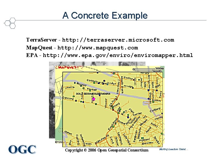
A Concrete Example Terra. Server - http: //terraserver. microsoft. com Map. Quest - http: //www. mapquest. com EPA - http: //www. epa. gov/enviromapper. html Copyright © 2006 Open Geospatial Consortium Making Location Count…
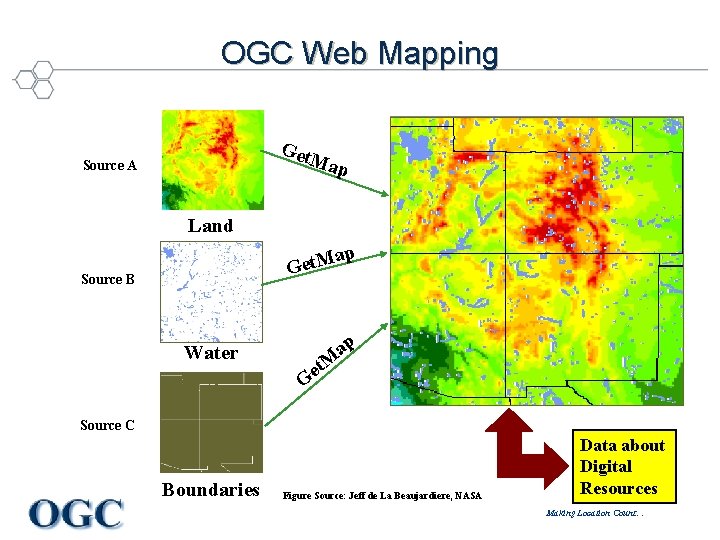
OGC Web Mapping Get M ap Source A Land p a Get. M Source B Water ap t. M e G Source C Boundaries Figure Source: Jeff de La Beaujardiere, NASA Data about Digital Resources Making Location Count…
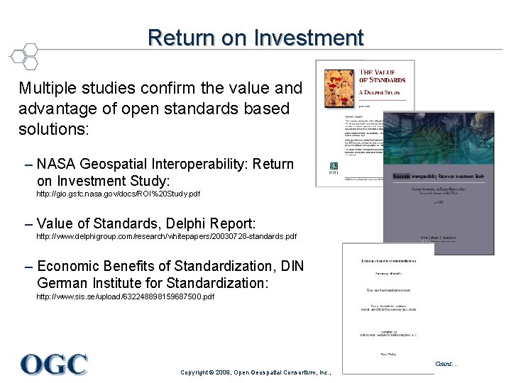
Return on Investment Multiple studies confirm the value and advantage of open standards based solutions: – NASA Geospatial Interoperability: Return on Investment Study: http: //gio. gsfc. nasa. gov/docs/ROI%20 Study. pdf – Value of Standards, Delphi Report: http: //www. delphigroup. com/research/whitepapers/20030728 -standards. pdf – Economic Benefits of Standardization, DIN German Institute for Standardization: http: //www. sis. se/upload/632248898159687500. pdf Making Location Count… Copyright © 2009, Open Geospatial Consortium, Inc. ,
Benefits - Participation in OGC Programs • Direct, legal, and broad dialog with industry on interoperability needs • Align industry on priority standards needs – User community organizations help to identify and prioritize requirements for new standards. • Improve choice and competition in the marketplace – Involvement in OGC helps create broad industry incentive to advance and implement OGC standards in their products. This increases the pool of standardsbased products that can be plugged into a system or enterprise -- no single application meets the needs of all users • Small investments in the OGC process help to reduce technology life cycle risk and cost – minor investments by many OGC members often yields industry action and consensus on standards. When this happens, organizations reduce their reliance on custom solutions and associated maintenance costs Making Location Count… © 2007 Open Geospatial Consortium, Inc. 18
OGC and Geosciences Tutorial 1. Why Open Standards Matter What do we mean by open standards? The value of open standards The OGC organization and programs OGC Standards Making Location Count… Copyright © 2010, Open Geospatial Consortium, Inc.
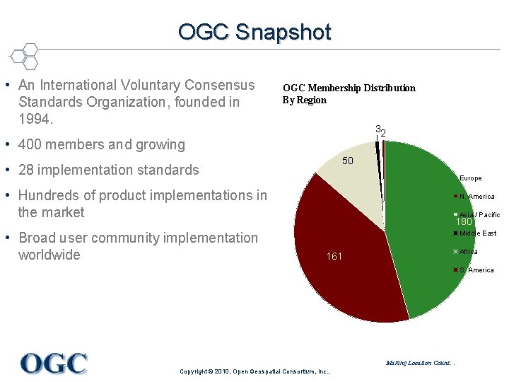
OGC Snapshot • An International Voluntary Consensus Standards Organization, founded in 1994. OGC Membership Distribution By Region 32 • 400 members and growing 50 • 28 implementation standards Europe • Hundreds of product implementations in the market • Broad user community implementation worldwide N. America Asia / Pacific 180 Middle East Africa 161 S. America Making Location Count… Copyright © 2010, Open Geospatial Consortium, Inc. ,
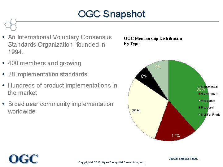
OGC Snapshot • An International Voluntary Consensus Standards Organization, founded in 1994. OGC Membership Distribution By Type • 400 members and growing 9% • 28 implementation standards 6% • Hundreds of product implementations in the market • Broad user community implementation worldwide Commercial 38% Government Academic Research 29% Not For Profit 17% Making Location Count… Copyright © 2010, Open Geospatial Consortium, Inc. ,
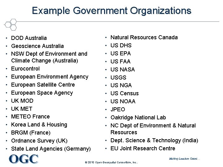
Example Government Organizations • DOD Australia • Geoscience Australia • NSW Dept of Environment and Climate Change (Australia) • Eurocontrol • European Environment Agency • European Satellite Centre • European Space Agency • UK MOD • UK MET • METEO France • Korea Land & Housing • BRGM (France) • Ordnance Survey (UK) • State Land Agencies (Germany) • • • Natural Resources Canada US DHS US EPA US FAA US NASA USGS US NGA US Census US NOAA JPEO Oakridge National Lab NC Dept of Environment & Natural Resources • Dept. Science & Technology (India) • EU Joint Research Centre Making Location Count… © 2010 Open Geospatial Consortium, Inc. .
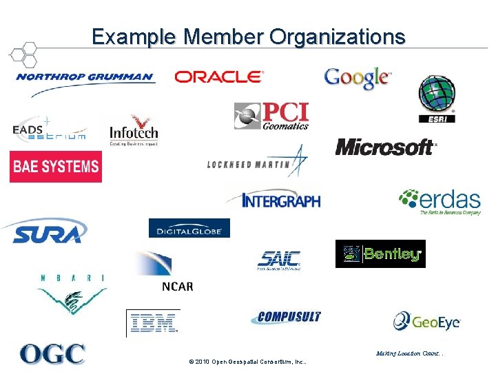
Example Member Organizations Making Location Count… © 2010 Open Geospatial Consortium, Inc. .
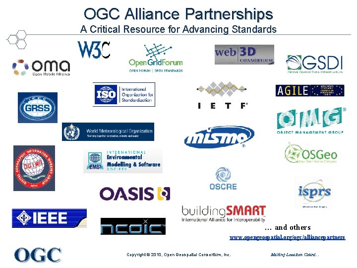
OGC Alliance Partnerships A Critical Resource for Advancing Standards … and others www. opengeospatial. org/ogc/alliancepartners Copyright © 2010, Open Geospatial Consortium, Inc. Making Location Count…
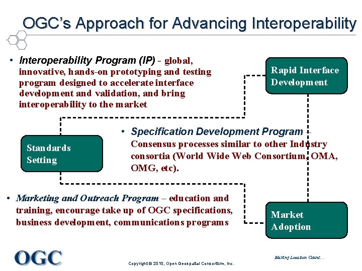
OGC’s Approach for Advancing Interoperability • Interoperability Program (IP) - global, innovative, hands-on prototyping and testing program designed to accelerate interface development and validation, and bring interoperability to the market Standards Setting Rapid Interface Development • Specification Development Program – Consensus processes similar to other Industry consortia (World Wide Web Consortium, OMA, OMG, etc). • Marketing and Outreach Program – education and training, encourage take up of OGC specifications, business development, communications programs Market Adoption Making Location Count… Copyright © 2010, Open Geospatial Consortium, Inc.
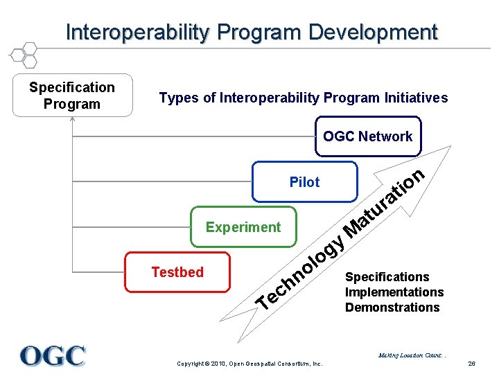
Interoperability Program Development Specification Program Types of Interoperability Program Initiatives OGC Network Pilot Experiment y g lo o n ch Testbed Te a r u n o ti M at Specifications Implementations Demonstrations Making Location Count… Copyright © 2010, Open Geospatial Consortium, Inc. 26
OGC and Geosciences Tutorial 1. Why Open Standards Matter What do we mean by open standards? The value of open standards The OGC organization and programs OGC Standards Making Location Count… Copyright © 2010, Open Geospatial Consortium, Inc.
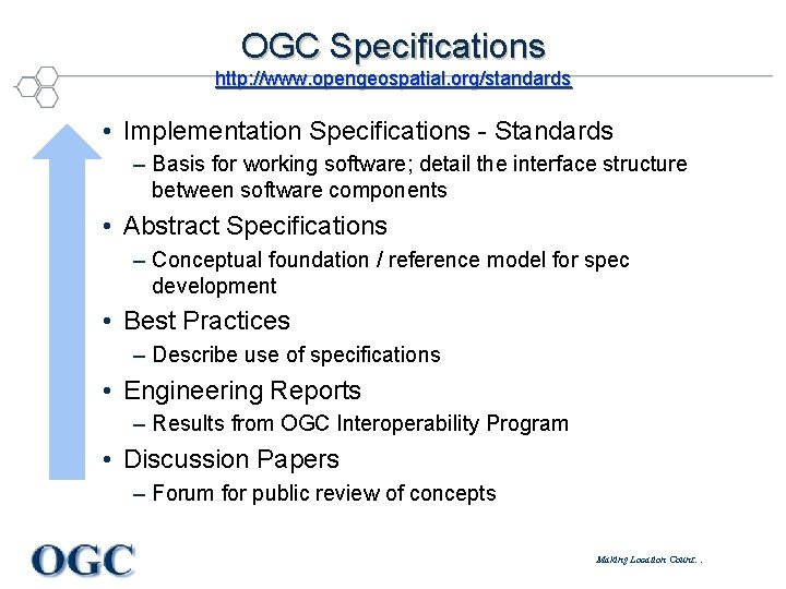
OGC Specifications http: //www. opengeospatial. org/standards • Implementation Specifications - Standards – Basis for working software; detail the interface structure between software components • Abstract Specifications – Conceptual foundation / reference model for spec development • Best Practices – Describe use of specifications • Engineering Reports – Results from OGC Interoperability Program • Discussion Papers – Forum for public review of concepts Making Location Count…
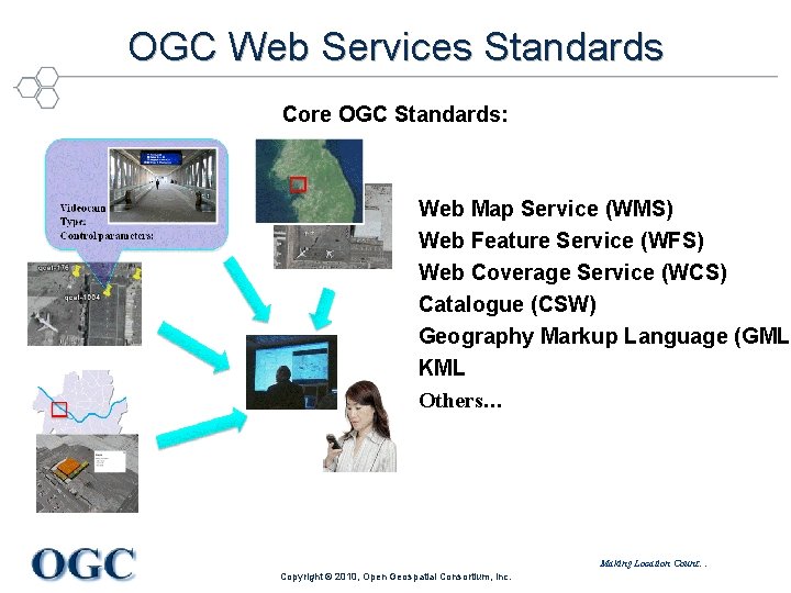
OGC Web Services Standards Core OGC Standards: Web Map Service (WMS) Web Feature Service (WFS) Web Coverage Service (WCS) Catalogue (CSW) Geography Markup Language (GML) KML Others… Making Location Count… Copyright © 2010, Open Geospatial Consortium, Inc.
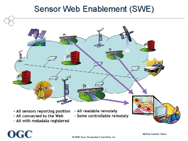
Sensor Web Enablement (SWE) Making Location Count… © 2009 Open Geospatial Consortium, Inc.
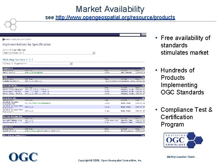
Market Availability see http: //www. opengeospatial. org/resource/products • Free availability of standards stimulates market • Hundreds of Products Implementing OGC Standards • Compliance Test & Certification Program Making Location Count… Copyright © 2009, Open Geospatial Consortium, Inc.
For Details on OGC Standards… • OGC Standards – Freely available – www. opengeospatial. org/standards • OGC Reference Model (ORM) – Overview of OGC Standards Baseline – Resource for defining architectures for specific applications – www. opengeospatial. org/standards/orm George Percivall, gpercivall at opengeospatial. org Making Location Count… Copyright © 2010, Open Geospatial Consortium, Inc.
OGC and Geosciences Tutorial 1. Why Open Standards Matter What do we mean by open standards? The value of open standards The OGC organization and programs OGC Standards Making Location Count… Copyright © 2010, Open Geospatial Consortium, Inc.
Exercise 1: KML • Google contributed KML to become an open standard for geobrowsers • Exercises: – e 1 a. Effelsberg – offline – e 1 b. KML samples - online Making Location Count… Copyright © 2010, Open Geospatial Consortium, Inc.
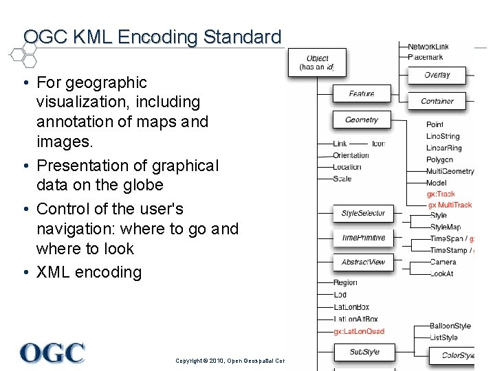
OGC KML Encoding Standard • For geographic visualization, including annotation of maps and images. • Presentation of graphical data on the globe • Control of the user's navigation: where to go and where to look • XML encoding Making Location Count… Copyright © 2010, Open Geospatial Consortium, Inc.
IGARSS 2010 Tutorial Use of OGC Standards in the Geosciences 1. Why open standards matter (08: 30 am) e 1. KML exercise 2. Standards for geoscience information e 2. CSML feature exercise 3. OGC Web Service standards Break (10: 15 to 10: 30 am) 4. Sensor Web Enablement standards e 3/4. OWS operation exercise 5. Geoweb – a global community e 5. OWS client exercise 6. Applying this on your system (adjourn 12: 30 pm) Copyright © 2010, Open Geospatial Consortium, Inc. Making Location Count…