Hydrologic Measurement Precipitation Evaporation Streamflow Channel Properties Topography
- Slides: 52
Hydrologic Measurement • • • Precipitation Evaporation Streamflow Channel Properties Topography GIS datasets Reading: Applied Hydrology Chapter 6
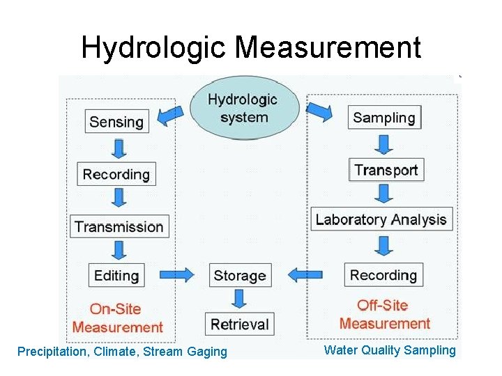
Hydrologic Measurement Precipitation, Climate, Stream Gaging Water Quality Sampling
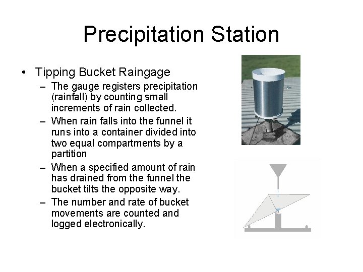
Precipitation Station • Tipping Bucket Raingage – The gauge registers precipitation (rainfall) by counting small increments of rain collected. – When rain falls into the funnel it runs into a container divided into two equal compartments by a partition – When a specified amount of rain has drained from the funnel the bucket tilts the opposite way. – The number and rate of bucket movements are counted and logged electronically.
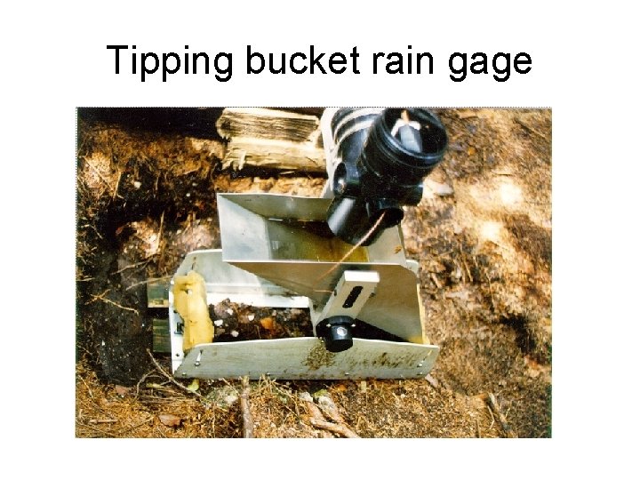
Tipping bucket rain gage
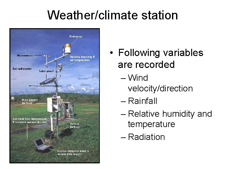
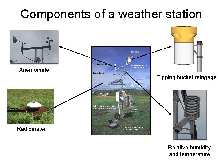
Weather/climate station • Following variables are recorded – Wind velocity/direction – Rainfall – Relative humidity and temperature – Radiation
Components of a weather station Anemometer Tipping bucket raingage Radiometer Relative humidity and temperature
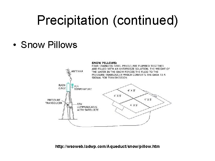
Precipitation (continued) • Snow Pillows http: //wsoweb. ladwp. com/Aqueduct/snow/pillow. htm
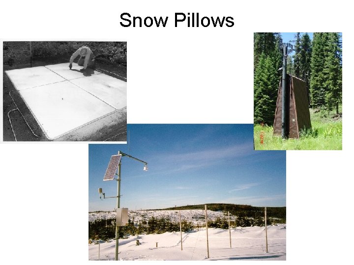
Snow Pillows 8
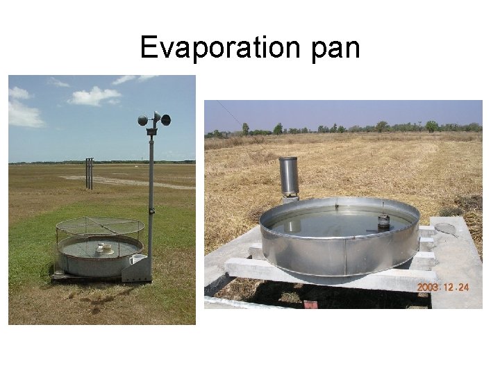
Evaporation pan
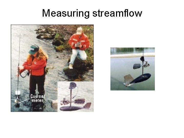
Measuring streamflow
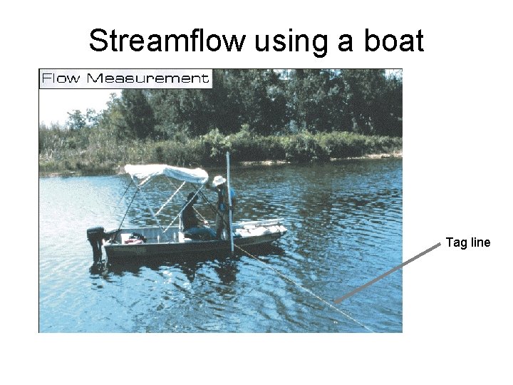
Streamflow using a boat Tag line
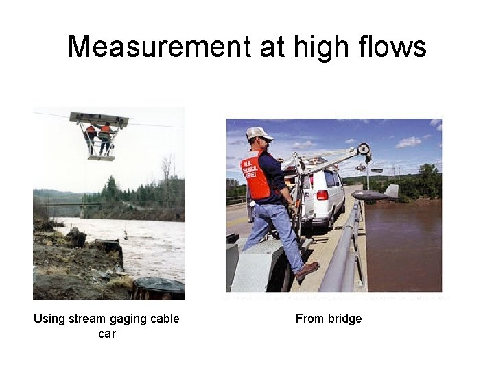
Measurement at high flows Using stream gaging cable car From bridge
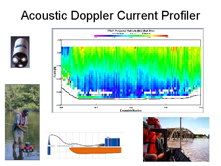
Acoustic Doppler Current Profiler 13
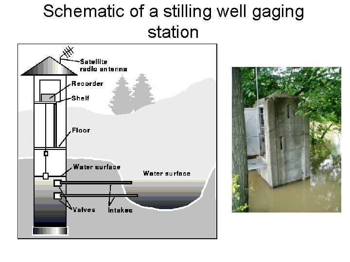
Schematic of a stilling well gaging station
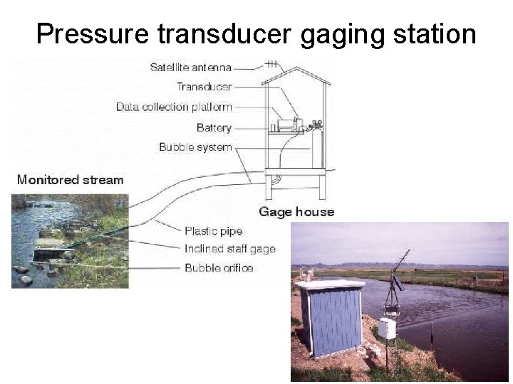
Pressure transducer gaging station
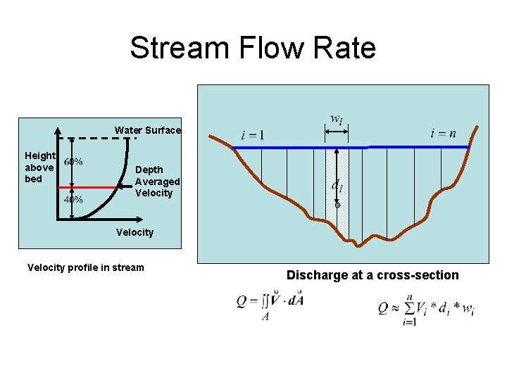
Stream Flow Rate Water Surface Height above bed Depth Averaged Velocity profile in stream Discharge at a cross-section
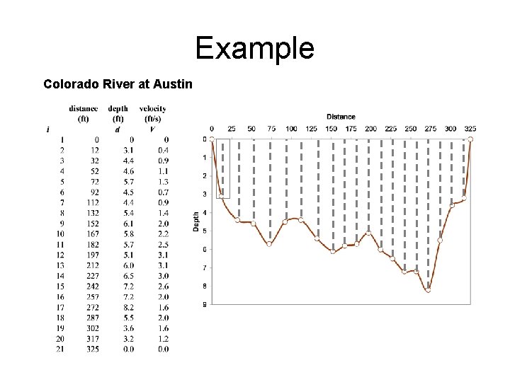
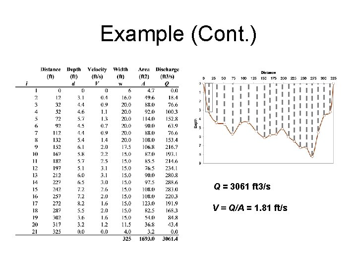
Example Colorado River at Austin
Example (Cont. ) Q = 3061 ft 3/s V = Q/A = 1. 81 ft/s
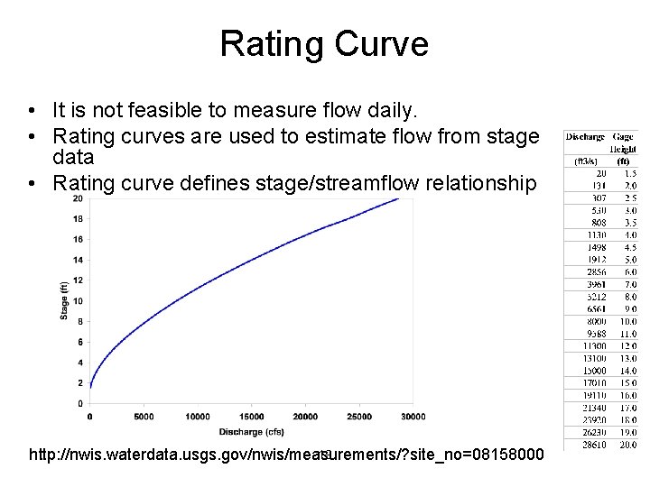
Rating Curve • It is not feasible to measure flow daily. • Rating curves are used to estimate flow from stage data • Rating curve defines stage/streamflow relationship 19 http: //nwis. waterdata. usgs. gov/nwis/measurements/? site_no=08158000
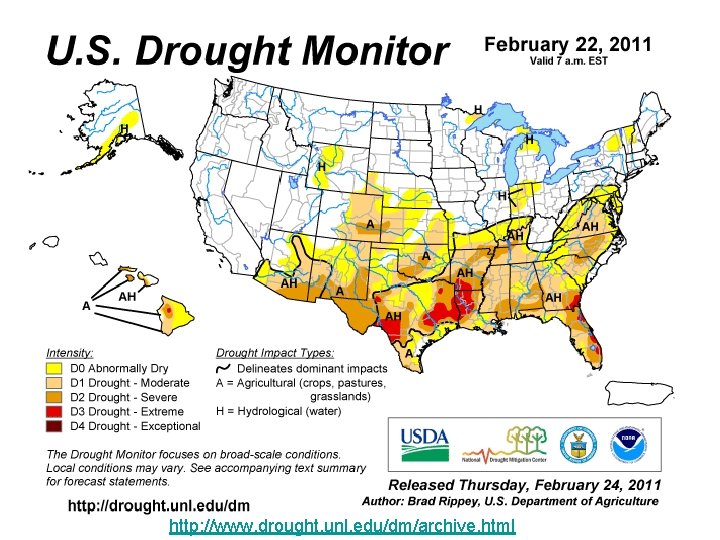
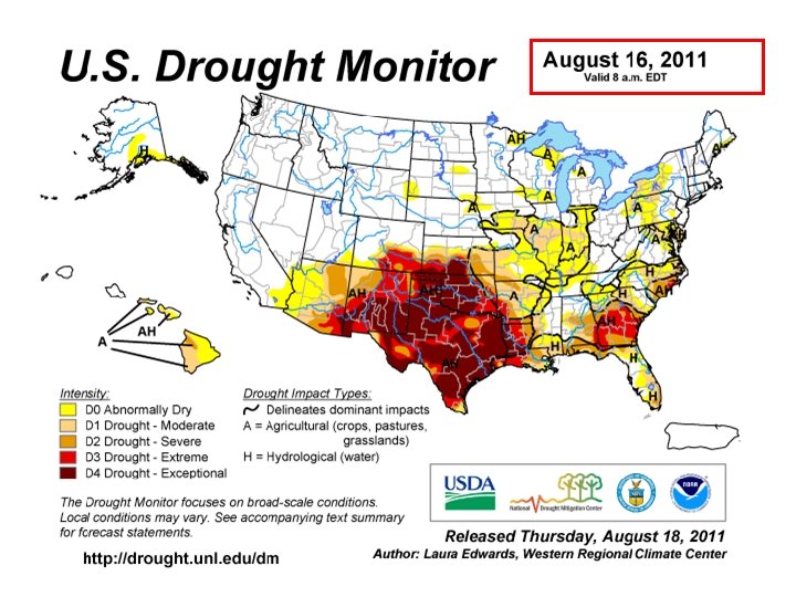
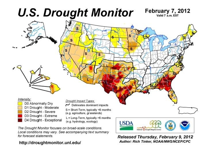
http: //www. drought. unl. edu/dm/archive. html
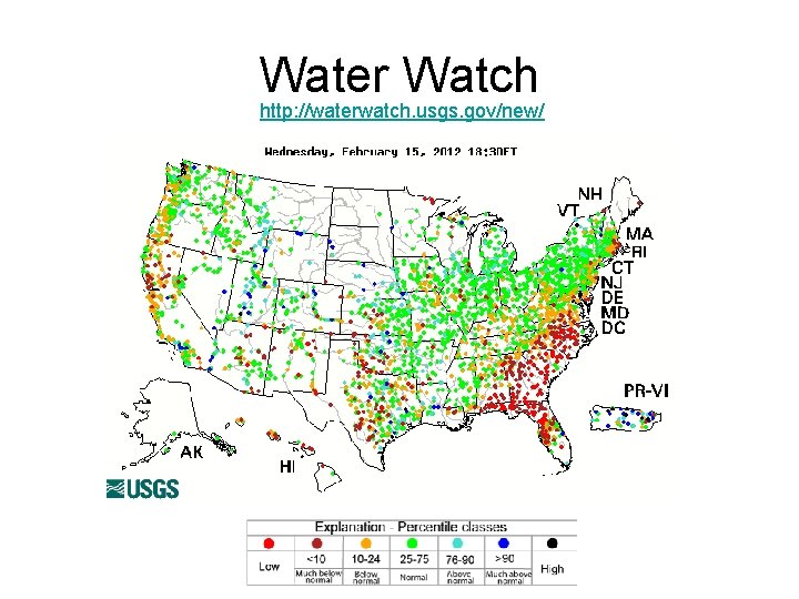
Water Watch http: //waterwatch. usgs. gov/new/
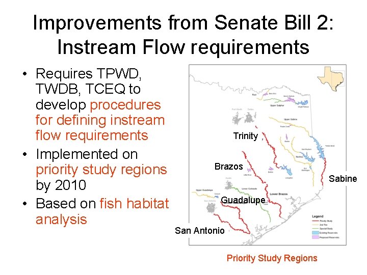
Improvements from Senate Bill 2: Instream Flow requirements • Requires TPWD, TWDB, TCEQ to develop procedures for defining instream flow requirements • Implemented on priority study regions by 2010 • Based on fish habitat analysis Trinity Brazos Sabine Guadalupe San Antonio Priority Study Regions
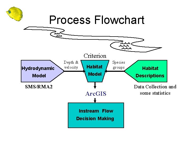
Process Flowchart Criterion Hydrodynamic Model Depth & velocity Habitat Species groups Model SMS/RMA 2 Arc. GIS Instream Flow Decision Making Habitat Descriptions Data Collection and some statistics
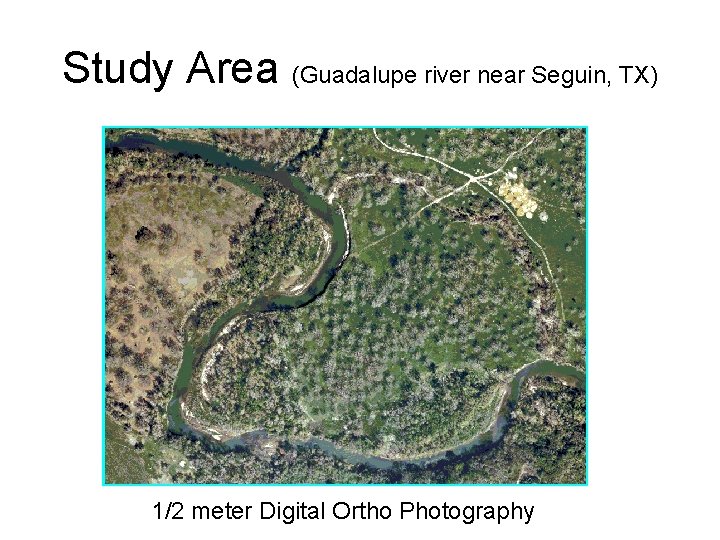
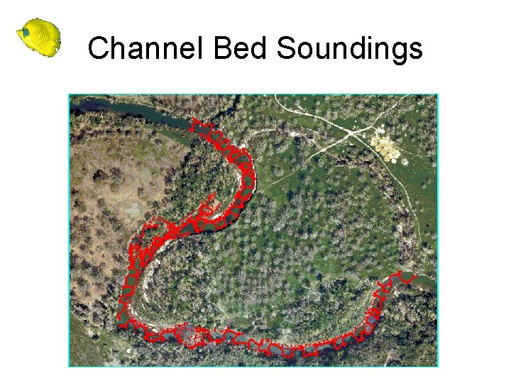
Study Area (Guadalupe river near Seguin, TX) 1/2 meter Digital Ortho Photography
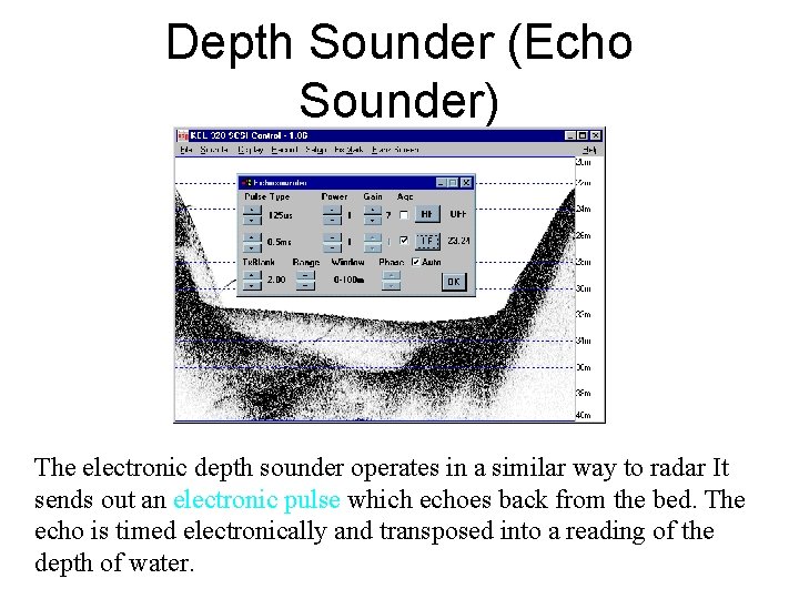
Depth Sounder (Echo Sounder) The electronic depth sounder operates in a similar way to radar It sends out an electronic pulse which echoes back from the bed. The echo is timed electronically and transposed into a reading of the depth of water.
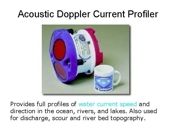
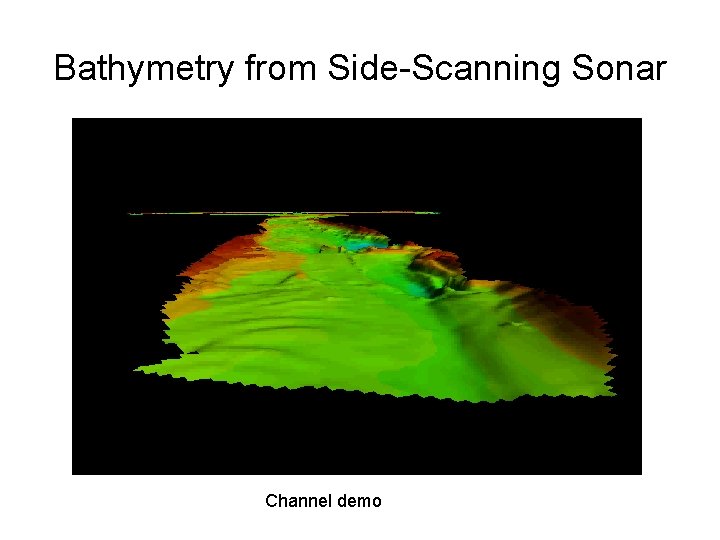
Acoustic Doppler Current Profiler Provides full profiles of water current speed and direction in the ocean, rivers, and lakes. Also used for discharge, scour and river bed topography.
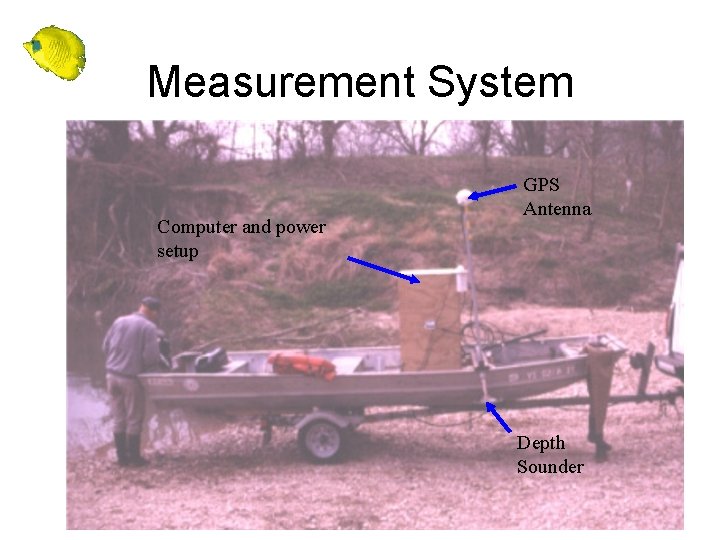
Measurement System Computer and power setup GPS Antenna Depth Sounder
Channel Bed Soundings
Bathymetry from Side-Scanning Sonar Channel demo
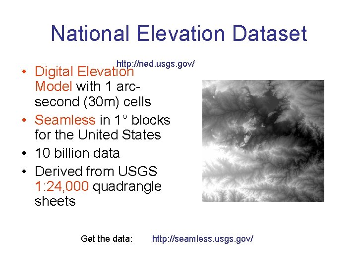
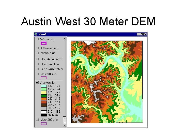
National Elevation Dataset http: //ned. usgs. gov/ • Digital Elevation Model with 1 arcsecond (30 m) cells • Seamless in 1° blocks for the United States • 10 billion data • Derived from USGS 1: 24, 000 quadrangle sheets Get the data: http: //seamless. usgs. gov/
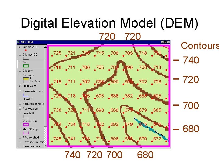
Digital Elevation Model (DEM) 720 Contours 740 720 700 680
Austin West 30 Meter DEM
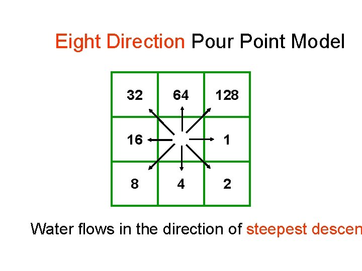
Eight Direction Pour Point Model 32 64 16 8 128 1 4 2 Water flows in the direction of steepest descen
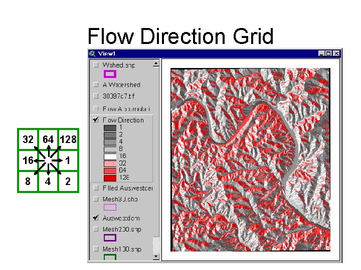
Flow Direction Grid 32 64 128 16 8 1 4 2
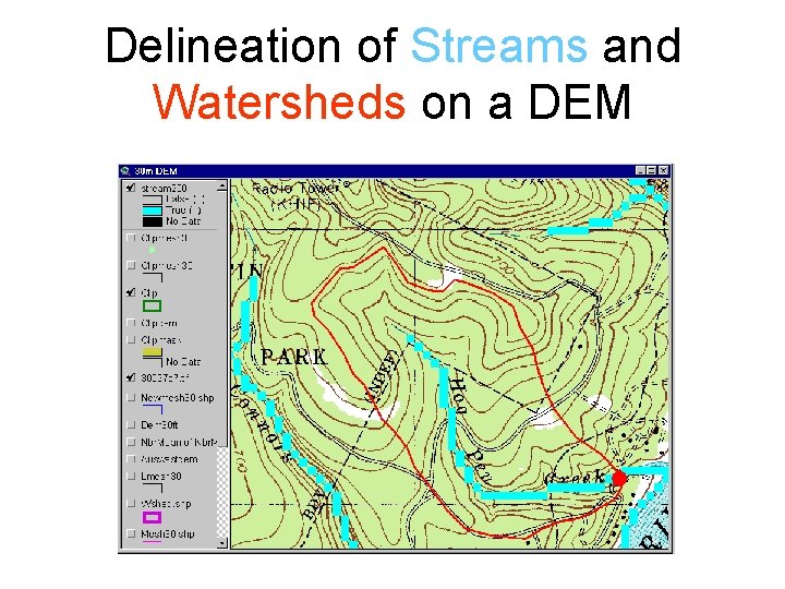
Delineation of Streams and Watersheds on a DEM
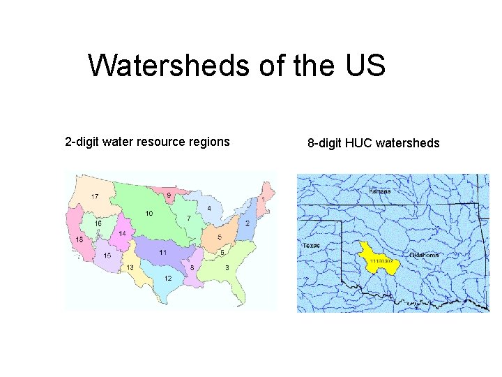
Watersheds of the US 2 -digit water resource regions 8 -digit HUC watersheds
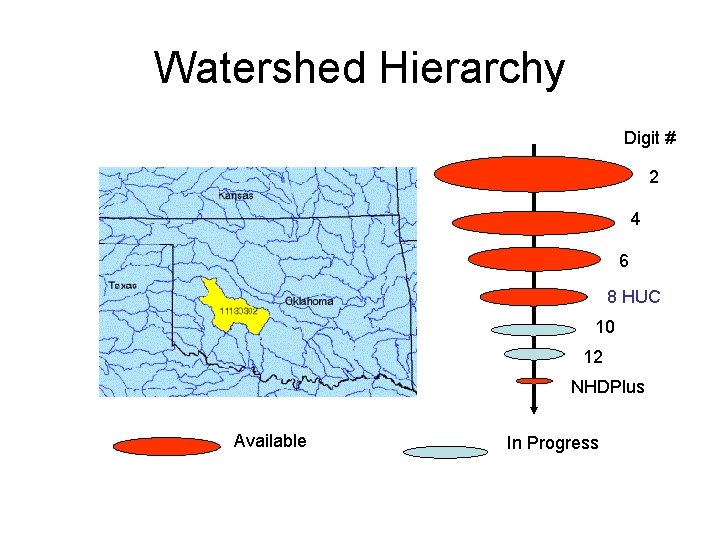
Watershed Hierarchy Digit # 2 4 6 8 HUC 10 12 NHDPlus Available In Progress
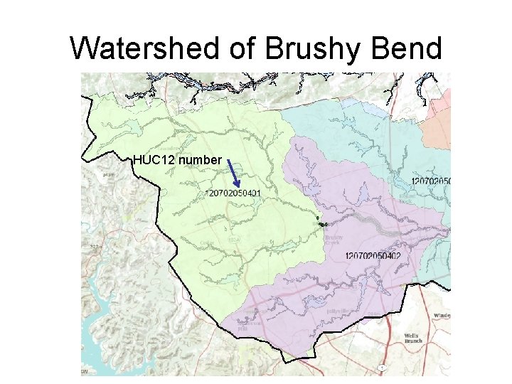
Watershed of Brushy Bend HUC 12 number
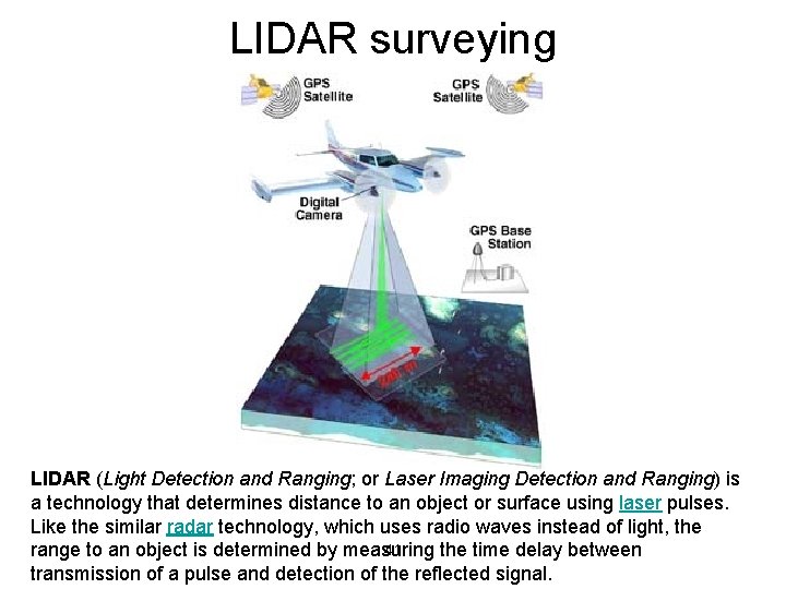
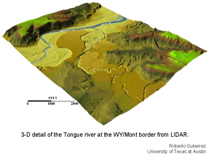
LIDAR surveying LIDAR (Light Detection and Ranging; or Laser Imaging Detection and Ranging) is a technology that determines distance to an object or surface using laser pulses. Like the similar radar technology, which uses radio waves instead of light, the 41 range to an object is determined by measuring the time delay between transmission of a pulse and detection of the reflected signal.
3 -D detail of the Tongue river at the WY/Mont border from LIDAR. Roberto Gutierrez University of Texas at Austin
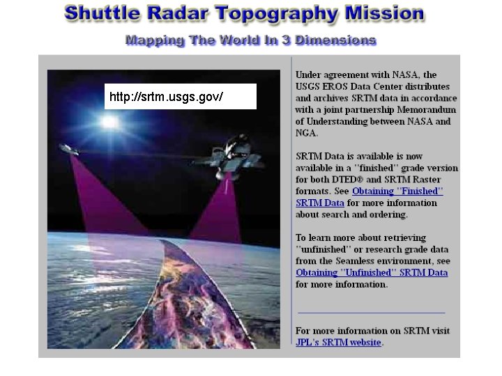
http: //srtm. usgs. gov/
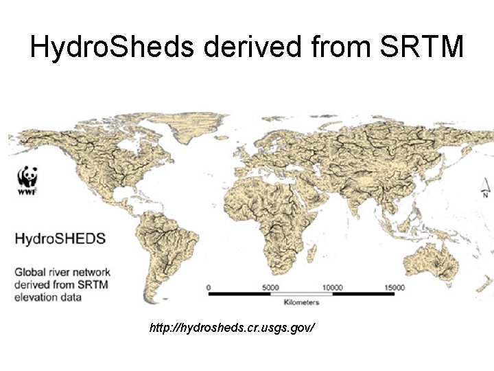
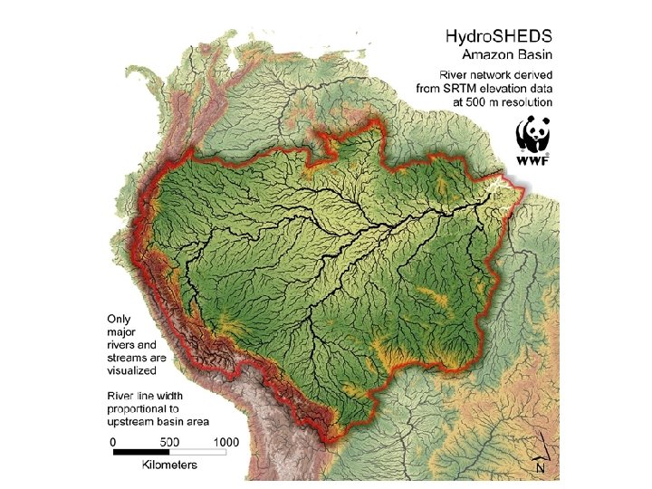
Hydro. Sheds derived from SRTM http: //hydrosheds. cr. usgs. gov/
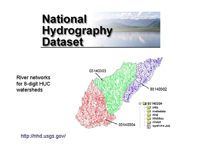
River networks for 8 -digit HUC watersheds http: //nhd. usgs. gov/
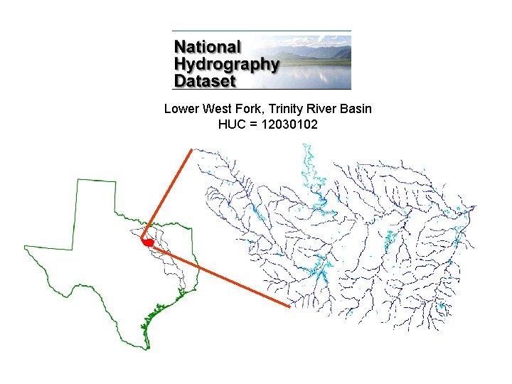
Lower West Fork, Trinity River Basin HUC = 12030102
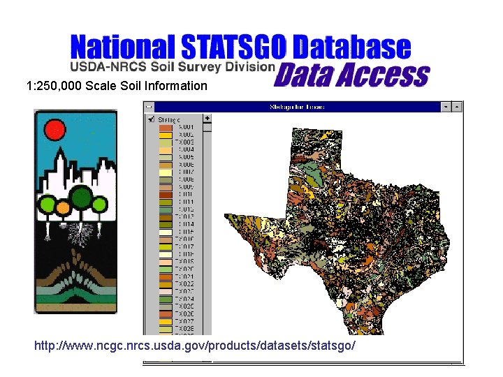
1: 250, 000 Scale Soil Information http: //www. ncgc. nrcs. usda. gov/products/datasets/statsgo/
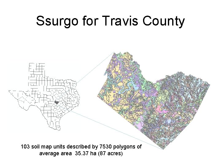
Ssurgo for Travis County 103 soil map units described by 7530 polygons of average area 35. 37 ha (87 acres)
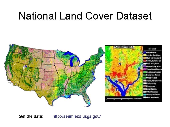
National Land Cover Dataset Get the data: http: //seamless. usgs. gov/