FLAGGMD Fluxes of Greenhouse Gases in Maryland Greenhouse


![Emission Ratios from Chalk Point Power Plant • Low enhancement of [SO 2] (mostly Emission Ratios from Chalk Point Power Plant • Low enhancement of [SO 2] (mostly](https://slidetodoc.com/presentation_image_h/801fe4c99ccc98cef0ea020a325e58c6/image-15.jpg)


![CO 2 along Downwind Transects O 2] (ppmv) • DC and Baltimore plumes were CO 2 along Downwind Transects O 2] (ppmv) • DC and Baltimore plumes were](https://slidetodoc.com/presentation_image_h/801fe4c99ccc98cef0ea020a325e58c6/image-29.jpg)


- Slides: 54

FLAGG-MD Fluxes of Greenhouse Gases in Maryland Greenhouse and Other Trace Gases from the Baltimore-Washington Area: Results from the WINTER 2015 Aircraft Observations Xinrong Ren, Sayantan Sahu, Dolly Hall, Courtney Grimm, Hao He, Doyeon Ahn, Ross Salawitch and Russell Dickerson Dept. of Atmos. & Oceanic Sci. , University of Maryland Olivia Salmon, Alexie Heimburger, and Paul Shepson Dept. of Chemistry, Purdue University

Motivation • Urban greenhouse gas (GHG) emissions contribute to the majority (~70%) of the anthropogenic GHG emissions. • Quantification of urban greenhouse gas (GHG) emissions is important for establishing scientifically sound and cost-effective policies for mitigating GHGs. • Discrepancies between observations and model simulations of GHGs suggests uncharacterized sources in urban environments.

WINTER Campaign Flight Area C-130 Cessna Duchess • • • Where: the Baltimore-Washington Metropolitan Area When: UMD Cessna: 2/6 – 2/26, 2015 Purdue Duchess: 2/16 -3/12, 2015 What: aircraft observations of GHGs, other trace gas, and aerosol scattering & absorption.

UMD Cessna 402 B Research Aircraft GPS Position (Lat, Long, Altitude) Met (T, RH, P, wind speed/direction) Trace gases: Gas Inlet Aerosol Inlet Met Sensors O 3: UV Absorption, modified TECO SO 2: Pulsed Fluorescence, modified TECO CH 4/CO 2/CO/H 2 O: Cavity Ringdown, Picarro NO 2: Cavity Ring Down, Los Gatos NO: Chemiluminescence, modified TECO VOCs: grab canisters/GC-FID Aerosol Optical Properties: Scattering: bscat (@450, 550, 700 nm), Nephelometer Absorption: bap (565 nm), PSAP Black Carbon: Aethalometer 4

CO 2 along the Flight Track on 2/20/15 wind Baltimore Dickerson Brandon Shores Washington Chalk Point Morgantown Power plant plumes clearly observed along the downwind transects.

CO 2 on 2 downwind transects along the latitude Chalk Point Morgantown Brandon Shores DC plume Baltimore plume

wind CH 4 along flight track Brown Station Landfill • Significant CH 4 emissions from Brown Station Landfill. • High CH 4 levels aloft along SW of the upwind leg: CH 4 emissions from fracking?

CH 4 on 2 downwind transects along the latitude DC plume Baltimore plume Much larger CH 4 enhancement in the DC plume than in the Baltimore plume.

Estimation of CO 2, CH 4 and CO Fluxes Mass Balance Experiment (MBE) approach: Flux E. R. : emission rate (flux) [C] : concentrations (downwind) [C]b : concentration in background U⊥ : perpendicular wind speed ∆z Background CO 2, CH 4, CO Urban CO 2, CH 4, CO ∆x Background

Emissions of CO 2, CH 4 and CO from Baltimore-DC CO 2: ~150 million tons/yr Note: (1) Estimated CH 4 emissions from Brown Station Landfill: 73 ± 19 moles s-1 (2) The population in the Balt–DC area is close to 10 million. (3) In 2011, CO 2 emission per capita in MD is ~11 tons/yr.

VOC Canister Sample of Ethane • Ethane versus methane: the ethane-to-methane ratio (slope) could potentially be used for identification and quantification of methane sources. • Limited canister samples show an ethane-to-methane ratio (i. e. , slope) of 3. 3%.

CH 4 Emissions from Brown Station Landfill wind Brown Statin Landfill E. R. : emission rate (flux) [C] : concentrations (downwind) [C]b : concentration in background U⊥ : perpendicular wind speed Flight # CH 4 Emission Rate (moles s-1) RF 1 57. 4 RF 2 68. 1 RF 4 105. 9 RF 5 83. 8 RF 6 65. 3 RF 8 56. 2 -----------------Mean 72. 8 ± 19. 0 ~11% of the total CH 4 emissions (670 moles s-1) from the Balt-DC area.

CO 2 along the Flight Track on 2/20/15 wind Brandon Shores Dickerson Chalk Point Morgantown Power plant plumes were clearly observed along the downwind transects.

Emissions from Chalk Point Power Plant • Reasonable agreement between the CEM emission rates and the emission rates derived from the aircraft observations. • Differences may be explained uncertainties in the CEM and obs.
![Emission Ratios from Chalk Point Power Plant Low enhancement of SO 2 mostly Emission Ratios from Chalk Point Power Plant • Low enhancement of [SO 2] (mostly](https://slidetodoc.com/presentation_image_h/801fe4c99ccc98cef0ea020a325e58c6/image-15.jpg)
Emission Ratios from Chalk Point Power Plant • Low enhancement of [SO 2] (mostly ~1 -2 ppb) causes high uncertainty in the SO 2 emission rate estimation using the aircraft observations.

Summary • Estimated emissions from the Baltimore-Washington area: F(CO 2): 110, 000± 20, 000 moles s-1 (or ~150 M tons/yr) F(CH 4): 700± 330 moles s-1 F(CO): 540± 188 moles s-1 • CH 4 emissions from Brown Station Landfill account for ~10% of total CH 4 emissions from the entire Baltimore-Washington area. • Limited VOC data show an ethane to methane ratio of 3. 3%. • Good agreement between the CEM emissions and the emissions derived from aircraft observations.

FLAGG-MD: Preliminary Results for Winter 2016 Aircraft Observations Purdue Duchess UMD Cessna UMD/NIST FLAGG-MD Meeting February 22, 2016 17

UMD Cessna 402 B Research Aircraft GPS Position (Lat, Long, Altitude, Speed) Met (T, RH, P, wind speed/direction) Trace gases: Gas Inlet Aerosol Inlet Met Sensors CH 4/CO 2/CO/H 2 O: Cavity Ring Down, Picarro K 30 CO 2 small sensor O 3: UV Absorption, TECO SO 2: Pulsed Fluorescence, modified TECO NO 2: Cavity Ring Down, Los Gatos VOCs: canister samples and GC-FID analysis Aerosol Optical Properties: Scattering: bscat (@450, 550, 700 nm), Nephelometer Absorption: bap (565 nm), PSAP Black Carbon: Aethalometer (7 -wavelengths) Data Acquisition: 1 sec 18

Purdue Duchess Research Aircraft Front View GPS Position (Lat, Long, Altitude) Met (T, RH, P, 3 -D wind by BAT) Back View Trace gases: CH 4/CO 2: Cavity Ring Down, Picarro O 3: UV Absorption, 2 B Technology H 2 O: Isotope measurement 19

Flight Plan for Winter 2016 spiral wind spiral Intercomp spiral 20

UMD Cessna Flight Track during FLAGG-MD 2016 • The UMD Cessna focused on downwind vertical profiles. • Various wind directions on different flight days. 21

UMD Cessna Flights during FLAGG-MD 2016 22

Preliminary Results from Cessna RF 5 02/19/2016 23

RF 5 Flight Track Surface wind 24

HYSPLIT 12 -h Back Trajectory Runs Start time: 19: 00 Feb 19 2016 (UTC) Start location: lat, lon: Each red circles Altitude: 700 m Start time: 19: 00 Feb 19 2016 (UTC) Start location: lat, lon: Each red circles Altitude: 200 m SSE winds near surface SSW winds aloft PA KMBR WV PA 58 M KMBR WV 58 M VA VA NC Thanks to Doyeon! NC 25

Three Vertical Profiles Mixing layer depth ~800 m 26

Three Vertical Profiles Mixing layer depth ~700 -800 m 27

CO 2 along Downwind Transects KMBR 58 M 28
![CO 2 along Downwind Transects O 2 ppmv DC and Baltimore plumes were CO 2 along Downwind Transects O 2] (ppmv) • DC and Baltimore plumes were](https://slidetodoc.com/presentation_image_h/801fe4c99ccc98cef0ea020a325e58c6/image-29.jpg)
CO 2 along Downwind Transects O 2] (ppmv) • DC and Baltimore plumes were observed separate. • Background [CO 2] ~413 -415 ppm – need to combine Purdue’s data. 29

CO 2 on flight track Dickerson Brandon Shores Chalk Point Morgantown Surface wind 30

CH 4 on flight track Surface wind 31

CO on flight track 32

CH 4 vs. CO 2 colored with CO Urban plumes Free troposphere 33

Preliminary Results from Cessna RF 3 02/17/2016 34

HYSPLIT 12 -h Back Trajectory Runs Start time: 18: 00 Feb 12 2016 (UTC) Start location: lat, lon: Each red circles Altitude: 700 m Start time: 18: 00 Feb 12 2016 (UTC) Start location: lat, lon: Each red circles Altitude: 200 m UKIEY SVILL 35

Cessna RF 3 Flight Track 36

Three Vertical Profiles Mixing layer depth ~1400 m 37

CO 2 along Downwind Transects 38

CO 2 along Downwind Transects 39

CH 4 on flight track wind 40

CO 2 on flight track Dickerson Brandon Shores Chalk Point Morgantown 41

CH 4 vs. CO 2 colored with SO 2 Urban plumes Brandon Shores Free troposphere Significantly high background [CO 2] and [CH 4] in DC plume than in Baltimore plume. 42

Summary • UMD Cessna successfully conducted 11 flights on 5 flight days together Purdue Duchess. • 4 of 5 flight days are good for mass balance calculation. • Continuous downwind vertical profiles by the Cessna captured vertical variations in GHG. • We will combine the Duchess’ data to determine the background GHG concentrations and mixing layer heights in order to calculate GHG fluxes from the Balt-DC area. • Tested a CO 2 small sensor during flight – Results to be analyzed. 43

Methane Emissions from Marcellus Shale Natural Gas Operations: Results from Summer 2015 Aircraft Observations Xinrong Ren, Dolly Hall, Timothy Vinciguerra, Sayantan Sahu, Hao He, Sheryl Ehrman, and Russell Dickerson MDE Quarterly Meeting February 29, 2016

Motivation • Quantification of methane (CH 4) emissions from oil and gas operations is important for establishing scientifically sound and cost-effective policies for mitigating greenhouse gases (GHGs). • Discrepancies between observation-based (topdown) and inventory-based (bottom-up) CH 4 emissions suggests more observations are needed.

Marcellus Shall NG production and Area Surveyed Prevailing wind September 2 Production data are from WV DEP (http: //www. dep. wv. gov), PA DEP (www. paoilandgasreporting. state. pa. us ) and OH DNR (http: //oilandgas. ohiodnr. gov/production)

Estimation of CO 2, CH 4 and CO Fluxes Mass Balance Experiment (MBE) approach: Flux [C] : concentrations (downwind) [C]b : concentration in background U⊥ : perpendicular wind speed wind ∆z Background CH 4 O&NG CH 4 ∆x Background

CH 4 along Flight Track 8/25/2016

Time Series of Altitude, CH 4 and WD 8/25/2016

Time Series of Altitude, CH 4 and WD 8/25/2016 Mixing layer top

CH 4 Loss Rate Estimate

CH 4 Flux and Compared to Literature • Average flux = 4, 160± 1, 030 moles s-1 , or 5. 0± 1. 2 g CH 4 km-2 s-1, consistent with the results (2. 0 -14 g CH 4 km-2 s-1) by Caulton et al. (2014) in SW PA, but larger than the results (1. 2± 0. 6 g CH 4 km-2 s-1—measurements made in 2012) in SW PA by Swarthout et al. (2015) and an order of magnitude larger than the results (~0. 4 g CH 4 km-2 s-1) by Peischl et al. (2015) in the Marcellus Shale region in NE PA. • CH 4_flux/NG_production = 4. 7± 1. 8%, much greater than the loss rate (0. 18– 0. 41%) estimated for the Marcellus region in northern PA by Peischl et al. (2015)

Ethane to CH 4 ratio (slope) Areas of Oil & NG Operations Baltimore-DC Area Possible reason for a smaller ethane to CH 4 slope: Coal mining emissions of CH 4 that do not emit significant ethane

Summary • • • The averaged CH 4 flux from a 110 x 120 km area in the Marcellus Shale region in SW PA and Northern WV was estimated to be 4, 160± 1, 030 moles s-1. CH 4_flux/NG_production = 4. 7± 1. 8%. The observed ethane/CH 4 = 2. 4%, agrees with the USGS ethane/CH 4 composition ratio (2. 3%) of for this region, but is smaller than what (3. 3%) was obtained in the DC-Baltimore area in winter 2015. Future Work • To obtain other CH 4 sources in the surveyed area to derive a more accurate CH 4 leak rate.
 What are the greenhouse gases
 Greenhouse gases are good or bad
 What human activity produces the most greenhouse gases
 Greenhouse gases composition
 Greenhouse gases are good or bad
 Money follows the person maryland
 Local government investment pool registration
 Umcap hospital
 Merchant cash advance in maryland
 Bradbury compound maryland
 Arrears management program
 Nti training adoption maryland
 Crisp health information exchange
 Loyola university maryland registrar
 Maryland dental hygiene license renewal
 Mc culloch v maryland
 Maryland community health resource commission
 Maryland commitment to veterans
 Buyer agency agreement maryland
 Loyola maryland core curriculum
 Talbot county maryland frederick douglass
 Instytut stomatologii cmuj
 Maryland gpi
 French classical menu in english
 Types of english saddles
 Adam ortiz maryland
 Ken priddy
 University of maryland
 Mike jones maryland
 Maryland work permit for minors
 Stet legal definition
 Maryland court hierarchy
 Maryland insurance administration
 [email protected]
 Community first choice
 William atkinson maryland
 Maryland on line iep
 Md online iep
 Brian lopez maryland
 Maryland breastfeeding coalition
 Quit now maryland
 Mabe maryland
 Mc culloch v maryland
 Juliette general mlm
 Aasc loyola
 Erhau
Erhau Maryland master naturalist
 Maryland health connection
 [email protected]
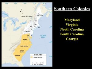
 Virginia, maryland, north carolina, south carolina, georgia
 Mcculloch v. maryland significance
 University of maryland observatory
 Maryland health enterprise zones
 Bikesafe admin
 Maryland soccer referee
