NORTH AFRICA SOUTHWEST ASIA AND CENTRAL ASIA CHAPTER


- Slides: 27

NORTH AFRICA, SOUTHWEST ASIA, AND CENTRAL ASIA

CHAPTER 15: NORTH AFRICA

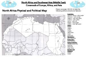
ATLAS MOUNTAINS • 4 Tectonic Plates interacting: African, Arabian, Anatolian, and Eurasian • Atlas Mts. is Africa’s longest range • From SW Morocco to NE Tunisia

DESERTS • Northern edge of Sahara Desert • Ergs: sandy dune covered areas • Regs: stony plains with rocky gravel (“desert pavement”) • Hamadas: flat, sandstone plateaus

AHAGGAR • A large, mountainous plateau region in northcentral Sahara • Highest mt: Mt. Tahat (9, 573 ft) in SE Algeria • Extend into Niger (S) and Libya (N)

TIBESTI MOUNTAINS • NE Niger and S Libya • Range is 300 miles long • Highest summit in the Sahara: Emi Koussi (Chad)---11, 204 ft.

NILE RIVER • Nile: world’s longest river (4, 160 mi. ); flows north from Ethiopia/Uganda • Nile Delta: very fertile; home to ancient Egypt • Regular flooding spreads ALLUVIAL SOIL: sand mud deposited by flowing water

ASWAN HIGH DAM • Built in the 1950 s to control flow and flooding of Nile • Also provide irrigation and hydroelectric power • Prevents spread of alluvial soil thus diminishing soil fertility • WADIS: streambeds that remain dry until heavy rains

WATER BOUNDARIES • Mediterranean Sea separates Africa from Europe • Sinai Peninsula, the Red Sea, and the Gulf of Aden separate N. Africa from the Arabian Peninsula

CLIMATE • Desert (arid)and Steppe (semi-arid) • Plant life: cacti and shrubs; olive trees, date palms • Small-level farming around oases

SAHEL • Flat plain stretching for 3, 300 miles across south Sahara • Semi-arid (steppe) • Forms the transition zone from desert to savanna

NATURAL RESOURCES • PHOSPHATES: natural mineral with chem compounds used in fertilizers • Natural gas and petroleum as well

SECTION 2: HUMAN GEOGRAPHY OF NORTH AFRICA

EARLY PEOPLES • Settled around 10, 000 yrs ago by hunter/gatherers • First to domesticate plants and animals

EGYPT • Developed 6, 000 yrs ago around the Nile River valley • Used sophisticated irrigation • Created a 365 -day calendar • Developed HIEROGLYPHICS: writing system in which pictures and symbols represent words or sounds • Brilliant in mathematics and engineering

ARAB INFLUENCE • A. D. 600 s: Arab armies move in from Arabian Peninsula • Bring Islam • Maintain control of region until 1500 s • Ottoman Empire takes over • Ottoman control ends in 1918

EUROPEAN INFLUENCE • Mid-1800 s: French invade Algeria • Italy colonizes Libya • Disagreements over who ruled North Africa • European colonials drew GEOMETRIC BOUNDARIES: fixed limit that follows straight lines • No consideration for natural or cultural features

INDEPENDENCE • Mid-1800 s: educated middle class develops in Africa • Nationalist feelings arise • Demand for self-rule • Egypt gains in 1922 • Algeria in 1962

LIBYA • Gained independence from Italy in 1951 • Ruled by Western-friendly monarchy • 1969: Overthrown by a coup, led by Colonel Muammar al-Qaddafi • 2010: violent protests overthrow and kill Qaddafi • This sets off the “Arab Spring”---movements in Egypt, Libya, and Tunisia against oppressive, nondemocratic govts

POPULATION PATTERNS

BERBERS • Indigenous people of N. Africa • 15 million today • Mostly farmers • Had been NOMADS: groups of people who move from place to place, following herds

BEDOUINS • Def: member of the nomadic desert peoples of N. Africa and SW Asia • Came with Arab invasions of 600 s • Arabic speaking • Vast majority are Sunni Muslim

NEED FOR WATER • Availability of water has biggest influence on settlement • Major population centers arise around water sources

SOCIETY AND CULTURE

RELIGION • Islam is predominant • Prayer 5 times a day • Muezzin (crier) calls for prayer from local mosque • Imam (prayer leader) leads prayer • Bow and kneel before Mecca

LANGUAGE • Arabic • Different dialects and accents • Algeria speaks French

ECONOMICS • Oil and natural gas are main exports • Tourism • Small level farming • High rates of unemployment leads to civil unrest
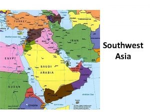
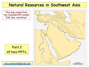
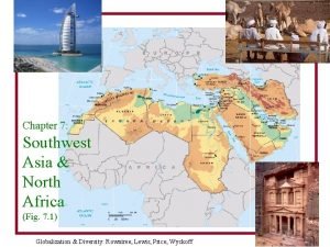
 Southwest asia and north africa map
 Southwest asia and north africa physical map
 North africa and southwest asia physical geography
 Southwest asia and north africa physical map
 North africa and southwest asia mountains
 Physical map of swana
 Goodguysww.
 Asia europe north america
 Chapter 22 human geography of southwest asia
 Chapter 21 physical geography of southwest asia
 Peninsulas and waterways in southwest asia
 Chapter 23 today's issues southwest asia
 Nationalism in india and southwest asia
 Difference between islam and christianity chart
 Nationalism in india and southwest asia
 Nationalism in india and southwest asia
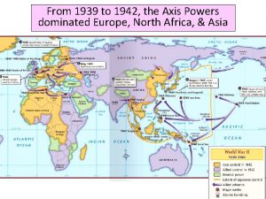
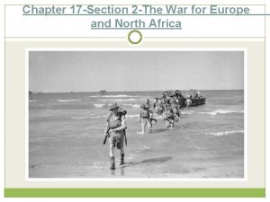
 Chapter 17 section 2 the war for europe and north africa
 The war for europe and north africa chapter 17 section 2
 Chapter 18 colonial encounters in asia and africa
 Brain wrinkles southwest asia
 Landform in asia
 Resources in southwest asia
 Relative location of southwest asia
 Agricultural hearths
 Brain wrinkles southwest asia answer key
 Somebody wanted but so us presence in sw asia
 Sw asian economies comprehension check
 Brain wrinkles southwest asia

