North Africa and Southwest Asia Physical Geography Mountains

")
 and semiarid.")


- Slides: 27
North Africa and Southwest Asia Physical Geography
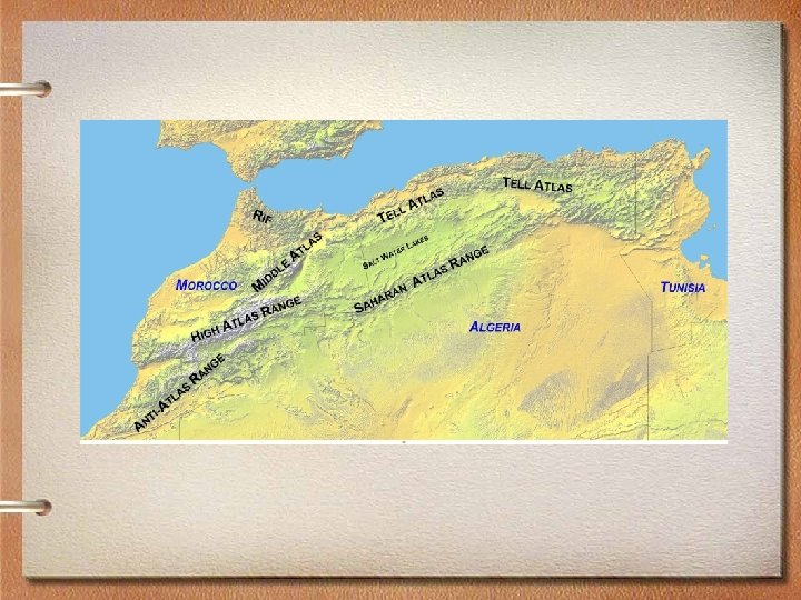
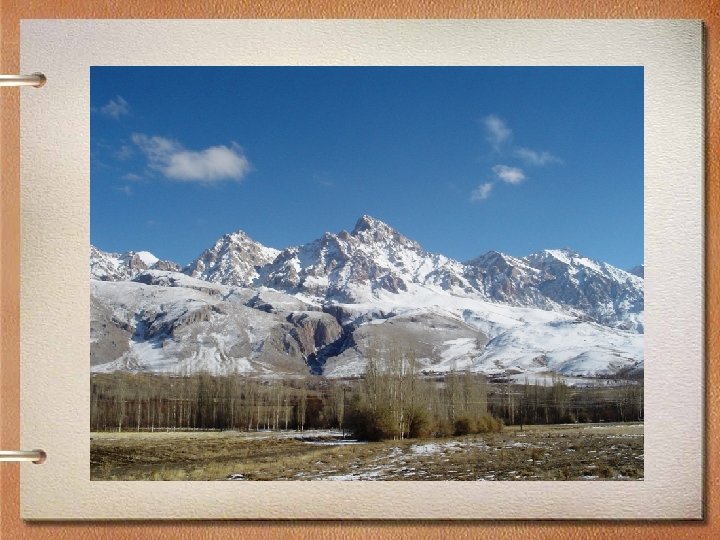
Mountains • The major mountain ranges in this area are: A. Atlas Mountains (Morocco) B. Taurus Mountains (Turkey) C. Zagros Mountains (Iran)
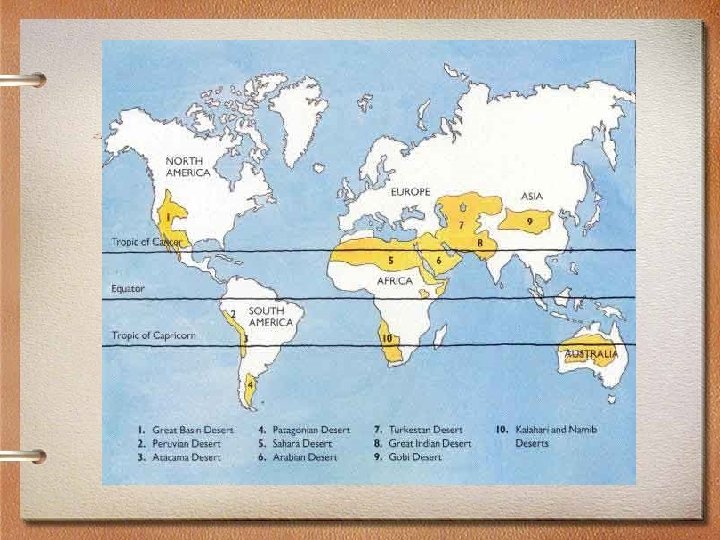
Climate • The most common climates in this area are desert (arid) and semiarid. A. The Sahara Desert covers North Africa. B. The Rub al-Khali is located on the Arabian Peninsula.
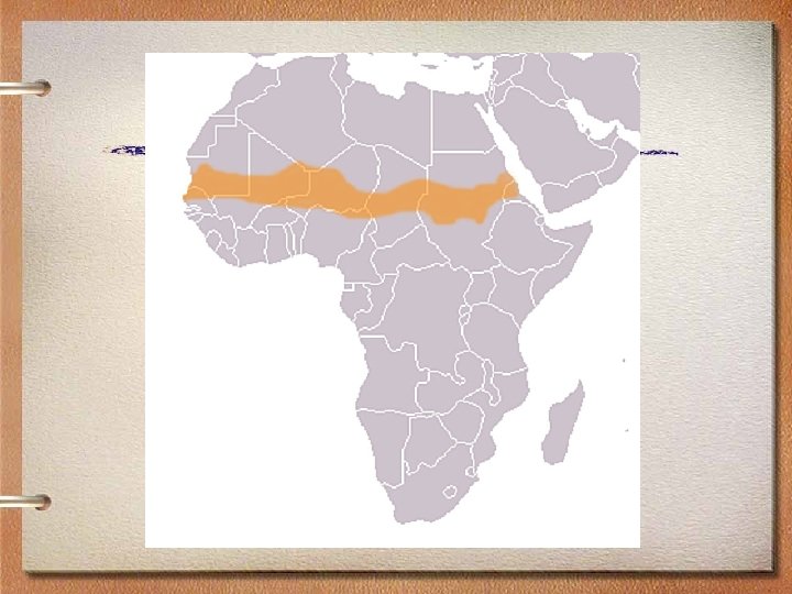
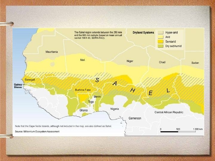
Sahara Desert • The Sahara Desert is the largest dry desert in the world. South of the Sahara Desert is a region called the Sahel. The Sahel has a semiarid climate zone and is covered by dry grass called steppe.
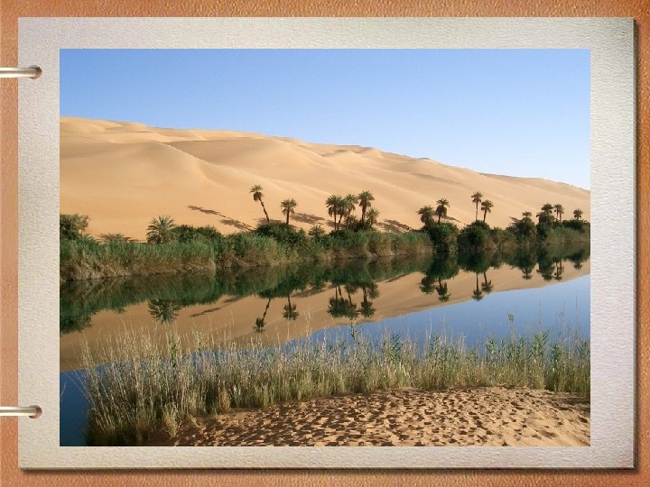
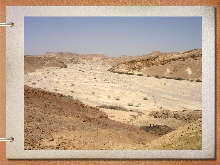
Wadis and Oases • An oasis is an area in the desert where vegetation can grow because water is near the surface or on the surface. • A wadi is a dry riverbed in a desert that fills up when it rains.
Desertification • The Sahel is a fragile area and is prone to desertification. • Desertification is the expansion of arid conditions into non-arid areas. Basically, the Sahara Desert is getting bigger.
Desertification • Desertification is caused by humans and natural conditions. Long droughts cause vegetation to die. However, humans with herds of goats, sheep, and camels also cause desertification.
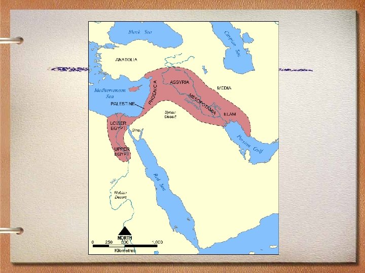
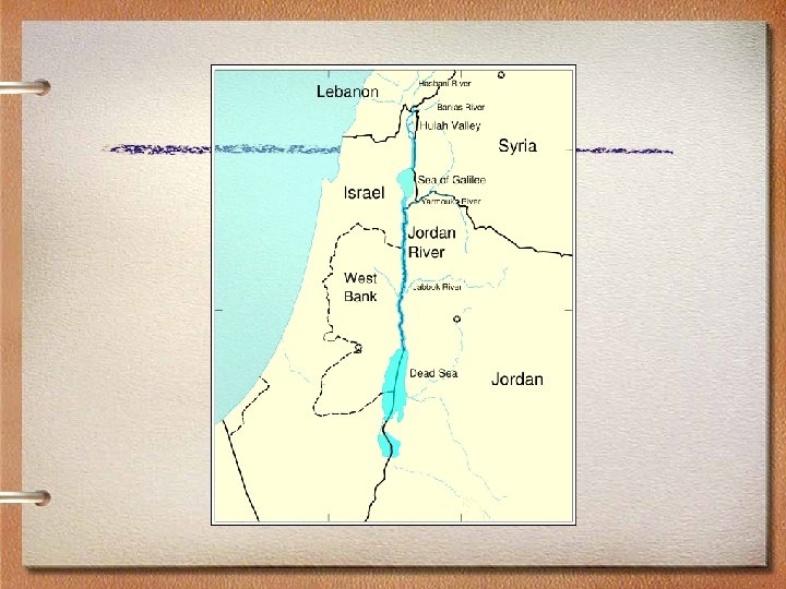
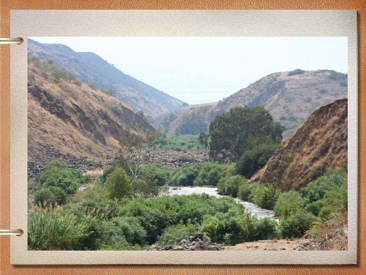
Water Features A. The Nile River in Egypt B. The Tigris and Euphrates Rivers in Iraq C. The Jordan River on the border of Jordan and Israel
Strategic Waterways • The Middle East has many strategic waterways, or narrow bodies of water that are important for trade or defense.
Bosporus and Dardanelles • The Bosporus and Dardanelles connect the Black Sea with the Mediterranean Sea. • Istanbul is an important city because it is located on the Bosporus and controls this important trade route.
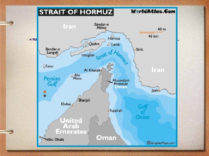
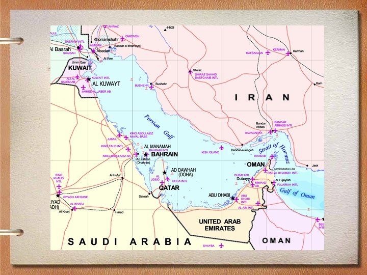
Strait of Hormuz • The Strait of Hormuz connects the Persian Gulf with the Arabian Sea. • Iran is on one side of the strait and the U. A. E. and Oman are on the other side. • The strait is important because most of the oil in the world must be transported from the Persian Gulf to world markets.
Persian Gulf • The Persian Gulf is also known as the Arabian Gulf. • The term Arabian Gulf is used by Arab countries near the Persian Gulf such as Saudi Arabia, Oman, and the U. A. E. but it is not recognized by the United Nations.
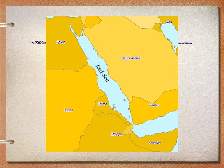
Red Sea • The Red Sea is connected to the Mediterranean Sea by the Suez Canal. • The Suez Canal does not have locks like the Panama Canal or the St. Lawrence Seaway because there is no change in elevation.