New Jersey Water Monitoring Council and Monitoring Assessment


- Slides: 44

New Jersey Water Monitoring Council and Monitoring & Assessment Programs Leslie J. Mc. George, Administrator NJDEP Water Monitoring and Standards Presented at: National Water Quality Monitoring Council Meeting Philadelphia, PA July 24, 2007

Overview Water Monitoring Council Monitoring Programs Freshwater Marine Water & Beach Volunteer Water Quality Assessment Data Exchange Project Innovative Coastal Monitoring Techniques (Bob Connell)

NJ Water Monitoring Council • Formed: October 2003 on World Water Monitoring Day • Vision: provide water information foundation for management of aquatic environment • Mission: coordination, collaboration and communication of ambient water quality/quantity data to support effective environmental management • Scope: biological, chemical and physical conditions of surface and ground waters, freshwater, estuarine, & marine waters

NJ Water Monitoring Council 30 Members - 15 monitoring & research orgs. • Federal, state, interstate, regional, county government • Academia & Research Institutions • Volunteer representation Co-chairs – Leslie Mc. George (NJDEP) Rick Kropp (USGS Water Science Ctr) Coordinator – Alena Baldwin-Brown (NJDEP) Steering Committee – NJDEP, USGS, DRBC • 3 meetings/yr & subcommittees EPA mini-grant support (Watershed Protection Program)

NJ Water Monitoring Council Member Organizations • NJDEP • USGS/NJ Water Science Center • USEPA Region 2 • NOAA • Delaware River Basin Commission • Interstate Environmental Commission • Pinelands Commission • Rutgers U. - IMCS, Coop. Extension Service • NJ Water Resources Research Institute • NJ Marine Sciences Consortium • Passaic River Institute (Montclair State U. ) • Meadowlands Environmental Research Inst. • Monmouth County Health Department • NJ Water Supply Authority • Volunteer Monitoring coordinator

NJ Water Monitoring Council: Information Exchange • Meetings – biological monitoring, microbial monitoring & source trackdown, water quantity, county/local/volunteer monitoring • State Water Monitoring Workshop – April 20, 2006 • Use of Council website (www. nj. gov/dep/wms/wmcchome. html) • Water Monitoring Inventory development

NJ Water Monitoring Council: Benefits • State water monitoring community partnerships • Technical information exchange • National Council information • Monitoring data gap identification • Joint project/grant development opportunities • Increased data submittals to NJDEP

NJ’s Monitoring & Assessment Programs • Programs described in Long. Term Strategic Plan (2005 -2014) • Identifies gaps & partnership resource needs www. nj. gov/dep/wms/longtermstrategyreport. p

Freshwater Monitoring • Where do we monitor ? • Rivers/streams (>18, 000 miles at 1: 24, 000 scale) • Lakes • Groundwater • What do we monitor • Water column • Sediment • Biological conditions ?

Freshwater & Biological Monitoring Program Designs Fixed stations Rotating basins Probabilistic designs Targeted monitoring (e. g. , TMDL support, stressor identification, stormwater monitoring)

Ambient Surface Water Network Cooperative program with USGS Develops chemical/physical data for water column & sediment status & trends 115 stations, 42 randomly selected 4 x/year Parameters Include: Nutrients DO Bacteriological Metals Volatile Organics Pesticides

Groundwater Monitoring Network -Cooperative program with USGS - 5 rotating basins - Shallow well network - 150 targeted stations – 30/yr - Land use-based - Agriculture - Undeveloped - Urban - Parameters monitored: nutrients, VOCs, metals, pesticides, radioactivity

Benthic Macroinvertebrates - Ambient Biomonitoring Network (AMNET) Indicator of river/stream aquatic health Over 800 stations 5 Rotating basins Sampled 1 x/5 yrs Index period – April - Nov

Ambient Biological Monitoring Network Results Non-impaired Moderately impaired Severely impaired

Benthic Macroinvertebrate Program Status 3 Rounds of all 5 Water Regions complete. Existing single Multi-metric index being replaced with 3 NJ-customized ecoregionspecific indices Pinelands High gradient (adaptable to headwaters) Coastal Plain New indices at genus species level

Fish Index of Biotic Integrity Network (FIBI) Program initiated in 2000 (N. New Jersey) 100 Fixed Site network 20 Sites per Year, 5 Year Rotation Index Period – June through Mid-October Round 2 Sampling

Fish Index of Biotic (FIBI) Integrity Network Results 2000 -04 FIBI Ratings (First Round)

Inner Coastal Plain (S. Jersey) FIBI Development NJ Div. of Fish & Wildlife - lead for Coastal Plain FIBI development Validation Study Completed in 2006 Monitoring began 2007

Lakes Monitoring Network 200 Lake network, 40 lakes/year. Began 2004. Probabilistic design, using USEPA - GRTS protocol, representing ~1100 named lakes Average 3 stations/lake Parameters selected to assess lake productivity

Ambient Lakes Monitoring Network Sample Parameters: Total Phosphorus Total Kjeldahl Nitrogen Nitrite+Nitrate Nitrogen Ammonia Nitrogen Dissolved Oxygen Temperature Specific Conductance p. H Alkalinity Hardness Turbidity Secchi depths Chlorophyll “a”

Marine Monitoring for Public Health: Seafood Safety Required by NJ Statute (NJSA 58: 24). Required by US FDA for interstate sale of shellfish (worth ~$500 million/year to the NJ economy). Supporting data for NJ’s Integrated Report to identify impaired shellfish use waters. 2, 500 locations, 15, 000 samples/year for coliform bacteria

Harvestable Acreage Improvements (1976 -2006)

Monitoring for Public Health: Ocean & Bay Bathing Beaches 127 miles ocean shoreline 325 locations monitored, including 188 ocean beaches and 76 bay beaches Monitored weekly – more frequently if needed Cooperative program with counties Enterococcus Indicator Criterion = 104 enterococcus/100 ml

Marine Monitoring for Public Health: Ocean & Bay Bathing Beaches Most NJ beaches have never been closed. In 2006, >97% beaches with no closures. Monitoring supports $36 billion beach tourism industry in NJ 2006

Marine Monitoring for Public Health: Ocean Beach Closures NOTE: Indicator changed from fecal to enterococcus in 2004

Marine Monitoring: Ecosystem Health Required by the Federal Clean Water Act. Used for NJ’s Integrated Report to identify impaired waters. 250 locations 1000 samples/year, DO, nutrients, chlorophyll

Marine Monitoring: Ecosystem Health National Coastal Assessment Program Part of national assessment of estuarine systems Sediment Toxicity Sediment Chemistry Benthic Diversity Fish Tissue

Marine Monitoring: Nonpoint Source Monitoring in NJ Applications Source Tracking Land use load estimates for TMDL modeling Mobile laboratory microbiology & nutrients Automated flow measurement and sample collection

NJ Volunteer Monitoring Program Watershed Watch Network (started 2002) 29 River/Stream Monitoring Organizations Biological Visual Habitat Chemical Bacteria 58 Lake Monitoring Organizations Bacteria Chemical

Volunteer Program Watershed Watch Network Internal NJDEP Advisory Council Water Monitoring & Standards Division of Watershed Management Office of Quality Assurance External Advisory Council – Volunteer Program Coordinators from: Riverkeeper Organizations Watershed Associations

Volunteer Program Outcomes Training (e. g. , field collection, habitat assessment, data integration, benthic macroinvertebrates) Annual Volunteer Monitoring Summit Technical Assistance - NJ Service Provider Network Resource Support – Mini-Grant Program Online Data Management System (under development) Increased high quality data submissions to

NJ’s 4 Tiered Approach Allows for volunteers to choose level of monitoring involvement based on: Intended purpose for monitoring Intended data users Tier A-Environmental Education Tier B-Stewardship Tier C-Community Assessment Tier D-Indicators/Regulatory

Water Quality Assessment: CWA – Section 305(b) Required 1 x/2 yrs Statewide water quality status Water quality trends Causes & sources of nonattainment Actions needed to improve water quality Cost estimate of actions

Water Quality Assessment: CWA Section 303(d) Formerly Impaired Waterbody List ID specific waterbodies & stream miles not meeting uses ID pollutants exceeding standards & requiring TMDLs TMDL schedule Public Participation required Use all available data

Water Quality Assessment: Integrated Report Process* Data solicitation Assessment Methods document Assessment of data (> 6400 individual designated use assessments in 2006) Integrated Waterbody List Stakeholder input Integrated Report w/ 305(b) water quality characterization EPA List Approval * Based on EPA guidance: “Guidance for 2006 Assessment, Listing and. Database Data submission to EPA via Assessment Reporting Requirements Pursuant to Sections 303(d), 305(b) and 314 of the Clean Water Act (IRG)”, July 2005.

2006 NJ Assessment Enhancements Assessment units based on USGS HUC 14 subwatersheds vs. waterbody segments Assessment units now consistent for each Integrated Report cycle Increased use of external data (36 groups) – federal agencies, interstate, volunteers, watershed associations, local governments, MUA’s

Overall Assessment for 2006 Goal – all waters fully assessed <10% of subwatersheds assessed for all uses 25% of subwatersheds fully assessed with exception of fish consumption use

2006 Assessment Results

2006 Assessment Results Top Impairments – All Waters

NJ Water Quality Data Exchange Goals Develop searchable inventory of monitoring activities Integrate federal, state, county and local ambient water quality monitoring data into NJDEP’s enterprise environmental data management system Continue making NJDEP’s water quality data readily available to public Exchange ambient water quality monitoring data with USEPA (not just submit NJDEP data to EPA) Funding: National Environmental Information

NJDEP WQ Data Exchange Web Server XML spreadsheets Web forms XML NJDEP NJ DHSS Lab Web Services spreadsheets Web forms XML Counties Commissions spreadsheets Web forms XML Non-NWIS Data USGS/NWIS Web Services spreadsheets Web forms XML USEPA Central Data Exchange (CDX) TMDL Contractors 319(h) Grantees Inventory Volunteer Organizations (Who, What, Where, When, Why)

Data Exchange Project Key Challenges EPA data exchange standard (WQX) does not contain some data elements needed to describe monitoring for inventory (e. g. , municipality, categories – metals, organics, etc. ) How get data from the USGS/NWIS web services (when available) since not initially Exchange Network (EN) compliant (i. e. , can’t use EN software tools) How get data from EPA’s EN node since new WQX web services may not initially be EN compliant (i. e. , can’t use EN software tools)

Possible Solutions from NJDEP’s NEIEN Grant Inventory: Work with EN to enhance WQX to include inventory related data elements. Enhance EN Browser to accomplish inventory tasks (requires consultation with EN Leadership Council and ECOS) USGS/NWIS web services: NJDEP build application to get data from soon to be released USGS web services and make data WQX compliant for loading in NJDEP’s data system. EPA’s WQX web services: NJDEP to build application to get data from new WQX web service and load into NJDEP’s data system.

Acknowledgements Council - Alena Baldwin-Brown Marine - Bob Connell & Virginia Loftin Volunteer - Danielle Donkersloot Assessment - Debra Hammond & Nancy Immesberger Freshwater - Al Korndoerfer Data Exchange - Paul Morton & Angela Witcher
 Water and water and water water
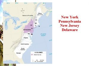
 New york, new jersey, pennsylvania, and delaware
 National water quality monitoring conference
 National water quality monitoring council
 4 regions of nj
 New jersey center for teaching and learning
 How many total squares are there
 Www.njctl.org answer key
 Virginia plan and new jersey plan venn diagram
 Universal waste management in new jersey
 New jersey space grant consortium
 How many feet for parallel parking test in nj
 Board of bar examiners nj
 New jersey accent words
 Tri club new jersey
 New jersey dyslexia handbook
 New jersey plan
 Hesaa njfams
 Obtaining a driver license illegally may result in
 New jersey social emotional learning standards
 New jersey courts
 Nj institute for continuing legal education
 Italiani in new jersey
 Kelly allen new jersey
 The new jersey plan
 Viva new jersey vocabulary
 Viva new jersey vocabulary
 New jersey absolute location
 New jersey plan
 Sea lice new jersey
 Chapter 1 the new jersey driver license system answers
 Nj division of vocational rehabilitation
 New jersey beefsteak tomatoes
 Are motorized bicycles legal in new jersey
 New jersey science teachers association
 Chapter 1 the new jersey driver license system answers
 Flood dream ocean city new jersey 1971
 Leadership development new jersey
 New jersey association of public accountants
 Nj yokogawa
 New jersey interpreters
 New jersey vs tlo
 Ossur new jersey
 New jersey educational opportunity fund
 Richard hackney
