Mission Aircrew Course Weather APR 2010 Aircrew Tasks


- Slides: 50

Mission Aircrew Course Weather (APR 2010)

Aircrew Tasks m P-2008 (O) m P-2009 DISCUSS THE DANGERS OF ICING DISCUSS THE DANGERS OF REDUCED VISIBILITY CONDITIONS (O) m P-2010 DISCUSS THE DANGERS OF WIND AND THUNDERSTORMS (O) m P-2023 DISCUSS HOW REDUCED VISIBILITY AND TURBULENCE EFFECT SEARCH OPERATIONS (S)

Objectives m Discuss how convection currents affect aircraft glide path. m Discuss wind patterns around high- and lowpressure areas. m Define “freezing level” and “lapse rate” m Discuss airframe icing and its affect on aircraft performance. m Discuss carburetor icing and its affect on aircraft performance.

Objectives (con’t) m Discuss the characteristics of cold, unstable air masses and warm, stable air masses. m Concerning reduced visibility conditions, state the minimums for: • VFR visibility • Cloud bases when they cover one-half the sky • How far aircraft must remain below cloud cover m Discuss the dangers of windshear. m Describe the ‘stages’ of a typical thunderstorm and discuss the dangers of flying too close.

Weather m The most important aspect of weather is its impact on flight conditions m Safety is paramount m Navigation — Visual verses Instruments m Effects on Search • Prevailing visibility • Search patterns and altitudes m Information — National Weather Service, Flight Service Stations, Flight Watch, PIREP’s

Flight precautions m Each member of the aircrew must be vigilant during all phases of flight • Assign each an area to watch m Characterize visibility in the search area to establish the proper scanning range • May be different than assumed m Visibility conditions or turbulence may increase fatigue

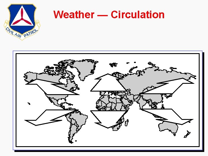
Weather — Circulation

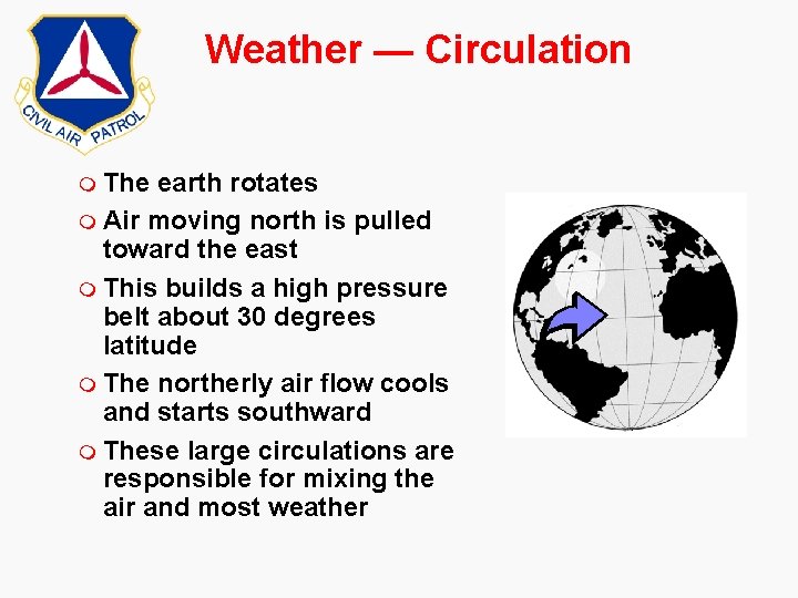
Weather — Circulation m The earth rotates m Air moving north is pulled toward the east m This builds a high pressure belt about 30 degrees latitude m The northerly air flow cools and starts southward m These large circulations are responsible for mixing the air and most weather

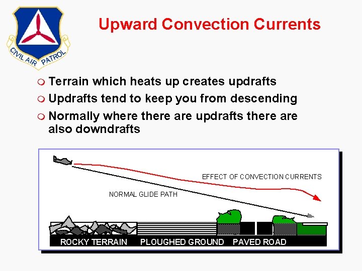
Upward Convection Currents m Terrain which heats up creates updrafts m Updrafts tend to keep you from descending m Normally where there are updrafts there also downdrafts EFFECT OF CONVECTION CURRENTS NORMAL GLIDE PATH ROCKY TERRAIN PLOUGHED GROUND PAVED ROAD

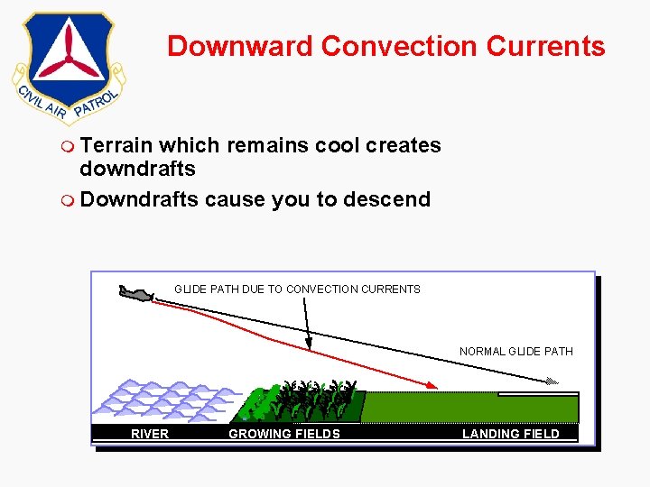
Downward Convection Currents m Terrain which remains cool creates downdrafts m Downdrafts cause you to descend GLIDE PATH DUE TO CONVECTION CURRENTS NORMAL GLIDE PATH RIVER GROWING FIELDS LANDING FIELD

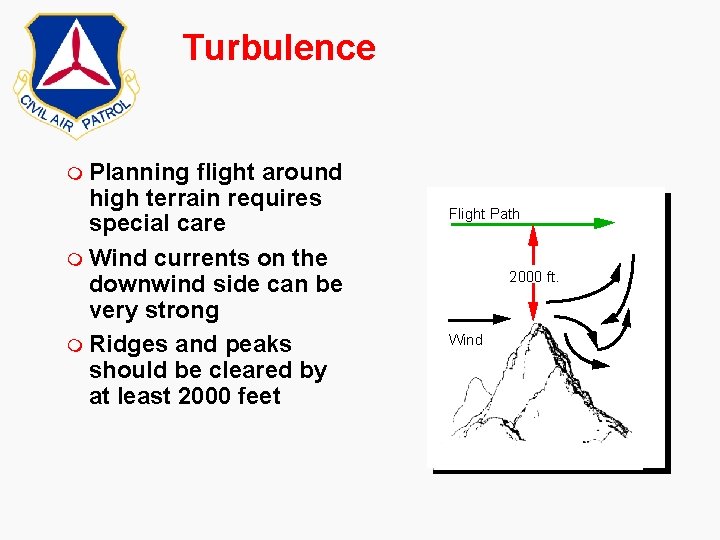
Turbulence m Planning flight around high terrain requires special care m Wind currents on the downwind side can be very strong m Ridges and peaks should be cleared by at least 2000 feet Flight Path 2000 ft. Wind

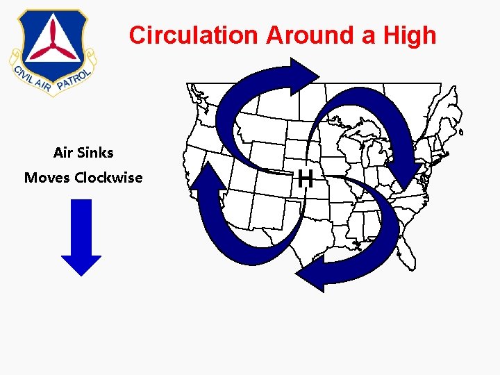
Circulation Around a High Air Sinks Moves Clockwise H

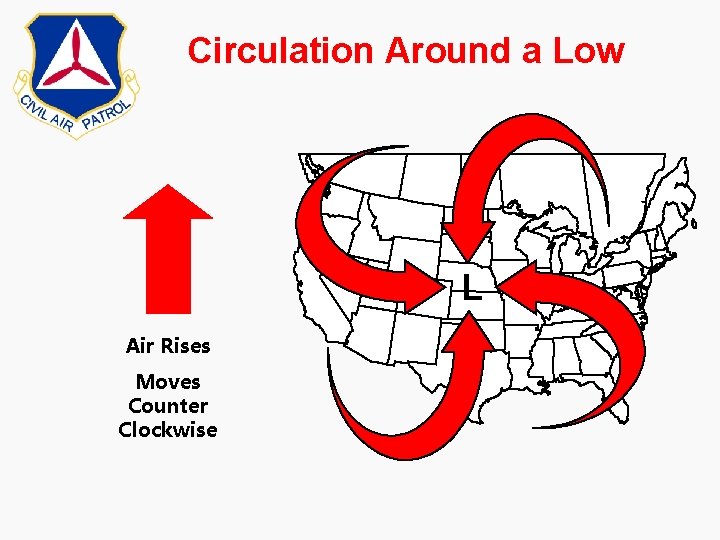
Circulation Around a Low L Air Rises Moves Counter Clockwise


LAPSE RATE m As altitude increases the temperature decreases at a fairly uniform rate of 3. 6 degrees F per 1000 (2. 0 degrees C per 1000) feet; this is known as lapse rate • Use this on hot days to determine how high you should climb to get to a comfortable temperature m At some altitude the air temperature reaches the freezing temperature of water; the freezing level

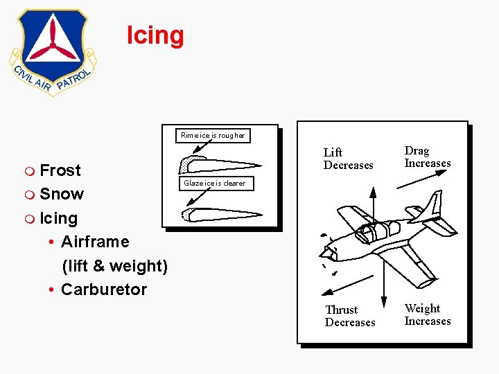
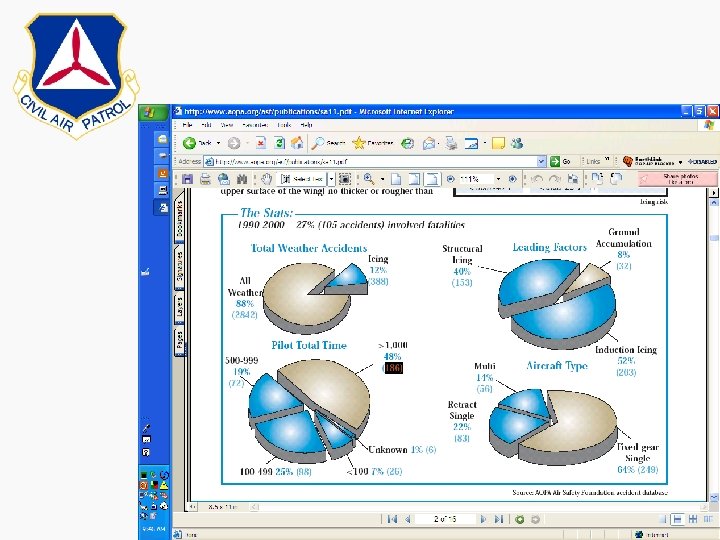
Icing Rime ice is rougher m Frost m Snow Lift Decreases Drag Increases Thrust Decreases Weight Increases Glaze ice is clearer m Icing • Airframe (lift & weight) • Carburetor


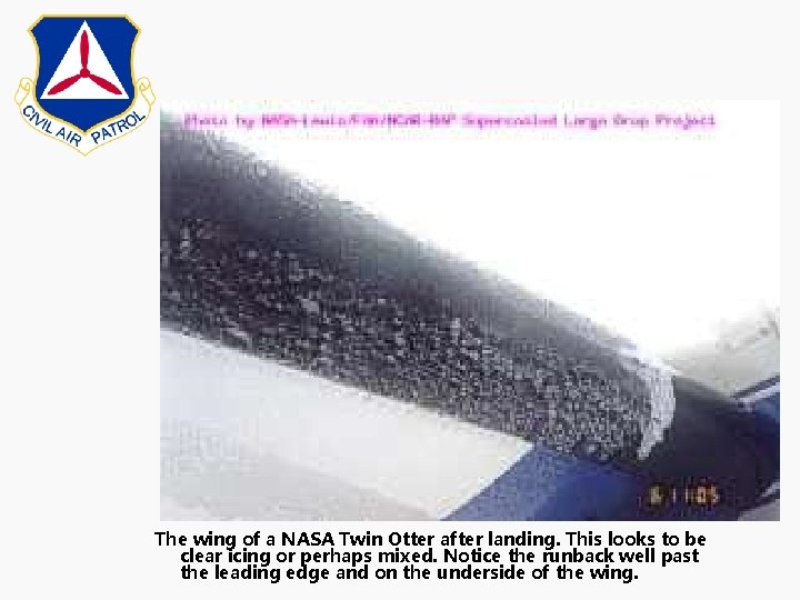
The wing of a NASA Twin Otter after landing. This looks to be clear icing or perhaps mixed. Notice the runback well past the leading edge and on the underside of the wing.

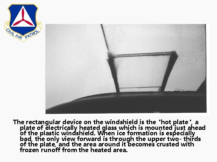
The rectangular device on the windshield is the "hot plate", a plate of electrically heated glass which is mounted just ahead of the plastic windshield. When ice formation is especially bad, the only view forward is through the upper two- thirds of the plate, and the area around it becomes crusted with frozen runoff from the heated area.


Carburetor Icing m Moisture in the air can condense, then freeze, blocking further flow of air and fuel to the engine. m Airplanes most vulnerable when operated in high humidity OR visible moisture with temperatures between 45 F and 85 F. m Most likely to form at low power settings such as in descents and approaches to landings. m Fuel injected engines are not vulnerable to carburetor icing.

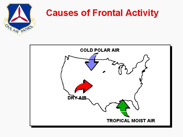
Causes of Frontal Activity COLD POLAR AIR DRY AIR TROPICAL MOIST AIR

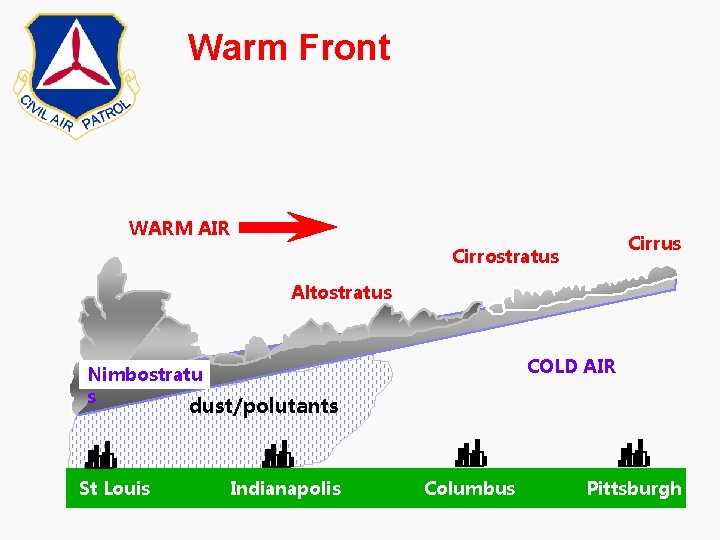
Warm Front WARM AIR Cirrus Cirrostratus Altostratus COLD AIR Nimbostratu s dust/polutants St Louis Indianapolis Columbus Pittsburgh

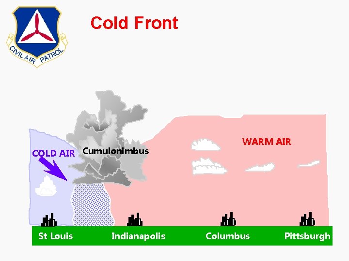
Cold Front COLD AIR Cumulonimbus St Louis Indianapolis WARM AIR Columbus Pittsburgh

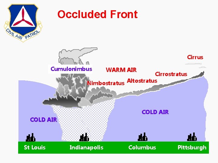
Occluded Front Cirrus Cumulonimbus WARM AIR Cirrostratus Nimbostratus Altostratus COLD AIR St Louis Indianapolis Columbus Pittsburgh

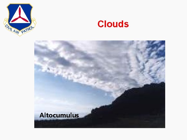
Clouds Altocumulus

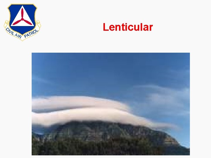
Lenticular

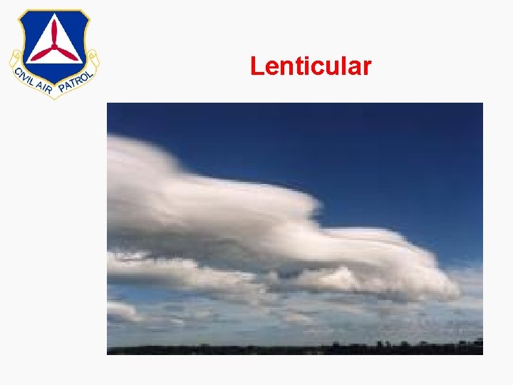
Lenticular

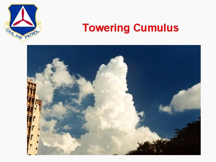
Towering Cumulus

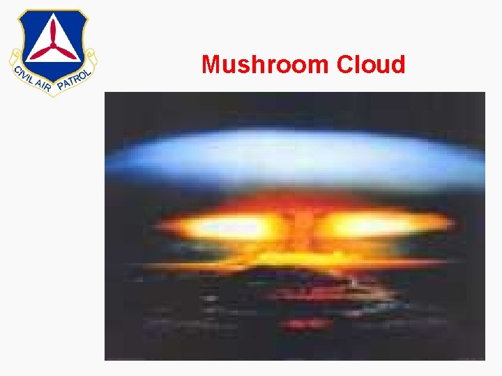
Mushroom Cloud

Reduced Visibility m Under almost all circumstances, VFR daytime flight requires: • At least three miles visibility • When clouds cover more than one-half the sky, cloud bases must be no lower than 1, 000 ft. AGL • Search aircraft must usually remain at least 500 ft. below the cloud deck

Reduced Visibility m Fog m Haze m Snow m White out m Blowing dust m Affected by sun angle and direction m Aircrew must increase vigilance during these conditions

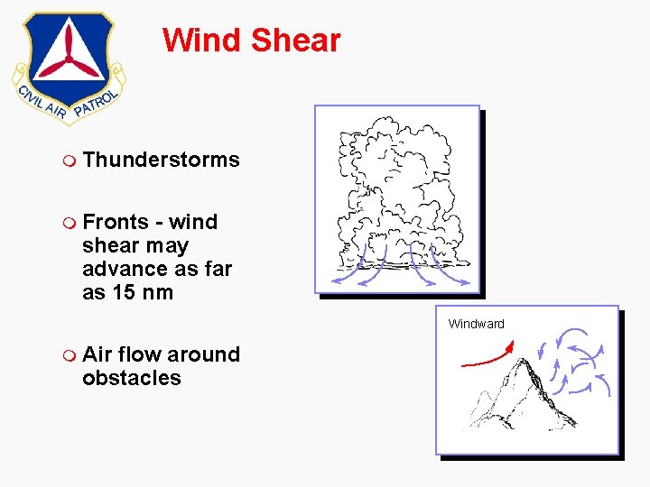
Wind Shear m Thunderstorms m Fronts - wind shear may advance as far as 15 nm Windward m Air flow around obstacles

Wind Shear m Two potentially hazardous situations, dangerous mainly during landing: • Tailwind turns calm or to a headwind • Headwind turns calm or to a tailwind m Critical conditions for potential low-level wind shear: • Cold Front: – After front passes – If moving 30 kts or more, may exist below 5000 ft for up to 3 hours • Warm front: – Before front passes – May exist below 5000 ft. for up to 6 hours – Danger passes once front passes airport m Pilot must adjust quickly

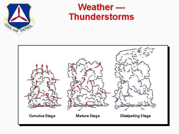
Weather — Thunderstorms Cumulus Stage Mature Stage Dissipating Stage

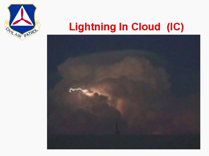
Lightning In Cloud (IC)

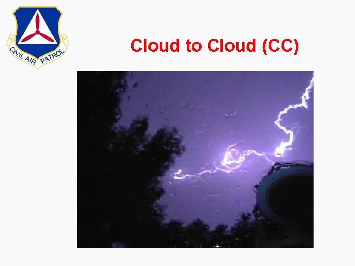
Cloud to Cloud (CC)

Flight Planning WX Sources Telephone National Weather Service 1 -800 –WX Brief (1 -800 -992 -7433) Standard Briefing – METARS (updated as significant change has occurred) – Terminal Area Forecast (i. e. IND) • Good for 12 hours • 3 x per day – Area Forecast (entire state or area you designate) • Every 12 hours • Route of Flight

– Winds Aloft • All altitudes • Notams – Current Airmets – Convective Sigmets – Cloud Tops (reported) – Pilot Reports (PIREPS) – High/Low Pressure Areas – Fronts

Flight Planning WX Sources Computer m AOPA. org • Weather • Satellite Images • Radar Imagery • Surface Wx Imagery • Upper Air Imagery • Textural Wx.

Flight Planning WX Sources Computer m Weatherunderground. com • • • Temperature Heat Index Wind Chill Radar Dewpoint Visibility

Flight Planning WX Sources Computer m Intellicast. com • • • Radar Severe Weather Satellite Surface Analysis Hurricane Watch More Spam

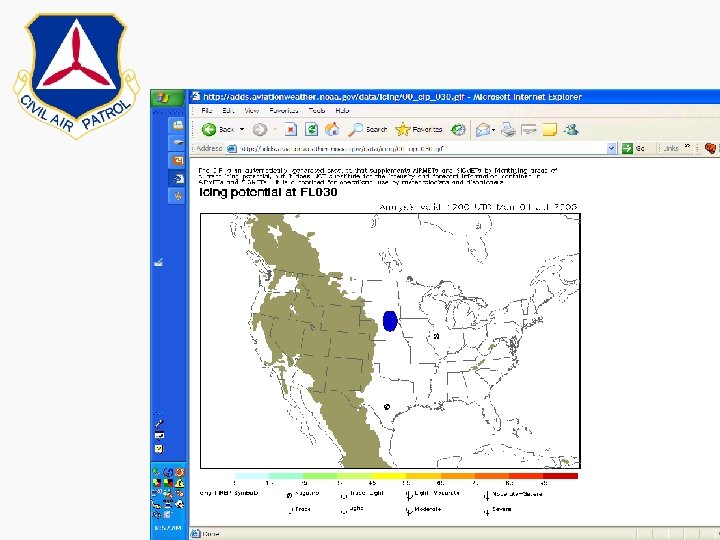
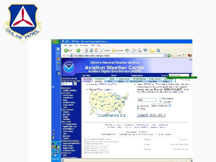
Flight Planning WX Sources Computer m NOAA’s National Weather Center (adds. aviationweather. noaa. gov) • Turbulence • Convection • Winds/Temps • Prog Charts • Metars • Tafs • Pireps


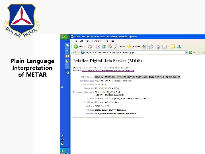
Plain Language Interpretation of METAR

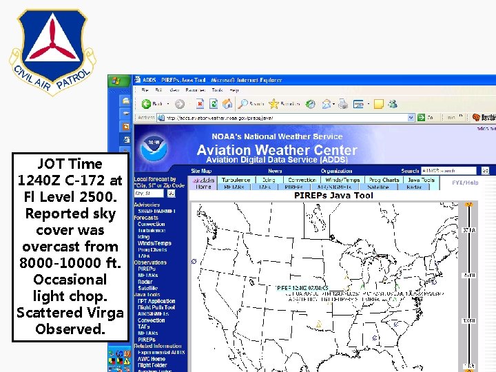
JOT Time 1240 Z C-172 at Fl Level 2500. Reported sky cover was overcast from 8000 -10000 ft. Occasional light chop. Scattered Virga Observed.

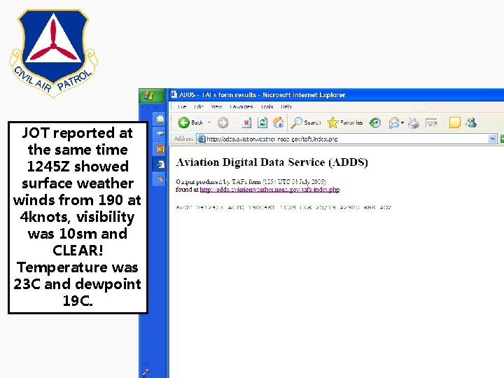
JOT reported at the same time 1245 Z showed surface weather winds from 190 at 4 knots, visibility was 10 sm and CLEAR! Temperature was 23 C and dewpoint 19 C.

Radio Services m Flight Service Station (FSS) m Flight Watch (122. 0) m Automatic Terminal Information Service(ATIS) m Transcribed weather broadcasts (TWEB) m Scheduled weather broadcasts • Fifteen minutes after the hour • Alerts, hourly weather, Advisory, Pilot Reports, Radar m Pilot Weather Reports (PIREP)


Questions?