Introduction to Watershed Hydrology RACC High School Training


- Slides: 32

Introduction to Watershed Hydrology RACC High School Training June 26, 2012 Jody Stryker University of Vermont

What is a watershed? • An area of land that drains water, sediment, and dissolved materials to a common outlet. • Watershed are separated by drainage divides. • Can be any shape and size. • Sub-watershed = watershed within a watershed. LEGEND flow lines sub-watersheds Elevation “Watershed” = “catchment” = “drainage basin”

Within a watershed Image credit: Watershed Activities to Encourage Restoration, http: //www. watershedactivities. com/projects/fall/h 2 omodel. html

What happens downstream? Image credit: NOAA Figures show dead zone near mouth of Mississippi River, Gulf of Mexico. Image credit: APA News/NASA

Stream order Headwaters Confluences Outlet Image Credit: Developed by T. Endreny at SUNY ESF in the Department of Environmental Resources Engineering

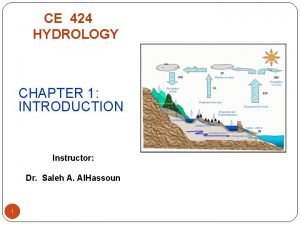
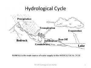
Global hydrologic cycle Figure credit: URI Water Quality Home

Rainfall to runoff Precipitation Transpiration Interception by canopy • Groundwater flow • Subsurface flow (interflow) • Overland flow Evaporation Stem-flow Overland runoff Root uptake Infiltration Subsurface flow Groundwater flow Infiltration

Runoff pathways • Groundwater flow • Subsurface flow (interflow) • Overland flow Source: M. Ritter, The Physical Environment.

Surface runoff is affected by. . . Climate characteristics such as: • Type of precipitation • Rainfall intensity • Rainfall duration • Rainfall distribution • Antecedent precipitation and soil moisture • . . . Source: M. Ritter, The Physical Environment.

Surface runoff is affected by. . . Physical characteristics such as: • Land use • Vegetation • Soil • Basin shape • Elevation • Slope • Topography • Drainage patterns • . . . Source: M. Ritter, The Physical Environment.

… landforms reflect dominant runoff processes V-shaped valley of a humid, temperate landscape Photo credit: Field Studies Council, UK Badland topography of an arid landscape Photo credit: National Park Service

Effects of development on runoff Image credit: Minnesota Center fro Environmental Advocacy

Effects of development on runoff Image credit: Minnesota Center fro Environmental Advocacy Natural Landscape ü Low runoff ü High infiltration and recharge ü Healthy summer stream flow ü Natural pollutant treatment Developed - High runoff, low recharge - Lower water tables - Low stream flow -Nuisance flooding

Measuring river runoff Steps: 1. Measure stream stage (height of water surface). 2. Measure discharge. 3. Define relationship between stage and discharge. Image credit: Vermont EPSCo. R CWDD , http: //www. uvm. edu/~streams/index_old. php? Content=pages/2010_2011_Undergraduates

Measuring river runoff Steps: 1. Measure stream stage (height of water surface). Diagram of a typical USGS stream gage with stilling well. Image credit: The USGS Water Science School , http: //ga. water. usgs. gov/edu/streamflow 1. html

Measuring river runoff 2. Measure discharge. Discharge = velocity * width * depth Image credit: The USGS Water Science School , http: //ga. water. usgs. gov/edu/streamflow 2. html Steps:

Image credit: The USGS Water Science School , http: //ga. water. usgs. gov/edu/streamflow 3. html Measuring river runoff Steps: 3. Define relationship between stage and discharge.

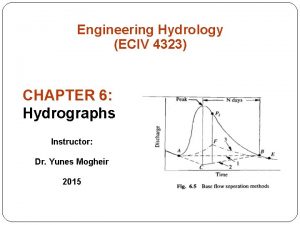
Hydrograph • A way to look at the response of a watershed to hydrologic event • Discharge (cms/cfs) vs. time • Comprised of base flow and direct flow

Hydrograph pattern is the result of: Image credit: BBC: Intermediate Geography Rivers Watershed characteristics

Hydrograph pattern is the result of: Climate • Humid vs. arid • Previous rainfall Storm characteristics • Intensity • Duration • Spatial distribution of events Image credit: http: //echo 2. epfl. ch/VICAIRE/mod_1 a/chapt_2/main. htm

Image credit: Battle River Watershed Alliance, CA.

Stream channel morphology Image credit: Fisheries and Oceans Canada, http: //www. pac. dfo-mpo. gc. ca/habitat/Glossary-glossaire-eng. htm

Stream morphology and stream health Image credit: Vermont Water Quality Division

Climate change and hydrology • What climate related changes might we see?

Climate change and hydrology • What climate related changes might we see? Higher surface temperatures Reduced snowpack Increased drought conditions Increase in regional precipitation – Longer growing seasons – Greater frequency of extreme events – –

Climate change and hydrology • What climate related changes might we see? Higher surface temperatures Reduced snowpack Increased drought conditions Increase in regional precipitation – Greater frequency of extreme events – – • What hydrologic changes might we see?

Climate change and hydrology • What climate related changes might we see? Higher surface temperatures Reduced snowpack Increased drought conditions Increase in regional precipitation – Greater frequency of extreme events – – • What hydrologic changes might we see? – Higher runoff – More erosion – Increased transportation of dissolved materials – Increased flooding frequency and/or magnitude – Geomorphic channel adjustments – More altered landscapes – Higher water demand

Climate change, hydrology, new challenges Image credit: Vermont Watershed Management Division Image credit: Vermont Agency for Natural Resources Image credit: Vermont Watershed Management Division

Hydrologic effects of deforestation/development Image credit: USGS, http: //ga. water. usgs. gov/edu/watercyclerunoff. html

An experiment • Sprinkle rainfall on “forested” watershed – collect runoff in cup • Deforest and develop your watershed • Sprinkle rainfall on “developed” watershed – collect runoff in cup

An experiment In each case consider: • How much of rainfall runs off? • How long before runoff begins at the bottom of the watershed? • What happens when rainfall stops?

Why does land use matter? Influences how much water runs off Influences how and where water runs off
 Ragc asistencia duoc
 The unwanted roomatr
 High school introduction paragraph
 Introduction paragraph examples high school
 Applied hydrology
 Scs method
 Meteorology hydrology and water management
 Arithmetic mean rainfall
 Hydrosphere unit test answers
 Drh in hydrology
 Interception hydrology
 Applied hydrology
 Hydrograph
 Hyteograph
 Applied hydrology
 The basic assumptions of unit hydrograph theory are
 Drh in hydrology
 Applied hydrology
 Hydrology continuity equation
 Qg 424
 Applied hydrology
 Bernoulli equation hydrology
 Branches of hydrology
 Continuity equation hydrology
 Continuity equation hydraulics
 Caribbean weather satellite
 Hydrology lecture
 Hydrology is science which deals with
 Quadrant method hydrology
 Hydrology department kerala
 Isohyetal method procedure
 Design storm in hydrology
 Groundwater
