Introduction to Map Skills CONSIDER THIS What elements


 Seven components")
 Compass Rose Map Key/Legend Map Scale")


 • Conic Projection – Fairly accurate overall • Goode’s Interrupted Equal")
 • Robinson’s Projection – Overall fairly accurate – However poles distorted")


- Slides: 33
Introduction to Map Skills
CONSIDER THIS! What elements can you name on a map or globe? When you are handed a map, what do you look for?
Important parts of Maps and Globes (What you should look for first) Seven components that are included on a useful map. Reportedly, the term originated by the National Geographic Society of the United States. 1. 2. 3. 4. 5. 6. 7. Title - should be pertaining to the subject of the map. Orientation - Compass Rose should indicate North. Date - What the date is. Author - Who created the map. Legend - What symbols mean on the map. Scale - The size of space on the map. Source - The Publisher or Organization of the map.
Parts of a Map (this is the title!) Compass Rose Map Key/Legend Map Scale
Activity: Identify the Map Parts
Map Projection • Transforming something spherical into something flat means that the 2 -D image will never exactly represent what is visible in three-dimensions. • Geographers use numerous mathematical equations to produce map projections. • Mercator Projection – Fairly accurate however not with size or distance • Specifically at the poles
Map Projections (Con’t) • Conic Projection – Fairly accurate overall • Goode’s Interrupted Equal Area Projection – Show’s true size and shape – However distances are inaccurate
Map Projections (Con’t) • Robinson’s Projection – Overall fairly accurate – However poles distorted • Azimuthal/Polar – Size accurate – Shows distances over poles, often used for air navigation
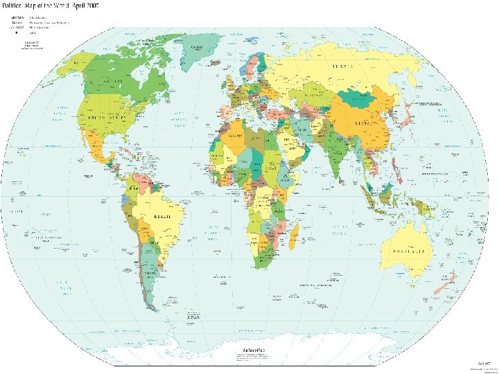
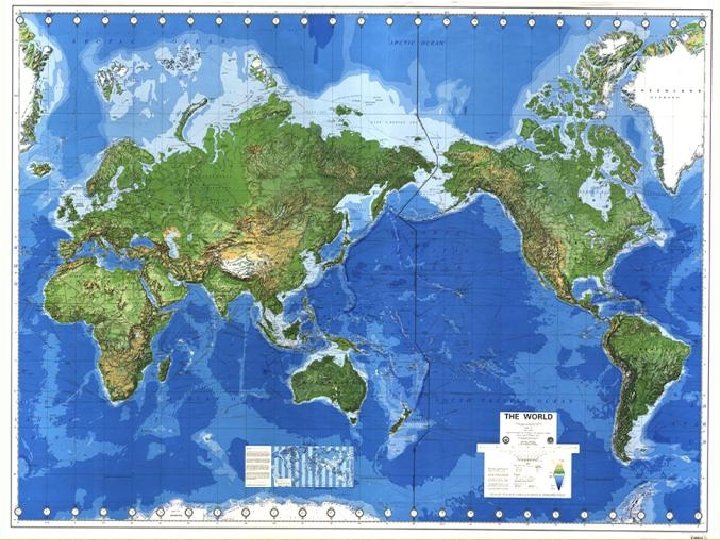
What types of maps are there? • Physical • Political • Thematic (Choropleth and Cartogram)
What Are Political Maps? • Show features on the earth’s surface that humans created Political Borders – borders decided by Governments (latitude & longitude) • Examples? National and State Borders, City Limits, capitals
What Are Physical Maps? • show types of landforms and bodies of water • • Physical Borders – countries Separated by a physical feature • Ex. Rio Grande River, Ural Mountains
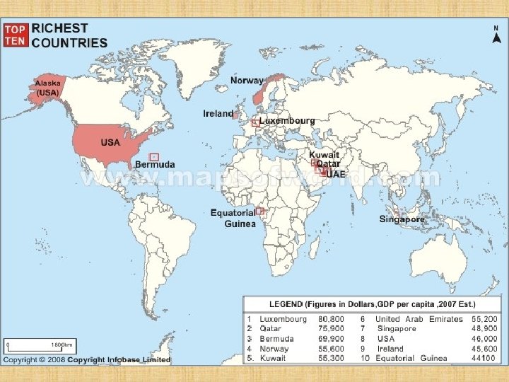
What Are Choropleths? • • Thematic map that uses graded differences in shading or color or the placing of symbols inside defined areas on the map in order to indicate the average values of some property or quantity in those areas Many different kinds. Examples? ? ? • Climate • Vegetation • Natural Resources • Population
What are Cartograms? • A cartogram is a map in which some thematic mapping variable is substituted for land area or distance. • The geometry or space of the map is distorted in order to convey the information of this alternate variable. Area cartograms are maps in which the sizes of geographic regions such as countries or provinces appear in proportion to some demographic feature such as population, avg. income, disease incidence, etc. ).
The Geographer’s Grid and Latitude/Longitude
What are important lines on “Geographer’s Grid”? • Equator – Divides the earth between Northern Hemisphere and Southern Hemisphere • Prime Meridian – Divides the Eastern Hemisphere from Western Hemisphere
What is a hemisphere? • One half of the Earth. • North, South, East, West all have hemispheres.
Where are the “The Tropics”? • Tropic of Cancer – 23. 5* North of Equator • Sun’s most northern location on June 21 st • Tropic of Capricorn – 23. 5* South of Equator • Sun’s most southern location on December 21 st
Where are the “Polar Circles”? • Arctic Circle – 66. 5* North of the Equator • begins the North polar region • Antarctic Circle – 66. 5* South of the Equator • begins South polar regions
What is “Latitude and Longitude”? • It is a grid for finding your location on the Earth. Like “X and Y” from the grid in math class. Or like a football field. Or like the game “Battleship”
What is Latitude? • • Run parallel to Equator Measures North and South 90 degrees North latitude 90 degrees South latitude Important lines of Latitude: 1. Equator 2. Tropic of Cancer 3. Tropic of Capricorn 4. Arctic Circle 5. Antarctic Circle
What is Longitude? • Run parallel to Prime Meridian • Measures East and West • 180 degrees of East longitude • 180 degrees of West longitude • Total = 360 degree circle • All lines meet at North Pole and stretch to South Pole
How do you use Latitude and Longitude to find your way? 1. 2. 3. Find the right hemispheres (N, S, E, W). Trace latitude and longitude till they meet. FOLLOW THE CURVE!
Practice on the Big Map Find the major city closest to the latitude and longitude below Remember: 1. Find the right hemispheres (N, S, E, W). 2. Trace latitude and longitude till they meet. 3. FOLLOW THE CURVE! • • 30*N, 95*W 50*N, 0*E 40*N, 115*E 35*S, 60*W
Activity 1 – Using Political Maps Use the World Political Map on p. A 4 -A 5 of your textbook to answer these questions. 1. What are the five largest countries in the world in terms of total area? 2. What are the two countries that lie on the Himalayan border between India and China? 3. What is the name of the largest island in the world? 4. Which country has the most borders with other nations? Who are its neighbors?
Activity 2 – Using Physical Maps Use the World Physical Map on p A 2 -A 3 of your textbook to answer these questions on your own paper. 1. What mountain range separates European Russia from Asia? 2. What two mountain ranges run the length of North and South America? 3. What are the world’s four oceans?
Activity 3 – Using Thematic Maps Use the “World Language Families Today” map on p 74 of your textbook to answer these questions. World Languages 1. What is the most common language family spoken throughout the world? 2. What are the major language families spoken in Asia? 3. What are three main language families spoken in Africa? Use the “World Population Density” map on p 80 of your textbook to answer these questions. World Population Density 1. What are the most lightly populated areas of the world today? 2. Where does the majority of the world’s population live today? 3. What are the largest population centers in the Southern Hemisphere? 4. Which region in North America has among the lowest population density? 5. What conditions are likely to contribute to this fact?