Map terminology and map symbols Map Definition of

Map terminology and map symbols

Map • Definition of a map: picture or representation of the earth’s surface. How places are related to each other in distance, direction and size.

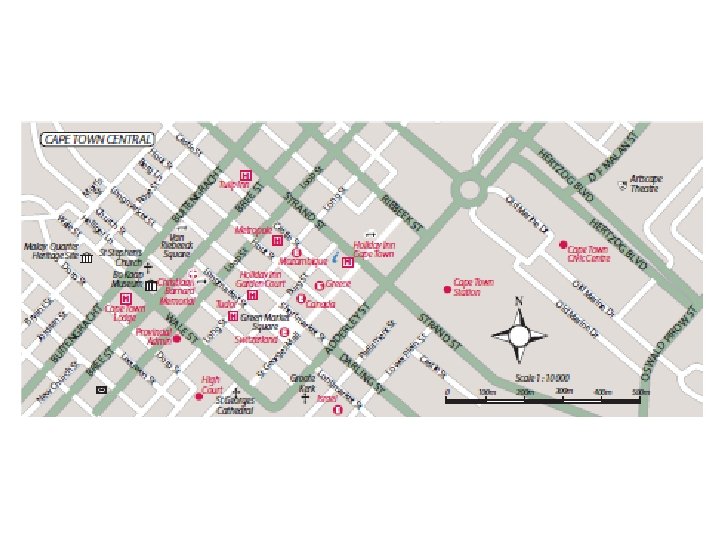
1 Map symbols • Why map symbols? To be able to interpret the information on the map. These symbols are shown in a legend on the map.

Example of a legend and line scale

Symbols you must know


2 Scale • Definition of scale: it represents the ratio of a distance on the map to the actual distance on the ground. This is important when we plan a tour. • Example: 1: 50 000 means 1 cm represents 50 000 cm or 0, 5 km in reality. Ratio is usually indicated on a line scale.

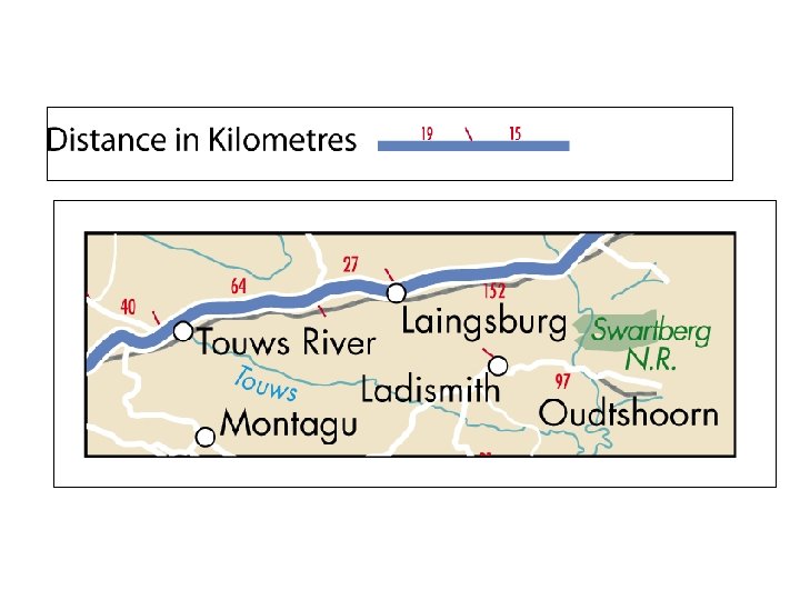
3 Distance indicators • Distance indicators on a map show the distances between places on the routes connecting towns. • Usually used on tourist maps, then they can calculate the distances between destinations.

4 Direction • Direction is the way to describe the position of one place in relation to another. There are 16 different points of directions. Four main points are known as the cardinal points namely North, East, South and West.


4 Direction • Draw a vertical line through the point where the direction is being taken: North-South line. Then draw a horizontal line through the same point: West-East line. Draw a line joining the two places – the place where the direction is being measured to the place to which direction is being measured.

North-South line West-East line SSW or SW

Terminology relevant to time zones • Countries are located in different time zones thus travel agents consider time differences when working out suitable travel times for tourists.

Lines of Longitude North Pole Greenwich Meridian The 0° line of longitude Eastern hemisphere Western hemisphere South Pole All Meridian runs from the North Pole to the South Pole and divides the earth into 24 time zones. Each 15° line = one hour in time. Because it takes 24 hours for the earth to rotate from west to east.


Line of Latitude Northern Hemisphere Southern Hemisphere Lines of Latitude runs parallel with the equator, the 0° line of latitude

Grid lines • We use grid lines to locate a place or feature on a map. • A grid = coordinate system, that consist of vertical and horizontal lines, which is placed on a map. • The commonly used grid system is a numbered square grid seen on page 76

Time Zones • The time zone of a country is calculated in relation to the Universal Time Coordinate (UTC) that is based on the local standard time of the Greenwich Meridian 0° line. • Time Zones is based on the line of longitude that runs through the country. SAST – South African Standard Time is determined by the 30°E line of longitude.


IDL
 • This is an imaginary line on the earths surface")
International Date Line (IDL) • This is an imaginary line on the earths surface at 180°longitude. • The time on both sides are the same but the dates differ.
- Slides: 24