GEORGIAS GEOGRAPHY AND CLIMATE SS 8 CG 1


- Slides: 23

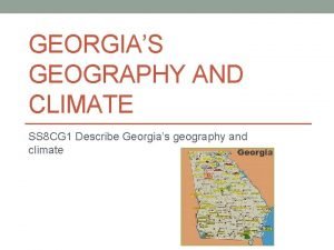
GEORGIA’S GEOGRAPHY AND CLIMATE SS 8 CG 1 Describe Georgia’s geography and climate

SS 8 CG 1 a- Locate Georgia in relation to region, nation, continent, and hemispheres Region- Georgia is located in the southeastern United States Country- United States Continent- North America

SS 8 CG 1 a- Locate Georgia in relation to region, nation, continent, and hemispheres Georgia is located in the Northern (latitude) and Western (longitude) Hemispheres

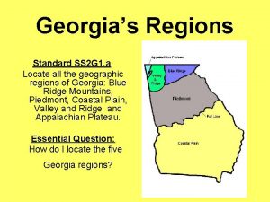
SS 8 G 1 b- Distinguish among the five geographic regions of Georgia in terms of location, climate, agriculture, and economic contributions

The Appalachian Plateau Region • Location- Northwest GA, known as the TAG corner (borders Tennessee and Alabama), smallest region • Physical Characteristics- Flat or gently sloping land sitting above surrounding valleys • Climate- Cooler temps due to its higher elevations (rarely gets above 90 degrees during the summer) • Agriculture- limited due to poor soil (some corn and soybeans are produced. • Economic contributions- Tourism and industry with some coal production

Pictures of the Appalachian Plateau

The Valley and Ridge Region • Location: Northern GA, lies between the Appalachian Plateau and Blue Ridge regions • Physical Characteristics- Long, parallel ridges separated by wide, fertile valleys • Climate- Cooler temps due to its higher elevation, similar to the Appalachian Plateau • Agriculture- Corn, soybeans, wheat, and cotton • Economic contributions- Textile and carpets (Dalton)

Pictures of the Valley and Ridge Region

Blue Ridge • Location- Northeastern corner of the state • Physical characteristics- Blue Ridge Mountains, Brasstown Bald is GA’s highest point (4, 784 feet above sea level) • Climate- High elevation makes it cooler during the summer. Highest amounts of precipitation in the state • Agriculture- Small farms produce apples, corn, and vegetables • Economic contributions- Historically-mining Todaytourism

Blue Ridge Region Pictures

Piedmont Region (where we live) • Location- central part of the state (2 nd largest region), Atlanta is located in this region • Physical Characteristics- Gently rolling hills, major rivers, red clay • Climate- hot summers, cool winters (can snow) • Agriculture- Significant crops include cotton, soybeans, and wheat. Poultry is important to the region • Economic contributions- Timber, industry, automobile manufacturing

Piedmont Pictures

Coastal Plain Region • Location- Southernmost region in the state • Physical Characteristics- Largest region, flat land, major rivers, fertile soil • Climate- hot, steamy summers and cool winters. Snowfall less likely • Agriculture- peanuts, peaches, pecans, cotton, soybeans, and Vidalia onions. Pine trees are harvested • Economic contributions- pulp and paper industry, commercial fishing, tourism. Deepwater ports of Savannah and Brunswick

Coastal Plain pictures

SS 8 CG 1 c- Locate key physical features of Georgia and explain their importance; include the Fall Line, Okefenokee Swamp, Appalachian Mountains, Chattahoochee and Savannah Rivers, and barrier islands

Fall Line • Natural boundary that separates the Piedmont and Coastal Plain Regions • Waterfalls are found here due to the drop in elevation • Columbus, Macon and Augusta are located hererapidly flowing rivers= source of energy • Mills were located here

Okefenokee Swamp • Largest freshwater swamp in North America • Located in SE GA • Many American Indian tribes lived here throughout history • One of the world’s largest intact fresh water ecosystems

Appalachian Mountains • Located in north GA • Produce high rainfall patterns in the spring and summer and frequent snowfalls during the winter • Major rivers begin in these mountains • Tourism is important to this region

Chattahoochee River • Begins in the Blue Ridge Region, forms part of the border with Alabama. • Food and water source • Primary water source and recreation activities for millions of Georgians

Savannah River • Forms the border between Georgia and South Carolina • Source of water, food, and transportation for thousands of years • Primary water source for Savannah and Augusta • Generate hydroelectric power

Barrier Islands • Chain of islands off the coastline of Georgia • Protect the mainland beaches from wind (hurricanes) and water erosion • Tourist and recreation areas today

SS 8 G 1 d- Analyze the importance of water in Georgia’s historical development and economic growth

Importance of water in GA • Much of GA’s boundaries are bodies of water • People have used water for transportation, food, and water sources • Rivers have been used for “highways” for trade.
 Okefenokee swamp
 Blue ridge region
 Georgias regions
 Georgias colony
 Georgias region
 Climate change 2014 mitigation of climate change
 Scandinavian climate and geography
 World geography today
 13 colonies foldable
 Iroquois geography and climate
 Monti doc rome
 Middle colonies climate/geography
 Ap human geography frq format
 5 themes of geography ap human geography
 Stateless nation
 What is the coldest vegetation region in canada
 Percolation vs infiltration
 North america vegetation zones
 Clim 101
 What is this
 Which colonial region contained rocky soil and cold climate
 Climate and vegetation zones
 Climate change meaning and definition
 Chapter 5 section 2
