Experimental forecasting of severe storms at the ESSL
- Slides: 46

Experimental forecasting of severe storms at the ESSL Testbed Pieter Groenemeijer Alois M. Holzer Kathrin Riemann-Campe Georg Pistotnik With thanks to Lucia Úhrinová and Magdalena Pichler for their photos! 7 th European Conference on Severe Storms, Helsinki

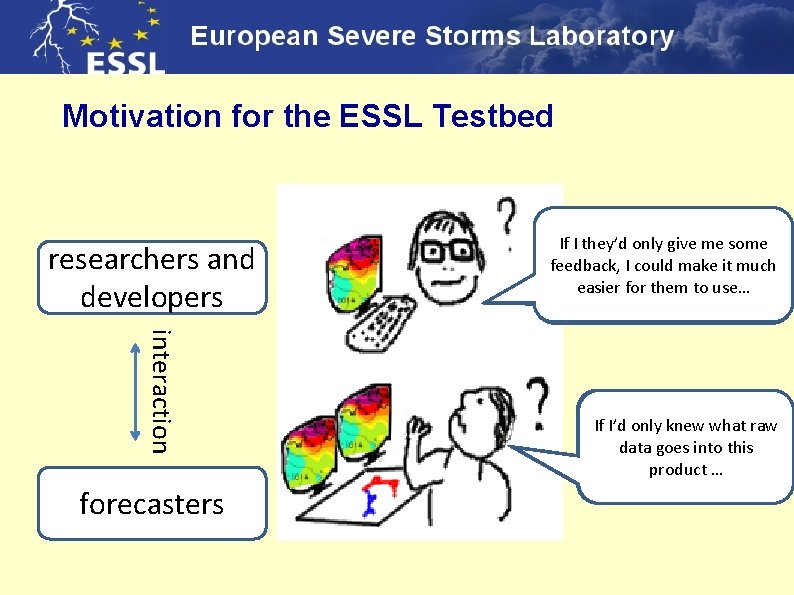
Motivation for the ESSL Testbed researchers and developers interaction forecasters If I they’d only give me some They should know what my Do they have time during their feedback, I could make it much product is capable of and what forecasting shifts to look at my easier for them to use… not…. product the way it is now? If they’d only invert the If I’d only knew what raw Nice product, but in a colorscale, it would make polar air mass it misses data goes into this much more sense… every second event. product …

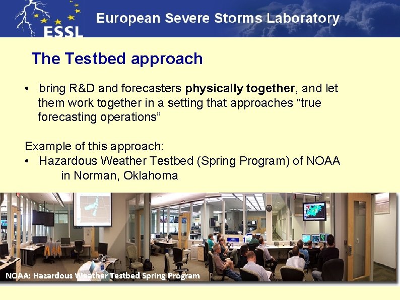
The Testbed approach • bring R&D and forecasters physically together, and let them work together in a setting that approaches “true forecasting operations” Example of this approach: • Hazardous Weather Testbed (Spring Program) of NOAA in Norman, Oklahoma NOAA: Hazardous Weather Testbed Spring Program

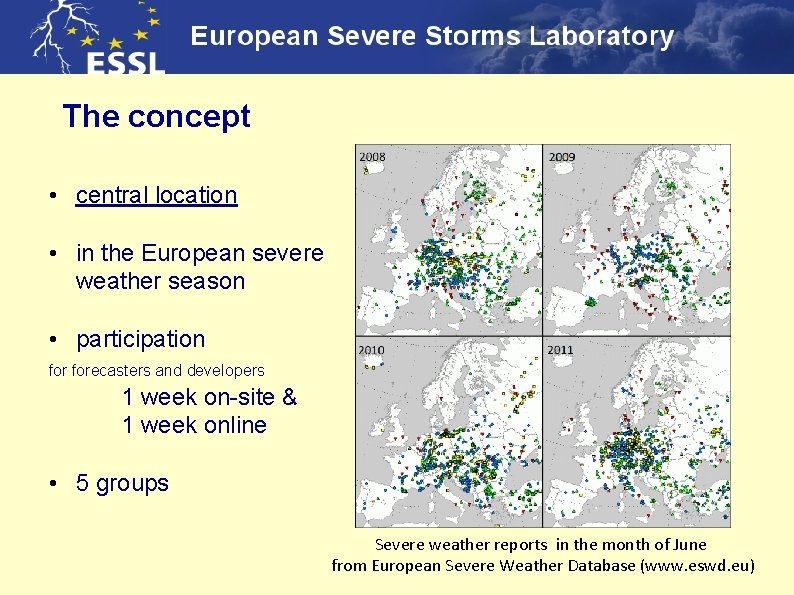
The concept • central location • in the European severe weather season • participation forecasters and developers 1 week on-site & 1 week online ESSL Training Centre in Wiener Neustadt (Austria) • 5 groups Severe weather reports in the month of June from European Severe Weather Database (www. eswd. eu)

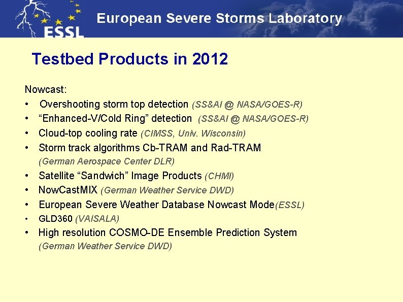
Testbed Products in 2012 Nowcast: • Overshooting storm top detection (SS&AI @ NASA/GOES-R) • “Enhanced-V/Cold Ring” detection (SS&AI @ NASA/GOES-R) • Cloud-top cooling rate (CIMSS, Univ. Wisconsin) • Storm track algorithms Cb-TRAM and Rad-TRAM (German Aerospace Center DLR) • Satellite “Sandwich” Image Products (CHMI) • Now. Cast. MIX (German Weather Service DWD) • European Severe Weather Database Nowcast Mode(ESSL) • GLD 360 (VAISALA) • High resolution COSMO-DE Ensemble Prediction System (German Weather Service DWD)

A day a the Testbed… • Forecasting • Forecast verification • Product evaluation • Online Weather Briefings • Product Lectures

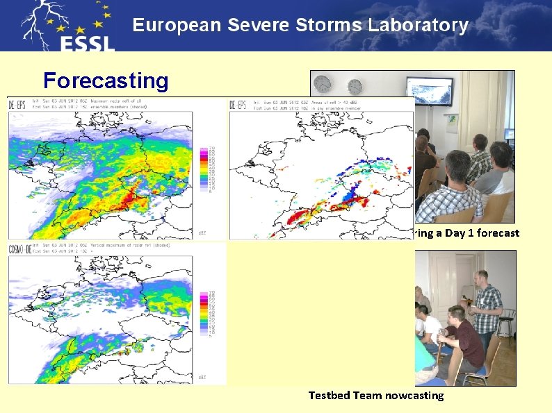
Forecasting Task: • Two teams indicate the areas of where severe weather is expected. Periods: • • Day 1 Day 2 Day 3 through 5 Nowcasting (next two hours) Testbed Team preparing a Day 1 forecast Severe weather: Large hail (2 cm) Tornadoes Severe wind gusts (>25 m/s) Excessive Precipitation Testbed Team nowcasting

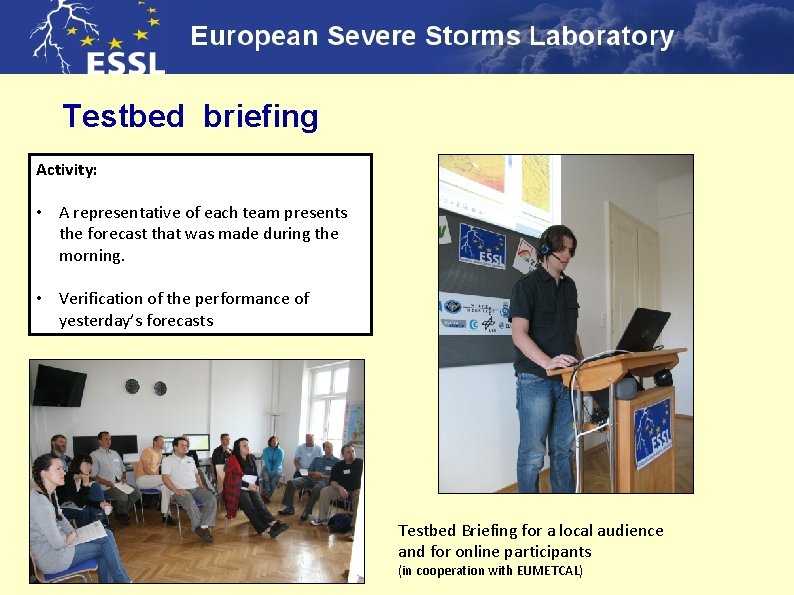
Testbed briefing Activity: • A representative of each team presents the forecast that was made during the morning. • Verification of the performance of yesterday’s forecasts Testbed Briefing for a local audience and for online participants (in cooperation with EUMETCAL)

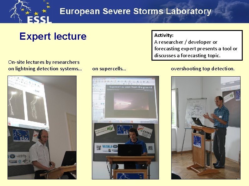
Expert lecture Activity: A researcher / developer or forecasting expert presents a tool or discusses a forecasting topic. On-site lectures by researchers on lightning detection systems… on supercells… overshooting top detection.

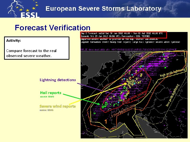
Forecast Verification Activity: Compare forecast to the real observed severe weather. ning ight rob. l p high 2 (h Severe wind reports b re) e v. se source: ESWD 1 (l o ro w p b. li rob p igh pro source: ESWD re) e v. se low Hail reports ght nin g Lightning detections

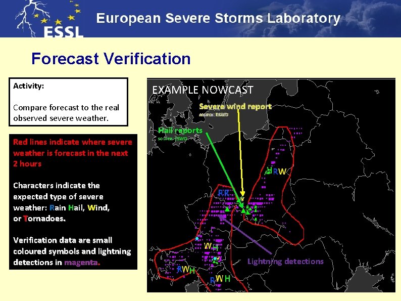
Forecast Verification Activity: EXAMPLE NOWCAST Severe wind report Compare forecast to the real observed severe weather. source: ESWD Hail reports Red lines indicate where severe weather is forecast in the next 2 hours source: ESWD Characters indicate the expected type of severe weather: Rain Hail, Wind, or Tornadoes. Verification data are small coloured symbols and lightning detections in magenta. Lightning detections

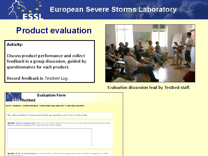
Product evaluation Activity: Discuss product performance and collect feedback in a group discussion, guided by questionnaires for each product. Record feedback in Testbed Log. Evaluation discussion lead by Testbed staff. Evaluation Form

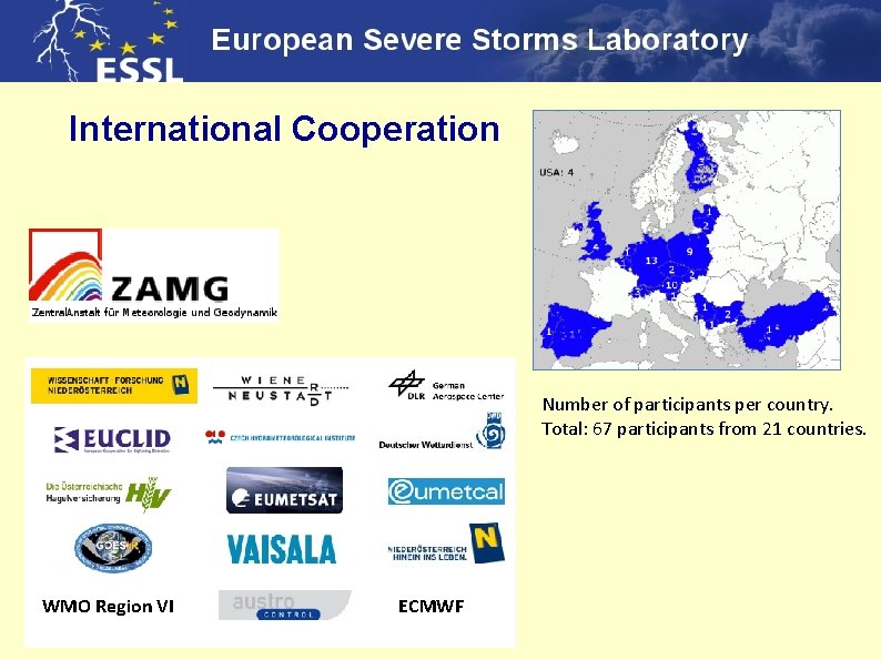
International Cooperation Number of participants per country. Total: 67 participants from 21 countries. WMO Region VI ECMWF

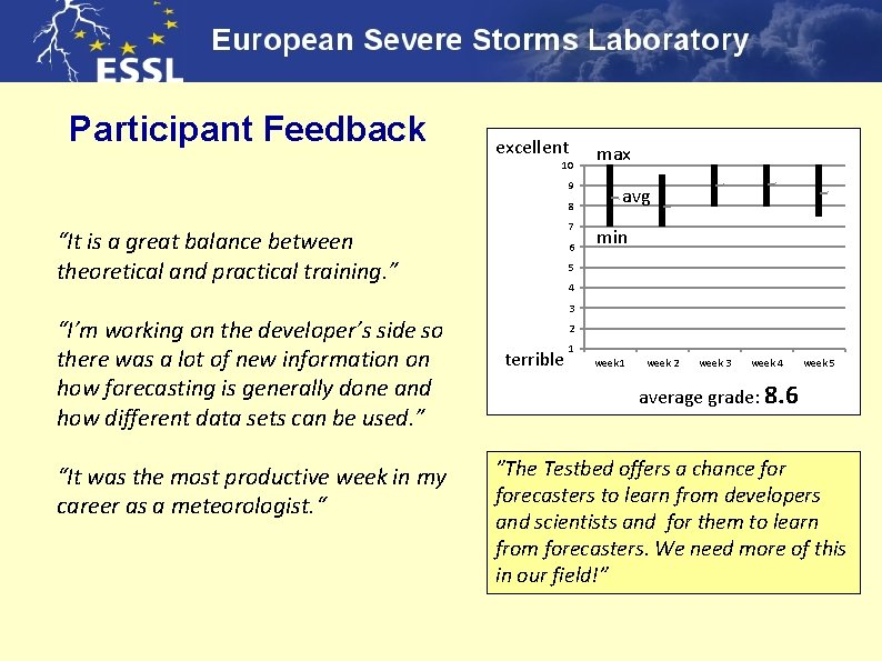
Participant Feedback excellent 10 9 8 7 “It is a great balance between theoretical and practical training. ” “I’m working on the developer’s side so there was a lot of new information on how forecasting is generally done and how different data sets can be used. ” “It was the most productive week in my career as a meteorologist. “ 6 max avg min 5 4 3 2 terrible 1 week 2 week 3 week 4 week 5 average grade: 8. 6 ”The Testbed offers a chance forecasters to learn from developers and scientists and for them to learn from forecasters. We need more of this in our field!”

Upcoming ESSL Testbed Next Testbed is from 1 -26 July 2013 at the ESSL Research and Training Centre in Wiener Neustadt, Austria. Products planned for the Testbed 2013: • • • SATCAST / Convective Initiation (DWD; EUMETSAT; Univ. Alabama) Mesocyclone Detection Algorithm (DWD) Near. CAST (CIMSS, Univ. Wisconsin) Nowcast. MIX (DWD) GLD 360 (VAISALA) COSMO-DE-EPS visualizations (DWD) New feature: a publicly-accessible ‘Testbed Blog’ will be maintained at www. essl. org/testbed

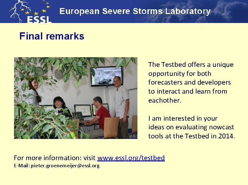
Final remarks The Testbed offers a unique opportunity for both forecasters and developers to interact and learn from eachother. I am interested in your ideas on evaluating nowcast tools at the Testbed in 2014. For more information: visit www. essl. org/testbed E-Mail: pieter. groenemeijer@essl. org

Thank you !

Statutory goals of the ESSL 1. Perform and support severe weather research at a European level 2. Management and development of the European Severe Weather Database ESWD www. eswd. eu 3. Organization or support of the European Conference on Severe Storms www. ecss. eu

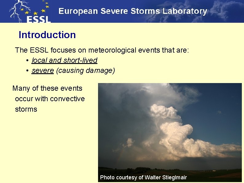
Introduction The ESSL focuses on meteorological events that are: • local and short-lived • severe (causing damage) Many of these events occur with convective storms Supercell storms over southern Germany Photo courtesy of Walter Stieglmair

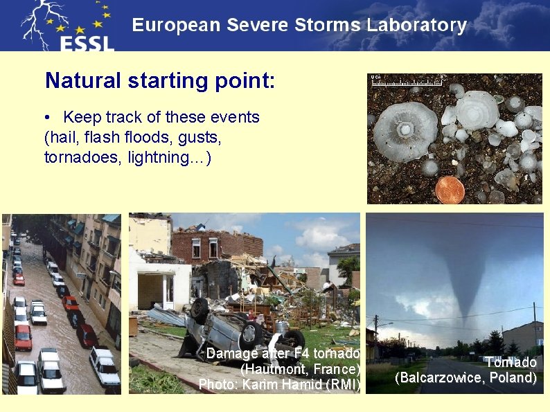
Natural starting point: • Keep track of these events (hail, flash floods, gusts, tornadoes, lightning…) Damage after F 4 tornado (Hautmont, France) Photo: Karim Hamid (RMI) Tornado (Balcarzowice, Poland)

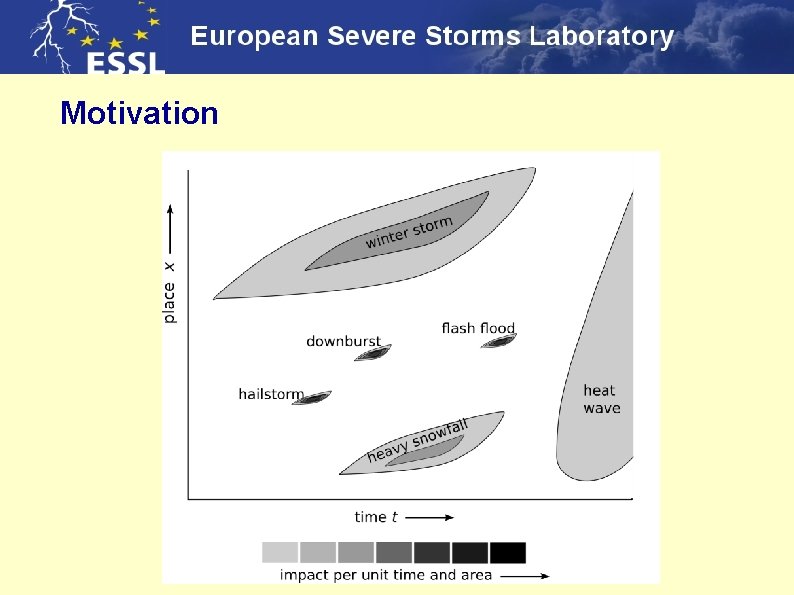
Motivation

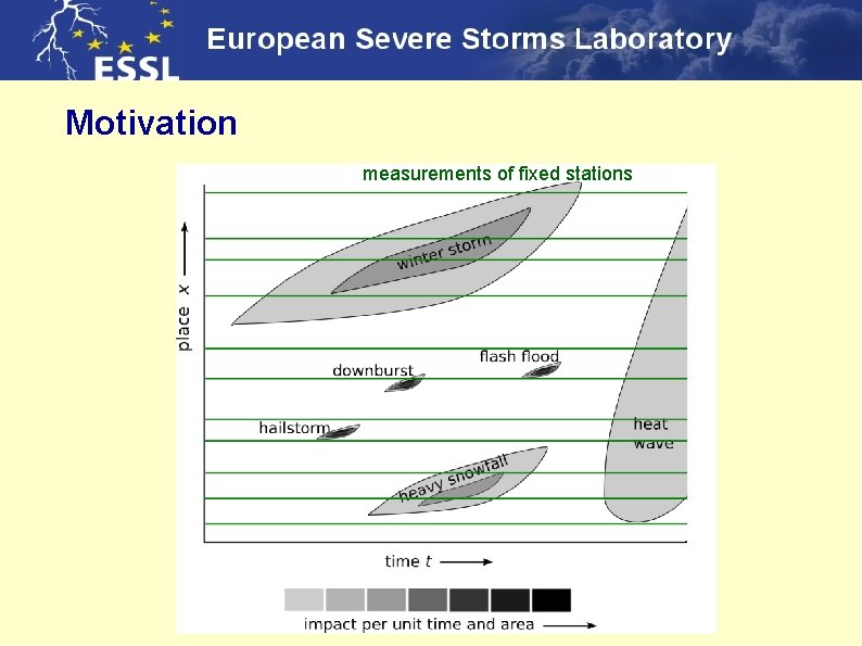
Motivation measurements of fixed stations

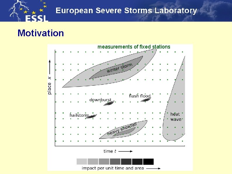
Motivation measurements of fixed stations

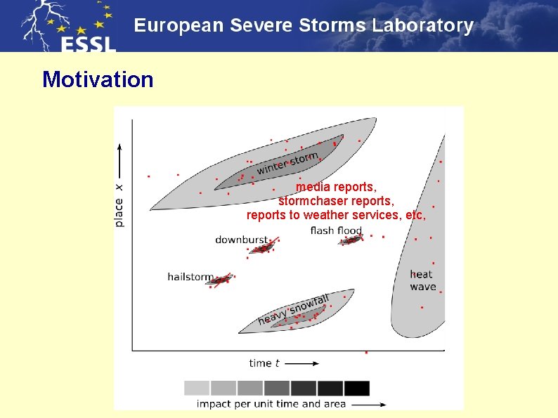
Motivation media reports, stormchaser reports, reports to weather services, etc,

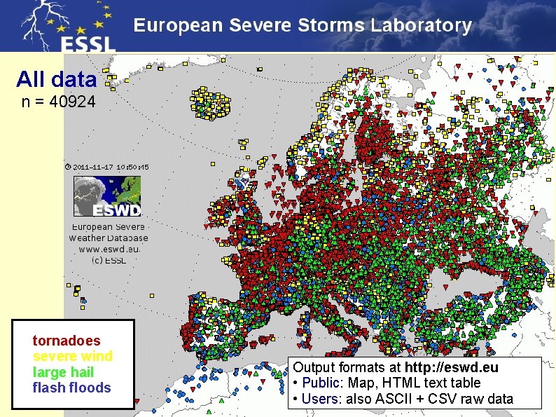
All data n = 40924 tornadoes severe wind large hail flash floods Output formats at http: //eswd. eu • Public: Map, HTML text table • Users: also ASCII + CSV raw data

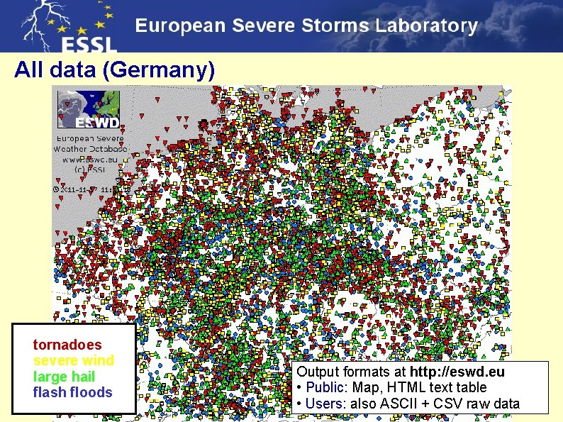
All data (Germany) tornadoes severe wind large hail flash floods Output formats at http: //eswd. eu • Public: Map, HTML text table • Users: also ASCII + CSV raw data

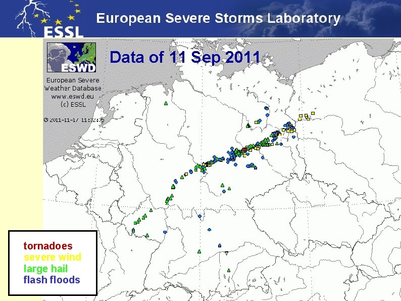
Data of 11 Sep 2011 tornadoes severe wind large hail flash floods

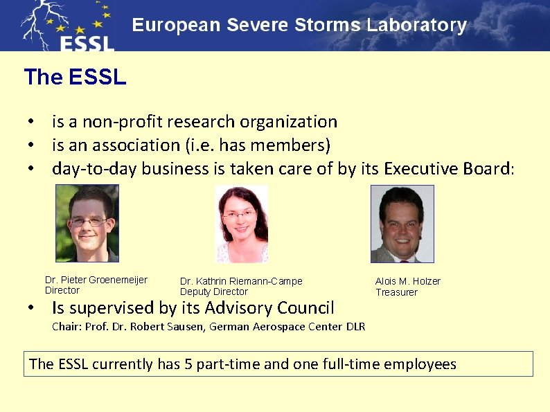
The ESSL • is a non-profit research organization • is an association (i. e. has members) • day-to-day business is taken care of by its Executive Board: Dr. Pieter Groenemeijer Director Dr. Kathrin Riemann-Campe Deputy Director • Is supervised by its Advisory Council Alois M. Holzer Treasurer Chair: Prof. Dr. Robert Sausen, German Aerospace Center DLR The ESSL currently has 5 part-time and one full-time employees

Members of ESSL Individual members Institutional members: ● ● 6 national meteorological services EUMETSAT 5 reinsurance companies German Aerospace Center

Externally-funded projects of ESSL ● ● EWENT (EU) – Extreme Weather impacts on European Networks of Transport Evolution of hailstorms over Europe in a changing climate (AXA Research Fund / U. K. Met. Office) new starting projects: STEPCLIM: Severe Thunderstorm Evaluation and Prediction in Climate Models (within Mi. Klip programme funded by German Research Ministry) Automatic satellite recognition of Mediterranean cyclones (EUMETSAT)

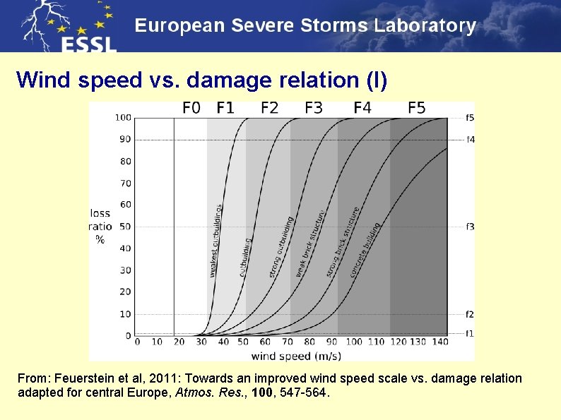
Wind speed vs. damage relation (I) From: Feuerstein et al, 2011: Towards an improved wind speed scale vs. damage relation adapted for central Europe, Atmos. Res. , 100, 547 -564.

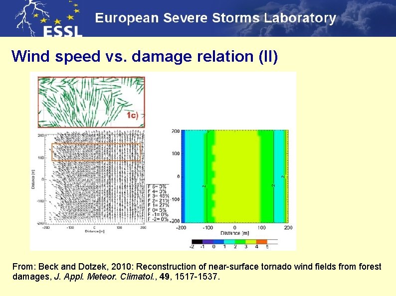
Wind speed vs. damage relation (II) From: Beck and Dotzek, 2010: Reconstruction of near-surface tornado wind fields from forest damages, J. Appl. Meteor. Climatol. , 49, 1517 -1537.

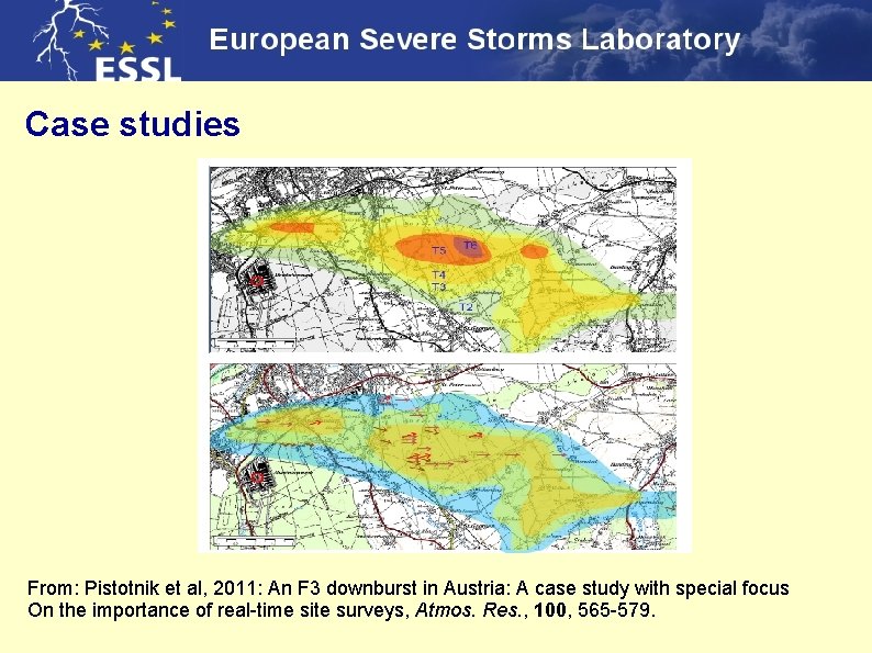
Case studies From: Pistotnik et al, 2011: An F 3 downburst in Austria: A case study with special focus On the importance of real-time site surveys, Atmos. Res. , 100, 565 -579.

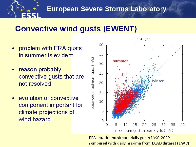
Convective wind gusts (EWENT) • problem with ERA gusts in summer is evident • reason probably convective gusts that are not resolved summer winter • evolution of convective component important for climate projections of wind hazard ERA-Interim maximum daily gusts 1990 -2009 compared with daily maxima from ECAD dataset (DWD)

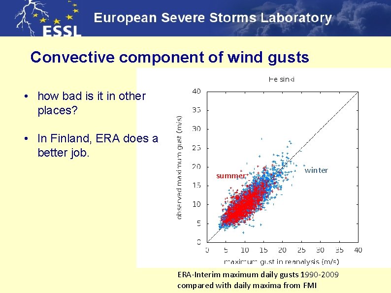
Convective component of wind gusts • how bad is it in other places? • In Finland, ERA does a better job. summer winter ERA-Interim maximum daily gusts 1990 -2009 compared with daily maxima from FMI

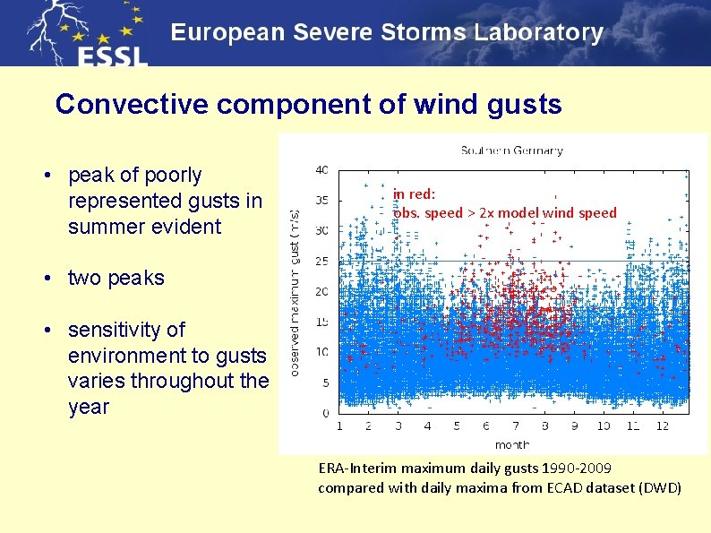
Convective component of wind gusts • peak of poorly represented gusts in summer evident in red: obs. speed > 2 x model wind speed • two peaks • sensitivity of environment to gusts varies throughout the year ERA-Interim maximum daily gusts 1990 -2009 compared with daily maxima from ECAD dataset (DWD)

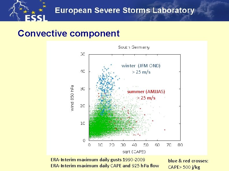
Convective component winter (JFM OND) > 25 m/s summer (AMJJAS) > 25 m/s ERA-Interim maximum daily gusts 1990 -2009 ERA-Interim maximum daily CAPE and 925 h. Pa flow blue & red crosses: CAPE> 500 j/kg

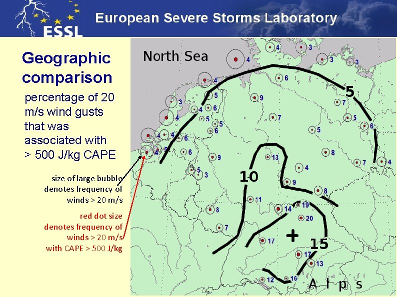
Geographic comparison percentage of 20 m/s wind gusts that was associated with > 500 J/kg CAPE size of large bubble denotes frequency of winds > 20 m/s winter summer red dot size denotes frequency of winds > 20 m/s with CAPE > 500 J/kg ERA-Interim maximum daily gusts 1990 -2009 compared with daily maxima from ECAD dataset (DWD)

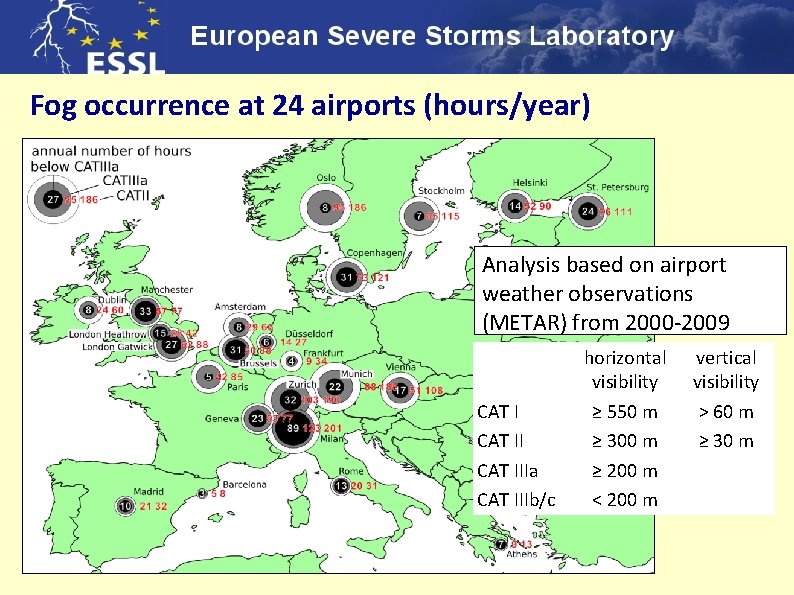
Fog occurrence at 24 airports (hours/year) Analysis based on airport weather observations (METAR) from 2000 -2009 CAT IIIa CAT IIIb/c horizontal visibility ≥ 550 m ≥ 300 m ≥ 200 m < 200 m vertical visibility > 60 m ≥ 30 m

Trend of fog (vis < 200 m) at 3 selected airports very strong and significant decrease of fog occurrence

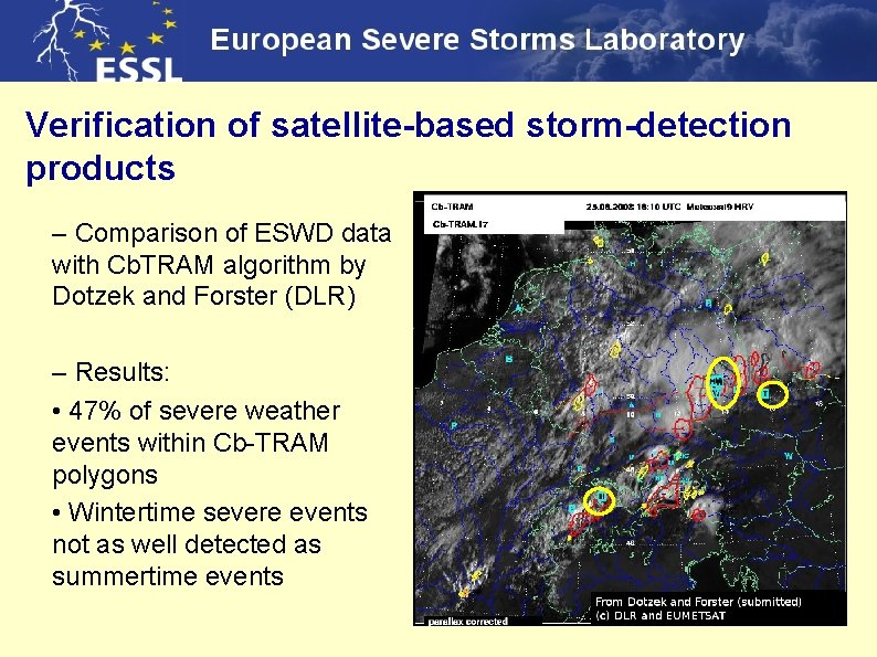
Verification of satellite-based storm-detection products – Comparison of ESWD data with Cb. TRAM algorithm by Dotzek and Forster (DLR) – Results: • 47% of severe weather events within Cb-TRAM polygons • Wintertime severe events not as well detected as summertime events

STEPCLIM Severe Thunderstorm Evaluation and Prediction in Climate Models • part of BMBF Programme on Mittelfristige Klimaprognosen (Mi. Klip) • goal: to develop proxies to evaluate climate (and other coarse) models w. r. t. to severe thunderstorm occurrence

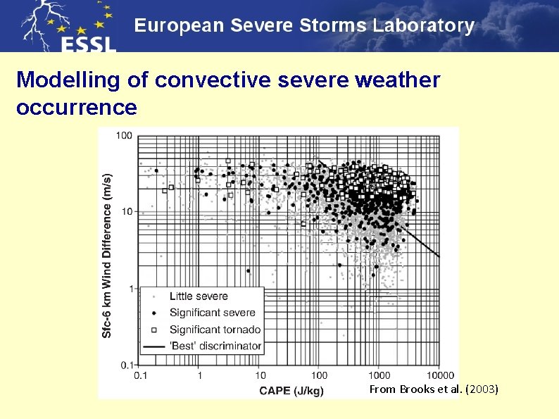
Modelling of convective severe weather occurrence From Brooks et al. (2003)

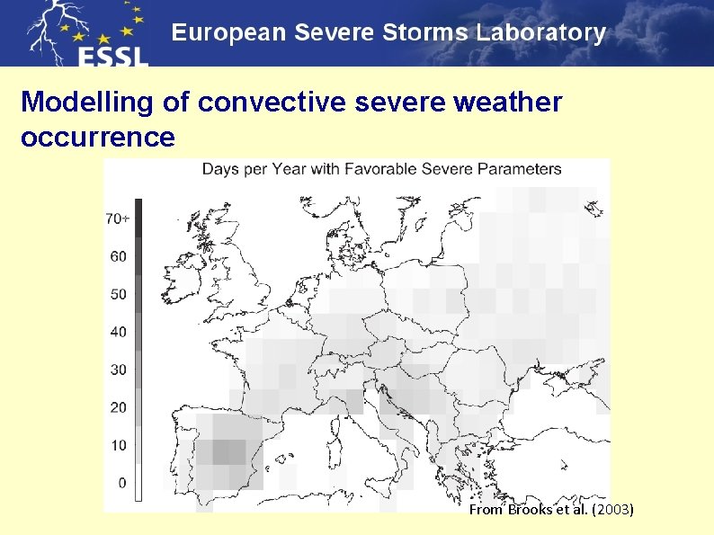
Modelling of convective severe weather occurrence From Brooks et al. (2003)

European Conferences on Severe Storms 6 th ECSS, Palma de Mallorca, 3 -7 October 2011: 217 participants from over

Thank you ! Web sites for more information on: the Testbed: www. essl. org/testbed the ESWD database: www. essl. org/eswd the ECSS conference: www. essl. org/ecss the ESSL in general: www. essl. org