WMO Severe Weather Forecasting Demonstration Project SWFDP Alice
- Slides: 13

WMO Severe Weather Forecasting Demonstration Project (SWFDP) Alice Soares Scientific Officer Data-Processing and Forecasting Systems (DPFS) Division asoares@wmo. int Curaçao, 10 -13 October 2016 WMO; WDS

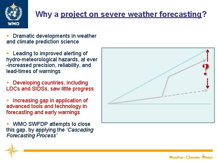
Why a project on severe weather forecasting? § Dramatic developments in weather and climate prediction science § Leading to improved alerting of hydro-meteorological hazards, at ever -increased precision, reliability, and lead-times of warnings ? § Developing countries, including LDCs and SIDSs, saw little progress § Increasing gap in application of advanced tools and technology in forecasting and early warnings § WMO SWFDP attempts to close this gap, by applying the ‘Cascading Forecasting Process’ 2

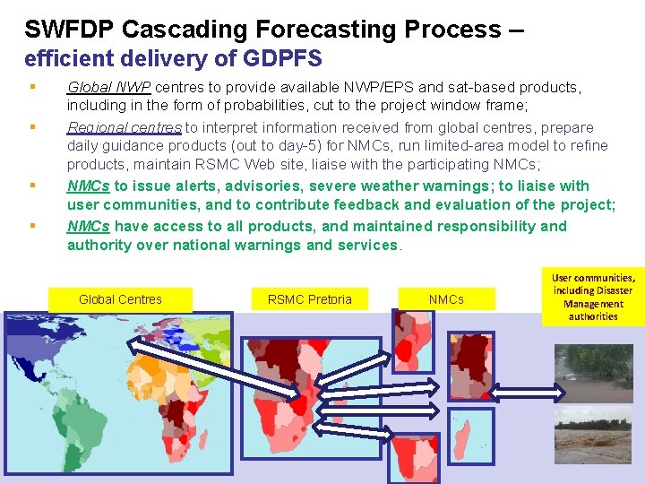
SWFDP Cascading Forecasting Process – efficient delivery of GDPFS § Global NWP centres to provide available NWP/EPS and sat-based products, including in the form of probabilities, cut to the project window frame; Regional centres to interpret information received from global centres, prepare daily guidance products (out to day-5) for NMCs, run limited-area model to refine products, maintain RSMC Web site, liaise with the participating NMCs; NMCs to issue alerts, advisories, severe weather warnings; to liaise with user communities, and to contribute feedback and evaluation of the project; NMCs have access to all products, and maintained responsibility and authority over national warnings and services. § § § Global Centres 3 RSMC Pretoria NMCs User communities, including Disaster Management authorities

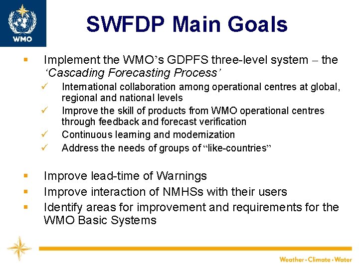
SWFDP Main Goals § Implement the WMO’s GDPFS three-level system – the ‘Cascading Forecasting Process’ ü ü § § § International collaboration among operational centres at global, regional and national levels Improve the skill of products from WMO operational centres through feedback and forecast verification Continuous learning and modernization Address the needs of groups of “like-countries” Improve lead-time of Warnings Improve interaction of NMHSs with their users Identify areas for improvement and requirements for the WMO Basic Systems

SWFDP Strengths • • • Cost effectiveness; Simplicity; NMHSs need good internet only; Highly operational; Capacity development through specialized training programme • improved forecasts and lead-time of warnings 5

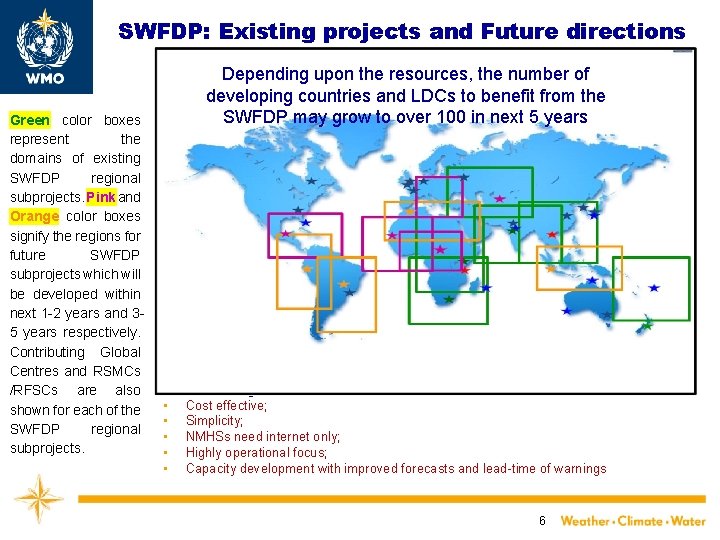
SWFDP: Existing projects and Future directions Green color boxes represent the domains of existing SWFDP regional subprojects. Pink and Orange color boxes signify the regions for future SWFDP subprojects which will be developed within next 1 -2 years and 35 years respectively. Contributing Global Centres and RSMCs /RFSCs are also shown for each of the SWFDP regional subprojects. Depending upon the resources, the number of developing countries and LDCs to benefit from the SWFDP may grow to over 100 in next 5 years SWFDP Strengths: • Cost effective; • Simplicity; • NMHSs need internet only; • Highly operational focus; • Capacity development with improved forecasts and lead-time of warnings 6

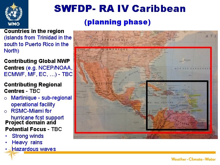
SWFDP- RA IV Caribbean (planning phase) Countries in the region (islands from Trinidad in the south to Puerto Rico in the North) Contributing Global NWP Centres (e. g. NCEP/NOAA, ECMWF, MF, EC, …) - TBC Contributing Regional Centres - TBC o Martinique - sub-regional operational facility o RSMC-Miami for hurricane fcst support Project domain and Potential Focus - TBC • Strong winds • Heavy rains • Hazardous waves

ECMWF operational forecasting system High resolution deterministic forecast (HRES) : – twice per day 9 km 137 levels, to 10 days ahead Ensemble forecast (ENS): – twice per day 51 members, 18 km 91 levels, to 15 days ahead – Monday/Thursday 00 UTC extended to 1 month ahead (Monthly Forecast, 18/36 km ) Seasonal forecast: once a month – 51 -members, ~80 km 91 levels, to 7 months ahead – sub-set of 15 members is run for 13 months every quarter (30 years of hindcasts) Slide 8 EUROPEAN CENTRE FOR MEDIUM-RANGE WEATHER FORECASTS October 29, 2014

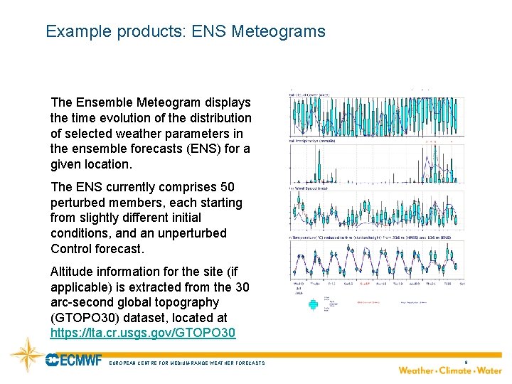
Example products: ENS Meteograms The Ensemble Meteogram displays the time evolution of the distribution of selected weather parameters in the ensemble forecasts (ENS) for a given location. The ENS currently comprises 50 perturbed members, each starting from slightly different initial conditions, and an unperturbed Control forecast. Altitude information for the site (if applicable) is extracted from the 30 arc-second global topography (GTOPO 30) dataset, located at https: //lta. cr. usgs. gov/GTOPO 30 EUROPEAN CENTRE FOR MEDIUM-RANGE WEATHER FORECASTS October 29, 2014 9

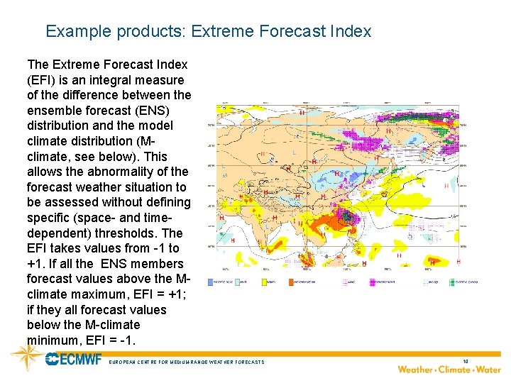
Example products: Extreme Forecast Index The Extreme Forecast Index (EFI) is an integral measure of the difference between the ensemble forecast (ENS) distribution and the model climate distribution (Mclimate, see below). This allows the abnormality of the forecast weather situation to be assessed without defining specific (space- and timedependent) thresholds. The EFI takes values from -1 to +1. If all the ENS members forecast values above the Mclimate maximum, EFI = +1; if they all forecast values below the M-climate minimum, EFI = -1. EUROPEAN CENTRE FOR MEDIUM-RANGE WEATHER FORECASTS October 29, 2014 10

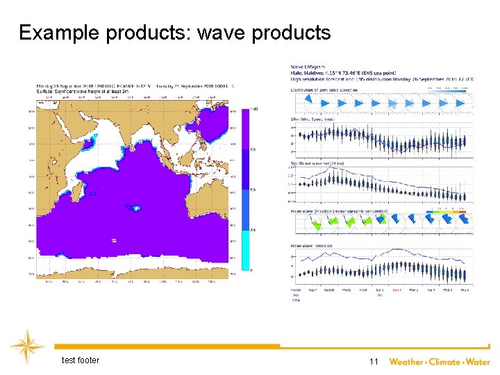
Example products: wave products test footer 11

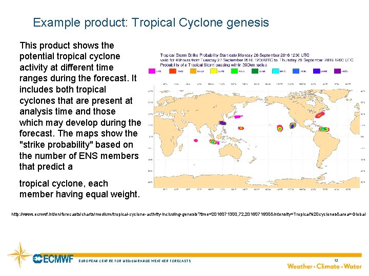
Example product: Tropical Cyclone genesis This product shows the potential tropical cyclone activity at different time ranges during the forecast. It includes both tropical cyclones that are present at analysis time and those which may develop during the forecast. The maps show the "strike probability" based on the number of ENS members that predict a tropical cyclone, each member having equal weight. http: //www. ecmwf. int/en/forecasts/charts/medium/tropical-cyclone-activity-including-genesis? time=2016071300, 72, 2016071600&intensity=Tropical%20 cyclones&area=Global EUROPEAN CENTRE FOR MEDIUM-RANGE WEATHER FORECASTS October 29, 2014 12

WMO Thank You Alice Soares asoares@wmo. int