Adoption of Current Scott County Development Plan Adoption


- Slides: 32
Adoption of Current Scott County Development Plan
Adoption of Current Scott County Development Plan STATE OF IOWA ENABLING LEGISLATION FOR COUNTY ZONING Code of Iowa Chapter 335 County Zoning: • Gives Iowa county’s the option to adopt zoning ordinance but does not make it mandatory. • Exempts farm land, farm houses and farm buildings from county zoning ordinances “ which are primarily adopted, by reason of nature and area, for use for agricultural purposes, while so used. ” • Other than the above language; the statute does not establish how counties should determine what a farm, farm house or farm building is • Counties only have jurisdiction over land outside of corporate city limits • Requires zoning regulations to be made in accordance with a comprehensive plan (without defining what a comp plan is) • Requires public hearing to adopt and amend ordinance or zoning map.
Adoption of Current Scott County Development Plan STATE OF IOWA ENABLING LEGISLATION FOR COUNTY ZONING The basis for county zoning ordinances under the Code of Iowa Chapter 335 is: • To preserve the availability of agricultural land; • To consider the protection of soil from wind and water erosion; • To encourage efficient urban development patterns; • To lessen congestion of traffic on streets; • To secure safety from fire flood and panic; • To promote health and the general welfare; • To insure adequate light and air; • To prevent the overcrowding of land; • To avoid undue concentration of population; • To promote the conservation of energy resources; and • To facilitate the adequate provision of transportation, water, sewerage schools and parks.
Adoption of Current Scott County Development Plan PLANNING AND ZONING IN SCOTT COUNTY • 1949 - Scott County was first county in Iowa to adopt zoning ordinance. • 1979 - Subdivision Ordinance adopted. • 1980 - Scott County Development Plan and Land Use Policies adopted. • 1981 - Revised Zoning Ordinance and Zoning Map adopted. • 1994 - Agriculture Service Floating zone created. • 1997 - Revised Land Use Policies adopted. • 1998 - Future Land Use Map adopted. • 2007 – New Comprehensive Plan drafted
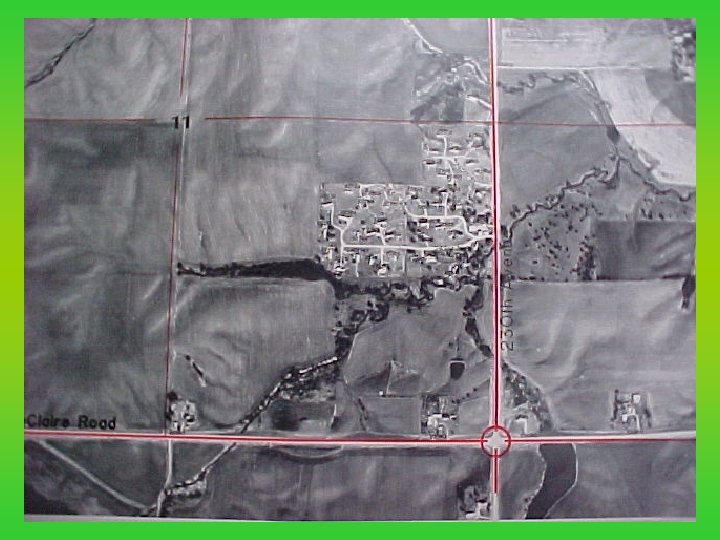
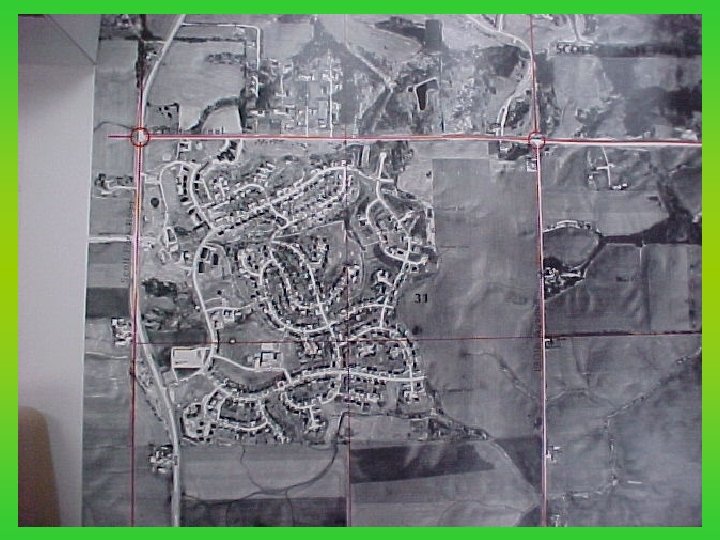
Adoption of Current Scott County Development Plan 240 th Street, West of 130 th Avenue, Sheridan Township
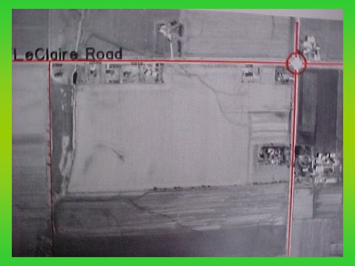
Adoption of Current Scott County Development Plan Willow Stream Estates, North of Le. Claire Road, Lincoln Twp
Adoption of Current Scott County Development Plan St Ann’s Road, Little Acres Subdivision, Winfield Twp
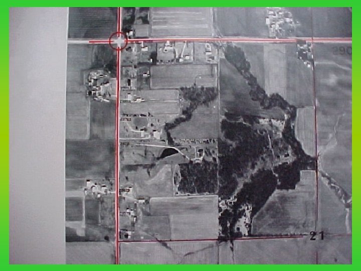
Adoption of Current Scott County Development Plan Lake Huntington, Squire Meadows, & Indian Hills, Butler Twp
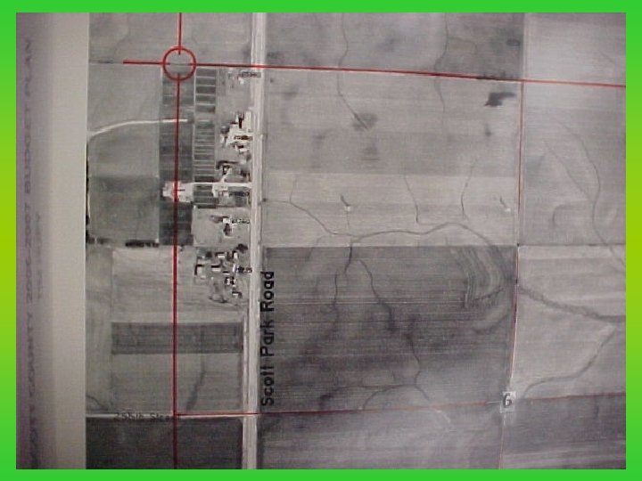
Adoption of Current Scott County Development Plan Scott Park Road, North of Eldridge, Lincoln Twp
Adoption of Current Scott County Development Plan Park View, Butler Twp
Adoption of Current Scott County Development Plan Scott County adopted its first land use policies and comprehensive development plan in 1980. The land use policies established goals, objectives and specific policies to control and direct the future growth and development of land in unincorporated Scott County. The Cities of Davenport, Bettendorf and Eldridge all approved resolutions supporting Scott County's Land Use Policies. The Development Plan was a study of the economic, social, physical and environmental characteristics of rural Scott County. Updates of the Development Plan were drafted and approved in 1986, 1994, 1995, 1997, and 1998.
Adoption of Current Scott County Development Plan 1980 SCOTT COUNTY DEVELOPMENT PLAN Goals of Land Use Policies 1. To ensure orderly and efficient growth of residential, commercial, industrial, public and semi-public land uses while maintaining the general welfare. 2. To protect and conserve the natural, human, and economic resources that are the basis of the agricultural economy and rural lifestyle of the County. 3. To ensure a decent home and suitable living environment for all families, present and future, living in Scott County. 4. To encourage cooperation and communication among the County, other units of local government, and the general public to improve human development, economic development, and ecological preservation.
Adoption of Current Scott County Development Plan 1980 SCOTT COUNTY DEVELOPMENT PLAN Objectives of Land Use Policies – Preservation of Agricultural Land – Protection of Critical Resource Areas – Future Land Use and Development
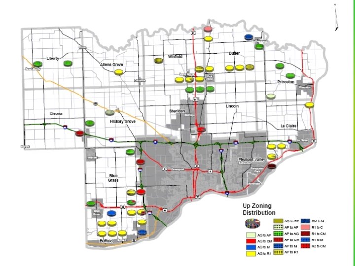
Adoption of Current Scott County Development Plan Agricultural Zoning Districts Ag uses, farm houses and farm buildings are exempt from County zoning and building codes. New farm houses and buildings must meet ag exemption criteria as defined in the Zoning Ordinance. Only one farmstead split of a farm house from the farm is permitted. Non farm houses can only be built on farmstead lots if the existing house is removed or destroyed or on parcels less than fifteen acres in size recorded prior to April 2, 1981. Agricultural zoned land cannot be subdivided for non agricultural purposes.
Adoption of Current Scott County Development Plan
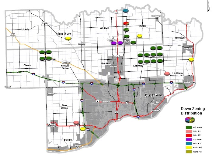
Adoption of Current Scott County Development Plan Creation of Agriculture Service Floating Zone In 1994 the Land Use Policies were amended to allow for the creation of an Agriculture Service Floating Zone. The purpose of the amendment was to create a separate floating zoning district for agriculture service businesses. Due to concentrations of chemicals, small and large animals, and agricultural produce, these businesses are not compatible to central city locations. Ag service businesses must serve the local farming community, be located away from floodplains, residential development and environmentally sensitive areas and be located along or adjacent to paved roads. Ag-Floating zones can be approved in an Ag. Preservation, Ag-General, Commercial-Light Industrial or Heavy Manufacturing district.
Adoption of Current Scott County Development Plan Adoption of Revised Land Use Policies In 1997 the Scott County Planning and Zoning Commission and the Board of Supervisors held public hearings to review and consider revisions to the existing land use policies. Those hearings resulted in no significant changes from the 1980 policies. However some minor changes were made. One additional objective stated: "to develop a Future Land Use Map to graphically illustrate where the general areas for residential, commercial and industrial development within the unincorporated areas of Scott County may be appropriate. "
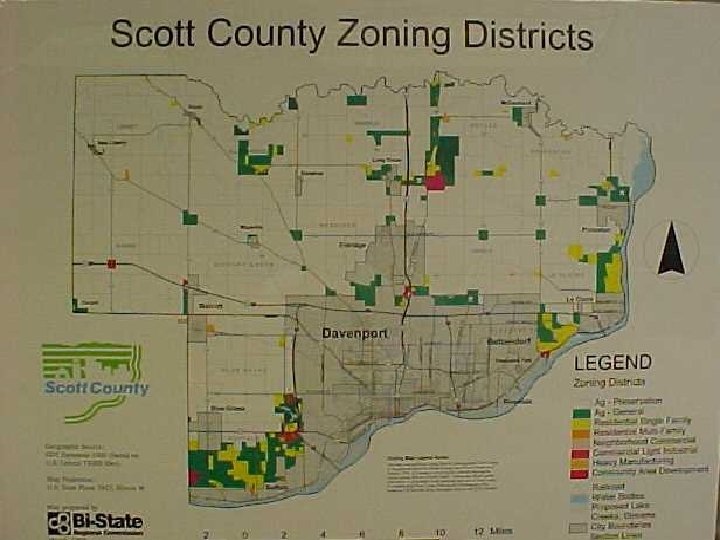
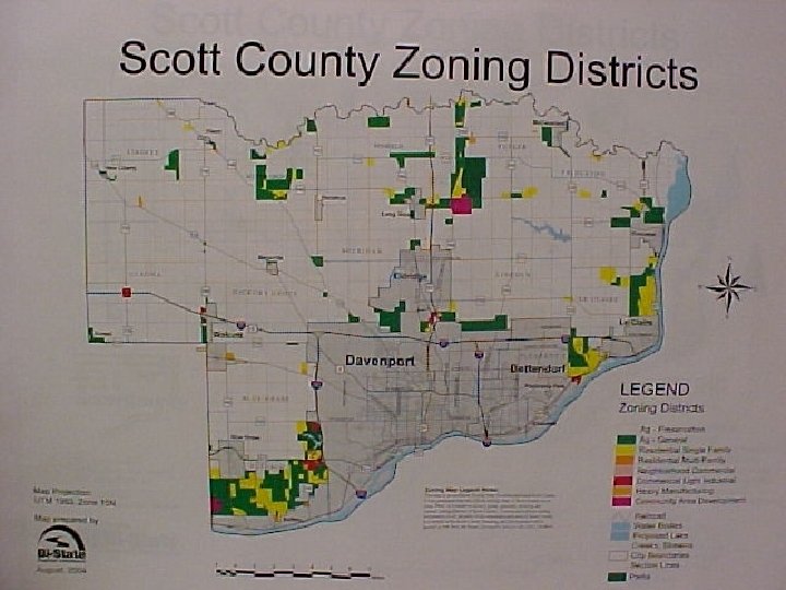
Adoption of Current Scott County Development Plan Creation of Future Land Use Map The Planning and Zoning Commission, with public input, developed a Future Land Use Map to act as a guide to show graphically where and what type of development is appropriate and may occur in the unincorporated areas of Scott County. The primary focus of the Future Land Use Map is to establish the County policy for those areas zoned Agricultural-General. The Map is to be used in conjunction with the Revised Land Use Policies. The Map is intended to be used as a guideline by the Board of Supervisors and the Planning and Zoning Commission when reviewing proposed land use changes and future development proposals or requests. The Future Land Use Map was adopted April 2, 1998.
Adoption of Current Scott County Development Plan
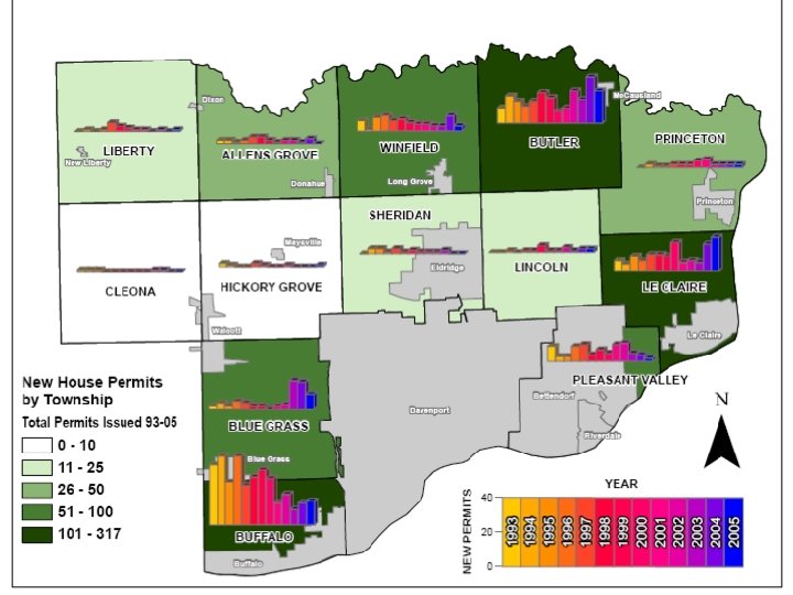
Adoption of Current Scott County Development Plan New House Permits issued in Unincorporated Scott County 1993 -2005 Township 93 94 95 96 97 98 99 00 01 02 Allens Grove 2 2 1 2 4 4 2 1 2 2 Blue Grass 2 4 2 5 4 2 2 0 2 Buffalo 35 40 23 28 32 27 Butler 9 16 13 10 13 18 15 Cleona 1 1 1 0 0 0 Hickory Grove 2 1 0 0 2 Le. Claire 6 4 9 6 Liberty 0 1 0 Lincoln 0 0 Pleasant Valley 9 Princeton 04 05 Totals 1 3 0 26 3 17 16 9 68 13 18 9 13 14 317 7 9 19 14 27 19 189 0 0 0 1 1 0 0 5 1 0 0 0 1 8 10 10 9 17 5 6 5 16 20 123 1 5 3 2 1 1 0 1 16 1 0 1 1 4 1 1 3 1 2 2 17 3 3 9 10 4 7 5 10 11 5 4 2 82 0 2 1 1 2 2 2 4 5 2 2 27 Sheridan 0 3 3 1 2 1 1 1 2 0 0 18 Winfield 6 1 8 9 6 7 5 4 4 3 3 9 3 68 72 78 67 84 83 81 82 68 54 69 61 92 73 964 Total 03
Adoption of Current Scott County Development Plan QUESTIONS? OR COMMENTS