Use of satellite winds at Deutscher Wetterdienst DWD
- Slides: 31

Use of satellite winds at Deutscher Wetterdienst (DWD) Alexander Cress Deutscher Wetterdienst, Frankfurter Strasse 135, 63067 Offenbach am Main, Germany alexander. cress@dwd. de Ø Introduction Ø Atmospheric motion vector winds (geo and polar) Ø MISR winds Ø IODC experiments

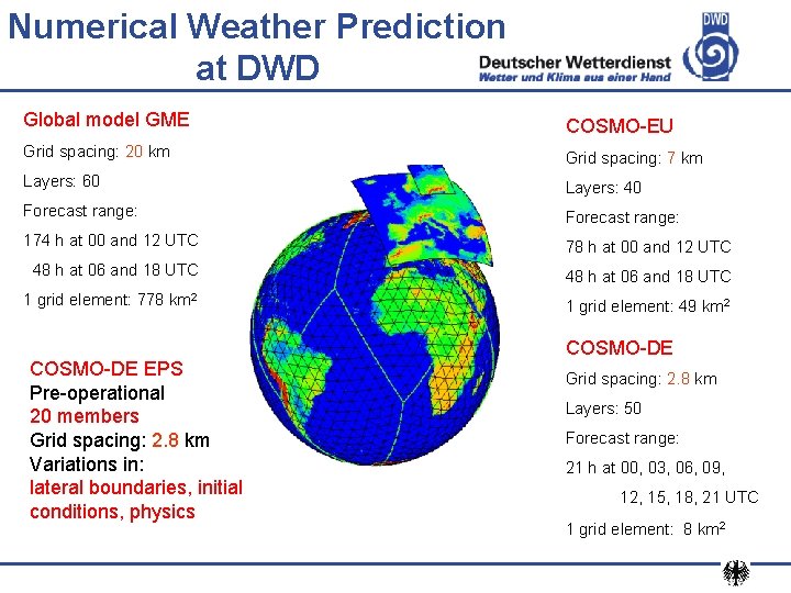
Numerical Weather Prediction at DWD Global model GME COSMO-EU Grid spacing: 20 km Grid spacing: 7 km Layers: 60 Layers: 40 Forecast range: 174 h at 00 and 12 UTC 78 h at 00 and 12 UTC 48 h at 06 and 18 UTC 1 grid element: 778 km 2 1 grid element: 49 km 2 COSMO-DE EPS Pre-operational 20 members Grid spacing: 2. 8 km Variations in: lateral boundaries, initial conditions, physics COSMO-DE Grid spacing: 2. 8 km Layers: 50 Forecast range: 21 h at 00, 03, 06, 09, 12, 15, 18, 21 UTC 1 grid element: 8 km 2

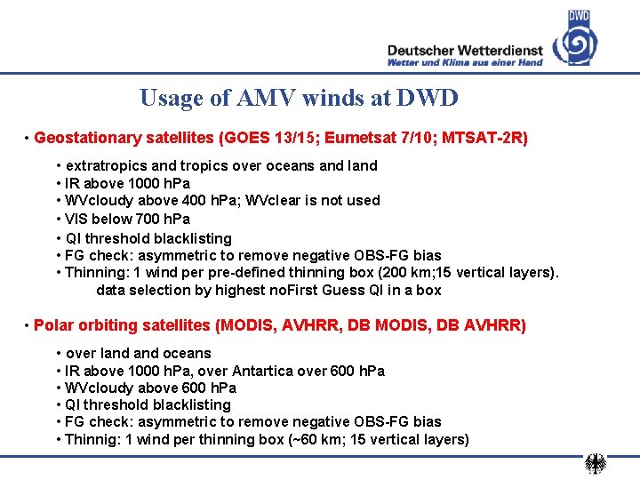
Usage of AMV winds at DWD • Geostationary satellites (GOES 13/15; Eumetsat 7/10; MTSAT-2 R) • extratropics and tropics over oceans and land • IR above 1000 h. Pa • WVcloudy above 400 h. Pa; WVclear is not used • VIS below 700 h. Pa • QI threshold blacklisting • FG check: asymmetric to remove negative OBS-FG bias • Thinning: 1 wind per pre-defined thinning box (200 km; 15 vertical layers). data selection by highest no. First Guess QI in a box • Polar orbiting satellites (MODIS, AVHRR, DB MODIS, DB AVHRR) • over land oceans • IR above 1000 h. Pa, over Antartica over 600 h. Pa • WVcloudy above 600 h. Pa • QI threshold blacklisting • FG check: asymmetric to remove negative OBS-FG bias • Thinnig: 1 wind per thinning box (~60 km; 15 vertical layers)

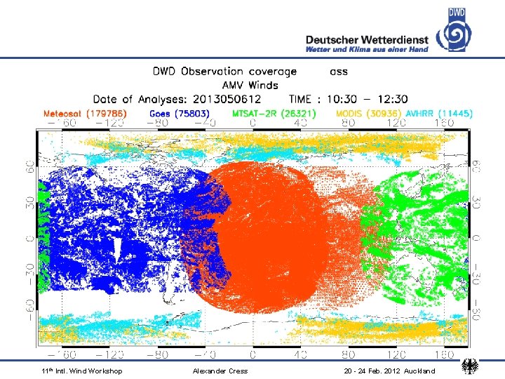
11 th Intl. Wind Workshop Alexander Cress 20 - 24 Feb. 2012 Auckland

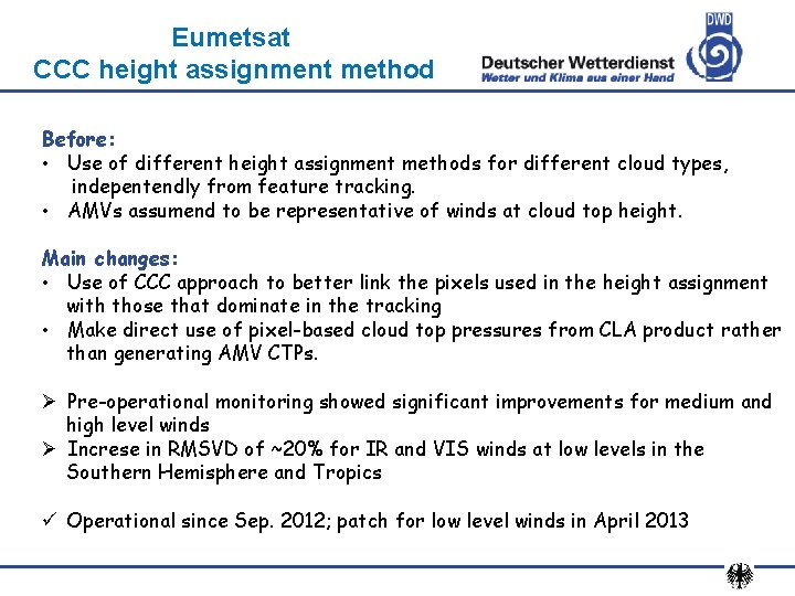
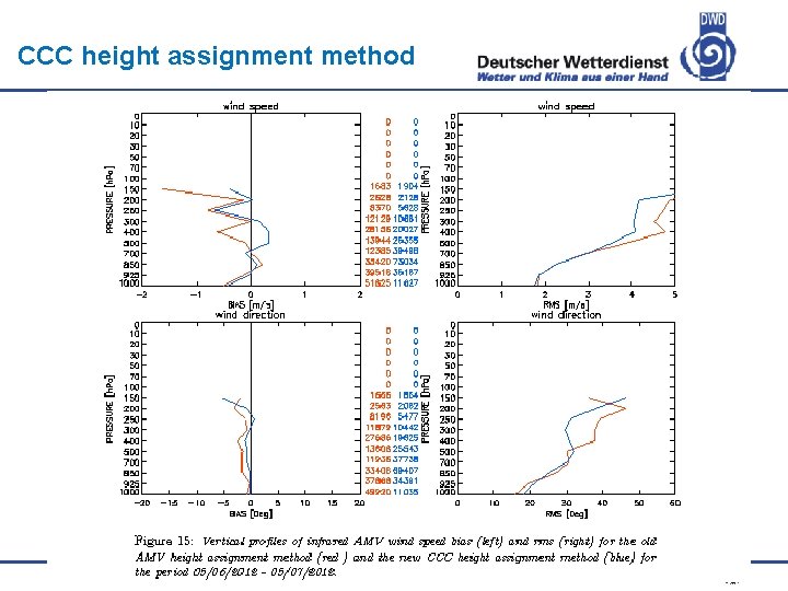
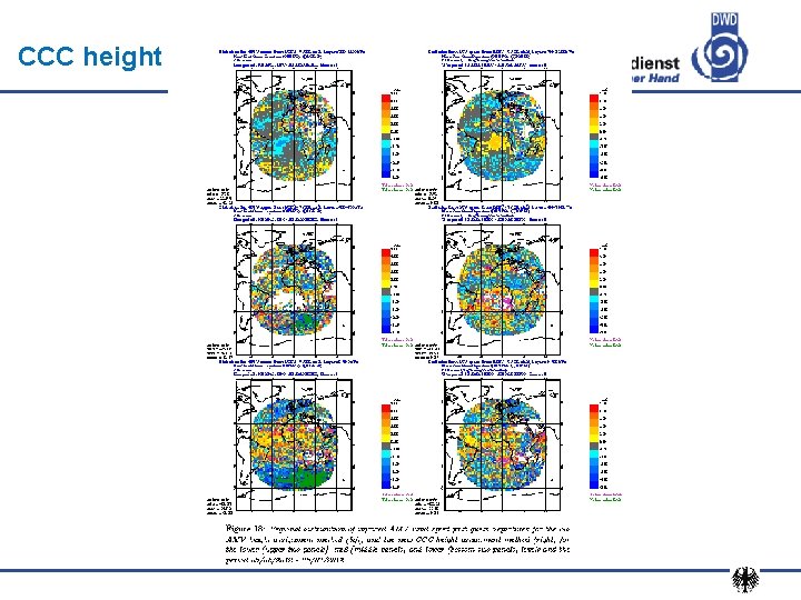
Eumetsat CCC height assignment method Before: • Use of different height assignment methods for different cloud types, indepentendly from feature tracking. • AMVs assumend to be representative of winds at cloud top height. Main changes: • Use of CCC approach to better link the pixels used in the height assignment with those that dominate in the tracking • Make direct use of pixel-based cloud top pressures from CLA product rather than generating AMV CTPs. Ø Pre-operational monitoring showed significant improvements for medium and high level winds Ø Increse in RMSVD of ~20% for IR and VIS winds at low levels in the Southern Hemisphere and Tropics ü Operational since Sep. 2012; patch for low level winds in April 2013

CCC height assignment method

CCC height assignment method

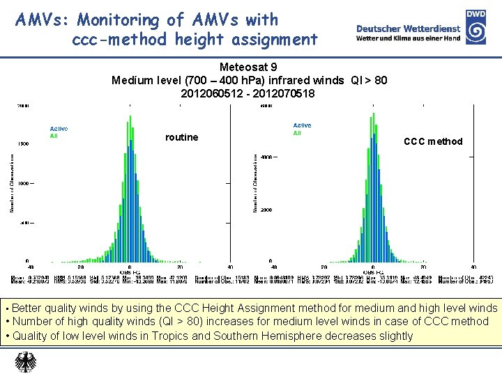
AMVs: Monitoring of AMVs with ccc-method height assignment Meteosat 9 Medíum level (700 – 400 h. Pa) infrared winds QI > 80 2012060512 - 2012070518 routine CCC method • Better quality winds by using the CCC Height Assignment method for medium and high level winds • Number of high quality winds (QI > 80) increases for medium level winds in case of CCC method • Quality of low level winds in Tropics and Southern Hemisphere decreases slightly

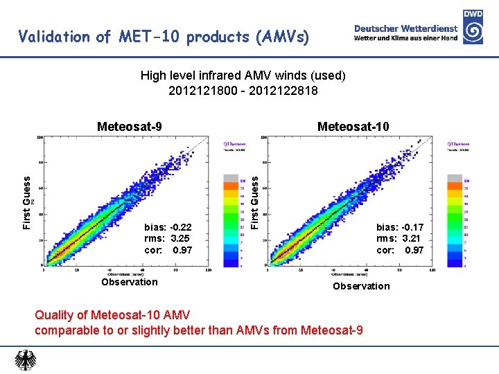
Validation of MET-10 products (AMVs) High level infrared AMV winds (used) 2012121800 - 2012122818 bias: -0. 22 rms: 3. 25 cor: 0. 97 Observation Meteosat-10 First Guess Meteosat-9 bias: -0. 17 rms: 3. 21 cor: 0. 97 Observation Quality of Meteosat-10 AMV comparable to or slightly better than AMVs from Meteosat-9

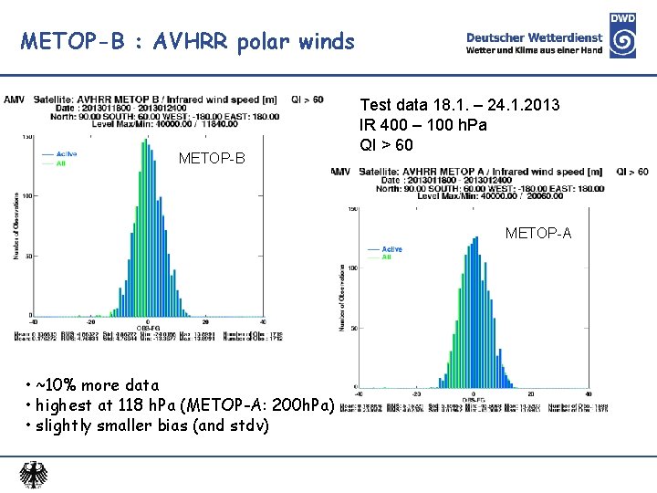
METOP-B : AVHRR polar winds METOP-B Test data 18. 1. – 24. 1. 2013 IR 400 – 100 h. Pa QI > 60 METOP-A • ~10% more data • highest at 118 h. Pa (METOP-A: 200 h. Pa) • slightly smaller bias (and stdv)

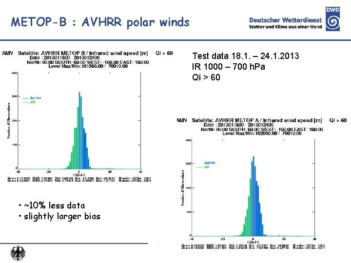
METOP-B : AVHRR polar winds Test data 18. 1. – 24. 1. 2013 IR 1000 – 700 h. Pa Qi > 60 • ~10% less data • slightly larger bias

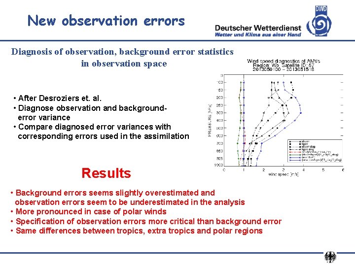
New observation errors Diagnosis of observation, background error statistics in observation space • After Desroziers et. al. • Diagnose observation and backgrounderror variance • Compare diagnosed error variances with corresponding errors used in the assimilation Results • Background errors seems slightly overestimated and observation errors seem to be underestimated in the analysis • More pronounced in case of polar winds • Specification of observation errors more critical than background error • Same differences between tropics, extra tropics and polar regions

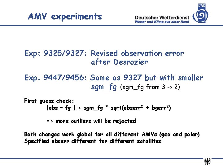
AMV experiments Exp: 9325/9327: Revised observation error after Desrozier Exp: 9447/9456: Same as 9327 but with smaller sgm_fg (sgm_fg from 3 -> 2) First guess check: |obs – fg | < sgm_fg * sqrt(obserr 2 + bgerr 2) => more outliers will be rejected Both changes work global for all different AMVs (geo and polar) Specified obserr different for different satellites

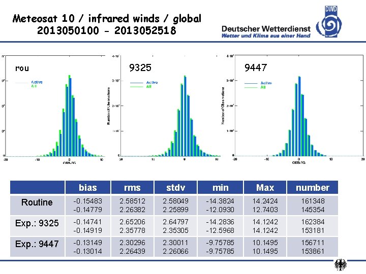
Meteosat 10 / infrared winds / global 2013050100 - 2013052518 rou 9325 9447 bias rms stdv min Max number Routine -0. 15483 -0. 14779 2. 58512 2. 26382 2. 58049 2. 25899 -14. 3824 -12. 0930 14. 2424 12. 7403 161348 145354 Exp. : 9325 -0. 14741 -0. 14919 2. 65206 2. 35778 2. 64797 2. 35305 -14. 2836 -12. 5968 14. 1242 162384 153181 Exp. : 9447 -0. 13149 -0. 13014 2. 30296 2. 26439 2. 30011 2. 26066 -9. 75785 10. 1495 156711 153861

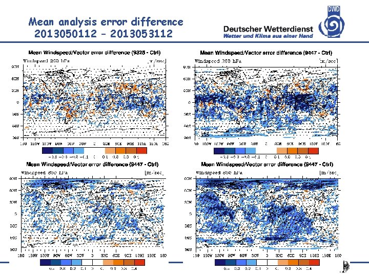
Mean analysis error difference 2013050112 – 2013053112

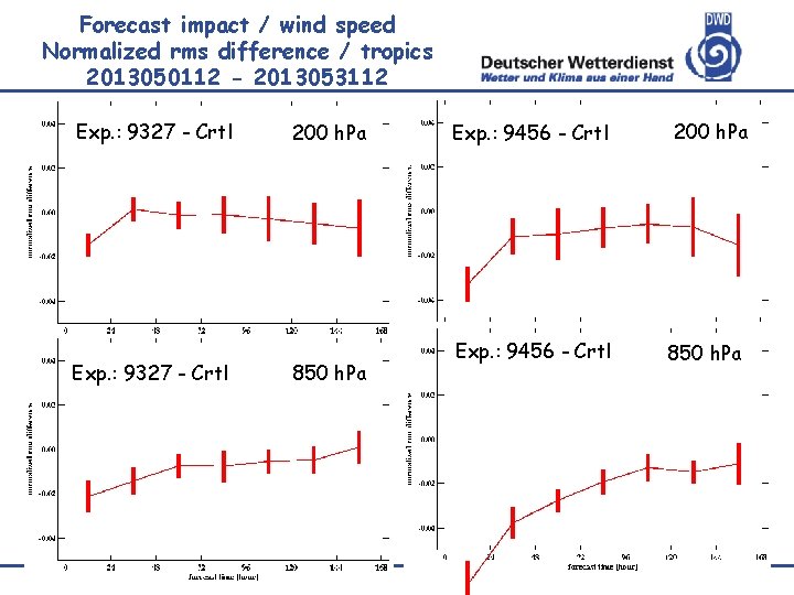
Forecast impact / wind speed Normalized rms difference / tropics 2013050112 - 2013053112 Exp. : 9327 - Crtl 200 h. Pa 850 h. Pa Exp. : 9456 - Crtl 200 h. Pa 850 h. Pa

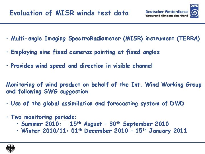
Evaluation of MISR winds test data • Multi-angle Imaging Spectro. Radiometer (MISR) instrument (TERRA) • Employing nine fixed cameras pointing at fixed angles • Provides wind speed and direction in visible channel Monitoring of wind product on behalf of the Int. Wind Working Group and following SWG suggestion • Use of the global assimilation and forecasting system of DWD • Two monitoring periods: • Summer 2010: 15 th August – 30 th September 2010 • Winter 2010/11: 01 th December 2010 – 15 th January 2011

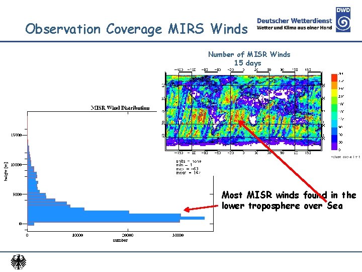
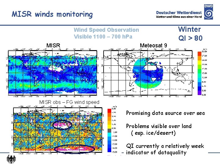
Observation Coverage MIRS Winds Number of MISR Winds 15 days Most MISR winds found in the lower troposphere over Sea

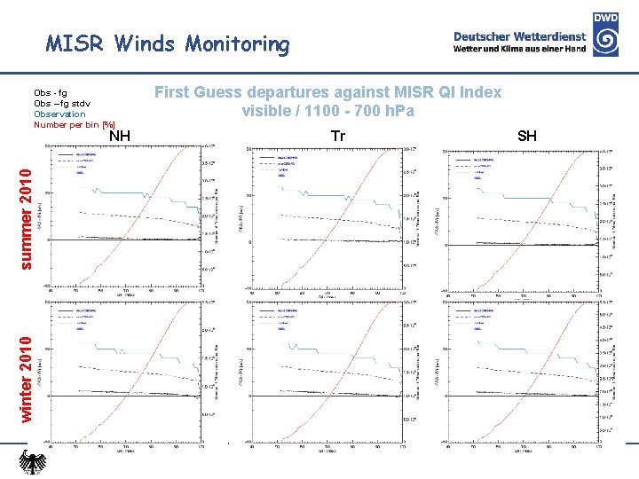
MISR Winds Monitoring Obs - fg Obs – fg stdv Observation Number per bin [%] winter 2010 summer 2010 NH First Guess departures against MISR QI Index visible / 1100 - 700 h. Pa Tr SH

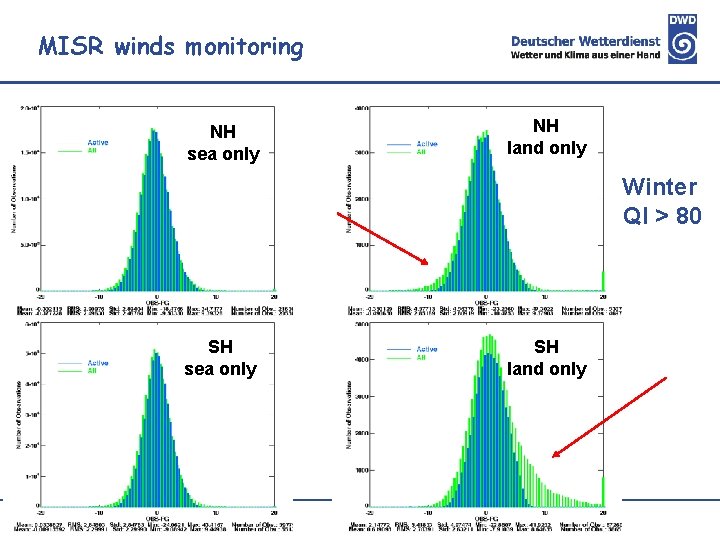
MISR winds monitoring NH sea only NH land only Winter QI > 80 SH sea only SH land only

MISR winds monitoring Winter QI > 80 Wind Speed Observation Visible 1100 – 700 h. Pa MISR Meteosat 9 MISR obs – FG wind speed Promising data source over sea Problems visible over land ( esp. ice/desert) QI currently a relatively week indicator of dataquality

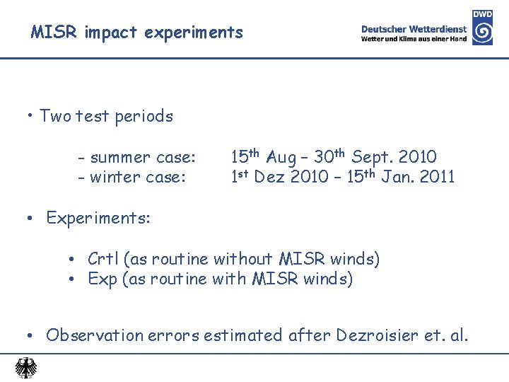
MISR impact experiments • Two test periods - summer case: - winter case: 15 th Aug – 30 th Sept. 2010 1 st Dez 2010 – 15 th Jan. 2011 • Experiments: • Crtl (as routine without MISR winds) • Exp (as routine with MISR winds) • Observation errors estimated after Dezroisier et. al.

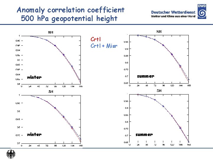
Anomaly correlation coefficient 500 h. Pa geopotential height Crtl + Misr winter summer

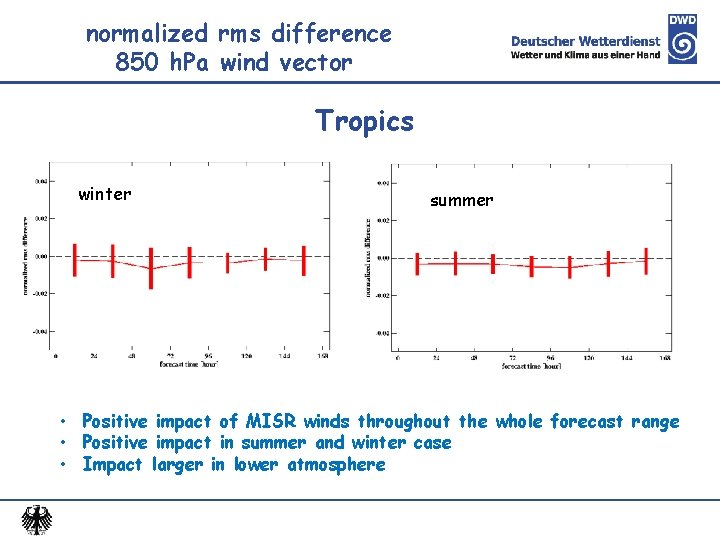
normalized rms difference 850 h. Pa wind vector Tropics winter summer • Positive impact of MISR winds throughout the whole forecast range • Positive impact in summer and winter case • Impact larger in lower atmosphere

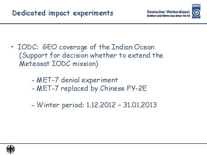
Dedicated impact experiments • IODC: GEO coverage of the Indian Ocean (Support for decision whether to extend the Meteosat IODC mission) - MET-7 denial experiment - MET-7 replaced by Chinese FY-2 E - Winter period: 1. 12. 2012 – 31. 01. 2013

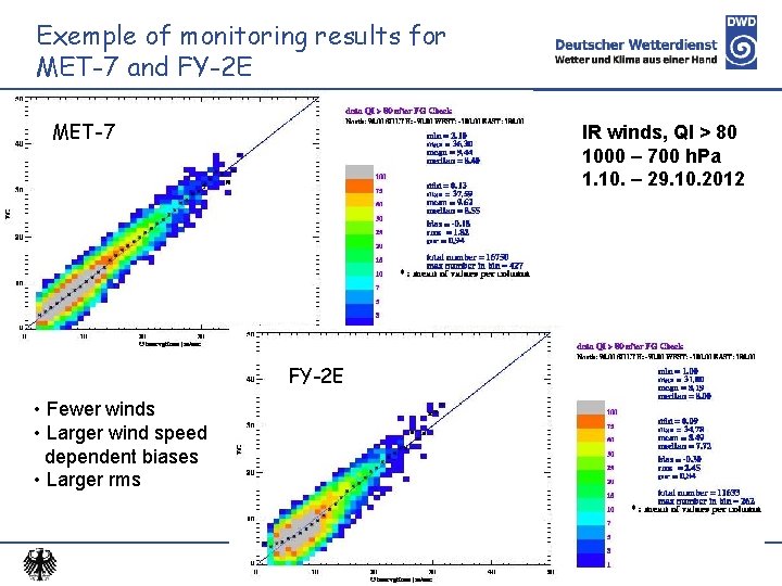
Exemple of monitoring results for MET-7 and FY-2 E MET-7 IR winds, QI > 80 1000 – 700 h. Pa 1. 10. – 29. 10. 2012 FY-2 E • Fewer winds • Larger wind speed dependent biases • Larger rms

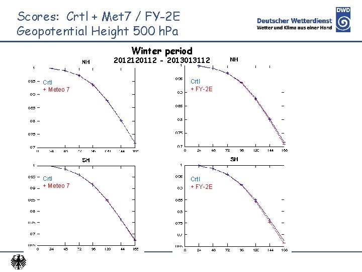
Scores: Crtl + Met 7 / FY-2 E Geopotential Height 500 h. Pa Winter period 2012120112 - 2013013112 Crtl + Meteo 7 Crtl + FY-2 E

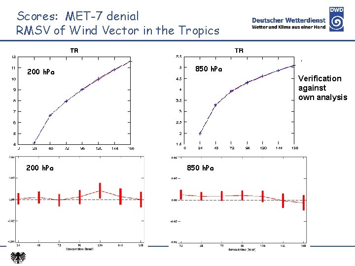
Scores: MET-7 denial RMSV of Wind Vector in the Tropics 200 h. Pa 850 h. Pa Verification against own analysis 850 h. Pa

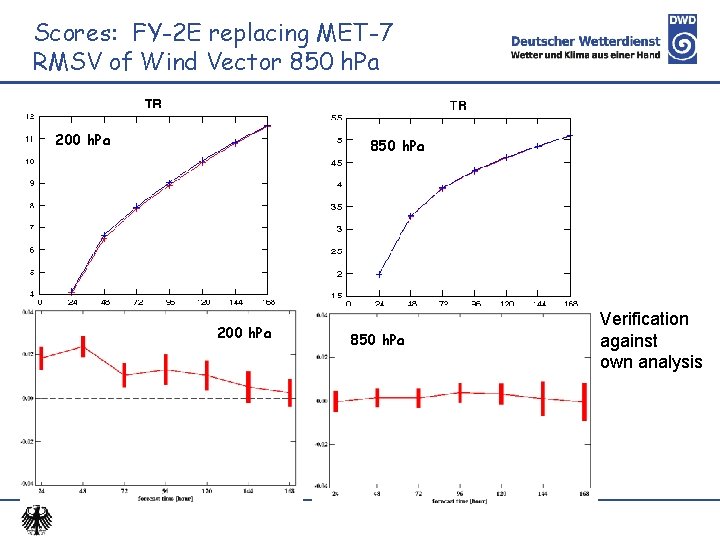
Scores: FY-2 E replacing MET-7 RMSV of Wind Vector 850 h. Pa 200 h. Pa 850 h. Pa Verification against own analysis

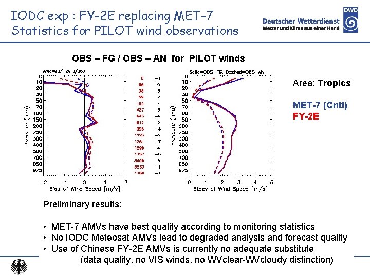
IODC exp : FY-2 E replacing MET-7 Statistics for PILOT wind observations OBS – FG / OBS – AN for PILOT winds Area: Tropics MET-7 (Cntl) FY-2 E Preliminary results: • MET-7 AMVs have best quality according to monitoring statistics • No IODC Meteosat AMVs lead to degraded analysis and forecast quality • Use of Chinese FY-2 E AMVs is currently no adequate substitute (data quality, no VIS winds, no WVclear-WVcloudy distinction)

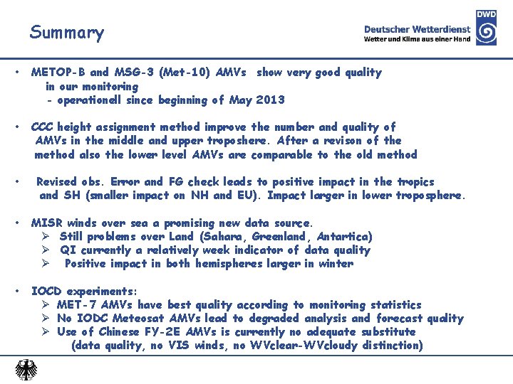
Summary • METOP-B and MSG-3 (Met-10) AMVs show very good quality in our monitoring - operationell since beginning of May 2013 • CCC height assignment method improve the number and quality of AMVs in the middle and upper troposhere. After a revison of the method also the lower level AMVs are comparable to the old method • Revised obs. Error and FG check leads to positive impact in the tropics and SH (smaller impact on NH and EU). Impact larger in lower troposphere. • MISR winds over sea a promising new data source. Ø Still problems over Land (Sahara, Greenland, Antartica) Ø QI currently a relatively week indicator of data quality Ø Positive impact in both hemispheres larger in winter • IOCD experiments: Ø MET-7 AMVs have best quality according to monitoring statistics Ø No IODC Meteosat AMVs lead to degraded analysis and forecast quality Ø Use of Chinese FY-2 E AMVs is currently no adequate substitute (data quality, no VIS winds, no WVclear-WVcloudy distinction)