Use of NCEP Meteorological Model Predictions for HPAC




- Slides: 47

Use of NCEP Meteorological Model Predictions for HPAC Applications Jeff Mc. Queen, Dusan Jovic, Binbin Zhou, Sundara Gopalakrishnan, Marina Tsidulko, Jun Du and Geoff Di. Mego NOAA/NWS National Centers for Environmental Prediction Environmental Modeling Center December 18, 2006

National Centers for Environmental Prediction (NCEP) • Among the Nation’s leaders in providing global and national climate and weather analysis, forecasts and guidance • Develop and Improve numerical weather, climate, hydrological, space and ocean prediction systems • Applied research in data analysis, modeling and product development

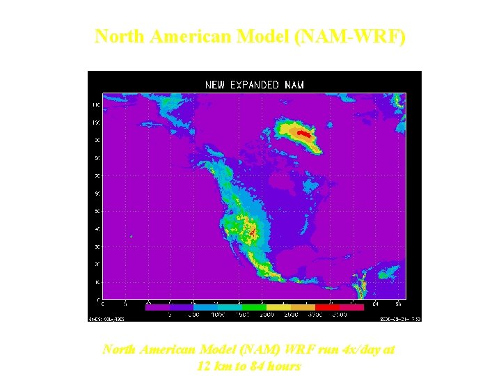
North American Model (NAM-WRF) North American Model (NAM) WRF run 4 x/day at 12 km to 84 hours

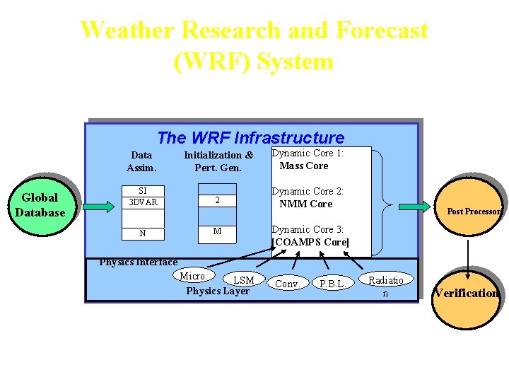
Weather Research and Forecast (WRF) System The WRF Infrastructure Global Database Data Assim. Initialization & Pert. Gen. Dynamic Core 1: Mass Core SI 3 DVAR 2 Dynamic Core 2: NMM Core N M Post Processors Dynamic Core 3: [COAMPS Core] Physics Interface Micro. LSM Physics Layer Conv. P. B. L. Radiatio n Verification

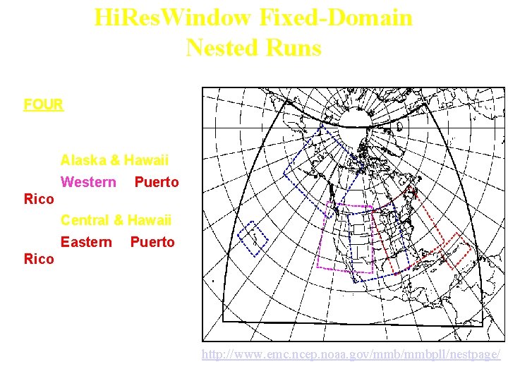
Hi. Res. Window Fixed-Domain Nested Runs • FOUR routine runs made at the same time every day • 00 Z : Alaska & Hawaii • 06 Z : Western & Puerto Rico • 12 Z : Central & Hawaii • 18 Z : Eastern & Puerto Rico • Everyone gets daily high resolution runs if & only if hurricane runs are not needed http: //www. emc. ncep. noaa. gov/mmbpll/nestpage/

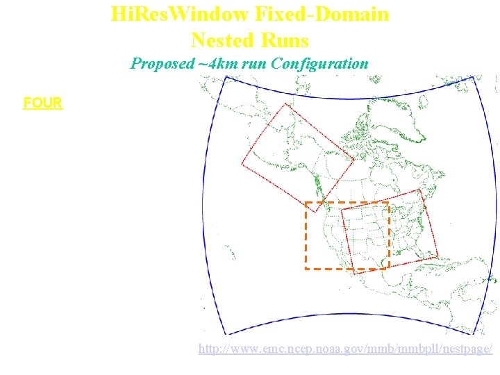
Hi. Res. Window Fixed-Domain Nested Runs Proposed ~4 km run Configuration • FOUR routine runs made at the same time every day • 00 Z : ECentral & Hawaii • 06 Z : Alaska & Puerto Rico • 12 Z : ECentral & Hawaii • 18 Z : WCentral & Puerto Rico • Everyone gets daily high resolution runs if & only if hurricane runs are not needed http: //www. emc. ncep. noaa. gov/mmbpll/nestpage/

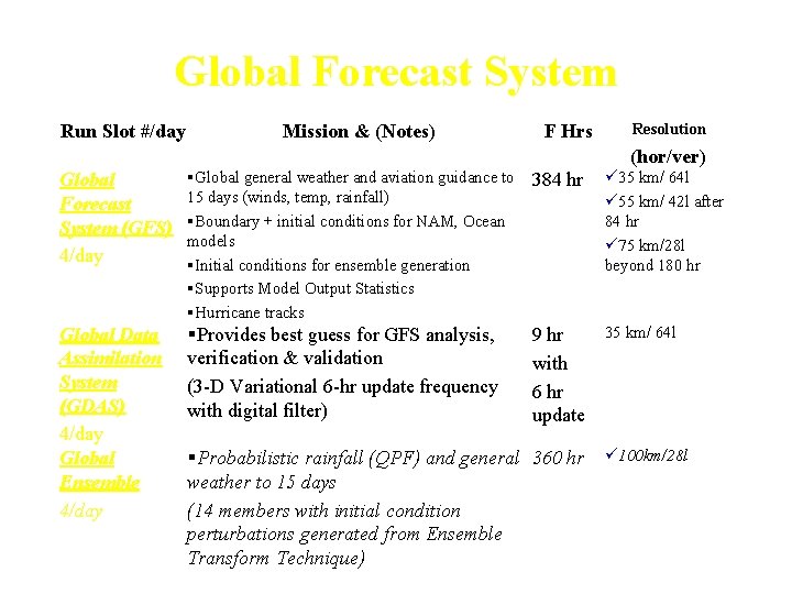
Global Forecast System Run Slot #/day Mission & (Notes) F Hrs Resolution (hor/ver) Global Forecast System (GFS) 4/day §Global general weather and aviation guidance to 15 days (winds, temp, rainfall) §Boundary + initial conditions for NAM, Ocean models §Initial conditions for ensemble generation §Supports Model Output Statistics §Hurricane tracks 384 hr ü 35 km/ 64 l ü 55 km/ 42 l after 84 hr ü 75 km/28 l beyond 180 hr Global Data Assimilation System (GDAS) 4/day Global Ensemble 4/day §Provides best guess for GFS analysis, verification & validation (3 -D Variational 6 -hr update frequency with digital filter) 9 hr with 6 hr update 35 km/ 64 l §Probabilistic rainfall (QPF) and general 360 hr weather to 15 days (14 members with initial condition perturbations generated from Ensemble Transform Technique) ü 100 km/28 l

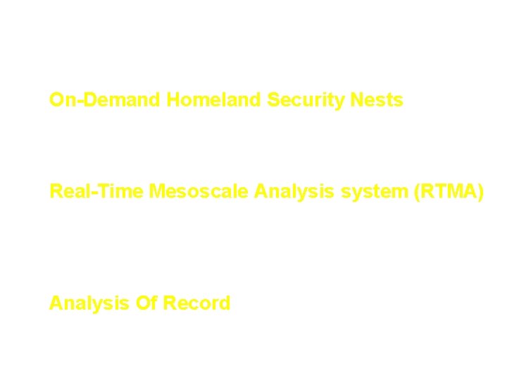
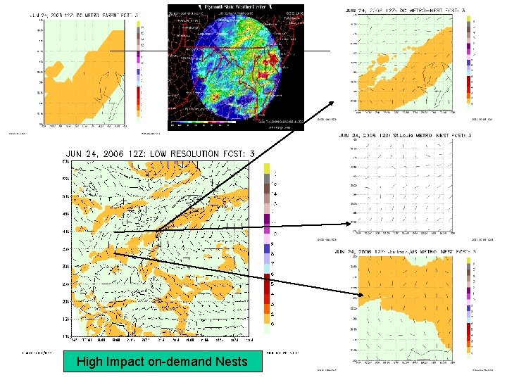
Additional NCEP products with applications for AT&D • On-Demand Homeland Security Nests – On-demand real-time High Resolution WRF 4 km Grid Runs – 26 pre-defined nests • Real-Time Mesoscale Analysis system (RTMA) – 2 -D Variable data assimilation at the surface – hourly analyses at 5 km resolution • Analysis Of Record – Downscaled from NDAS analysis to provide high resolution climatology than 32 km Regional Reanalyses

Provision of Additional Products • NCEP Products to DTRA-MDS – Global Forecast System ½ degree 3 hrly predictions to 16 days – Global Ensemble Mean and Spread files to 16 days – Short Range Ensemble to 84 hours (4 x/day) – NAM-WRF high resolution 12 km CONUS and North American grids – Added Cartesian vertical velocities, PBL height, eddy diffusivities, u* to grids – Test ensemble wind variance and covariance files

WRF Output to improve HPAC coupling • Instantaneous and time-averaged surface sensible heat, latent heat, and momentum fluxes • Roughness length, vegetation types and fraction • Shelter level, skin, and soil temperature, moisture, and wind • Cloud fraction • Mixing length • 3 D Wind, temperature, and specific humidity • 3 D TKE • 3 D eddy diffusivity of heat • PBL height • Time-averaged winds, TKE and mixing lengths • Eddy energy dissipation rates • 3 -D eddy diffusivity of momentum • 3 -D wind variance from ensemble • LSV proportional to wind variance ?

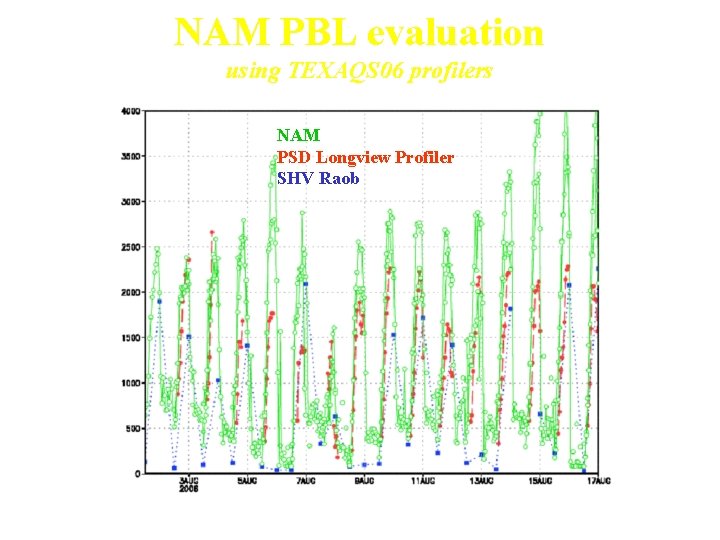
NAM PBL evaluation using TEXAQS 06 profilers NAM PSD Longview Profiler SHV Raob Use of profilers as ground truth for raob derived Zi

NCEP AT&D Focus for HPAC • Improved Coupling of Mesoscale Models w/ HPAC – – Special real-time High Resolution Nested Grid Runs (eg: Torino Olympics) Additional turbulence Fields output to NCEP GRIB files and to DTRA servers Evaluation of WRF turbulence characteristics with PSU & Hanna Cons. Development of a real-time PBL height and cloud cover verification system • Development and Testing of a High Resolution Ensemble Prediction Systems • NCEP WRF ensemble breeding system • Uses both ARW and NMM cores and physics suites • Can be initialized from GDAS or NDAS land or Atmos. states – Began testing a 10 member WRF HREF – Providing experimental ensemble wind variance fields needed to drive HPAC uncertainty calculations • Incorporation of probabilistic verification for Ensemble System evaluation – Deterministic FVS developments: pbl hgt & cloud cover verification – Ranked Histograms, spread, statistical consistency, outlier diagrams added for ensemble verification

High Impact on-demand Nests

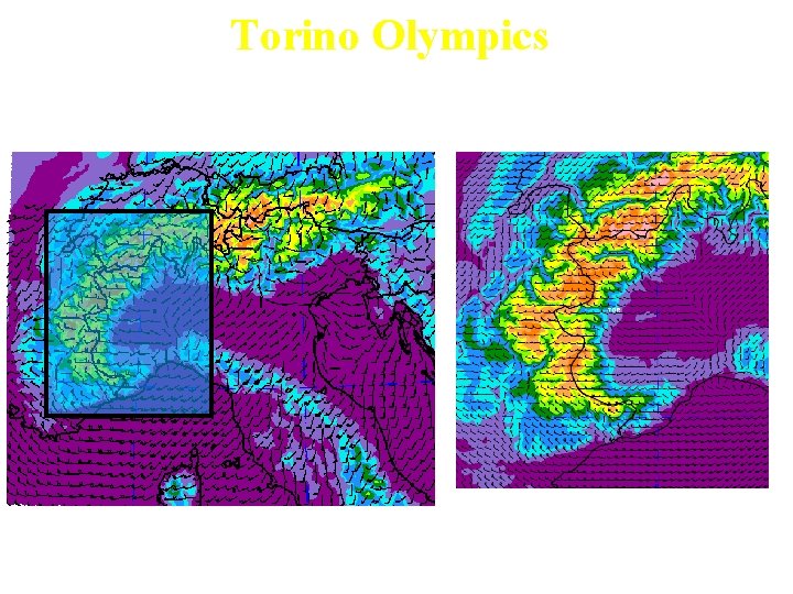
Torino Olympics WRF nested runs (Dusan Jovic) • WRF-NMM V 2. 1 using H-WRF nested grid configurations • 24 h forecasts at 00 and 12 UTC • 90 mins w/ 64 tasks • 4 km Alps nest w/in 12 km Europe Domain • 50 levels • Initialized with ½ degree GFS Pressure grids • Ferrier Microphysics No convective Param. • MYJ TKE, NOAH LSM

Torino Olympics NCEP 4 km Domain Full 4 km WRF Nested Grid Domain Zoomed view around Torino

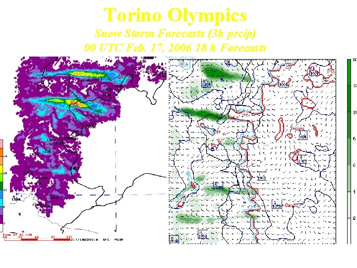
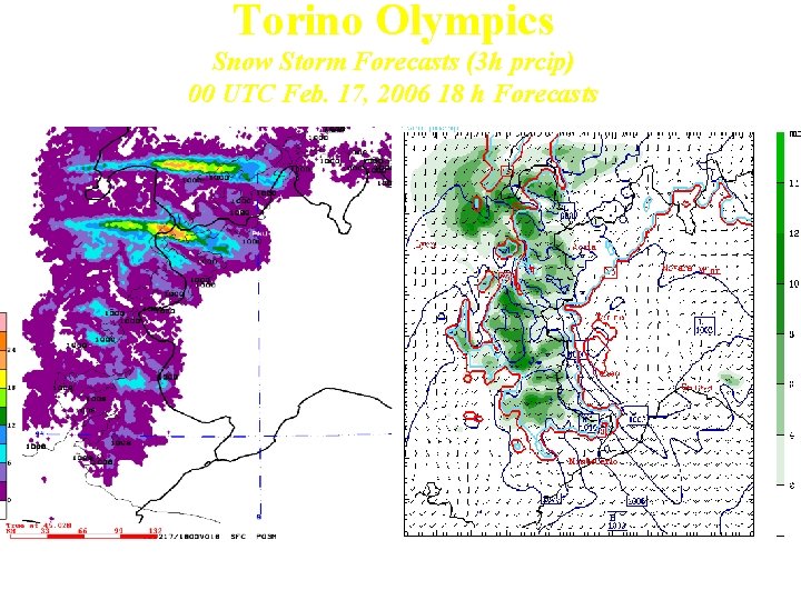
Torino Olympics Snow Storm Forecasts (3 h prcip) 00 UTC Feb. 17, 2006 18 h Forecasts WRF-NMM 4 km Zoom MM 5 4 km

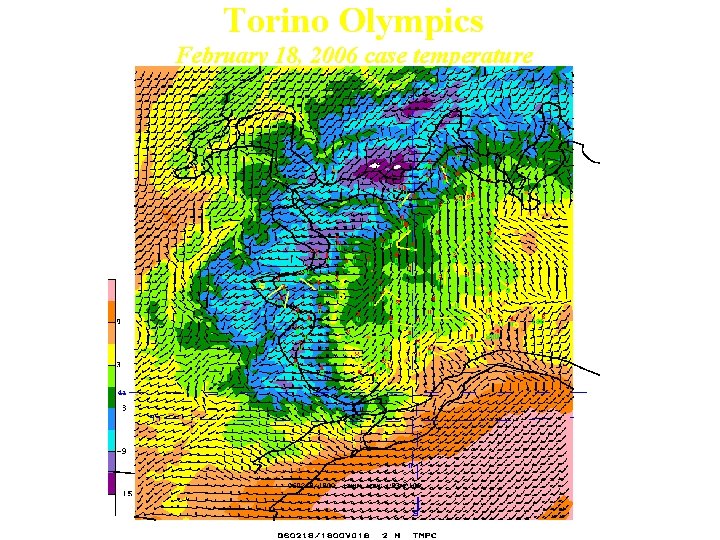
Torino Olympics February 18, 2006 case temperature

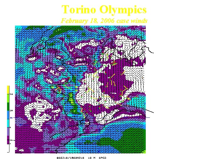
Torino Olympics February 18, 2006 case winds Some down valley Flows captured Mediterranean low is better captured in larger domain Synoptic-orographic interactions are important

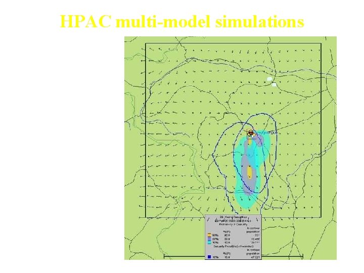
HPAC multi-model simulations MM 5 & WRF • WRF & MM 5 Plumes near Torino Olympics • Blue lines: HPAC uncertainties w/ constant large scale variances • Courtesy Pat Hayes, DTRA-NGC Feb. 22, 00 Z release (Case 5)

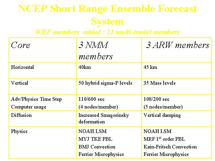
NCEP Short Range Ensemble Forecast System WRF members added : 21 multi-model members Core 3 NMM members 3 ARW members Horizontal 40 km 45 km Vertical 50 hybrid sigma-P levels 35 Mass levels Adv/Physics Time Step Computer usage 110/600 sec (4 nodes/member) 108/200 sec (5 nodes/member) Diffusion Increased Smagorinsky deformation Vertical damping Physics NOAH LSM MYJ TKE PBL BMJ Convection Ferrier Microphysics NOAH LSM MRF 1 st order PBL Kain-Fritsch Convection Ferrier Microphysics

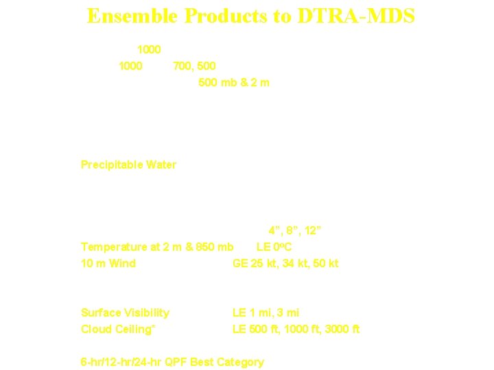
Ensemble Products to DTRA-MDS Means/ Spread(uncertainties) • Heights at 1000, 850, 700, 500, 250 mb • U+V at 1000, 850, 700, 500, 250 mb & 10 m • Temperature 850, 700, 500 mb & 2 m • Dew Point (RH) 850, 700, 500 mb & 2 m • QPF at 3, 6, 12 and 24 hour totals • 12 -hr Snowfall • Sea Level Pressure • Precipitable Water Probabilistic Fields • 3 -hr/6 -hr QPF GE. 01”, . 25”, . 50”, 1. 0” • 12 -hr/24 -hr QPF GE 01”, . 25”, . 50”, 1. 0”, 2. 0” • 12 -hr Snowfall GE 1”, 4”, 8”, 12” (have 2. 5, 5, 10, 20”) • Temperature at 2 m & 850 mb LE 0 o. C • 10 m Wind GE 25 kt, 34 kt, 50 kt • CAPE GE 500, 1000, 2000, 3000, 4000 • Lifted Index LE 0, -4, -8 • Surface Visibility LE 1 mi, 3 mi • Cloud Ceiling* LE 500 ft, 1000 ft, 3000 ft • Probability of precipitation types (have rain, frozen, & freezing) • 6 -hr/12 -hr/24 -hr QPF Best Category

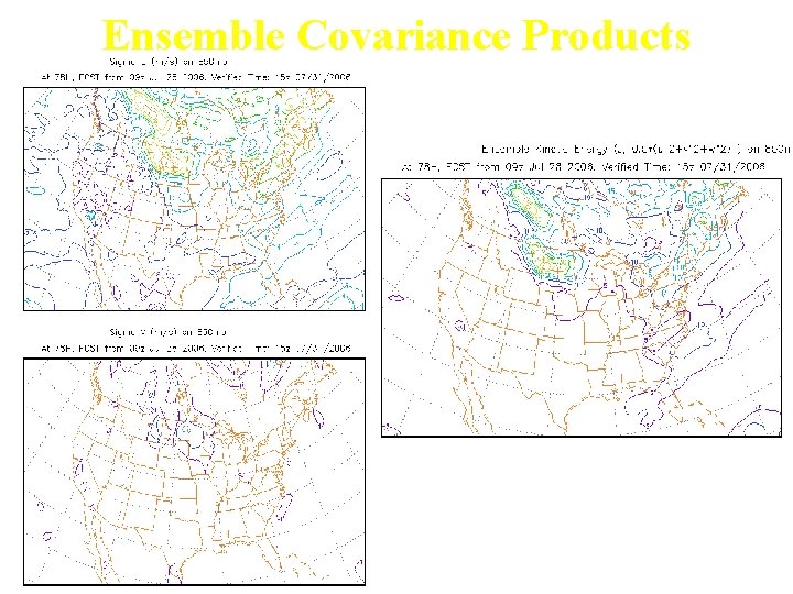
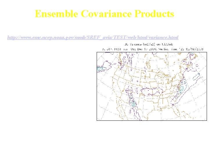
Ensemble Covariance Products Binbin Zhou, EMC EKE=0. 5*(UU+VV+WW), where UU, VV, WW are ensemble variances

Ensemble Covariance Products Daily ensemble products Binbin Zhou, EMC http: //www. emc. ncep. noaa. gov/mmb/SREF_avia/TEST/web/html/variance. html EKE=0. 5*(UUE+VVE+WWE) N UUE = 1/N ∑( Umij - Uij )2 N VVE = 1/N ∑( Vmij - Vij )2 N UVE = 1/N ∑( Umij - Uij )2 ( Vmij - Vij )2 N WWE = 1/N ∑( Wmij - Wij )2 Ensemble mean sensible heat flux Ensemble mean latent heat flux U and V spread

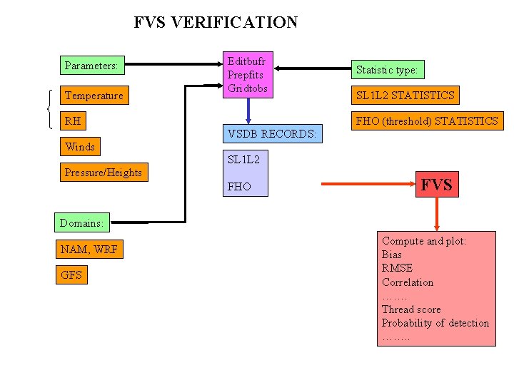
NCEP’s FVS Verification System • Input observations are from NCEP operational PREPBUFR files which include 1) radiosonde & dropsonde Z, temp, wind & moisture; 2) surface land & marine P, temp, wind, moisture observations; 3) ACARS & conventional aircraft wind, temp [moisture], and 4) Profiler winds. • Verified Fields include temperature, wind and moisture fields on pressure and shelter levels. • Recently added sensible weather (eg: Visibility) , wind shear, and PBL height • Grid verification of cloud cover using AFWA cloud cover products New FVS On-line System Web-based MYSQL Database

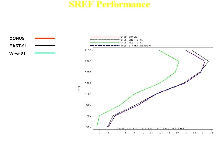
SREF Performance 48 h Wind forecast Spread (August 2006 ) CONUS EAST-21 West-21 • Spread is largest in East and near Tropopause

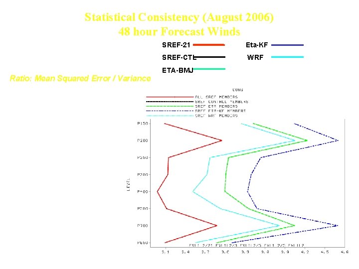
Statistical Consistency (August 2006) 48 hour Forecast Winds SREF-21 Eta-KF SREF-CTL WRF ETA-BMJ Ratio: Mean Squared Error / Variance best ~ 1 (Buizza, et al. 1999) • SREF-21 improved • WRF subset yields lowest statistical consistency compared to Eta subsets

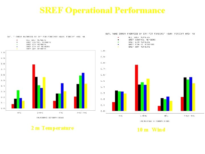
SREF Operational Performance Outlier Percentage 48 h forecasts (August 2006) 2 m Temperature 10 m Wind • Outlier percentage reduced for SREF/21 system • WRF sub-member agree best w/ obs as compared to Eta and RSM submembers

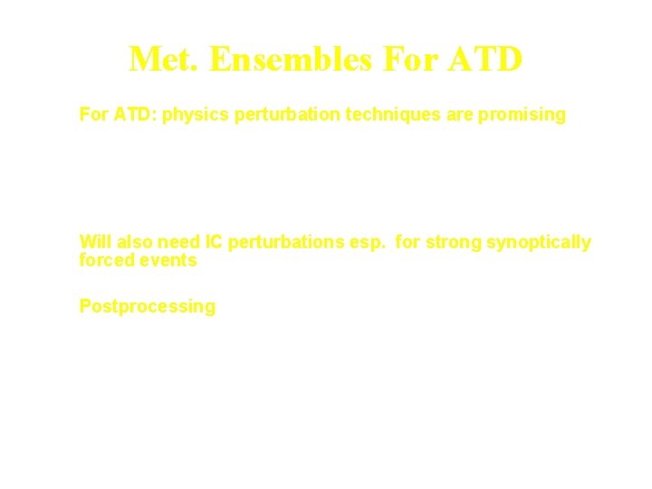
Met. Ensembles For ATD • For ATD: physics perturbation techniques are promising – – PBL parameterization Land Surface Model specifications Convective parameterizations Stochastic physics efforts • Will also need IC perturbations esp. for strong synoptically forced events • Postprocessing – Bias correct winds, temp, rh, precip – Use ensemble wind variance as estimate of LSV (Wind error correlated with Wind variance, Coielle, 2005) – Reforecasting Project – Cluster ensemble members to drive Scipuff most likely scenarios (COSMO-LEPS approach)

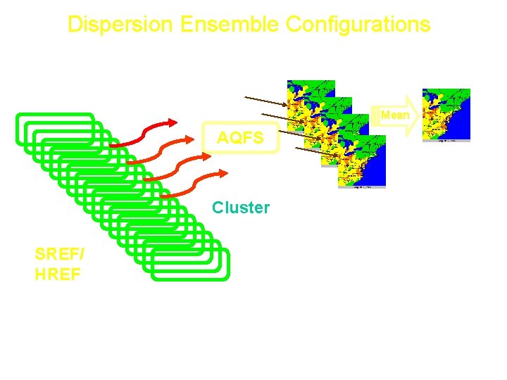
Dispersion Ensemble Configurations 1. One HPAC run (Ens. Median/variance) 2. One HPAC run for each member 3. One HPAC run for main clusters Mean AQFS Cluster SREF/ HREF Cluster analysis can chose a smaller set of members statistically different from one another that correspond to the daily weather pattern.

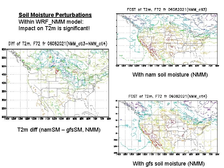
Soil Moisture Perturbations Within WRF_NMM model: Impact on T 2 m is significant! With nam soil moisture (NMM) T 2 m diff (nam. SM – gfs. SM, NMM) With gfs soil moisture (NMM)

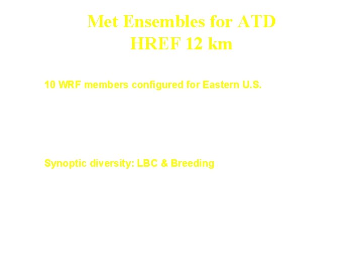
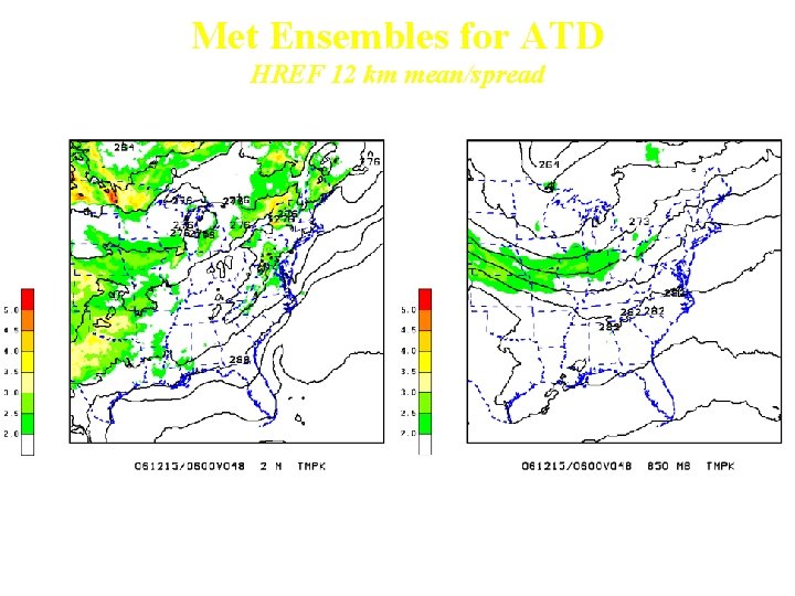
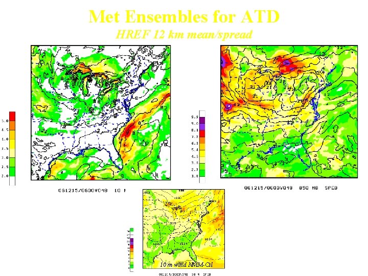
Met Ensembles for ATD HREF 12 km • 10 WRF members configured for Eastern U. S. – 12 km DX, 48 hour forecasts, 2 x/day (06 & 18 Z) – 5 WRF ARW members (1 control, 2 breeding pairs) • Physics: YSU PBL, Kain-Fritsch Convection, RRTM radiation – 5 WRF NMM members (1 control, 2 breeding pairs) • Physics: MYJ TKE, Betts-Miller-J convection, GFDL radiation • Synoptic diversity: LBC & Breeding – Breeding: 12 hour forecast differences to drive IC perturbations – LBC – 3 hrly : • GENS 1 -4 ET members for 2 NMM perturbed pairs • GENS 5 -8 ET members for 2 ARW perturbed pairs • GENS Ctl for NMM and ARW control

Met Ensembles for ATD HREF 12 km mean/spread 2 m Temperature mean/spread 850 mb Temperature mean/spread

Met Ensembles for ATD HREF 12 km mean/spread 10 m Winds 850 mb Winds 10 m wind NMM-Ctl

Future Work • Evaluate 12 km Relocatable HREF System – Add pbl & LSM diversity to initial condition diversity system – Compare against SREF, GENS, ARPS 4 km for NCEP/SPC spring program • High Resolution Testing – Test the addition of a 4 km nest to HREF NMM control – Evaluate with DCNET and URBANET data • Provision of Products – Provision of ensemble median, wind variance and length scales to MDS for SCIPUFF sensitivity testing • Complete evaluation of WRF turbulence & PBL fields for coupling with HPAC w/ PSU • Improved probabilistic verification package

BACKUPS

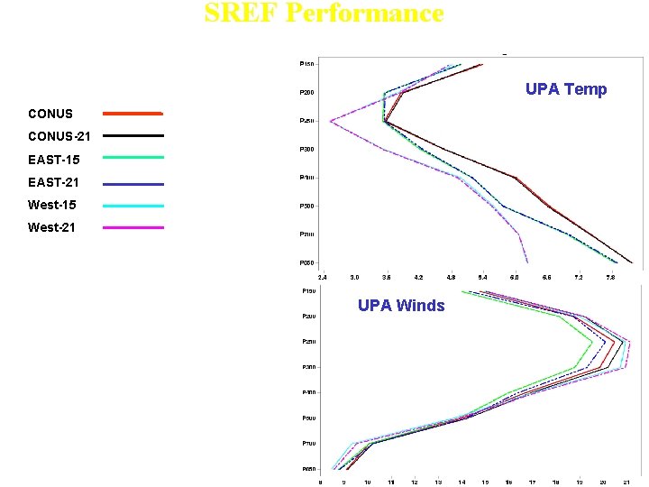
SREF Performance 48 h forecast Spread (Nov. 2005) UPA Temp CONUS-21 EAST-15 EAST-21 West-15 West-21 • SREF-21 improved over SREF-15 • Temperature: • Spread is smallest in West and near Tropopause • Winds: • Spread is greatest in West and near Tropopause UPA Winds

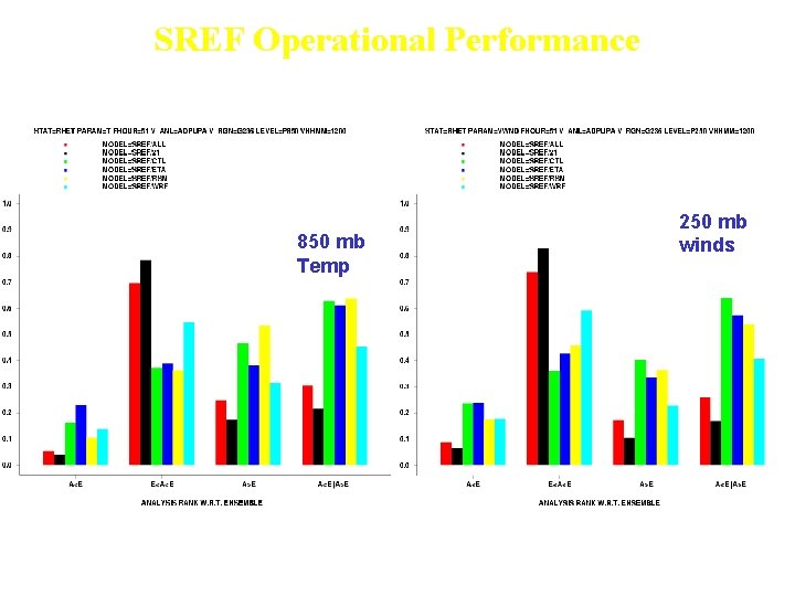
SREF Operational Performance Outlier Percentage 48 h forecasts (November 2005) 850 mb Temp 250 mb winds • Outlier percentage reduced for SREF/21 system • WRF sub-member agree best w/ obs as compared to Eta and RSM submembers

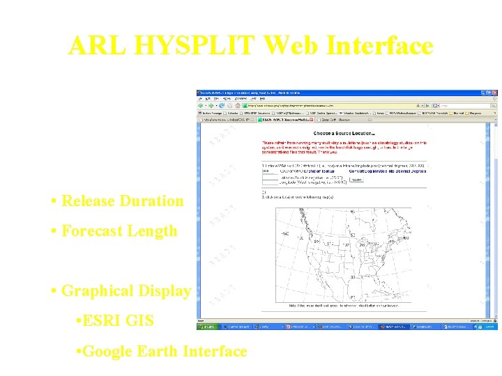
ARL HYSPLIT Web Interface • Web based interface that allow user to customize: • Source location • Source strength • Deposition effects • Release Duration • Forecast Length • Graphical Display • ESRI GIS • Google Earth Interface

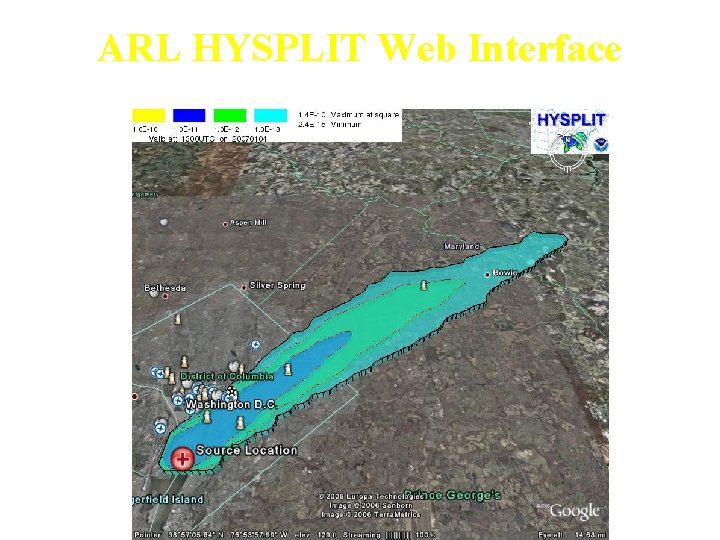
ARL HYSPLIT Web Interface Google Earth Display

Torino Olympics Snow Storm Forecasts (3 h prcip) 00 UTC Feb. 17, 2006 18 h Forecasts WRF-NMM 4 km Zoom MM 5 4 km

FVS VERIFICATION Parameters: Temperature Editbufr Prepfits Gridtobs RH Statistic type: SL 1 L 2 STATISTICS FHO (threshold) STATISTICS VSDB RECORDS: Winds SL 1 L 2 Pressure/Heights FHO FVS Domains: NAM, WRF GFS Compute and plot: Bias RMSE Correlation ……. Thread score Probability of detection ……. .

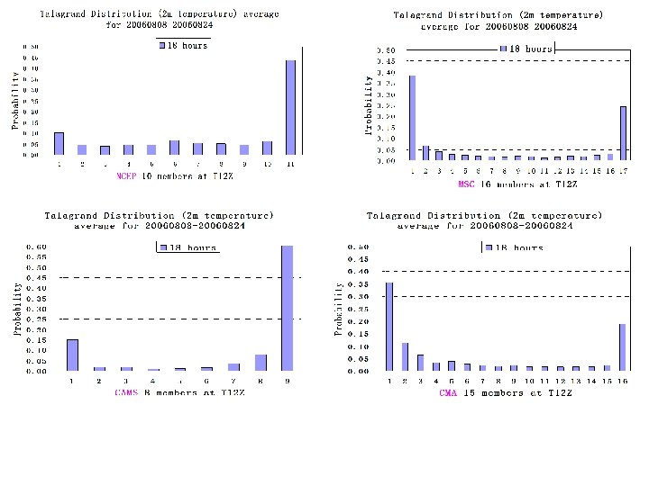
( from NMC/CMA, Y. Li)

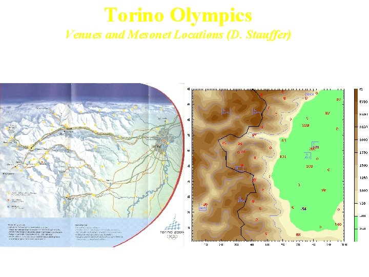
Torino Olympics Venues and Mesonet Locations (D. Stauffer)

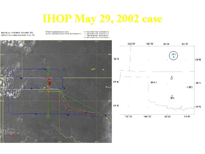
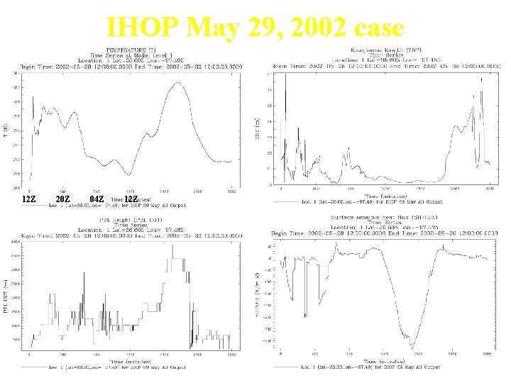
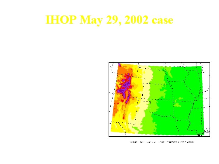
IHOP May 29, 2002 case

IHOP May 29, 2002 case 12 Z 20 Z 04 Z 12 Z

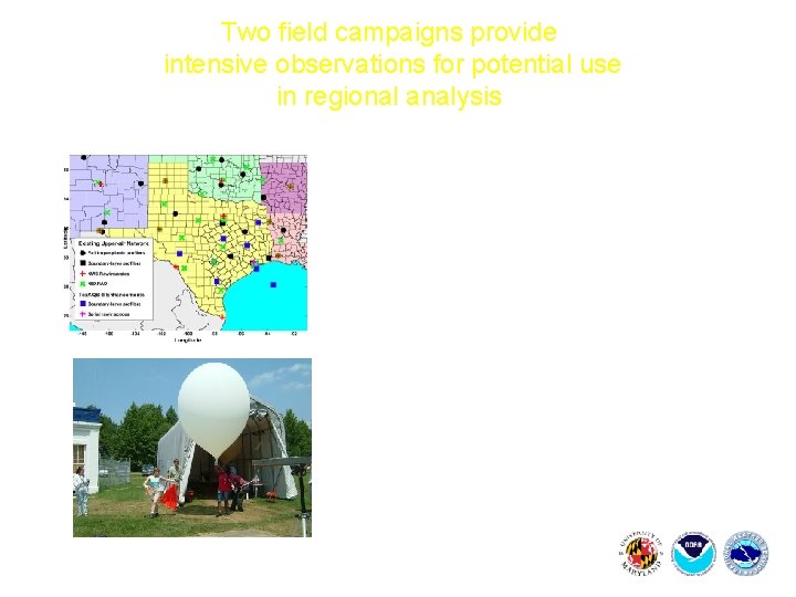
Two field campaigns provide intensive observations for potential use in regional analysis 2006 Texas Air Quality Study/Gulf of Mexico Atmospheric Composition and Climate Study (8/1 - 9/30) WAVES_2006: Water Vapor Validation Experiment – Satellite/Sondes in Beltsville, MD (7/17– 8/10)

IHOP May 29, 2002 case • WRF-NMM Initialized from NDAS at May 28, 2002, 12 Z • 4 km, 50 Level, 48 hour forecasts • Central U. S. Nest (260 x 410) • Mellor-Yamada-Janjic TKE • NOAH LSM • Ferrier Micro-physics • Betts-Miller-J Convection Central Nest