SO 442 Tropical Meteorology Tropical Cyclone Lifecycle http
- Slides: 22

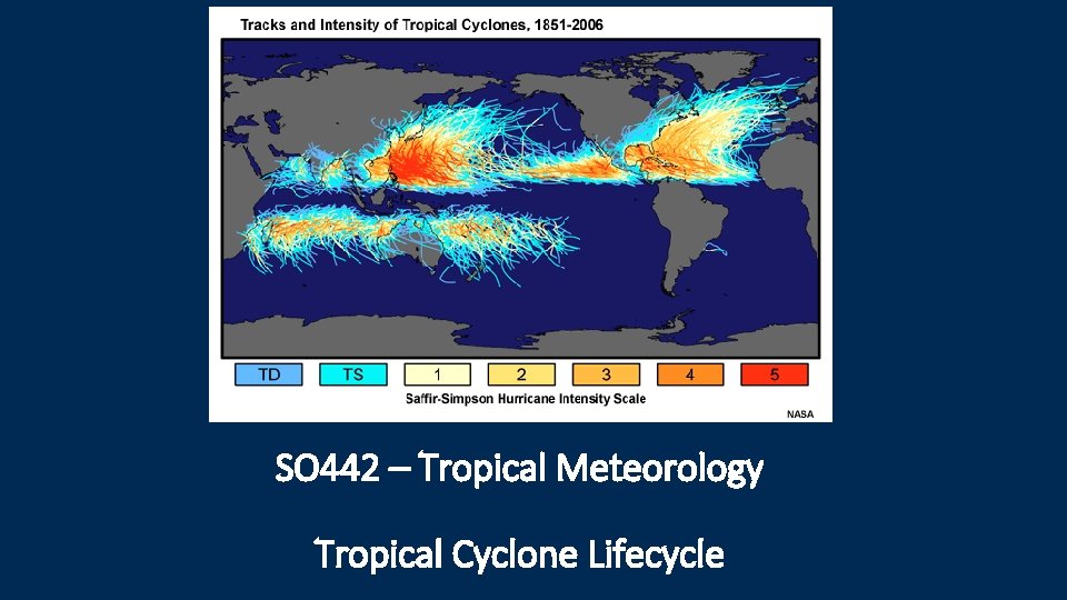
SO 442 – Tropical Meteorology Tropical Cyclone Lifecycle

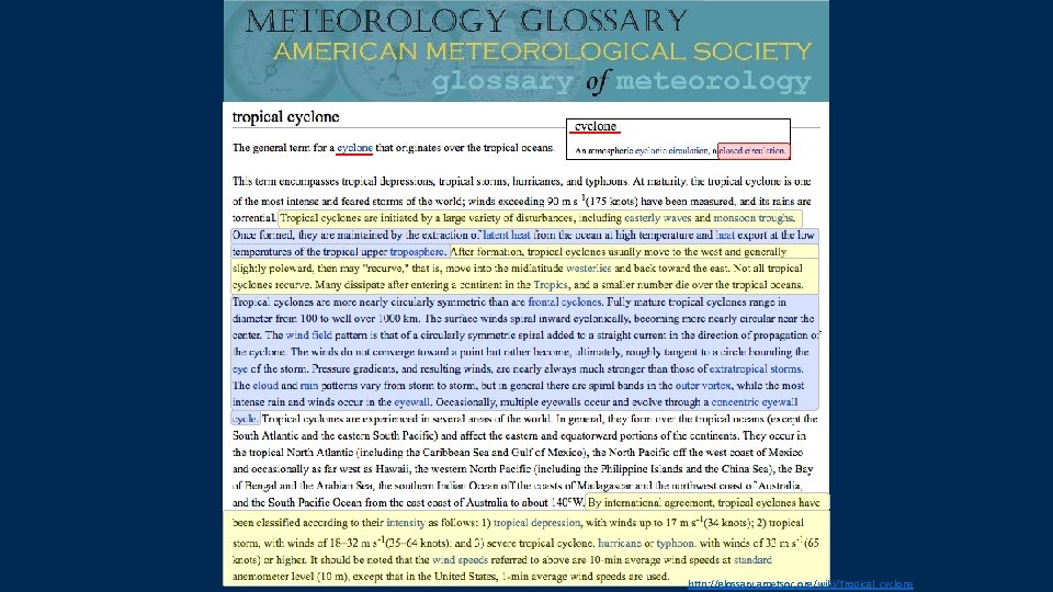
http: //glossary. ametsoc. org/wiki/Tropical_cyclone

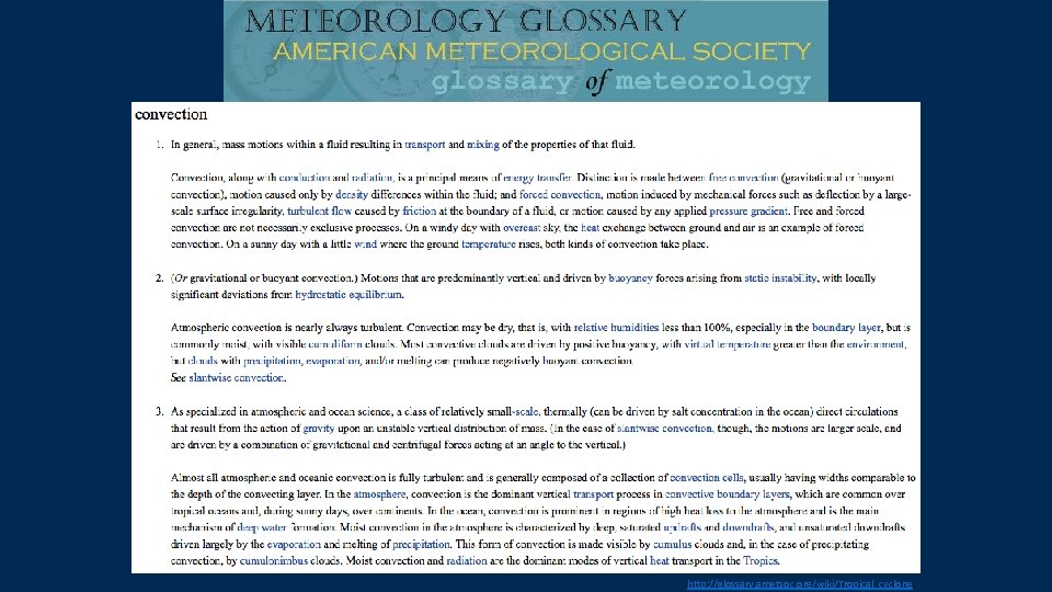
http: //glossary. ametsoc. org/wiki/Tropical_cyclone

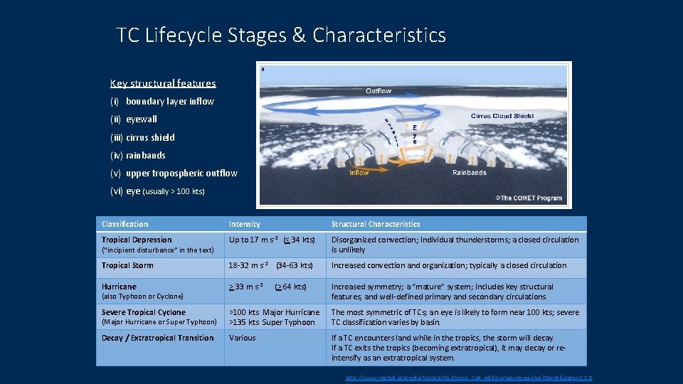
TC Lifecycle Stages & Characteristics Key structural features (i) boundary layer inflow (ii) eyewall (iii) cirrus shield (iv) rainbands (v) upper tropospheric outflow (vi) eye (usually > 100 kts) Classification Intensity Structural Characteristics Tropical Depression Up to 17 m s-1 (< 34 kts) Disorganized convection; Individual thunderstorms; a closed circulation is unlikely Tropical Storm 18 -32 m s-1 (34 -63 kts) Increased convection and organization; typically a closed circulation Hurricane > 33 m s-1 (> 64 kts) Increased symmetry; a “mature” system; includes key structural features, and well-defined primary and secondary circulations. Severe Tropical Cyclone (Major Hurricane or Super Typhoon) >100 kts Major Hurricane >135 kts Super Typhoon The most symmetric of TCs; an eye is likely to form near 100 kts; severe TC classification varies by basin. Decay / Extratropical Transition Various If a TC encounters land while in the tropics, the storm will decay. If a TC exits the tropics (becoming extratropical), it may decay or reintensify as an extratropical system. (“incipient disturbance” in the text) (also Typhoon or Cyclone) http: //www. meted. ucar. edu/tropical/textbook_2 nd_edition/navmenu. php? tab=9&page=2. 1. 0

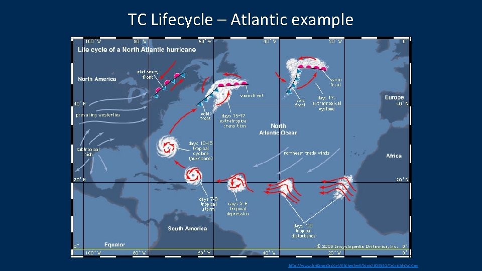
TC Lifecycle – Atlantic example http: //www. britannica. com/EBchecked/topic/606551/tropical-cyclone

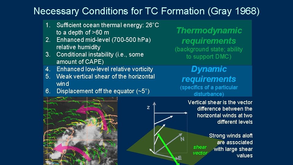
Necessary Conditions for TC Formation (Gray 1968) 1. Sufficient ocean thermal energy: 26°C to a depth of >60 m 2. Enhanced mid-level (700 -500 h. Pa) relative humidity 3. Conditional instability (i. e. , some amount of CAPE) 4. Enhanced low-level relative vorticity 5. Weak vertical shear of the horizontal wind 6. Displacement off the equator (~5°) z Thermodynamic requirements (background state; ability to support DMC) Dynamic requirements (specifics of a particular disturbance) Vertical shear is the vector difference between the horizontal winds at two different levels N E Strong winds aloft are associated shear with large shear vector values

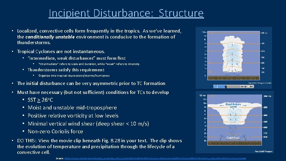
Incipient Disturbance: Structure • Localized, convective cells form frequently in the tropics. As we’ve learned, the conditionally unstable environment is conducive to the formation of thunderstorms. • Tropical Cyclones are not instantaneous. • “Intermediate, weak disturbances” must form first • “Intermediate” refers to scale and duration, while “weak” refers to intensity • Thunderstorms satisfy this requirement • Organize into tropical depressions/storms/hurricanes • The initial disturbance can be very asymmetric prior to TC formation • Must have necessary (but not sufficient) conditions for TCs to develop • • • SST > 26 o. C Moist and unstable mid-troposphere Positive relative vorticity at low levels Minimal vertical wind shear (deep shear < 10 m/s) Non-zero Coriolis force • DO THIS: View the movie clip beneath Fig. 8. 28 in your text. The clip shows the evolution of temperature and precipitation through the lifecycle of a convective cell. Source: https: //www. meted. ucar. edu/sign_in. php? go_back_to=http%253 A%252 Fwww. meted. ucar. edu%252 Ftropical%252 Ftextbook_2 nd_edition%252 Fprint_8. htm##

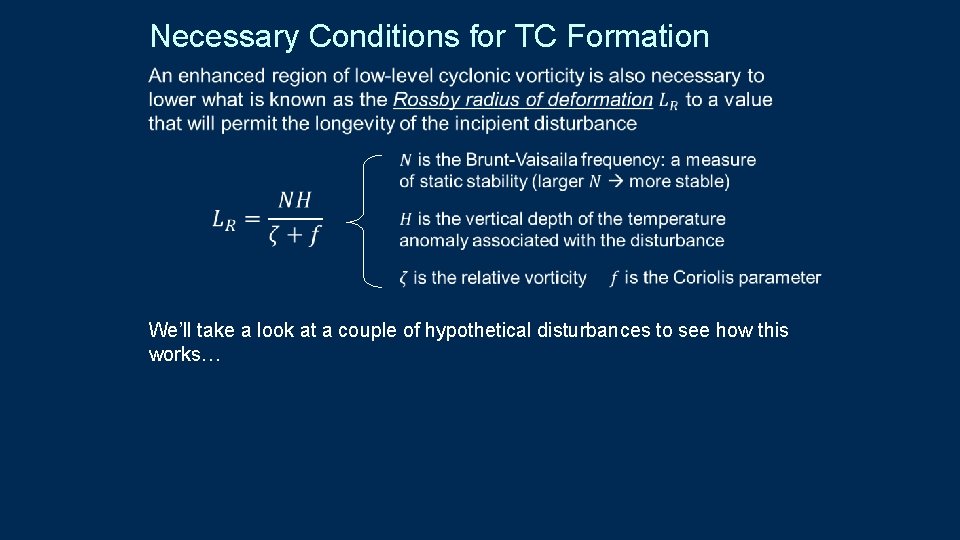
Necessary Conditions for TC Formation We’ll take a look at a couple of hypothetical disturbances to see how this works…

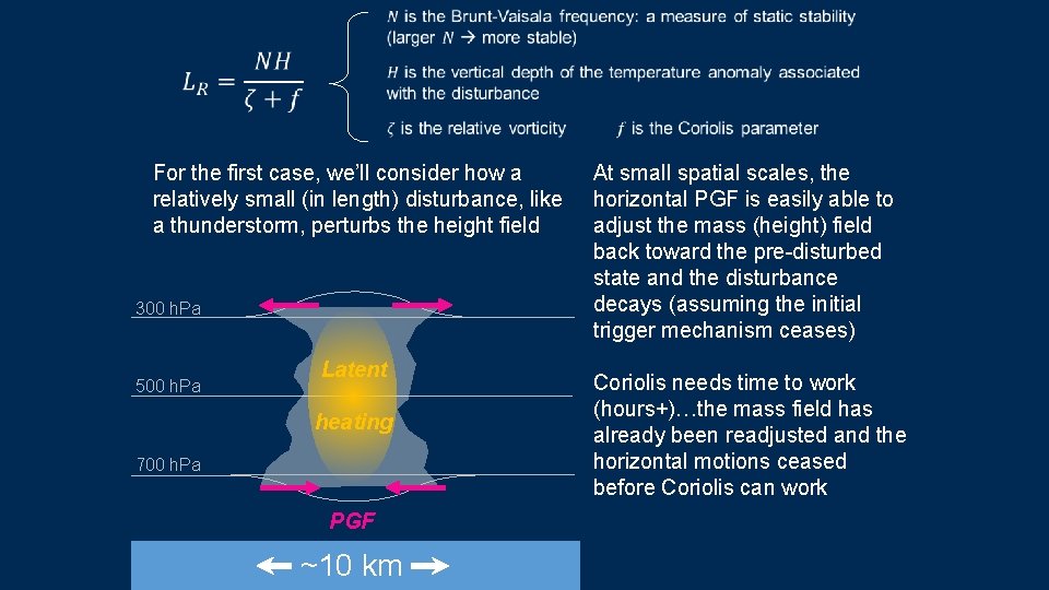
For the first case, we’ll consider how a relatively small (in length) disturbance, like a thunderstorm, perturbs the height field 300 h. Pa 500 h. Pa Latent heating 700 h. Pa PGF ~10 km At small spatial scales, the horizontal PGF is easily able to adjust the mass (height) field back toward the pre-disturbed state and the disturbance decays (assuming the initial trigger mechanism ceases) Coriolis needs time to work (hours+)…the mass field has already been readjusted and the horizontal motions ceased before Coriolis can work

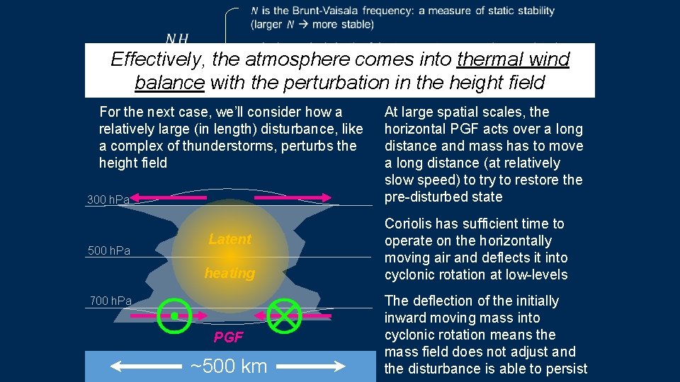
Effectively, the atmosphere comes into thermal wind the height field balance with the perturbation in For the next case, we’ll consider how a relatively large (in length) disturbance, like a complex of thunderstorms, perturbs the height field 300 h. Pa Latent 500 h. Pa heating 700 h. Pa PGF ~500 km At large spatial scales, the horizontal PGF acts over a long distance and mass has to move a long distance (at relatively slow speed) to try to restore the pre-disturbed state Coriolis has sufficient time to operate on the horizontally moving air and deflects it into cyclonic rotation at low-levels The deflection of the initially inward moving mass into cyclonic rotation means the mass field does not adjust and the disturbance is able to persist

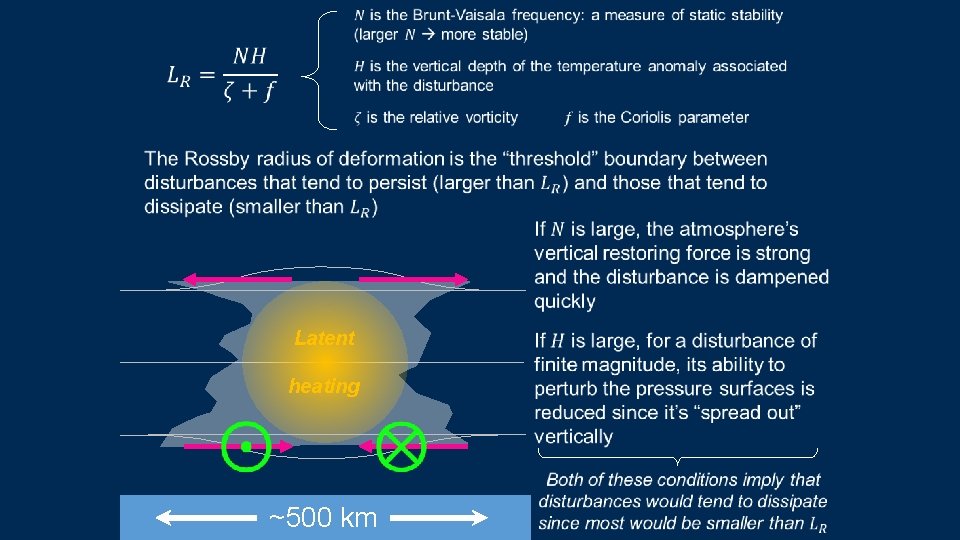
Latent heating ~500 km

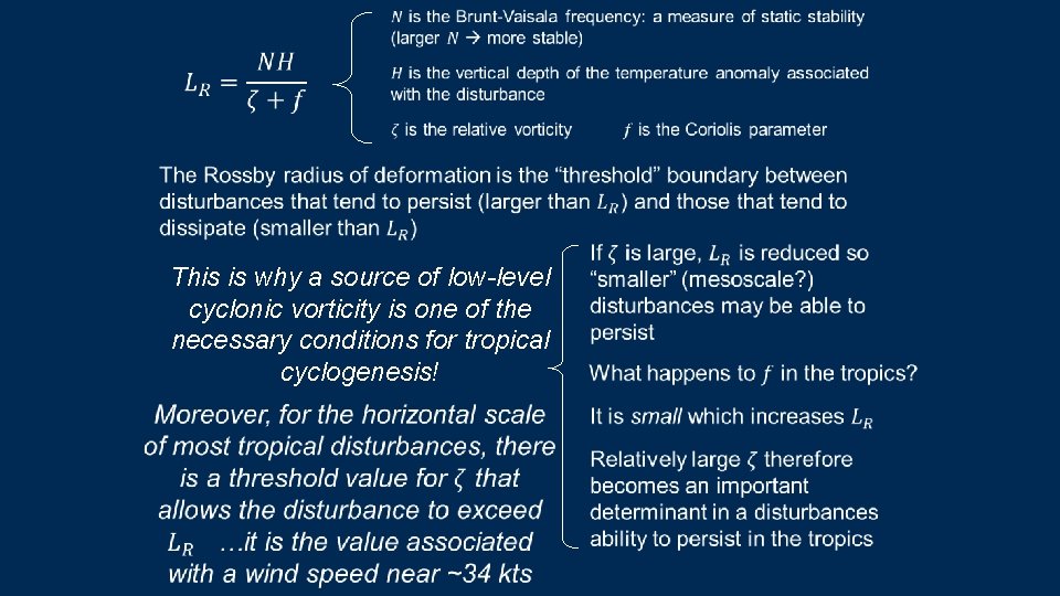
This is why a source of low-level cyclonic vorticity is one of the necessary conditions for tropical Latent cyclogenesis! heating ~500 km

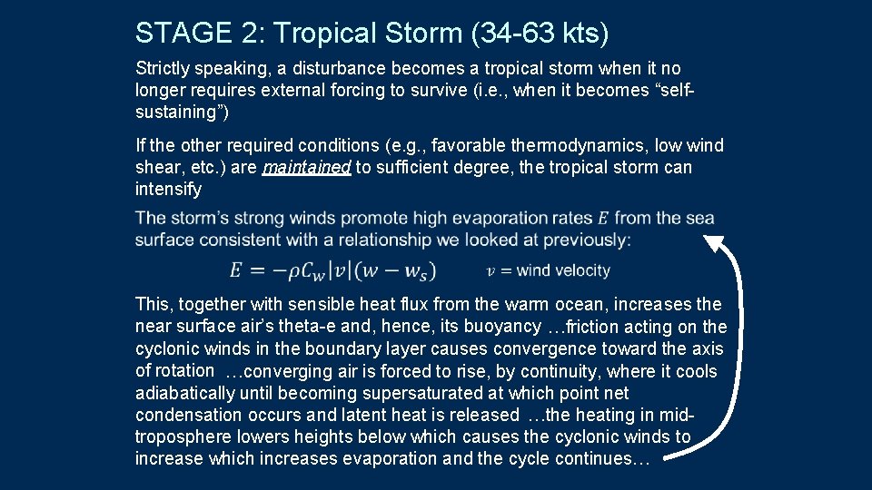
STAGE 2: Tropical Storm (34 -63 kts) Strictly speaking, a disturbance becomes a tropical storm when it no longer requires external forcing to survive (i. e. , when it becomes “selfsustaining”) If the other required conditions (e. g. , favorable thermodynamics, low wind shear, etc. ) are maintained to sufficient degree, the tropical storm can intensify This, together with sensible heat flux from the warm ocean, increases the near surface air’s theta-e and, hence, its buoyancy …friction acting on the cyclonic winds in the boundary layer causes convergence toward the axis of rotation …converging air is forced to rise, by continuity, where it cools adiabatically until becoming supersaturated at which point net condensation occurs and latent heat is released …the heating in midtroposphere lowers heights below which causes the cyclonic winds to increase which increases evaporation and the cycle continues…

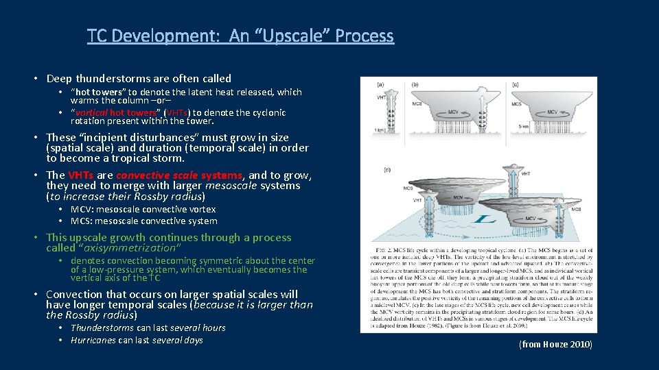
TC Development: An “Upscale” Process • Deep thunderstorms are often called • “hot towers” to denote the latent heat released, which warms the column –or– • “vortical hot towers” (VHTs) to denote the cyclonic rotation present within the tower. • These “incipient disturbances” must grow in size (spatial scale) and duration (temporal scale) in order to become a tropical storm. • The VHTs are convective scale systems, and to grow, they need to merge with larger mesoscale systems (to increase their Rossby radius) • MCV: mesoscale convective vortex • MCS: mesoscale convective system • This upscale growth continues through a process called “axisymmetrization” • denotes convection becoming symmetric about the center of a low-pressure system, which eventually becomes the vertical axis of the TC • Convection that occurs on larger spatial scales will have longer temporal scales (because it is larger than the Rossby radius) • Thunderstorms can last several hours • Hurricanes can last several days (from Houze 2010)

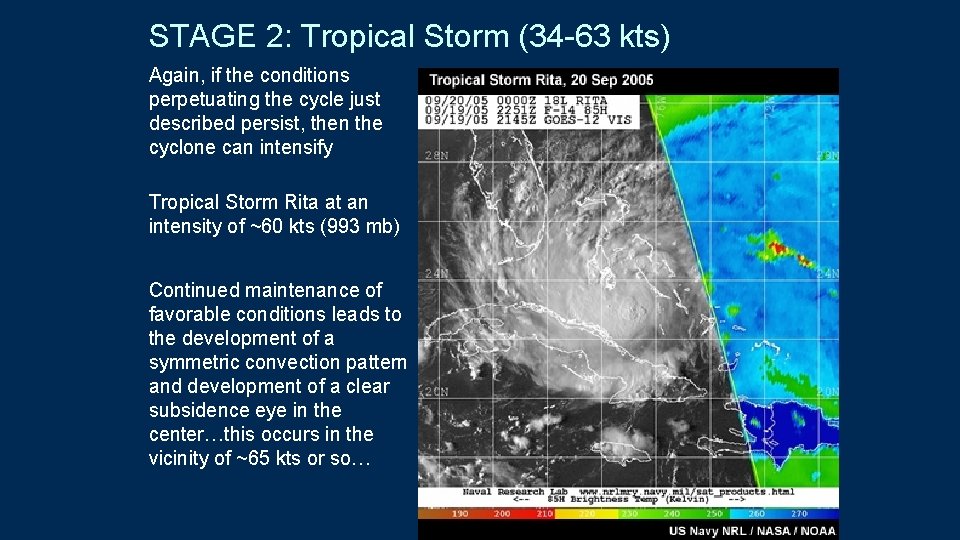
STAGE 2: Tropical Storm (34 -63 kts) Again, if the conditions perpetuating the cycle just described persist, then the cyclone can intensify Tropical Storm Rita at an intensity of ~60 kts (993 mb) Continued maintenance of favorable conditions leads to the development of a symmetric convection pattern and development of a clear subsidence eye in the center…this occurs in the vicinity of ~65 kts or so…

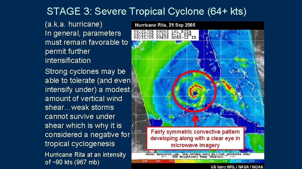
STAGE 3: Severe Tropical Cyclone (64+ kts) (a. k. a. hurricane) In general, parameters must remain favorable to permit further intensification Strong cyclones may be able to tolerate (and even intensify under) a modest amount of vertical wind shear…weak storms cannot survive under shear which is why it is considered a negative for tropical cyclogenesis Hurricane Rita at an intensity of ~90 kts (967 mb) Fairly symmetric convective pattern developing along with a clear eye in microwave imagery

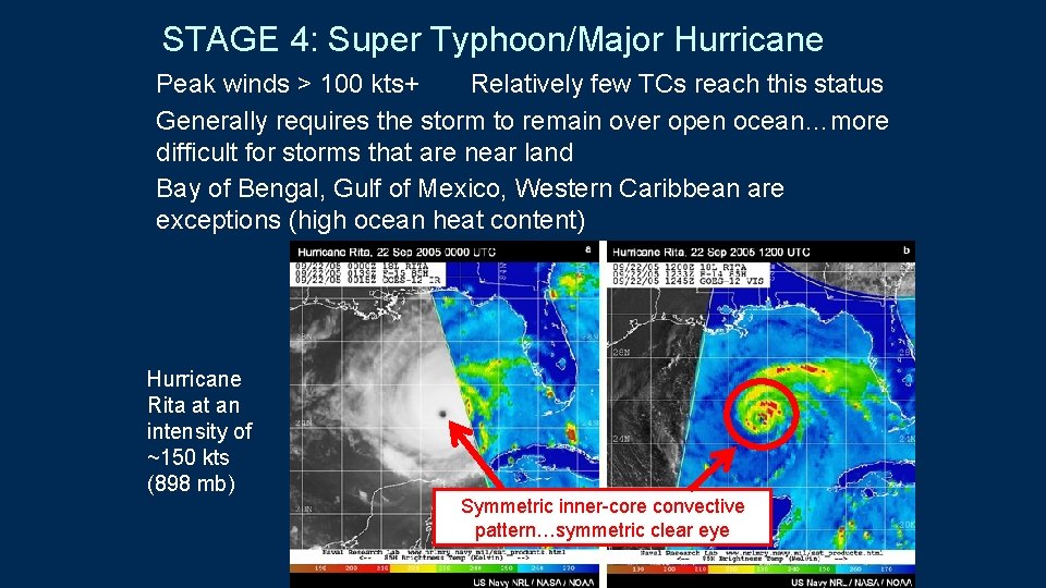
STAGE 4: Super Typhoon/Major Hurricane Peak winds > 100 kts+ Relatively few TCs reach this status Generally requires the storm to remain over open ocean…more difficult for storms that are near land Bay of Bengal, Gulf of Mexico, Western Caribbean are exceptions (high ocean heat content) Hurricane Rita at an intensity of ~150 kts (898 mb) Symmetric inner-core convective pattern…symmetric clear eye

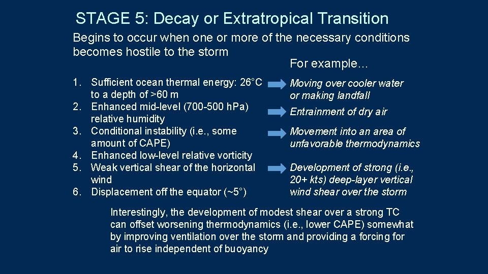
STAGE 5: Decay or Extratropical Transition Begins to occur when one or more of the necessary conditions becomes hostile to the storm For example… 1. Sufficient ocean thermal energy: 26°C to a depth of >60 m 2. Enhanced mid-level (700 -500 h. Pa) relative humidity 3. Conditional instability (i. e. , some amount of CAPE) 4. Enhanced low-level relative vorticity 5. Weak vertical shear of the horizontal wind 6. Displacement off the equator (~5°) Moving over cooler water or making landfall Entrainment of dry air Movement into an area of unfavorable thermodynamics Development of strong (i. e. , 20+ kts) deep-layer vertical wind shear over the storm Interestingly, the development of modest shear over a strong TC can offset worsening thermodynamics (i. e. , lower CAPE) somewhat by improving ventilation over the storm and providing a forcing for air to rise independent of buoyancy

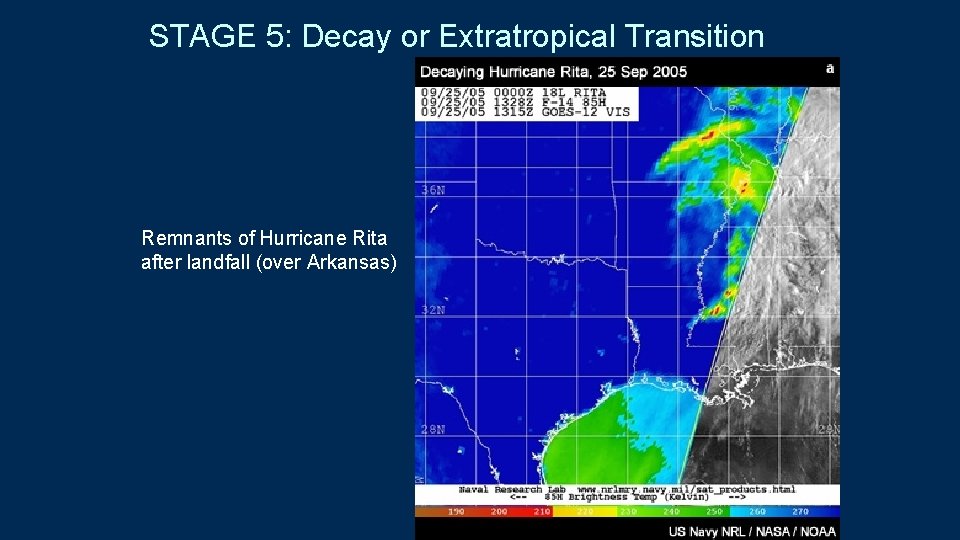
STAGE 5: Decay or Extratropical Transition Remnants of Hurricane Rita after landfall (over Arkansas)

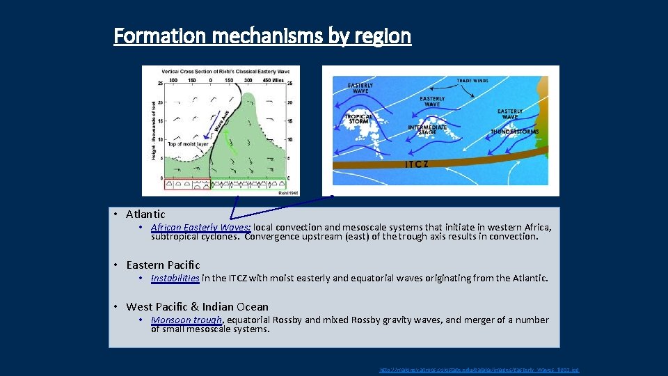
Formation mechanisms by region • Atlantic • African Easterly Waves: local convection and mesoscale systems that initiate in western Africa, subtropical cyclones. Convergence upstream (east) of the trough axis results in convection. • Eastern Pacific • Instabilities in the ITCZ with moist easterly and equatorial waves originating from the Atlantic. • West Pacific & Indian Ocean • Monsoon trough, equatorial Rossby and mixed Rossby gravity waves, and merger of a number of small mesoscale systems. http: //maloney. atmos. colostate. edu/galaka/images/Easterly_Waves_fig 02. jpg

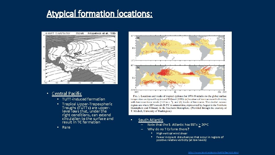
Atypical formation locations: • Central Pacific • TUTT-induced formation • Tropical Upper-Tropospheric Troughs (TUTTs) are upperlevel lows that, under the right conditions, can extend circulation to the surface and result in TC formation • Rare • South Atlantic – – Note that the S. Atlantic has SSTs > 26 o. C Why do no TCs form there? • • High vertical wind shear Fewer incipient disturbances that occur in regions of positive relative vorticity (at low levels) http: //www. aoml. noaa. gov/hrd/tcfaq/A 10. html

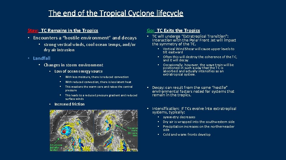
The end of the Tropical Cyclone lifecycle Stay: TC Remains in the Tropics • Encounters a “hostile environment” and decays • strong vertical winds, cool ocean temps, and/or dry air intrusion • Landfall • Changes in storm environment • Loss of ocean energy source • • • With less moisture, there is reduced convection • This leads to a reduced pressure gradient and reduced surface winds Go: TC Exits the Tropics • TC will undergo “Extratropical Transition”: Interaction with the Polar Front Jet will impact the symmetry of the TC. • Vertical Wind Shear will cause upper levels to tilt eastward • Often this will destroy the coherence of the TC, and it will decay. • Occasionally, however, the wave train will be positioned in such a way that the TC is absorbed and actually intensifies as an extratropical system. With reduced convection, there is less latent heat This weakens the warm core and raises the central pressure • Increased friction • Decay: can result from the same “hostile” environmental factors noted for systems that remain in the tropics. • Intensification: If TCs evolve into extratropical systems, typically: • symmetry decreases • Dry air is wrapped into the southwestern side • Precipitation increases on the northerneaster side • Cold and warm fronts develop