Tropical Cyclones Tornadoes Formation of Tropical Cyclones n


- Slides: 40

Tropical Cyclones & Tornadoes

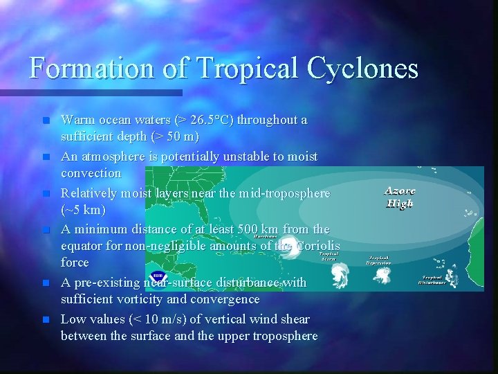
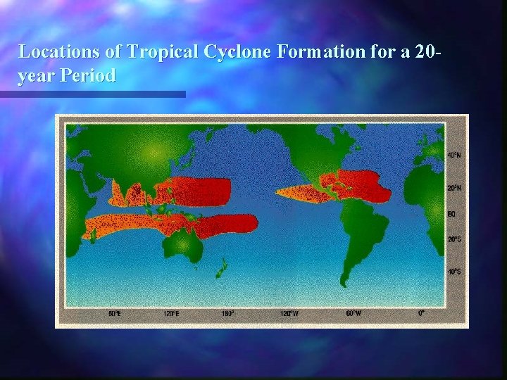
Formation of Tropical Cyclones n n n Warm ocean waters (> 26. 5°C) throughout a sufficient depth (> 50 m) An atmosphere is potentially unstable to moist convection Relatively moist layers near the mid-troposphere (~5 km) A minimum distance of at least 500 km from the equator for non-negligible amounts of the Coriolis force A pre-existing near-surface disturbance with sufficient vorticity and convergence Low values (< 10 m/s) of vertical wind shear between the surface and the upper troposphere

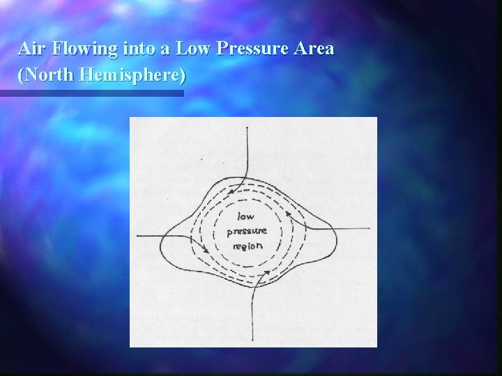
Air Flowing into a Low Pressure Area (North Hemisphere)

Locations of Tropical Cyclone Formation for a 20 year Period

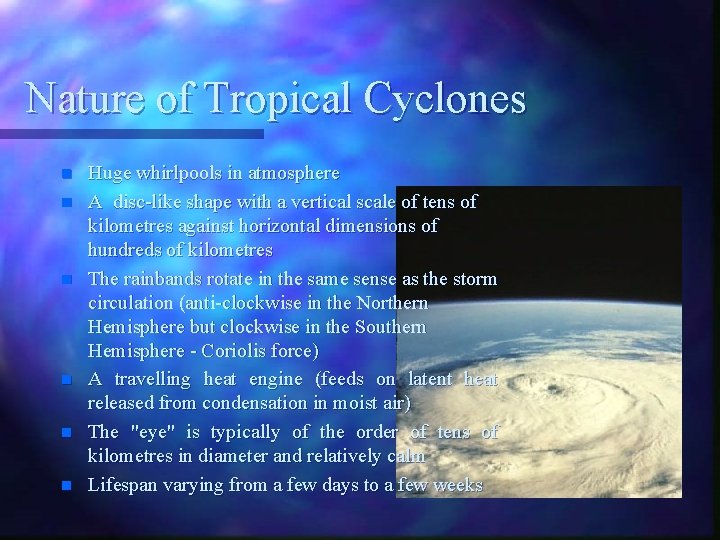
Nature of Tropical Cyclones n n n Huge whirlpools in atmosphere A disc-like shape with a vertical scale of tens of kilometres against horizontal dimensions of hundreds of kilometres The rainbands rotate in the same sense as the storm circulation (anti-clockwise in the Northern Hemisphere but clockwise in the Southern Hemisphere - Coriolis force) A travelling heat engine (feeds on latent heat released from condensation in moist air) The "eye" is typically of the order of tens of kilometres in diameter and relatively calm Lifespan varying from a few days to a few weeks

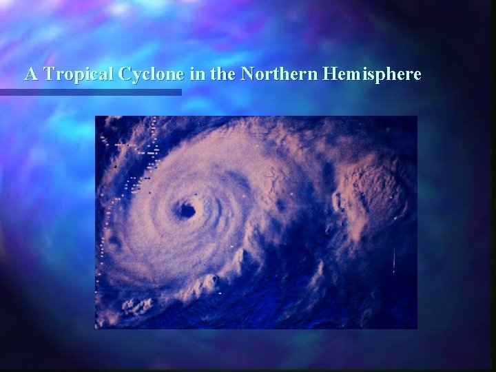
A Tropical Cyclone in the Northern Hemisphere

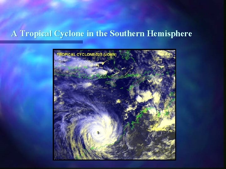
A Tropical Cyclone in the Southern Hemisphere

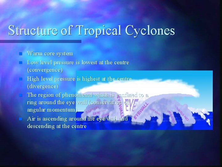
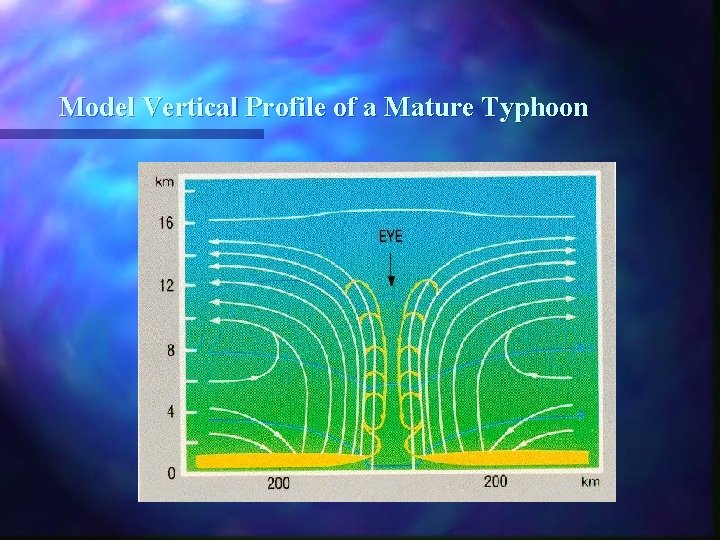
Structure of Tropical Cyclones n n n Warm core system Low level pressure is lowest at the centre (convergence) High level pressure is highest at the centre (divergence) The region of phenomenal winds is confined to a ring around the eye wall (conservation of angular momentum) Air is ascending around the eye wall and descending at the centre

Model Vertical Profile of a Mature Typhoon

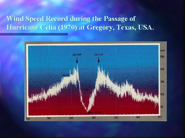
Wind Speed Record during the Passage of Hurricane Celia (1970) at Gregory, Texas, USA.

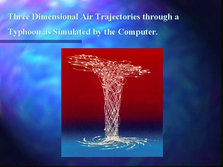
Three Dimensional Air Trajectories through a Typhoon as Simulated by the Computer.


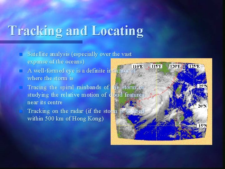
Tracking and Locating n n Satellite analysis (especially over the vast expanse of the oceans) A well-formed eye is a definite indicator of where the storm is Tracing the spiral rainbands of the storm or studying the relative motion of cloud features near its centre Tracking on the radar (if the storm is located within 500 km of Hong Kong)

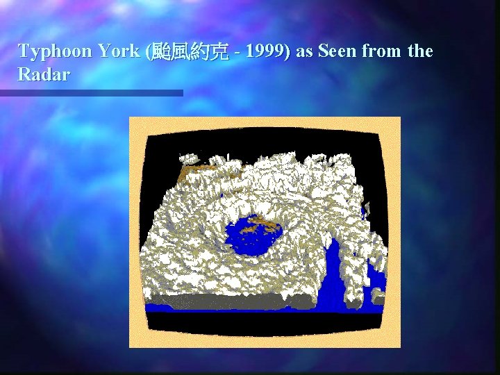
Typhoon York (颱風約克 - 1999) as Seen from the Radar

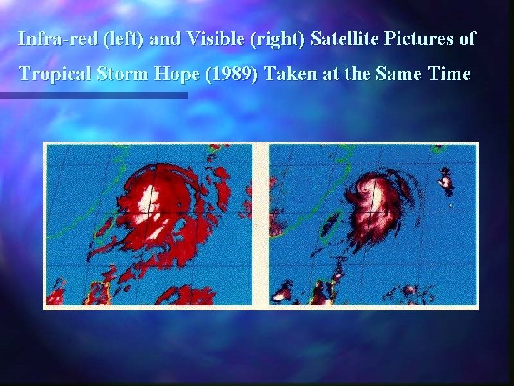
Infra-red (left) and Visible (right) Satellite Pictures of Tropical Storm Hope (1989) Taken at the Same Time

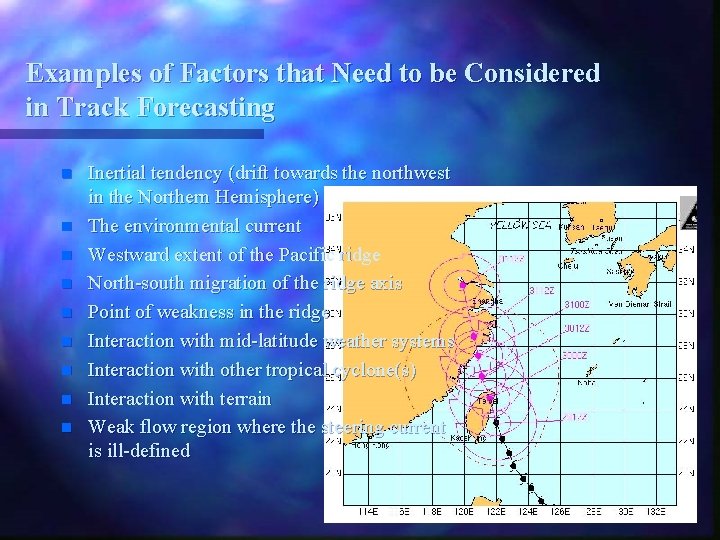
Examples of Factors that Need to be Considered in Track Forecasting n n n n n Inertial tendency (drift towards the northwest in the Northern Hemisphere) The environmental current Westward extent of the Pacific ridge North-south migration of the ridge axis Point of weakness in the ridge Interaction with mid-latitude weather systems Interaction with other tropical cyclone(s) Interaction with terrain Weak flow region where the steering current is ill-defined

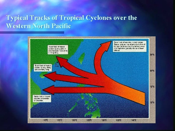
Typical Tracks of Tropical Cyclones over the Western North Pacific

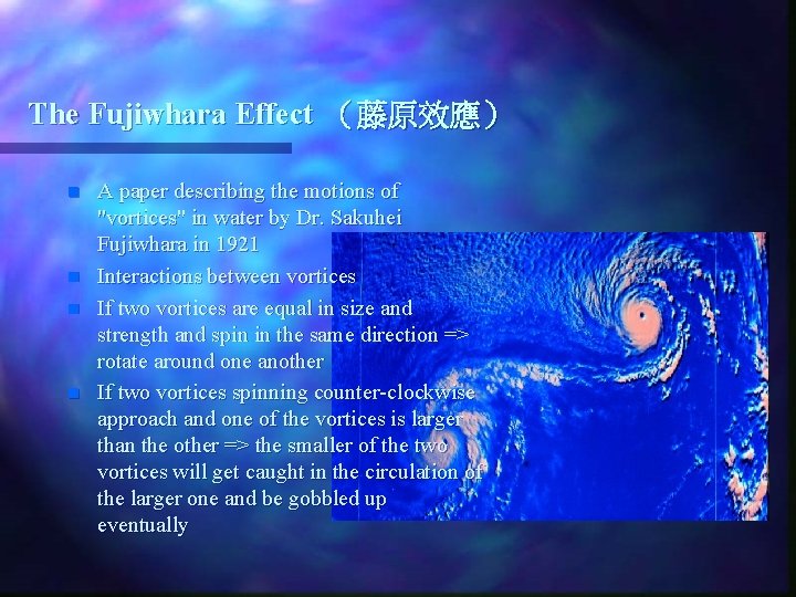
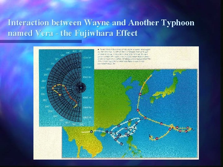
The Fujiwhara Effect (藤原效應) n n A paper describing the motions of "vortices" in water by Dr. Sakuhei Fujiwhara in 1921 Interactions between vortices If two vortices are equal in size and strength and spin in the same direction => rotate around one another If two vortices spinning counter-clockwise approach and one of the vortices is larger than the other => the smaller of the two vortices will get caught in the circulation of the larger one and be gobbled up eventually

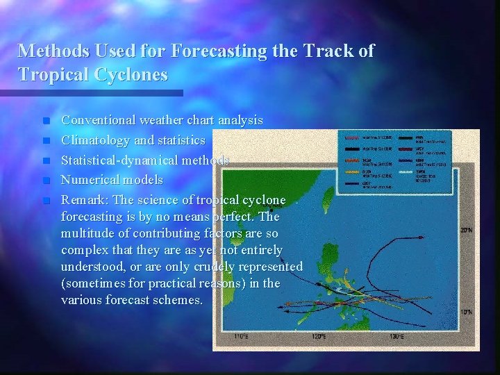
Methods Used for Forecasting the Track of Tropical Cyclones n n n Conventional weather chart analysis Climatology and statistics Statistical-dynamical methods Numerical models Remark: The science of tropical cyclone forecasting is by no means perfect. The multitude of contributing factors are so complex that they are as yet not entirely understood, or are only crudely represented (sometimes for practical reasons) in the various forecast schemes.

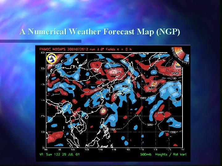
A Numerical Weather Forecast Map (NGP)

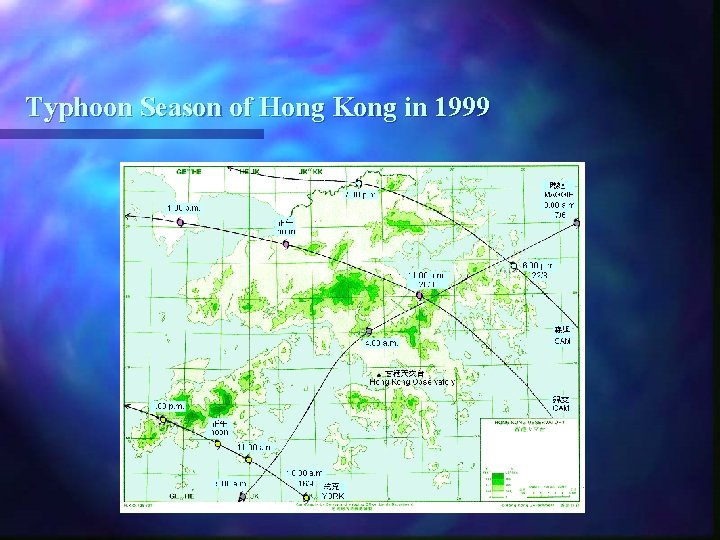
Typhoon Season of Hong Kong in 1999

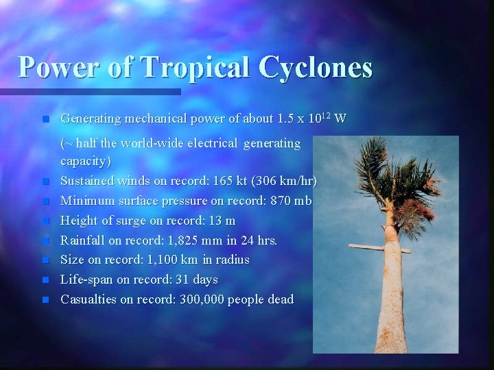
Power of Tropical Cyclones n n n n Generating mechanical power of about 1. 5 x 10¹² W (~ half the world-wide electrical generating capacity) Sustained winds on record: 165 kt (306 km/hr) Minimum surface pressure on record: 870 mb Height of surge on record: 13 m Rainfall on record: 1, 825 mm in 24 hrs. Size on record: 1, 100 km in radius Life-span on record: 31 days Casualties on record: 300, 000 people dead

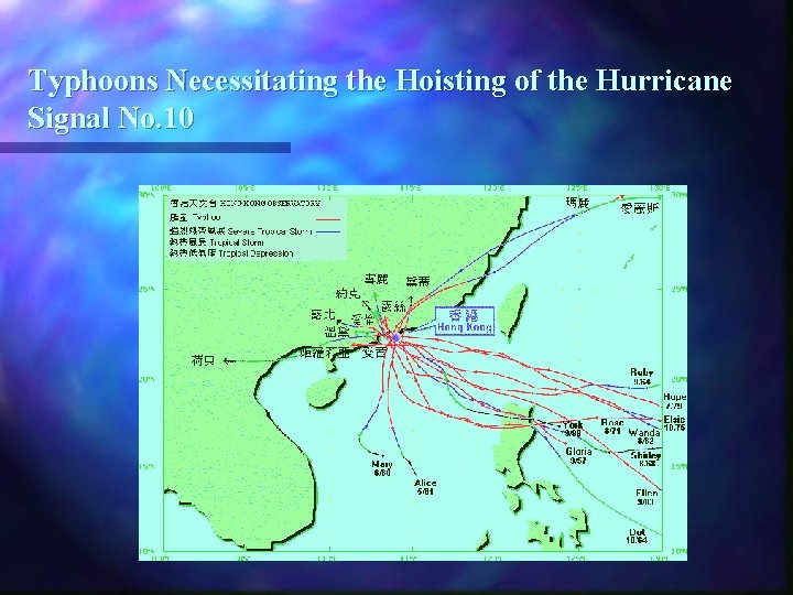
Typhoons Necessitating the Hoisting of the Hurricane Signal No. 10

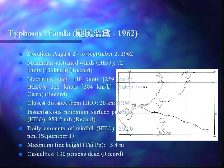
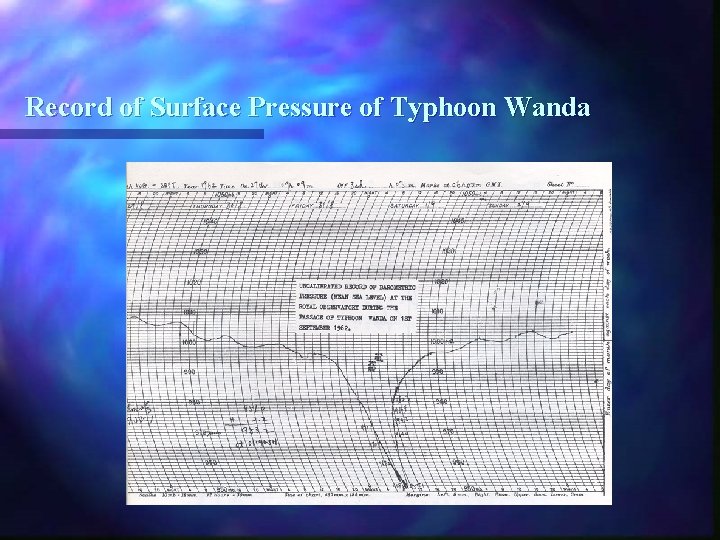
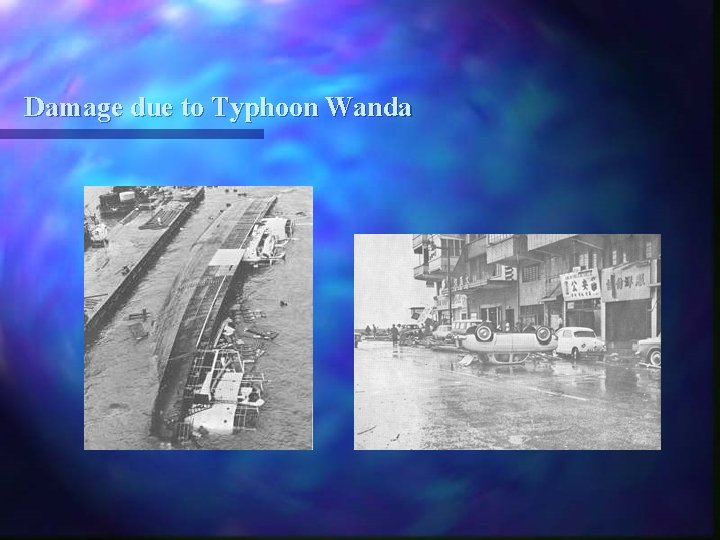
Typhoon Wanda (颱風溫黛 - 1962) n n n n Duration: August 27 to September 2, 1962 Maximum sustained winds (HKO): 72 knots [133 km/h] (Record) Maximum gust: 140 knots [259 km/h] (HKO); 153 knots [284 km/h] (Tate's Cairn) (Record) Closest distance from HKO: 20 km SSW Instantaneous minimum surface pressure (HKO): 953. 2 mb (Record) Daily amounts of rainfall (HKO): 203. 0 mm (September 1) Maximum tide height (Tai Po): 5. 4 m Casualties: 130 persons dead (Record)

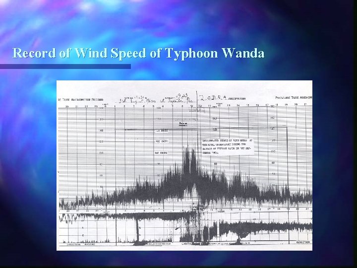
Record of Wind Speed of Typhoon Wanda

Record of Surface Pressure of Typhoon Wanda

Damage due to Typhoon Wanda

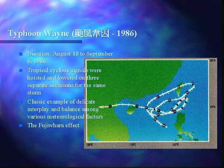
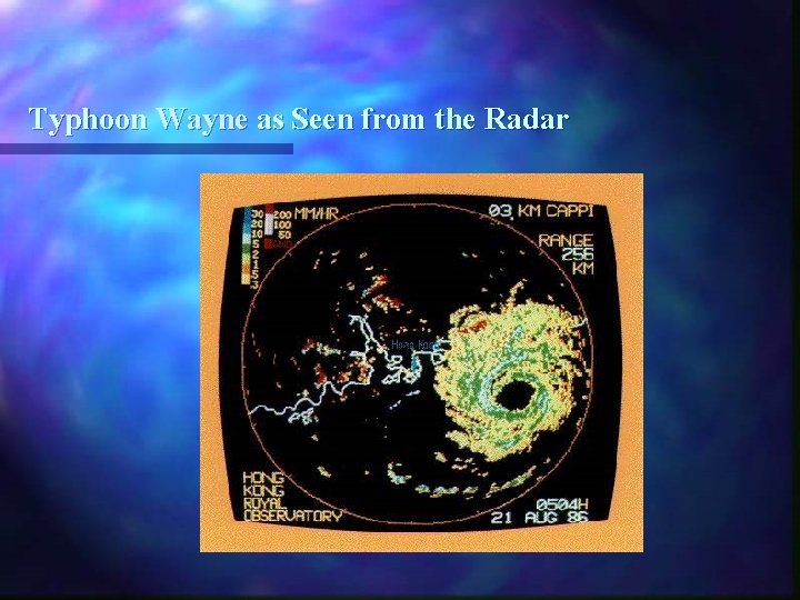
Typhoon Wayne (颱風韋因 - 1986) n n Duration: August 18 to September 6, 1986 Tropical cyclone signals were hoisted and lowered on three separate occasions for the same storm Classic example of delicate interplay and balance among various meteorological factors The Fujiwhara effect

Typhoon Wayne as Seen from the Radar

Interaction between Wayne and Another Typhoon named Vera - the Fujiwhara Effect

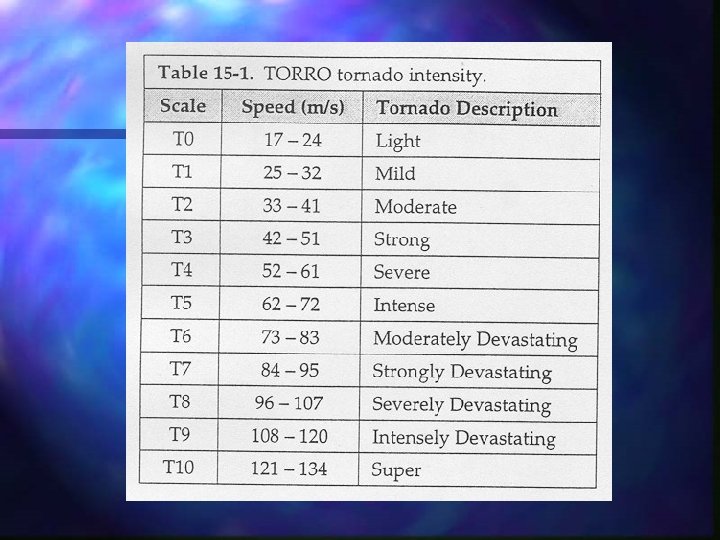
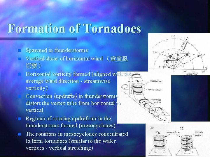
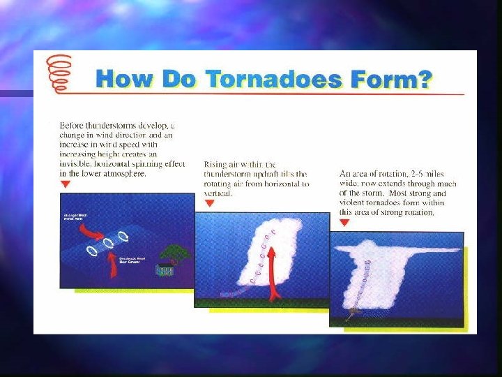
Formation of Tornadoes n n n Spawned in thunderstorms Vertical shear of horizontal wind (垂直風 切變) Horizontal vorticity formed (aligned with the average wind direction - streamwise vorticity) Convection (updrafts) in thunderstorms distort the vortex tube from horizontal to vertical Regions of rotating updraft air in the thunderstorms formed (mesocyclones) The rotations in mesocyclones concentrated to form tornadoes (similar to the water vortices - vertical stretching)


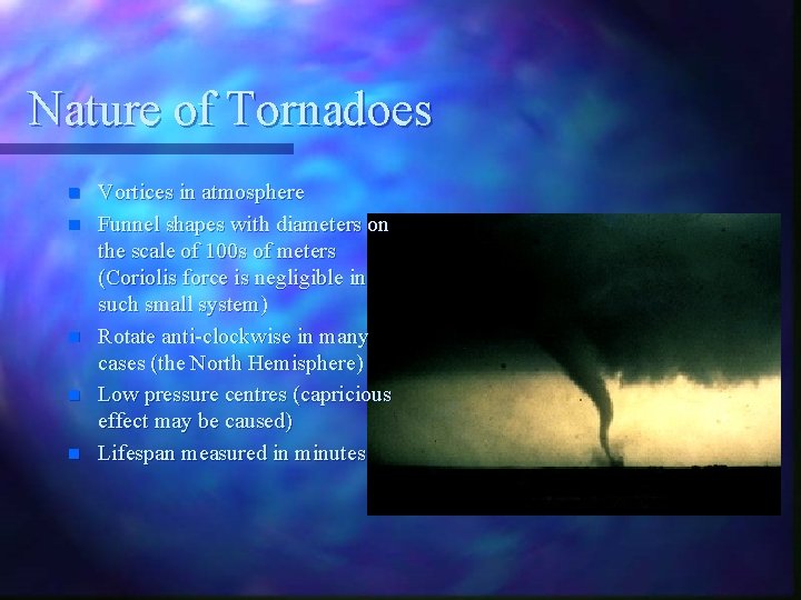
Nature of Tornadoes n n n Vortices in atmosphere Funnel shapes with diameters on the scale of 100 s of meters (Coriolis force is negligible in such small system) Rotate anti-clockwise in many cases (the North Hemisphere) Low pressure centres (capricious effect may be caused) Lifespan measured in minutes

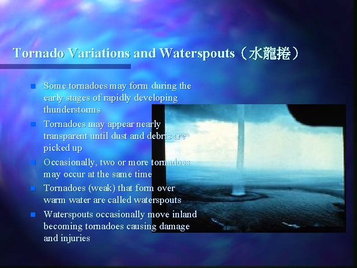
Tornado Variations and Waterspouts(水龍捲) n n n Some tornadoes may form during the early stages of rapidly developing thunderstorms Tornadoes may appear nearly transparent until dust and debris are picked up Occasionally, two or more tornadoes may occur at the same time Tornadoes (weak) that form over warm water are called waterspouts Waterspouts occasionally move inland becoming tornadoes causing damage and injuries

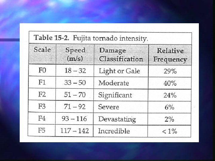
Tornadoes Spawned by Tropical Cyclones (TC Tornadoes) n n n n Spawn when certain instability and vertical shear criteria are met The smaller and shallower storm cells => weaker tornadoes (no F 5 rated TC tornadoes in the past 50 years of reliable data) Almost all tropical cyclones making landfall in the United States spawn at least one tornado The right-front quadrant of a tropical cyclone (relative to TC motion) is strongly favored for tornado formation (the Northern Hemisphere) Tornadoes may be spawned up to three days after landfall of tropical cyclones Hurricane Beulah spawned a reported 141 tornadoes in southeast Texas during the first several days after its landfall in September 1967 TC tornadoes are especially difficult to deal with because the unusually small storm cells that may be overlooked

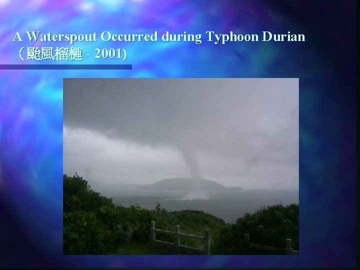
A Waterspout Occurred during Typhoon Durian (颱風榴槤 - 2001)

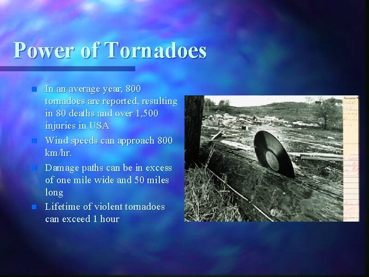
Power of Tornadoes n n In an average year, 800 tornadoes are reported, resulting in 80 deaths and over 1, 500 injuries in USA Wind speeds can approach 800 km/hr. Damage paths can be in excess of one mile wide and 50 miles long Lifetime of violent tornadoes can exceed 1 hour
