
Weather State Objectives 4 c 4 d 4
Weather State Objectives 4. c, 4. d, 4. h.
Discussion What are some ways in which weather affects your everyday life?

What is Weather? �Atmosphere layer of gases surrounding Earth. �Weather is the conditions of the atmosphere. �Temperature �Air Pressure �Humidity �Wind �Clouds �Precipitation �Main cause for changes in weather is energy from the sun.
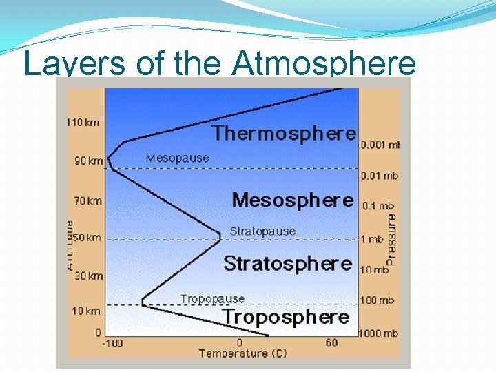
Layers of the Atmosphere
Temperature �Indicates the amount of heat (kinetic energy) in the atmosphere. �Represents the speed of the molecules. �The higher the temperature, the faster the air molecules are moving. �Warmer air rises and cooler air sinks which causes convection currents. �Measured with a thermometer. �Standard unit is Fahrenheit (°F) �SI Unit is Celsius (°C)
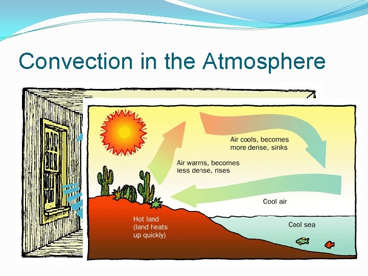
Convection in the Atmosphere
Air Pressure/Barometric Pressure �Air has weight because it has mass. �Air pressure is a measure of the force of air being exerted on a given area of Earth’s surface. �As temperature increases, pressure decreases. �Cool air is more dense, which causes it to sink (high pressure). �As altitude increases, air pressure decreases.
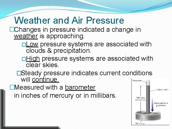
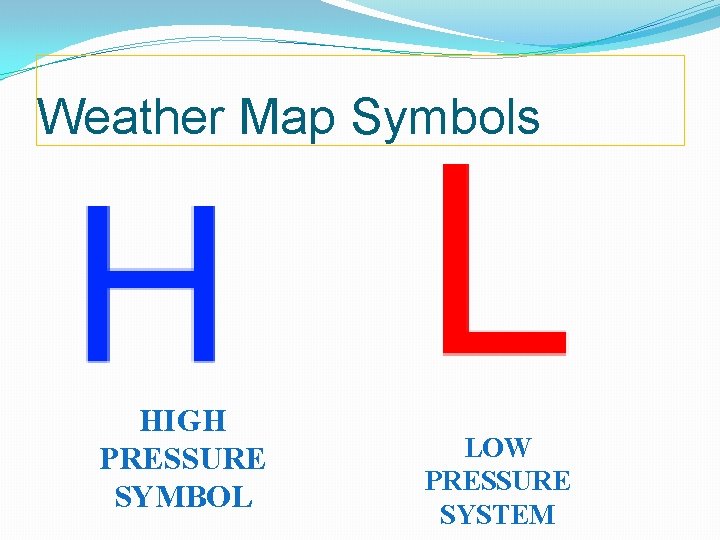
Weather and Air Pressure �Changes in pressure indicated a change in weather is approaching. �Low pressure systems are associated with clouds & precipitation. �High pressure systems are associated with clear skies. �Steady pressure indicates current conditions will continue. �Measured with a barometer in inches of mercury or in millibars.
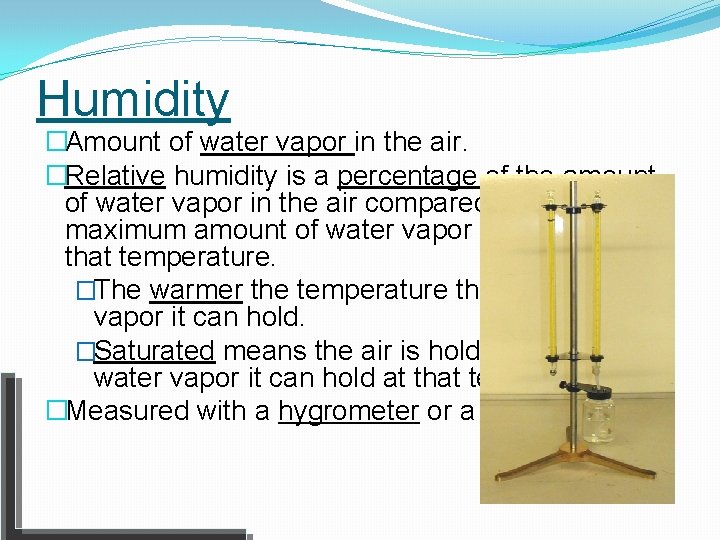
Humidity �Amount of water vapor in the air. �Relative humidity is a percentage of the amount of water vapor in the air compared to the maximum amount of water vapor it can hold at that temperature. �The warmer the temperature the more water vapor it can hold. �Saturated means the air is holding 100% of the water vapor it can hold at that temperature. �Measured with a hygrometer or a psychrometer.
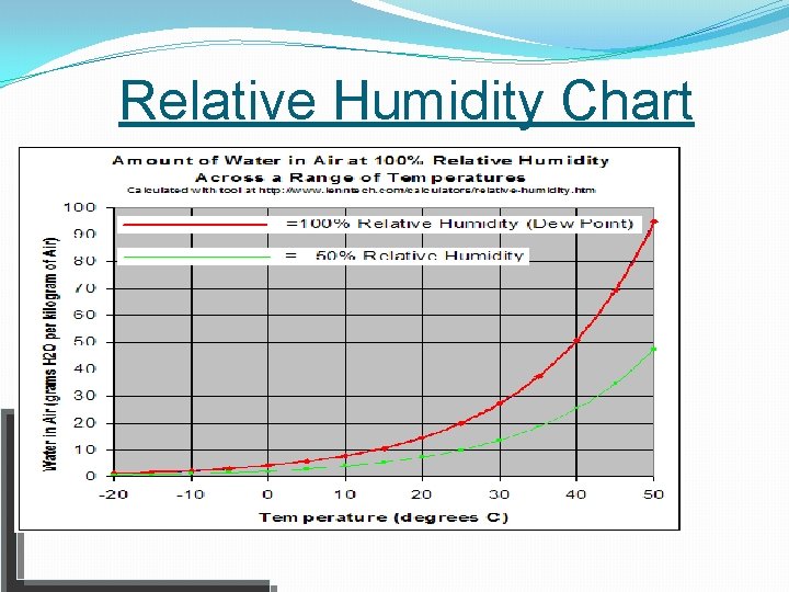
Relative Humidity Chart
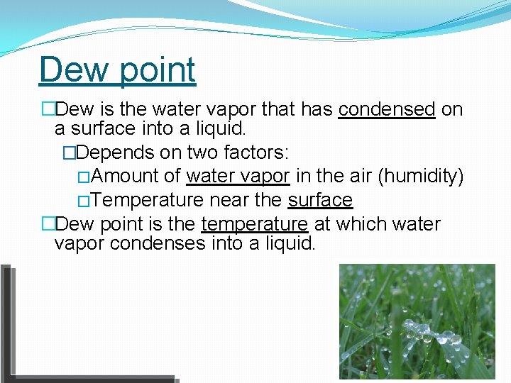
Dew point �Dew is the water vapor that has condensed on a surface into a liquid. �Depends on two factors: �Amount of water vapor in the air (humidity) �Temperature near the surface �Dew point is the temperature at which water vapor condenses into a liquid.
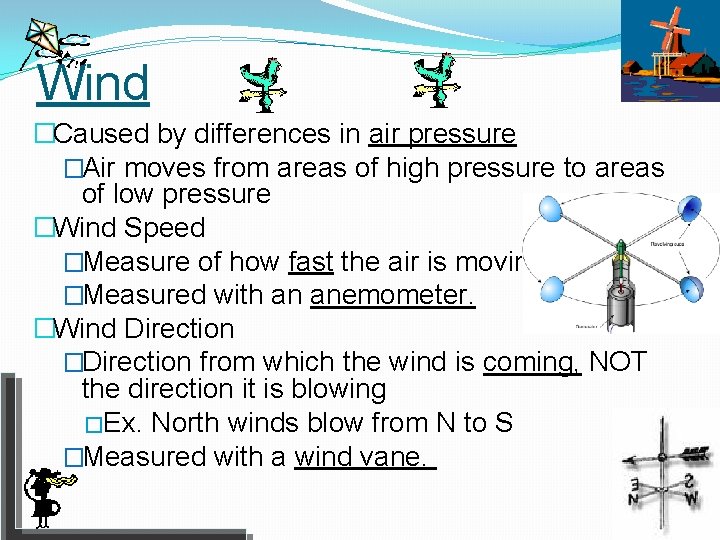
Wind �Caused by differences in air pressure �Air moves from areas of high pressure to areas of low pressure �Wind Speed �Measure of how fast the air is moving. �Measured with an anemometer. �Wind Direction �Direction from which the wind is coming, NOT the direction it is blowing �Ex. North winds blow from N to S �Measured with a wind vane.
Global Wind Patterns �Blow steadily across Earth in paths that are thousands of kilometers long �Steer weather in certain directions (usually west to east in the U. S. ) �Caused by thermal energy from the sun �The sun does not heat the surface evenly causing uneven heating of the atmosphere.
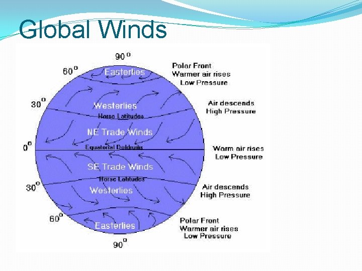
Global Winds
Types of Global Winds �Surface winds at low altitudes: �Trade winds: blow from east to west near the equator. �Westerlies: blow from west to east in the mid-latitudes. �Coriolis Effect: Earth’s rotation causes winds to curve to the right in the Northern Hemisphere and to the left in the Southern Hemisphere.
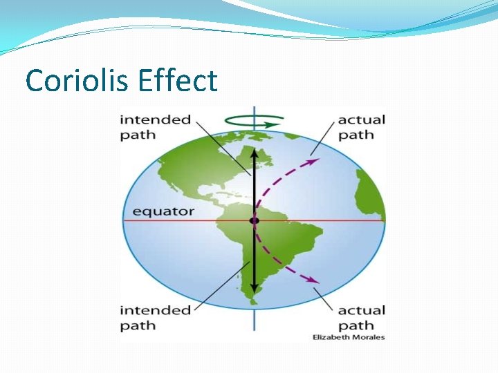
Coriolis Effect
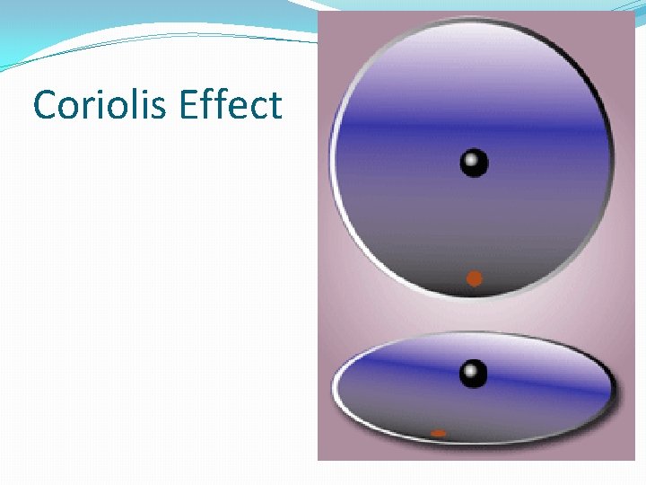
Coriolis Effect
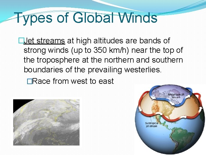
Types of Global Winds �Jet streams at high altitudes are bands of strong winds (up to 350 km/h) near the top of the troposphere at the northern and southern boundaries of the prevailing westerlies. �Race from west to east
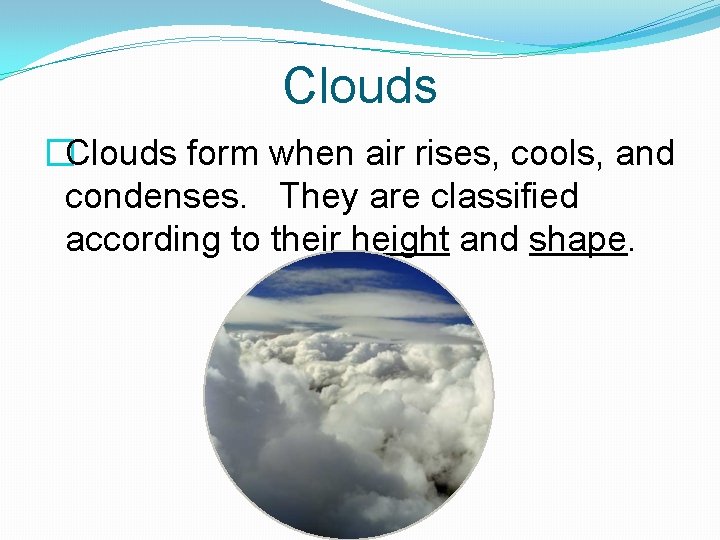
Clouds �Clouds form when air rises, cools, and condenses. They are classified according to their height and shape.
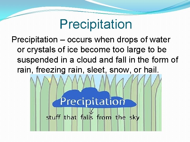
Precipitation – occurs when drops of water or crystals of ice become too large to be suspended in a cloud and fall in the form of rain, freezing rain, sleet, snow, or hail.
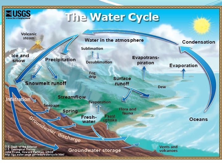
The Water Cycle �Earth’s surface is about 70% water and it exists in all three states. �The water cycle is the constant movement of water on Earth. �The Sun provides the energy for the water cycle.
Parts of the Water Cycle � 1. Evaporation occurs when water changes from a liquid into a gas after gaining heat energy from the Sun. � 2. Transpiration is the evaporation of water from the leaves of plants.
Parts of the Water Cycle � 3. Condensation occurs when water vapor changes into liquid water to form clouds or fog. � 4. Precipitation occurs when water droplets fall to Earth.
What is an Air Mass? �An air mass is a large body of air that develops over a particular region. �It has characteristics of the area over which it develops. �Cold, dry air masses come from Canada and warm, dry air masses develop over Mexico.
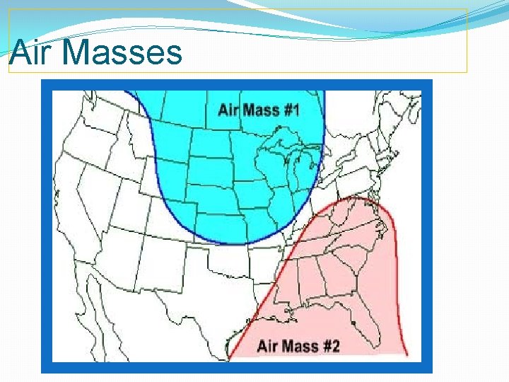
Air Masses
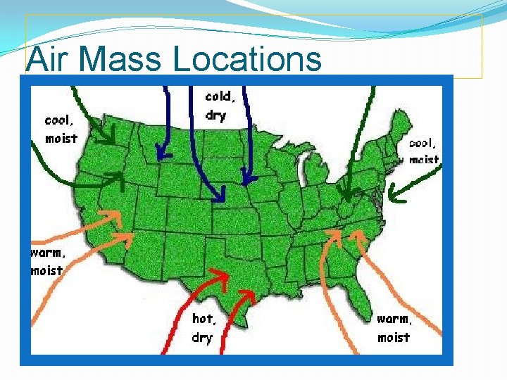
Air Mass Locations
Fronts �A front is a boundary between two air masses. �When two fronts meet, the cold air mass will move under the warm air mass because the cold air is more dense.
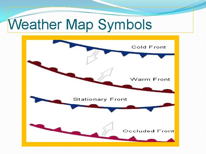
Types of Fronts � 1. A cold front forms when a cold air mass pushes under a warm air mass. Cumulus clouds form and thunderstorms may occur. � 2. A warm front forms when a warm air mass moves up and over a cold air mass. Cirrus and stratus clouds form and light, steady precipitation occurs.
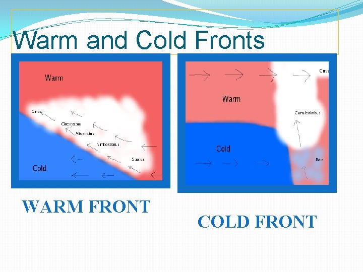
Warm and Cold Fronts WARM FRONT COLD FRONT
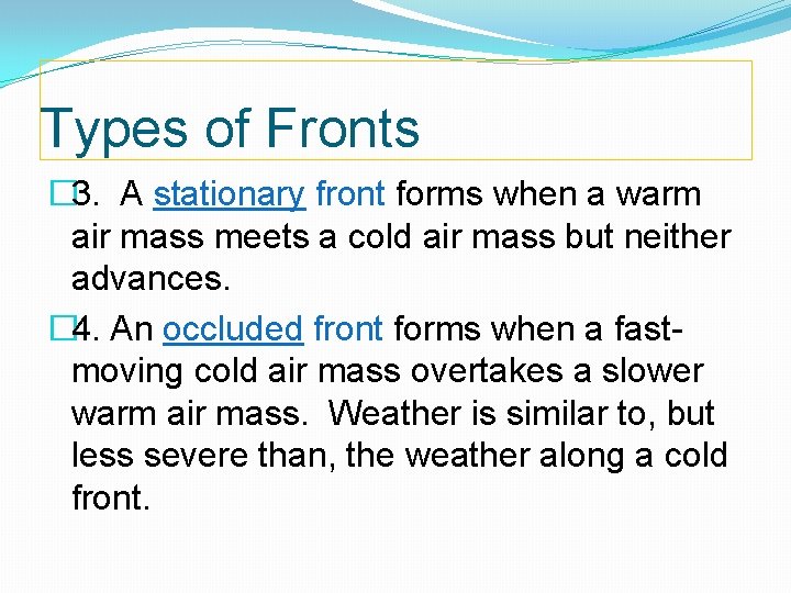
Types of Fronts � 3. A stationary front forms when a warm air mass meets a cold air mass but neither advances. � 4. An occluded front forms when a fastmoving cold air mass overtakes a slower warm air mass. Weather is similar to, but less severe than, the weather along a cold front.
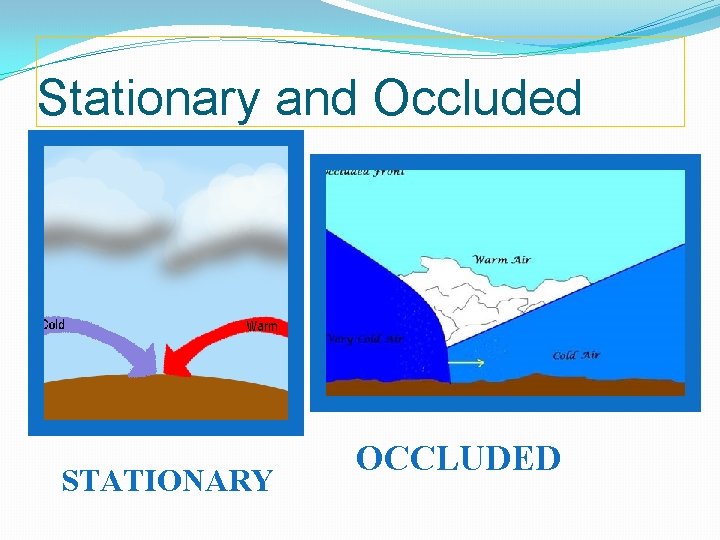
Stationary and Occluded STATIONARY OCCLUDED
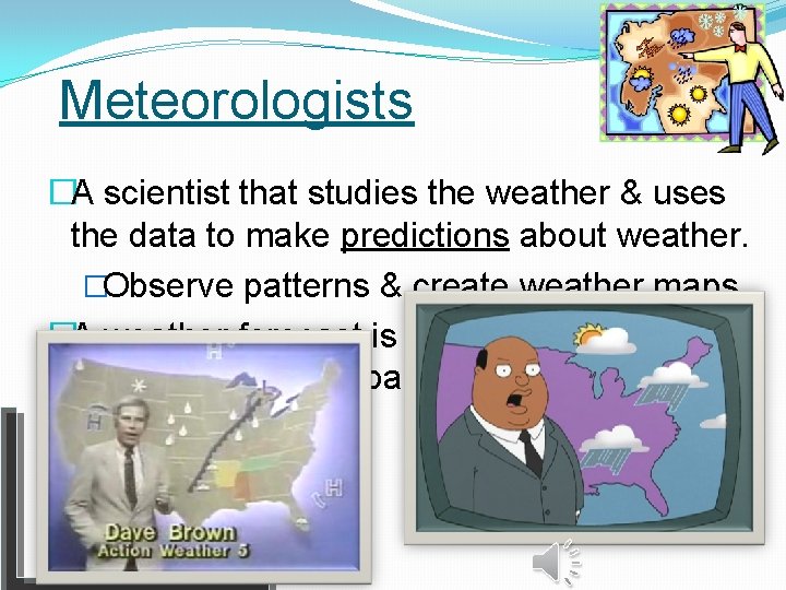
Meteorologists �A scientist that studies the weather & uses the data to make predictions about weather. �Observe patterns & create weather maps �A weather forecast is a prediction of present conditions based on observations and data.
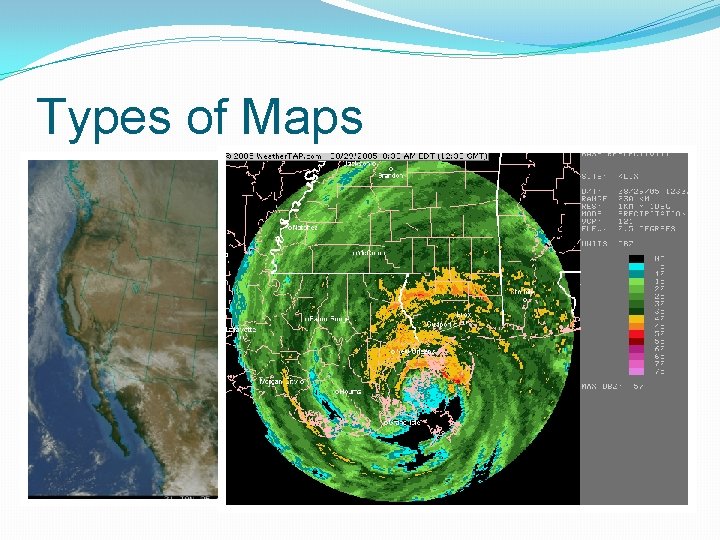
Weather Maps �Satellite map: allow meteorologists to monitor weather on the global scale �Radar Map: uses electromagnetic waves to monitor velocity and altitude.
Types of Maps
Weather Map Symbols
Weather Map Symbols HIGH PRESSURE SYMBOL LOW PRESSURE SYSTEM
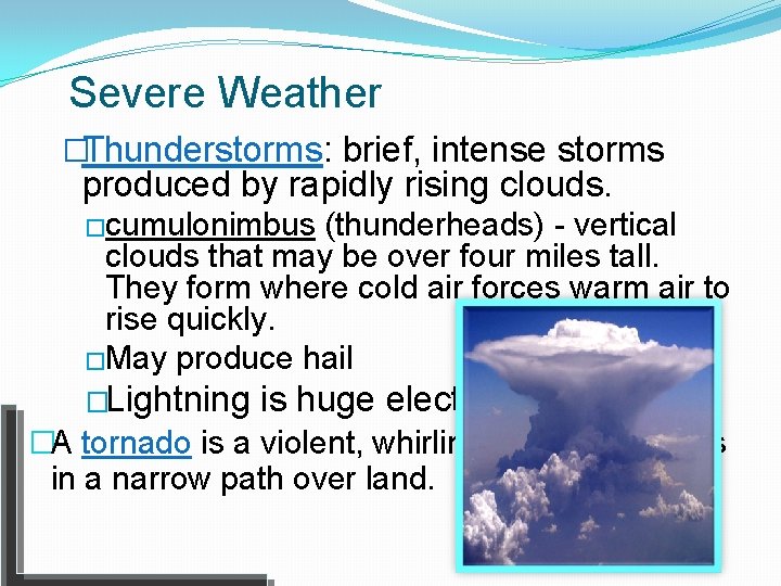
Severe Weather �Thunderstorms: brief, intense storms produced by rapidly rising clouds. �cumulonimbus (thunderheads) - vertical clouds that may be over four miles tall. They form where cold air forces warm air to rise quickly. �May produce hail �Lightning is huge electrical discharges. �A tornado is a violent, whirling wind that moves in a narrow path over land.
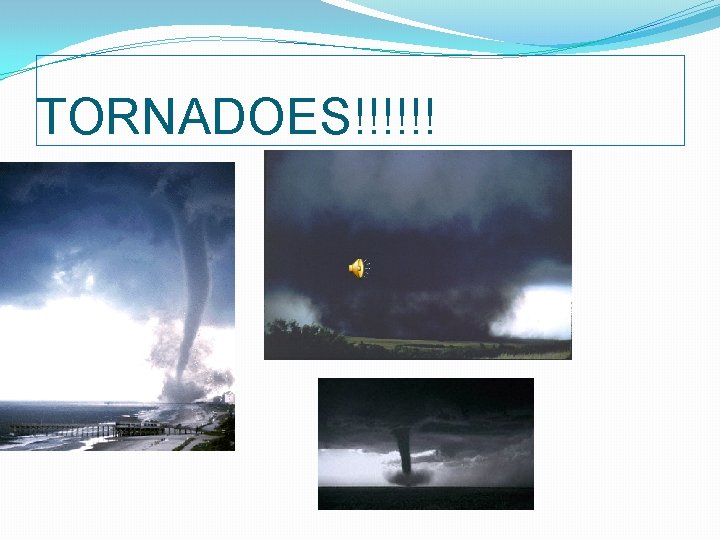
TORNADOES!!!!!!
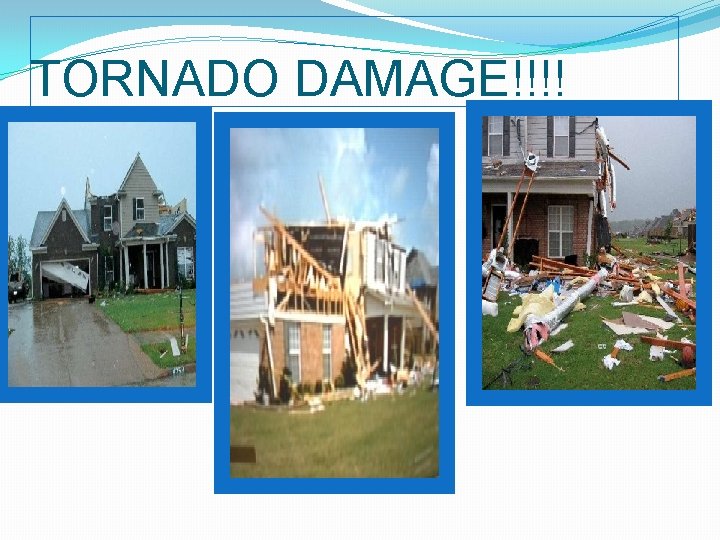
TORNADO DAMAGE!!!!
Watches and Warnings �A watch is issued when conditions are favorable for severe weather to occur. �A warning is issued when severe weather has been sighted. �The National Weather Service monitors weather and issues watches and warnings when appropriate.
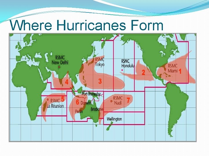
What is a Hurricane? �A hurricane is a low-pressure system that forms over tropical oceans. �Also called typhoons or tropical cyclones. �Named for the Mayan god Hurakan who blew his breath across the water.
Disturbances, Depressions, and Storms �A tropical disturbance is an area of organized convection that originates in the tropics. It has no eye or rotation. �A tropical depression is a cyclone that has a maximum wind speed of 38 mph. �A tropical storm has a wind speed between 39 mph and 73 mph.
Conditions Required for Hurricane Formation �Warm ocean waters of at least 80° F. �High humidity in the troposphere. �An atmosphere that quickly cools with altitude. �A distance of at least 300 miles from the equator. �A surface system with convergent winds. �Low wind shear. Wind shear is the rate of wind speed or direction change with altitude.
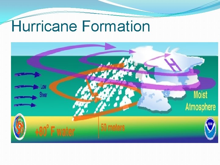
Hurricane Formation
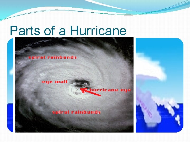
Parts of a Hurricane �The eye is the circular area of calm, relatively light winds at the center of a hurricane. It is the area of lowest pressure. �The eyewall is the ring surrounding the eye that contains the highest wind speeds. �Rainbands are bands of heavy rain that spiral outward from the storm’s center.
Parts of a Hurricane
Where Hurricanes Form
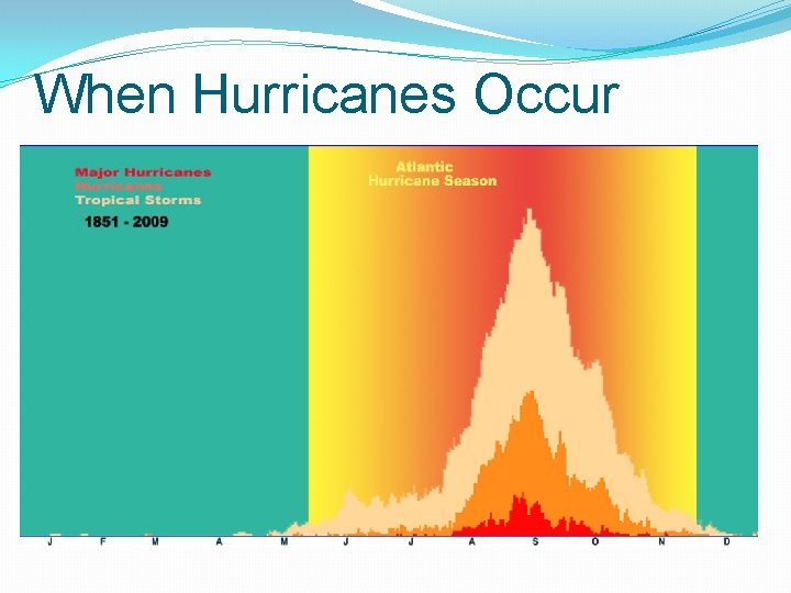
When Hurricanes Occur �The Atlantic hurricane season lasts from June 1 - November 30. �These dates include about 97% of hurricanes. �Most occur from August to October.
When Hurricanes Occur
Tracking Hurricanes �Hurricanes can be tracked using satellites, radar (near land), and hurricane hunters. �Hurricane Hunters is the nickname of the 53 rd Weather Reconnaissance Squadron of the Air Force Reserve. They are based in Biloxi, Mississippi. �Gathers data including wind direction and speed, pressure, temperature, and humidity from the planes altitude to the water’s surface.
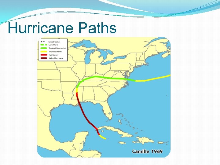
Paths of Hurricanes �Depends on where the hurricane forms. �Trade winds cause hurricanes to move west near the equator. �As hurricanes move north, they begin to turn back to the east after the 30 N latitude line.
Hurricane Paths
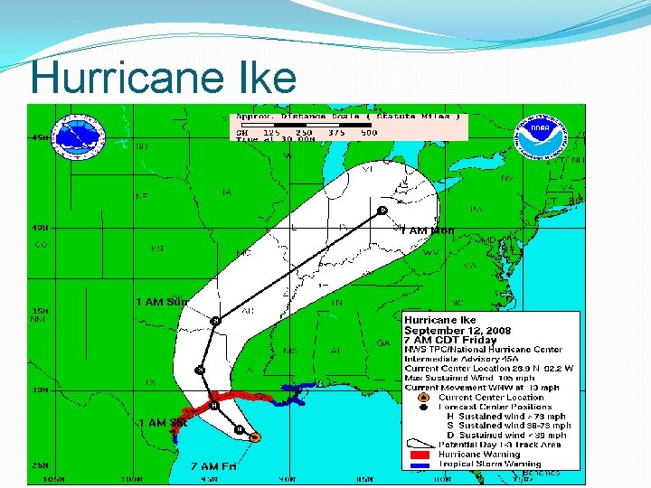
Hurricane Ike
Effects of Hurricanes �High winds �Heavy rain and flooding �Tornadoes after landfall �Storm surge is the rising wall of water that comes ashore with a hurricane. It causes the most damage and is responsible for 90% of deaths.
Storm Surge �Storm Surge Animation
Rating Hurricanes �The Saffir-Simpson scale is uses wind speed to rate the strength of hurricanes. �Category 1 - 74 -95 mph Minimal �Category 2 - 96 -110 mph Moderate �Category 3 - 111 -130 mph Extensive �Category 4 - 131 -155 mph Extreme �Category 5 - 156+ mph Catastrophic
Strongest Hurricanes in History �Typhoon Tip (1979) was the most intense (lowest pressure- 870 mb) hurricane in history. �Hurricane Wilma (2005) was the strongest Atlantic hurricane. �Typhoon Nancy (1961) had maximum sustained winds (two minute average) of 213 mph.
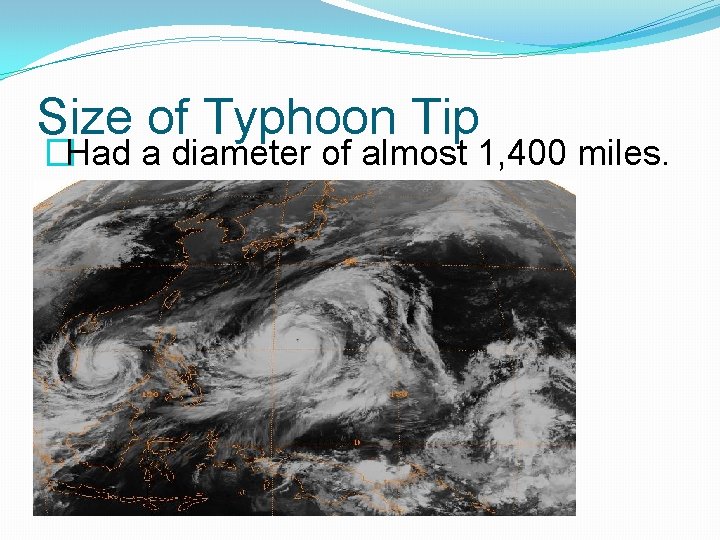
Size of Typhoon Tip �Had a diameter of almost 1, 400 miles.
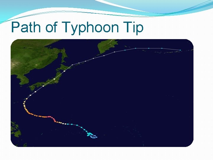
Path of Typhoon Tip
Hurricane Katrina (2005) �Costliest hurricane in U. S. history ($81 billion in damage). �Fifth deadliest hurricane (1, 836 deaths) �Crossed Florida as a Category 1 but gained strength in the Gulf of Mexico. �Made landfall in Louisiana and Mississippi on August 29 as a Category 3.
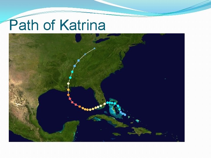
Path of Katrina
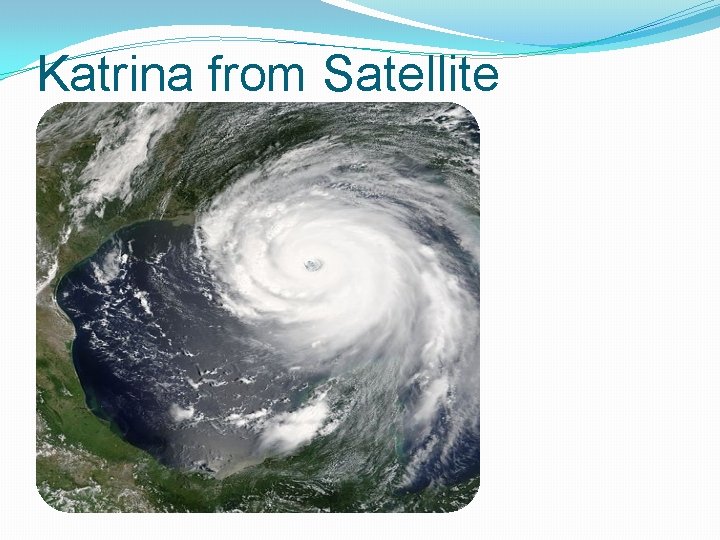
Katrina from Satellite
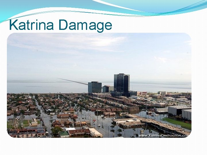
Katrina Damage
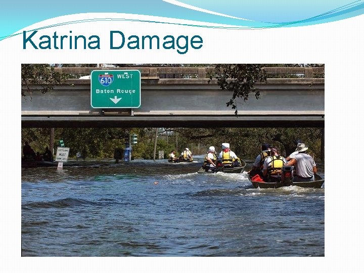
Katrina Damage
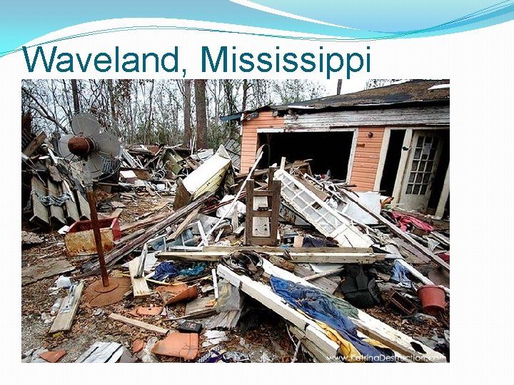
Waveland, Mississippi
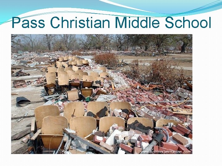
Pass Christian Middle School
- Slides: 67