MINISTRY OF NATURAL RESOURCES ENERGY AND MINING David

- Slides: 31
MINISTRY OF NATURAL RESOURCES, ENERGY AND MINING David Gondwe DEPARTMENT OF CLIMATE CHANGE AND METEOROLOGICAL SERVICES
CLIMATE OF MALAWI Malawi has got sub-tropical type of climate • The warm-wet season stretches from November to April. • Annual average rainfall varies from 725 mm to 2, 500 mm- Blantyre › 1127 mm Lilongwe › 900 mm Mzuzu › 1289 mm Zomba › 1433 mm • A cool, dry winter season is evident from May to August – Min. Temp. range › 4 - 10°C Max. Temp. range › 17 - 27°C • A hot, dry season lasts from September to October - Average Temp. › 25 - 37°C
TROPICAL CYCLONE MONITORING IN MALAWI TOOLS FOR T/C MONITORING The following products are used at the Malawi NMC: • Own surface weather chart analysis. • Weather bulletins from RSMC- La Reunion Tropical Cyclone Centre. • Satellite Imagery. • RSMC-Pretoria Guidance Forecasts • NCEP Products. • ECMWF Products
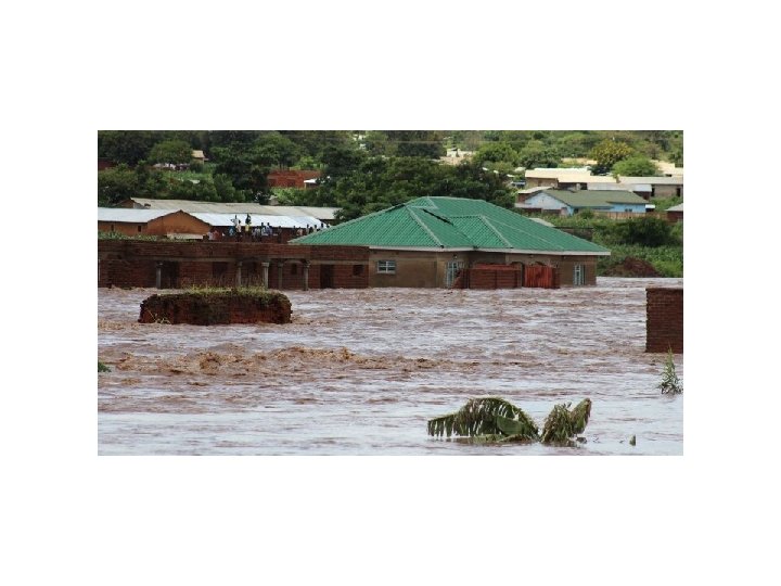
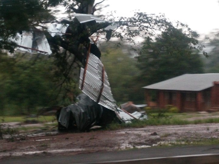
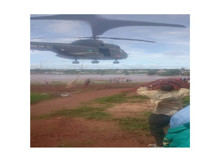
SEVERE WEATHER PHENOMENA EXPERIENCED IN MALAWI • Malawi is within the peripheral of South West Indian Ocean which is the area of cyclogenesis for most of the Tropical Cyclones that hit Africa. • Heavy precipitation due to Tropical Cyclone • Strong winds due to Tropical Cyclones • Malawi has a history of severe flooding of which some are caused by Tropical cyclones. • Some of the floods are due to the presence of ITCZ coupled with moist and unstable Congo air mass (Triple point) • Another severe weather that affects mostly the fishing community is strong south easterly winds over the lake
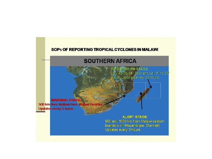
STAGES FOR TROPICAL CYCLONE MONITORING • INFORMATION STAGE 45 degrees to 55 degrees east and 5 degrees to 20 degrees south • ALERT STAGE - Radius of 1, 000 km from Malawi boarder. • WARNING STAGE - Radius of 500 km from Malawi boarder.
INFORMATION STAGE At 45 deg. to 55 deg. east and 5 deg. to 20 deg. South and is issued every 24 hours. The following are informed: • Director of Department of Climate Change and Meteorological Services • Principal Secretary for Natural Resources, Energy and Mining. • Commissioner for Department of Disaster Management Affairs. • Ministry of Water Development. • Department of Civil Aviation.
ALERT STAGE Radius of 1000 km from Malawi boarder & issued every 6 hours. The following are informed: • Principal Secretary for Natural Resources, Energy and Mining • All TV & Radio Stations. • Office of President and Cabinet. • Commissioner for Department of Disaster Management Affairs. • Ministry of Water Development. • Department of Civil Aviation. • Air craft operators. • Malawi defence Force. • Malawi Police Service. • National Roads Authority. • District Commissioners and Climate Information Centres • Electricity Supply Commission of Malawi. • Water Boards
WARNING STAGE • • • Radius of 500 km from Malawi boarder & issued every 3 hours. The following are informed: Principal Secretary for Transport and Public Works. Office of President and Cabinet. Commissioner for Department of Disaster Management Affairs. Ministry of Water Development. Department of Civil Aviation. Air craft operators.
WARNING STAGE CONT. • Malawi defence Force. • Malawi Police Service. • National Roads Authority. • District Commissioners and Climate Information • Centres • Electricity Supply Commission of Malawi. • Ministry of Agriculture, Irrigation and Food Security. • Executive Officer of Malawi Telecommunication Limited. • All TV & Radio Stations • Director of Information.
WARNING STAGE Cont. • The Director of Airtel. • The Director of Telecommunication Networks. • The Director of Malawi Broadcasting Corporation both Radio and Television Stations. • The Director Red Cross. • Ministry of Health. • The General public through the Electronic and Print Media
Effects of Tropical Cyclones on Malawi Weather Malawi is either directly or indirectly affected by tropical storms that either form in the Mozambique Channel or over the South West Indian Ocean and propagate westwards during the southern hemispheric summer. The tropical storms can either enhance rainfall which could trigger floods or prolonged dry spells depending on their positions in the Mozambique Channel.
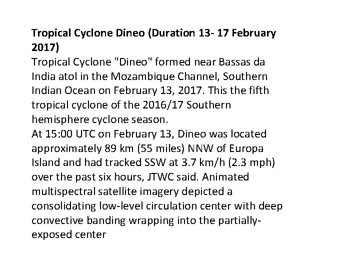
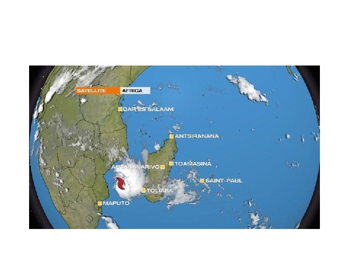
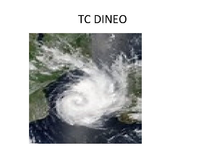
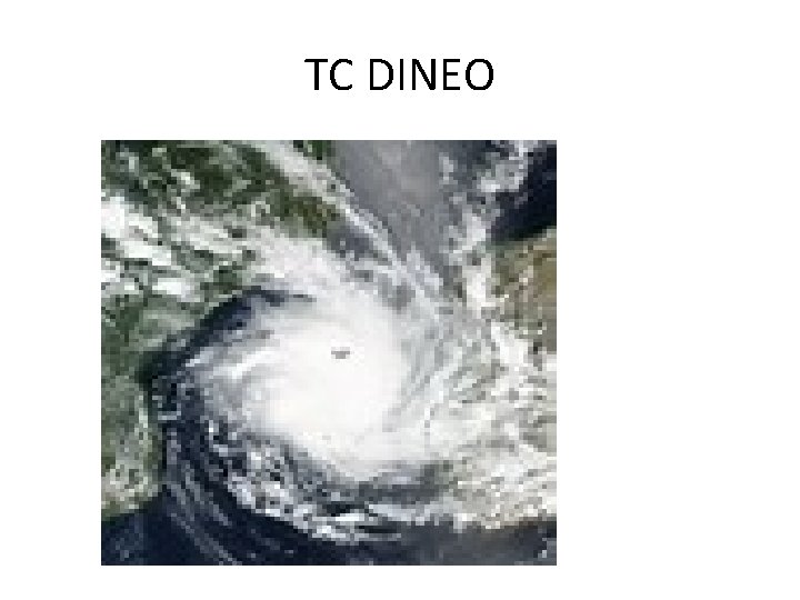
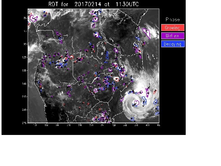
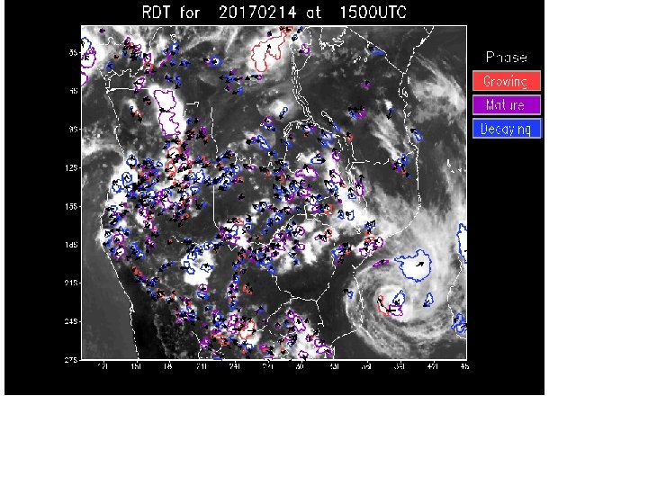
Tropical Cyclone Dineo (Duration 13 - 17 February 2017) Tropical Cyclone "Dineo" formed near Bassas da India atol in the Mozambique Channel, Southern Indian Ocean on February 13, 2017. This the fifth tropical cyclone of the 2016/17 Southern hemisphere cyclone season. At 15: 00 UTC on February 13, Dineo was located approximately 89 km (55 miles) NNW of Europa Island had tracked SSW at 3. 7 km/h (2. 3 mph) over the past six hours, JTWC said. Animated multispectral satellite imagery depicted a consolidating low-level circulation center with deep convective banding wrapping into the partiallyexposed center
TC DINEO
TC DINEO
TC DINEO
TC DINEO
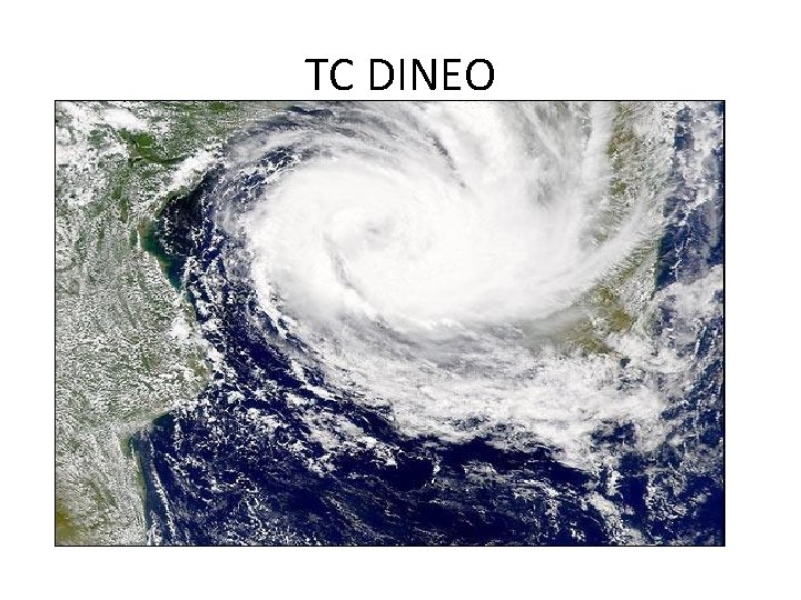
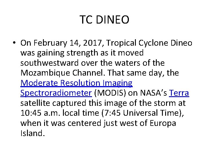
TC DINEO • On February 14, 2017, Tropical Cyclone Dineo was gaining strength as it moved southwestward over the waters of the Mozambique Channel. That same day, the Moderate Resolution Imaging Spectroradiometer (MODIS) on NASA’s Terra satellite captured this image of the storm at 10: 45 a. m. local time (7: 45 Universal Time), when it was centered just west of Europa Island.
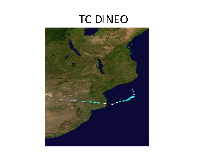
TC DINEO • A few hours later (12: 00 Universal Time), the Joint Typhoon Warning Center reported maximum sustained winds of 55 knots (60 miles per hour). Forecasters predicted the storm would continue strengthening over the next 24 hours before making landfall over southern Mozambique.
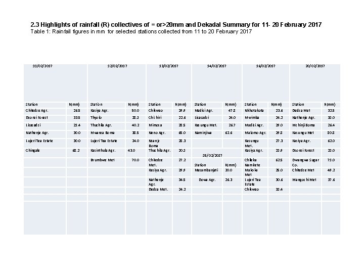
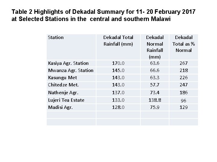
2. 3 Highlights of rainfall (R) collectives of = or>20 mm and Dekadal Summary for 11 - 20 February 2017 Table 1: Rainfall figures in mm for selected stations collected from 11 to 20 February 2017 11/02/2017 12/02/2017 33. 5 Thyolo 28. 1 Chichiri 22. 6 Lisasadzi 24. 0 Mwimba 24. 2 Nathenje Agr. 31. 0 Lisasadzi 21. 4 Thuchila Agr. 40. 2 Mimosa 28. 5 Kasungu Met. 26. 7 Madisi Agr. 29. 0 Mchinji Boma 26. 4 Nathenje Agr. 30. 0 Mwanza Boma 38. 5 Neno Agr. 65. 0 Naminjiwa Malomo Agr. 29. 8 Kasungu Met 80. 8 Lujeri Tea Estate 30. 0 Lujeri Tea Estate 24. 0 Nsanje Boma Thuchila Agr. 28. 3 27. 3 Kasiya Agr. 62. 0 20. 1 Kasungu Met. Kasiya Agr. 21. 9 Dzonzi Forest 21. 0 Chitedze Met. Kasiya Agr. 27. 2 62. 5 25. 0 Dwangwa Sugar Co. Chitedze Met 71. 0 29. 9 Station Masambanjati 34. 5 Dowa Agr. 30. 6 Mangochi Met 37. 6 31. 4 43. 0 70. 0 R(mm) 29. 9 Station Madisi Agr. R(mm) 47. 8 Station Nkhotakota 20/02/2017 Dzonzi Forest Kasinthula Agr. Station Chikweo 16/02/2017 R(mm) 26. 5 68. 2 R(mm) 50. 0 14/02/2017 Station Chitedze Agr. Chingale Station Kasiya Agr. 13/02/2017 62. 6 15/02/2017 R(mm) 23. 6 Bvumbwe Met Nathenje Agr. Dedza Met. 24. 2 Chileka Namitete Makoka Met Lujeri Tea Estate Chikweo R(mm) 20. 0 26. 3 Station Dedza Met 49. 2 R(mm) 32. 5
Table 2 Highlights of Dekadal Summary for 11 - 20 February 2017 at Selected Stations in the central and southern Malawi Station Dekadal Total Rainfall (mm) Kasiya Agr. Station Mwanza Agr. Station Kasungu Met Chitedze Met. Nathenje Agr. Lujeri Tea Estate Madisi Agr. Dekadal Total as % Normal 170. 0 145. 0 143. 0 137. 0 133. 0 128. 0 Dekadal Normal Rainfall (mm) 63. 6 66. 6 63. 3 57. 7 73. 4 138. 8 75. 9 267 218 226 247 186 96 129
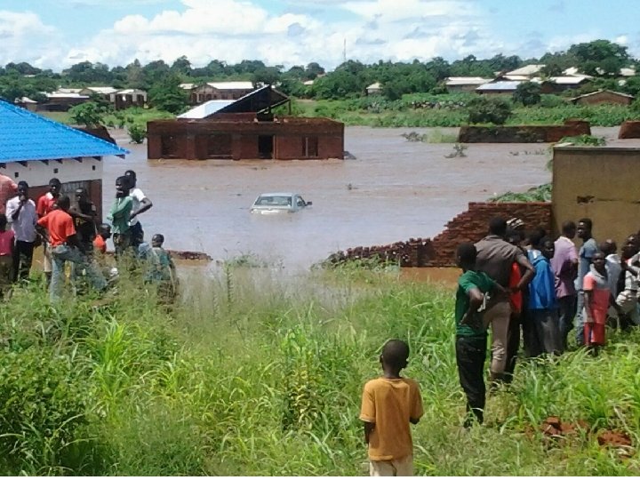
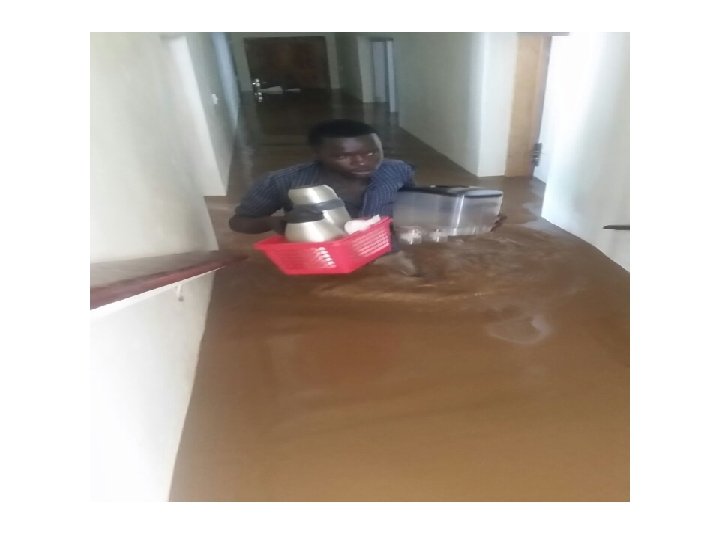
conclusion 2015 -2016 tropical cyclone season was quiet over Malawi, but the 2016 -2017 season had indirect impact on Malawi weather with Tropical Cyclone Dineo enhancing unstable Congo Air mass into Malawi resulting in heavy rains in Central and Southern Malawi.
Thank you for your attention