Remote Sensing Microwave Image 1 Penetration of Radar


 ► Real aperture SLAR system - the oldest,")

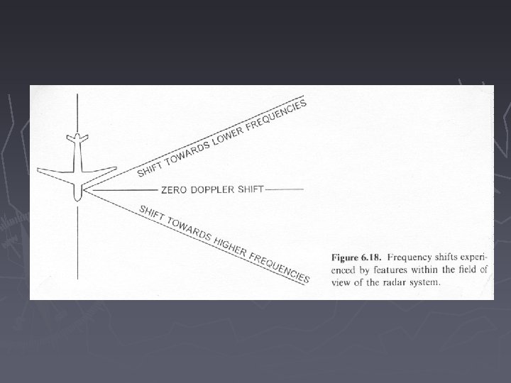
 ► Doppler effect - objects experience different frequency shifts")
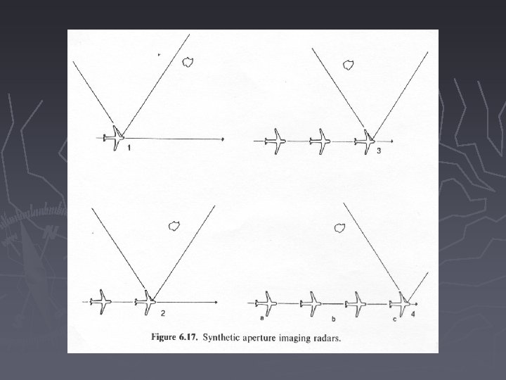
 ► Doppler effect - the frequency shift allows the")


- Slides: 34
Remote Sensing Microwave Image
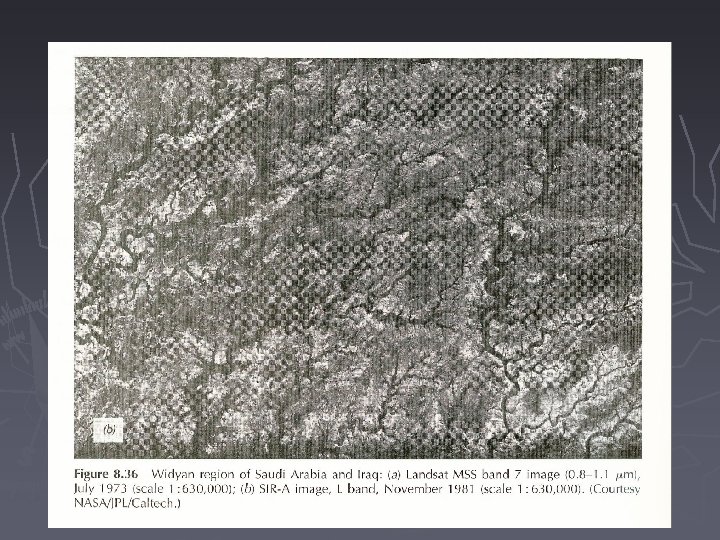
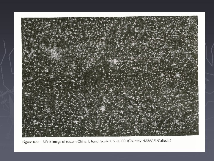
1. Penetration of Radar Signal ► Radar signals are able to penetrate some solid features, e. g. soil surface and vegetative covers
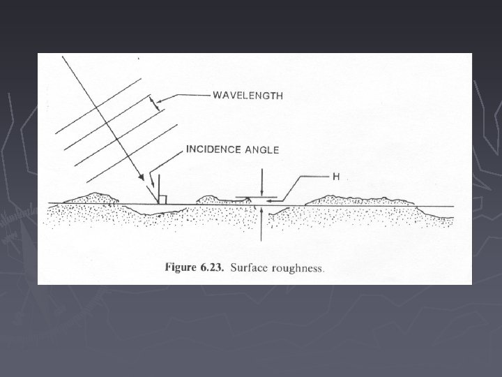
1. Penetration of Radar Signal ► Skin depth - the depth to which the strength of a signal is reduced to 1/e (approx. 37%) of its surface magnitude - skin depth increases with wavelength, absence of moisture, surface roughness, and depression angle
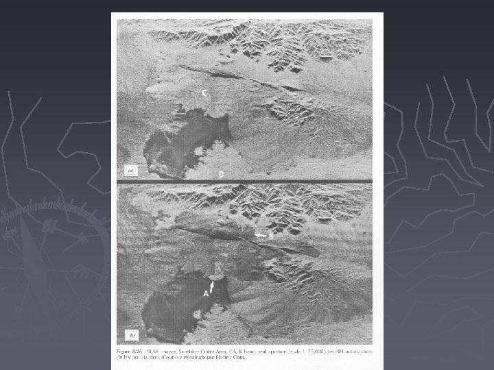
2. Polarization ► HH image - radar transmits horizontally polarized signals and receives the horizontally polarized return signal ► HV image - radar transmits horizontally polarized signals but receives vertically polarized signals
http: //www. crisp. nus. edu. sg/~research/tutorial/freqpol. htm
2. Polarization ► Most radar produce HH images, some are designed to produce both. There also VH and VV images
2. Polarization ► Depolarization - the horizontally polarized microwave energy is changed into vertically polarized energy - depolarizers on the ground appear brighter on HV image - rough surface and inhomogeneous subsurface are depolarizers
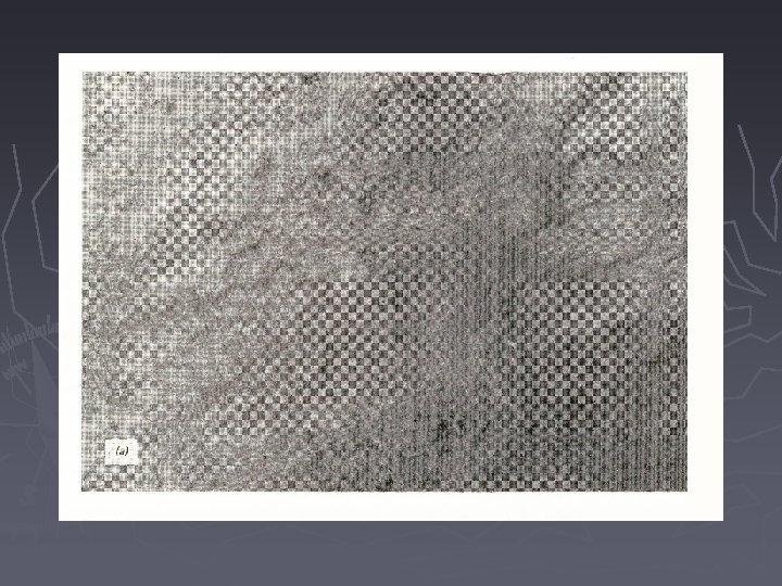
3. Synthetic Aperture Radar Systems (SAR) ► Real aperture SLAR system - the oldest, simplest, and least expensive of radar systems ► Synthetic Aperture Systems (SAR) - use an array of real antennas to synthesize the effect of a very long antenna
http: //www. crisp. nus. edu. sg/~research/tutorial/mw. htm#freq
3. Synthetic Aperture Systems (SAR) ► Doppler effect - objects experience different frequency shifts in relation to their distances from the aircraft track - objects at the leading edge of a beam reflect pulses with higher frequency than those at the trailing edge
3. Synthetic Aperture Systems (SAR) ► Doppler effect - the frequency shift allows the system to assign reflections to features at their correct positions
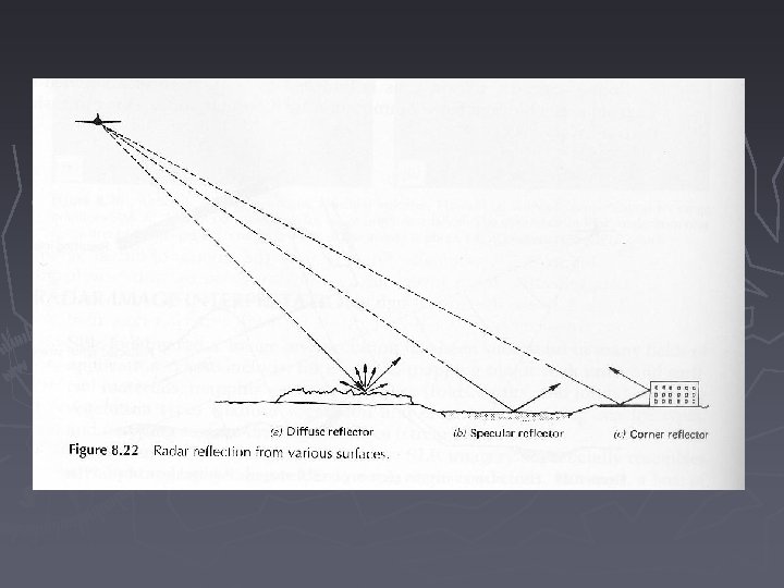
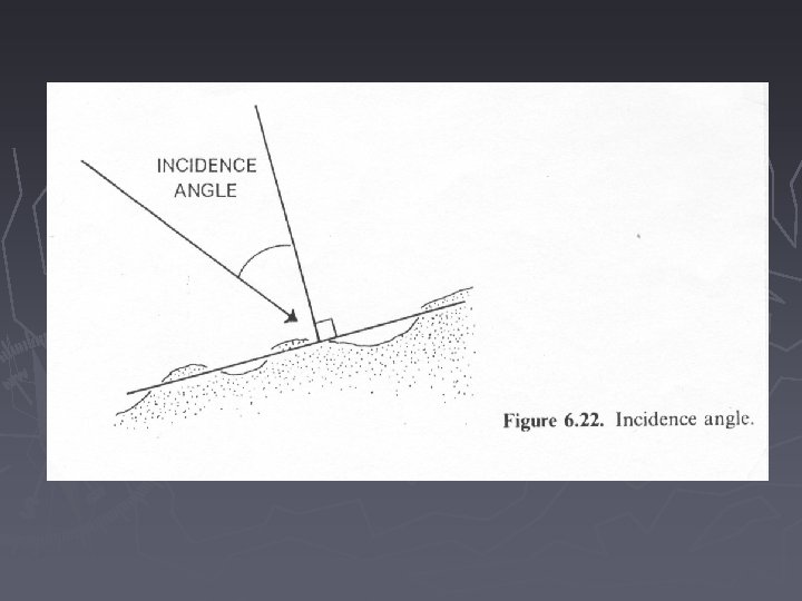
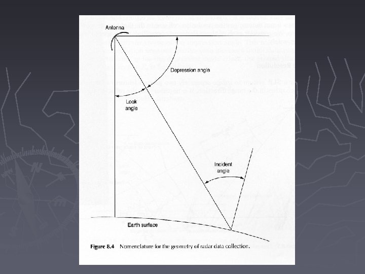
4. Reflectance ► Incidence angle - the angle between the axis of the incident radar signal and a perpendicular to the surface that the signal strikes ► Specular reflection ► Diffuse reflection ► Corner reflection
4. Reflectance ► Specular reflection - when surface is smooth relative to the wavelength - incident angle = reflection angle
4. Reflectance ► Diffuse reflection - when surface is rough relative to the wavelength - the signal will be scattered equally all directions
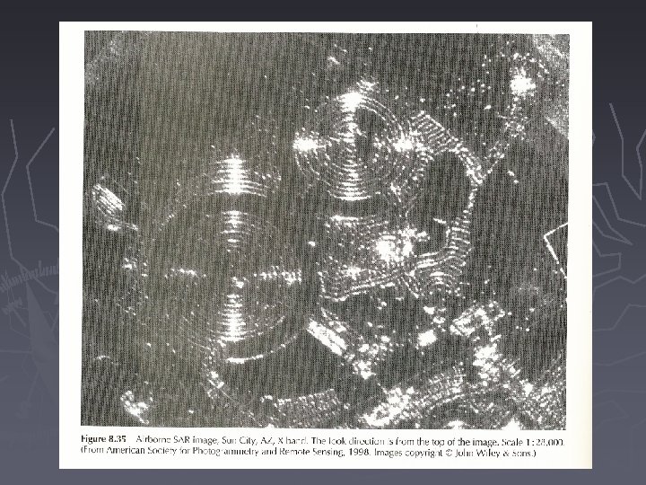
4. Reflectance ► Corner reflection - a double reflection caused by adjacent smooth surface - high reflectance appears as sparkles on the image - tends to be proportionately larger than its real size
5. Radar Image Brightness ► Geometric characteristics - slope facing with respect to sensor determines signal returns - surface roughness determines the type and amount of returns
5. Radar Image Brightness ► Electrical characteristics - Complex Dielectric Constant: water 80, most material 3 -8 when dry - moisture content is more significant than material themselves in increasing reflectance - metal objects have high returns, e. g. metal bridges, silos
6. Natural Features Response ► Soil responses - top soil moisture gives high returns and - limits penetration of radar waves
6. Natural Features Response ► Vegetation responses - when l = plant size or plant is dense, the return is high - high moisture content returns more energy - HH polarized sensing penetrates vegetation more than HV
6. Natural Features Response ► Water and ice responses - smooth water yields specular reflectance with no return - rough water surface returns with various strength - ice age, surface roughness, snow cover etc. affect returns
Readings ► Chapter 8
1. Penetration of Radar Signal <- Long wavelength Short wavelength -> http: //www. crisp. nus. edu. sg/~research/tutorial/freqpol. htm
Synthetic Aperture Radar http: //www. crisp. nus. edu. sg/~research/tutorial/mw. htm#freq