Environmental Remote Sensing What is Remote Sensing Remote


: – Major regional features are visible (rivers,")
: – Detailed features are visible! – Usually")
 Spectral –")


- Slides: 36
Environmental Remote Sensing
What is Remote Sensing? Remote sensing is a method of obtaining information about the properties of an object without coming into physical contact with it.
Why use Satellites to Study the Earth? • Consistent, routine, global measurements • Overview of information on the hemispheric, regional, national, and local scales – the “big picture” • Provide information in areas where there are no ground-based measurements • Advance warning of impending environmental events and disasters • Visual appeal: a picture is worth a thousand words
Satellites Provide a Global View Satellite data are used for many applications, including monitoring global weather, studying climate change, and observing the environment.
A Picture is Worth a Thousand Words! Satellites provide consistent, routine, global coverage of environmental events
General Introduction
General Introduction
Detecting the Remote Signals
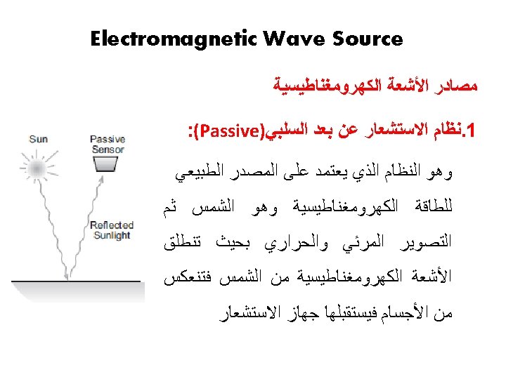
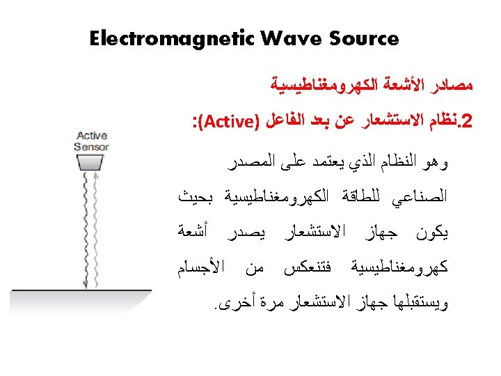
Main Components of RS System • Radiation Source • Transmission Path • Target Object • Sensor
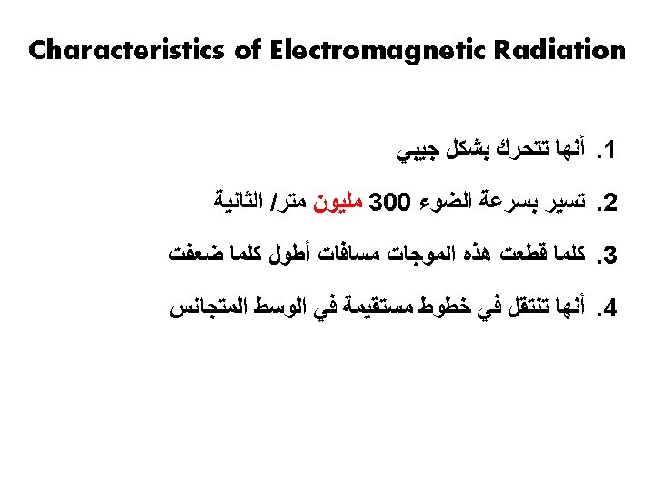
Definition of Electromagnetic Radiation ﻣﻐﻨﺎﻃﻴ ﺴﻲ
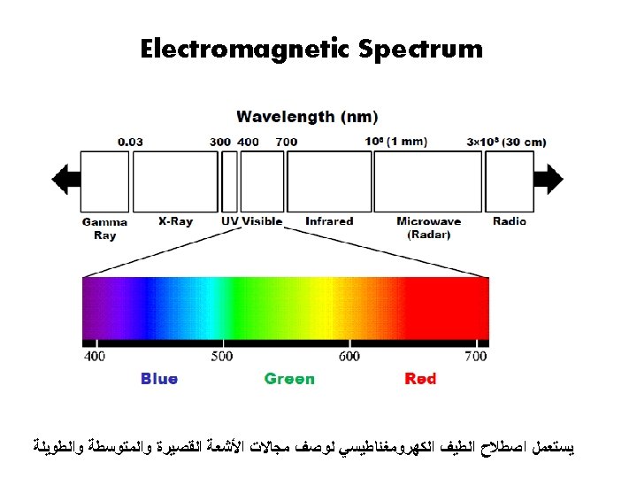
Electromagnetic Spectrum
Reflection of Colors
Reflection of Colors
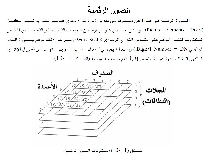
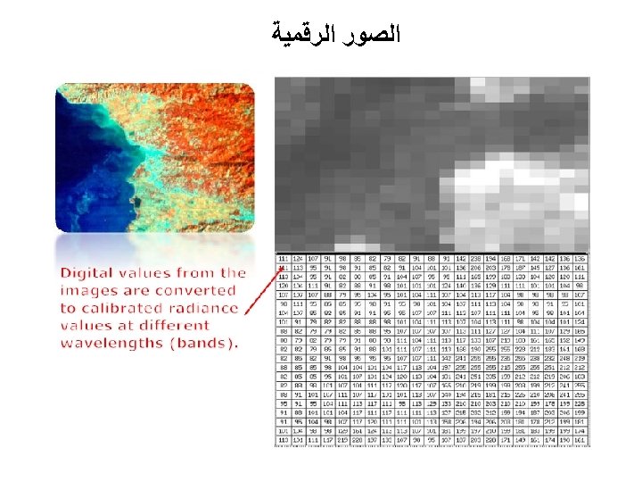
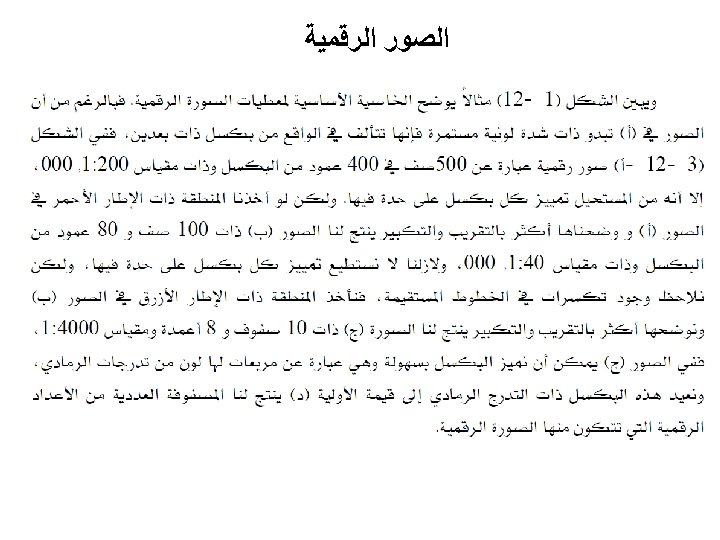
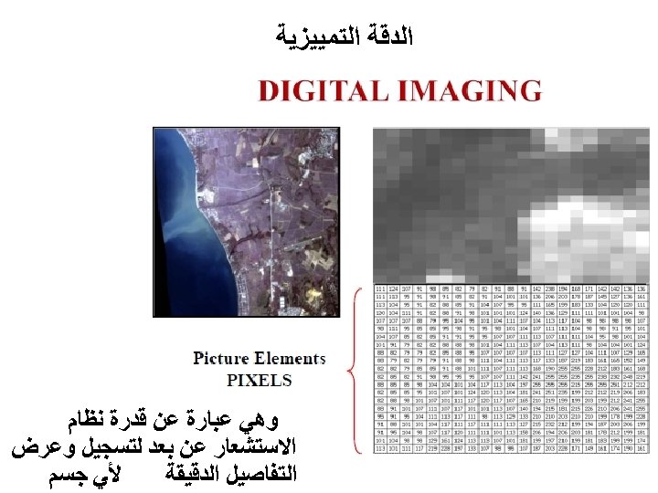
ﺍﻟﺼﻮﺭ ﺍﻟﺮﻗﻤﻴﺔ 10 x 8 pixels 100 x 80 pixels 500 x 400 pixels
• Low spatial resolution (1 km): – Major regional features are visible (rivers, urban areas, clouds) – Detailed features are NOT visible!
• High spatial resolution (10 m): – Detailed features are visible! – Usually high spatial resolution images are expensive!!
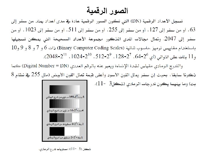
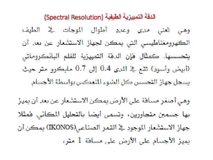
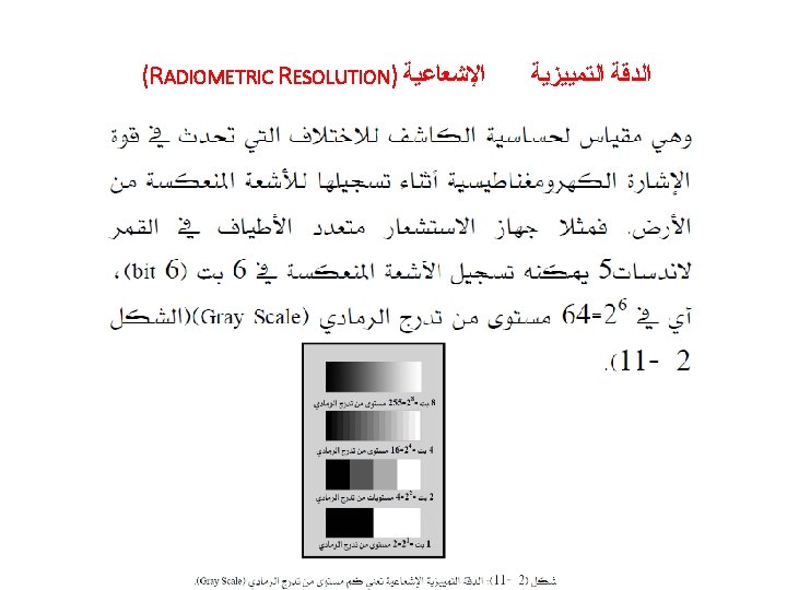
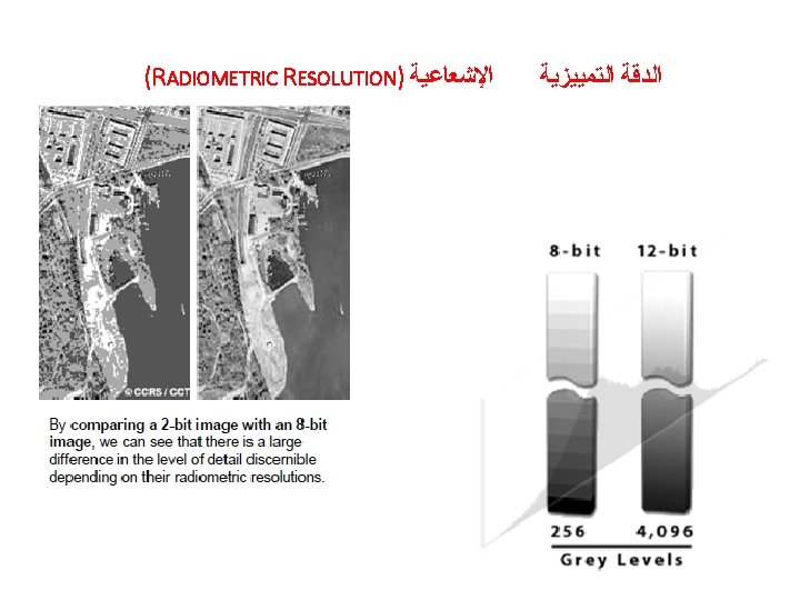
Sensor resolution Spatial – the size of field of view (pixel size) Spectral – range of EM spectrum each band of sensor detects Temporal – frequency of measurements at a certain location Radiometric – sensitivity of a sensor to difference in EM energy strength (recording resolution of sensor) Radiometric: a sensor records EM energy as brightness value (integer) 2 -bit 0 8 -bit 0 9 -bit 0 Conversion from binary to decimal for 2 -bit 00 = 0 x 21 +0 x 20 = 0 01 = 0 x 21 +1 x 20 = 1 10 = 1 x 21 +0 x 20 = 2 11 = 1 x 21 +1 x 20 = 3 3 255 511
Sensor resolution radiometric spatial spectral
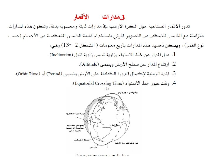
ﺍﻻﺳﺘﺸﻌﺎﺭ ﻋﻦ ﺑﻌﺪ ﻓﻲ ﺍﻟﺒﻴﺌﺔ ﺗﻄﺒﻴﻘﺎﺕ • Snow measurement • Air Quality • Ocean Environment, Resources and Quality • Surface Water Quality and Monitoring (lakes, rives…. )