Physics of the Earths Interior Hokkaido Univ Dynamics


 Centrifugal force")
 月:大きすぎる衛星 Moon: Too large for the Earth")


 From Is the Earth really")
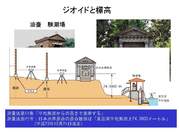

 for the definition and realization of an International Height Reference")

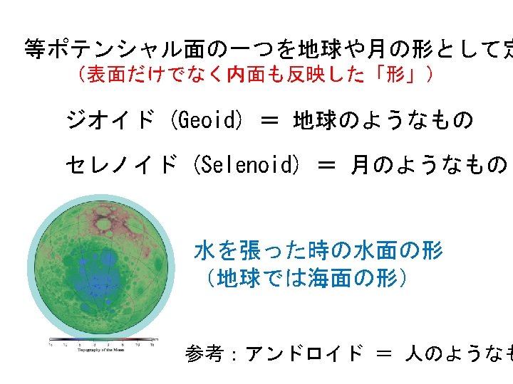
 地球の等ポテンシャ ル面 Geoid (GRACE 360次) 月の方がでこぼ こ Selenoid")

")


- Slides: 41
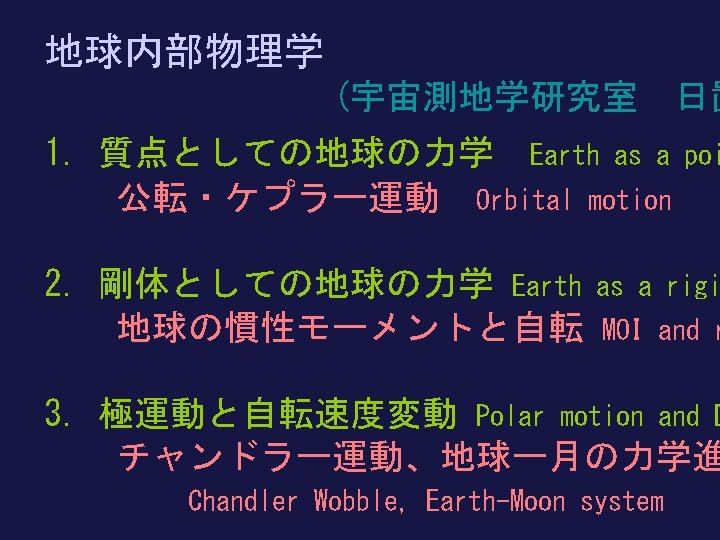
地球内部物理学 Physics of the Earth’s Interior 北海道大学理学院 Hokkaido Univ 地球惑星ダイナミクス講座 Dynamics . Earth and Planetary 日置 幸介 Kosuke Heki へ き こうすけ heki@sci. hokudai. ac. jp
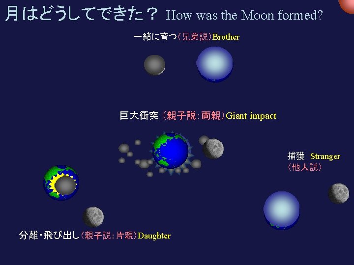
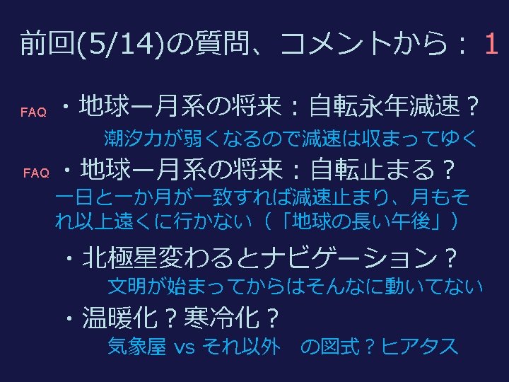
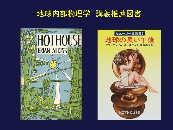
復習:潮汐摩擦と地球ー月系の進化 理想 Tidal friction and the Earth-Moon system ideal 現実 realistic 角運動量保存のため 月が遠ざかる The Moon goes away to conserve angular momentum トルクが自転を減速 Torque brakes the spin
軌道での加速とその結果 Acceleration in the orbit
45億年前の潮汐は今の 8000倍 4. 5 byr ago: Tide ~8000 times stronger (自転の遠心力は 25倍) Centrifugal force ~25 times stronger 過去(~ 45 億年前) 現在 Now Past (4. 5 byr ago) 1 day = 24 hours 1 day = 5 hours 20, 000 km 380, 000 km 月ー地球の距離は 1/20 Earth-moon distance was 1/20
~10, 000 km 重さ 80 : 1 (mass) 月:大きすぎる衛星 Moon: Too large for the Earth ~2, 700 km
地球 The Earth 月 The Moon 重さ 80 : 1 mass 火星 Mars フォボス、ダイモス Two moons of Mars 重さ 50000000 : 1 mass タイタン Titan (太陽系最大級) 重さ 4000 : 1 mass
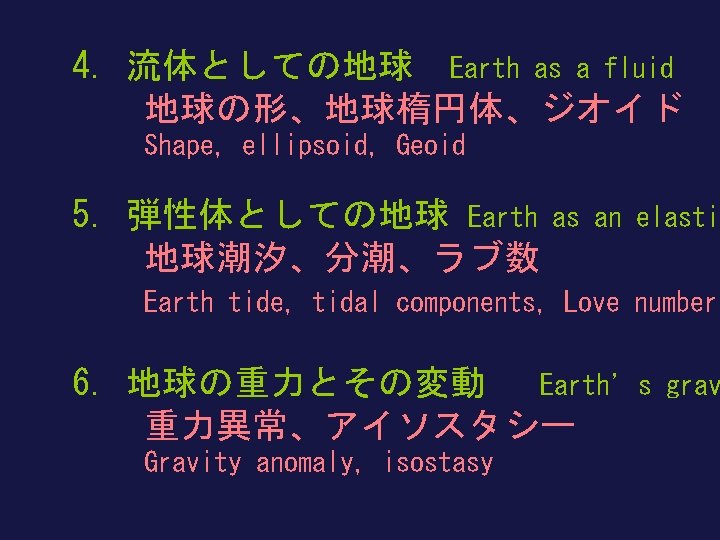
7. 現実的な地球・地球熱学 Realistic earth 粘弾性、マントル対流、プレート運動 viscoelasticity, mantle convection, plate mo 8. 固体地球の中の波動と振動 地震、地球自由振動 Wave and osc Earthquake, Free oscillation 9. 固体地球の電磁気学 地球磁場Geomagnetism Electromagnetics
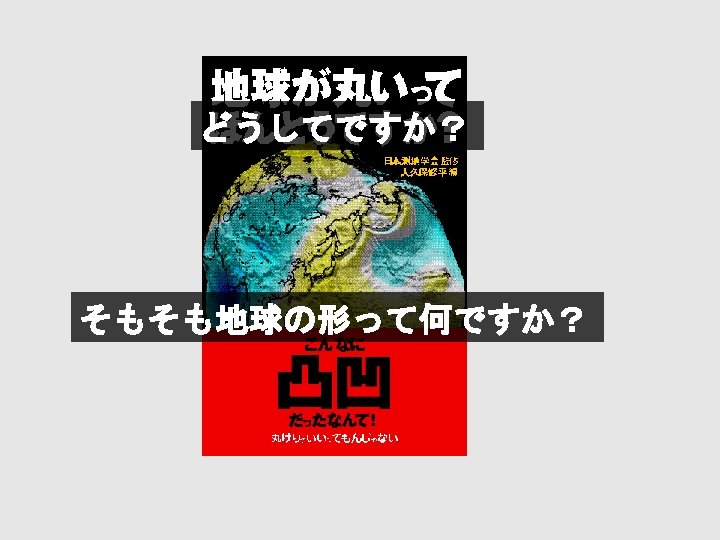
そうだったのか地球の形 The Shape of the Earth ! This is it !
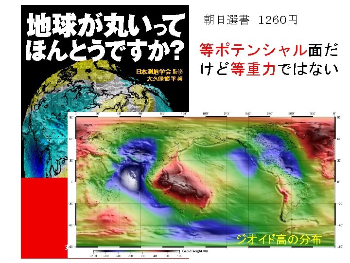
日本列島のジオイド Geoid in Japan Geoid From Modern Geodesy, GSJ (1994) From Is the Earth really round? , GSJ (2004) 質量分布を反映 ジオイドの山に登っても疲れない
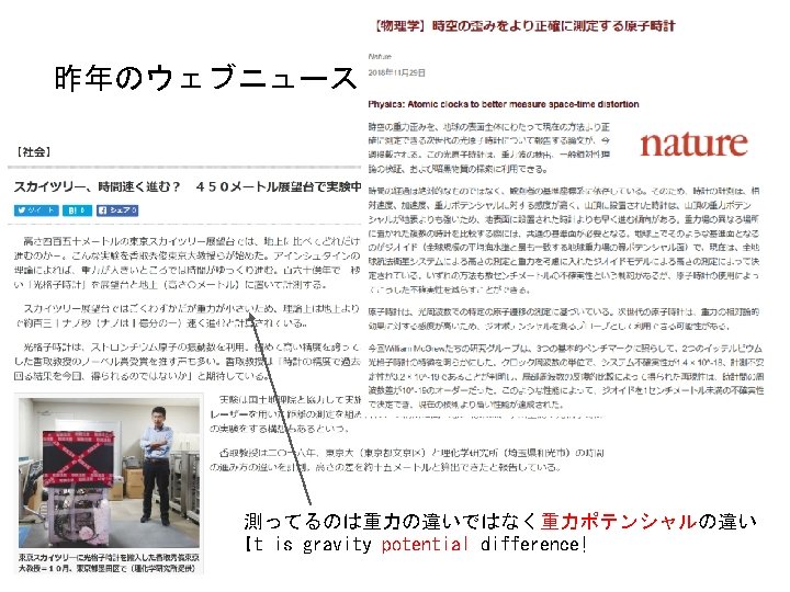
最近の話題 重力ポテンシャルの直接計測 Lisdat et al. , Nature Comm. 2016. The strontium lattice clocks are located at the national metrology institutes SYRTE and PTB in Paris and Braunschweig, respectively. The course and lay-out of the fibre link sections to Strasbourg (705 km from Paris, 710 km from Braunschweig) are indicated on the map. Additionally, the individual setups consisting of a clock laser, optical lattice, fs frequency comb, transfer laser and stabilized link are shown schematically. In Strasbourg, the frequency difference between the transfer lasers is measured.
IAG Resolution (No. 1) for the definition and realization of an International Height Reference System (2015 IAG/IUGG@Prague) 最近の話題:世界共通の高さ基準 (IHRS) The International Association of Geodesy, recognizing that ・ to determine and to investigate the global changes of the Earth, the geodetic reference systems with long‐term stability and worldwide homogeneity are required; ・to detect sea level change of a few millimeters per year can only be possible when a stable spatial reference with globally high accuracy over a long period of time is realized; for this purpose, an integrated global geodetic reference frame with millimeter accuracy must be implemented; to reach this goal, the inconsistencies existing between analysis strategies, models, and products related to the Earth's geometry and gravity field must be solved; ・ to accomplish both definition and realization of a height reference system (HRS) standards and conventions that allow a consistent definition and a reliable realization are required; noting ・ the results of the GGOS Theme 1 investigations for the definition and realization of an International Height Reference System in particular the conventions and the computations of the height reference level as the potential value W 0 at the geoid based on the newest global gravity field and sea surface models; ・ the necessity of ensuring the reproducibility and interpretability of the reference value, the procedure applied for the determination of W 0 must be well documented including conventions and guidelines; resolves ・ the following conventions for the definition of an International Height Reference System (see note 1): 1. the vertical reference level is an equipotential surface of the Earth gravity field with the geopotential value W 0 (at the geoid); 2. parameters, observations, and data shall be related to the mean tidal system/mean crust; 3. the unit of length is the meter and the unit of time is the second (SI); 4. the vertical coordinates are the differences ‐ WP between the potential WP of the Earth gravity field at the considered points P, and the geoidal potential value W 0; the potential difference ‐ WP is also designated as geopotential number CP: ‐ WP = CP = W 0 ‐ WP; 5. the spatial reference of the position P for the potential WP = W(X) is related as coordinates X of the International Terrestrial Reference System; ・ W 0 = 62 636 853. 4 m 2 s‐ 2 as realization of the potential value of the vertical reference level for the IHRS (see note 2). Note 1: Ihde J. , Barzaghi R. , Marti U. , Sánchez L. , Sideris M. , Drewes H. , Foerste Ch. , Gruber T. , Liebsch G. , Pail R. : Report of the Ad‐hoc Group on an International Height Reference System (IHRS); In: IAG Reports 2011‐ 2015 (Travaux de l’AIG Vol. 39), http: //iag. dgfi. tum. de/index. php? id=329. Note 2: Report of Joint Working Group 0. 1. 1: Vertical Datum Standardization (JWG 0. 1. 1); In: IAG Reports 2011‐ 2015 (Travaux de l’AIG Vol. 39), http: //iag. dgfi. tum. de/index. php? id=329. W 0 = 62 636 853. 4 m 2 s‐ 2
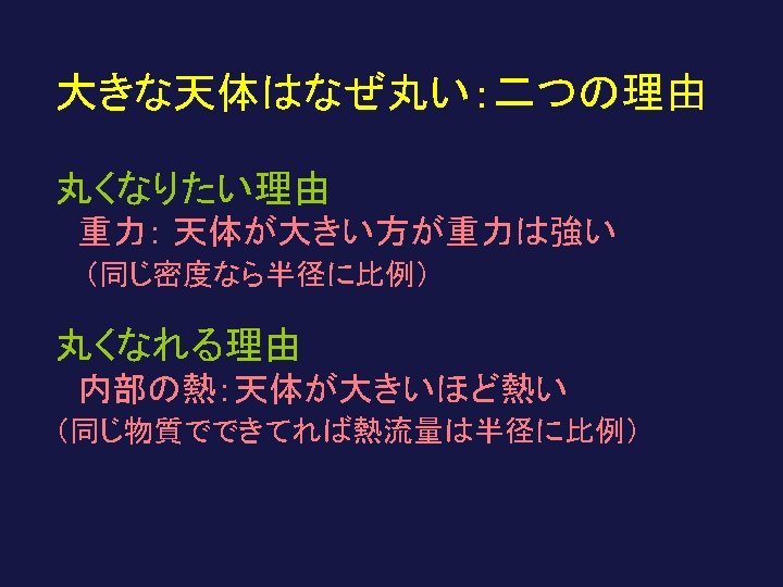
地球や月の形 shape of the Earth and the Moon 1. 大局的な形 球 Overall shape 金星 回転楕円体 ellipsoid地球 sphere 三軸不等楕円体 the earth triaxial ellipsoid 月 2. 不規則な凹凸 venus the moon Random undulations 大きな天体で小さい smaller for larger b
月の等ポテンシャル 面 Selenoid (SGM 100 h) 地球の等ポテンシャ ル面 Geoid (GRACE 360次) 月の方がでこぼ こ Selenoid is more irregular
大きいほど丸い A large body is rounder Vesta ~250 km Itokawa 0. 5 km long Gaspra 19 x 12 x 11 km Eros 30 km long Ida 56 km long
Itokawa 0. 5 km 234 km Ida 265 km 50 km Vesta (一番小さな丸い星?)
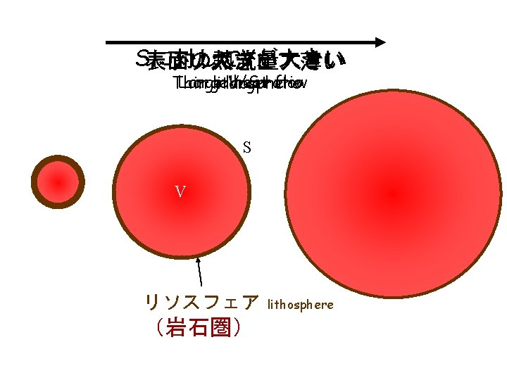
大きな天体=中が熱い天体=柔らかい天体 Large body = hot inside = soft body 大きいほどアイソスタシーが効いて凸凹がならされる Isostatic compensation more effective in a large body 地殻 crust マントル mantle
体積のわりに表面積が小さいと冷めにくい Stay warm if surface area is small for volume 大きい人ほど 冷めにくい Larger one can stay warm 丸っこい人ほど 冷めにくい Rounder one can stay warm
地球の大きさ Dimension of the Earth メートルの定義 Definition of 1 meter 10, 000 km 40, 000 km 地球の半径 radius = 40, 000 / 2 p
地球の大局的な形: 回転楕円体 Overall shape of the Earth: Ellipsoid 形の扁平率 Flattening of the shape a a - b ~ 20 km b 扁平率 (flattening) ~ 1/300
一度の弧の長さ 北極 ~112. 7 km 赤道 ~110. 6 km 1 degree Arc length of 1 degree Pole ~112. 7 km Equator ~110. 6 km 地球 The Earth 1 degree
Pierre Bouguer 1698 -1758 Louis Godin 1704 -1760 Charles Marie de La Condamine 1701 -1774
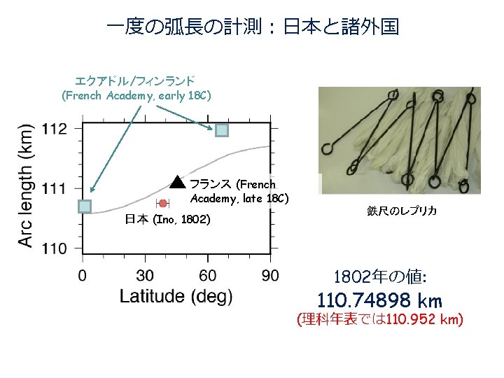
緯 度 一 度 分 の 距 離 は 二 十 八 里 二 分 Astronomical latitude measurement Measurement in 1802: Meridian arc length: 110. 74898 km (110. 952 km)
f =0. 065 水 f =~0. 0 f =0. 108 金 f =~0. 0 f =0. 0034 f =0. 0052