MESOSCALE CLOUD PATTERNS AND MESOSCALE CLOUD PATTERNS AND

- Slides: 35

MESOSCALE CLOUD PATTERNS AND

MESOSCALE CLOUD PATTERNS AND FEATURES Streets, Bands and Lines of Convective Clouds Lee waves and Orographic Clouds Rope Clouds Small Vortices Cellular Clouds Ships Trails (Anomalous Cloud Lines). Aircraft Condensation Trails (Contrails)

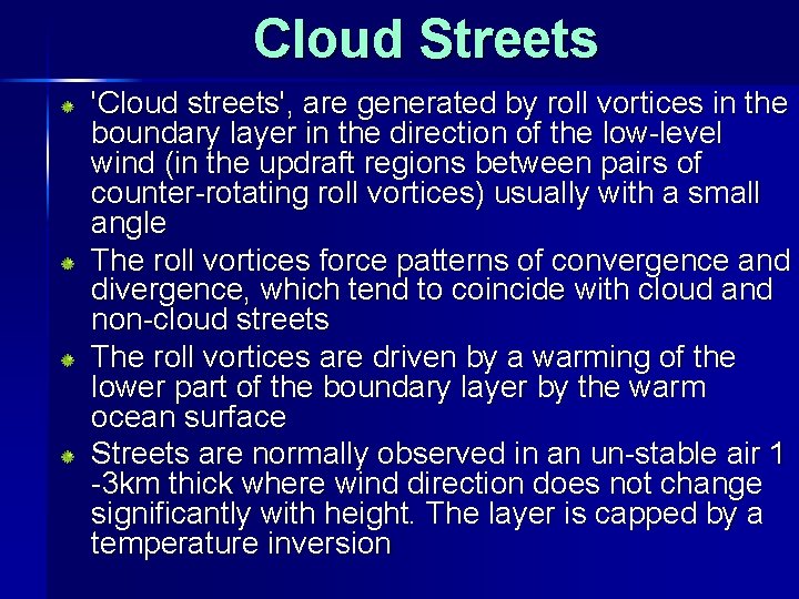
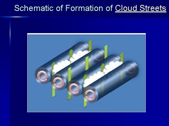
Cloud Streets 'Cloud streets', are generated by roll vortices in the boundary layer in the direction of the low-level wind (in the updraft regions between pairs of counter-rotating roll vortices) usually with a small angle The roll vortices force patterns of convergence and divergence, which tend to coincide with cloud and non-cloud streets The roll vortices are driven by a warming of the lower part of the boundary layer by the warm ocean surface Streets are normally observed in an un-stable air 1 -3 km thick where wind direction does not change significantly with height. The layer is capped by a temperature inversion

Schematic of Formation of Cloud Streets

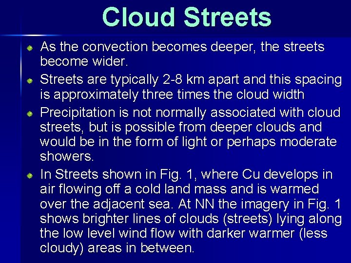
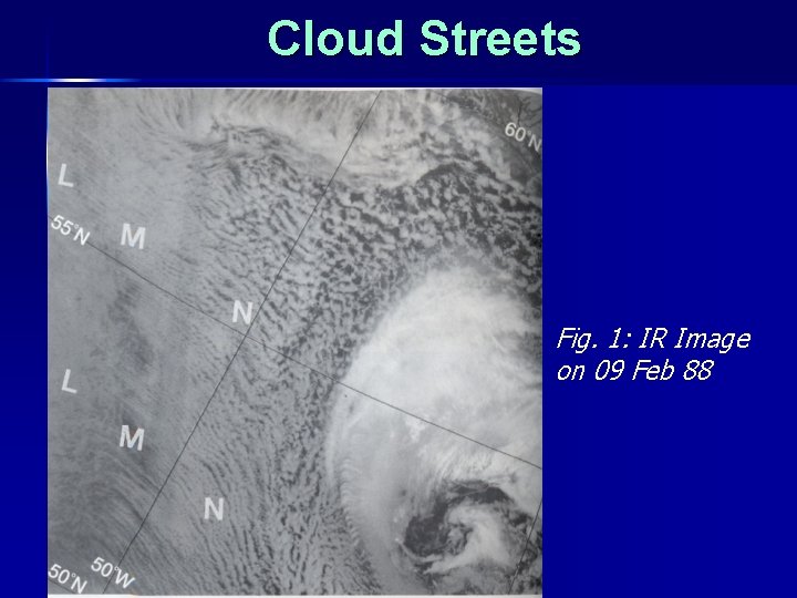
Cloud Streets As the convection becomes deeper, the streets become wider. Streets are typically 2 -8 km apart and this spacing is approximately three times the cloud width Precipitation is not normally associated with cloud streets, but is possible from deeper clouds and would be in the form of light or perhaps moderate showers. In Streets shown in Fig. 1, where Cu develops in air flowing off a cold land mass and is warmed over the adjacent sea. At NN the imagery in Fig. 1 shows brighter lines of clouds (streets) lying along the low level wind flow with darker warmer (less cloudy) areas in between.

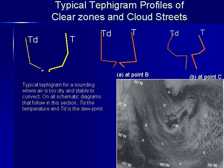
Typical Tephigram Profiles of Clear zones and Cloud Streets T Td Td Typical tephigram for a sounding where air is too dry and stable to convect. On all schematic diagrams that follow in this section, Tis the temperature and Td is the dew-point. T (a) at point B Td T (b) at point C

Cloud Streets Fig. 1: IR Image on 09 Feb 88

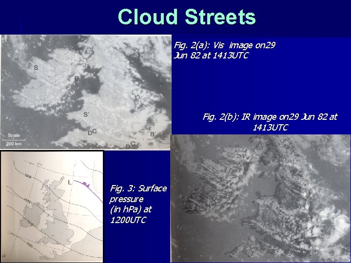
Cloud Streets Fig. 2(a): Vis image on 29 Jun 82 at 1413 UTC Fig. 2(b): IR image on 29 Jun 82 at 1413 UTC Fig. 3: Surface pressure (in h. Pa) at 1200 UTC

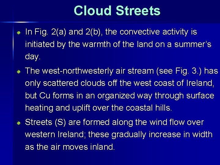
Cloud Streets In Fig. 2(a) and 2(b), the convective activity is initiated by the warmth of the land on a summer’s day. The west-northwesterly air stream (see Fig. 3. ) has only scattered clouds off the west coast of Ireland, but Cu forms in an organized way through surface heating and uplift over the coastal hills. Streets (S) are formed along the wind flow over western Ireland; these gradually increase in width as the air moves inland.

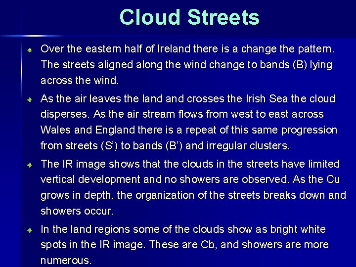
Cloud Streets Over the eastern half of Ireland there is a change the pattern. The streets aligned along the wind change to bands (B) lying across the wind. As the air leaves the land crosses the Irish Sea the cloud disperses. As the air stream flows from west to east across Wales and England there is a repeat of this same progression from streets (S’) to bands (B’) and irregular clusters. The IR image shows that the clouds in the streets have limited vertical development and no showers are observed. As the Cu grows in depth, the organization of the streets breaks down and showers occur. In the land regions some of the clouds show as bright white spots in the IR image. These are Cb, and showers are more numerous.

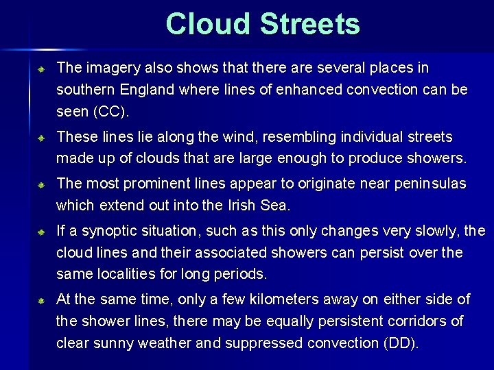
Cloud Streets The imagery also shows that there are several places in southern England where lines of enhanced convection can be seen (CC). These lines lie along the wind, resembling individual streets made up of clouds that are large enough to produce showers. The most prominent lines appear to originate near peninsulas which extend out into the Irish Sea. If a synoptic situation, such as this only changes very slowly, the cloud lines and their associated showers can persist over the same localities for long periods. At the same time, only a few kilometers away on either side of the shower lines, there may be equally persistent corridors of clear sunny weather and suppressed convection (DD).

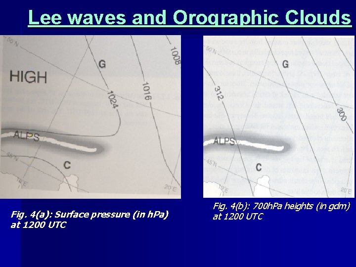
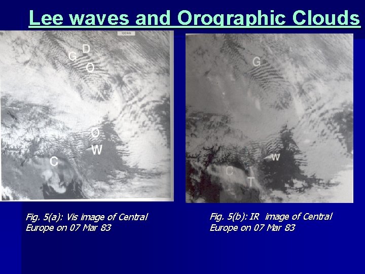
Lee waves and Orographic Clouds When NWly flow sweeps across central Europe, with a strong thermal wind in the same direction, as in Fig. 4(a) and Fig. 4(b), lee waves often develop. The high ground near Dresden (D) and the German —Czech border sets off frequent displays such as that shown in Fig. 5(a) and Fig. 5(b). The succession of wave clouds which forms downwind of the mountain ridge (G) lie roughly parallel to the ridge and across the northwesterly wind flow. The details are complex but the overall pattern of the waves stands out.

Lee waves and Orographic Clouds Fig. 4(a): Surface pressure (in h. Pa) at 1200 UTC Fig. 4(b): 700 h. Pa heights (in gdm) at 1200 UTC

Lee waves and Orographic Clouds Fig. 5(a): Vis image of Central Europe on 07 Mar 83 Fig. 5(b): IR image of Central Europe on 07 Mar 83

Lee waves and Orographic Clouds The lee waves disappear as the air stream descends onto the plains of Hungary in the bottom right corner of the image. Orographic Ac at middle levels in the troposphere stands out clearly in both VIS and IR. They are particularly easy to see against the dark surface in the absence of lower cloud layers, as at ‘O’. Typical wavelengths of the lee waves, shown by the spacing between successive cloud lines, is 10 — 20 km.

Lee waves and Orographic Clouds Although wave systems may extend through much of the depth of the troposphere, the troughs and peaks of the wave at different levels normally lie on a sloping rather than a vertical line. Consequently the up currents at high levels (where orographic Ci forms) normally lie over the down currents at lower levels (where the orographic Ac or Sc disperses). Evidence of orographic Ci, which does not evaporate rapidly even in descending air, may therefore be seen against the clear ground in both VIS and IR images. At the bottom of Fig. 5(b) over northern Italy, two small areas of high wave cloud (W) and some orographic Ci (C) are particularly prominent in the IR image. There is a long trail at T streaming from a wave cloud composed of ice crystals.

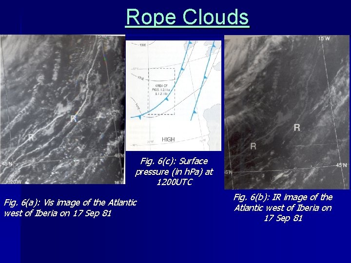
Rope Clouds Rope clouds are near-surface features, often associated with fronts. Its temperature is too close to that of the sea surface for it to be seen in the IR image. It represents a roll-like circulation about a horizontal axis, with cloud forming in the up draught portion of the roll. Fig. 6 shows another example from the same area of the ocean. There are several rope clouds (R) unconnected with any organized frontal clouds, but deep enough to be detectable on the IR image (Fig. 6(b)). Sometimes, these denote a series of Surface air-mass discontinuities. These rope-like lines of surface clouds, which can stretch for 1000 km or more, are the final remains of the original air-mass differences. In the form seen in Fig. rope clouds only occur over the oceans in areas of light winds. They are common in the Mediterranean when air-masses of

Rope Clouds Fig. 6(c): Surface pressure (in h. Pa) at 1200 UTC Fig. 6(a): Vis image of the Atlantic west of Iberia on 17 Sep 81 Fig. 6(b): IR image of the Atlantic west of Iberia on 17 Sep 81

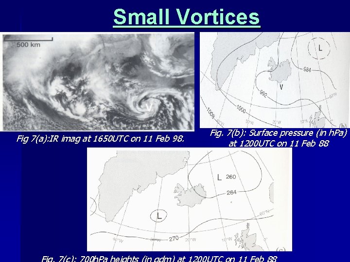
Small Vortices Many types of cloud ‘swirls’ may be observed in satellite imageries. Some may appear to be generated in the lee of orographic features, such as isolated, mountainous islands, but in other instances the reason for their presence may not be obvious. Fig. 7(a) illustrates some swirls, or vortices, which the imagery shows were undoubtedly present, but which were too small in size to be analysed from the sparse observational coverage on routine synoptic charts. The vortex V seen in the IR image has not been detected in any detail by the few conventional observations over the sea to the south of Iceland.

Small Vortices Fig 7(a): IR imag at 1650 UTC on 11 Feb 98. Fig. 7(b): Surface pressure (in h. Pa) at 1200 UTC on 11 Feb 88

Small Vortices A flat, featureless trough has been analysed at low levels Fig. 7(b)) but, although the cloud associated with V looks cold in the IR image, the analyses at higher levels, such as Fig. 7(c), fail to depict any trace of a circulation. The sizes of these vortices can result from obstacles, shear or thermal effects. Small chains of orographic mesoscale vortices form to the leeside of mountains in areas of Sc or St clouds. The vortex chain may stretch up to a thousand kilometers. Families of Mesoscale vortices are sometimes observed on the cold air side of frontal cloud bands, due to horizontal shear. Regardless of the origin of the vortex, its detection in the imagery gives valuable assistance to forecaster which is not available from any other source.

Cellular Clouds Cellular cloud patterns arise as a result of mesoscale convective mixing within the large scale flow. Two types of cellular cloud patterns are normally observed. Open Cells Closed Cells

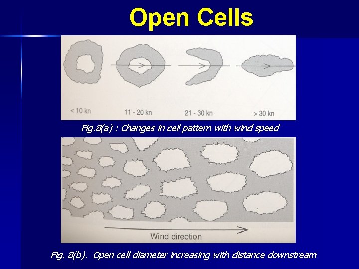
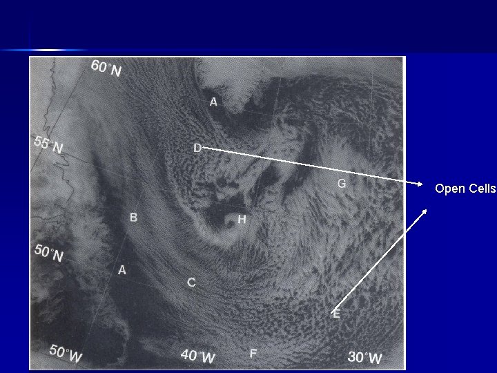
Open Cells They are cloud formations of quasi-hexagonal shape with cloudless space inside and a ring of convective clouds at the edges. The cloud ring consists of a number of cloud elements merging into one another or separated by cloud free spaces. Usually develop during cold air outbreak at locations where air-sea temp difference is greatest. They are normally associated with little vertical wind shear. Downdraughts are induced from evaporative cooling by rain in CB and hence the shape of a ring. Deepest convection occurs ahead of upper air trough with low level cyclonic low level flow. With wind speed < 20 kt, the shape is polygonal (Fig. 8(a)) and when speed is light they may appear hexagonal.

Open Cells Fig. 8(a) : Changes in cell pattern with wind speed Fig. 8(b). Open cell diameter increasing with distance downstream

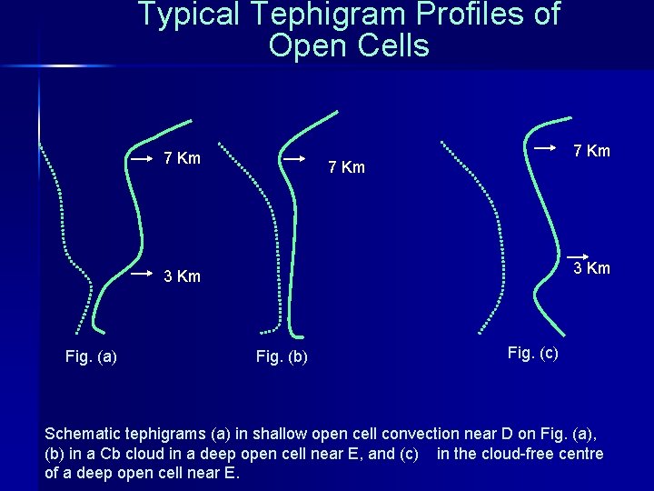
Typical Tephigram Profiles of Open Cells 7 Km 3 Km Fig. (a) Fig. (b) Fig. (c) Schematic tephigrams (a) in shallow open cell convection near D on Fig. (a), (b) in a Cb cloud in a deep open cell near E, and (c) in the cloud-free centre of a deep open cell near E.

Open Cells

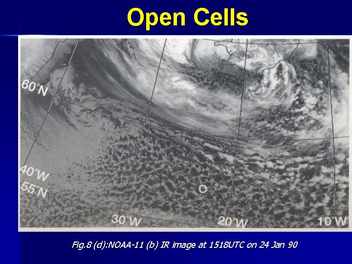
Open Cells Fig. 8 (d): NOAA-11 (b) IR image at 1518 UTC on 24 Jan 90

Open Cells As the wind speed becomes >20 kt, the peripheral ring may become more broken and their dimension tend to increase along the flow (Fig. 8(b)). Their horizontal extent varies from 10 -100 kilometers. In the satellite imagery an open cellular field has less than 50 percent of cloud cover. In the extra tropical latitudes open cloud cells consist of Cu or Cb whereas in the subtropics they consist mostly of Sc and Cu. The diameter of open cells is related more to the depth of instability than the wind speed. The cells have aspect ratio up to 30: 1(Diameter to height) The open cells in satellite imageries are shown in Fig 8(c) and Fig 8. (d).

Closed Cells They are quasi-hexagonal in shape with rising air at the centre and descending air at the edges. Their edges are surrounded by cloudless space. Closed convective cells consist of Sc clouds. The horizontal sizes of cells vary from 10 -100 km. A closed cellular field forms a near overcast condition. With wind speed >20 kt, the peripheral ring may become more broken and their dimension tend to increase along the flow. They are found in subsiding air where unstable air is capped by stable air.

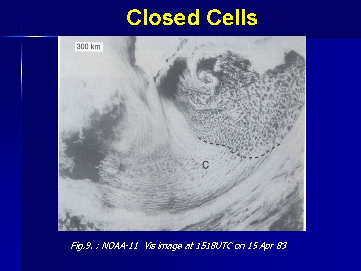
Closed Cells They can also result from radiative cooling of stratiform cloud tops. They are mainly associated with anti-cyclonic low level flow. They are seen on SE quadrant of oceanic anticyclone in NH Closed cellular structure can be produced if air and sea temp diff is large and there is a strong inversion aloft. They are commonly associated with weak convection and low level winds < 20 Kt. They appear white in Visible image but relatively warm in IR image. Closed cellular field has >80 % cloud cover. In Fig. 9, closed cells are seen at C. The dashed line in the fig is the boundary between open and closed cells.

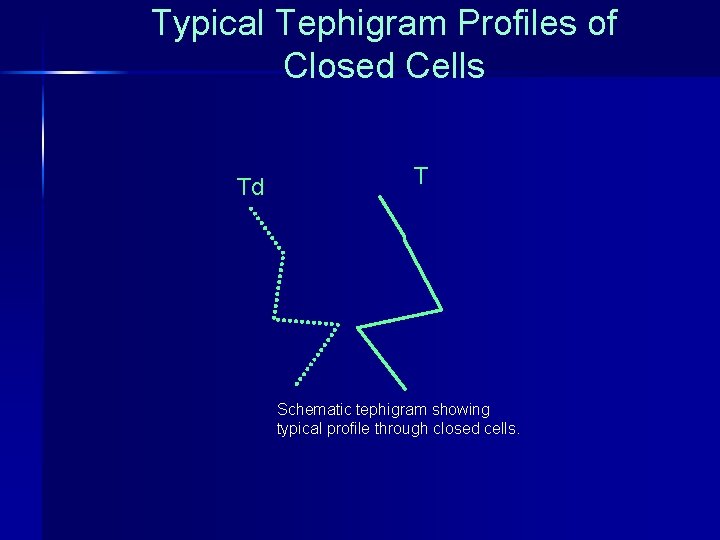
Typical Tephigram Profiles of Closed Cells Td T Schematic tephigram showing typical profile through closed cells.

Closed Cells Fig. 9. : NOAA-11 Vis image at 1518 UTC on 15 Apr 83

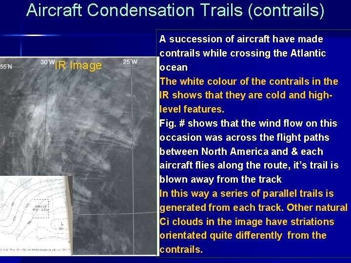
Aircraft Condensation Trails (contrails) IR Image A succession of aircraft have made contrails while crossing the Atlantic ocean The white colour of the contrails in the IR shows that they are cold and highlevel features. Fig. # shows that the wind flow on this occasion was across the flight paths between North America and & each aircraft flies along the route, it’s trail is blown away from the track In this way a series of parallel trails is generated from each track. Other natural Ci clouds in the image have striations orientated quite differently from the contrails.

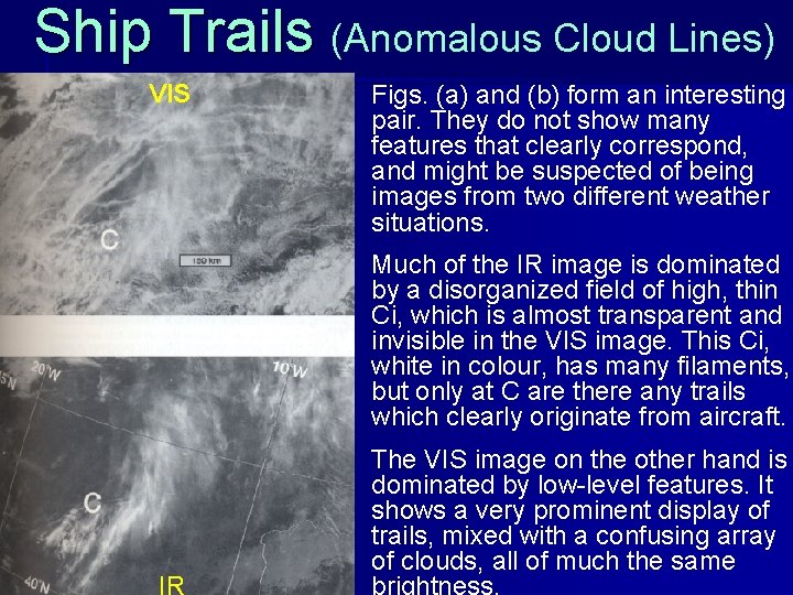
Ship Trails (Anomalous Cloud Lines) VIS Figs. (a) and (b) form an interesting pair. They do not show many features that clearly correspond, and might be suspected of being images from two different weather situations. Much of the IR image is dominated by a disorganized field of high, thin Ci, which is almost transparent and invisible in the VIS image. This Ci, white in colour, has many filaments, but only at C are there any trails which clearly originate from aircraft. The VIS image on the other hand is dominated by low-level features. It shows a very prominent display of trails, mixed with a confusing array of clouds, all of much the same brightness.

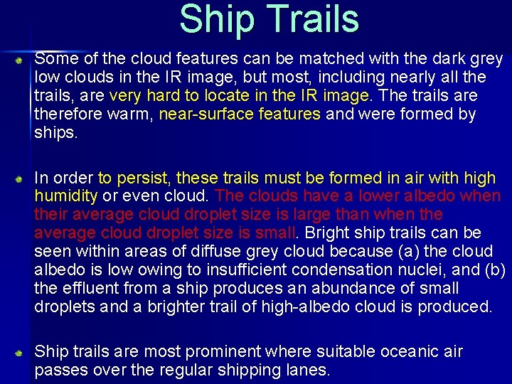
Ship Trails Some of the cloud features can be matched with the dark grey low clouds in the IR image, but most, including nearly all the trails, are very hard to locate in the IR image. The trails are therefore warm, near-surface features and were formed by ships. In order to persist, these trails must be formed in air with high humidity or even cloud. The clouds have a lower albedo when their average cloud droplet size is large than when the average cloud droplet size is small. Bright ship trails can be seen within areas of diffuse grey cloud because (a) the cloud albedo is low owing to insufficient condensation nuclei, and (b) the effluent from a ship produces an abundance of small droplets and a brighter trail of high-albedo cloud is produced. Ship trails are most prominent where suitable oceanic air passes over the regular shipping lanes.