Lectures 4 6 Summary Earthquake Science Condensed John





- Slides: 31
Lectures 4 -6 (Summary) Earthquake Science (Condensed) John Rundle GEL/EPS 131
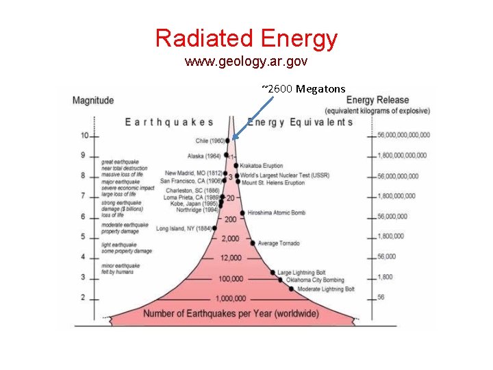
Earthquake Energy – Basic Facts • Approximately 1016 Joules/yr of radiated energy are released in earthquakes • Radiated energy (energy in waves) is only one part of the energy budget • There is also energy of heating on the fault, change in stored elastic energy, and change in gravitational potential energy • A good discussion is in H. Kanamori (Journal of Geophysical Research, 1977)
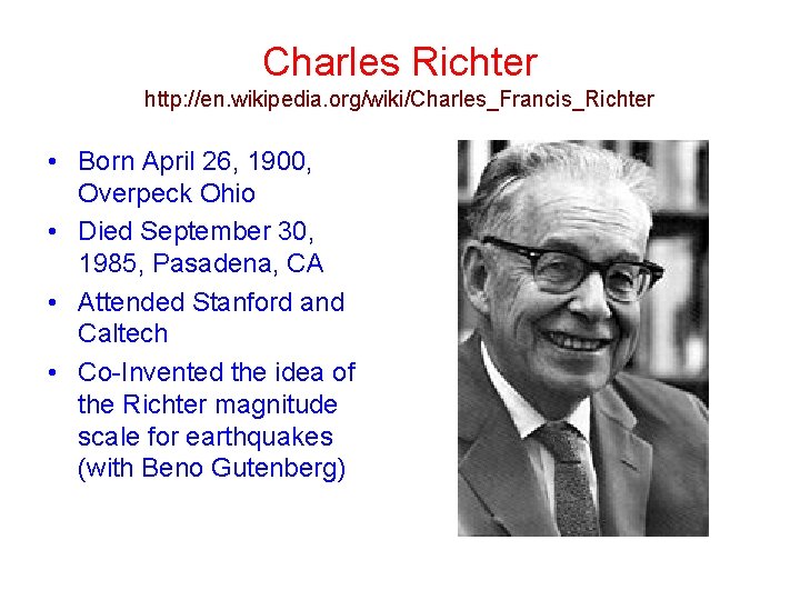
Charles Richter http: //en. wikipedia. org/wiki/Charles_Francis_Richter • Born April 26, 1900, Overpeck Ohio • Died September 30, 1985, Pasadena, CA • Attended Stanford and Caltech • Co-Invented the idea of the Richter magnitude scale for earthquakes (with Beno Gutenberg)
Charles Richter http: //en. wikipedia. org/wiki/Charles_Francis_Richter • • • Richter went to work at the Carnegie Institute in 1927 after receiving a job offer to be a research assistant there from Robert Millikan Here he began a collaboration with Beno Gutenberg. The Seismology Lab at the California Institute of Technology was hoping to begin publishing regular reports on earthquakes in southern California and had a pressing need to have a system of measuring the strength of earthquakes for these reports. Together, they had devised the scale that would become known as the Richter scale to fill this need, based on measuring quantitatively the displacement of the earth due to seismic waves, as had been suggested by Kiyoo Wadati, a Japanese seismologist. The pair designed a seismograph that measured this displacement, and developed a logarithmic scale to measure amplitude of displacement.
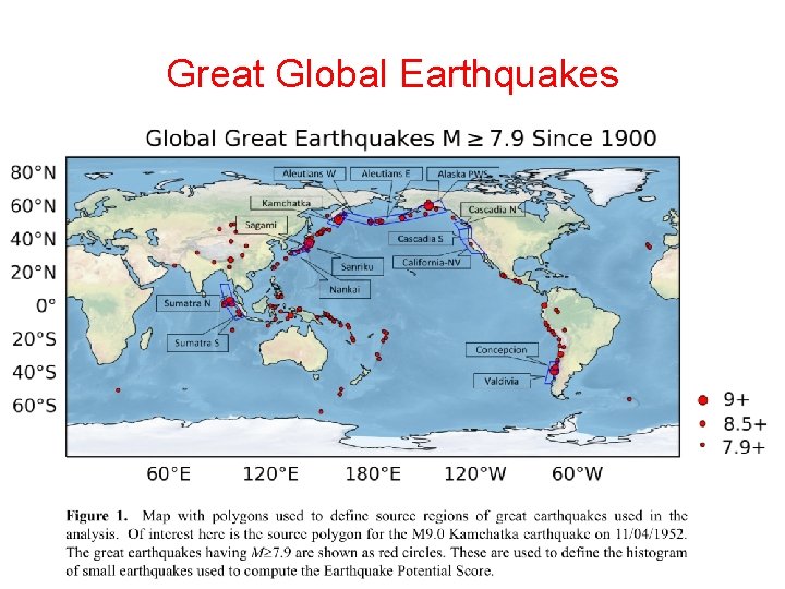
Great Global Earthquakes
Radiated Energy www. geology. ar. gov ~2600 Megatons
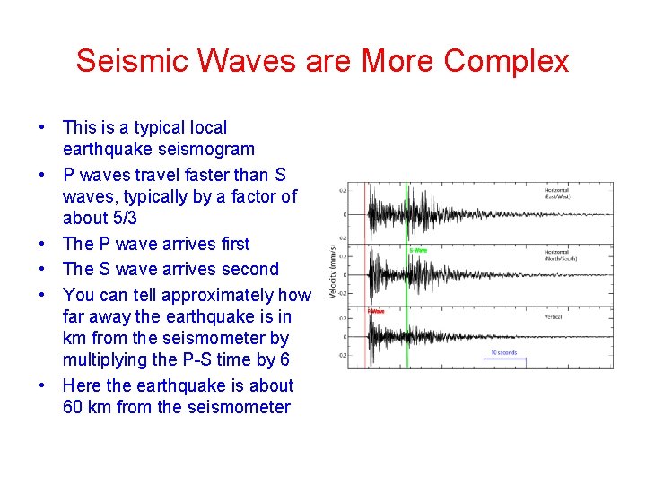
Seismic Waves are More Complex • This is a typical local earthquake seismogram • P waves travel faster than S waves, typically by a factor of about 5/3 • The P wave arrives first • The S wave arrives second • You can tell approximately how far away the earthquake is in km from the seismometer by multiplying the P-S time by 6 • Here the earthquake is about 60 km from the seismometer
Seismometers are of Two Types • Velocity transducers, that measure the ground velocity at the seismometer site • Strong motion instruments, that measure the ground acceleration at the seismometer • It can be shown that acceleration decays more rapidly with distance than does velocity, although the relationship is complex • Ground motion also depends on magnitude of the source earthquake, due to saturation effects • This is discussed for example in Boore and Atkinson (Earthquake Spectra, 2008)
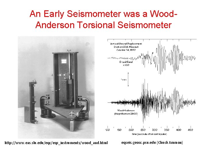
An Early Seismometer was a Wood. Anderson Torsional Seismometer http: //www. eas. slu. edu/eqc_instruments/wood_and. html eqseis. geosc. psu. edu (Chuck Ammon)
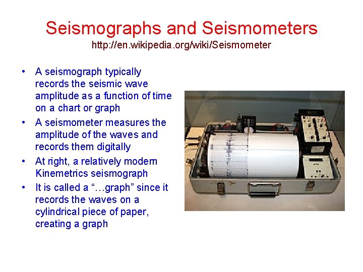
Seismographs and Seismometers http: //en. wikipedia. org/wiki/Seismometer • A seismograph typically records the seismic wave amplitude as a function of time on a chart or graph • A seismometer measures the amplitude of the waves and records them digitally • At right, a relatively modern Kinemetrics seismograph • It is called a “…graph” since it records the waves on a cylindrical piece of paper, creating a graph
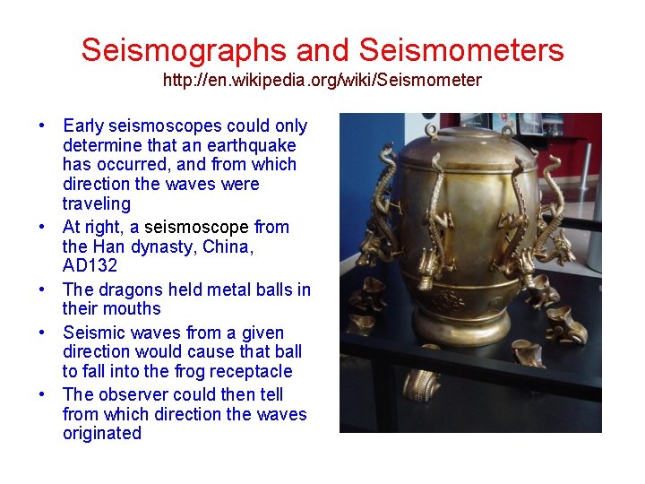
Seismographs and Seismometers http: //en. wikipedia. org/wiki/Seismometer • Early seismoscopes could only determine that an earthquake has occurred, and from which direction the waves were traveling • At right, a seismoscope from the Han dynasty, China, AD 132 • The dragons held metal balls in their mouths • Seismic waves from a given direction would cause that ball to fall into the frog receptacle • The observer could then tell from which direction the waves originated
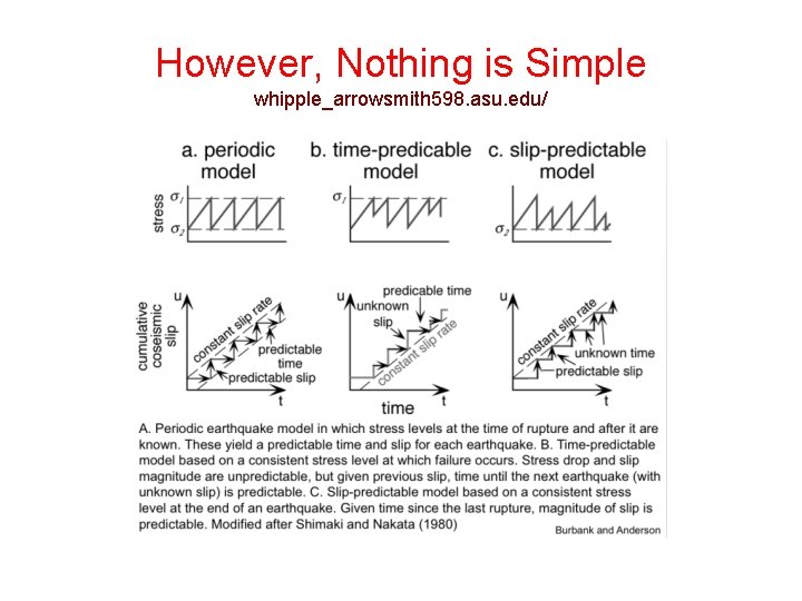
Earthquake Recurrence • Generally defined to be the average time interval between earthquakes on a fault • However, earthquakes on a fault do not repeat exactly • Should we use a point on a fault, or should we use some other criterion? • What to do if the earthquakes are usually different in magnitude and extent?
However, Nothing is Simple whipple_arrowsmith 598. asu. edu/
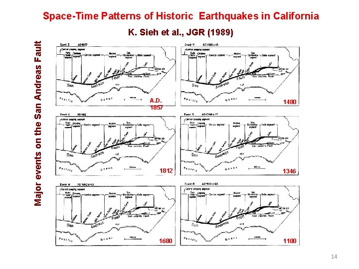
Space-Time Patterns of Historic Earthquakes in California Major events on the San Andreas Fault K. Sieh et al. , JGR (1989) A. D. 1857 1480 1812 1346 1680 1100 14
Recurrence and Paleoseismology whipple_arrowsmith 598. asu. edu/
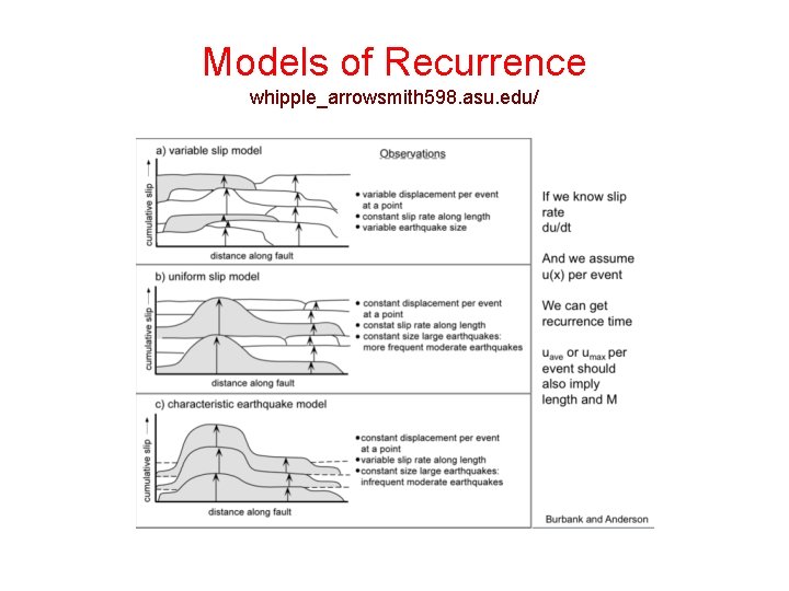
Models of Recurrence whipple_arrowsmith 598. asu. edu/
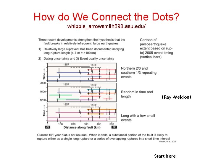
How do We Connect the Dots? whipple_arrowsmith 598. asu. edu/ (Ray Weldon) Start here
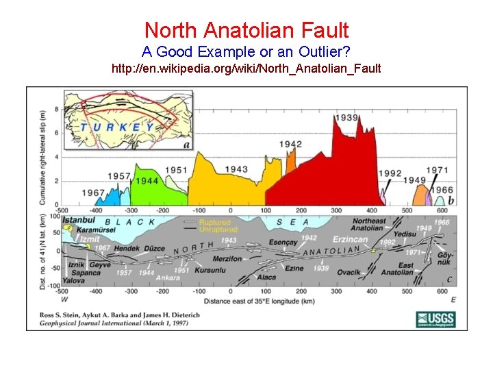
North Anatolian Fault A Good Example or an Outlier? http: //en. wikipedia. org/wiki/North_Anatolian_Fault
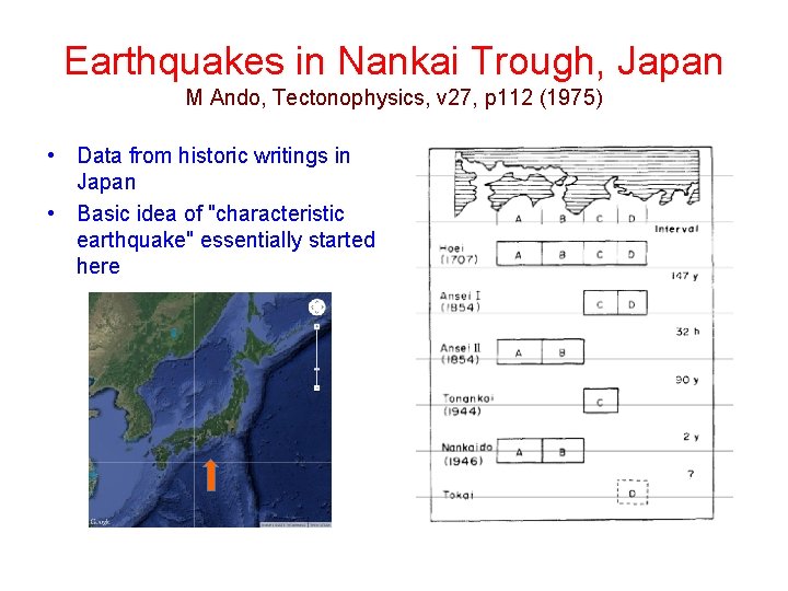
Earthquakes in Nankai Trough, Japan M Ando, Tectonophysics, v 27, p 112 (1975) • Data from historic writings in Japan • Basic idea of "characteristic earthquake" essentially started here
Two Types of Earthquake Measures • • Magnitude: A measure that characterizes the earthquake source (also seen in other types of hazard phenomena) Intensity: A measure that characterizes the effect of the earthquake on a local site (as before: seen in other types of hazard phenomena) Definitions • • • Epicenter: The point, projected onto the earth’s surface, at which the fault slip starts. Typically stated in latitude and longitude. Hypocenter: The actual point within the earth at which the fault slip starts. Typically stated in latitude, longitude, and depth. Source region: A somewhat loose term used to describe the volume of rock encompassing the active fault
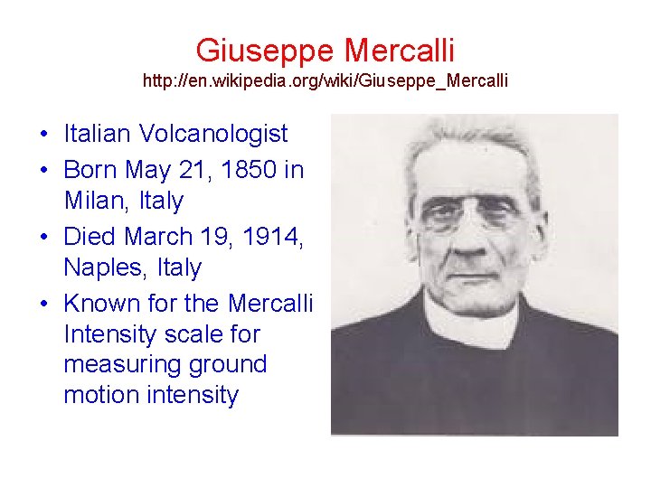
Giuseppe Mercalli http: //en. wikipedia. org/wiki/Giuseppe_Mercalli • Italian Volcanologist • Born May 21, 1850 in Milan, Italy • Died March 19, 1914, Naples, Italy • Known for the Mercalli Intensity scale for measuring ground motion intensity
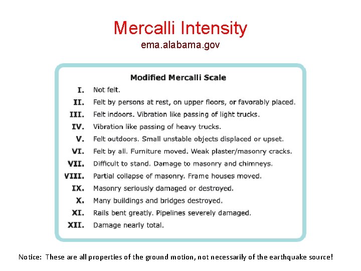
Mercalli Intensity ema. alabama. gov Notice: These are all properties of the ground motion, not necessarily of the earthquake source!
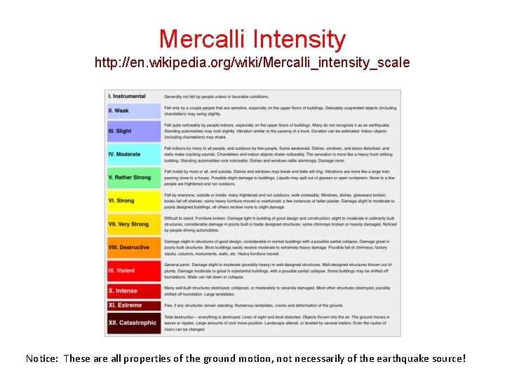
Mercalli Intensity http: //en. wikipedia. org/wiki/Mercalli_intensity_scale Notice: These are all properties of the ground motion, not necessarily of the earthquake source!
Mercalli Intensity vs. Magnitude • The Mercalli scale was a big advance for its time, and we still use it to express ground motion intensity • However, it says nothing about the earthquake source or its energy release • A great earthquake far away can produce the same ground motion as a small close-by earthquake • The magnitude scale was invented to address these problems – it characterizes only the source! • Note that other intensity scales exist besides Modified Mercalli Intensity: E. g. , the Japan Meteorogical Agency (JMA) intensity scale
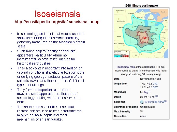
Isoseismals http: //en. wikipedia. org/wiki/Isoseismal_map • • • In seismology an isoseismal map is used to show lines of equal felt seismic intensity, generally measured on the Modified Mercalli scale. Such maps help to identify earthquake epicenters, particularly where no instrumental records exist, such as for historical earthquakes. They also contain important information on ground conditions at particular locations, the underlying geology, radiation pattern of the seismic waves and the response of different types of buildings. They form an important part of the macroseismic approach, i. e. that part of seismology dealing with non-instrumental data. The shape and size of the isoseismal regions can be used to help determine the magnitude, focal depth and focal mechanism of an earthquake.
Construction of Isoseismal Maps http: //en. wikipedia. org/wiki/Isoseismal_map • • “First, observations of the felt intensity need to be obtained for all areas affected by the tremor. In the case of recent earthquakes news reports are augmented by sending out questionnaires or by collecting information online about the intensity of the shaking. For a historical earthquake the procedure is much the same, except that it requires searching through contemporary accounts in newspapers, letters and diaries etc. Once the information has been assembled and intensities assigned at the location of the individual observations, these are plotted on a map. Isoseismal lines are then drawn to link together areas of equal shaking. ’ Because of local variations in the ground conditions isoseismals will generally separate zones of broadly similar felt intensity, while containing areas of both higher and lower degrees of shaking. To make the isoseismals less subjective, attempts have been made to use computer-based methods of contouring such as kriging, rather than relying on visual interpolation. ”
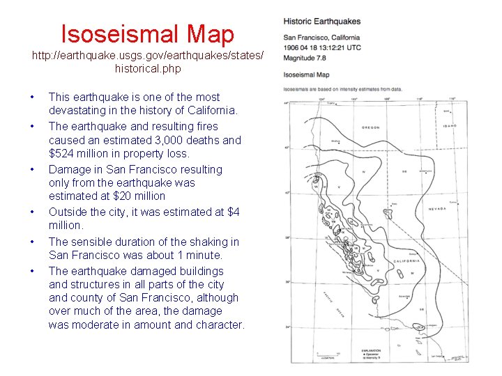
Isoseismal Map http: //earthquake. usgs. gov/earthquakes/states/ historical. php • • • This earthquake is one of the most devastating in the history of California. The earthquake and resulting fires caused an estimated 3, 000 deaths and $524 million in property loss. Damage in San Francisco resulting only from the earthquake was estimated at $20 million Outside the city, it was estimated at $4 million. The sensible duration of the shaking in San Francisco was about 1 minute. The earthquake damaged buildings and structures in all parts of the city and county of San Francisco, although over much of the area, the damage was moderate in amount and character.
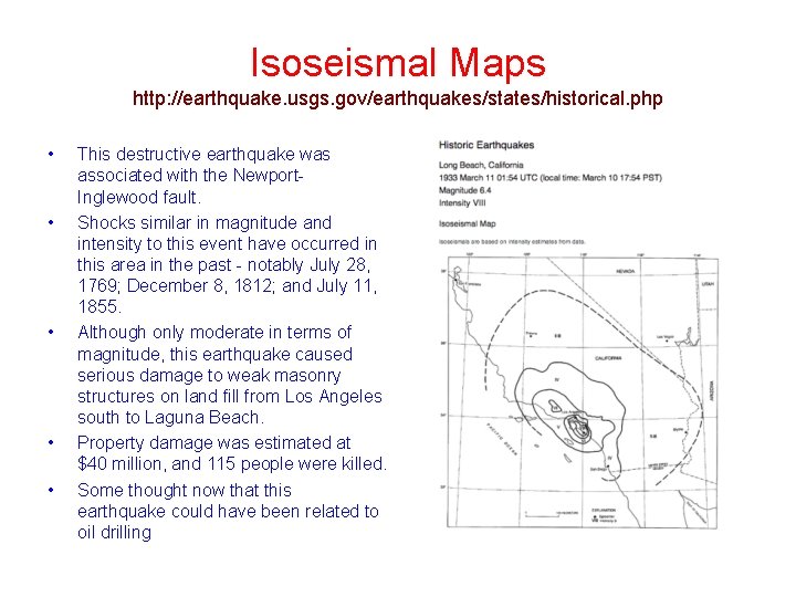
Isoseismal Maps http: //earthquake. usgs. gov/earthquakes/states/historical. php • • • This destructive earthquake was associated with the Newport. Inglewood fault. Shocks similar in magnitude and intensity to this event have occurred in this area in the past - notably July 28, 1769; December 8, 1812; and July 11, 1855. Although only moderate in terms of magnitude, this earthquake caused serious damage to weak masonry structures on land fill from Los Angeles south to Laguna Beach. Property damage was estimated at $40 million, and 115 people were killed. Some thought now that this earthquake could have been related to oil drilling
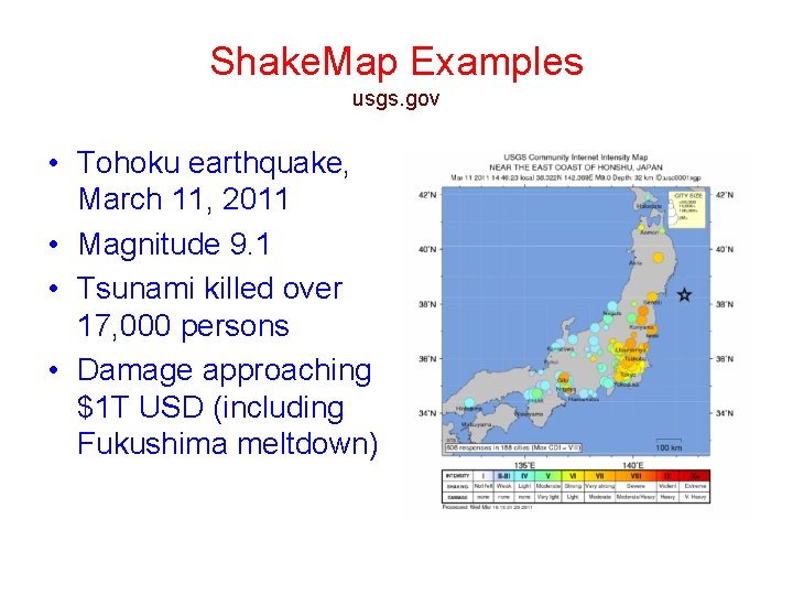
Shake. Map Examples usgs. gov • Tohoku earthquake, March 11, 2011 • Magnitude 9. 1 • Tsunami killed over 17, 000 persons • Damage approaching $1 T USD (including Fukushima meltdown)
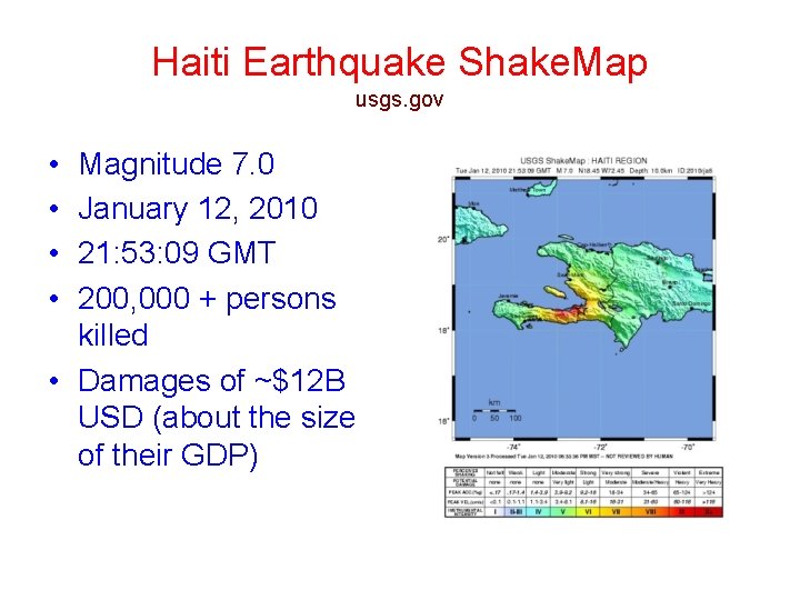
Haiti Earthquake Shake. Map usgs. gov • • Magnitude 7. 0 January 12, 2010 21: 53: 09 GMT 200, 000 + persons killed • Damages of ~$12 B USD (about the size of their GDP)
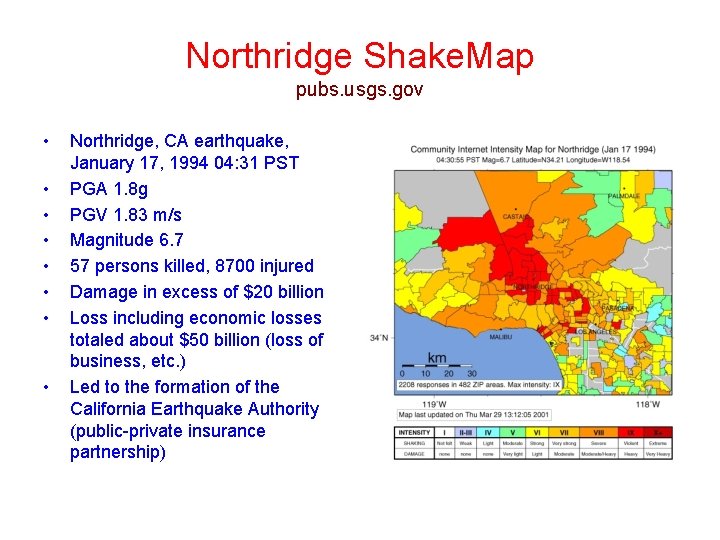
Northridge Shake. Map pubs. usgs. gov • • Northridge, CA earthquake, January 17, 1994 04: 31 PST PGA 1. 8 g PGV 1. 83 m/s Magnitude 6. 7 57 persons killed, 8700 injured Damage in excess of $20 billion Loss including economic losses totaled about $50 billion (loss of business, etc. ) Led to the formation of the California Earthquake Authority (public-private insurance partnership)