KANSAS WATER OFFICE KANSAS DEPARTMENT OF AGRICULTURE March


")
 Local Enhanced Management Areas (LEMAs) Water")
 Intensive Groundwater Use Control Areas (IGUCAs) Local Control Local Enhanced")
 • Signed into law in April 2015 by")
 in an area of need of")


")


")
 • Purpose: Approval of a 20 year term permit using")
 • Must have certified water rights (base")

 § Penalties for failure to submit")

- Slides: 36
KANSAS WATER OFFICE & KANSAS DEPARTMENT OF AGRICULTURE March 2016
More than 80% of Phase I Action Items Complete or Actively Underway
REGIONAL ADVISORY COMMITTEES
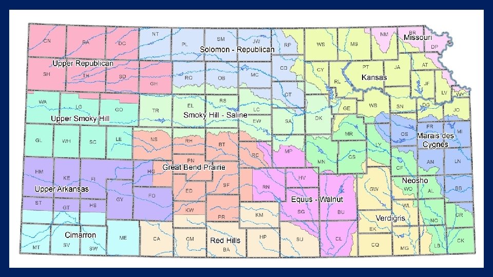
Regional goals prioritized § Newly formed Advisory Committees hit the ground running…. § Reducing groundwater declines in the Ogallala top priority for western regions ØCimarron promoting conservation with flexibility and technology adoption ØUpper Ark focused on LEMA and WCA development to achieve goal ØUpper Smoky proposes 25% reduction by 2025. Net irrigation requirement not exceeded in the region ØUpper Republican looking to partner with GMD #4 for goal setting and implementation ØGreat Bend Prairie and Equus-Walnut propose to achieve and maintain sustainability
Blue Ribbon Funding Task Force • Randall Allen—Kansas Association of Counties • Senator Jim Denning, Overland Park • John Bridson—Westar Energy • Senator Tom Hawk, Manhattan • Colin Hansen—Kansas Municipal Utilities • Senator Larry Powell, Garden City • Gary Harshberger—Kansas Water Authority • Representative Jerry Henry, Atchison • Terry Holdren—Kansas Farm Bureau • Representative Steven Johnson, Assaria • Karma Mason—KS Chamber & KWA • Representative Sharon Schwartz, Washington • Erik Sartorius—League of Kansas Municipalities • Robin Jennison— KDWP&T • Dennis Schwartz—KRWA & KWA • Jackie Mc. Claskey—KDA • Matt Teagarden—Kansas Livestock Association • Susan Mosier—KDHE • Tom Tunnell—Kansas Grain and Feed Association • Tracy Streeter—Kansas Water Office
BRFTF Schedule • March 18 – 1 -3 pm Ø Funding demands from a state perspective Ø Follow up discussion from January meeting • April 19 – All day Ø Stakeholder/public input on funding needs and potential sources Ø RSVP requested to determine number of conferees • May – Establish revenue needs and begin identifying revenue options • August – Review draft report and public input • September – Consideration adoption of final report • November – Present recommendations at Governor’s Water Conference
WATER TECHNOLOGY FARMS
Technology farms gaining momentum……. . • Provides for public/private partnerships • Local, state & federal contributions are possible • KSU and crop consultants play major roles • KWO has devoted funding to this effort • Major component in the Water Vision • • Objective – Reduce groundwater declines and maintain economic returns WCAs or LEMAs recommended to provide structure for water conservation goal • Education and outreach component included • Designed to promote field scale demonstration of various water saving opportunities • Our goal is to have at least one technology farm in each of the western planning regions • • irrigation equipment water management cropping alternatives telemetry • So far, three farms exist…. • Two in the Upper Ark • One in the Great Bend Prairie
MDI Evaluation – KSU • 2015 results comparing MDI to spray nozzles • • 30% reduction in evaporation 14” applied @ 600 gpm - 8” @ 300 gpm 247 bu/ac @ 600 gpm – 243 bu/ac @ 300 gpm 10% increase in yield with MDI on the 300 gpm well Water evenly distributed in soil profile Dry soil surface Minimal wheel tracks
WATER CONSERVATION AREAS (WCA)
Red Tape Intensive Groundwater Use Control Areas (IGUCAs) Local Enhanced Management Areas (LEMAs) Water Conservation Areas (WCAs)
Water Conservation Areas (WCAs) Intensive Groundwater Use Control Areas (IGUCAs) Local Control Local Enhanced Management Areas (LEMAs)
What are Water Conservation Areas (WCAs) • Signed into law in April 2015 by Governor Sam Brownback • Provide a tool to water right owners to extend the usable lifetime of the Ogallala-High Plains Aquifer • Developed by a water right owner or group of water right owners with the consent of the chief engineer to reduce water withdrawals while maintaining economic value via water right flexibility
Who is eligible? • Any groundwater right owner(s) in an area of need of conservation: • Groundwater levels in the area are declining or have declined excessively; • Rate of withdrawal of groundwater within the area in question equals or exceeds the rate of recharge in the area; • Preventable waste of water is occurring or may occur in the area; or • Unreasonable deterioration of the quality of water is occurring in the area.
What are the benefits? • Conserving water resources extends the usable lifetime of the water supply • Participation may afford flexibilities that are not available to water right owners outside of a WCA • WCAs do not make any permanent change in enrolling water rights • Can be limited in duration to allow water right owners to try out the controls
Franklin Family WCA Terms • Water rights: Six across two townships in Sherman County • Conservation: Limit irrigation to no more 4, 800 acre-feet every five years (~12 inches per acre, more than 2 inches less than NIR and far below GMD and county average) • Flexibility: Pooled allocation provided no single authorized quantity exceeded • Length: 15 years, evaluated every five years
Westside Dairy Terms • Water rights: Two water rights across four irrigated circles • Conservation: Limit diversions by a 15% conservation factor • Flexibility: Pooled allocation provided no single authorized quantity exceeded; term permit to allow rotation of irrigated acres • Length: Three consecutive one-year terms until 2018; review and renew for additional 5 -year period
RULES AND REGULATIONS & LEGISLATION
Rules and Regulations § Civil and other penalties for overpumping and other violations of the Kansas Water Appropriation Act (To Be Submitted to Department of Administration) § Authority to seal meters (To Be Submitted to Department of Administration) § Demonstration needed for point of diversion moves in areas of significant decline (Delayed for Additional Evaluation) § Civil and other penalties for failure to submit a water use report (Legislative Change)
Category Level A <24 Hours No Penalty w/in 5 yrs Written Notice of Non. Compliance One Penalty w/in 5 yrs $1000 per day and a reduction in quantity equal to 2 X quantity overpumped (not to exceed one year suspension) Two Penalties w/in 5 yrs Three Penalties w/in 5 yrs Level B 24 – 72 Hours $1000 per day and a reduction in in quantity equal to 2 X quantity equal to 3 X quantity overpumped (not to exceed one year suspension) $1000 per day and a one year suspension $1000 per day and a one year $1000 per day and a three year suspension Level C More than 72 Hours $1000 per day and a four year suspension $1000 per day and a three year suspension $1000 per day and a four year suspension $1000 per day and a five year suspension
Authority to Seal Meters § Retain existing regulation authorizing seals to enforce a cease and desist to render pump or other diversion decide inoperable § K. A. R. 5 -3 -6 a revised to allow the Chief Engineer or representatives to place a seal on flowmeters (bolt, chain, lock or any combination thereof) to prevent removal of flowmeter and access to internal working parts § Delegate authority to GMDs
Demonstration for PD Moves > 300 Feet • K. S. A. 82 a-708 b provides that water holders can apply for changes in a water right’s place of use, point of diversion or use made of water, without losing priority of right, provided: • the owner demonstrate to the chief engineer that any proposed change is reasonable and will not impair existing rights;
Demonstration for PD Moves > 300 Feet • No moves can be more than 1320 feet • No hop-scotching. No moves more than 1320 feet from the location of the point of diversion when the rule is implemented. • No moves more than 300 feet where the projected future saturated thickness is less than 40 feet, EXCEPT • Where a GMD has developed a regulation to specify a less future saturated thickness in their district
Demonstration for PD Moves > 300 Feet • Changes greater than 300 feet will still be permitted if they meet the demonstration. Many will. • Moves permitted when the effect of the change in location would not decrease the 50 -year future saturated thickness by more than 20% • The effect of the change is the difference in two Theis analyses: • the maximum impact of the pumping well to the nearest neighboring well, at current location (with the current pumping rate and quantity) vs. • the maximum effect at the proposed location (with the proposed rate and quantity) • Spreadsheet of 50 -Year Calculations http: //dwr. kda. ks. gov/Temp. Transfer/Theis. For. Excel 2010 For 300 ft. Move. Rulev 3. xlsm
Example Demonstration • Current location is 2398 feet from nearest well, pumping 196 acre-feet at 450 gpm. • Proposed location is 1795 feet fro nearest well, would pump 254 acre-feet at 915 gpm. • Best aquifer parameters used from GMD 3 model. • Projected future saturated thickness after 50 years is 62 feet. • 20% of 62 feet is 12. 4 ft, allowed as additional impact • Max. future impact at current location is 6. 81 feet. At proposed location is 10. 59 ft. • Difference is 3. 78 ft. Ok.
INTEGRATED STOCKWATERING IRRIGATION PERMITS (ISIWR)
Integrated stockwatering irrigation permits • Concept: • Allow for an existing water right associated with a stockwatering facility to be authorized for both irrigation and stockwatering use under the same right • Provide flexibility between uses as head count and the nutrient management plan fluctuates
Integrated stockwatering irrigation permits • Certified irrigation water right can be changed to add stockwatering use if the irrigation water right current authorized point of diversion and place of use are retained • Authorize irrigation and stockwatering uses on the same water right, add the new place of use and use made of water allowing the flexibility of the quantity to be used for either use during a calendar year • Original irrigation right remains as authorized prior to the approval of the dual use water right if the dual use right should no longer be needed for stockwatering use • Conditioned requiring totalizing flowmeters installed to current specifications in a manner that will accurately measure both uses the right separately • Require filing a separate annual water use report for each beneficial use
STOCKWATERING FACILITY PERMIT (SFP)
Stockwatering Facility Permit (SFP) • Purpose: Approval of a 20 year term permit using multiple stockwatering water rights as base water rights to provide the quantity for the term permit. • Primary Focus: Existing stockwatering water rights; allow for flexibility in water use and application; Should alleviate overpumping on single wells and the need for after the fact term permits to cover the unauthorized use. • Goal: Improve water management by enabling flexibility in the use and application of water, while neither impairing existing water rights, nor increasing the total amount of water diverted from a source of supply, such that this flexibility has no long-term additional negative effect on the source of supply
Requirements for the Stockwatering Facility Permit (SFP) • Must have certified water rights (base rights) that currently operate under common management and are currently authorized for STK. • Must establish a boundary for the SFP Term Permit, limited to the current combined physical limits of the STK facility which will become the overall place of use for the SPF. • Must determine a total quantity for the SFP that equals the current combined quantities for the STK water rights and must line up with KDHE’s waste permit. • The Base Water Rights selected for the SFP will overlap in place of use and shall be suspended while the SFP is authorized. The base water rights will retain full authority if and when the SFP is requested to be dismissed by the applicant. • The points of diversion of the base water rights placed into the SFP must be within 2 miles of the SFP point of diversion (geographic center of the project area). • Surface Water source of supply and Groundwater source of supply cannot be included on the same SFP application. • All base water rights must be in the same source of supply. • A base water right cannot be enrolled in multiple SFPs.
Steps to Obtain a SFP • Step 1. The applicant determines which base water rights the owner wishes to enroll (suspend) under the SFP. • Step 2. Completes the application form listing each of the base rights the owner is suspending. The SFP Term Permit point of diversion is a specified geographic center for the SFP area, which will encompass all of the proposed base water rights. • Step 3. Designate the STK Place of Use. • Step 4. Sum up total quantity of water and proposed rate of diversion for the SFP.
Legislative Items § Multi-Year Flex Accounts (SB 329) § Penalties for failure to submit water use reports (SB 337 & HB 2491) § Conservation Reserve Enhancement Program (CREP) (SB 330) § Water Right Filing Fee (SB 322/ S Sub H 2059)
QUESTIONS & DISCUSSION