Hussein S El Khansa Geospatial Transportation Information Section

- Slides: 28
Hussein S. El Khansa Geospatial Transportation Information Section Program Planning & Administration Division of Highways West Virginia Department of Transportation
Agenda v GIS Program at WVDOT v Enterprise GIS Development at WVDOT v Geospatial Resources at WVDOT: v Esri Roads & Highways v ERP(wv. OASIS) - Asset Management System v Questions & Discussion
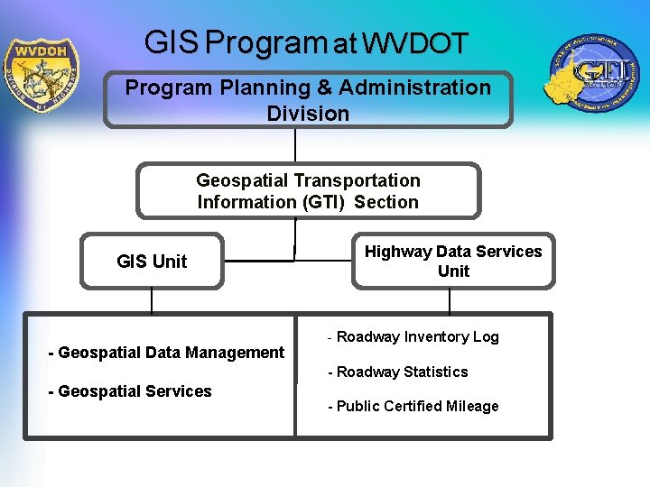
GIS Program at WVDOT Program Planning & Administration Division Geospatial Transportation Information (GTI) Section GIS Unit - Geospatial Data Management Highway Data Services Unit - Roadway Inventory Log - Roadway Statistics - Geospatial Services - Public Certified Mileage
Ongoing Major GIS Projects Support for ERP(wv. OASIS) - Asset Management System Our Advanced Solution with Integrated Systems Enterprise GIS Development Project. Wise Implementation Transportation GIS Data Collection GIS Portal New Straight Line Diagram New Highway Maps Web Mapping Applications 3 D GIS
WVDOT Data Sources • Routes (linear referencing system, LRS) • Non-State Public Routes (NSPR) • Ramps • Roadway Inventory Log (RIL) New county-level geometry and attribute edits • Local roads • Segmentation - split geometry at intersections (nodes) • Addressing
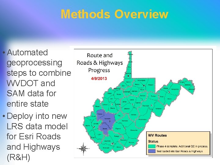
Methods Overview • Automated geoprocessing steps to combine WVDOT and SAM data for entire state • Deploy into new LRS data model for Esri Roads and Highways (R&H)
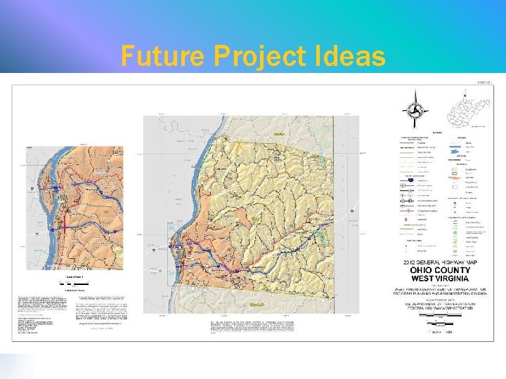
Future Project Ideas § Improved Federal Highway Performance Monitoring System reporting § Enhanced connections to local routes on printed and web-based maps § Updated routing for analysis – desktop and web mapping • Maintenance materials acquisition • Coal Resource Transportation System (CRTS)
Future Project Ideas
ESRI Roads and Highways • Advanced Linear Referencing System capabilities. • Easily manage, visualize, and analyze roadway networks and associated data for better planning, management, and maintenance. • Intelligently manage the location and position of asset data and information. • Use a workflow-driven process to improve quality and simplify management and maintenance of roadway geometry and asset data. • Integrate with existing roadway data and information stored in separate data systems. • Redlining capabilities to allow district and other central offices the ability to submit edits to our roadway network and assets.
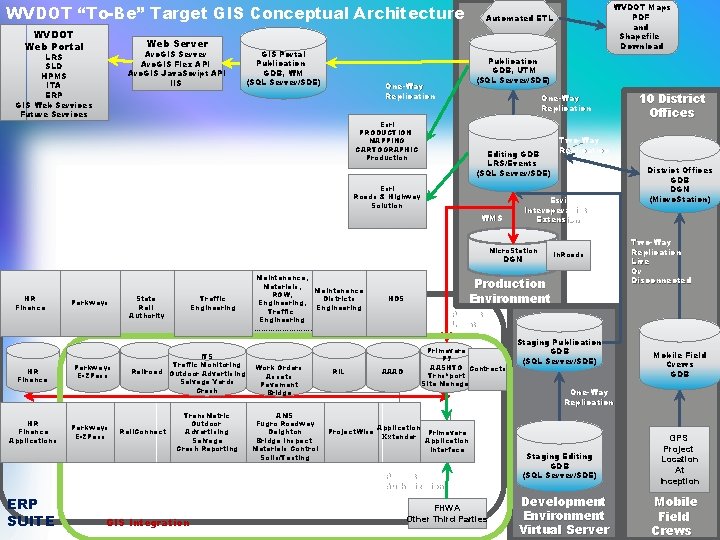
WVDOT “To-Be” Target GIS Conceptual Architecture WVDOT Web Portal Web Server Arc. GIS Flex API Arc. GIS Java. Script API IIS LRS SLD HPMS ITA ERP GIS Web Services Future Services GIS Portal Publication GDB, WM (SQL Server/SDE) Publication GDB, UTM (SQL Server/SDE) One-Way Replication Esri PRODUCTION MAPPING CARTOGRAPHIC Production Editing GDB LRS/Events (SQL Server/SDE) Esri Roads & Highway Solution Micro. Station DGN HR Finance Applications Parkways E-ZPass State Rail Authority ITS Traffic Monitoring Railroad Outdoor Advertising Salvage Yards Crash Rail. Connect Trans. Matric Outdoor Advertising Salvage Crash Reporting Work Orders Assets Pavement Bridge AMS Fugro Roadway Deighton Bridge Inspect Materials Control Soils/Testing RIL Project. Wise GIS Integration District Offices GDB DGN (Micro. Station) Two-Way Replication Live Or Disconnected Project Location AAAD Primavera P 7 AASHTO Contracts Trns*port Site Manager Application Primavera Xxtender Application Interface Project Authorization ERP SUITE In. Roads Production Environment HDS 10 District Offices Two-Way Replication Esri Interoperability Extension WMS Maintenance, Materials, Maintenance ROW, Traffic Districts Engineering, Engineering Traffic Engineering …………………. . WVDOT Maps PDF and Shapefile Download Automated ETL FHWA Other Third Parties Staging Publication GDB (SQL Server/SDE) Mobile Field Crews GDB One-Way Replication Develo Staging Editing pment GDB (SQL Server/SDE) Development Environment Virtual Server GPS Project Location At Inception Mobile Field Crews
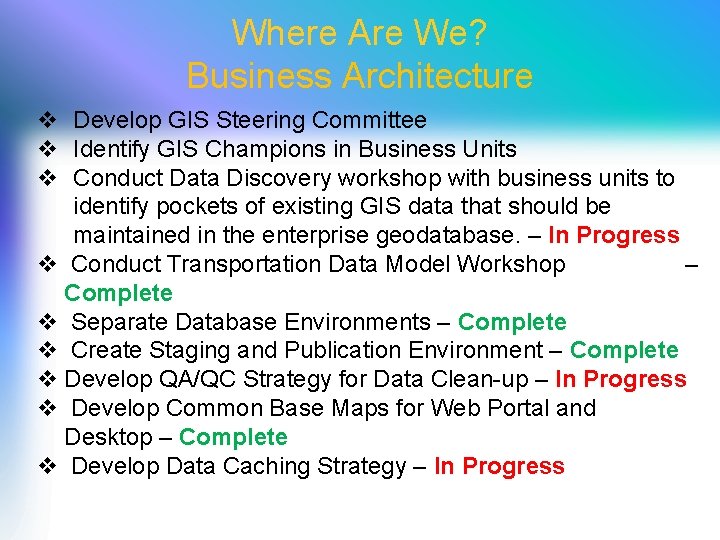
Where Are We? Business Architecture v Develop GIS Steering Committee v Identify GIS Champions in Business Units v Conduct Data Discovery workshop with business units to identify pockets of existing GIS data that should be maintained in the enterprise geodatabase. – In Progress v Conduct Transportation Data Model Workshop – Complete v Separate Database Environments – Complete v Create Staging and Publication Environment – Complete v Develop QA/QC Strategy for Data Clean-up – In Progress v Develop Common Base Maps for Web Portal and Desktop – Complete v Develop Data Caching Strategy – In Progress
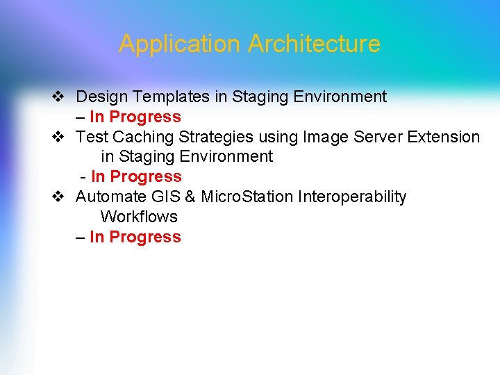
Application Architecture v Design Templates in Staging Environment – In Progress v Test Caching Strategies using Image Server Extension in Staging Environment - In Progress v Automate GIS & Micro. Station Interoperability Workflows – In Progress
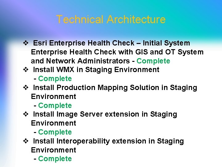
Technical Architecture v Esri Enterprise Health Check – Initial System Enterprise Health Check with GIS and OT System and Network Administrators - Complete v Install WMX in Staging Environment - Complete v Install Production Mapping Solution in Staging Environment - Complete v Install Image Server extension in Staging Environment - Complete v Install Interoperability extension in Staging Environment - Complete
Future Work v Complete Ongoing Tasks v Incorporate and Implement Ideas from the New 2012 Geospatial Strategic Plan by Cambridge Systematics/Transcend Spatial
WVDOT Geospatial Resources At WV DOT v Open to the Public Ø GTI Web Portal Continuously Operating Reference Stations (CORS) Network Ø WVDOT Ø Ø Ø GTI Web Portal CORS Network Fleet Management Videolog Viewer GIS Portal Straight Line Diagram Viewer Ø WVDOH District GIS Coordinator Network Ø GIS/GPS Training Ø Other Services (Transportation GIS User Group, etc. )
Data Catalog v v v Bridges Byways & Backways Guardrails Major Roads by Sign/District/County Railroads River Ports Public Airports WVDOT Facilities WVDOT Rest Areas WVDOT Substations Etc. http: //www. transportation. wv. gov/highways/programplanning/gti/GIS/Pages/Data. Catalog. aspx
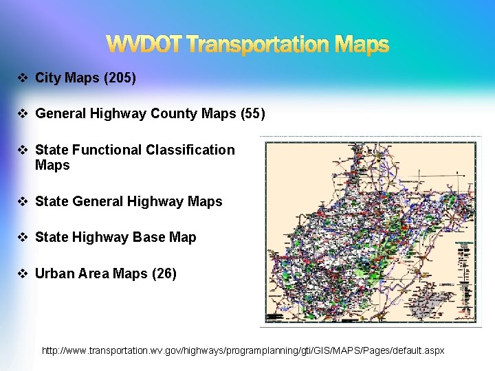
WVDOT Transportation Maps v City Maps (205) v General Highway County Maps (55) v State Functional Classification Maps v State General Highway Maps v State Highway Base Map v Urban Area Maps (26) http: //www. transportation. wv. gov/highways/programplanning/gti/GIS/MAPS/Pages/default. aspx
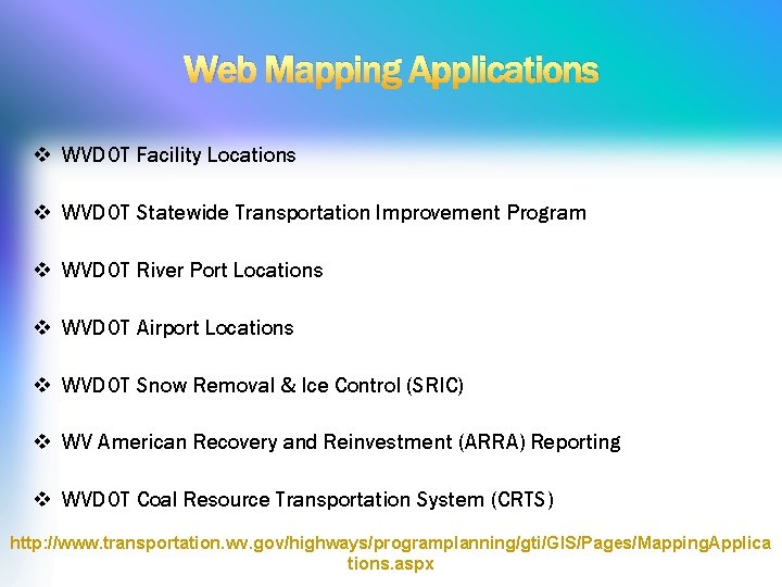
Web Mapping Applications v WVDOT Facility Locations v WVDOT Statewide Transportation Improvement Program v WVDOT River Port Locations v WVDOT Airport Locations v WVDOT Snow Removal & Ice Control (SRIC) v WV American Recovery and Reinvestment (ARRA) Reporting v WVDOT Coal Resource Transportation System (CRTS) http: //www. transportation. wv. gov/highways/programplanning/gti/GIS/Pages/Mapping. Applica tions. aspx
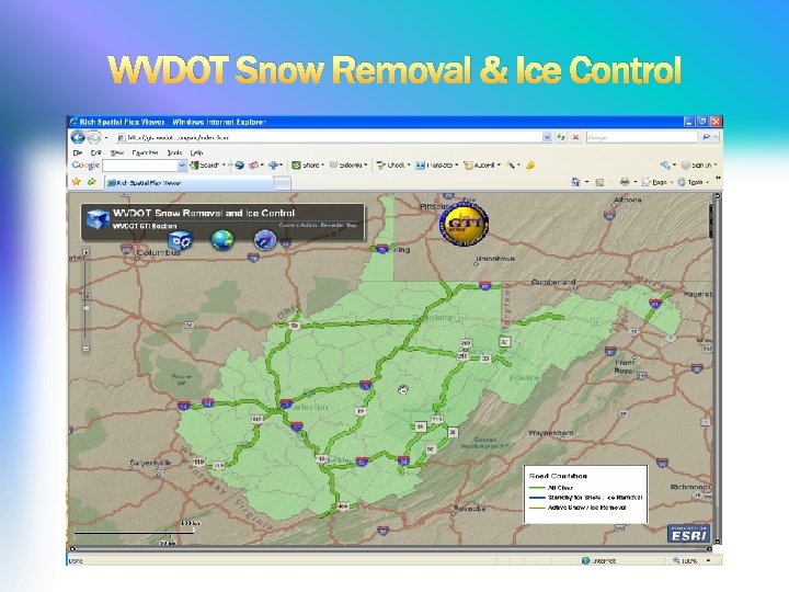
WVDOT Snow Removal & Ice Control
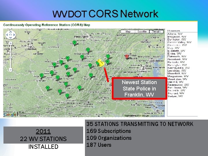
WVDOT CORS Network Newest Station State Police in Franklin, WV 2011 22 WV STATIONS INSTALLED 35 STATIONS TRANSMITTING TO NETWORK 169 Subscriptions 109 Organizations 187 Users
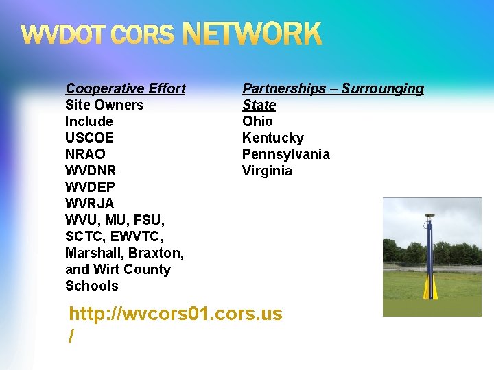
WVDOT CORS NETWORK Cooperative Effort Site Owners Include USCOE NRAO WVDNR WVDEP WVRJA WVU, MU, FSU, SCTC, EWVTC, Marshall, Braxton, and Wirt County Schools Partnerships – Surrounging State Ohio Kentucky Pennsylvania Virginia http: //wvcors 01. cors. us /
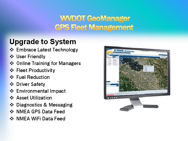
WVDOT Geo. Manager GPS Fleet Management Upgrade to System v v v Embrace Latest Technology User Friendly Online Training for Managers Fleet Productivity Fuel Reduction Driver Safety Environmental Impact Asset Utilization Diagnostics & Messaging NMEA GPS Data Feed NMEA Wi. Fi Data Feed
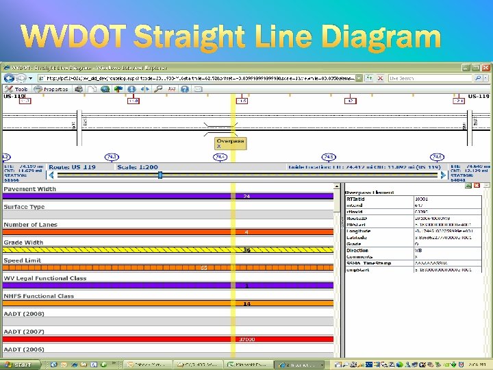
WVDOT Straight Line Diagram
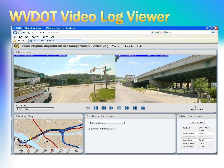
WVDOT Video Log Viewer
International Recognition 2008 ESRI Special Achievement Award in GIS 2010 WV GIS Conference Mapping Awards 2011 ESRI Special Achievement Award in GIS 2011 GIS-T People’s Choice Award 2012 GIS-T People’s Choice Award
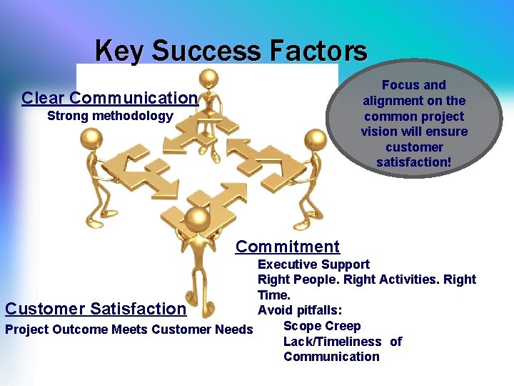
Key Success Factors Focus and alignment on the common project vision will ensure customer satisfaction! Clear Communication Strong methodology Commitment Executive Support Right People. Right Activities. Right Time. Customer Satisfaction Avoid pitfalls: Scope Creep Project Outcome Meets Customer Needs Lack/Timeliness of Communication