Fluxes of water sediment and elements class 1


- Slides: 32

Fluxes of water, sediment, and elements class 1. Introduce instrumentation and approach for surveying and flow gauging 2. Introduce and understand Manning’s equation 3. Consider the meaning of Floods and Bankful Discharge 4. Getting and understanding watershed flux data 5. Logisitcs

1 FLOW GAUGING • QUANTIFY VOLUME OF WATER MOVING THROUGH CHANNEL • NEED CHANNEL GEOMETRY • NEED VELOCITY

1 Survey Across Stream Distance Velocity Water Depth

1 The auto level Your view

1 : ( (: Level the instrument

1 TOP = DISTANCE BOTTOM = DISTANCE CENTER LINE - ELEVATION D

1 Good Data Table is key

Flow meter for measuring water speed 1

Divide and Conquer 1

Add up the pieces 1

1 From counts to speed

Stage and Discharge related through rating curve 1

Water Resources of North Dakota The top of a U. S. Geological Survey staff gage (a graduated rod against which water levels can be read) is barely visible above the water. The top of the gage represents a water level or river stage of 54. 50 feet, 2 feet above the 1997 East Grand Forks city levee. During the 1997 flood, the Red River crested at 54. 35 feet; the National Weather Service flood stage at Grand Forks is 28. 00 feet. 1

WEIR is the permanent solution Q = 2. 47 h 2. 5 1

2 Manning Equation Use fudge factor of 1. 49 when units are feet

2 SLOPE

2 Wetted Perimeter

2

2 http: //wwwrcamnl. wr. usgs. gov/sws/f ieldmethods/Indirects/nvalues/ Clark Fork at Missoula, Montana Boundary Ck at Porthill, Idaho n = 0. 030 n = 0. 073

3 Flow Levels Try to define in field using observations Bank full flow About once a year “Channel-forming flow” This is for alluvial channels

Extreme Floods How does the Huntington Fit? 3

3 DEFINE BASIN AREA COUNT BOXES OR USE DIGITIZER

4 Sediment Transport Through Rivers Bedload -- material moving along the bed, shear forces exerted by water sufficient to move clasts -- rarely measured (at % level) Suspended Load -- material kept in the water column by turbulence and lift forces (easy to measure in grab samples) Dissolved Load -- material in solution (easy to measure in grab samples) Bedload usually <<< than suspended load and ignored Dissolved load varies, usually < than suspended load

Sampling for suspended load……. 4

4 Mass Loadings and Erosion Rate Estimation Integrate suspended load over all flows (mass/time) + Integrate bedload over all flows (mass/time) + Integrate dissolved load over all flows (mass/time)

Load varies over time and discharge

USGS Water Quality Data on line Dissolved and Suspended Load http: //nwis. waterdata. usgs. gov/nwis/qwdata? site_n o=04282815&agency_cd=USGS&begin_date=&e nd_date=&format=html_table&inventory_output= 0&rdb_inventory_output=file&date_format=YYY Y-MMDD&rdb_compression=file&qw_sample_wide=0 &submitted_form=brief_list

4 Integration over all flows is a non trivial problem! Need Rating Curves (suspended, dissolved, bedload) Suspended Load Hysteresis loop

Other Approaches…Reservoir trapping (may miss dissolved) Nahal Yael, Negev Desert 4

4 SEDIMENT YIELD - What comes out = or ≠ Timescale Steady state Human impact Episodic disturbance SEDIMENT GENERATION - Material generated by erosion

River Lab Logistics • • On Huntington, in water Warm clothes, food, $, Daily Bread Measure discharge - survey and velocity Trace flow Compare pools and riffles Field estimate of bankfull stage OLD TENNIS SHOES! Teva/toenail story

Downstream Organization Survey one of each type Calculate discharge for one of each type Calculate roughness for one of each type COMPARE
 Water and water and water water
 A paved blacktop parking lot was built
 Sediment sorting
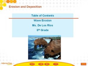
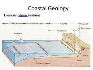
 Type of erosion
 Lithogenous sediment definition
 Ocean currents map
 Sediment traps construction
 Loose solid particles
 Christchurch bay sediment cell
 Construction entrance
 Ooze
Ooze Coawst
 Broad sediment-covered continental shelves
 Urinalysis sediment
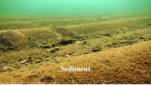
 Sediment
 Table
Table Jetties
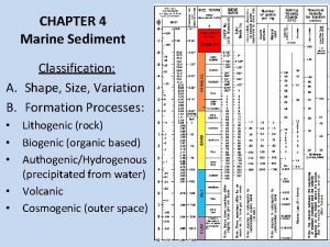
 Marine sediment classification
 Cliff regrading and drainage
 Haptonema function
 Sediment
 Abyssal plain
 Nephrotisches sediment
 Rounded sediment
 Pettijohn classification
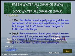
 Dock water allowance
 Overhead allocation
 Abstract class vs concrete class
 Abstract concrete class relationship
 7 rights of medication administration in order
 Static and dynamic class loading in java
 Water consumption water meter reading worksheet
 Water o water
