Earthquakes Poseidon Earthquakes Worldwide Earthquakes Since 1900 Where


 • Developed by Charles F. Richter in 1935. • Measurement of")


 Richter Scale Description Less than 3. 5 Not generally felt by")
 • used for measuring earthquakes (especially large ones), uses three")


- Slides: 52
Earthquakes Poseidon
Earthquakes Worldwide
Earthquakes Since 1900
Where are Earthquakes found? http: //earthquake. usgs. gov/earthquakes/world/ 10_largest_world. php
Montana Earthquakes
What is an Earthquake?
Seismic Waves - P-wave - S- wave - Surface Wave
What happens to seismic waves in Earth’s interior? -
Shadow Zones - P-wave - S-wave
Locating & Measuring Earthquakes Seismograms
- Seismographs produce seismogram Seismograph station at Cornell University
Locating an Earthquake Epicenter - Step 1 - Analyzing 3 Seismograms
- Step 2 - Read Travel-Time Graph
- Step 3 – Triangulate to find Epicenter.
Measuring Earthquakes – Magnitude is a quantitative measurement of energy released. • Richter Scale • Moment Magnitude – Intensity is a qualitative measurement that evaluates the earthquakes shaking perceived by individuals • Modified Mercalli Scale
Measuring Earthquakes – Magnitude is a quantitative measurement of energy released. Two ways to measure energy 1. Richter Scale 2. Moment Magnitude
-Richter Scale (Magnitude) • Developed by Charles F. Richter in 1935. • Measurement of energy. • Each increase of one whole number in Richter magnitude is a 10 x increase in amplitude of wave and a 32 x increase in energy release. For example, a magnitude 6 earthquake has 32 times the energy than a magnitude 5 earthquake. A magnitude 7 earthquake is more than 1024 times (32 x 32) more energy than magnitude 5 earthquake.
Magnitude
Reading a Nomogram
Richter Scale (Magnitude) Richter Scale Description Less than 3. 5 Not generally felt by humans 5. 5 - 6. 0 Slight damage to structures 7. 0 – 7. 9 Serious damage 8. 0 and greater Total destruction of nearby communities
- Moment Magnitude (Magnitude) • used for measuring earthquakes (especially large ones), uses three measurements: 1. Average area of slip along the fault; 2. Distance traveled; and 3. Considers the strength of the rock.
Example Magnitudes Location Date Richter Moment Magnitude San Francisco 1906 8. 3 7. 9 Alaska 1964 8. 5 9. 2 Alaska released at least twice as much energy because it involved greater movements along a much larger fault plane.
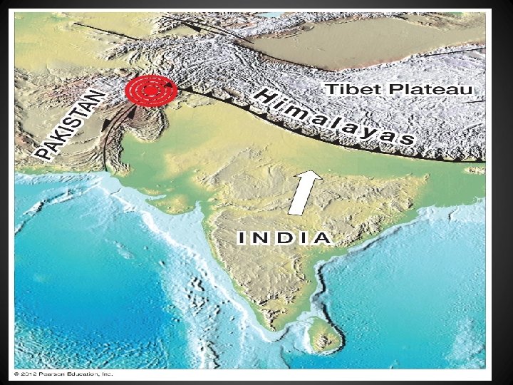
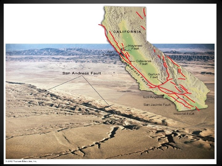
Earthquake Risk Where in the United States is the risk for earthquakes the greatest? Alaska and California are high risks since they are found near plate boundaries. The middle of the country by Missouri is also at a higher risk, because many faults are buried deep beneath sediments deposited by the Mississippi, Missouri, and Ohio rivers.
Damage from Earthquakes • • • Ground shaking Liquefaction Aftershocks Fire Tsunamis
Ground Shaking Ground shaking is produced by the waves set in motion by an earthquake’s sudden release of energy. Some of the ground vibrations are up-and-down, but the largest are side-to-side motions. Most buildings can withstand fairly violent up-and-down shaking; however, few buildings can survive violent side-to-side shaking, and as a result many buildings collapse.
Liquefaction -occurs when loose soil temporarily takes on some of the properties of a liquid. - A building located on soil that settles is no longer safely supported and may collapse. For example, buildings located on bog muds or soil landfill can suffer severe damage or can collapse because of foundation failure.
Liquefaction caused the building in the front to tip nearly 22°. The arrow points to a building that is tipped almost 70°.
Aftershocks - are a series of smaller earthquakes originating close to the focus of the large earthquake.
Fire - One of the most damaging effects of an earthquake may be fires. - Fires are caused by the rupturing of gas lines by ground movement.
Tsunami - Underwater earthquakes and landslides sometimes cause huge ocean waves.
Tsunami When a tsunami reaches shallower water near a shoreline, it will slow down and increase dramatically in height. A tsunami warning system is now in place for regions in the Pacific Ocean. Scientists monitor wave activity at various stations throughout the Pacific.
Tsunami Animation
Elastic Rebound Theory - Stress is released and crust is cracked called the elastic-rebound theory normally occurring at faults. -Stresses: • Plate Tectonics • Thermal expansion and contraction. • Gravitational attraction • Mineral phases
Tensional stress pulls rock away Normal faults occur when rock from adjacent rock thinning along one side of the fault slide crust. down relative to the other. Divergent Boundary
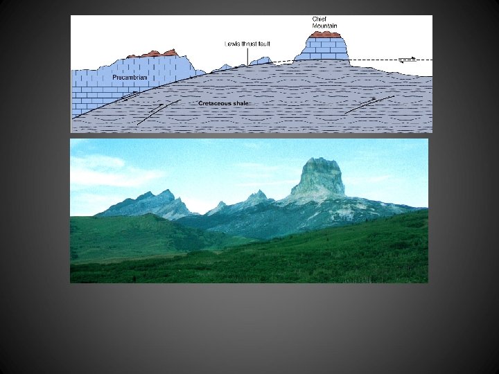
Compressional stress Reverse faults occur when pushes rock together causing. rocks are pushed together and one side of the fault moves up. Convergent Boundary
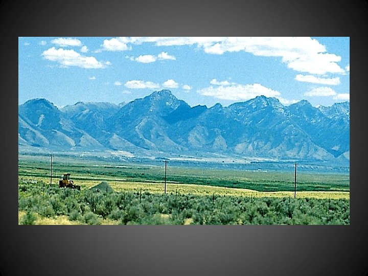
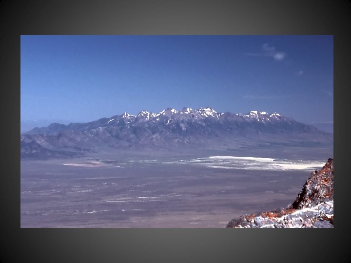
Rocky Mountain Front
Strike-slip faults occur when • Shearing stress pushes rock in two different directions blocks of rock on each side of the fault move in opposite adjacent to one another. directions. TRANSFORM PLATE BOUNDARY
Mountain Building
Isostasy This iceberg demonstrates the process of isostatic rebound.
Ocean-Ocean Convergence trench Volcanic island arc Basaltic magma Examples: Aleutian Islands, Japan Phillipines, ______
Uplifted Mountains intrusive igneous rock, less structural deformation Boulder Example: ______ Batholith
Snycline
Anticline Syncline
Plunging Anticline
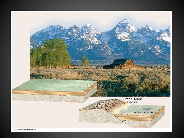
Fault-Block Mountains mostly sediment ary rock Example: Grand _____, Tetons Basin and Range