Chapter 30 Physical Geography of Southeast Asia Oceania

 – Malay (Malaysia, part")


- Slides: 29
Chapter 30 Physical Geography of Southeast Asia, Oceania, and Antarctica
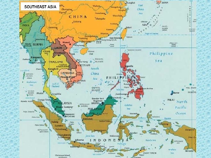
Southeast Asia Physical • Peninsulas – Indochinese (Thailand, Vietnam, Cambodia) – Malay (Malaysia, part of Thailand) • Islands – Archipelago (Philippines, Indonesia) • Mountains – ranges run north and south – Annamese Cordillera • Volcanoes – mostly island mountains • Rivers and coastlines – farming and fishing
Indonesia Singapore Vietnam Philippines www. concierge. com
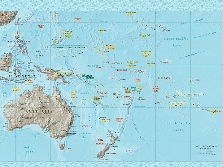
Lands of the Oceania • Oceania – Pacific islands as a group (not Philippines, Indonesia, and islands close to mainland; people tied culturally to Asia) • High islands – created by volcanoes • Low islands – made by coral reefs, poor soil • Oceania not rich in resources
FIJI French Polynesia www. concierge. com
Human-Environment Interaction • Pacific Islanders developed technology to travel the Pacific. • Handmade charts, the voyaging canoe and the outrigger canoe were used. • European colonizers brought rabbits to Australia that grazed crops.
Voyaging Canoe
Outrigger canoe
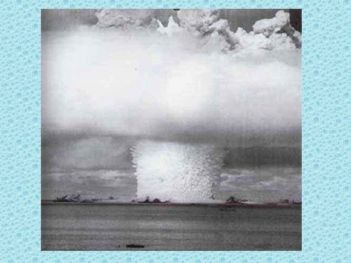
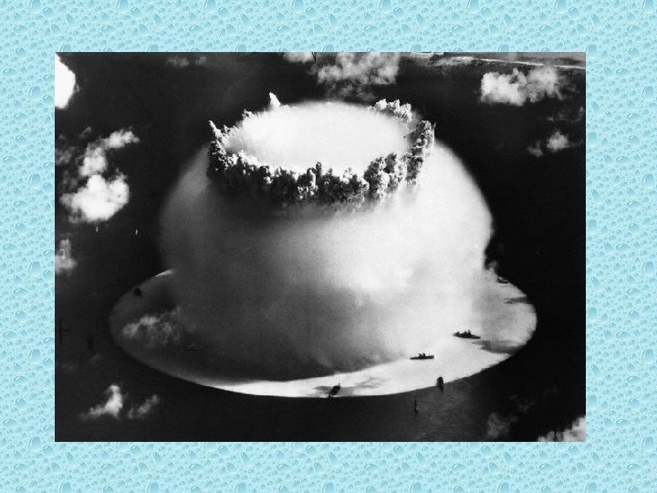
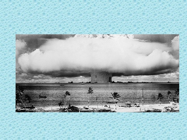
• Bikini Atoll was the site of U. S. atomic weapons tests. • 1951 -1958 U. S. held over 60 explosions that vaporized several islands and contaminated the entire area with radiation.
Long Term Effects • The testing vaporized several small islands and contaminated the entire area with high levels of radiation. • In the 1960 s, the U. S. government declared the Bikini Atoll safe for human habitation however, after the people moved back, many became ill or died. • In 1978, doctors discovered dangerous levels of radiation ins the islanders bodies and they were again removed from the islands
Pacific Ring of Fire
New Zealand Physical • 2 islands – North Island South Island • South Island – South Alps – 16 peaks 10000+ feet – 360+ glaciers • North Island – volcanic – Fertile farmland – Timber industry • Few mineral resources • Rivers for hydroelectricity
www. concierge. com
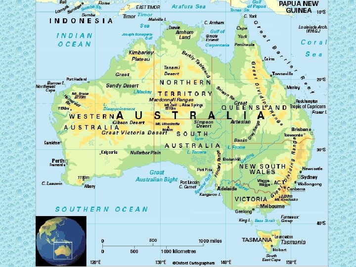
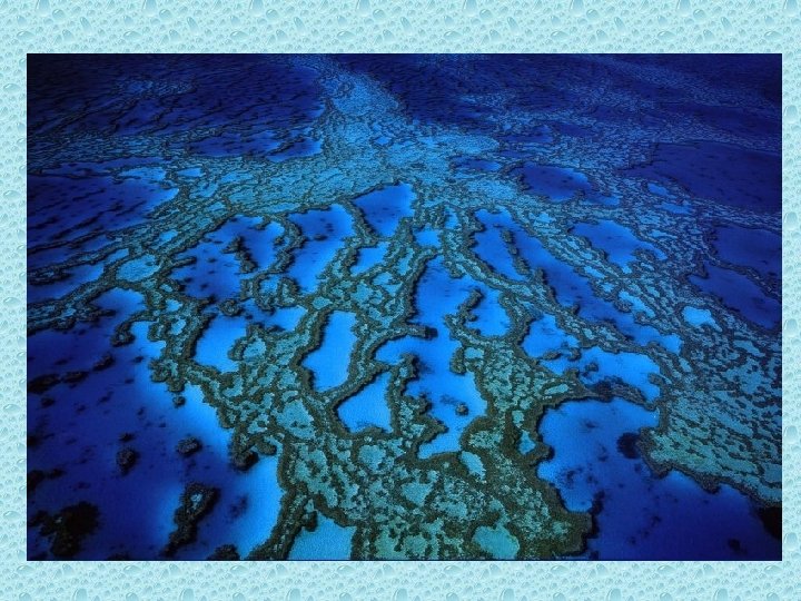
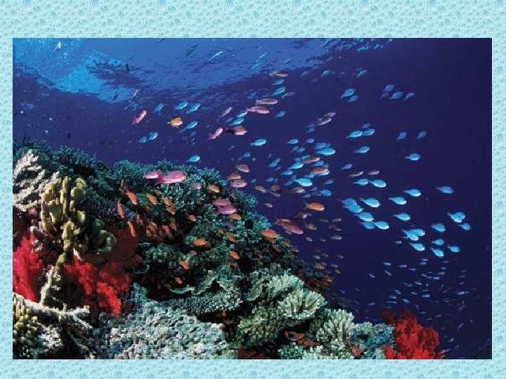
Australia • • • Flattest, smallest continent Very few rivers Rich in minerals Smaller mountains Great Barrier Reef – 1250 mile chain of coral reefs – 400 species of coral
www. concierge. com
The Great Barrier Reef
The Great Barrier Reef
Antarctica
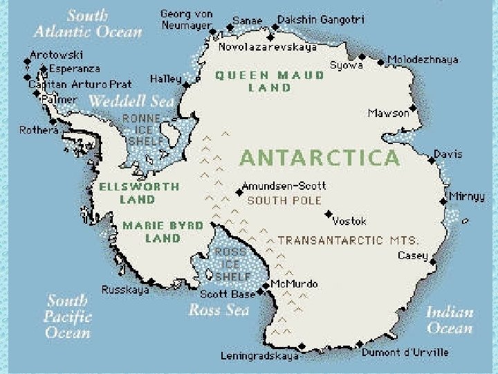
Icy Antarctica • 5 th largest continent • Generally circular, centered on South Pole • Covered by ice – largest fresh water supply in the world • Transantarctic Mountains – split in half – East – plateau surrounded by mounts/valleys – West – group of separate islands linked by ice
http: //www. alaska-in-pictures. com/data/media/22/antarctica-icebergs_4608. jpg http: //www. coolantarctica. com/Bases/South_Pole/south_pole 0002. html http: //www. coolantarctica. com/gallery/scenic/mountains/antarctica_mountains_2. htm