Chapter 21 Southwest Asia Middle East Harsh Arid
 Harsh & Arid Lands")


 Size of Texas")


- Slides: 37
Chapter 21 - Southwest Asia (Middle East) Harsh & Arid Lands
Section 1 Landforms & Resources
Sulemaniye Mosque Turkey
Syria Damascus Umayyad Mosque
Parliament Square in Beirut Lebanon
Tel Aviv Dead Sea Salt Beds Negev Desert Israel Dome of the Rock
Jordan Abdullah Mosque Amman One of the new 7 wonders of the world Petra King Abdullah II
Saddam Hussein Iraq Bombing of Baghdad Tigris River
King Fahd Empty Quarter Saudi Arabia
Iran Tehran Shahid Motahari Mosque
Sanaa Yemen
Mosque Oman Sultan’s Palace
Abu Dhabi United Arab Emirates
Museum Doha Qatar Desert
Kuwait Water Towers Kuwait City Oil wells
Section 1 - Landforms & Resources Peninsulas & Waterways Peninsula- area of land that is almost completely surrounded by water, except for a small portion connecting it to the mainland Strait- narrow body of water connecting 2 larger bodies of water
Section 1 - Landforms & Resources Suez Canal- artificial waterway between the Mediterranean Sea & the Red Sea
Section 1 - Landforms & Resources Arabian Peninsula- very dry, sandy, & windy, covered by plains. Wadis- riverbeds that remain dry except for the rainy season.
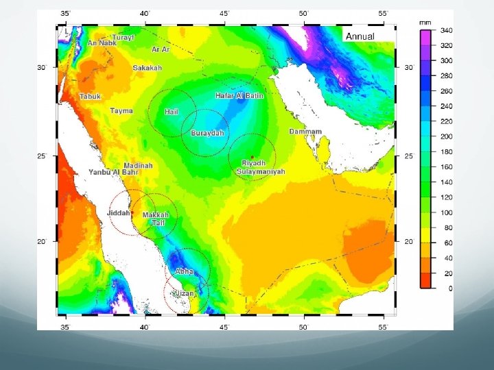
Section 1 - Landforms & Resources Water is the most important resource in this region Tigris & Euphrates river valleys supported several ancient societies
Section 1 - Landforms & Resources Jordan River- provides a natural boundary for Israel & Jordan Flows into the Dead Sea
Section 1 - Landforms & Resources Dead Sea- landlocked salt lake So salty that only bacteria lives in it Lowest place on the exposed surface of the earth. 1349 feet below sea level
Section 1 - Landforms & Resources Oil Largest reserves in the world (1/2 of all known reserves) Most prominent resource Water is still most valuable resource in SW Asia
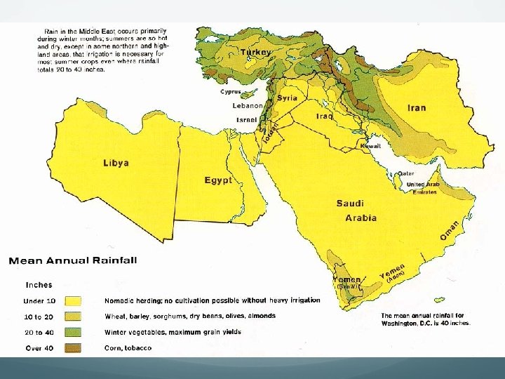
Section 2 - Climate & Vegetation Rub Al-Khali (the empty quarter) Size of Texas One of largest sandy deserts in world Surface temps, can reach 150° 10 years may pass w/out rain
Section 2 - Climate & Vegetation Salt Flat- flat land made of chemical salts that remain after winds evaporate the moisture in the soil Common in Iran Usually uninhabited
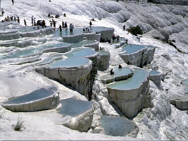
Pamukkale is one of the extraordinary natural wonders of Turkey. The great attraction is the white immensity of the cliffs with sculptured basins full of water and congealed waterfalls; they seem done of snow, cloud, or cotton.
The scientific explanation is the hot thermal places that lie under the mount provoke the calcium carbonate spill, that makes the forms as solid as marble.
Tourists come to bathe; the Turks call this place PAMUKKALE, which means "Castle of Cotton".
Section 3 - Human-Environment Interaction Fresh water supplies are available only in small amounts Dams are very controversial in this region as they affect multiple countries at once.
Section 3 - Human-Environment Interaction Water Conservation is a major priority in SW Asia Drip Irrigation- practice of using small pipes that slowly drip water just above ground
Section 3 - Human-Environment Interaction Desalinization- removal of salt from ocean water Very expensive Can’t meet all needs
Section 3 - Human-Environment Interaction Fossil Water- water pumped from underground aquifers Little chance of being refilled in this area because of little rainfall
Section 3 - Human-Environment Interaction Petroleum- remains of plants & animals, formed from pressure & heat over millions of years. Oil is not in big pools under the ground, it is trapped in the pores of rocks. Taken out of ground by pressure
Section 3 - Human-Environment Interaction Crude Oil- petroleum that has not been processed Refinery- converts crude oil into useful products like gasoline & kerosene
Section 3 - Human. Environment Interaction Oil Spills are a risk when transporting oil in narrow straits or around reefs Largest in U. S. History is the Exxon Valdez spill in 1989