tornadoes Tornado alley 32012 Kentucky tornado Trees knocked


")


")


- Slides: 36
tornadoes
Tornado alley
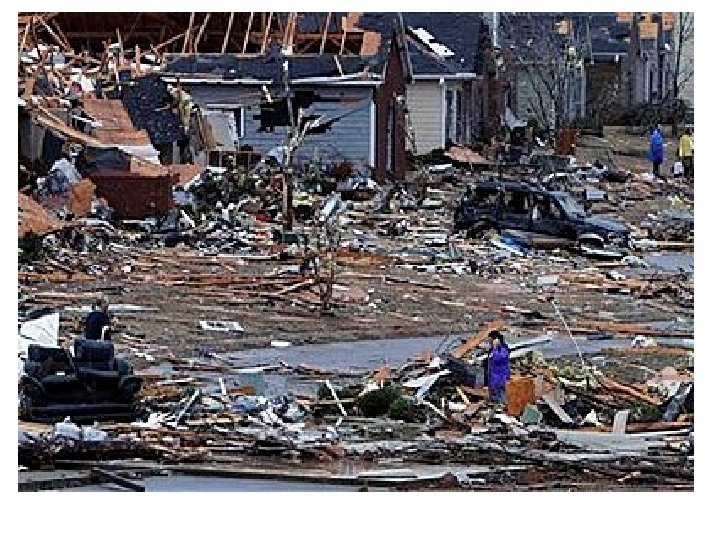
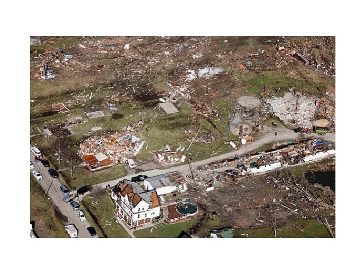
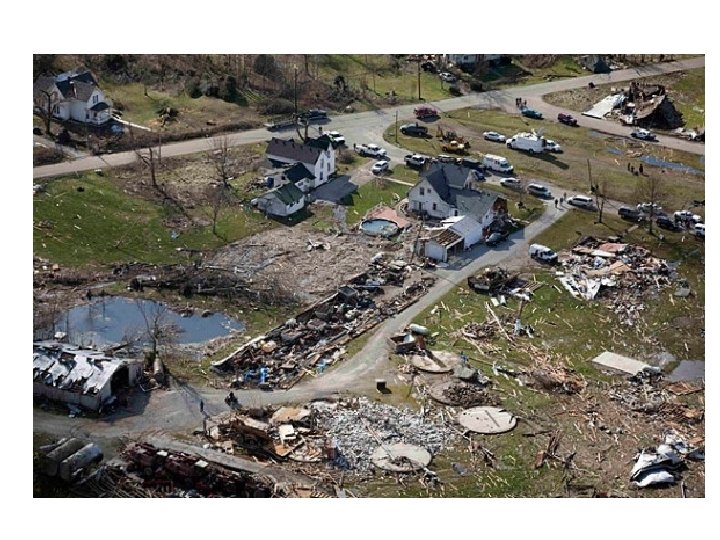
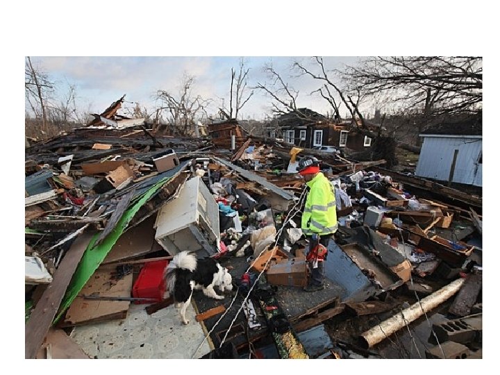
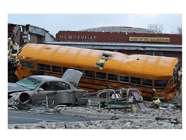
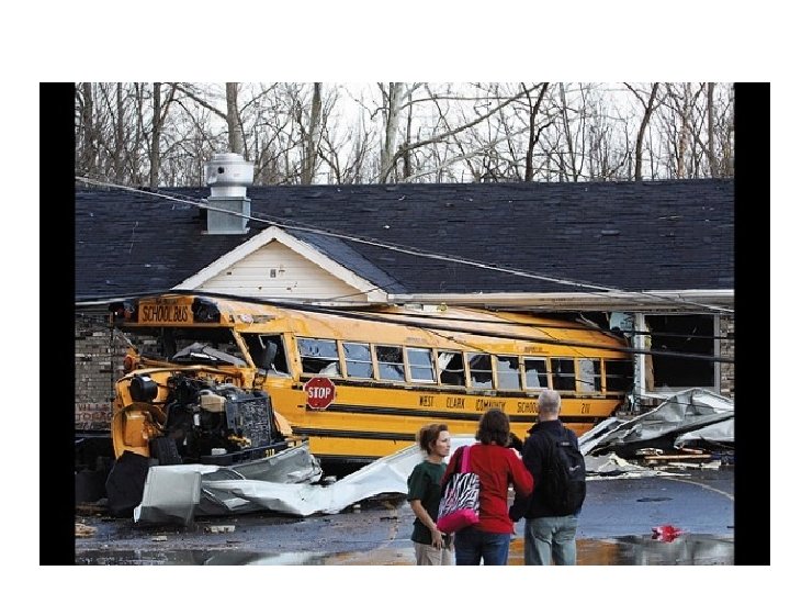
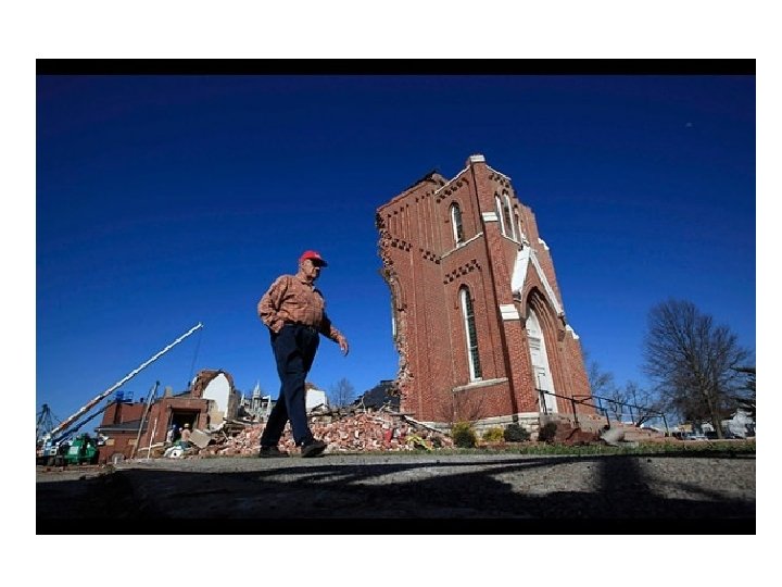
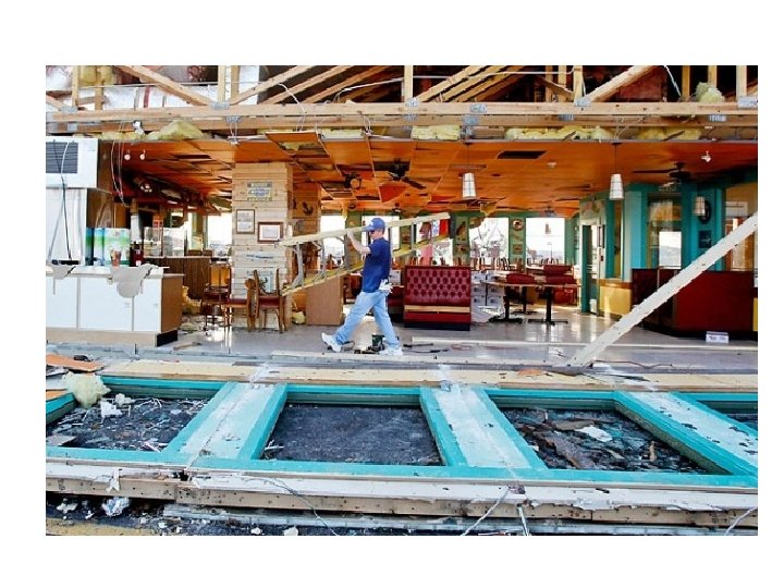
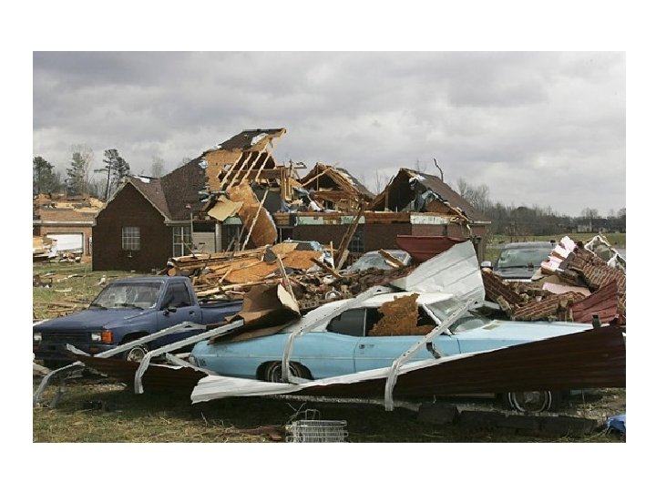
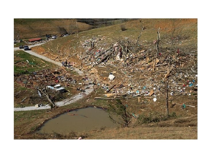
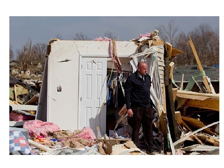
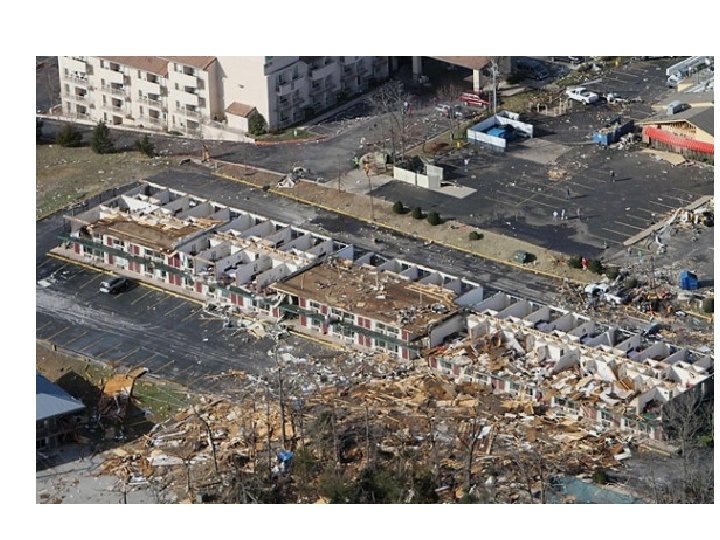
3/2012 Kentucky tornado
Trees knocked down in a circular pattern
OK 837
How tornadoes form • http: //www. youtube. com/watch? v=MRykmxj. Psk&feature=related • http: //www. youtube. com/watch? v=e 17 LOS 0 Ummg&featu re=relmfu • http: //www. youtube. com/watch? v=UELQCXUKd. Zs&featu re=relmfu • http: //www. youtube. com/watch? v=Mjjw. PQRVb. Wk&featur e=relmfu
tornadoes chasers • http: //video. nationalgeographic. com/video/environment-naturaldisasters/tornadoes/tornado-samaras/ • http: //video. nationalgeographic. com/video/environment-naturaldisasters/tornadoes/samaras-tornado-missions-wcvin/ • (game) http: //www. youtube. com/watch? feature=endscreen&v=cj 0 HPni 092 E&NR=1
Notes: • Occurs: – with strong cold fronts –travel with parent thunderstorms – In tornado alley and over land short lived (minutes to 1 hr) – When c. P meets m. T – In late spring to early summer (biggest difference in temps) – Around a low pressure center Center is the vortex – may be 20 ft to 1 mile in diameter Very high winds 200 -300 mph Damage is done by high winds and flying debris VERY difficult to predict path Doppler radar has given earlier warnings (10 -15 min) Stay inside – small room w/no windows Stay in basement & under heavy objects (table/bath tube…) Stay under bridge base or in ditch
How hurricanes form • http: //www. youtube. com/watch? v=OEPZOC 6 YHUc how they form Nat’l geo • http: //www. youtube. com/watch? v=j. B 7 t 4 KKV 38 U&feature =related hurricane Katrina from space • http: //www. youtube. com/watch? v=v. BAe. Znf. MEWc&featur e=relmfu why they spin
How they form • http: //www. youtube. com/watch? NR=1&feature=endscreen&v=y 163 hw. Ey. RX 8 hurricanes form tornadoes • http: //www. youtube. com/watch? v=mr. XIb. XCufh 8&feature=relmfu why the form • http: //www. youtube. com/watch? v=k. FN 0 c. Bc. AGv. U&feature=relmfu inside the wall • http: //www. youtube. com/watch? v=Ip 6 FXe. DO 1 e 8&feature=relmfu how the eye forms
Start of a hurricane: Tropical storm
Super cell or hurricane
How the wall and eye form Wall of the storm: http: //www. youtube. com/watch? feature=endscreen&NR=1&v=k. FN 0 c. Bc. AGv. U • http: //www. youtube. com/watch? v=Ip 6 FXe. DO 1 e 8&feature=related how the eye forms • http: //www. youtube. com/watch? feature=fvwp&NR=1&v=5 i. N 352 id. Lks • http: //www. youtube. com/watch? feature=endscreen&v=bat 5 l 9 a 8 z. HM&NR=1
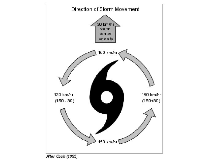
Winds
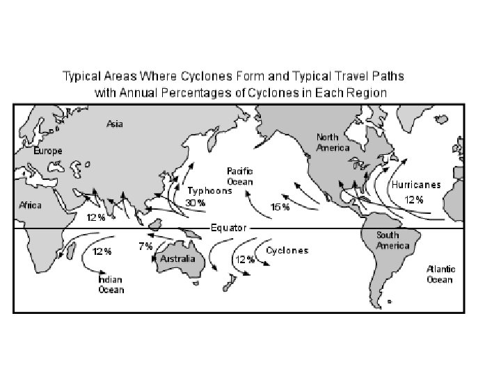
Frequency (season ends in Feb)
Typical paths
Storm surge
• http: //www. youtube. com/watch? v=s 76 Qn 7 bp. Cs. Q storm surge from Katrina
Notes: • Forms: – Over warm waters 25 o N to 25 o S – In late summer/early fall (ocean is warmest) NO fronts associated w/ hurricanes As ocean is heated, water evaporates Rising air creates LOW pressure centers Rising air condenses, warming the air, causing air to rise more The more the air rising, the lower the pressure gets, the stronger the updrafts are.
• Surface winds blow INTO the low • The more evaporation, the lower the pressure, the greater the wind speed • Evaporation, air rises, condensation, air warms and rises, updrafts form, surface air blows into the low. • Winds between 75 mph – 150 mph • HUGE – maybe 300 -500 miles in diameter • EYE is the center (low pressure) of rising air – calm –little winds • Long lasting 1 -2 weeks • Brings heavy rain, flooding, winds, debris, storm surges • Most damage comes from flooding – especially during high tides and spring tides. • Easier to predict path
• Evacuate inland to shelters • Stay indoors away from windows NOT IN THE BASEMENT • Board up windows/ put cars in garage…. • Bring in loose items • Boats to safe areas – deeper water or different harbor • Have extra food, water, medicines, supplies • Have battery operated radio, lights… • power may be out for days