The Kenya Water Towers Agency Water Catchments and


 Social Bearable Ecology Planet (Earth Environment) Equitable Sustainable")


")


 Farmlands 8589 8283")


- Slides: 26
The Kenya Water Towers Agency Water Catchments and Storage Systems: The Mau Catchment Dilemma Simon M Onywere Capacity Development and Consultancy Services Kenyatta University Department of Environmental Planning and Management onywere. simon@ku. ac. ke onyweres@gmail. com
We Live in Two Worlds The Natural World The Constructed World Self-Regulating, self-sustaining interconnected ecosystems Getting Degraded & need to be Managed The two are Increasingly in Conflict
The Context of sustainability Seeing the Whole • • • Ecosystems Flows Patterns Linkages Trends Value Managing Development • • Watersheds Supporting capacity Livelihood systems Impacts on Neighborhoods • Regional effects
The Context of sustainability People (Humanity) Social Bearable Ecology Planet (Earth Environment) Equitable Sustainable Viable Economic Profit (Development) Environmental Management Paradigm for Sustainability
Dilemma of a Nation 2018 Natural Disasters Energy Climate Change Migration Loss of Nature Biodiversity Inequality Water Urbanization Population Pollution Social Conflict Consumption Locusts (Loima Turkana) Yellow Fever (Wajir) Cholera (16 Counties) Fall Army Worms (Maize Growing Areas) Dengue fever (Kwale) Mudslides (Murang’a) The Belt of fractures (South Rift) Floods (All-over) and a Dam failure in Solai S. M Onywere
The Altitude zones of Kenya Altitude Region Area Km 2 Per cent Below 500 m 244196 41% 501 -1000 m 178897 30% 1001 -1500 m 79781 13% 1501 -2000 m 59164 10% Above 2000 m 34403 6% • • Most of Kenya is <500 asl Areas >2000 m asl receive 1000 mm of rainfall and are the water tower area Psalm 24: 1 -4
Kenya’s River Basins in Rift Valley and Lake Victoria Regions. The rift valley drainage basins of lakes Magadi, Naivasha, Nakuru, Bogoria and Turkana are structurally controlled and Elongate in the North-South direction
Defining the Water Tower “Water towers refer to upland areas (hills, plateaus and mountains) whose climate, geology, tectonics, substrate, land cover/use and hill-slope morphological characteristics support reception, infiltration, percolation and storage of rainfall (or any form of precipitation) on the surface, in the soil, rock and aquifers that, apart from surface runoff, is a gradual source of water through springs, rivers and swamps in a drainage basin (also called catchment [UK] or watershed [US])”
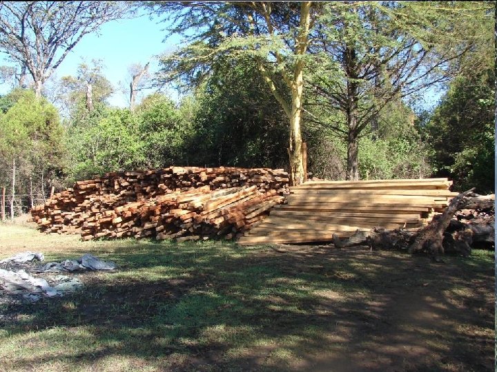
The Mau Complex Area • Mau Complex forms the Western Escarpment of the Great East African Rift Valley • It is a highly drainage dissected, uplifted fault block that is a water tower feeding Nyando, Sondu, Mara (L. Victoria), Molo (L. Baringo), Ewaso Ngiro South (L. Natron), & rivers recharging Lake Nakuru • The substrate is composed of porous, permeable surfaces of volcanic ashes, pumiceous pyroclastics and faulted lava and tuff on which percolation of runoff, lead to potentially high groundwater storage • Rainfall varies between 1000 - 1400 mm • The formally heavily forested area’s functions included protecting the water tower, purifying water and air, regulating river flows, providing ecosystem services
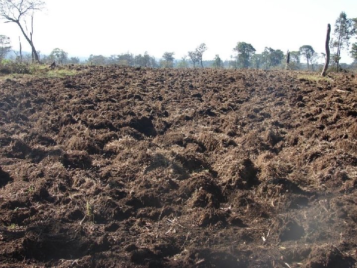
STATUS & CHARACTER OF MAU COMPLEX FOREST • Due to rapid economic, social, political, institutional, technological and environmental changes the Mau Complex the forest has greatly been compromised • The current loss of forest is a significant problem expressed in terms of the impacts on ecosystem functions e. g. the hydrological cycle and the flow regimes of rivers in the area • The occurrence, distribution, circulation of water, the quality of water & the timing of discharge have been greatly affected Why?
The Mau Catchment Dilemma • Analysis of time series satellite images shows that since 1985 Mau Complex forest has persistently been removed and replaced by agricultural land settlements • The destruction of the forests has effectively threatened hydrological functions and endangered water supplies for a large proportion of the population downstream • It is also causing severe siltation, flooding, and extreme low flows during the dry season Despite the campaigns has anything changed?
Consequence of Human Impacts on the Mau Complex Forest Ecosystem – Conflict over the Cut-line RGB – Green RGB - Red
Land Use 1986 1995 2009 1986 -2017 Changes 2017 (Km 2) Farmlands 8589 8283 10614 9809 Forest 4986 4975 2752 2603 Plantation Settlement 390 105 790 41 356 260 1057 392 Water Body 34 25 30 44 Bare land 30 19 121 228 14133 Total 1986 -2017 % Change 1220 14% -2383 -48% 667 171% 287 273% 10 29% 198 660%
Mau Complex Landuse Changes as from the year 1986 -2017 15000 10000 5000 0 1986 1995 2009 2017 Farmlands Forest Plantation Settlement Waterbody Barelands Mau Complex Changes against its Main couses 15000 10000 5000 0 1986 Farmlands 1995 2009 Forest 2017 Settlement The Extent & Oscillation of Forest degradation is evident
The DEM of Mau Water Tower
The Shaded Relief Mau Water Tower The Mau Basins
The consequence is Evident
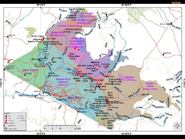
A participatory catchment / land / resources / water management plan Require Spatial Thinking at all levels OBSERVATION What do you see? (where? ) INTERPRETATION What does it mean? (use, impacts) APPLICATION How do I respond? (interventions) THE GOAL Changed lives (sustainability) Example of the Mara Ecosystem
The Great Mara-Serengeti Migration 1. 4 Million Wildebeest, 500, 000 zebra A challenged ecosystem
Name Maasai Mara National Reserve Isaaten Siana Conservancy Mara Triangle Mara North Conservancy Naboisho Conservancy Talek Communal Land Ol Deriskei Conservancy Olare Orok Conservancy Ol Kinyei Conservancy Lemek Conservancy Ol Chorro Conservancy Motorogi Conservancy Leleshwa Conservancy Enonkishu Conservancy Sum Area (Km 2) 1522 952 477 341 210 107 99 94 77 55 53 48 27 27 21 4110
Distribution infrastructure Resource development Bulk infrastructure Connector infrastructure Distribution reservoir Water treatment works Bulk water pipeline Internal infrastructure Connect or pipeline Internal pipe network To other settlements Dam Pumping station River Collector sewer Sewerage Waste water treatment works Assimilative capacity of Treated Impacts on aquatic receiving water effluent environment and downbody outflow stream water users Outflow sewer Sewerage pump station Sewerage reservoir
Water Source and Supply System springs, rivers, Water swamps, lakes, dams, and resources groundwater Water Supply Services Water supply chain Outflow impacts Sewerage on environment Effluent & downstream users management Transfer from sources, treatment works, pumping and piping Quality Water Distribution reservoirs, connectors, piping infrastructure network Collector piping, Water eco- sewerage Protection reservoir, treatment works
onywere. simon@ku. ac. ke onyweres@gmail. com