Swearing Creek Watershed Restoration Plan GIS M ETHODOLOGY

- Slides: 37
Swearing Creek Watershed Restoration Plan GIS M ETHODOLOGY Piedmont Triad Regional Council 8/26/2015
GIS Methodology 1. Past Local Watershed Projects (Project Selection) 2. New Techniques for Swearing Creek 3. Piedmont Together Scenario Modeling & Green Infrastructure Network – how to apply Piedmont Triad Regional Council 8/26/2015
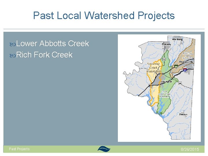
Past Local Watershed Projects Lower Abbotts Creek Rich Fork Creek Past Projects 8/26/2015
Lower Abbotts Creek Watershed Assessment Field Assessment (focused on 6 out of 10 subwatersheds) 1, 733 opportunities identified at 830 sites using 17 BMP categories Restoration Plan – to coordinate needs identified in the assessment 4 phases outline actions steps to implement: 10 policy recommendations 25 projects Past Projects 8/26/2015
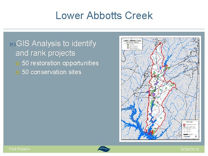
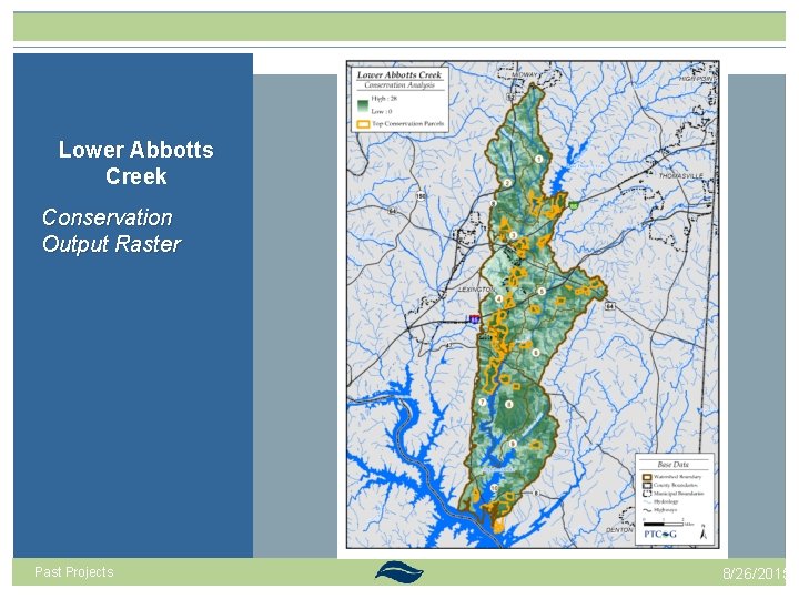
Lower Abbotts Creek GIS Analysis to identify and rank projects 50 restoration opportunities 50 conservation sites Past Projects 8/26/2015
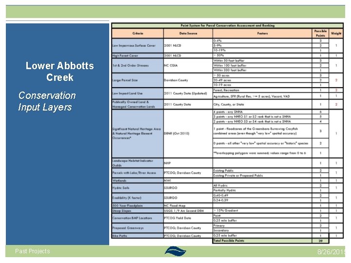
Lower Abbotts Creek Conservation Input Layers Past Projects 8/26/2015
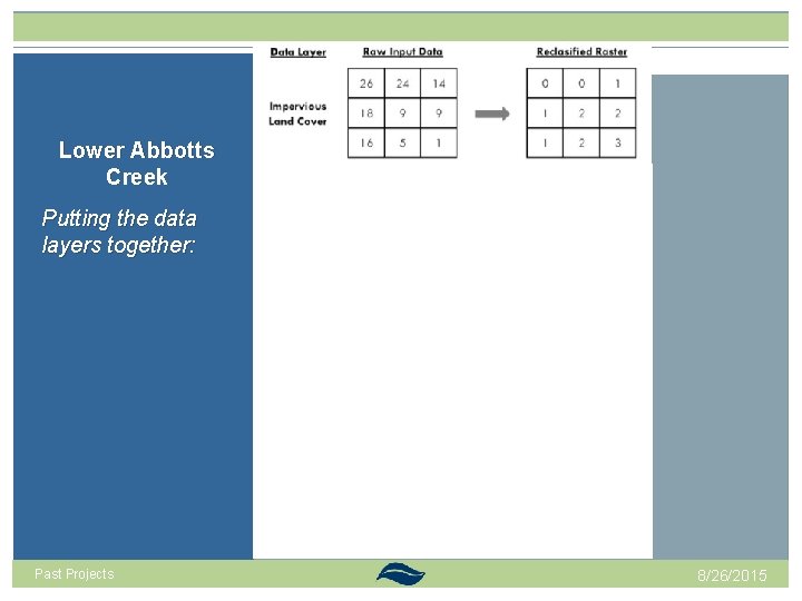
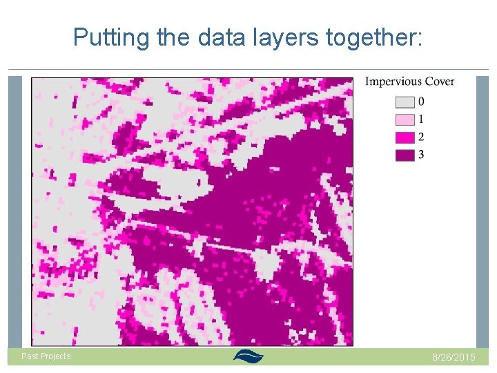
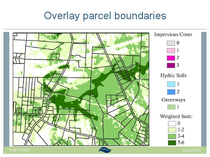
Lower Abbotts Creek Putting the data layers together: Past Projects 8/26/2015
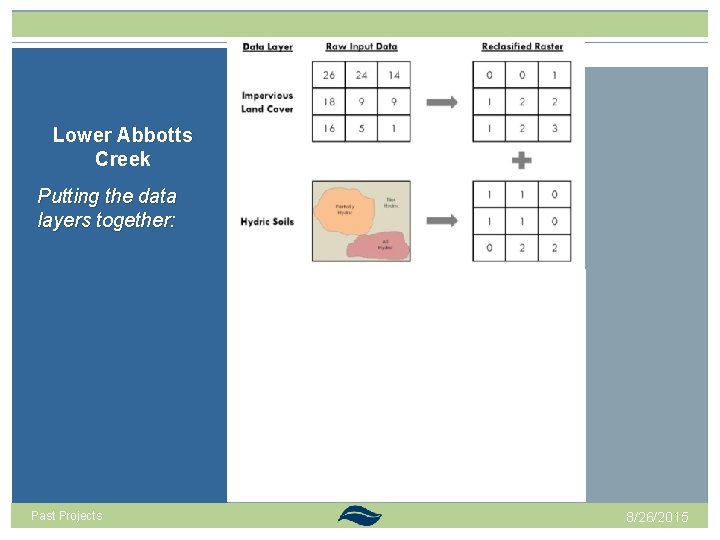
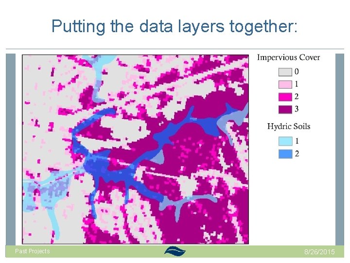
Lower Abbotts Creek Putting the data layers together: Past Projects 8/26/2015
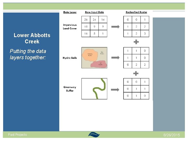
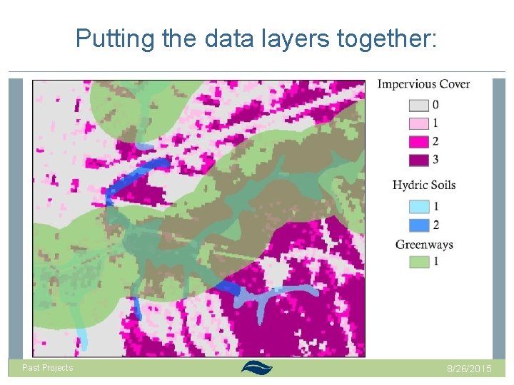
Lower Abbotts Creek Putting the data layers together: Past Projects 8/26/2015
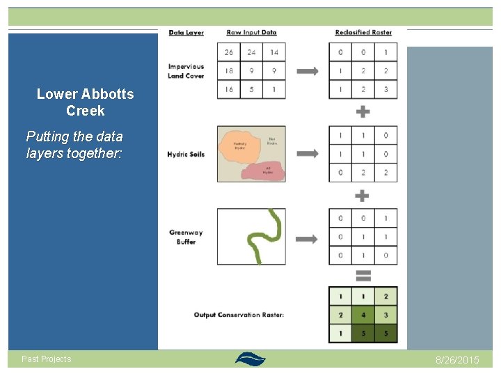
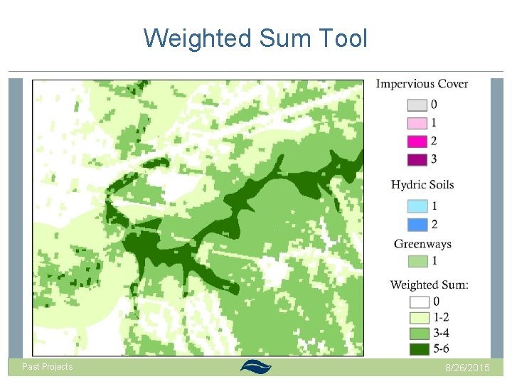
Lower Abbotts Creek Putting the data layers together: Past Projects 8/26/2015
Putting the data layers together: Past Projects 8/26/2015
Putting the data layers together: Past Projects 8/26/2015
Putting the data layers together: Past Projects 8/26/2015
Weighted Sum Tool Past Projects 8/26/2015
Overlay parcel boundaries Past Projects 8/26/2015
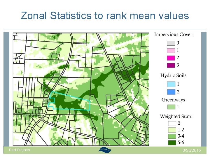
Zonal Statistics to rank mean values Past Projects 8/26/2015
Lower Abbotts Creek Conservation Output Raster Past Projects 8/26/2015
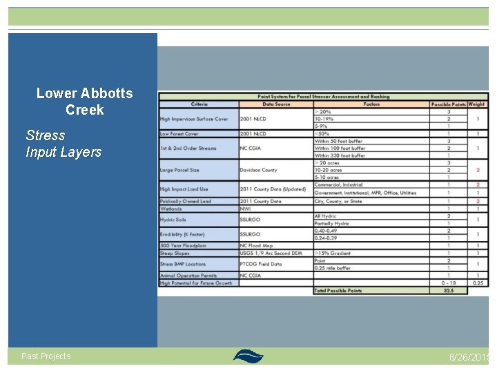
Lower Abbotts Creek Stress Input Layers Past Projects 8/26/2015
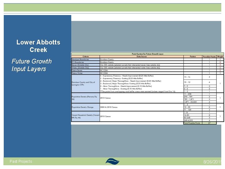
Lower Abbotts Creek Future Growth Input Layers Past Projects 8/26/2015
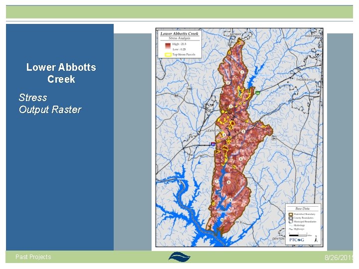
Lower Abbotts Creek Stress Output Raster Past Projects 8/26/2015
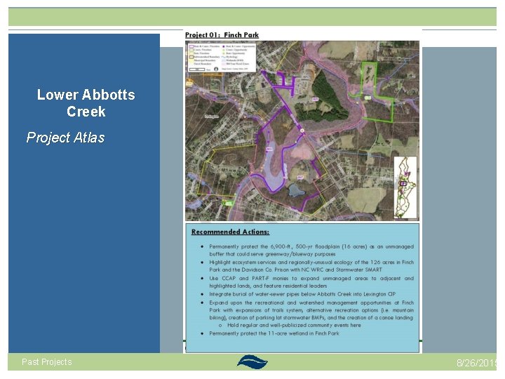
Lower Abbotts Creek Project Atlas Past Projects 8/26/2015
New Techniques for Swearing Creek 1. Buffer Analysis 2. GIS to guide field work Past Projects New Techniques 8/26/2015
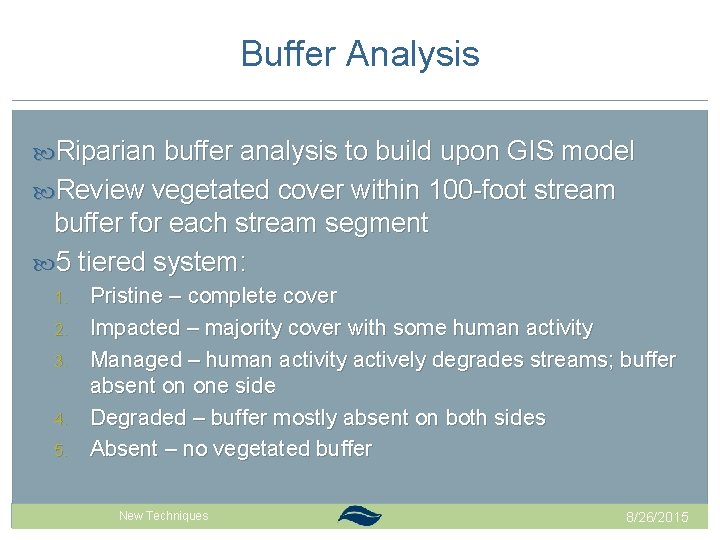
Buffer Analysis Riparian buffer analysis to build upon GIS model Review vegetated cover within 100 -foot stream buffer for each stream segment 5 tiered system: 1. 2. 3. 4. 5. Pristine – complete cover Impacted – majority cover with some human activity Managed – human activity actively degrades streams; buffer absent on one side Degraded – buffer mostly absent on both sides Absent – no vegetated buffer Past Projects New Techniques 8/26/2015
Elkin Water Supply Watershed Buffer analysis Stream Health Past Projects New Techniques 8/26/2015
Elkin Water Supply Watershed Buffer analysis Stream Health Past Projects New Techniques 8/26/2015
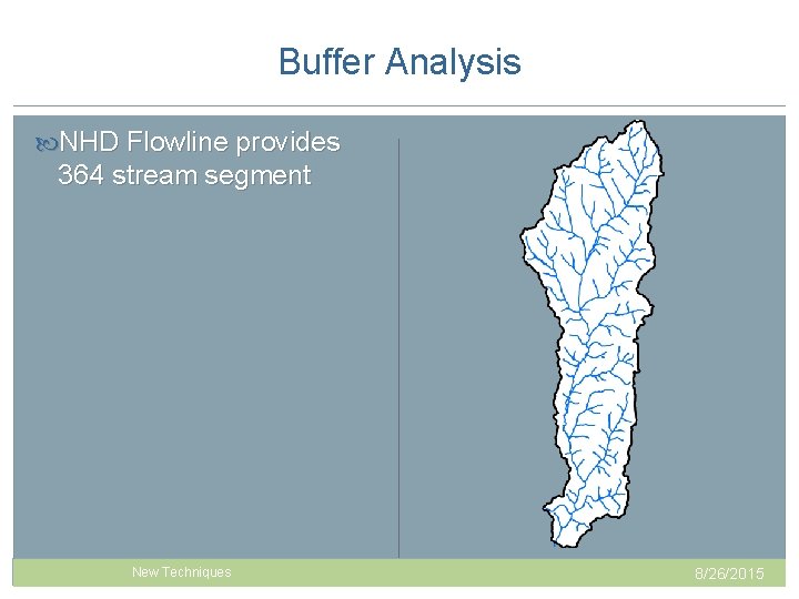
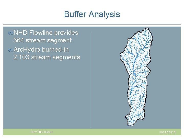
Buffer Analysis NHD Flowline provides 364 stream segment Past Projects New Techniques 8/26/2015
Buffer Analysis NHD Flowline provides 364 stream segment Arc. Hydro burned-in 2, 103 stream segments Past Projects New Techniques 8/26/2015
GIS Modeling to Guide Fieldwork Predictions for: Sediment loads Nitrogen & phosphorus loads Bacterial impairment BMP Sites Model potential benefits of potential BMP sites Runoff based on landuses Past Projects New Techniques 8/26/2015
GIS Modeling to Guide Fieldwork Better Assessment Science Integrating Point and Non. Point Sources (BASINS) Generalized Watershed Loading Function (GWLF) Assesses non-point source flow and sediment and nutrient loading from urban and rural watersheds Simulates runoff, sediment, and nutrient loadings (N & P) from a watershed given land covers Pollutant Loading Estimator (PLOAD) Computes nonpoint source loads based on annual precipitation, land uses and BMPs Past Projects New Techniques 8/26/2015
Piedmont Together Work – how do we incorporate? 1. Green Infrastructure Network 2. Scenario Modeling 3. Map. Viewers Past Projects Together New Techniques Piedmont 8/26/2015
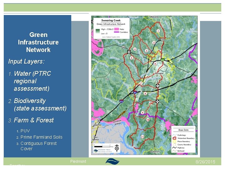
Green Infrastructure Network Input Layers: 1. Water (PTRC regional assessment) 2. Biodiversity (state assessment) 3. Farm & Forest 1. 2. 3. PUV Prime Farmland Soils Contiguous Forest Cover Past Projects Together New Techniques Piedmont 8/26/2015
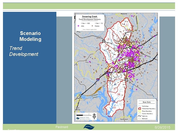
Scenario Modeling Trend Development Past Projects Together New Techniques Piedmont 8/26/2015
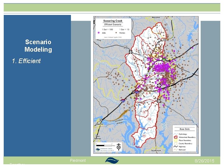
Scenario Modeling 1. Efficient Past Projects Together New Techniques Piedmont 8/26/2015
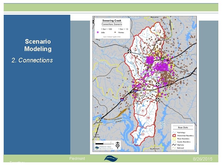
Scenario Modeling 2. Connections Past Projects Together New Techniques Piedmont 8/26/2015
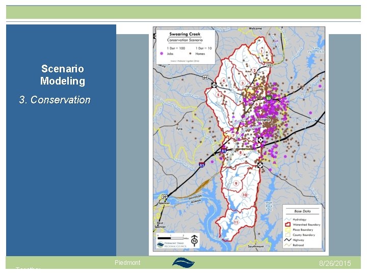
Scenario Modeling 3. Conservation Past Projects Together New Techniques Piedmont 8/26/2015
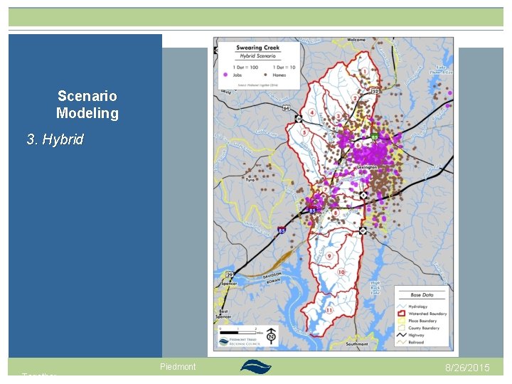
Scenario Modeling 3. Hybrid Past Projects Together New Techniques Piedmont 8/26/2015
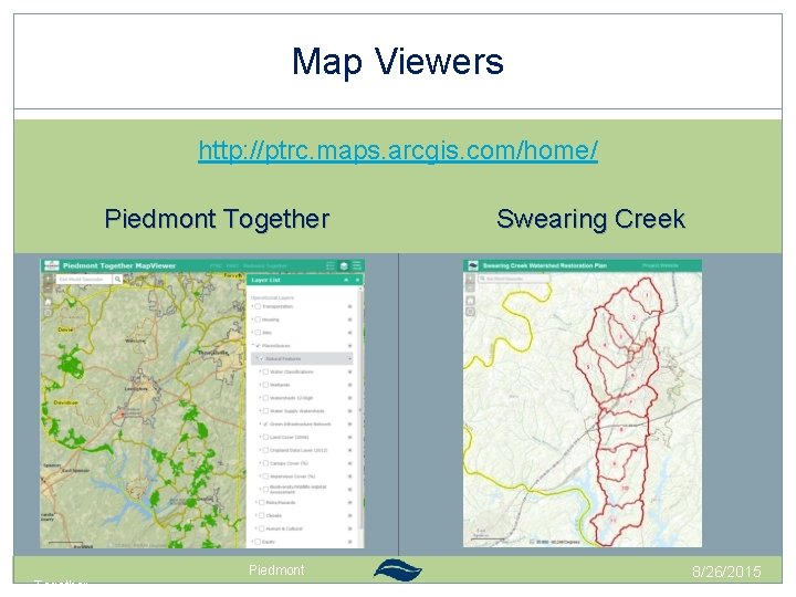
Map Viewers http: //ptrc. maps. arcgis. com/home/ Piedmont Together Past Projects Together New Techniques Piedmont Swearing Creek 8/26/2015