GIS in Watershed Analysis Why watershed Analysis with


")
")
")
 • HUC 8, 10, 12 and beyond")


- Slides: 28
GIS in Watershed Analysis
Why watershed Analysis with GIS? • Concepts • Important datasets • Analysis Tools
Regional stressors
Impacts of Human Activities Timber Mining Agriculture Stream alterations
Watershed based frameworks • Integrative approach • Legislative roots in the 1972 Clean Water Act – Goal to clean up and protect US water bodies from point and nonpoint sources 2012 Designated uses – evaluated as part of the Clean Water Act
Watershed cataloging units USGS Regions (2 digit)
Watershed cataloging units USGS Sub-regions (4 digit)
Watershed cataloging units USGS Sub-basins (8 digit)
NRCS WBD • Watershed Boundary Dataset (WBD) • HUC 8, 10, 12 and beyond http: //datagateway. nrcs. usda. gov/
Issues • More local watersheds needed • One to one relationship between land cover runoff and receiving stream segment • Track runoff from land to stream
Example of scale differences DNR Stocked streams Tier 2. 5 - Reproducing trout streams Impaired streams Watershed boundaries 11
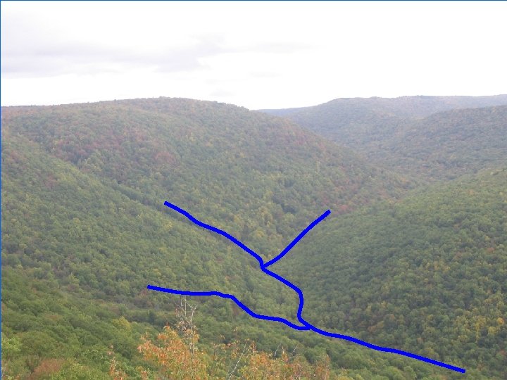
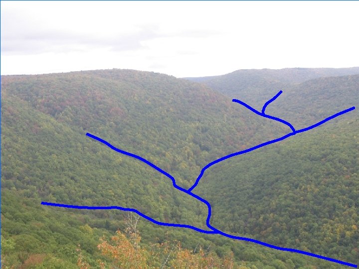
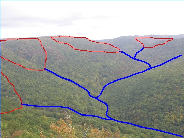
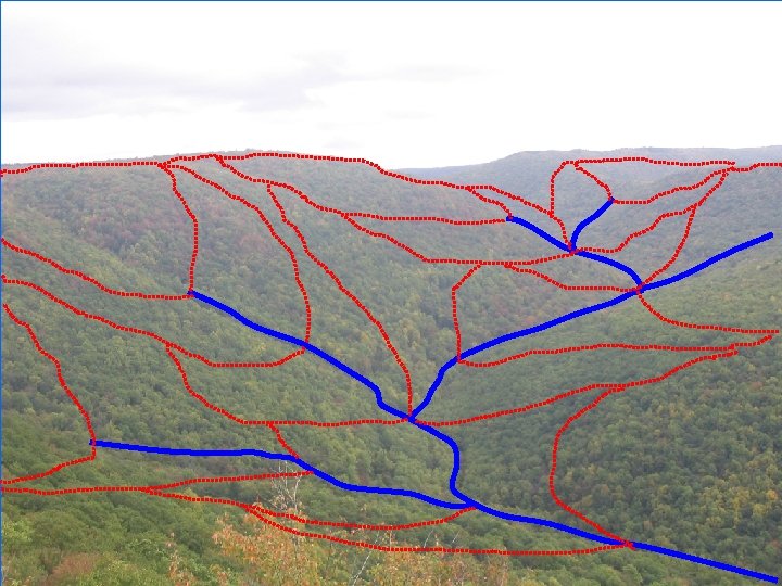
Previous method • Delineate watershed boundaries using the topography to guide us
Manual method
subwatersheds 14
Segment-level watersheds • Benefits: – Hydrologically based – Not based on drainage area cutoffs – Not based on management areas – Stream segment by segment – Fully compatible with 1: 100 K and 1: 24 K NHD – Networked, based on NHD
Existing issue • Nesting of watersheds • Pass through issues
Watershed modeling • Segment level watersheds can be used in watershed modeling • Also compiled flow tables for each watershed Outlet Watershed Schematic: Simplified segment-level watersheds and associated flow table
Geospatial Technologies and Water Resources • A valuable tool for water resources management GTs in watershed management: 1. Elevation surface is key 2. Delineate watersheds 3. Track flow from a point 4. Find intermittent stream paths 5. Calculate drainage areas
GIS use in the hydro cycle
Elevation surface or grid • The starting point for all hydrological modeling in GIS • USGS Digital elevation model 30 m or 10 m elevation cells, or 3 m for WV • Each cell or grid represents a value for the elevation
Summary points • Watersheds are the key unit of analysis for examining water quality issues • Scale issues require us to delineate smaller watersheds for local issues • GIS can aid in watershed management by 1. 2. 3. 4. 5. Using elevation grids Delineate watersheds Track flow from a point Find intermittent stream paths Calculate drainage areas
Limitations • Static snapshot of data • Older Elevation grids • Only modeling surface interactions
Questions / comments?