Recent JPSS Data Applications Daniel Nietfeld 2016 NOAA
- Slides: 25
Recent JPSS Data Applications Daniel Nietfeld 2016 NOAA Satellite Proving Ground / User Readiness Meeting
JPSS/NPP data in the WFO • How important is the data to the operational forecast/warning (DSS) problem? • Is it valuable… even if only one-two snapshots per day? • Is it unique to other datasets? (NPP visible vs. GOES visible) • Can I get the same data from other sources? • Is the data accurate/representative? • Is the data timely? • Has the utility of all data been adequately explored? • Access to data? • Understanding of data? (i. e. , 1. 61 imagery, ATMS)
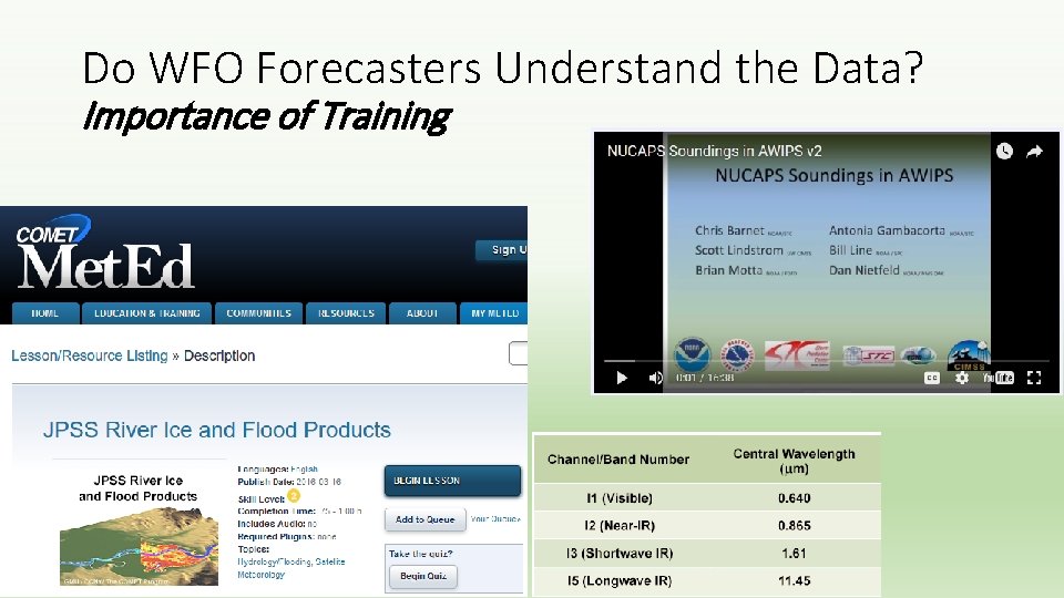
Do WFO Forecasters Understand the Data? Importance of Training
S-NPP Data that is making traction in the WFO • NUCAPS • VIIRS for river monitoring (see COMET module) • RGBs (dust, snow vs. clouds, etc…) • Day-Night Band (NCC – covered by Dan Lindsey and Eric Guillot) • JPSS Snowfall Rate (SFR) Product (used at WFO Sterling) • Other applications/data covered this week
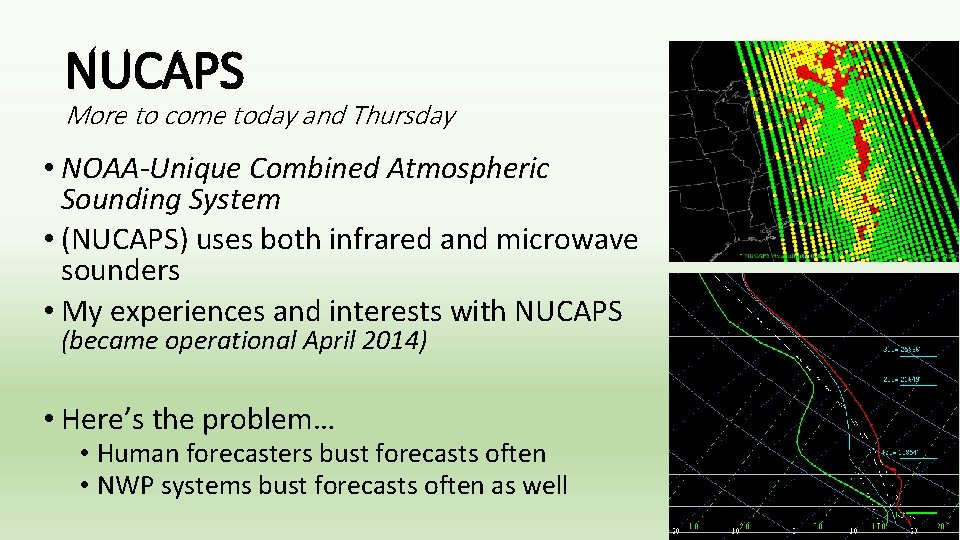
NUCAPS More to come today and Thursday • NOAA-Unique Combined Atmospheric Sounding System • (NUCAPS) uses both infrared and microwave sounders • My experiences and interests with NUCAPS (became operational April 2014) • Here’s the problem… • Human forecasters bust forecasts often • NWP systems bust forecasts often as well
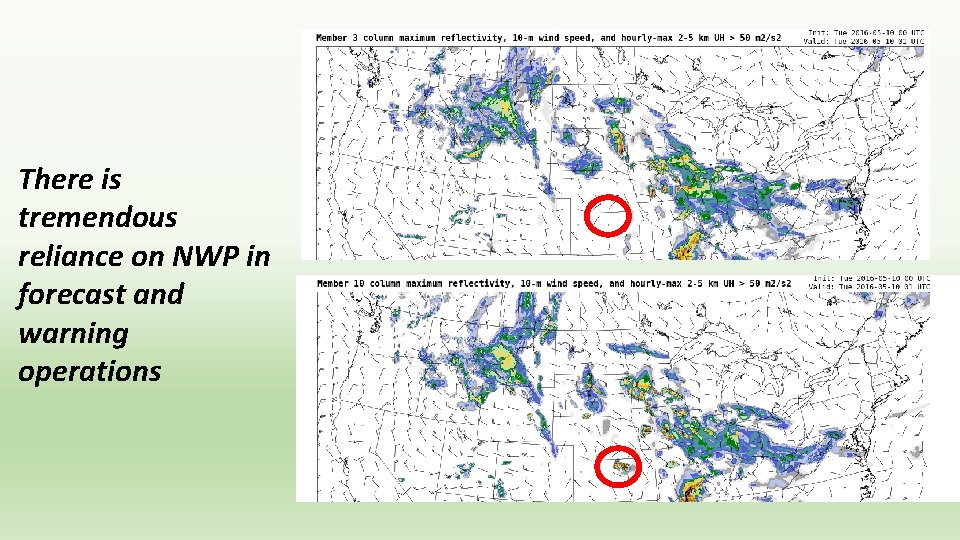
There is tremendous reliance on NWP in forecast and warning operations
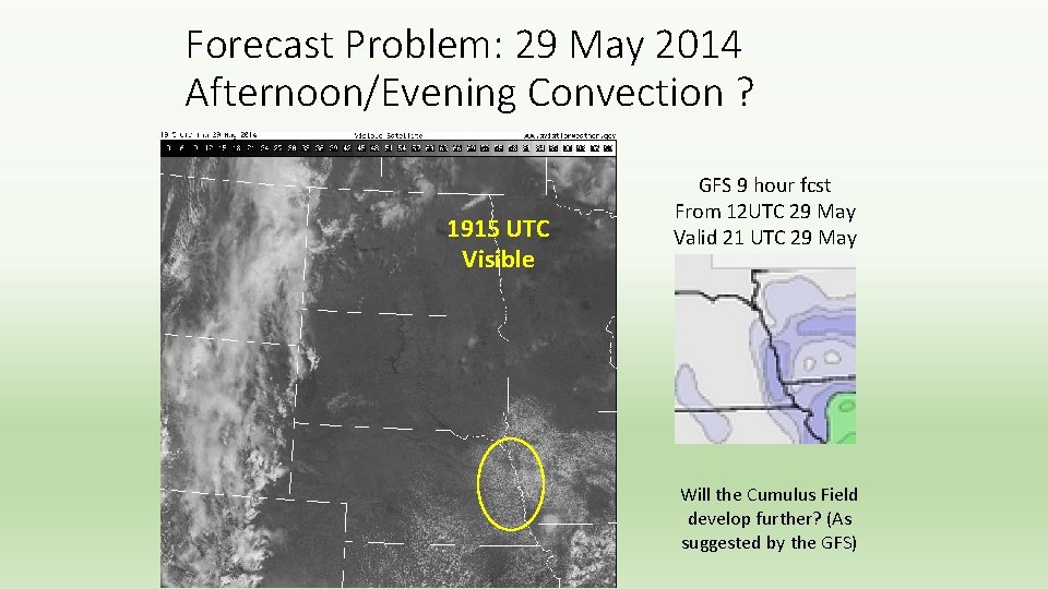
Forecast Problem: 29 May 2014 Afternoon/Evening Convection ? 1915 UTC Visible GFS 9 hour fcst From 12 UTC 29 May Valid 21 UTC 29 May Will the Cumulus Field develop further? (As suggested by the GFS)
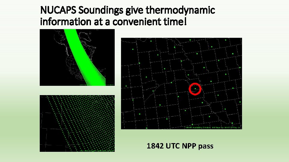
NUCAPS Soundings give thermodynamic information at a convenient time! 1842 UTC NPP pass
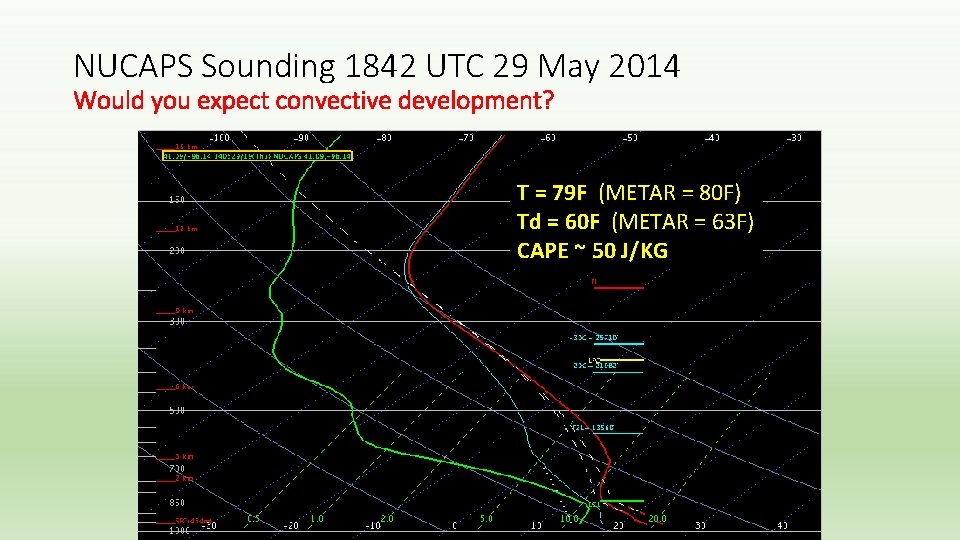
NUCAPS Sounding 1842 UTC 29 May 2014 Would you expect convective development? T = 79 F (METAR = 80 F) Td = 60 F (METAR = 63 F) CAPE ~ 50 J/KG
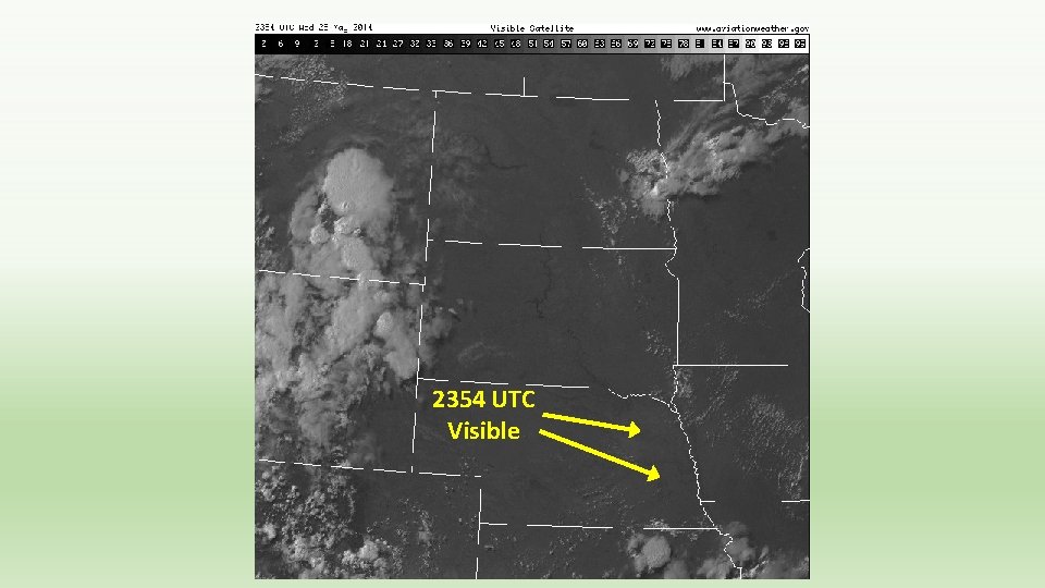
2354 UTC Visible
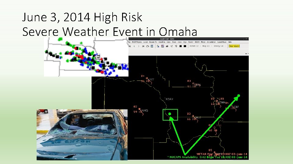
June 3, 2014 High Risk Severe Weather Event in Omaha
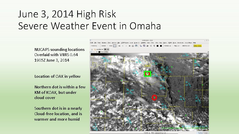
June 3, 2014 High Risk Severe Weather Event in Omaha NUCAPS sounding locations Overlaid with VIIRS 0. 64 1905 Z June 3, 2014 OAX Location of OAX in yellow Northern dot is within a few KM of KOAX, but under cloud cover Southern dot is in a nearly Cloud-free location, and is warmer and more humid
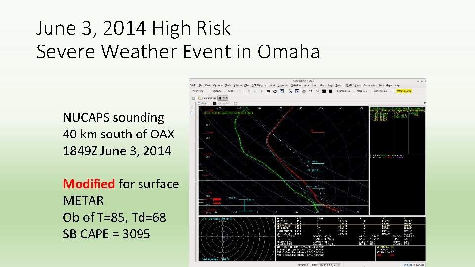
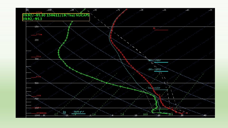
June 3, 2014 High Risk Severe Weather Event in Omaha NUCAPS sounding 40 km south of OAX 1849 Z June 3, 2014 Modified for surface METAR Ob of T=85, Td=68 SB CAPE = 3095
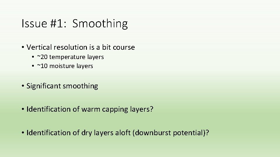
Issue #1: Smoothing • Vertical resolution is a bit course • ~20 temperature layers • ~10 moisture layers • Significant smoothing • Identification of warm capping layers? • Identification of dry layers aloft (downburst potential)?
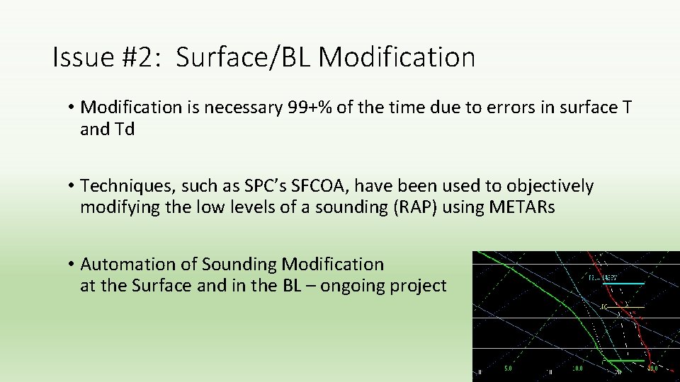
Issue #2: Surface/BL Modification • Modification is necessary 99+% of the time due to errors in surface T and Td • Techniques, such as SPC’s SFCOA, have been used to objectively modifying the low levels of a sounding (RAP) using METARs • Automation of Sounding Modification at the Surface and in the BL – ongoing project
Improving NUCAPS Soundings for CONUS Severe Weather Applications via Data Fusion Jack Dostalek, Dan Lindsey, John Haynes, Chris Barnet, Dan Nietfeld JPSS-funded project at CIRA
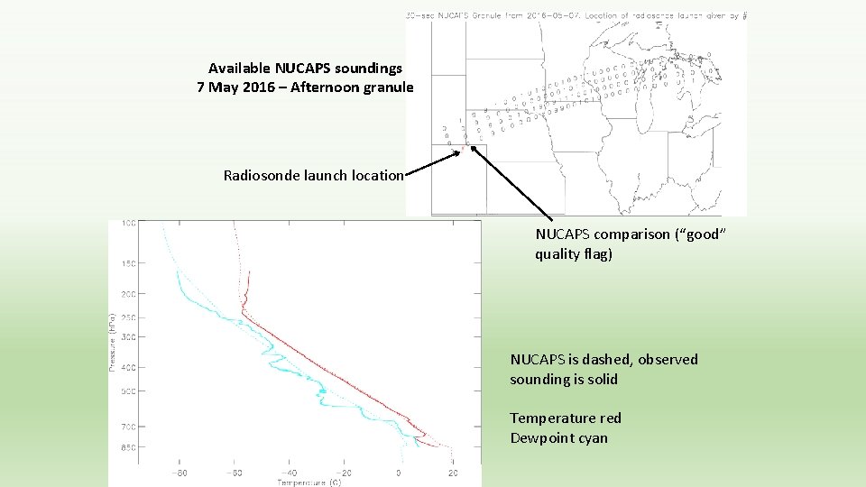
• One of the main comments on NUCAPS from the HWT over the last 2 years has been that surface temperature and dewpoint are often incorrect, so the sounding must be manually modified to correct the surface values • A relatively new JPSS-funded project at CIRA involves blending of NUCAPS retrievals with surface and near-surface data to produce an improved sounding for severe weather nowcasting • We first need to characterize the performance of the NUCAPS retrievals during the warm season (April-September) over the United States, so we’re currently performing a careful validation of these matchups with radiosondes launched in the afternoon • We will also compare to the Rapid Refresh (RAP) Model soundings and potentially use that NWP data in the new altered soundings
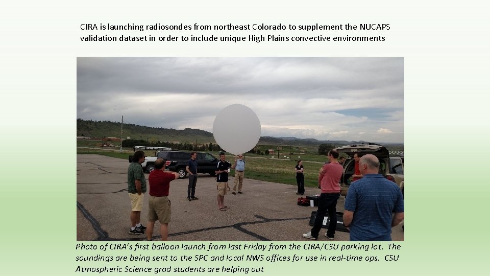
CIRA is launching radiosondes from northeast Colorado to supplement the NUCAPS validation dataset in order to include unique High Plains convective environments Photo of CIRA’s first balloon launch from last Friday from the CIRA/CSU parking lot. The soundings are being sent to the SPC and local NWS offices for use in real-time ops. CSU Atmospheric Science grad students are helping out
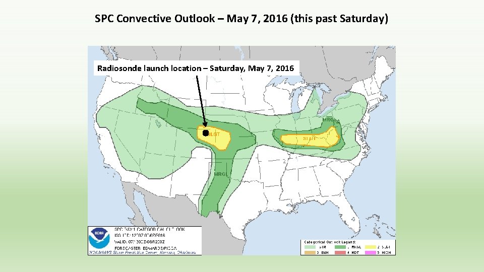
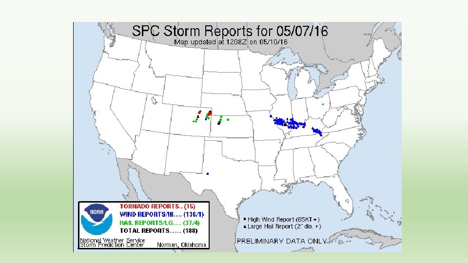
SPC Convective Outlook – May 7, 2016 (this past Saturday) Radiosonde launch location – Saturday, May 7, 2016
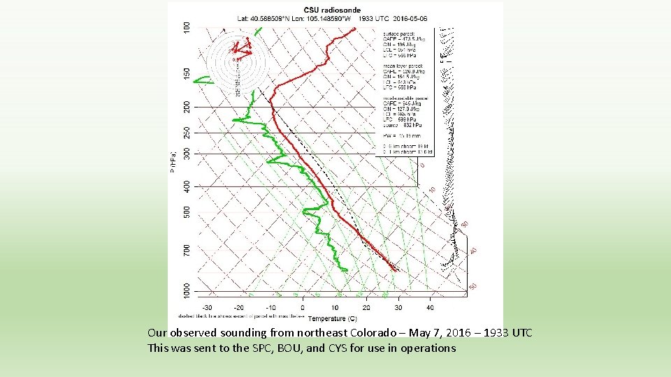
Our observed sounding from northeast Colorado – May 7, 2016 – 1933 UTC This was sent to the SPC, BOU, and CYS for use in operations
Available NUCAPS soundings 7 May 2016 – Afternoon granule Radiosonde launch location NUCAPS comparison (“good” quality flag) NUCAPS is dashed, observed sounding is solid Temperature red Dewpoint cyan
JPSS/NPP (NUCAPS) data in the WFO • How important is the data to the operational forecast/warning (DSS) problem? • Is it valuable… even if only one-two snapshots per day? • Is it unique to other datasets? • Can I get the same data from other sources? • Is the data accurate/representative? • Is the data timely? • Has the utility of all data been adequately explored? • Access to data? [Available on AWIPS 2 with QC status displayed] • Understanding of data? [Training module is available]
Successful Implementation of Applications into Forecast Operations • Tie it to a forecast problem • Show the added value • Ensure the data is available • Platform • Format • Timely • Help forecasters understand the data and application (training) • Talk to the users…the forecasters… make it a two-way conversation