OCEANS Hypsometric Curve OCEANS TIDES Spring Tides Neap


 • Isostatic adjustment")
- Slides: 52
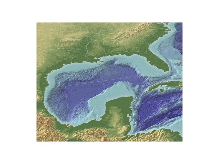
OCEANS
Hypsometric Curve
OCEANS TIDES
Spring Tides Neap Tides
What phase of the moon would you expect to be associated with the highest tides? A. New Moon B. First Quarter C. Third Quarter
Tides affected by shoreline shape
WAVES
Generated by wind speed, duration, fetch Wavebase = ½ wavelength
WAVES
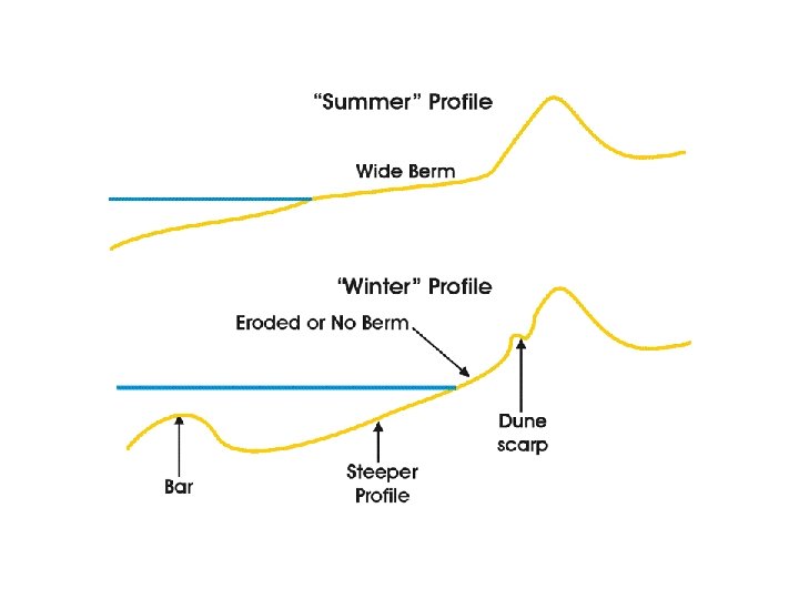
Shore profile is dynamic equilibrium
Wave Refraction waves bend toward slower medium
Wave energy focused on headlands = erosion Wave energy dispersed in bays = deposition
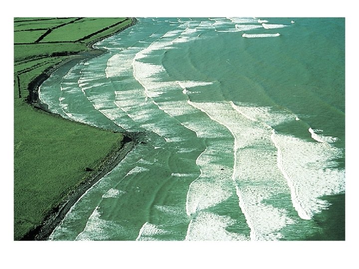
Wave refraction generates longshore current
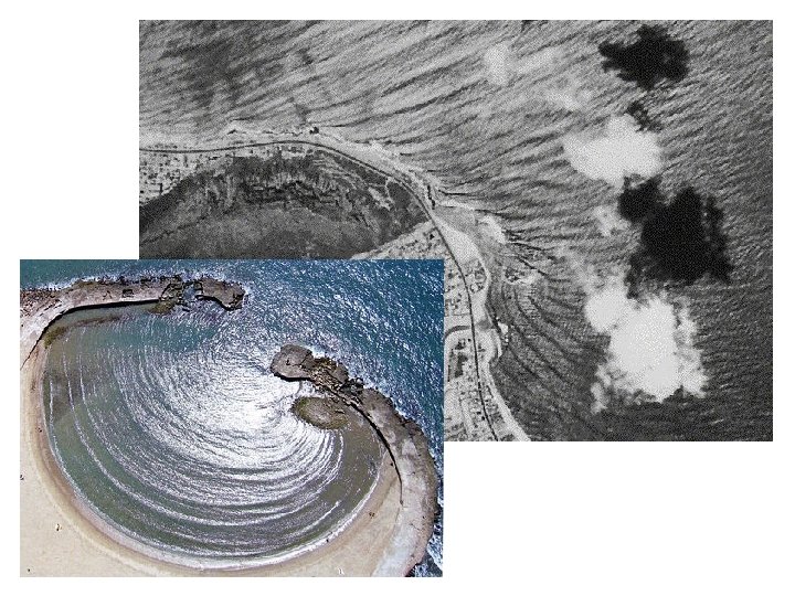
Creates Spits Alligator point
Which way is the longshore current flowing? A. To the North B. To the South C. To the East D. To the West E. Can’t tell
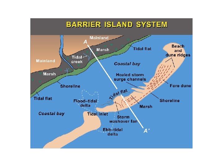
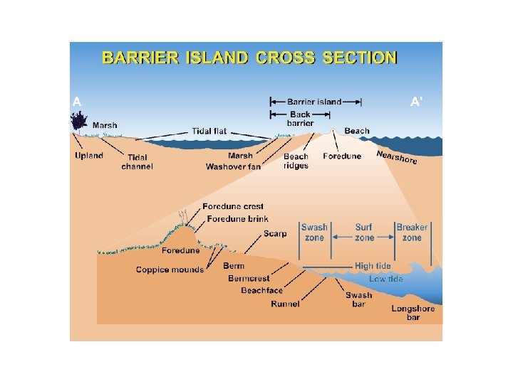
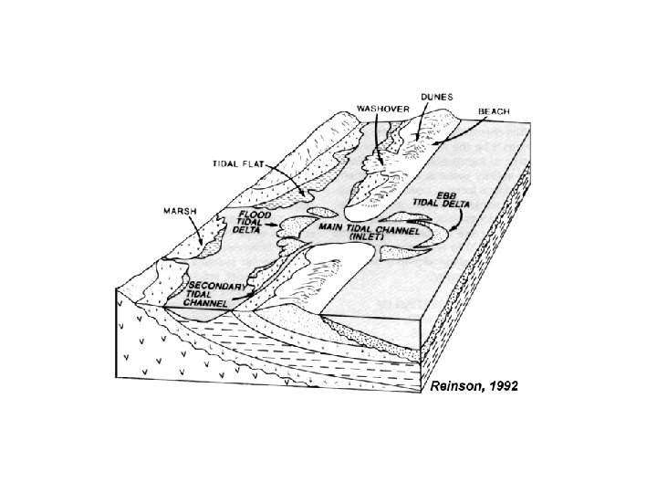
Barrier Islands How formed? • Cutoff Spit • Drowned Dunes • Exposed Sand Bar
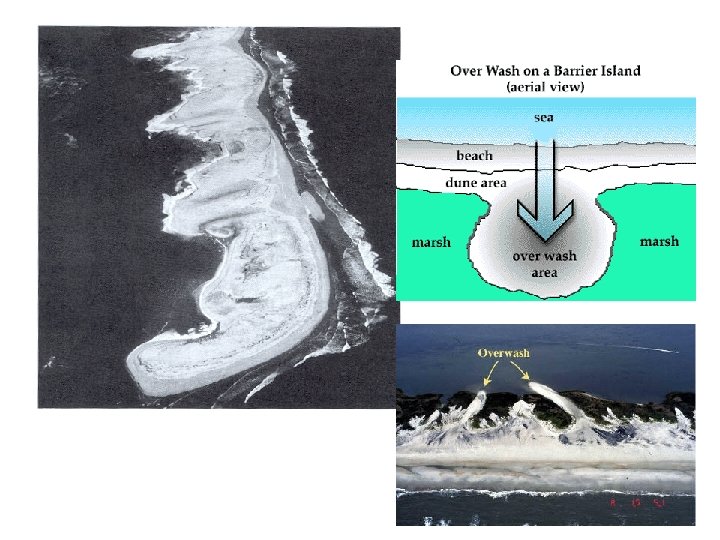
PRS Overwash causes barrier islands to move in which direction? A. Toward shore B. Toward the ocean C. Parallel to the coast
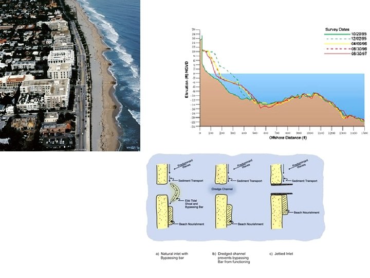
Coastal Engineering Seawalls
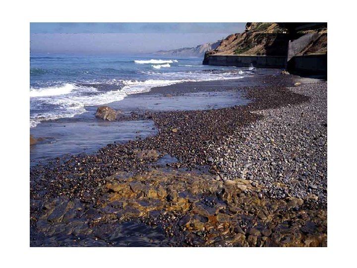
Beach Armor – Rip-Rap
Groins, jetties
PRS Which way is the longshore current flowing? A. To the North B. To the South C. To the East D. To the West E. Can’t tell
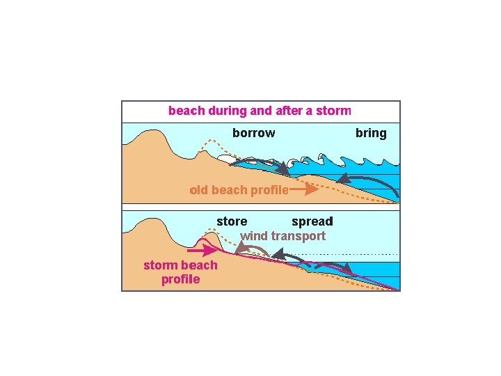
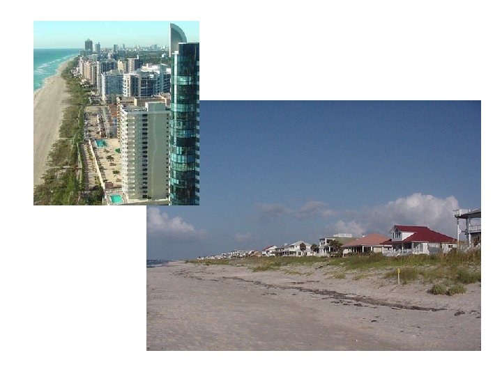
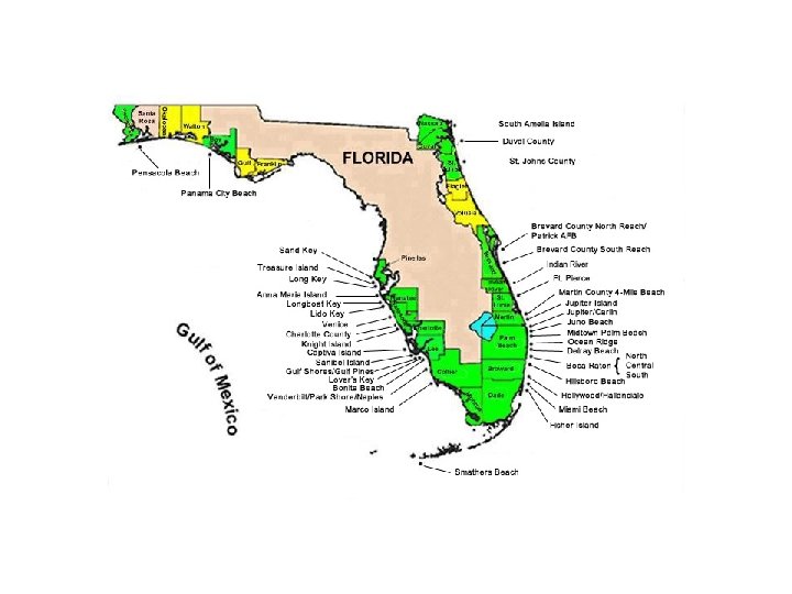
Beach Nourishment
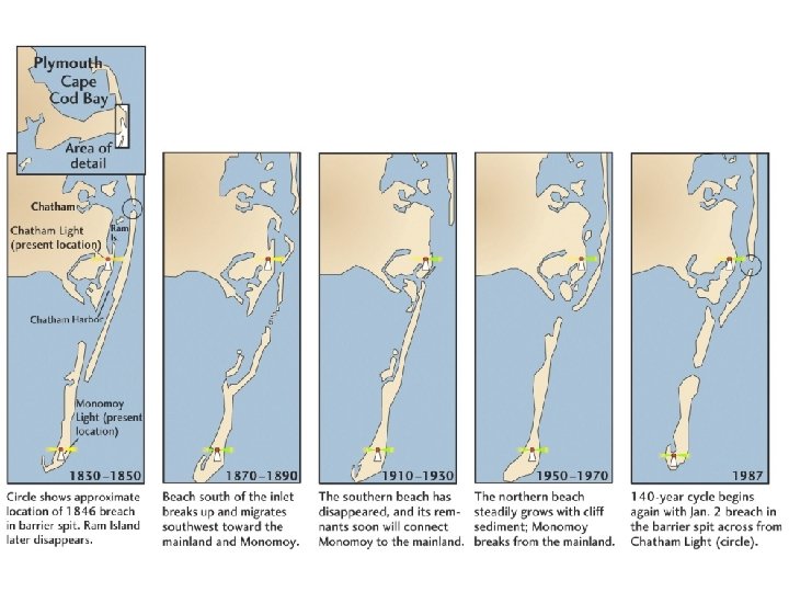
GROUP PRS Why has the southern part of the island migrated onshore? A. B. C. D. E. Change of wave direction Development on southern island Rise in sealevel Inlet jetties Change in longshore current
Rip Currents
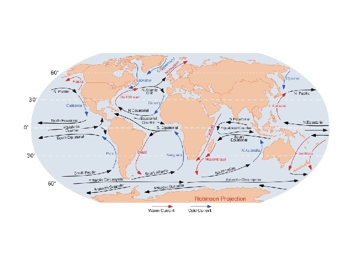
Ocean Currents Surface currents primarily driven by wind and Coriolis force
Ocean Currents Deep currents primarily driven by density due to temperature and salinity. Cold water density > warm water More Saline water density > less saline
Upwelling Zones
Ocean Upwelling: Winds drive surface waters offshore causing deep water to rise. Coastal Upwelling
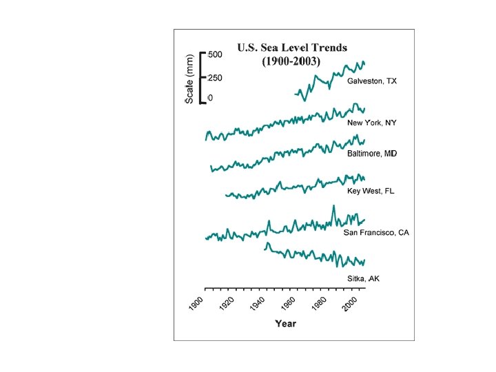
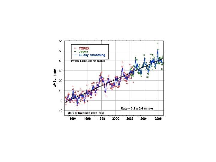
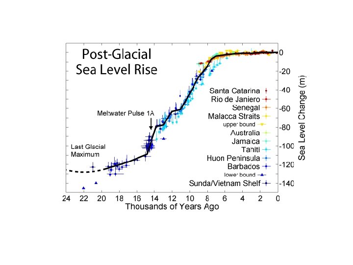
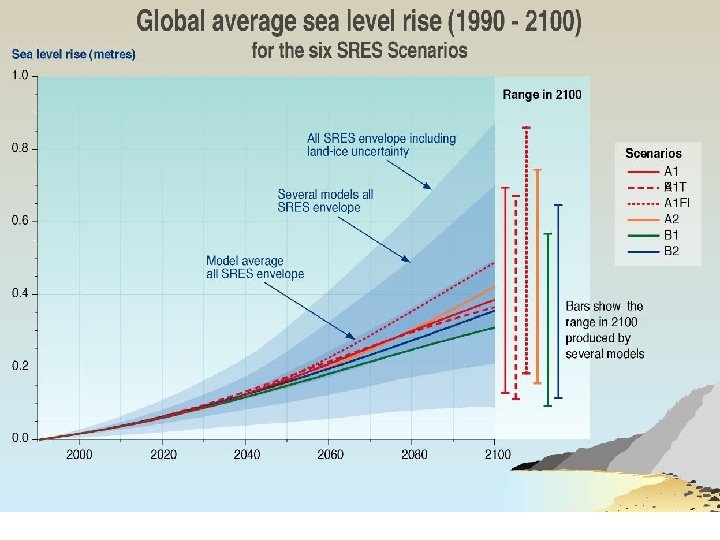
EUSTATIC SEALEVEL CONTROLS
LOCAL SEALEVEL CONTROLS • Subsidence • Tectonism (mtn building) • Isostatic adjustment