OCEANS Hypsometric Curve EUSTATIC SEALEVEL CONTROLS LOCAL SEALEVEL


 • Isostatic adjustment")


- Slides: 59
OCEANS
Hypsometric Curve
EUSTATIC SEALEVEL CONTROLS
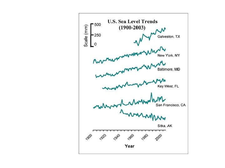
LOCAL SEALEVEL CONTROLS • Subsidence • Tectonism (mtn building) • Isostatic adjustment
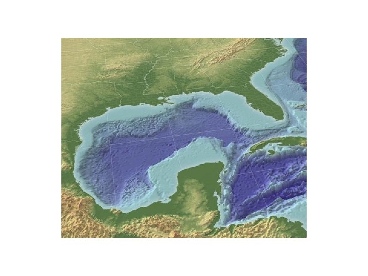
GROUP PRS Why is sealevel in Sitka falling? A. Mountain building B. Distance to equator C. Glacial melting D. Mid-ocean spreading E. Local subsidence
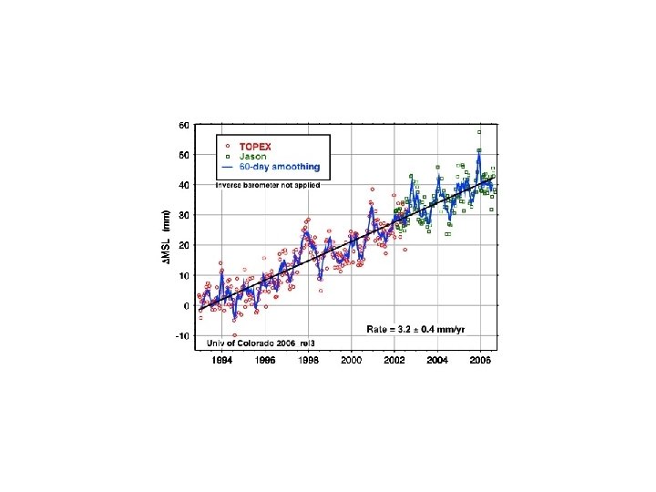
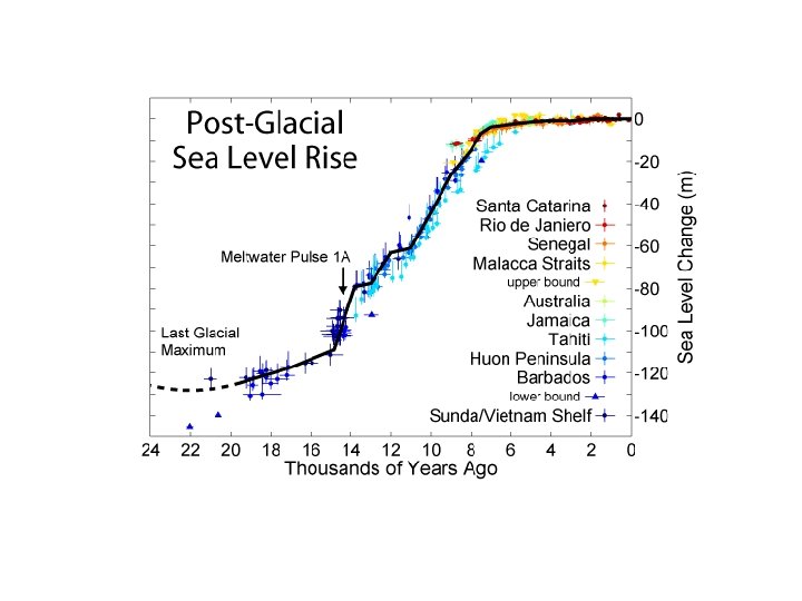
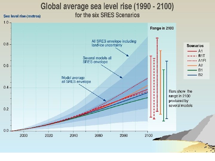
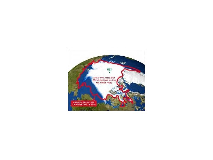
Greenland ice melts = 5 m rise
What impact would a. 5 -1 m sealevel rise have on the US? Given that we may not know how much it will rise for another 20 -30 years, what if anything, do we do now?
OCEANS TIDES
Spring Tides Neap Tides
PRS If the moon was twice as far away the tides would be A. Larger B. Smaller C. No change
Tides affected by shoreline shape
Tides affected by latitude
PRS If the Bay of Fundy was on the equator how would the highest tides be affected? A. Higher B. Lower C. No change
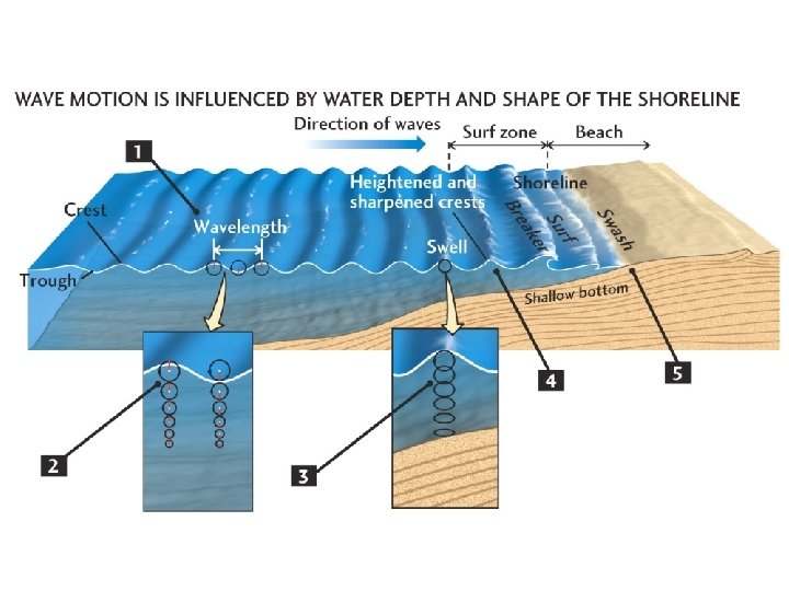
WAVES
Generated by wind speed, duration, fetch Wavebase = ½ wavelength
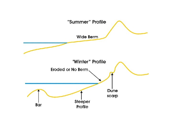
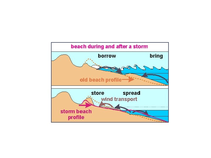
Shore profile is dynamic equilibrium
Wave Refraction waves bend toward slower medium
Wave energy focused on headlands = erosion Wave energy dispersed in bays = deposition
Wave refraction generates longshore current
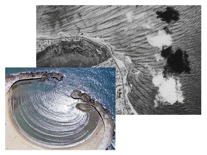
Creates Spits Alligator point
PRS Which way is the longshore current flowing? A. To the North B. To the South B. C. To the East D. to the West E. Can’t tell
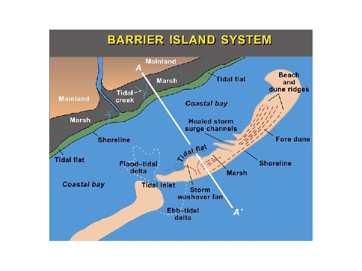
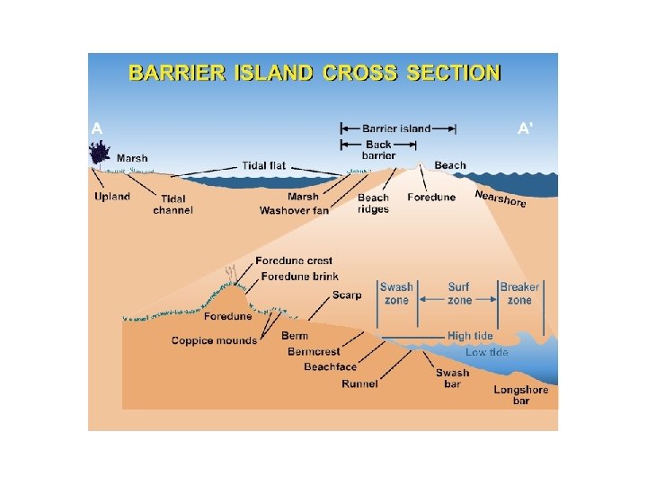
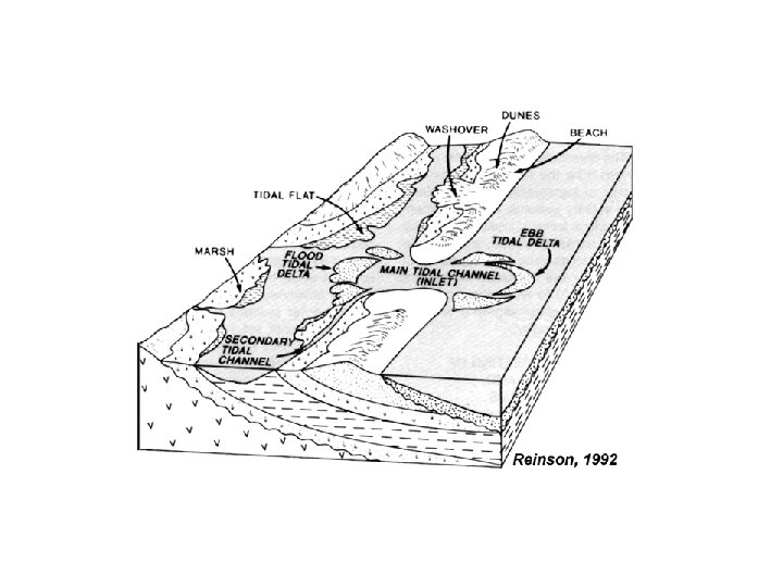
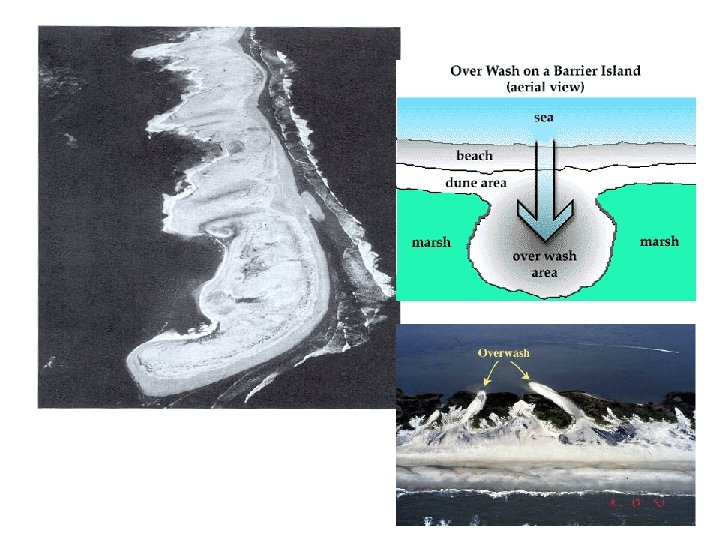
Barrier Islands How formed? • Cutoff Spit • Drowned Dunes • Exposed Sand Bar
PRS Overwash causes barrier islands to move in which direction? A. Toward shore B. Toward the ocean B. C. Parallel to the coast
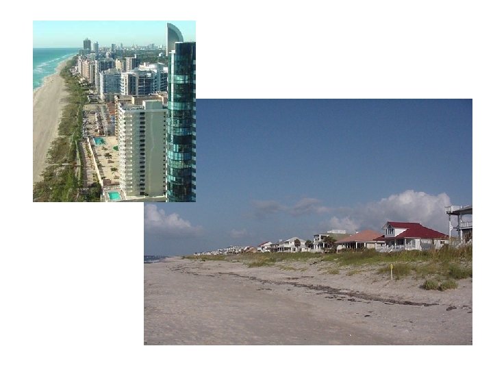
Coastal Engineering Seawalls
Beach Armor – Rip-Rap
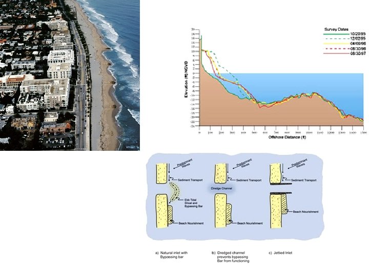
Groins, jetties
PRS Which way is the longshore current flowing? A. To the North B. To the South C. To the East D to the West E. Can’t tell
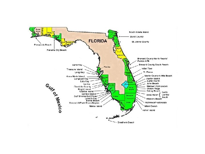
Beach Nourishment
GROUP PRS Why has the southern part of the island migrated onshore? A. Change of wave direction B. Development on southern island C. Rise in sealevel D. Inlet jetties E. Change in longshore current
Rip Currents
Convection
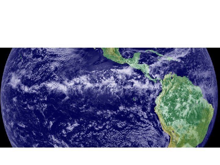
ITCZ = Inter Tropical Convergence Zone - Low pressure Rising air cools and rains
Note the pronounced shift in the ITCZ over India. What causes this?
PRS The shift is caused by A. Plate tectonics B. C. Atmospheric CO 2 C. E. Human interference B. Eccentricity in earth’s orbit D. Asia
Coriolis effect
Convection cells and zonal wind flow