Meshless wavelets and their application to terrain modeling







- Slides: 57
Meshless wavelets and their application to terrain modeling A DARPA GEO* project Jack Snoeyink, Leonard Mc. Millan, Marc Pollefeys, Wei Wang (UNC-CH) Charles Chui, Wenjie He (UMSL)
Outline • Project Team, Motivation, & Objectives • Meshless wavelets – CK Chui: Compactly supported, refinable spline fcns – Y Liu: Order-k Voronoi diagrams & simplex splines • Simplification/compression for applications – Mobility: elevation & slope mapping – Feature identification and matching • Management, Risks & Rewards
Team Introduction • U of Missouri, St. Louis – Charles K Chui: wavelets & splines – Wenjie He: splines • UNC Chapel Hill – Jack Snoeyink: computational geometry – Marc Pollyfeys: computer vision – Leonard Mc. Millan: computer graphics – Wei Wang: spatial databases – Yuanxin (Leo) Liu & Henry Mc. Euen
Self-evident truths … • Terrain data volumes are increasing. – NIMA: “In only 9 days and 18 hours, SRTM collected elevation data for 80% of the world's landmass to enable the production of DTED Level 2. ” • Old data formats were chosen for ease of computation more than completeness of representation. – Consider USGS raster DEM’s use of integer identifiers. • Terrain is irregular and multi-scale; its representation should be, too. – breaklines, multiple sources & sensors, viewer level of interest… • Consistency is a virtue in multi-(use, resolution, sensor, spectral. . . ) – Example of elevation and slope mentioned in BAA • Image compression schemes are designed to look good. – TIFF, JPEG 2000, … • The GIS industry cannot innovate on data reps. – Backward compatibility trumps even algorithmic improvements • It is a good time to look at new options for terrain representation.
Key research question • What compact representations of terrain still support interesting queries? – Elevation + slope for mobility + visibility – Feature identification across imaging modes and viewing conditions for localization, change detection, and terrain construction
Bivariate meshless wavelets We propose • a new compact representation for geospatial data that is optimized for specific geometric and image queries. – ``meshless'' bivariate wavelets defined over scattered point sets allow a flexible description since the point set can be specified without connectivity and each point's influence is local, while still supporting the multiscale analysis afforded by wavelets. Objectives • complete theory of bivariate meshless wavelets • point/knot selection algorithms optimized for specific geometric tasks and data queries • demonstration implementation showing the advantages of our modeling approach.
Meshless Wavelet Tight-Frames Charles Chui Wenjie He University of Missouri-St. Louis March 29, 2005 Savannah, Georgia
Stationary Wavelets
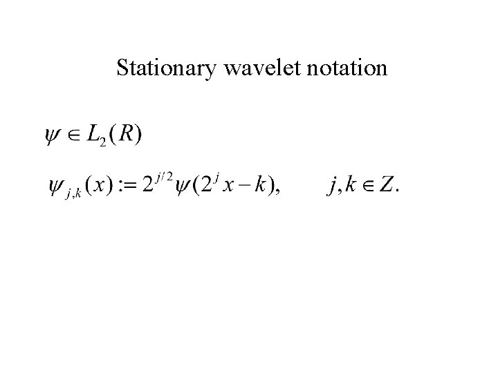
Stationary wavelet notation
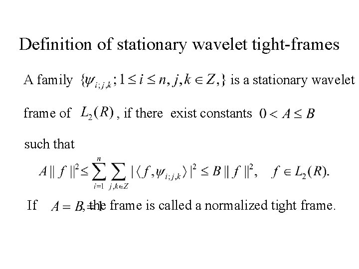
Definition of stationary wavelet tight-frames A family is a stationary wavelet frame of , if there exist constants such that If , the frame is called a normalized tight frame.
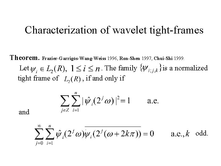
Characterization of wavelet tight-frames Theorem. Frazier-Garrigós-Wang-Weiss 1996, Ron-Shen 1997, Chui-Shi 1999. Let . The family is a normalized tight frame of , if and only if and odd.
Wavelet tight-frames associated with Multiresolution Analysis (MRA) • Refinable function: • Frame generators: • Two-scale symbols: • Vanishing moments of order K: is divisible by
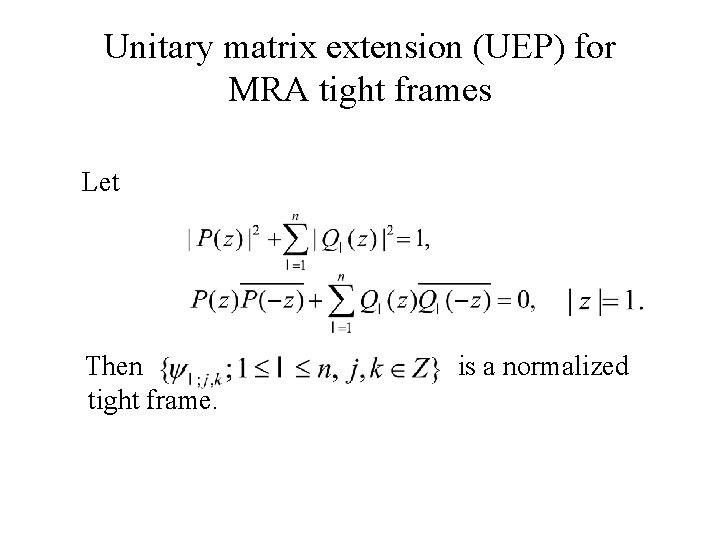
Unitary matrix extension (UEP) for MRA tight frames Let Then is a normalized tight frame.
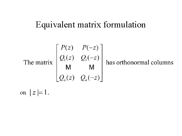
Equivalent matrix formulation on
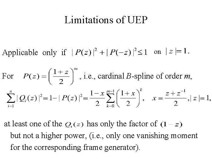
Limitations of UEP Applicable only if on For , i. e. , cardinal B-spline of order m, at least one of the has only the factor of but not a higher power, (i. e. , only one vanishing moment for the corresponding frame generator).
Full characterization of MRA tight frames Oblique Extension Principle (OEP)
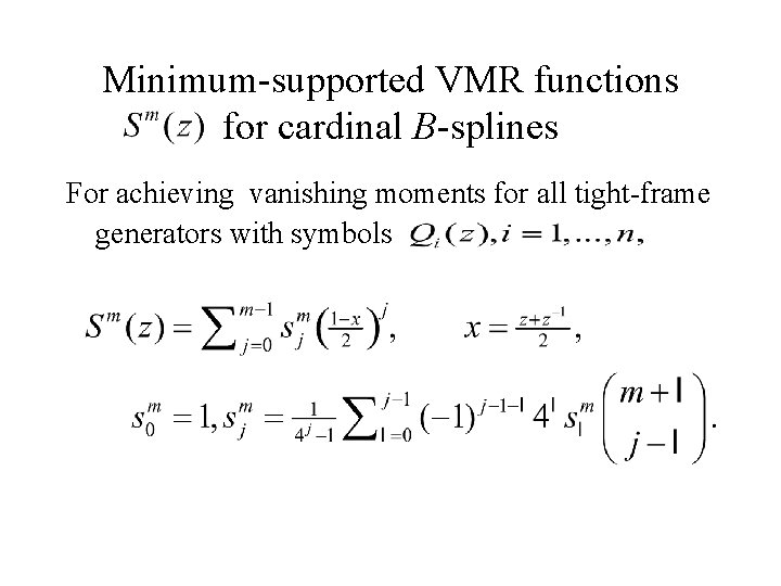
Minimum-supported VMR functions for cardinal B-splines For achieving vanishing moments for all tight-frame generators with symbols
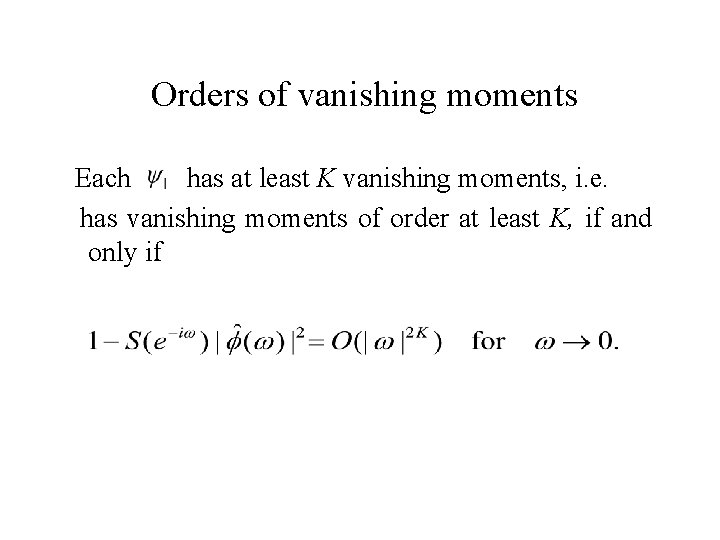
Orders of vanishing moments Each has at least K vanishing moments, i. e. has vanishing moments of order at least K, if and only if
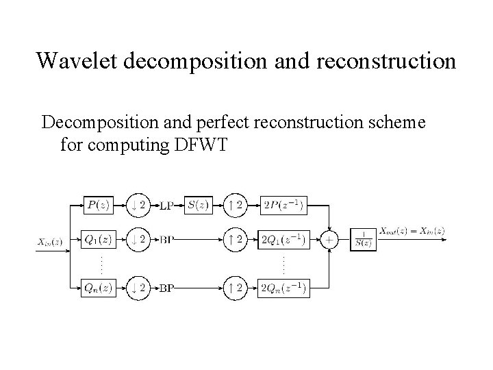
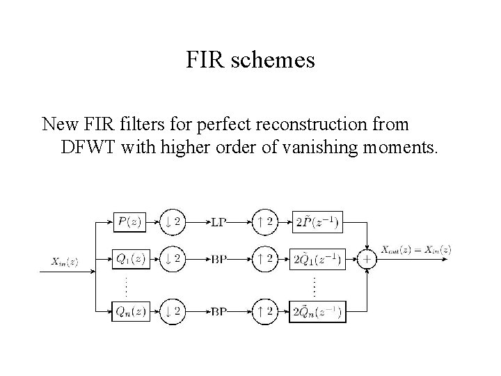
Wavelet decomposition and reconstruction Decomposition and perfect reconstruction scheme for computing DFWT
FIR schemes New FIR filters for perfect reconstruction from DFWT with higher order of vanishing moments.
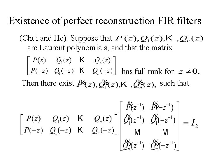
Existence of perfect reconstruction FIR filters (Chui and He) Suppose that are Laurent polynomials, and that the matrix has full rank for Then there exist such that
Non-Stationary Wavelets
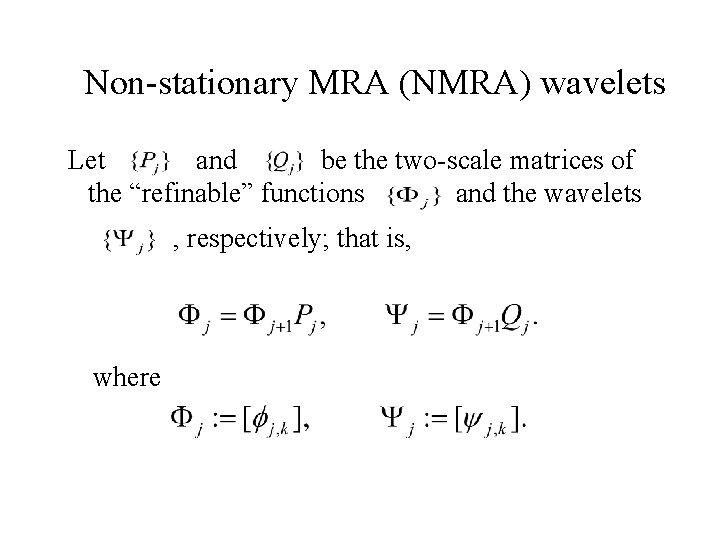
Non-stationary MRA (NMRA) wavelets Let and be the two-scale matrices of the “refinable” functions and the wavelets , respectively; that is, where
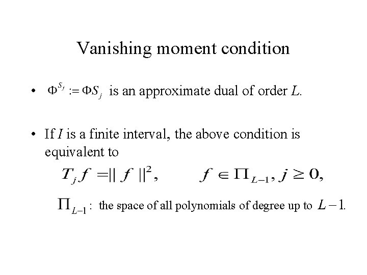
Vanishing moment condition • is an approximate dual of order L. • If I is a finite interval, the above condition is equivalent to : the space of all polynomials of degree up to .
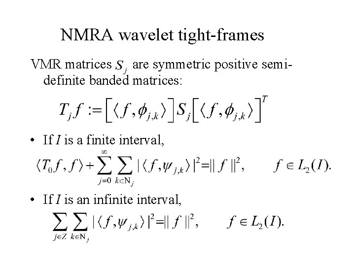
NMRA wavelet tight-frames VMR matrices are symmetric positive semidefinite banded matrices: • If I is a finite interval, • If I is an infinite interval,
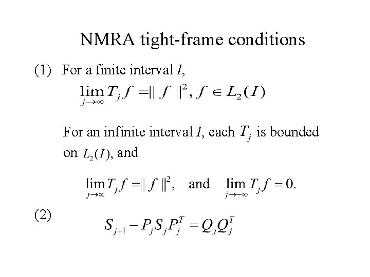
NMRA tight-frame conditions (1) For a finite interval I, For an infinite interval I, each is bounded on and (2)
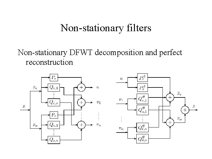
Non-stationary filters Non-stationary DFWT decomposition and perfect reconstruction
Matrix factorization for stationary tight frames
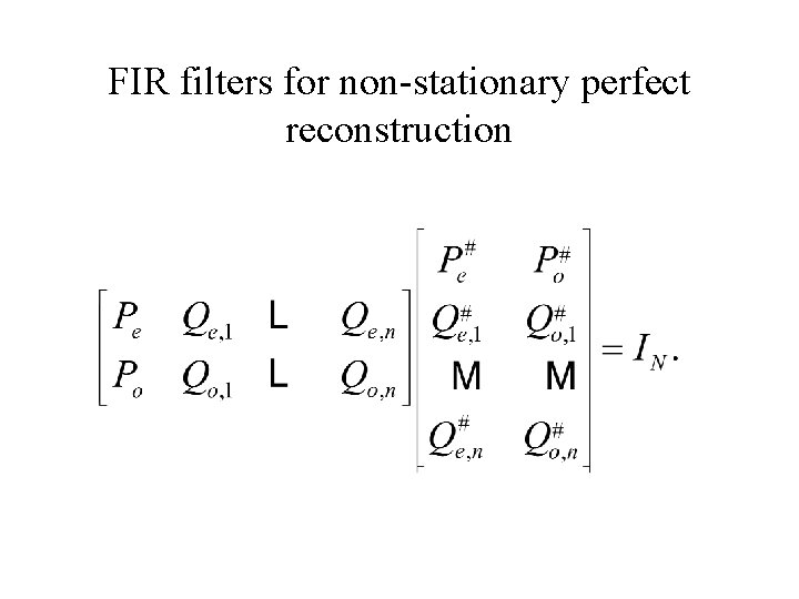
Matrix factorization for non-stationary tight frames where we use the notations and the even rows of the odd rows of
FIR filters for non-stationary perfect reconstruction
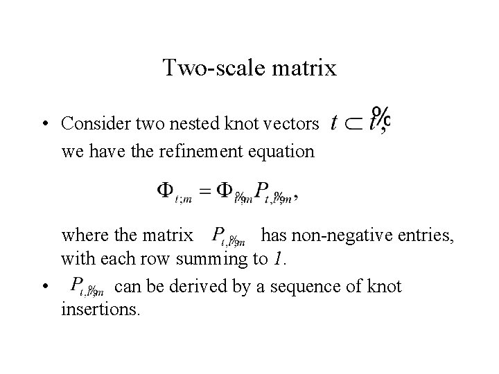
Two-scale matrix • Consider two nested knot vectors we have the refinement equation where the matrix has non-negative entries, with each row summing to 1. • can be derived by a sequence of knot insertions.
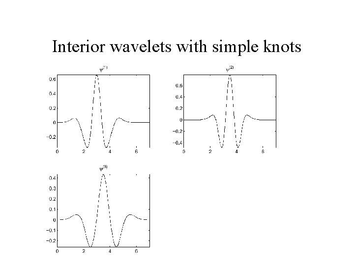
Interior wavelets with simple knots
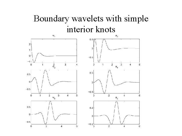
Boundary wavelets with simple interior knots
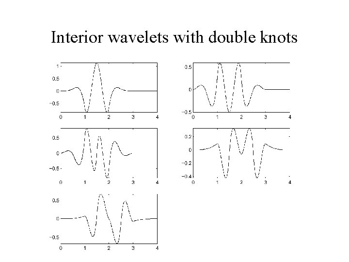
Interior wavelets with double knots
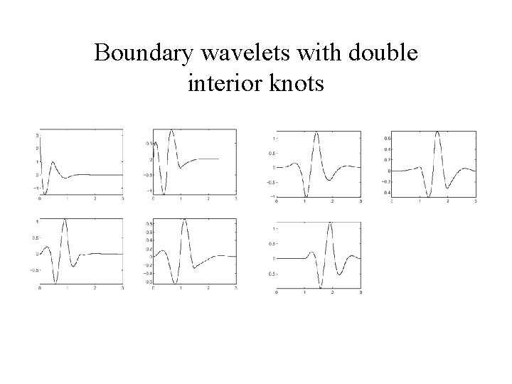
Boundary wavelets with double interior knots
Meshless Spline Wavelets
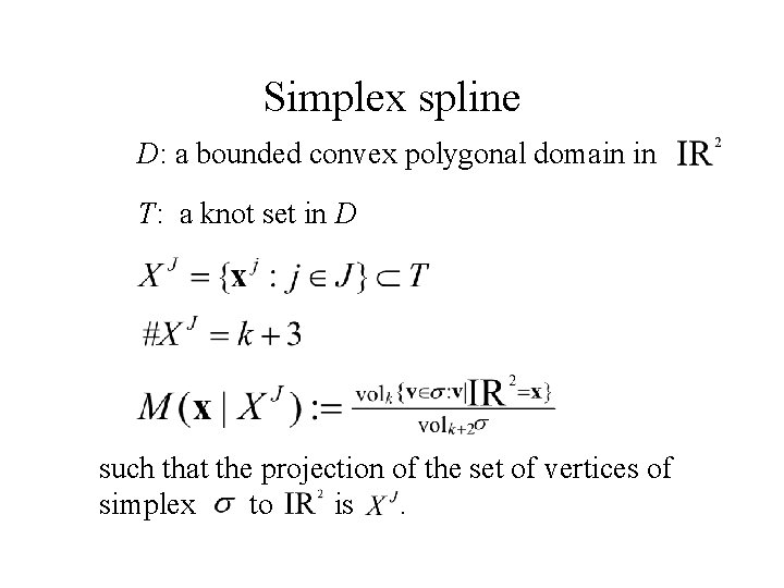
Simplex spline D: a bounded convex polygonal domain in T: a knot set in D such that the projection of the set of vertices of simplex to is .
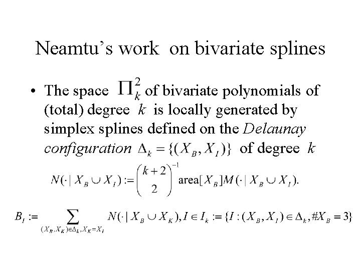
Neamtu’s work on bivariate splines • The space of bivariate polynomials of (total) degree k is locally generated by simplex splines defined on the Delaunay configuration of degree k
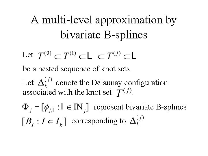
A multi-level approximation by bivariate B-splines Let be a nested sequence of knot sets. Let denote the Delaunay configuration associated with the knot set . represent bivariate B-splines corresponding to
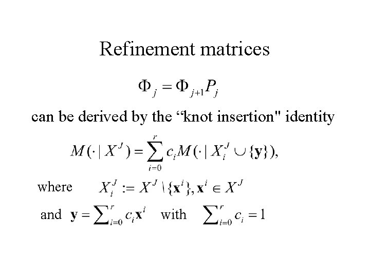
Refinement matrices can be derived by the “knot insertion" identity where and with
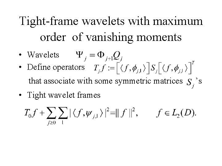
Tight-frame wavelets with maximum order of vanishing moments • Wavelets • Define operators that associate with some symmetric matrices ’s • Tight wavelet frames
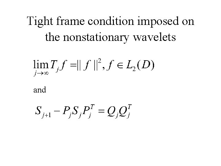
Tight frame condition imposed on the nonstationary wavelets and
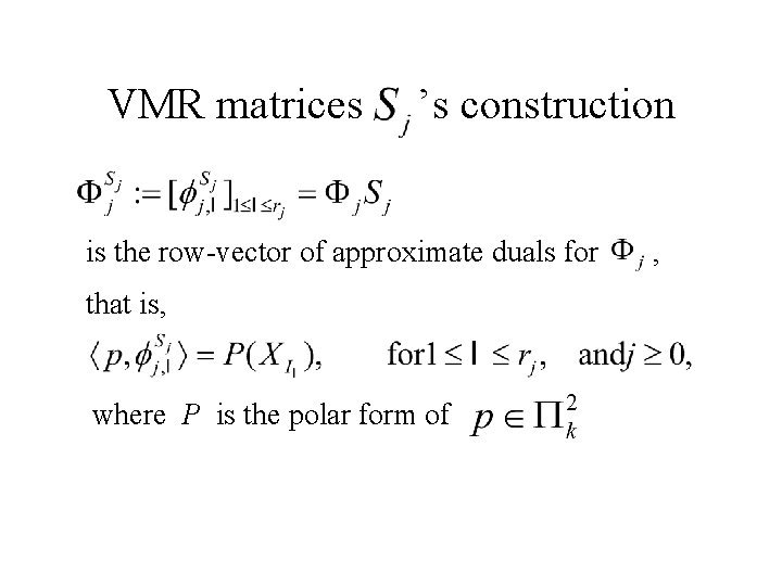
VMR matrices ’s construction is the row-vector of approximate duals for , that is, where P is the polar form of
k-Voronoi diagrams & simplex spline interpolation
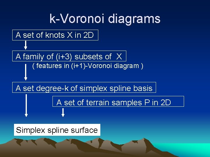
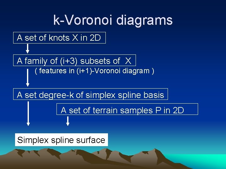
k-Voronoi diagrams A set of knots X in 2 D A family of (i+3) subsets of X ( features in (i+1)-Voronoi diagram ) A set degree-k of simplex spline basis A set of terrain samples P in 2 D Simplex spline surface
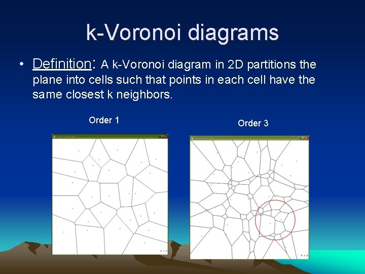
k-Voronoi diagrams • Definition: A k-Voronoi diagram in 2 D partitions the plane into cells such that points in each cell have the same closest k neighbors. Order 1 Order 3
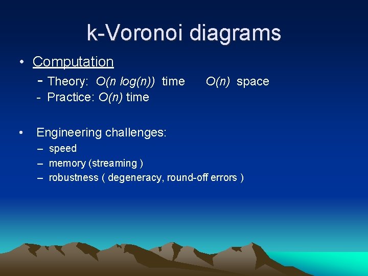
k-Voronoi diagrams • Computation - Theory: O(n log(n)) time - Practice: O(n) time • O(n) space Engineering challenges: – speed – memory (streaming ) – robustness ( degeneracy, round-off errors )
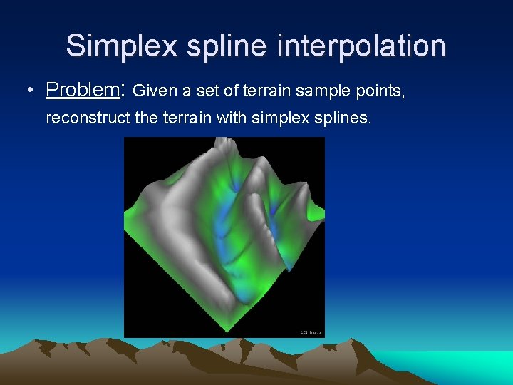
Simplex spline interpolation • Problem: Given a set of terrain sample points, reconstruct the terrain with simplex splines.
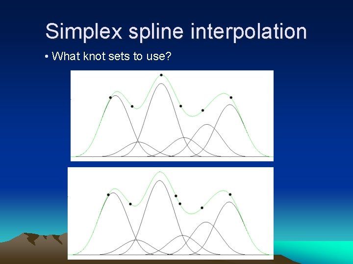
Simplex spline interpolation • What knot sets to use?
k-Voronoi diagrams A set of knots X in 2 D A family of (i+3) subsets of X ( features in (i+1)-Voronoi diagram ) A set degree-k of simplex spline basis A set of terrain samples P in 2 D Simplex spline surface
Simplify, preserving essentials BAA says that GEO* emphasizes the development of math and algorithms that enable parsimonious representations coupled to end user applications: image to DEM, targeting, route planning, and motion mobility simulations. ” Key question: who defines end user application? General compression schemes are good. To be better, we need a user, even if the user is us.
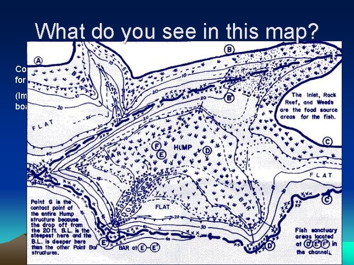
What do you see in this map? Contour map for fishing… (Imagine the boaters’ map)
Management • • POC: Jack Snoeyink UMSL - Mathematical development UNC - Algorithmic development Coupled by project wiki & visits
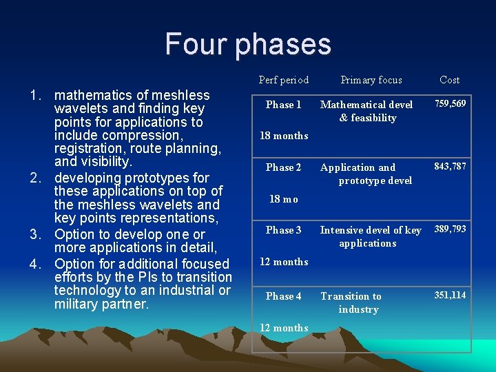
Four phases Perf period 1. mathematics of meshless wavelets and finding key points for applications to include compression, registration, route planning, and visibility. 2. developing prototypes for these applications on top of the meshless wavelets and key points representations, 3. Option to develop one or more applications in detail, 4. Option for additional focused efforts by the PIs to transition technology to an industrial or military partner. Phase 1 18 months Phase 2 18 mo Phase 3 Primary focus Mathematical devel & feasibility Cost 759, 569 Application and prototype devel 843, 787 Intensive devel of key applications 389, 793 Transition to industry 351, 114 12 months Phase 4 12 months
Risks • The mathematics is challenging – Goal is meshless wavelets, but can begin with tensor-product constructions • The implementation is complex – Order-k Voronoi + simplex splines + wavelets + interpolation will initially be dominated by regular grids • Need data and user contacts – Contact with Dr. Alexander Reid, terrain modeling project leader, U. S. Army TACOM Lab (Warren, MI)
Rewards • Wavelet analysis of surfaces from irregular data samples. • Compression that can be tuned to a particular application of the terrain • Feature identification across imaging modalities, conditions, and scales
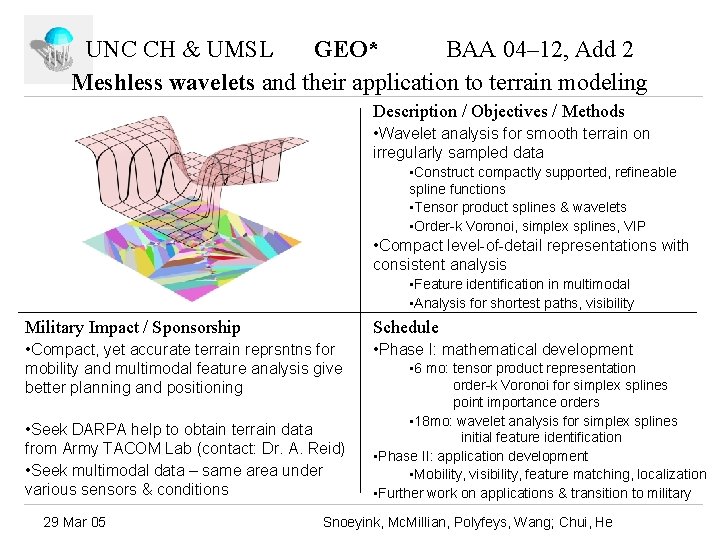
UNC CH & UMSL GEO* BAA 04– 12, Add 2 Meshless wavelets and their application to terrain modeling Description / Objectives / Methods • Wavelet analysis for smooth terrain on irregularly sampled data • Construct compactly supported, refineable spline functions • Tensor product splines & wavelets • Order-k Voronoi, simplex splines, VIP • Compact level-of-detail representations with consistent analysis • Feature identification in multimodal • Analysis for shortest paths, visibility Military Impact / Sponsorship Schedule • Compact, yet accurate terrain reprsntns for mobility and multimodal feature analysis give better planning and positioning • Phase I: mathematical development • Seek DARPA help to obtain terrain data from Army TACOM Lab (contact: Dr. A. Reid) • Seek multimodal data – same area under various sensors & conditions 29 Mar 05 • 6 mo: tensor product representation order-k Voronoi for simplex splines point importance orders • 18 mo: wavelet analysis for simplex splines initial feature identification • Phase II: application development • Mobility, visibility, feature matching, localization • Further work on applications & transition to military Snoeyink, Mc. Millian, Polyfeys, Wang; Chui, He