Lee cyclogenesis in the western Mediterranean Kristian Horvath

- Slides: 38

Lee cyclogenesis in the (western) Mediterranean Kristian Horvath, DHMZ horvath@cirus. dhz. hr 5 June 2012 Cyclone week 2012

Presenter • • Kristian Horvath, DHMZ Ph. D in 2008: Upper-level dynamics and lee cyclogenesis Postdoc 09/10: dynamical downscaling @ DHMZ + Desert Research Institute, USA Areas of interest: – – – • Lee cyclogenesis and severe winds Dynamical downscaling Meteotsunamis Data assimilation Wind energy applications http: //radar. dhz. hr/~horvath 5 June 2012 Cyclone week 2012 International conference on Alpine meteorology, Chambery, France, 2007 2

Contents • A classification of cyclone activity in the Mediterranean • Numerical analysis of MAP IOP 15 Genoa lee cyclogenesis • Conclusions 5 June 2012 Cyclone week 2012 3

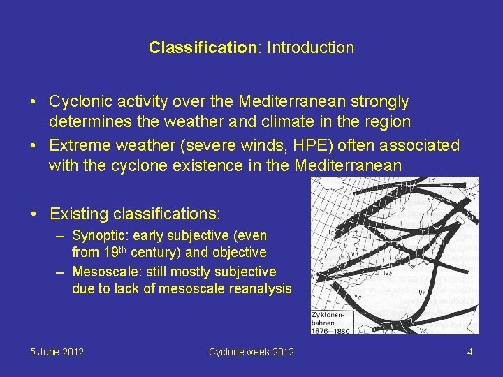
Classification: Introduction • Cyclonic activity over the Mediterranean strongly determines the weather and climate in the region • Extreme weather (severe winds, HPE) often associated with the cyclone existence in the Mediterranean • Existing classifications: – Synoptic: early subjective (even from 19 th century) and objective – Mesoscale: still mostly subjective due to lack of mesoscale reanalysis 5 June 2012 Cyclone week 2012 4

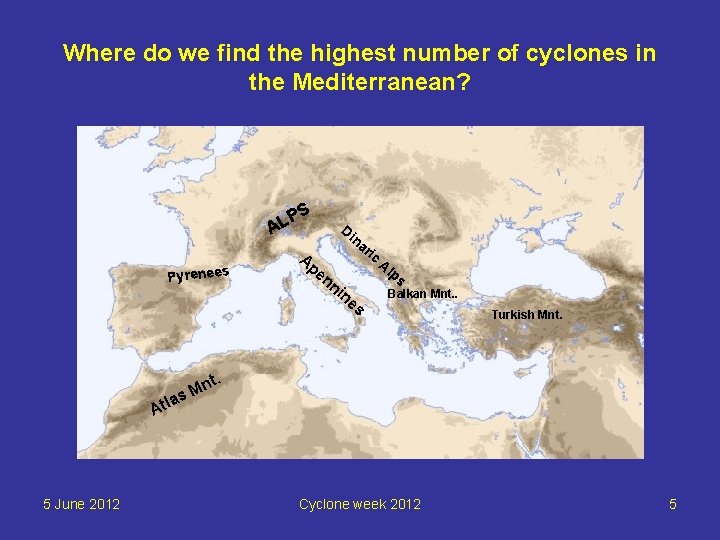
Where do we find the highest number of cyclones in the Mediterranean? P AL Pyrenees S Di Ap en na ni ric Al ne ps s Balkan Mnt. . Turkish Mnt. n s. M a Atl 5 June 2012 Cyclone week 2012 5

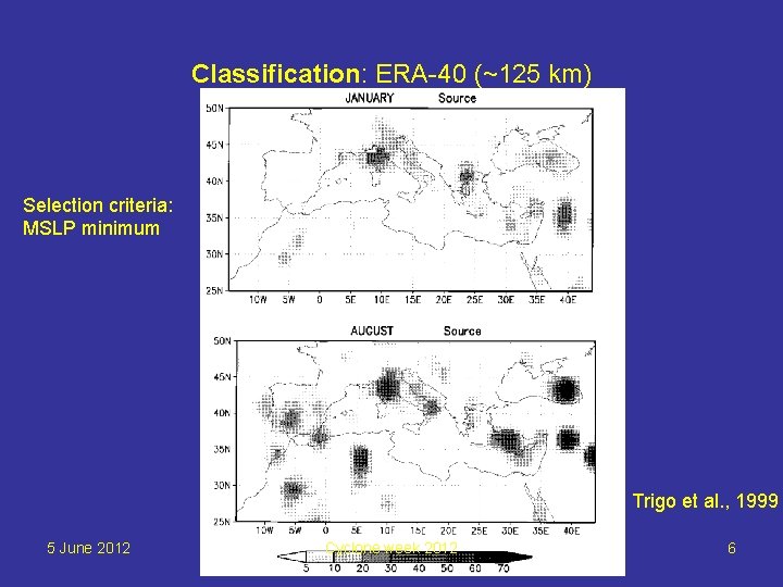
Classification: ERA-40 (~125 km) Selection criteria: MSLP minimum Trigo et al. , 1999 5 June 2012 Cyclone week 2012 6

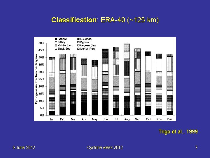
Classification: ERA-40 (~125 km) Trigo et al. , 1999 5 June 2012 Cyclone week 2012 7

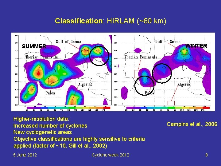
Classification: HIRLAM (~60 km) WINTER SUMMER Higher-resolution data: Increased number of cyclones New cyclogenetic areas Objective classifications are highly sensitive to criteria applied (factor of ~10, Gill et al. , 2002) 5 June 2012 Cyclone week 2012 Campins et al. , 2006 8

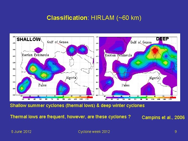
Classification: HIRLAM (~60 km) DEEP SHALLOW Shallow summer cyclones (thermal lows) & deep winter cyclones Thermal lows are frequent, however, are these cyclones ? 5 June 2012 Cyclone week 2012 Campins et al. , 2006 9

Are thermal lows cyclones ? Yes 5 June 2012 No Cyclone week 2012 10

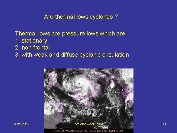
Are thermal lows cyclones ? Thermal lows are pressure lows which are: 1. stationary 2. non-frontal 3. with weak and diffuse cyclonic circulation 5 June 2012 Cyclone week 2012 11

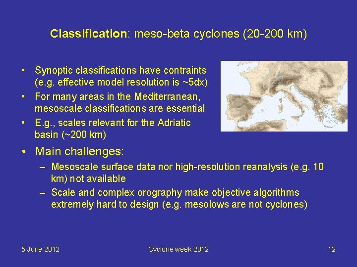
Classification: meso-beta cyclones (20 -200 km) • Synoptic classifications have contraints (e. g. effective model resolution is ~5 dx) • For many areas in the Mediterranean, mesoscale classifications are essential • E. g. , scales relevant for the Adriatic basin (~200 km) • Main challenges: – Mesoscale surface data nor high-resolution reanalysis (e. g. 10 km) not available – Scale and complex orography make objective algorithms extremely hard to design (e. g. mesolows are not cyclones) 5 June 2012 Cyclone week 2012 12

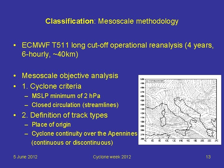
Classification: Mesoscale methodology • ECMWF T 511 long cut-off operational reanalysis (4 years, 6 -hourly, ~40 km) • Mesoscale objective analysis • 1. Cyclone criteria – MSLP minimum of 2 h. Pa – Closed circulation (streamlines) • 2. Definition of track types – Place of origin – Cyclone continuity over the Apennines (continuous or discontinuous) 5 June 2012 Cyclone week 2012 13

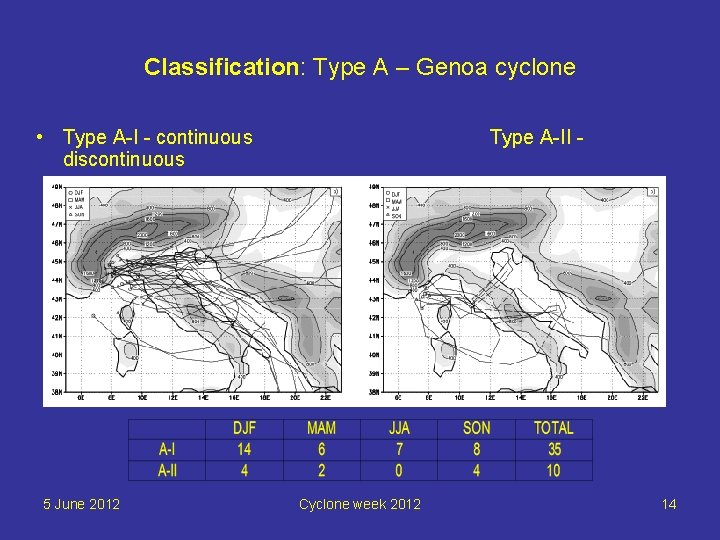
Classification: Type A – Genoa cyclone • Type A-I - continuous discontinuous 5 June 2012 Type A-II - Cyclone week 2012 14

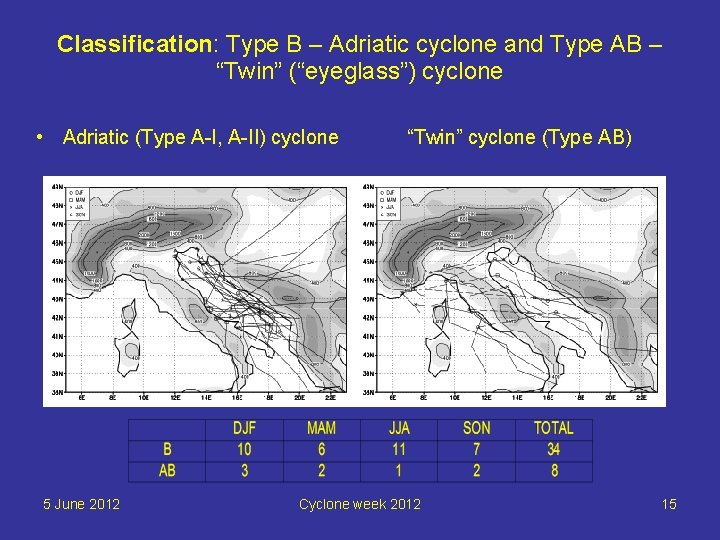
Classification: Type B – Adriatic cyclone and Type AB – “Twin” (“eyeglass”) cyclone • Adriatic (Type A-I, A-II) cyclone 5 June 2012 “Twin” cyclone (Type AB) Cyclone week 2012 15

Contents • A classification of cyclone activity in the Mediterranean • Numerical analysis of MAP IOP 15 Genoa lee cyclone • Conclusions 5 June 2012 Cyclone week 2012 16

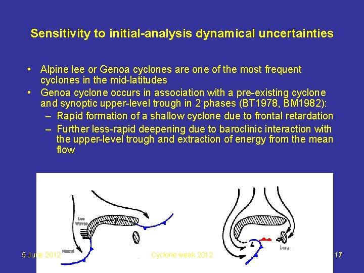
Sensitivity to initial-analysis dynamical uncertainties • Alpine lee or Genoa cyclones are one of the most frequent cyclones in the mid-latitudes • Genoa cyclone occurs in association with a pre-existing cyclone and synoptic upper-level trough in 2 phases (BT 1978, BM 1982): – Rapid formation of a shallow cyclone due to frontal retardation – Further less-rapid deepening due to baroclinic interaction with the upper-level trough and extraction of energy from the mean flow 5 June 2012 Cyclone week 2012 Italy 3. ICTP Conf. , Trieste, DHMZ 17

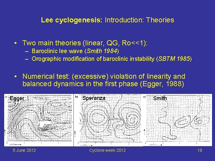
Lee cyclogenesis: Introduction: Theories • Two main theories (linear, QG, Ro<<1): – Baroclinic lee wave (Smith 1984) – Orographic modification of baroclinic instability (SBTM 1985) • Numerical test: (excessive) violation of linearity and balanced dynamics in the first phase (Egger, 1988) Egger 5 June 2012 Speranza Cyclone week 2012 Smith 18

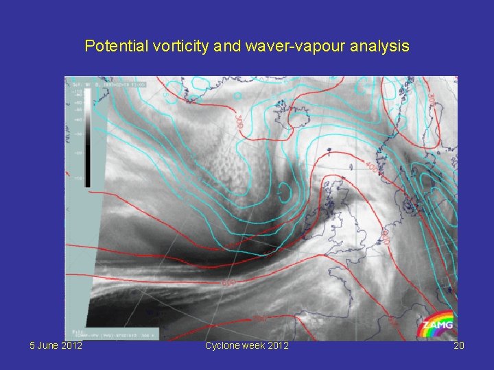
Lee cyclogenesis: Introduction: Potential vorticity approach Review by Hoskins et al. , 1985) • Potential vorticity (PV) • “PV thinking” – Conservation of PV – Invertibility principle • Application to understanding of lee cyclogenesis 5 June 2012 Cyclone week 2012 19

Potential vorticity and waver-vapour analysis 5 June 2012 Cyclone week 2012 20

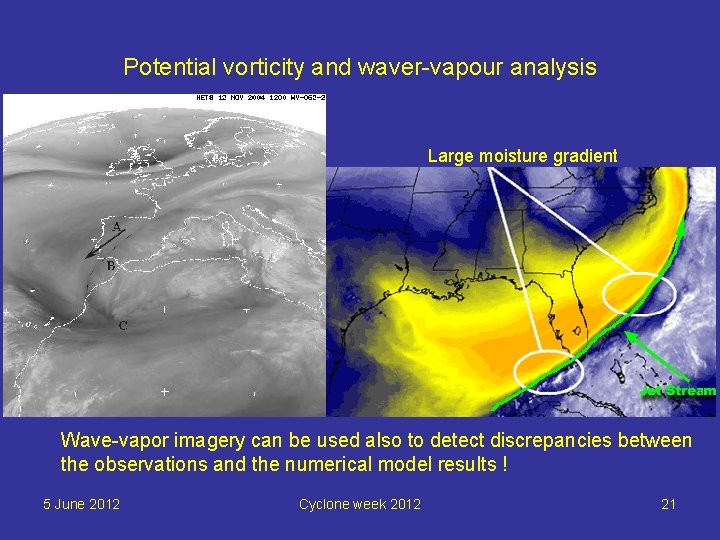
Potential vorticity and waver-vapour analysis Large moisture gradient Wave-vapor imagery can be used also to detect discrepancies between the observations and the numerical model results ! 5 June 2012 Cyclone week 2012 21

Sensitivity to initial-analysis dynamical uncertainties • The key roles in formation of Genoa cyclones is due to the Alpine orography and the upper-level trough • The predictability depends mainly on the features of the upper-level trough • Q 1: how to estimate the realistic initial-analysis dynamical uncertainties in the upper-levels? • Q 2: what is the influence of these uncertainties to the development of Genoa lee cyclone? 5 June 2012 Cyclone week 2012 22

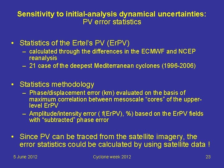
Sensitivity to initial-analysis dynamical uncertainties: PV error statistics • Statistics of the Ertel’s PV (Er. PV) – calculated through the differences in the ECMWF and NCEP reanalysis – 21 case of the deepest Mediterranean cyclones (1996 -2006) • Statistics methodology – Phase/displacement error (km) evaluated on the basis of maximum correlation between mesoscale “cores” of the upperlevel Er. PV – Amplitude/intensity error ( f(Er. PV), %) based on the Er. PV fields with “subtracted” phase error • Since PV can be traced from the satellite imagery, the error statistics could be calculated by using satellite data ! 5 June 2012 Cyclone week 2012 23

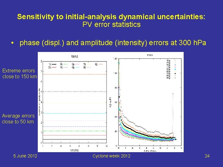
Sensitivity to initial-analysis dynamical uncertainties: PV error statistics • phase (displ. ) and amplitude (intensity) errors at 300 h. Pa Extreme errors close to 150 km Average errors close to 50 km 5 June 2012 Cyclone week 2012 24

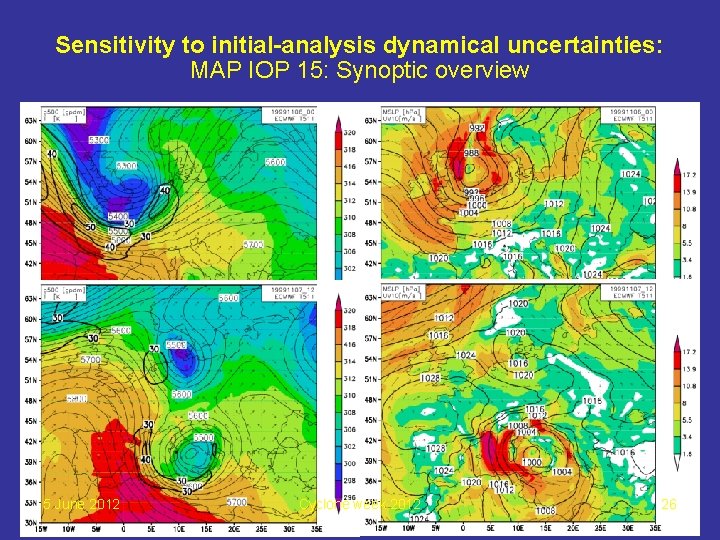
Sensitivity to initial-analysis dynamical uncertainties: MAP IOP 15: Introduction • Deep and rapid Genoa lee cyclone 06 -10 November 1999 (MAP IOP 15) • Extreme weather conditions: – Heavy rain in the northern Italy > 60 mm / 12 h – Gale winds in the northern Adriatic (10 -min average > 25 ms-1, gusts > 40 ms-1) • MM 5 mesoscale model at 2. 5 km and 35 vertical levels driven with ECMWF T 511 analysis • Parameterizations: Kain-Fritsch 2 CPS, MRF PBL, Reisner 2 microphysics 5 June 2012 Cyclone week 2012 25

Sensitivity to initial-analysis dynamical uncertainties: MAP IOP 15: Synoptic overview 5 June 2012 Cyclone week 2012 26

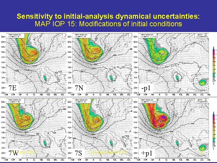
Sensitivity to initial-analysis dynamical uncertainties: MAP IOP 15: Modification of the initial conditions • Macroscale modifications of the upper-level dynamics only (PV error integrated over 500 -100 h. Pa for PVU>1) • Choice made: 90 th percentile to reflect the greatest possible dynamical initial-analysis errors – Phase – 157. 5 km – Amplitude – 23 % • => application to the MAP IOP 15 upper-level trough: – Moving the trough to the E, W, N and S – Increase and decrease the trough intensity 5 June 2012 Cyclone week 2012 27

Sensitivity to initial-analysis dynamical uncertainties: MAP IOP 15: Modifications of initial conditions 7 E 7 N 5 June 2012 7 W 7 S -p 1 Cyclone week 2012 +p 1 28

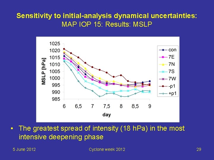
Sensitivity to initial-analysis dynamical uncertainties: MAP IOP 15: Results: MSLP • The greatest spread of intensity (18 h. Pa) in the most intensive deepening phase 5 June 2012 Cyclone week 2012 29

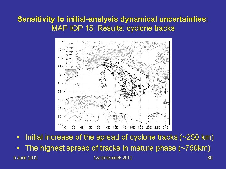
Sensitivity to initial-analysis dynamical uncertainties: MAP IOP 15: Results: cyclone tracks • Initial increase of the spread of cyclone tracks (~250 km) • The highest spread of tracks in mature phase (~750 km) 5 June 2012 Cyclone week 2012 30

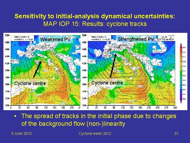
Sensitivity to initial-analysis dynamical uncertainties: MAP IOP 15: Results: cyclone tracks Strengthened PV Weakened PV Cyclone centre • The spread of tracks in the initial phase due to changes of the background flow (non-)linearity 5 June 2012 Cyclone week 2012 31

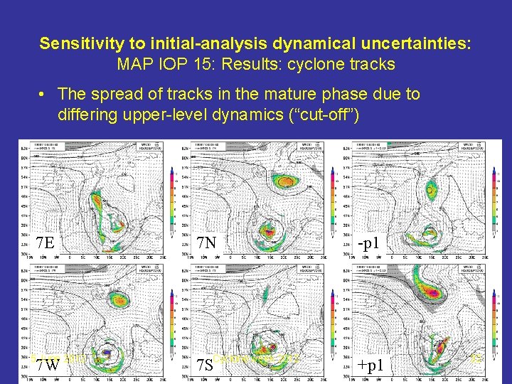
Sensitivity to initial-analysis dynamical uncertainties: MAP IOP 15: Results: cyclone tracks • The spread of tracks in the mature phase due to differing upper-level dynamics (“cut-off”) 7 E 5 June 2012 7 W 7 N -p 1 7 SCyclone week 2012 +p 1 32

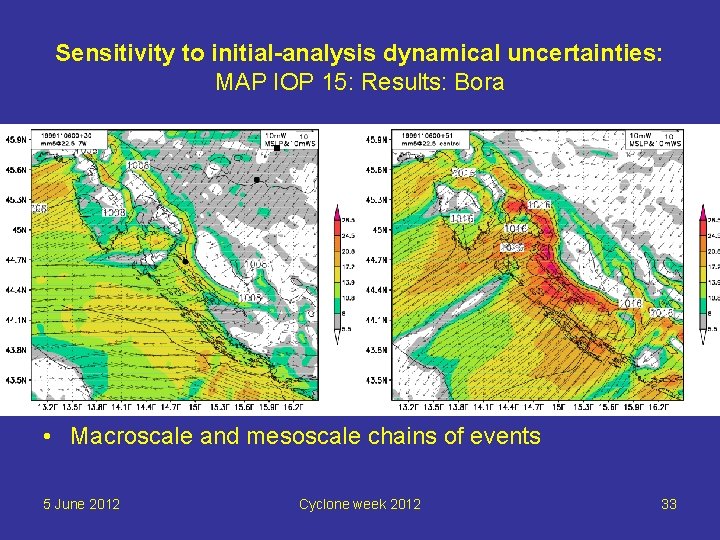
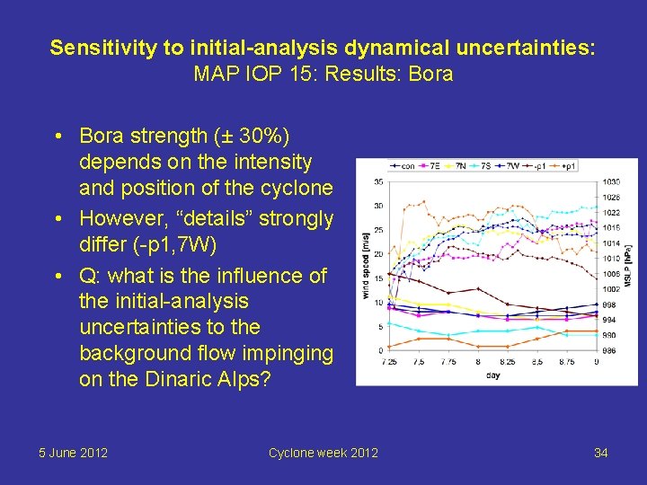
Sensitivity to initial-analysis dynamical uncertainties: MAP IOP 15: Results: Bora • Macroscale and mesoscale chains of events 5 June 2012 Cyclone week 2012 33

Sensitivity to initial-analysis dynamical uncertainties: MAP IOP 15: Results: Bora • Bora strength (± 30%) depends on the intensity and position of the cyclone • However, “details” strongly differ (-p 1, 7 W) • Q: what is the influence of the initial-analysis uncertainties to the background flow impinging on the Dinaric Alps? 5 June 2012 Cyclone week 2012 34

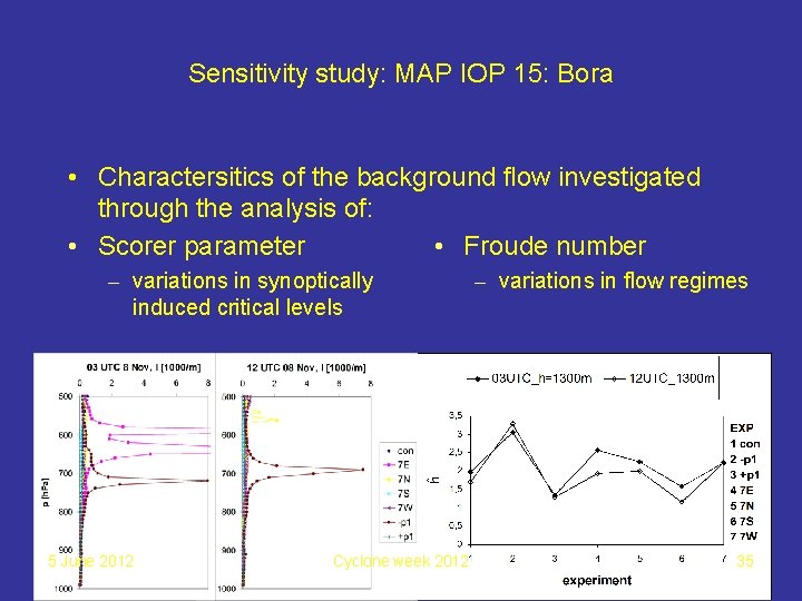
Sensitivity study: MAP IOP 15: Bora • Charactersitics of the background flow investigated through the analysis of: • Scorer parameter • Froude number – variations in synoptically induced critical levels 5 June 2012 Cyclone week 2012 – variations in flow regimes 35

Conclusions: Classification of Mediterranean cyclones • Main cyclogenetic areas in the Mediterranean are near the mountains such as the Alps, the Atlas, the Apennines, the Balkan mnts etc. • Two main types of cyclones in the Mediterranean: – Deep winter cyclones (mostly lee cyclones) – Shallow summer cyclones (mostly thermal lows) • Meso-beta cyclones hardly identified in global reanalysis may be equally frequent as the larger-scale cyclones • Special cyclone types do exist – e. g. discontinuous cyclones, twin cyclones, rotational twin cyclones etc. 5 June 2012 Cyclone week 2012 36

Conclusions: numerical analysis of lee cyclogenesis • Large sensitivity of Genoa cyclone to upper-level trough details for: – Intensity: in the most rapid deepening phase (18 h. Pa) – Track: in the late mature phase (750 km) • The sensitivity of Bora wind strength to initial-analysis dynamical uncertainties equals ± 30% • The water vapour satellite imagery is useful for analysis of the upper-level dynamical processes (troughs, jet streaks) • Satellite products may provide the realistic potential vorticity error estimates important for everyday probabilistic NWP 5 June 2012 Cyclone week 2012 37

THANK YOU ! 5 June 2012 Cyclone week 2012 38