Jens Hilke Landscape Change Project Perkins Geology Museum

- Slides: 31
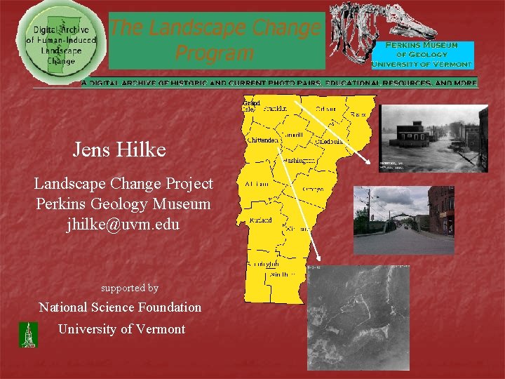
Jens Hilke Landscape Change Project Perkins Geology Museum jhilke@uvm. edu supported by National Science Foundation University of Vermont
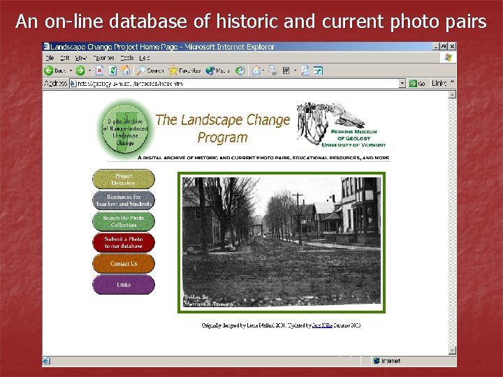
An on-line database of historic and current photo pairs
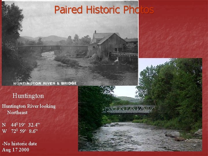
Paired Historic Photos Huntington River looking Northeast N 440 19’ 32. 4” W 720 59’ 8. 6” -No historic date Aug 17 2000
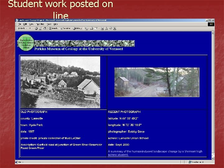
Student work posted on line
Human-induced landscape change n Landscape Natural History n Cultural History n Interactions (culture and landscape) n Technology n
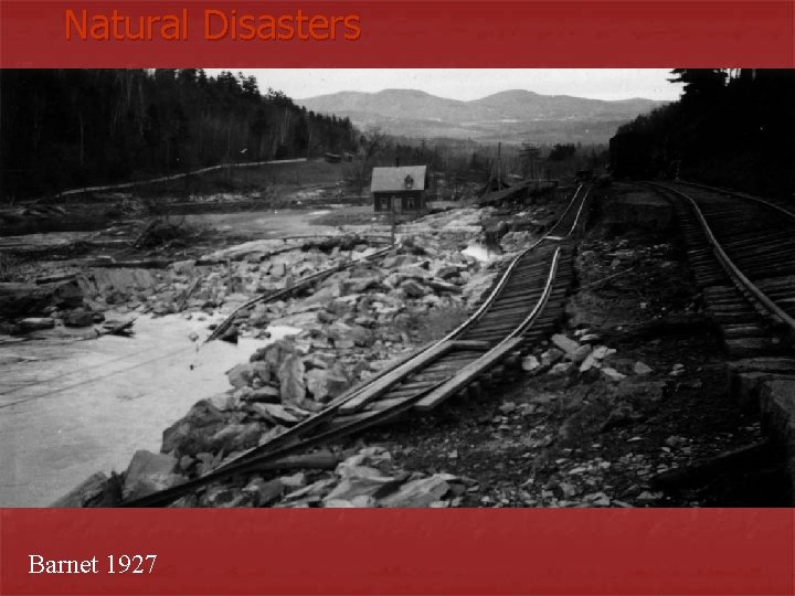
Natural Disasters Barnet 1927
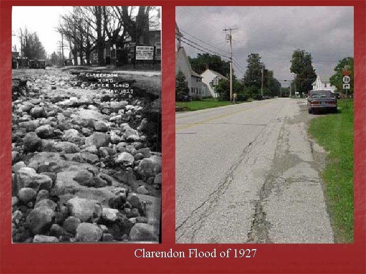
Clarendon Flood of 1927
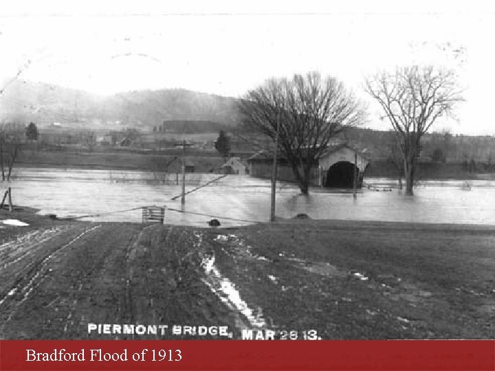
Bradford Flood of 1913
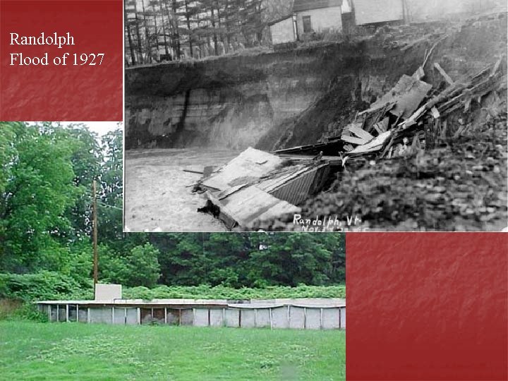
Randolph Flood of 1927
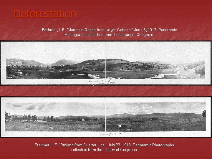
Deforestation Brehmer, L. F. "Mountain Range from Keyes Cottage. " June 6, 1913. Panoramic Photographs collection from the Library of Congress. Brehmer, L. F. “Rutland from Quarter Line. " July 29, 1913. Panoramic Photographs collection from the Library of Congress.
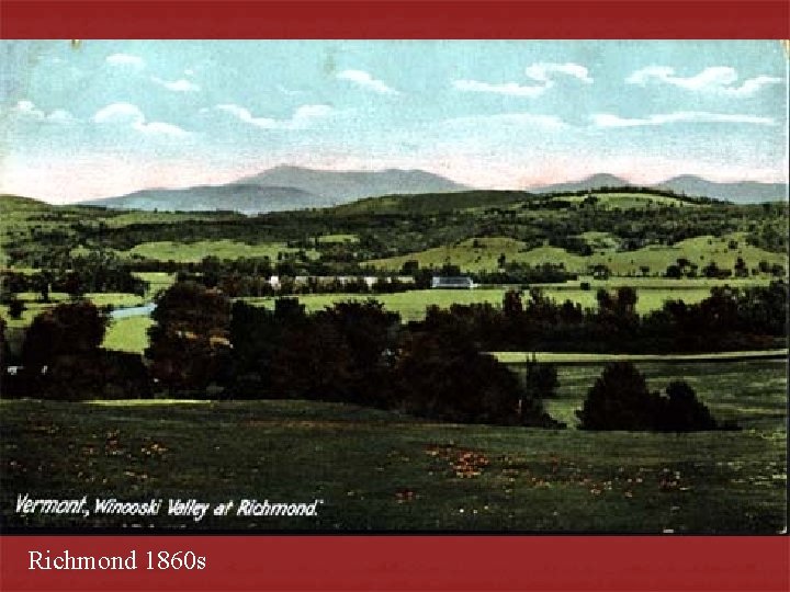
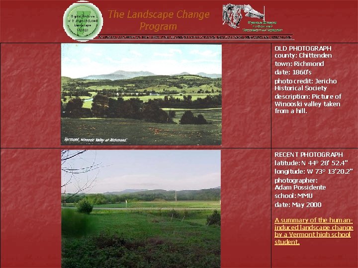
Richmond 1860 s
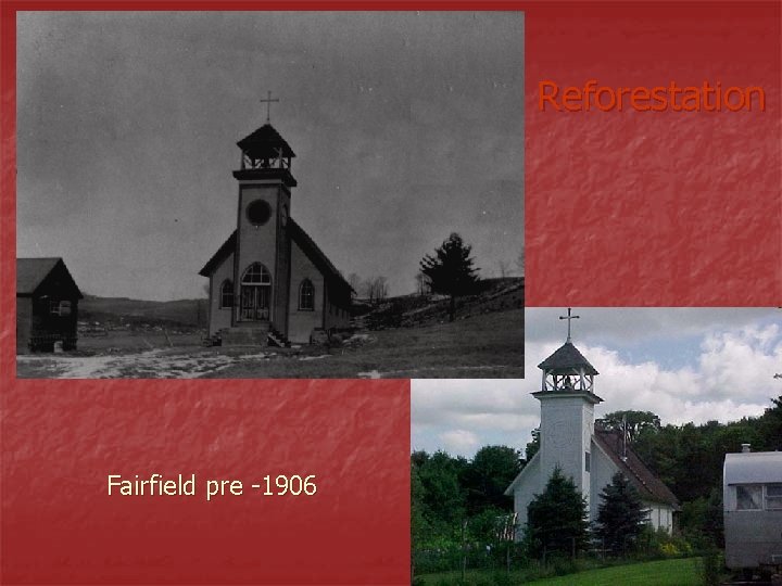
Reforestation Fairfield pre -1906
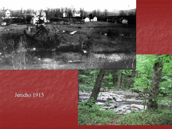
Jericho 1913
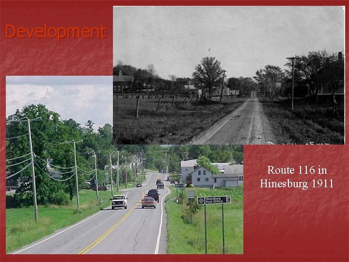
Development Route 116 in Hinesburg 1911
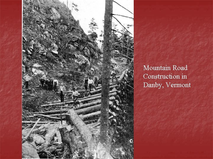
Mountain Road Construction in Danby, Vermont
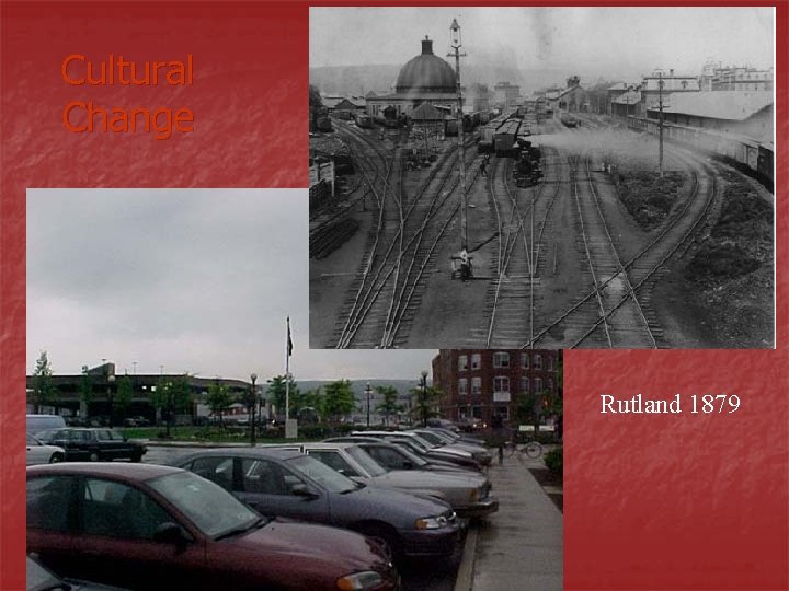
Cultural Change Rutland 1879
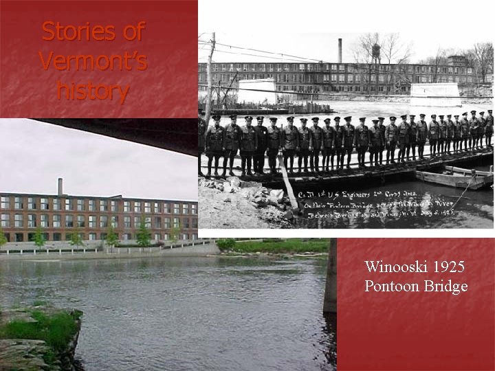
Stories of Vermont’s history Winooski 1925 Pontoon Bridge
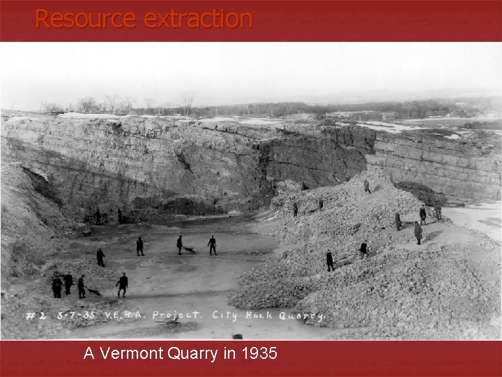
Resource extraction A Vermont Quarry in 1935
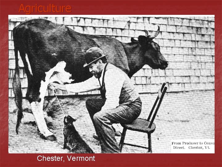
Agriculture Chester, Vermont
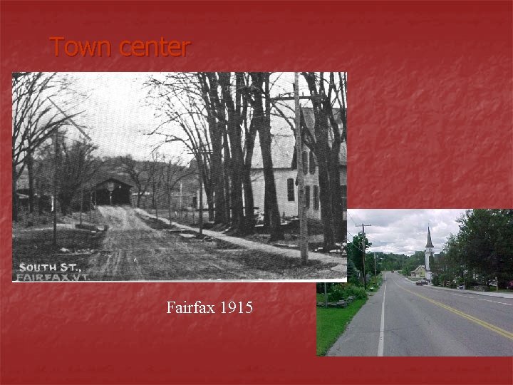
Town center Fairfax 1915
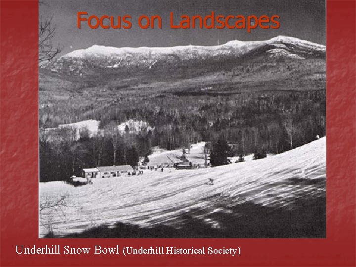
Focus on Landscapes Underhill Snow Bowl (Underhill Historical Society)
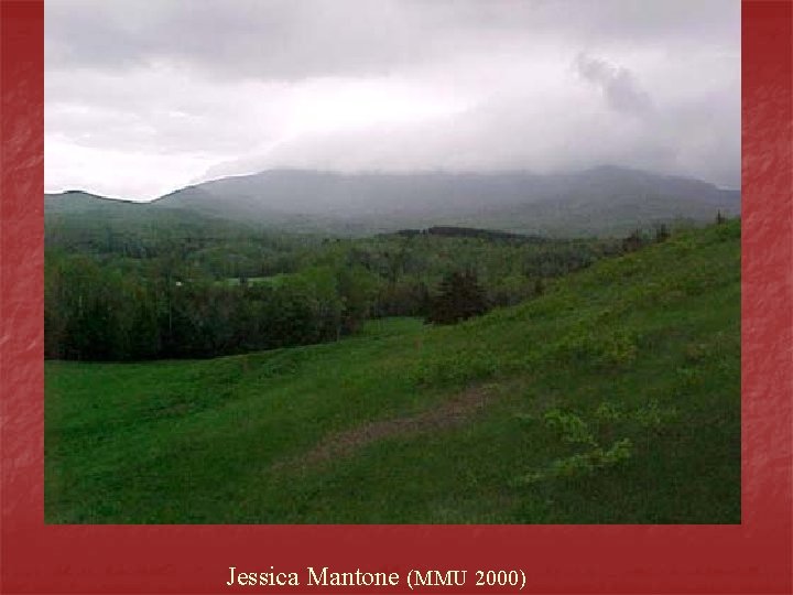
Jessica Mantone (MMU 2000)
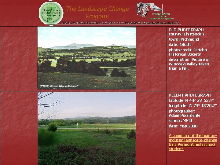
OLD PHOTOGRAPH county: Chittenden town: Richmond date: 1860's photo credit: Jericho Historical Society description: Picture of Winooski valley taken from a hill. RECENT PHOTOGRAPH latitude: N 44° 28' 52. 4" longitude: W 73° 13'20. 2" photographer: Adam Possidente school: MMU date: May 2000 A summary of the humaninduced landscape change by a Vermont high school student.
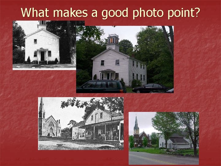
What makes a good photo point?
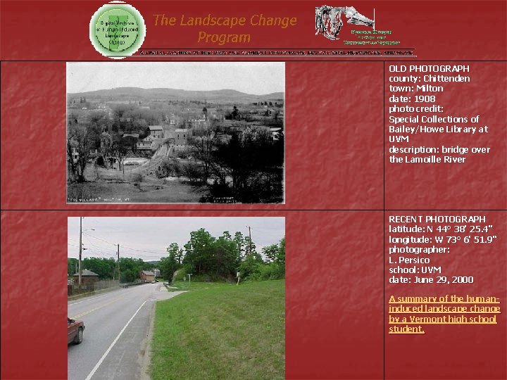
OLD PHOTOGRAPH county: Chittenden town: Milton date: 1908 photo credit: Special Collections of Bailey/Howe Library at UVM description: bridge over the Lamoille River RECENT PHOTOGRAPH latitude: N 44° 38' 25. 4'' longitude: W 73° 6' 51. 9'' photographer: L. Persico school: UVM date: June 29, 2000 A summary of the humaninduced landscape change by a Vermont high school student.
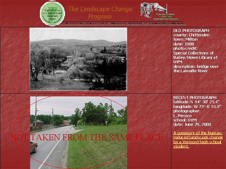
OLD PHOTOGRAPH county: Chittenden town: Milton date: 1908 photo credit: Special Collections of Bailey/Howe Library at UVM description: bridge over the Lamoille River RECENT PHOTOGRAPH latitude: N 44° 38' 25. 4'' longitude: W 73° 6' 51. 9'' photographer: L. Persico school: UVM date: June 29, 2000 NOT TAKEN FROM THE SAME PLACE A summary of the humaninduced landscape change by a Vermont high school student.
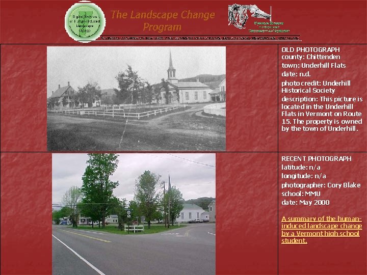
OLD PHOTOGRAPH county: Chittenden town: Underhill Flats date: n. d. photo credit: Underhill Historical Society description: This picture is located in the Underhill Flats in Vermont on Route 15. The property is owned by the town of Underhill. RECENT PHOTOGRAPH latitude: n/a longitude: n/a photographer: Cory Blake school: MMU date: May 2000 A summary of the humaninduced landscape change by a Vermont high school student.
OLD PHOTOGRAPH county: Chittenden town: Richmond date: 1860's photo credit: Jericho Historical Society description: Picture of Winooski valley taken from a hill. RECENT PHOTOGRAPH latitude: N 44° 28' 52. 4" longitude: W 73° 13'20. 2" photographer: Adam Possidente school: MMU date: May 2000 A summary of the humaninduced landscape change by a Vermont high school student.
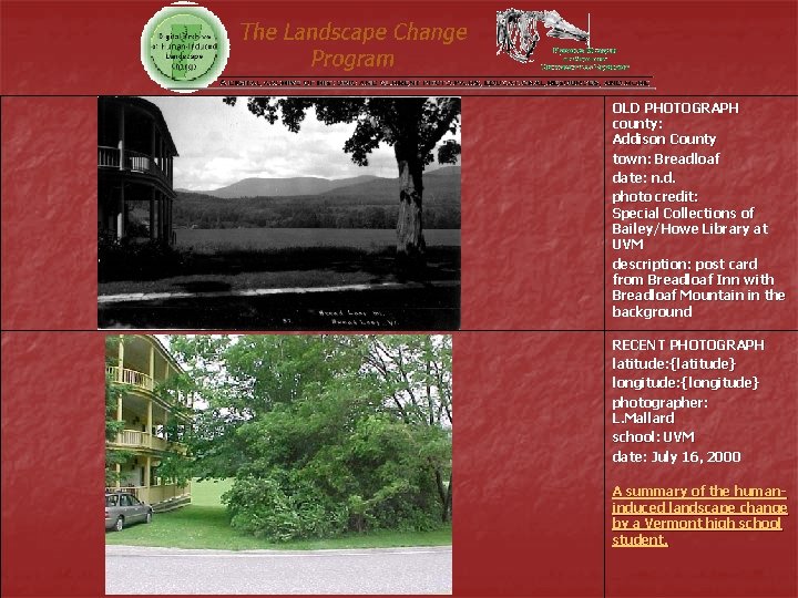
OLD PHOTOGRAPH county: Addison County town: Breadloaf date: n. d. photo credit: Special Collections of Bailey/Howe Library at UVM description: post card from Breadloaf Inn with Breadloaf Mountain in the background RECENT PHOTOGRAPH latitude: {latitude} longitude: {longitude} photographer: L. Mallard school: UVM date: July 16, 2000 A summary of the humaninduced landscape change by a Vermont high school student.
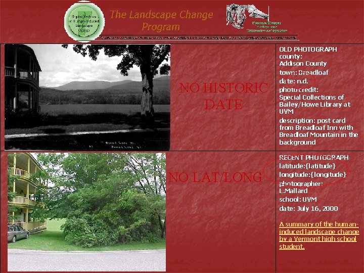
NO HISTORIC DATE NO LAT/LONG OLD PHOTOGRAPH county: Addison County town: Breadloaf date: n. d. photo credit: Special Collections of Bailey/Howe Library at UVM description: post card from Breadloaf Inn with Breadloaf Mountain in the background RECENT PHOTOGRAPH latitude: {latitude} longitude: {longitude} photographer: L. Mallard school: UVM date: July 16, 2000 A summary of the humaninduced landscape change by a Vermont high school student.