Forecasting Heavy Precipitation Associated with Coolseason 500 h
- Slides: 31

Forecasting Heavy Precipitation Associated with Cool-season 500 -h. Pa Cutoff Cyclones in the Northeast Melissa Payer, Lance F. Bosart, Daniel Keyser Department of Atmospheric and Environmental Sciences University at Albany, SUNY Neil A. Stuart and Thomas A. Wasula NOAA/NWS, Albany, NY Eastern Region Flash Flood Conference 2– 4 June 2010 NOAA/CSTAR Grant NA 07 NWS 4680001

Motivation • Forecasting precipitation distributions associated with 500 -h. Pa cool-season cutoff cyclones can be a challenge in the Northeast • Forecast uncertainties often arise due to variation in cutoff speed/location and interaction with the complex topography in the Northeast • Identifying signatures differentiating between precipitation distributions would help forecasters

Objectives • Create composites of cutoff cyclones categorized by tilt, structure, and precipitation amount • Investigate the 12– 16 March 2010 cutoff cyclone that produced widespread flooding in the Northeast by examining conventional synoptic and dynamic fields • Identify signatures differentiating between various precipitation distributions

Data • 0. 5° GFS analysis data • 2. 5° NCEP–NCAR reanalysis data – Climatologies created for 1979– 2008 • Standardized anomalies fields were created from 1. 0° GFS analyses with respect to climatology • 6 -h National Precipitation Verification Unit (NPVU) QPE • NEXRAD base reflectivity

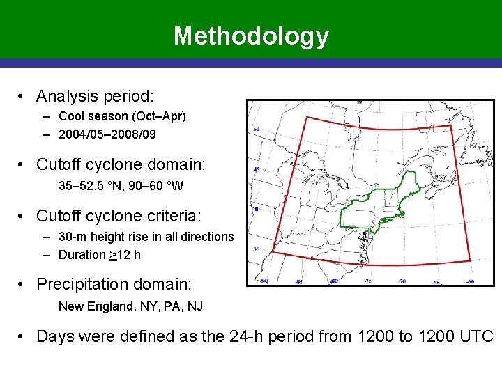
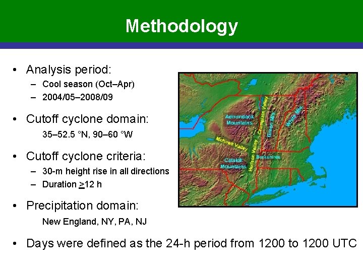
Methodology • Analysis period: – Cool season (Oct–Apr) – 2004/05– 2008/09 • Cutoff cyclone domain: 35– 52. 5 °N, 90– 60 °W • Cutoff cyclone criteria: – 30 -m height rise in all directions – Duration >12 h • Precipitation domain: New England, NY, PA, NJ • Days were defined as the 24 -h period from 1200 to 1200 UTC

Methodology • Analysis period: – Cool season (Oct–Apr) – 2004/05– 2008/09 • Cutoff cyclone domain: 35– 52. 5 °N, 90– 60 °W • Cutoff cyclone criteria: – 30 -m height rise in all directions – Duration >12 h • Precipitation domain: New England, NY, PA, NJ • Days were defined as the 24 -h period from 1200 to 1200 UTC

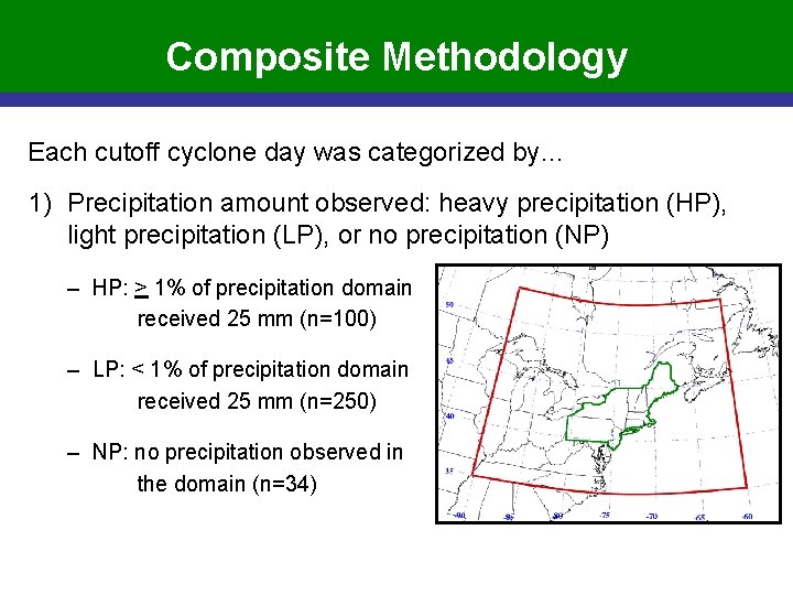
Composite Methodology Each cutoff cyclone day was categorized by… 1) Precipitation amount observed: heavy precipitation (HP), light precipitation (LP), or no precipitation (NP) – HP: > 1% of precipitation domain received 25 mm (n=100) – LP: < 1% of precipitation domain received 25 mm (n=250) – NP: no precipitation observed in the domain (n=34)

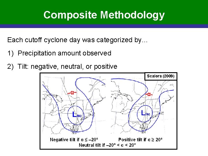
Composite Methodology Each cutoff cyclone day was categorized by… 1) Precipitation amount observed 2) Tilt: negative, neutral, or positive Scalora (2009)

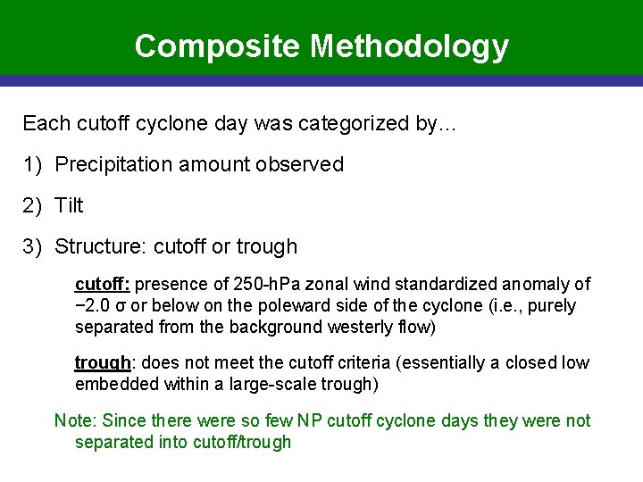
Composite Methodology Each cutoff cyclone day was categorized by… 1) Precipitation amount observed 2) Tilt 3) Structure: cutoff or trough cutoff: presence of 250 -h. Pa zonal wind standardized anomaly of − 2. 0 σ or below on the poleward side of the cyclone (i. e. , purely separated from the background westerly flow) trough: does not meet the cutoff criteria (essentially a closed low embedded within a large-scale trough) Note: Since there were so few NP cutoff cyclone days they were not separated into cutoff/trough

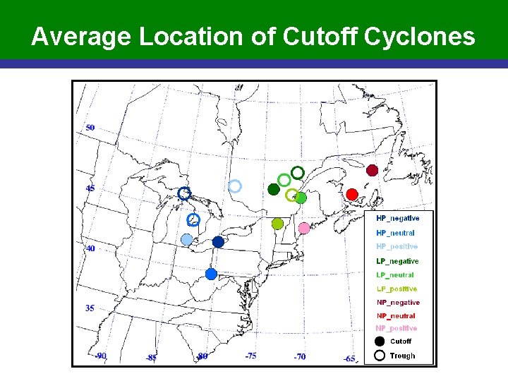
Average Location of Cutoff Cyclones

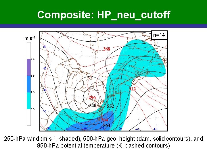
Composite: HP_neu_cutoff m s– 1 n=14 250 -h. Pa wind (m s– 1, shaded), 500 -h. Pa geo. height (dam, solid contours), and 850 -h. Pa potential temperature (K, dashed contours)

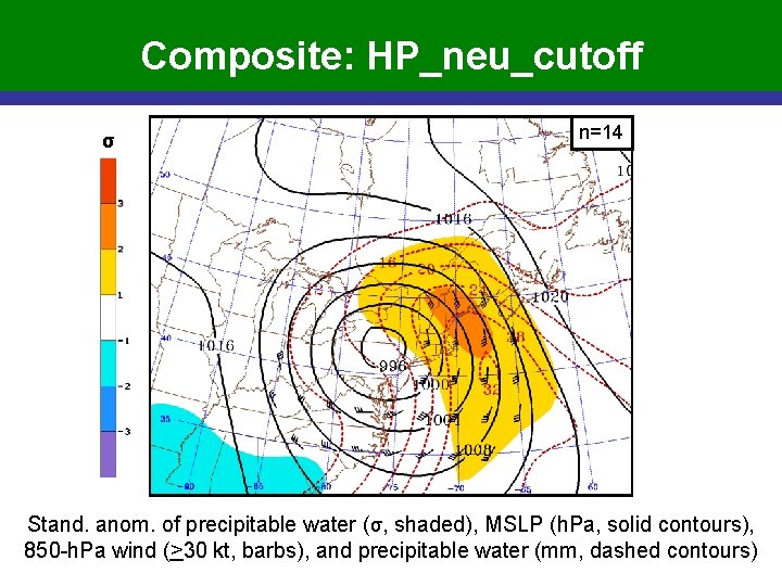
Composite: HP_neu_cutoff σ n=14 Stand. anom. of precipitable water (σ, shaded), MSLP (h. Pa, solid contours), 850 -h. Pa wind (>30 kt, barbs), and precipitable water (mm, dashed contours)

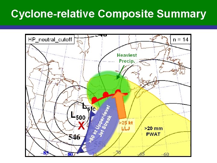
Cyclone-relative Composite Summary

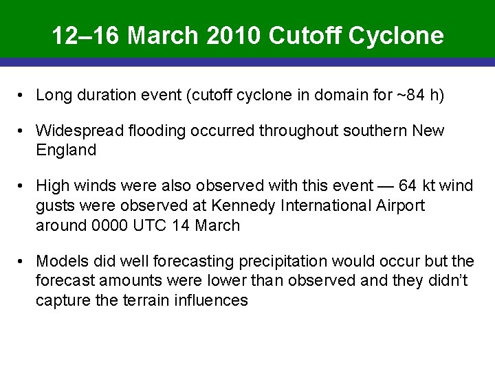
12– 16 March 2010 Cutoff Cyclone • Long duration event (cutoff cyclone in domain for ~84 h) • Widespread flooding occurred throughout southern New England • High winds were also observed with this event — 64 kt wind gusts were observed at Kennedy International Airport around 0000 UTC 14 March • Models did well forecasting precipitation would occur but the forecast amounts were lower than observed and they didn’t capture the terrain influences

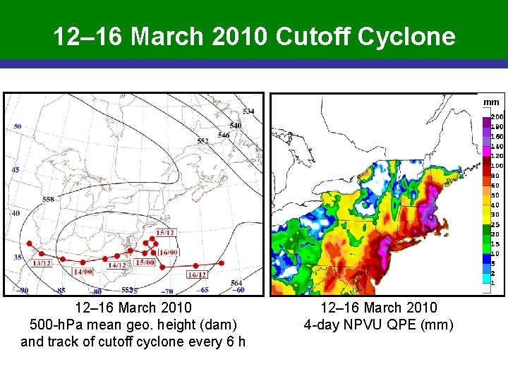
12– 16 March 2010 Cutoff Cyclone mm 12– 16 March 2010 500 -h. Pa mean geo. height (dam) and track of cutoff cyclone every 6 h 12– 16 March 2010 4 -day NPVU QPE (mm)

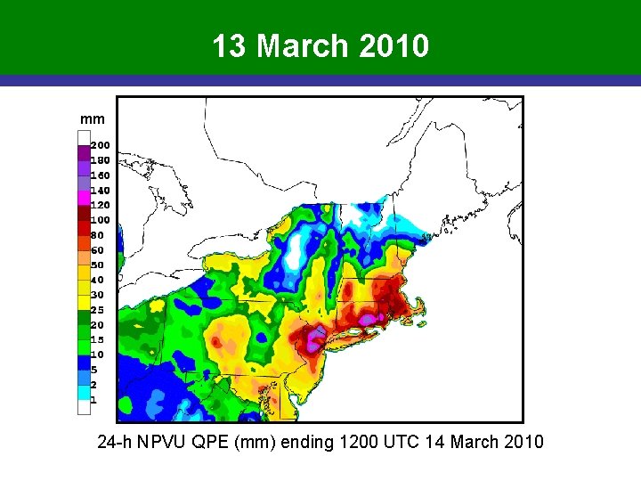
13 March 2010 mm 24 -h NPVU QPE (mm) ending 1200 UTC 14 March 2010

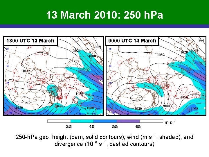
13 March 2010: 250 h. Pa 1800 UTC 13 March 0000 UTC 14 March m s– 1 250 -h. Pa geo. height (dam, solid contours), wind (m s– 1, shaded), and divergence (10– 5 s– 1, dashed contours)

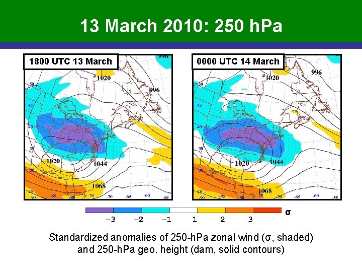
13 March 2010: 250 h. Pa 1800 UTC 13 March 0000 UTC 14 March σ Standardized anomalies of 250 -h. Pa zonal wind (σ, shaded) and 250 -h. Pa geo. height (dam, solid contours)

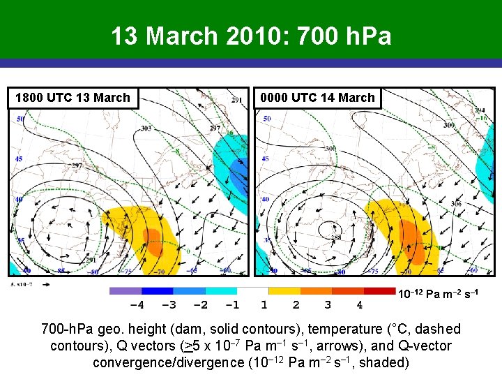
13 March 2010: 700 h. Pa 1800 UTC 13 March 0000 UTC 14 March 10− 12 Pa m− 2 s– 1 700 -h. Pa geo. height (dam, solid contours), temperature (°C, dashed contours), Q vectors (>5 x 10− 7 Pa m− 1 s− 1, arrows), and Q-vector convergence/divergence (10− 12 Pa m− 2 s− 1, shaded)

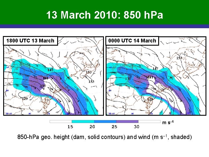
13 March 2010: 850 h. Pa 1800 UTC 13 March 0000 UTC 14 March m s– 1 850 -h. Pa geo. height (dam, solid contours) and wind (m s– 1, shaded)

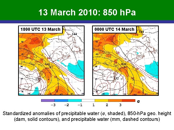
13 March 2010: 850 h. Pa 1800 UTC 13 March 0000 UTC 14 March σ Standardized anomalies of precipitable water (σ, shaded), 850 -h. Pa geo. height (dam, solid contours), and precipitable water (mm, dashed contours)

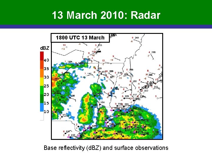
13 March 2010: Radar 1800 UTC 13 March d. BZ Base reflectivity (d. BZ) and surface observations

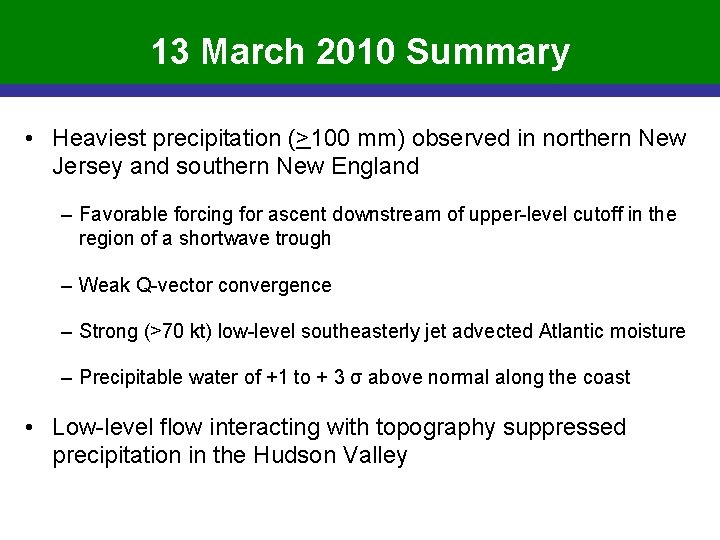
13 March 2010 Summary • Heaviest precipitation (>100 mm) observed in northern New Jersey and southern New England – Favorable forcing for ascent downstream of upper-level cutoff in the region of a shortwave trough – Weak Q-vector convergence – Strong (>70 kt) low-level southeasterly jet advected Atlantic moisture – Precipitable water of +1 to + 3 σ above normal along the coast • Low-level flow interacting with topography suppressed precipitation in the Hudson Valley

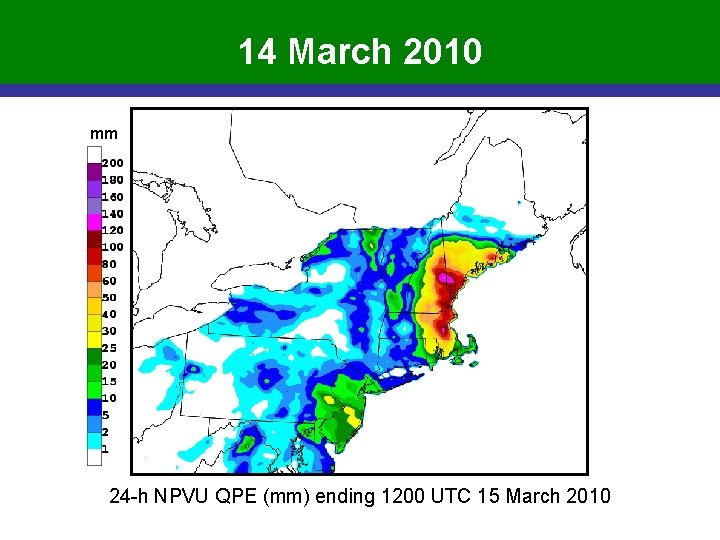
14 March 2010 mm 24 -h NPVU QPE (mm) ending 1200 UTC 15 March 2010

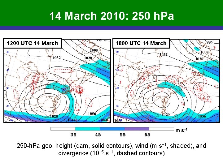
14 March 2010: 250 h. Pa 1200 UTC 14 March 1800 UTC 14 March m s– 1 250 -h. Pa geo. height (dam, solid contours), wind (m s− 1, shaded), and divergence (10− 5 s− 1, dashed contours)

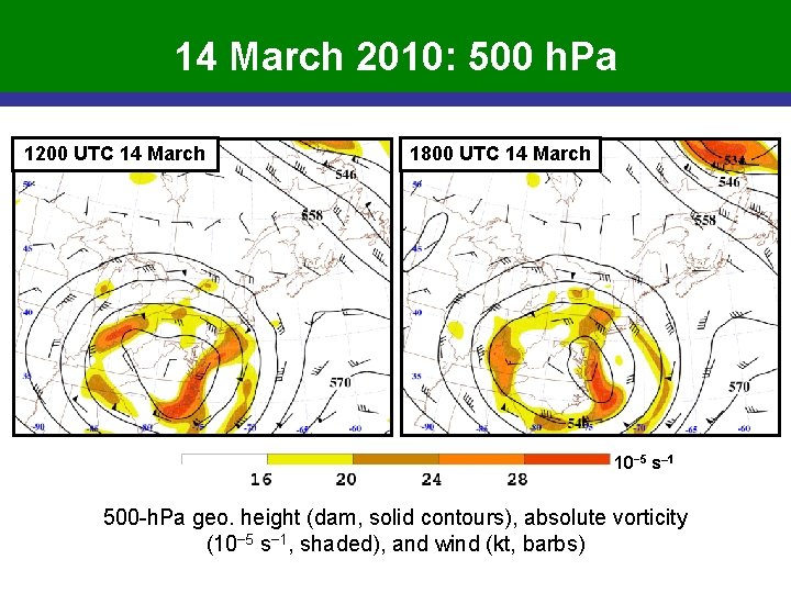
14 March 2010: 500 h. Pa 1200 UTC 14 March 1800 UTC 14 March 10− 5 s– 1 500 -h. Pa geo. height (dam, solid contours), absolute vorticity (10− 5 s− 1, shaded), and wind (kt, barbs)

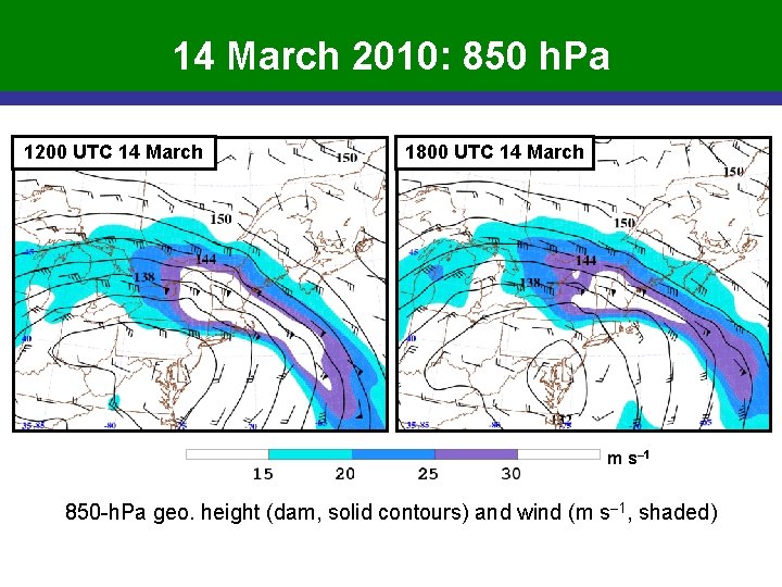
14 March 2010: 850 h. Pa 1200 UTC 14 March 1800 UTC 14 March m s– 1 850 -h. Pa geo. height (dam, solid contours) and wind (m s– 1, shaded)

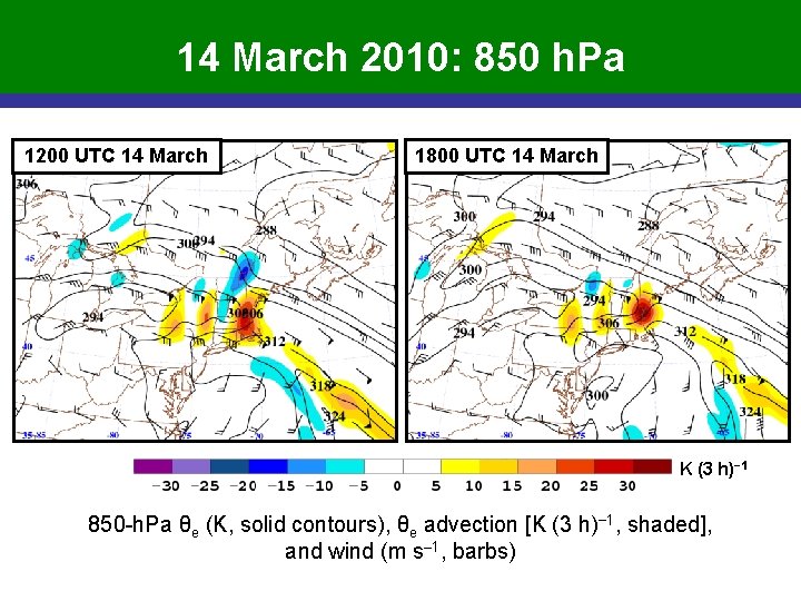
14 March 2010: 850 h. Pa 1200 UTC 14 March 1800 UTC 14 March K (3 h)− 1 850 -h. Pa θe (K, solid contours), θe advection [K (3 h)− 1, shaded], and wind (m s– 1, barbs)

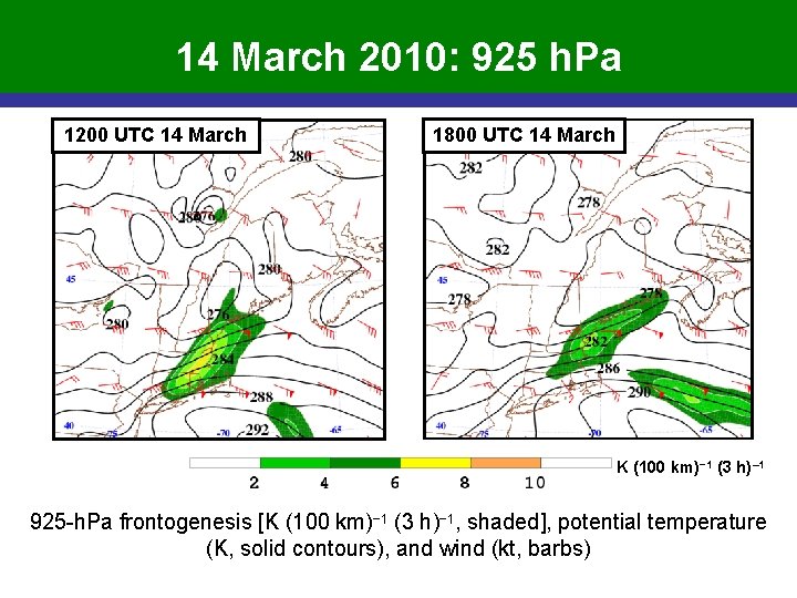
14 March 2010: 925 h. Pa 1200 UTC 14 March 1800 UTC 14 March K (100 km)− 1 (3 h)– 1 925 -h. Pa frontogenesis [K (100 km)− 1 (3 h)− 1, shaded], potential temperature (K, solid contours), and wind (kt, barbs)

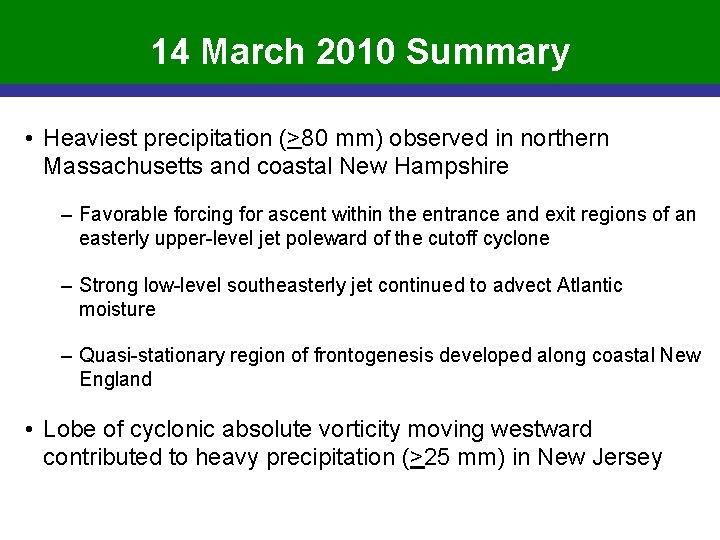
14 March 2010 Summary • Heaviest precipitation (>80 mm) observed in northern Massachusetts and coastal New Hampshire – Favorable forcing for ascent within the entrance and exit regions of an easterly upper-level jet poleward of the cutoff cyclone – Strong low-level southeasterly jet continued to advect Atlantic moisture – Quasi-stationary region of frontogenesis developed along coastal New England • Lobe of cyclonic absolute vorticity moving westward contributed to heavy precipitation (>25 mm) in New Jersey

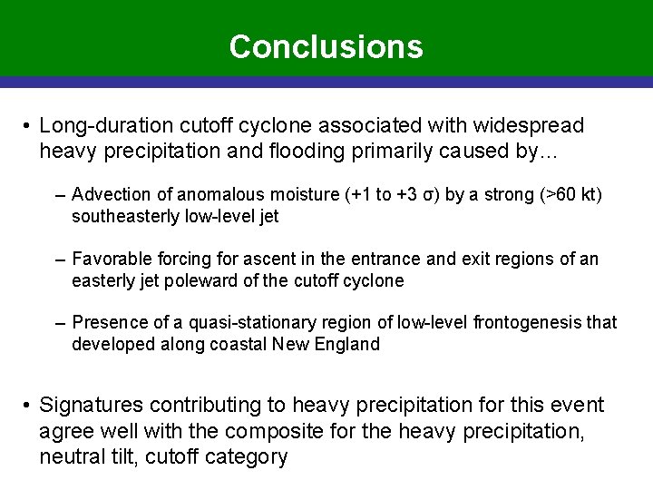
Conclusions • Long-duration cutoff cyclone associated with widespread heavy precipitation and flooding primarily caused by… – Advection of anomalous moisture (+1 to +3 σ) by a strong (>60 kt) southeasterly low-level jet – Favorable forcing for ascent in the entrance and exit regions of an easterly jet poleward of the cutoff cyclone – Presence of a quasi-stationary region of low-level frontogenesis that developed along coastal New England • Signatures contributing to heavy precipitation for this event agree well with the composite for the heavy precipitation, neutral tilt, cutoff category