Wetland Stream Crossing Impacts for Proposed Midcounty Highway


- Slides: 15

Wetland Stream Crossing Impacts for Proposed Mid-county Highway Extended (M-83) Sponsored by TAME Coalition tamecoalition. blogspot. com Produced by Richard D. Wilder

Overview • Maps and impact information was taken from the Montgomery County Department of Transportation Draft Mid-county Corridor May 2013 Draft Environmental Effects Report (EER) • 14 wetland stream crossing areas are discussed starting with the southern end of the proposed highway at Goshen Rd. in Montgomery Village until its northern end on Rt. 27 Ridge Rd. in Germantown. • Information discussed in this presentation is arranged in a more organized and consistent manner than in the EER which was very difficult to follow each alternative, multiple alignments and optional alignments. • The Master Plan Alignments 8 and 9 with optional alignments A, B, and D which MCDOT has persistently biased favorably in the EER were laid out before the 1972 Clean Water Act, have the most environmental impacts and have not been updated for 32 years in the Germantown and Gaithersburg Vicinity Master Plans is discussed here. • MCDOT biased the EER to favor the Master Plan Alignment 8 and 9 and failed to acknowledge that Alternatives 1, 2 and 5, singly or in combination, would satisfy the traffic requirements with little environmental impacts. Transit alternative 1 (no build) assumes that Corridor City Transitway would be built and that is starting to happen with both the Corridor City Transitway and the Rapid Bus Transit being funded. 2

Overview continued • The USACE and MDE Wetland Water Quality permits applied for were not identified by MCDOT if they were individual or general. It looks like the total wetland fill of 0. 874 acres were designed to be under 1 acre for the general permit (since wetland conversion impacts of 1. 580 acres were not counted) and is the easiest permit to get. Adding in the 1. 580 acres of wetland conversion would give 2. 454 acres of wetlands impacted which is well within the individual permit level and is more accurate since many of these wetland conversion wetlands will be destroyed or the wetland function reduced from the highest forested category to the lowest scrub-shrub/emergent category (see Dayspring Creek slide for a good example of this). • MCDOT has admitted that the wetland conversion area under the Blohm Park Bridge failed to account for four wetland areas. Their new approximation at that location is “about 0. 1 acres”, which seems still too low. Even so, MCDOT’s new estimate of wetland conversion will be higher by probably 0. 05 – 0. 07 acres. This gives: 0. 874 acres of wetland fill +1. 64 acres of wetland conversion = 2. 51 acres of wetlands impacted. 3

Overview continued • Summary of Impacts for alignments 8 and 9: • 19 wetland area impacts (WUS 52, WUS 66, W 67, WUS 68, WUS 53, W 57, W 58, W 61/62, W 63, W 64, WUS 76, W 77, WUS 78, W 79, W 72, WUS 73, WUS 1, WUS 69 and W 70) • 5 wetland conversion impacts under bridges (4, 200; 33, 894; 11, 425; 21, 519; and 4, 175 sf) will have to be mitigated at a 2 to 1 ratio since they primarily involve high quality forested wetlands. • 2 stream relocations (746 and 229 lf), • 1 widened bridge, • 1 new pedestrian/biker bridge (225 lf) • 5 new road bridges (230, 500, 170, 280 and 80 lf), • 3 culverts (150, 150 and 229 lf) • 1 swale (243 lf) are also associated with Alignments 8 and 9. • Also in addition to the impacts presented in the EER there will be many more impacts to wetlands during construction when heavy equipment needs to be brought in to remove trees; blast bedrock; re-grade terrain; transport road foundation material, bridge construction material, and culverts, etc. 4

Overview continued • Contruction of the Master Plan alignment will furthur exacerbate the need to reduce by 41. 6% Seneca Creek Total Maximum Daily Loading (TMDL) of sediment as stated in MDE report: “Total Maximum Daily Load of Sediment in the Seneca Creek Watershed, Montgomery County, Maryland dated September 20, 2011”. • Very good water quality is present in Clarksburg Special Protection Area (SPA) Wildcat Branch Class III Trout Reproducing and Dayspring Creek in Germantown. Benthic and fish data taken at monitoring stations in those streams and the finding of 8 amphibious species indicate high quality. Both of these areas would be adversely impacted by the Master Plan Alignments 8 A and 9 A. • With the extensive wetland stream crossing impacts and the required mitigation for the Master Plan Alignments 8 and 9 which was laid out before the 1972 Clean Water Act these alignments 8 and 9 should be removed from the Master Plans and the USACE and MDE Wetland Waterway permit applications for these alignments be rejected. 5

Mid-county Highway Extended Stream Crossings – Whetstone Run near Goshen Rd. Wetland WUS 52 • • Alignment: 9 Wetland Area: WUS 52 Wetland Fill: 0 Acres Wetland Conversion: 0 Acres Existing Conveyance: Culvert Proposed Conveyance: New Culvert 150 linear feet (lf) Comment: This existing section of the road will be widened to 6 lanes from 4. A Benthic Index of Biotic Integrity (IBI) score of 1. 5 (poor) from monitoring station (SENE-113 -R-2001) upstream was recorded however the stream still provides adequate fish habitat. 6

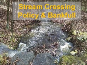
Mid-county Highway Extended Stream Crossings – Walkers Run (between Walkers Choice & Christopher) Wetlands WUS 66, W 67, WUS 68 • Alignment: 9 • Wetland Area: WUS 66 is a perennial stream, and a tributary to Whetstone Run buffered by a riparian forest; W 67 is small low-lying depressional, palustrine forested wetland; WUS 68 is an ephemeral channel abutting W 67. • Wetland Fill: 3, 463 sf (0. 0795 acres) of W 67 1 acre = 43, 560 sf • Wetland Conversion: 0 acres • Existing Conveyance: None • Proposed Conveyance: WUS 66 by a Culvert 150 lf and 8 ft in diameter and WUS 68 by a swale 243 lf alongside the road. • Provides poor yet adequate for fish and benthic macro-invertebrates due to perennial flow and riffle pool sequences. 7

Mid-county Highway Extended Stream Crossings – Whetstone Run at Watkins Mill Rd. Whetstone Run Alignment: 9 Wetland Areas: Whetstone Run Wetland Fill: 0 Acres Wetland Conversion: 0 Acres Existing Conveyance: Watkins Mill Rd. Bridge Proposed Conveyance: Widened Watkins Mill Rd. Bridge and new parallel pedestrian and biker bridge 225 ft long 14 ft wide and 5 ft high. • Comment: In 1992 the County Council unanimously rejected turning lanes for M-83 on the new Watkins Mill Rd. Bridge with the conclusion that M 83 would never be built. • • • 8

Mid-county Highway Extended Stream Crossings – Whetstone Run in Blohm Park Wetlands WUS 53, W 57, W 58, W 61/62 and W 64 • • Alignment: 8 and 9 Wetland Areas: WUS 53 is a perennial, meandering and incised channel buffered by a fairly wide riparian forest; W 57 and W 58 are small closed contour depressions ; W 58 is a palustrine forested wetland; W 61/62 are depressional wetlands; W 64 is a low-lying depression, palustrine scrubshrub/emergent wetland Wetland Fill: 9, 296 square feet (sf) (0. 2134 acres) Wetland Conversion: 4, 200 sf (about 0. 1 acres) (these conversion numbers are questionably small for such a large bridge – MCDOT admitted that the number in the draft EER was too low but has communicated that they will only increase the estimate to “about 0. 1 acres”, claiming that most of the areas under the bridge are floodplain but not wetlands and floodplain. ) Existing Conveyance: None. Stream has many meanders here. Proposed Conveyance: New 2 span bridge 230 ft long and 11 ft high and stream relocation 746 lf Comment: Proposed bridge is so wide and low that no vegetation will grow underneath and therefore all existing wetland functions will be lost. A Benthic IBI Score of 1. 57 (poor) and yet a decent fish habitat was recorded. 1 acre = 43, 560 sf 9

Mid-county Highway Extended Stream Crossings – Whetstone Run near Stedwick Clusters II Wetland W 63 • • Alignment: 8 and 9 Wetland Areas: W 63 is a palustrine forested wetland Wetland Fill: 9, 296 sf (0. 2134 acres) Wetland Conversion: 0 acres Existing Conveyance: None. Proposed Conveyance: Fill Comment: Fair/Good water quality 1 acre = 43, 560 sf 10

Mid-county Highway Extended Stream Crossings – Great Seneca Creek • Wetland Areas: WUS 76 is buffered by a 100+ ft wide riparian forest and W 77 is a large palustrine forested wetland on the wide floodplain terrace of Great Seneca Creek • Wetland Fill: 21, 895 sf (0. 5026 acres) Wetland s WUS 76 • Wetland Conversion: 33, 894 sf (0. 7781 acres) and W 77 • Existing Conveyance: None • Proposed Conveyance: New 3 span bridge 500 ft long 17 ft high • Comment: Many rock outcroppings here will require extensive blasting. A Benthic Index of Biotic Integrity (IBI) score of 22 (fair) and a Fish IBI score 11 of 4 (good) was recorded. 1 acre = 43, 560 sf

Mid-county Highway Extended Stream Crossings – Brandermill Tributary Wetlands WUS 78 and W 79 • Alignments : 8 and 9 • Wetland Areas: WUS 78 is buffered by a fairly wide riparian forest and W 79 is a palustrine forested wetland located at the base of a steep slope on one side of the creek 1 acre = 43, 560 sf • Wetland Fill: 0 acres • Wetland Conversion: 11, 425 sf (0. 2623 acres) • Existing Conveyance: None • Proposed Conveyance: New 1 span bridge 170 ft long 25 ft high • Comment: A Benthic IBI score of 18 (fair) and a Fish IBI score of 5 12 (excellent) was recorded at GSMS 203 monitoring station.

Mid-county Highway Extended Stream Crossings – Dayspring Creek Wetlands W 72 and WUS 73 • Alignments 8 and 9 Option A • Wetland Areas: W 72 is palustrine forested; WUS 73 is a perennial, meandering, braided stream buffered by a wide riparian forest • Wetland Fill: 851 sf (0. 0195 acres) • Wetland Conversion: 21, 519 sf (0. 4940 acres) • Existing Conveyance: None • Proposed Conveyance: New 2 span bridge 280 ft long 16 ft high. • Comment: A Benthic IBI score of (excellent) and Fish IBI score of (excellent) were recorded at monitoring station GSMS 203. 1 acre = 43, 560 sf 13

Mid-county Highway Extended Stream Crossings – Seneca Creek Tributary south of Brink Rd. Wetland WUS 1 • Alignments: 8 and 9 Option A • Wetland Area: WUS 1 is an unnamed perennial tributary to Great Seneca Creek buffered by a riparian forest • Wetland Fill: 0 acres • Wetland Conversion: 0 acres • Existing Conveyance: None • Proposed Conveyance: Stream relocation by pipe culverts 229 lf • Comment: A Benthic IBI score of 3 (fair) was recorded here at a monitoring site downstream 860 -3 -2001 and also a high quality fish habitat upstream was noted. 14

Mid-county Highway Extended Stream Crossings – Wildcat Branch Wetlands WUS 69 and W 70 • • Alignments: 8 and 9 Option A Wetland Areas: WUS 69 is a small ephemeral/intermittent stream buffered by a wide riparian forest and W 70 is a wetland feature along Wildcat Branch Wetland Fill: 0 acres Wetland Conversion: 4, 175 sf (0. 0981 acres) Existing Conveyance: Culvert and Fill Proposed Conveyance: New single span bridge 80 ft long 18 ft high Comment: Wildcat Branch is a Class III Trout Reproducing Stream in the Clarksburg Special Protection Area. Eight amphibian species were identified within Option A. 1 acre = 43, 560 sf 15
 Midcounty highway
 Difference between special crossing and general crossing
 Differentiate byte stream and character stream
 Submerged gravel wetland
 Why are wetlands important for biodiversity
 Wetland tillage
 Inland wetland
 Biome sb
 An ecosystem in which water either covers the soil
 Kung som dog 1611
 Sju för caesar
 Teckenspråk minoritetsspråk argument
 Mästare lärling modell
 Magnetsjukhus
 Rita perspektiv
 Formuö
