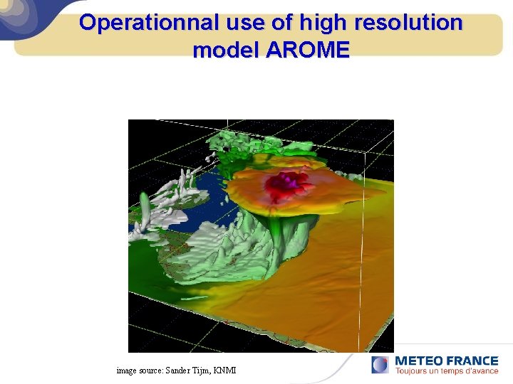
Operationnal use of high resolution model AROME image
- Slides: 34

Operationnal use of high resolution model AROME image source: Sander Tijm, KNMI

Abstract v Advantages of AROME versus global model ARPEGE Ø Examples of mesoscale structures: see breeze, precipitation features, fog and low clouds, etc… Ø Orography: precipitations and winds Ø Resolution of strong convection v Some problems of false alert Ø Gust and thunderstorm Ø Heavy rainfall

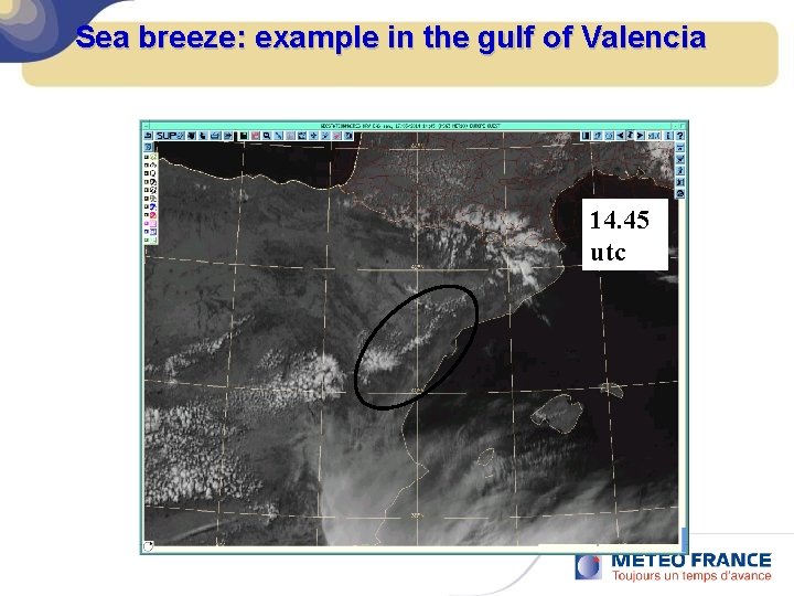
Sea breeze: example in the gulf of Valencia 05 14 utc 14. 45 utc

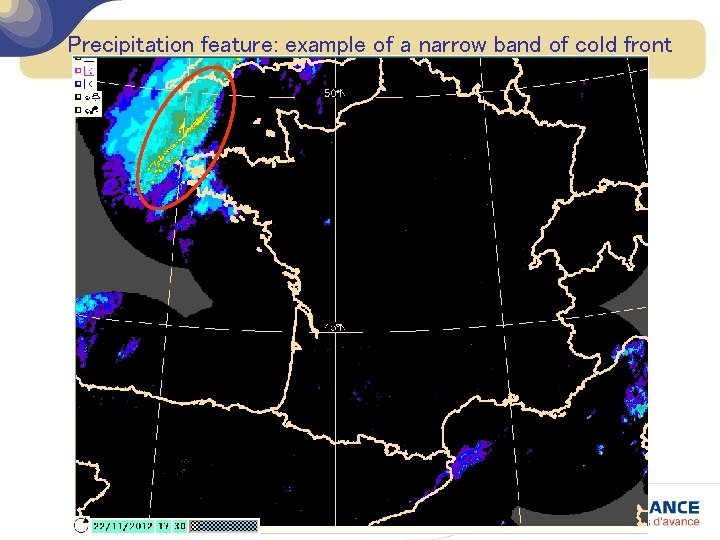
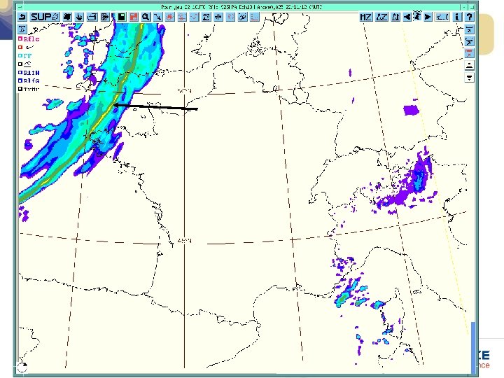
Precipitation feature: example of a narrow band of cold front


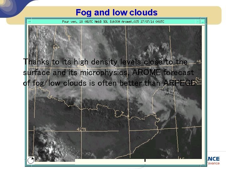
Fog and low clouds Thanks to its high density levels close to the surface and its microphysics, AROME forecast of fog/low clouds is often better than ARPEGE

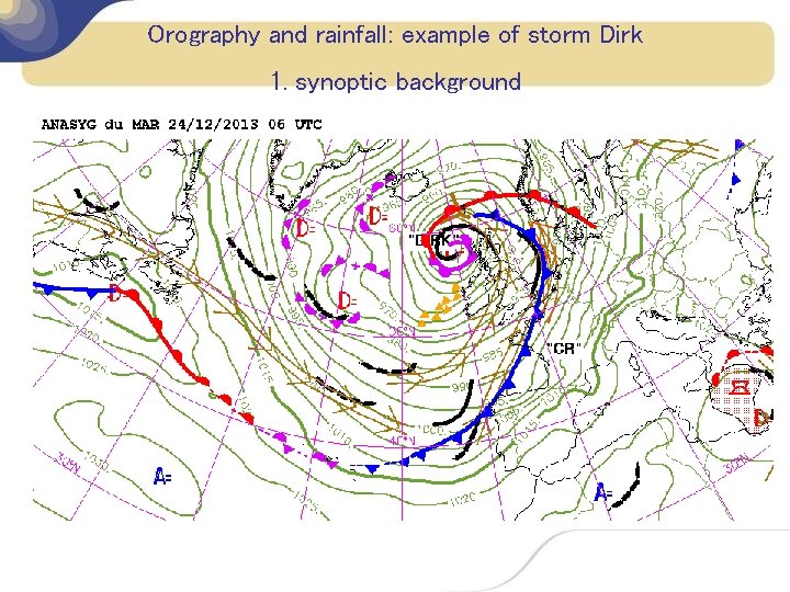
Orography and rainfall: example of storm Dirk 1. synoptic background

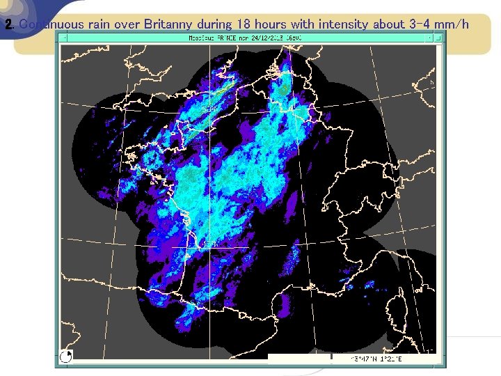
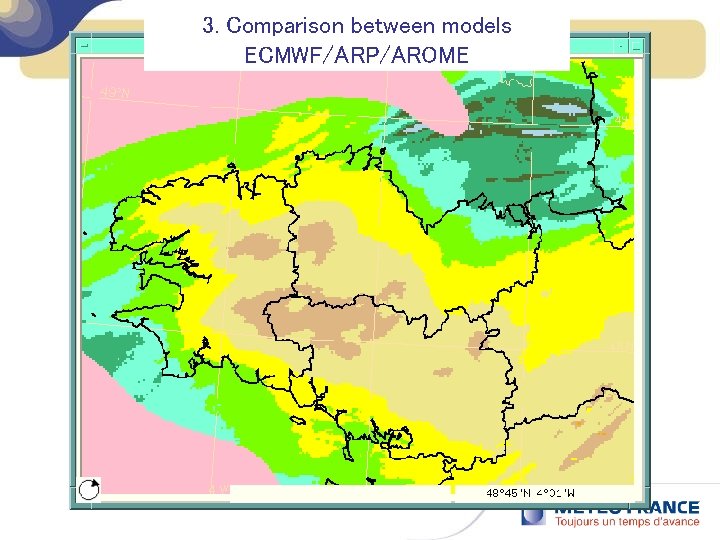
2. Continuous rain over Britanny during 18 hours with intensity about 3 -4 mm/h

3. Comparison between models ECMWF/ARP/AROME

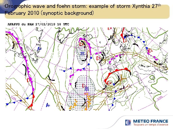
Orogrophic wave and foehn storm: example of storm Xynthia 27 th February 2010 (synoptic background)

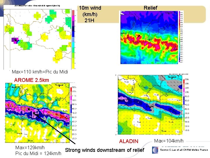
10 m wind (km/h) 21 H Relief ZOOM Vent 10 m (km/h) 21 H Max=110 km/h=Pic du Midi AROME 2. 5 km ALADIN Max=129 km/h Strong winds downstream of relief Pic du Midi = 124 km/h Max=104 km/h Source C. Lac et all CNRM Meteo France

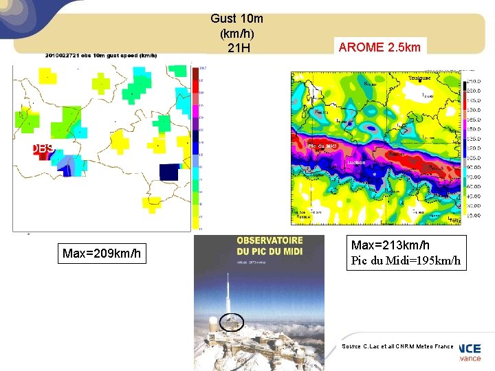
Gust 10 m (km/h) 21 H AROME 2. 5 km OBS Max=209 km/h Max=213 km/h Pic du Midi=195 km/h Source C. Lac et all CNRM Meteo France

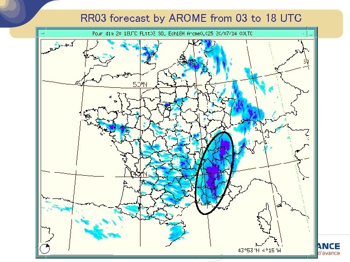
Strong convection When deep convection is prevailing, AROME is able to produce forecast that differ from its global model ARPEGE

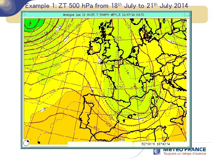
Example 1: ZT 500 h. Pa from 18 th July to 21 th July 2014

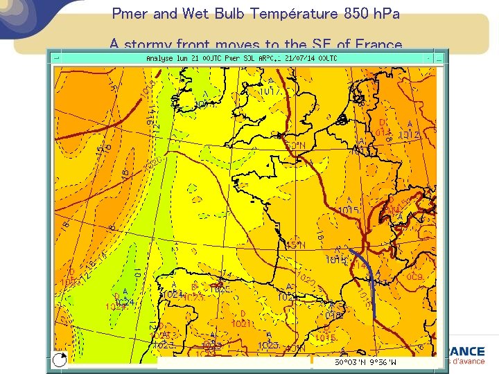
Pmer and Wet Bulb Température 850 h. Pa A stormy front moves to the SE of France

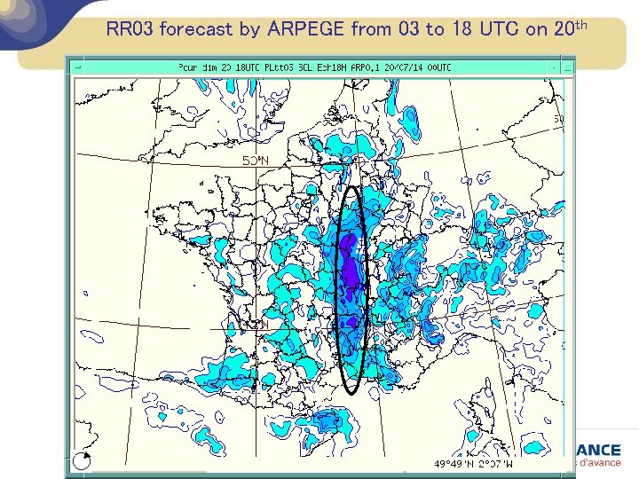
RR 03 forecast by ARPEGE from 03 to 18 UTC on 20 th

RR 03 forecast by AROME from 03 to 18 UTC

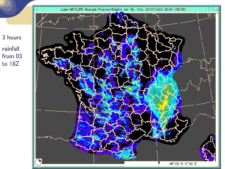
18 3 hours rainfall from 03 to 18 Z

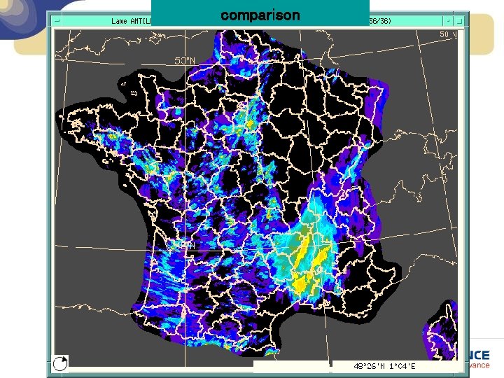
comparison

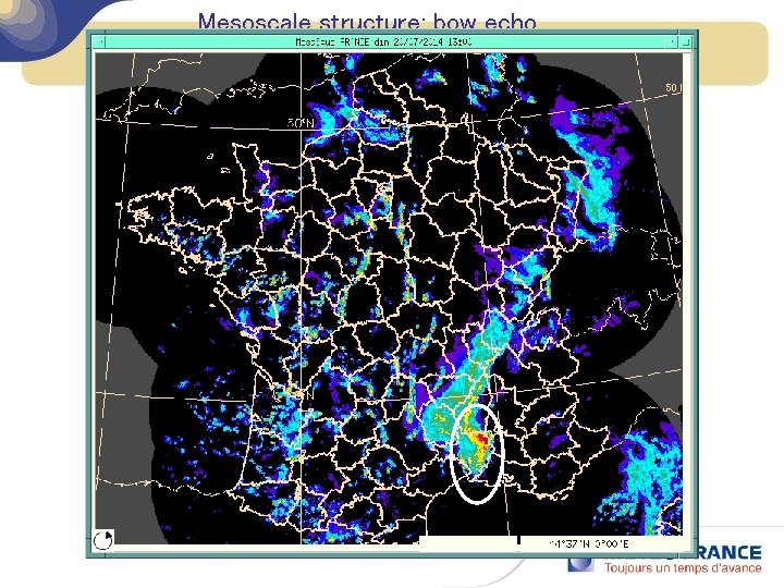
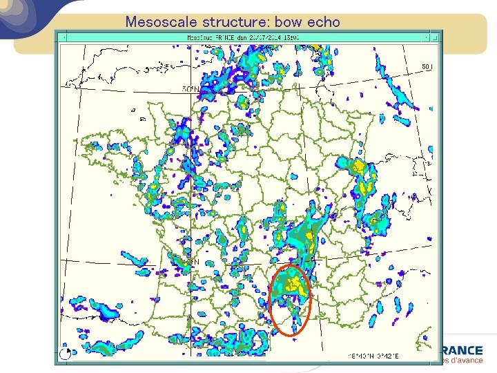
Mesoscale structure: bow echo

Mesoscale structure: bow echo

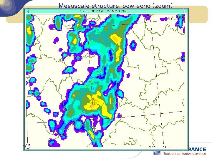
Mesoscale structure: bow echo (zoom)

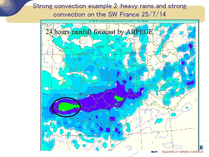
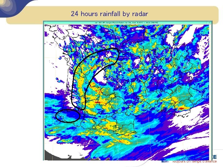
Strong convection example 2 : heavy rains and strong convection on the SW France 25/7/14 24 hours rainfall forecast by ARPEGE

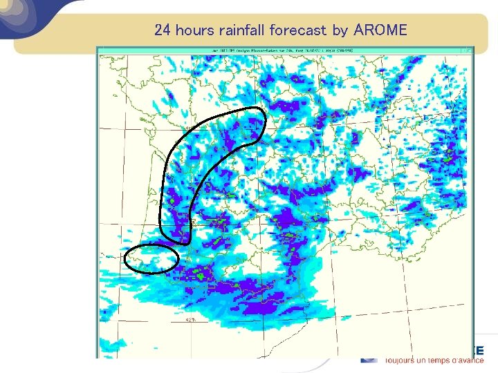
24 hours rainfall forecast by AROME

24 hours rainfall by radar

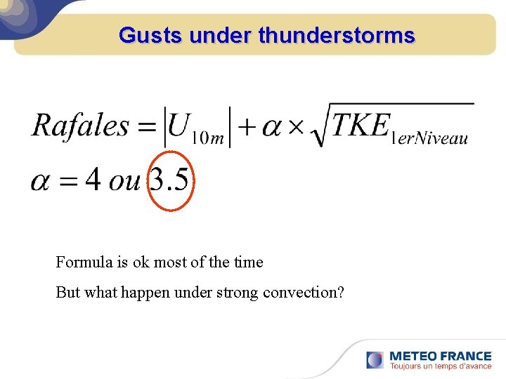
Gusts under thunderstorms Formula is ok most of the time But what happen under strong convection?

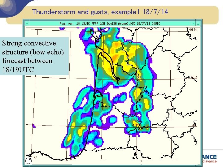
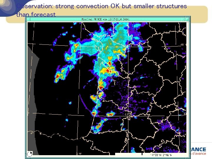
Thunderstorm and gusts, example 1 18/7/14 Strong convective structure (bow echo) forecast between 18/19 UTC

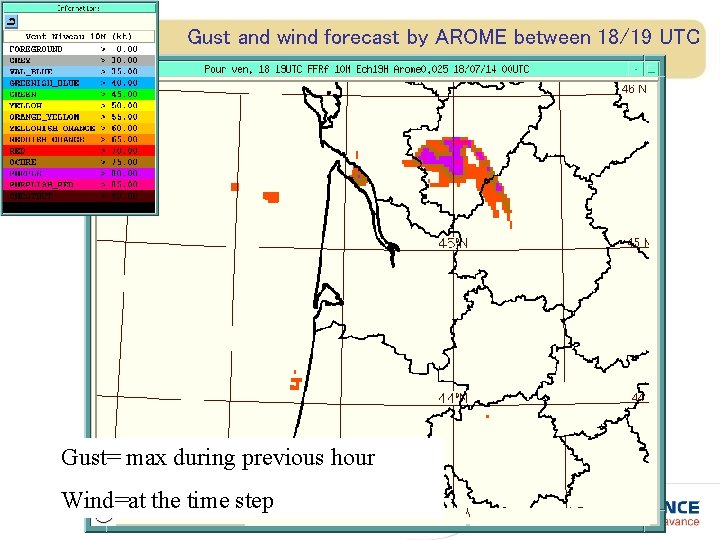
Gust and wind forecast by AROME between 18/19 UTC Gust= max during previous hour Wind=at the time step

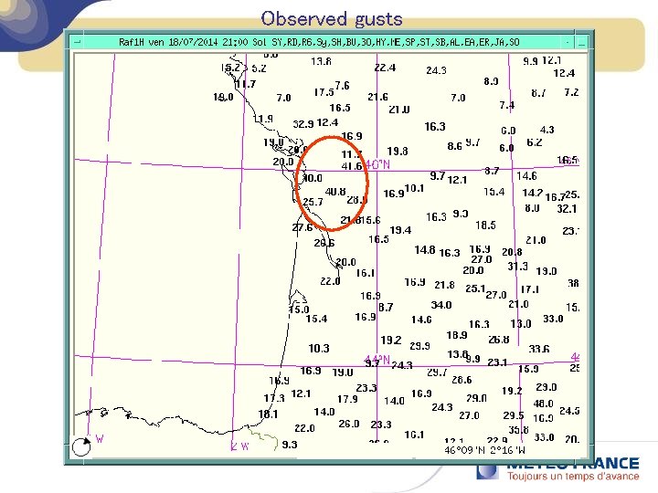
Observation: strong convection OK but smaller structures than forecast

Observed gusts

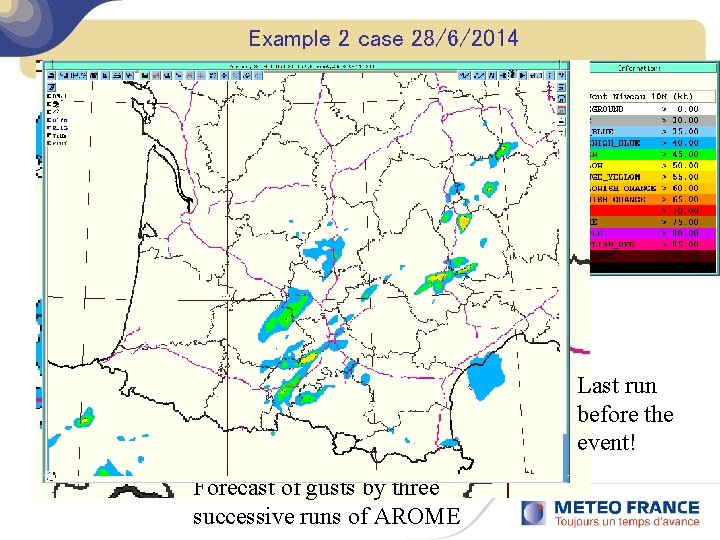
Example 2 case 28/6/2014 Last run before the event! Forecast of gusts by three successive runs of AROME

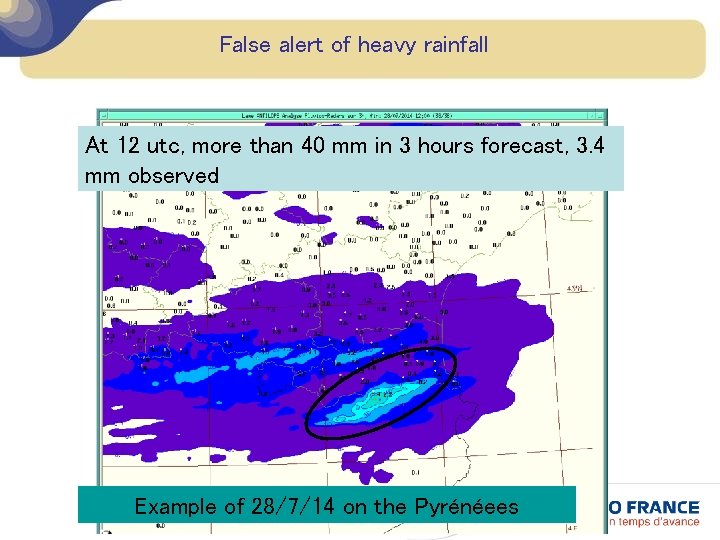
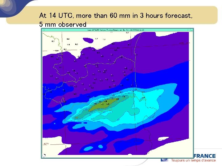
False alert of heavy rainfall At 12 utc, more than 40 mm in 3 hours forecast, 3. 4 mm observed Example of 28/7/14 on the Pyrénéees

At 14 UTC, more than 60 mm in 3 hours forecast, 5 mm observed

Conclusion v Positive balance sheet of AROME use by forecasters (previous synoptic study still required!) v Wishes Ø Extending the forecast period to 48 hours Ø More realistic convection (could be achieved with lower resolution? ) v Next challenge forecasters: work with the ensemble forecast AROME