LandscapesTopography Measurement of Earth Science Name Shape of
- Slides: 31
Landscapes/Topography/ Measurement of Earth Science Name ___________
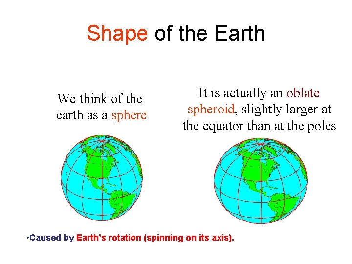
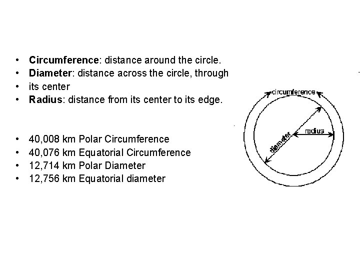
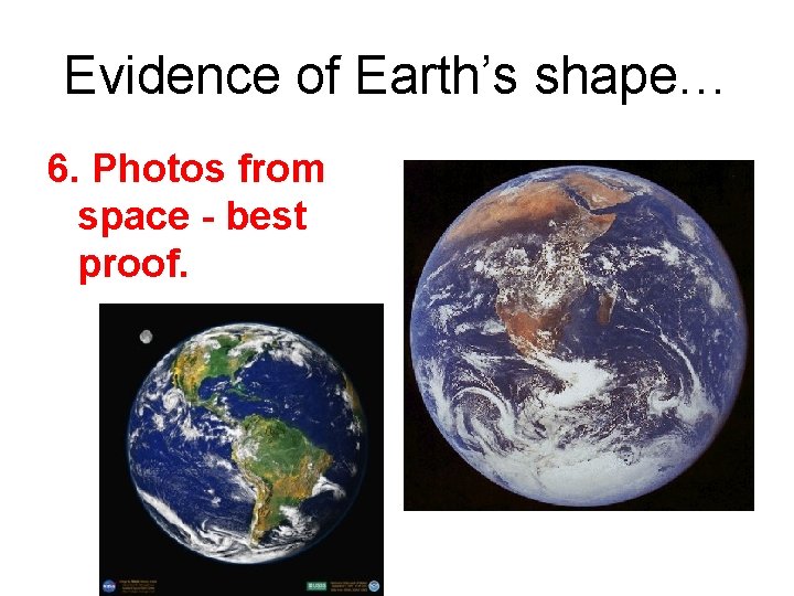
Shape of the Earth We think of the earth as a sphere It is actually an oblate spheroid, slightly larger at the equator than at the poles • Caused by Earth’s rotation (spinning on its axis).
• • Circumference: distance around the circle. Diameter: distance across the circle, through its center Radius: distance from its center to its edge. • • 40, 008 km Polar Circumference 40, 076 km Equatorial Circumference 12, 714 km Polar Diameter 12, 756 km Equatorial diameter
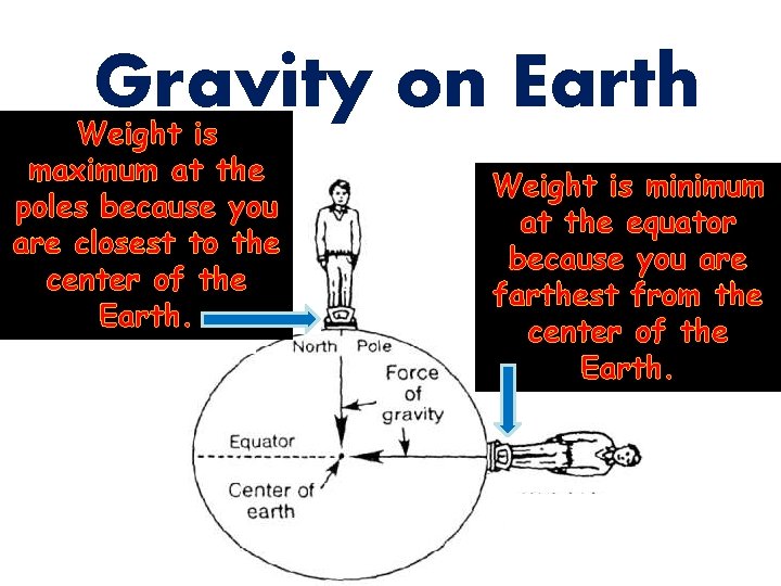
Gravity on Earth Weight is maximum at the poles because you are closest to the center of the Earth. Weight is minimum at the equator because you are farthest from the center of the Earth.
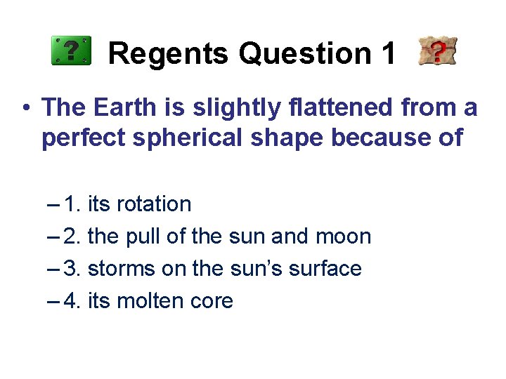
Regents Question 1 • The Earth is slightly flattened from a perfect spherical shape because of – 1. its rotation – 2. the pull of the sun and moon – 3. storms on the sun’s surface – 4. its molten core
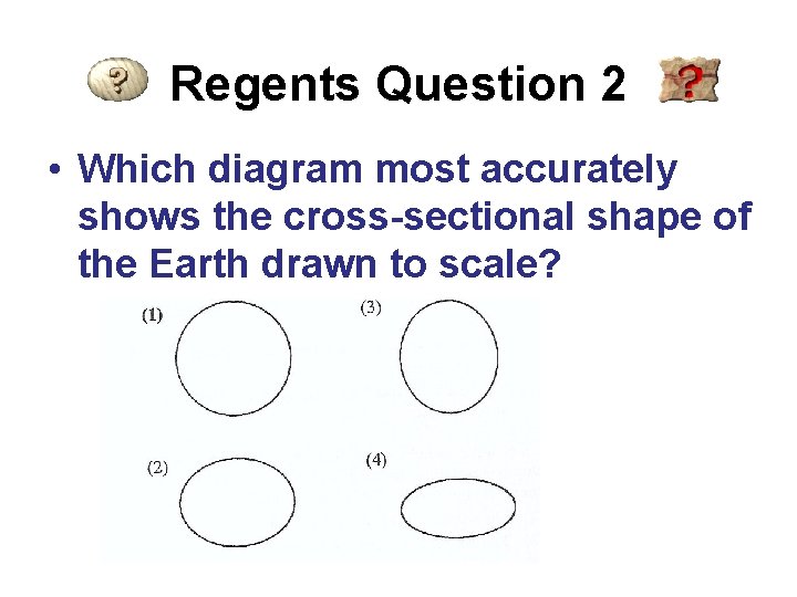
Regents Question 2 • Which diagram most accurately shows the cross-sectional shape of the Earth drawn to scale?
Evidence of Earth’s shape… 6. Photos from space - best proof.
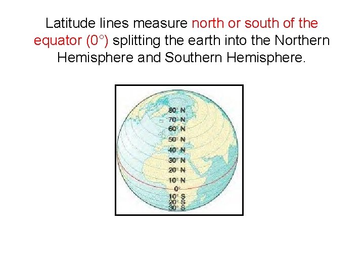
Latitude lines measure north or south of the equator (0°) splitting the earth into the Northern Hemisphere and Southern Hemisphere.
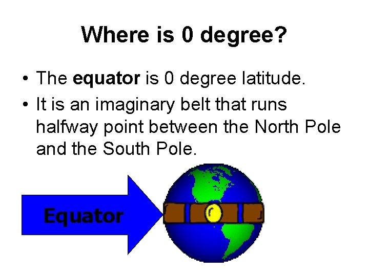
Where is 0 degree? • The equator is 0 degree latitude. • It is an imaginary belt that runs halfway point between the North Pole and the South Pole. Equator
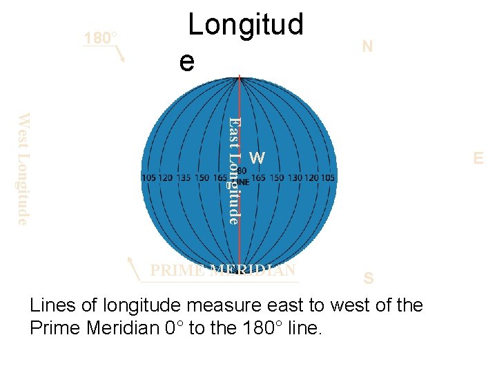
180° Longitud e N East Longitude West Longitude W PRIME MERIDIAN E S Lines of longitude measure east to west of the Prime Meridian 0° to the 180° line.
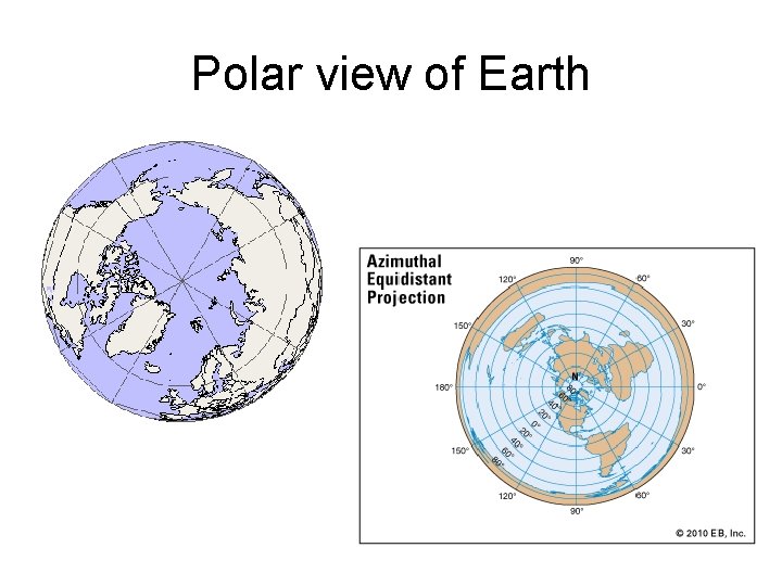
Polar view of Earth
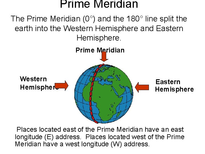
Prime Meridian The Prime Meridian (0°) and the 180° line split the earth into the Western Hemisphere and Eastern Hemisphere. Prime Meridian Western Hemisphere Eastern Hemisphere Places located east of the Prime Meridian have an east longitude (E) address. Places located west of the Prime Meridian have a west longitude (W) address.
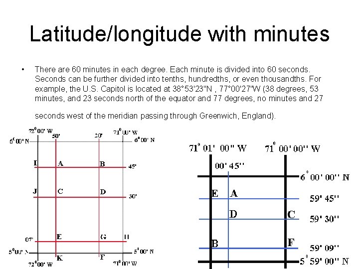
Latitude/longitude with minutes • There are 60 minutes in each degree. Each minute is divided into 60 seconds. Seconds can be further divided into tenths, hundredths, or even thousandths. For example, the U. S. Capitol is located at 38° 53'23"N , 77° 00'27"W (38 degrees, 53 minutes, and 23 seconds north of the equator and 77 degrees, no minutes and 27 seconds west of the meridian passing through Greenwich, England).
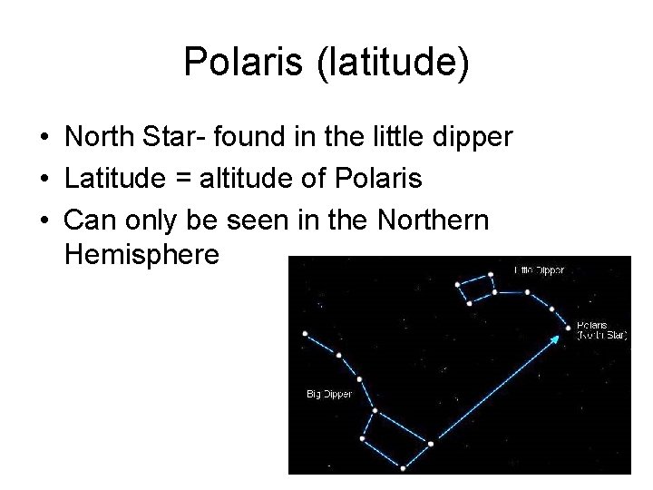
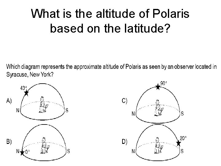
Polaris (latitude) • North Star- found in the little dipper • Latitude = altitude of Polaris • Can only be seen in the Northern Hemisphere
What is the altitude of Polaris based on the latitude?
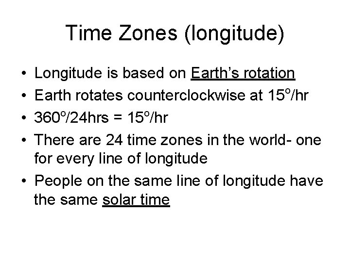
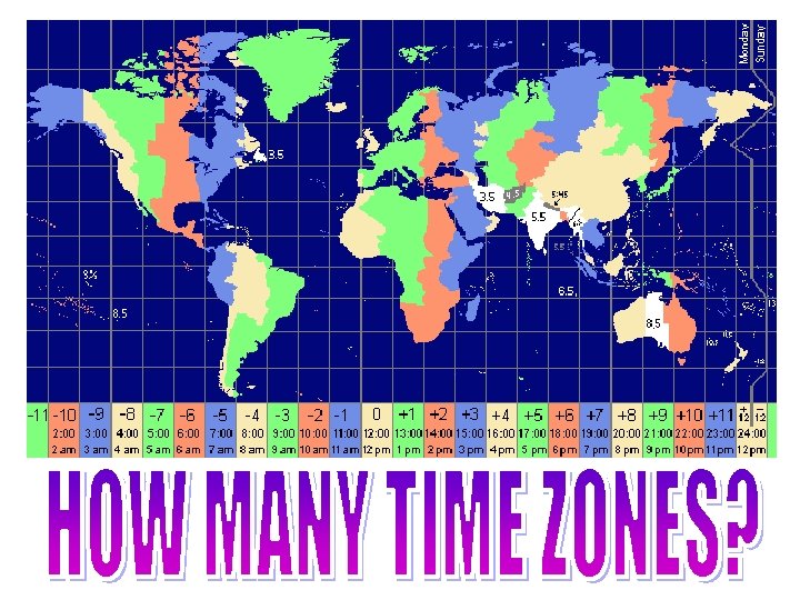
Time Zones (longitude) • • Longitude is based on Earth’s rotation Earth rotates counterclockwise at 15 o/hr 360 o/24 hrs = 15 o/hr There are 24 time zones in the world- one for every line of longitude • People on the same line of longitude have the same solar time
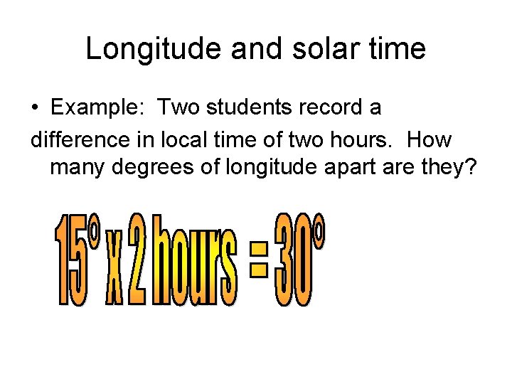
Longitude and solar time • Example: Two students record a difference in local time of two hours. How many degrees of longitude apart are they?
Topography • Definition- the physical features of a place – The shape of the land – Relief- differences in elevation
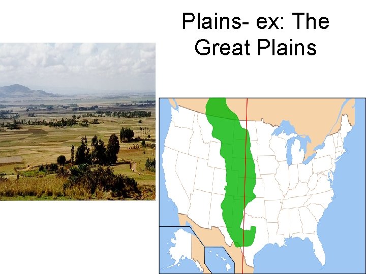
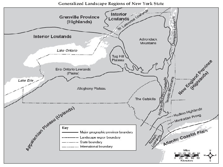
3 topographic features • Mountains-large areas that are raised. Formed by plate boundaries converging – May include a volcano – Mostly made from metamorphic rocks • Plateaus- are large areas that are raised and nearly flat on top – Formed by tectonic activity – Eroded by wind or water – Mostly made of sedimentary rock • Plains- large areas that are flat – Used for farmland-in the middle of the United States – Made of sedimentary rock
Plains- ex: The Great Plains
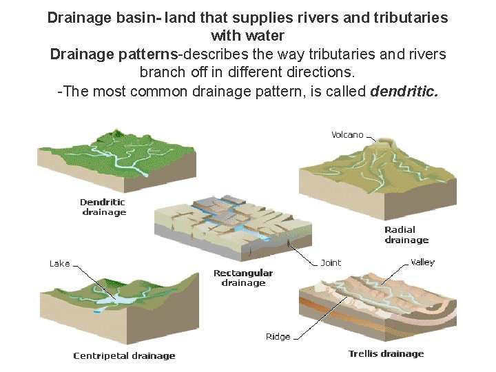
Drainage basin- land that supplies rivers and tributaries with water Drainage patterns-describes the way tributaries and rivers branch off in different directions. -The most common drainage pattern, is called dendritic.
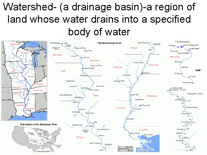
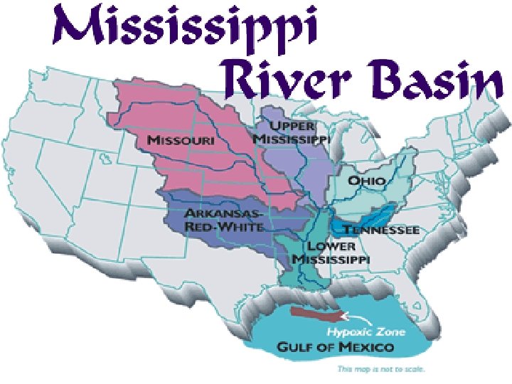
Watershed- (a drainage basin)-a region of land whose water drains into a specified body of water
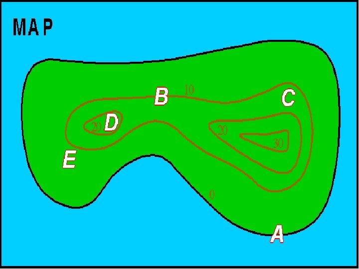
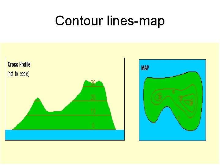
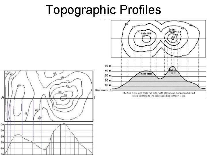
Topographic maps • Maps that indicate differences in elevation compared to sea level • Use contour lines to show elevation – Which are a type of Isoline- a continuous line connecting points of equal value – Contour interval- space between isolines showing difference in elevation
Contour lines-map
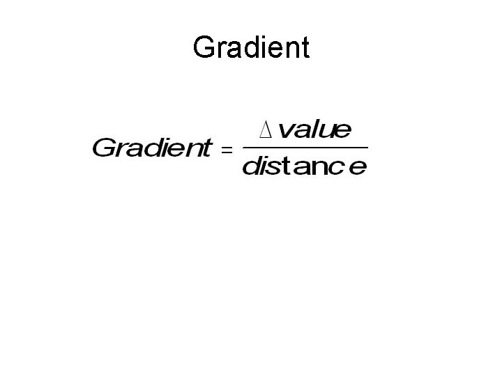
Gradient
Topographic Profiles